J. Wyld Maps
to
1
1
1
1
1
1
1
1
1
1
1
104
58
28
21
Creator: J. Wyld
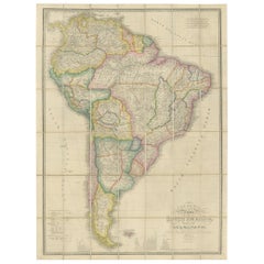
Antique Map of South America by Wyld, circa 1850
By J. Wyld
Located in Langweer, NL
Beautiful folding map of South America titled 'Colombia Prima or South America Drawn from the Large Map in Eight Sheets by Louis Stanislas D ' Arcy Delarochette'. Three insets in the...
Category
Mid-19th Century British Antique J. Wyld Maps
Materials
Paper
$1,377 Sale Price
20% Off
Related Items
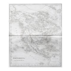
Original Antique Map of North America by Dower, circa 1835
Located in St Annes, Lancashire
Nice map of North America
Drawn and engraved by J.Dower
Published by Orr & Smith. C.1835
Unframed.
Free shipping
Category
1830s English Antique J. Wyld Maps
Materials
Paper
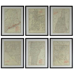
Set of 6 Original Vintage Maps of American States, circa 1900
Located in St Annes, Lancashire
Wonderful set of 6 vintage maps.
Random American states including Maine, Utah, New Hampshire, Nevada, Vermont and New Mexico.
Monochrome with red color outline.
Published by Rand,...
Category
Early 1900s American Edwardian Antique J. Wyld Maps
Materials
Paper
$950 / set
H 23.75 in W 17.75 in D 0.75 in
Original Antique Map of The United States of America by Dower, circa 1835
Located in St Annes, Lancashire
Nice map of the USA
Drawn and engraved by J.Dower
Published by Orr & Smith. C.1835
Unframed.
Free shipping
Category
1830s English Antique J. Wyld Maps
Materials
Paper
$60
H 12.25 in W 9.25 in D 0.07 in
Original Antique Map of Australia by Dower, circa 1835
Located in St Annes, Lancashire
Nice map of Australia
Drawn and engraved by J.Dower
Published by Orr & Smith. C.1835
Unframed.
Free shipping
Category
1830s English Antique J. Wyld Maps
Materials
Paper
Original Antique Decorative Map of South America-West Coast, Fullarton, C.1870
Located in St Annes, Lancashire
Great map of Chili, Peru and part of Bolivia
Wonderful figural border
From the celebrated Royal Illustrated Atlas
Lithograph. Original color.
Published by Fullarton, Edi...
Category
1870s Scottish Antique J. Wyld Maps
Materials
Paper
$120
H 18.5 in W 12.5 in D 0.07 in
Original Antique Map of Africa by Dower, circa 1835
Located in St Annes, Lancashire
Nice map of Africa
Drawn and engraved by J.Dower
Published by Orr & Smith. C.1835
Unframed.
Free shipping
Category
1830s English Antique J. Wyld Maps
Materials
Paper
Original Antique Map of the American State of South Carolina, 1903
Located in St Annes, Lancashire
Antique map of South Carolina
Published By A & C Black. 1903
Original colour
Good condition
Unframed.
Free shipping
Category
Early 1900s English Antique J. Wyld Maps
Materials
Paper
Original Antique Map of the American State of Kansas, 1903
Located in St Annes, Lancashire
Antique map of Kansas
Published By A & C Black. 1903
Original colour
Good condition
Unframed.
Free shipping
Category
Early 1900s English Antique J. Wyld Maps
Materials
Paper
Original Antique Map of the American State of Alabama, 1903
Located in St Annes, Lancashire
Antique map of Alabama
Published By A & C Black. 1903
Original colour
Good condition
Unframed.
Free shipping
Category
Early 1900s English Antique J. Wyld Maps
Materials
Paper
Original Antique Map of the American State of Louisiana, 1903
Located in St Annes, Lancashire
Antique map of Louisiana
Published By A & C Black. 1903
Original colour
Good condition
Unframed.
Free shipping
Category
Early 1900s English Antique J. Wyld Maps
Materials
Paper
Original Antique Map of the American State of Washington, 1903
Located in St Annes, Lancashire
Antique map of Washington
Published By A & C Black. 1903
Original colour
Good condition
Unframed.
Free shipping
Category
Early 1900s English Antique J. Wyld Maps
Materials
Paper
Original Antique Map of the American State of Alaska, 1903
Located in St Annes, Lancashire
Antique map of Alaska
Published By A & C Black. 1903
Original colour
Good condition
Unframed.
Free shipping
Category
Early 1900s English Antique J. Wyld Maps
Materials
Paper
Previously Available Items
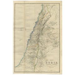
Antique Map of Syria by J. Wyld, 1840
By J. Wyld
Located in Langweer, NL
Large original color map of the Ottoman province of Syria, covering modern Syria, Israel, Gaza and the West Bank and Lebanon. The information on the map is a mixture of contemporary ...
Category
Mid-19th Century Antique J. Wyld Maps
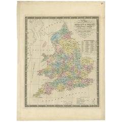
Antique Map of England and Wales by J. Wyld, 1844
By J. Wyld
Located in Langweer, NL
Antique map of England and Wales titled 'A Map Shewing the Places in England & Wales Sending Members to Parliament with the numbers returned, divisions of counties and population, pl...
Category
Mid-19th Century Antique J. Wyld Maps
Materials
Paper
J. Wyld maps for sale on 1stDibs.
J. Wyld maps are available for sale on 1stDibs. These distinctive items are frequently made of paper and are designed with extraordinary care. There are many options to choose from in our collection of J. Wyld maps, although beige editions of this piece are particularly popular. If you’re looking for additional options, many customers also consider maps by John Speed, John Cary, and Captain Greenvile Collins. Prices for J. Wyld maps can differ depending upon size, time period and other attributes — on 1stDibs, these items begin at $1,558 and can go as high as $1,558, while a piece like these, on average, fetch $1,558.
