John Speed Landscape Prints
to
1
4
Overall Width
to
Overall Height
to
1
4
182
169
146
131
4
4
4
4
4
4
3
3
1
4
3
1
Artist: John Speed
AMERICA
By John Speed
Located in Santa Monica, CA
IMPORTANT AMERICAN MAP - ONE OF THE FIRST TO SHOW CALIFORNIA as an ISLAND
JOHN SPEED (1552-1629)
AMERICA - With Those Known Parts In That Unknown Worlde (sic),
1626-(76)
(Burden 217 iv/iv) Engraving, uncolored. Engraved by Abraham Goos and
published by Thomas Basset and Richard Chiswell - 4th state of 4 in 1676
15 1/8 x 20 1/2” From “A Prospect of the Most Famous Parts of the
World”. Generally good condition. A repaired split in lower centerfold. This
is the most common version of this important map...
Category
1620s Old Masters John Speed Landscape Prints
Materials
Engraving
$4,000 Sale Price
52% Off
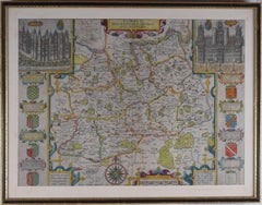
John Speede, Map of the County of Surrey, described and divided into hundreds
By John Speed
Located in London, GB
To see our other views and maps of England - including London, Oxford and Cambridge, scroll down to "More from this Seller" and below it click on "See all from this Seller" - or send us a message if you cannot find the view you want.
John Speed/Speede (1551/2-1629)
The County of Surrey Described and Divided into Hundreds
Engraving with later hand colouring and text to the reverse.
Dated to c.1650
36 x 49 cm
Probably the most famous early English mapmaker, John Speed's early life is somewhat of an enigma. He is believed to have trained as a rolling-press printer, but he was at heart an historian granted a sinecure in the Customs House by Queen Elizabeth to indulge his passion, later becoming a Fellow of the Society of Antiquaries. His first maps were historical, of the Holy Land 'Canaan as it was Possessed both in Abraham and Israels Dayes' and of England and Ireland recording 'all their Civill Warres since the Conquest'.
In 1611 he published his 'Hostory of Great Britaine' which he regarded as his magnum opus, but it was the companion atlas 'Theatre of the Empire of Great Britaine' that - as the first printed atlas of Great Britain - sealed his reputation. William Rogers engraved the first map, 'the County Palatine of Chester' in about 1600, but following his untimely death the task of engraving was passed to Jodocus Hondius of Amsterdam.
By 1612 the atlas was complete, the maps famed for their decorative elements. Many have town plans - Britain's first series of such plans - and descriptive text was printed to the reverse until the 1676 edition. Later printings (up until 1770) were issued without this text. By 1627 it has become a part of a world atlas 'Prospect of the Most Famous Parts of the World'. During the 17th century the plates passed through the hands of a series of publishers, the 1676 edition of Thomas Bassett and Richard Chiswell being regarded as its high point with the inclusion for the first time of a series of important maps. For the first half of the eighteenth century they were firmly established in the hands of the Overton family.
This particular edition originally featured in The Theatre Of The Empire Of Great Britaine. It features attractive inset views of the long-since destroyed Richmond...
Category
17th Century Realist John Speed Landscape Prints
Materials
Engraving
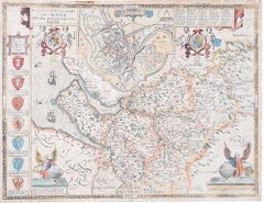
John Speede Map The Countye Palatine of Chester with that most ancient citie
By John Speed
Located in London, GB
To see our other views and maps of England - including London, Oxford and Cambridge, scroll down to "More from this Seller" and below it click on "See all from this Seller" - or send...
Category
17th Century Realist John Speed Landscape Prints
Materials
Engraving
John Speede Map The Countye of Monmouth
By John Speed
Located in London, GB
To see our other views and maps of England - including London, Oxford and Cambridge, scroll down to "More from this Seller" and below it click on "See all from this Seller" - or send...
Category
17th Century Realist John Speed Landscape Prints
Materials
Engraving
Related Items
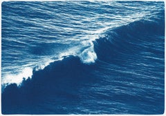
Venice Beach Seascape, Long Wave, Nautical Scene in Blue Tones, Limited Edition
By Kind of Cyan
Located in Barcelona, ES
This is an exclusive handprinted limited edition cyanotype.
This beautiful cyanotype is titled "Long Wave in Venice Beach" and it shows an outstanding wave in one of the most iconic ...
Category
2010s Realist John Speed Landscape Prints
Materials
Paper, Emulsion, Watercolor, Engraving, Etching, Monotype
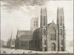
The West Prospect of the Cathedral of York /// "Britannia Illustrata" Engraving
By Johannes Kip
Located in Saint Augustine, FL
Artist: Johannes "Jan" Kip (Dutch, 1652/3-1722)
Title: "The West Prospect of the Cathedral of York" (Vol. 3, Plate 31)
Portfolio: Britannia Illustrata / Le Nouveau Théâtre de la Grande Bretagne
Year: 1715-1724 (Third edition)
Medium: Original Engraving and Etching on cream laid paper
Limited edition: Unknown
Printer: Joseph Smith, London, UK
Publisher: Joseph Smith, London, UK
Reference: "London Illustrated 1604-1850" - Adams No. 22; Crace No. 201; Brunet IV No. 114; Lowndes No. 1277; Lewine page 263-264
Sheet size: 19.25" x 24.19"
Image size: 16.75" x 22.5"
Condition: With centerfold as issued. Some light toning and foxing mainly in margins, and some light edgewear. Has been professionally stored away for decades. It is otherwise a strong impression in very good condition
Rare
Notes:
Provenance: private collection - Ross-on-Wye, UK. Engraved by Dutch artist Johannes "Jan" Kip (1652/3-1722) after a drawing by Dutch artist Leonard Knyff or Leendert Knijff (1650-1722). Comes from Kip's six volume (including Supplement and 'Atlas Anglois') "Britannia Illustrata" / Le Nouveau Théâtre de la Grande Bretagne", (1724-1728) (Third edition), which consists of 394 engravings and etchings. Printed in one color from one copper plate: black.
Biography:
Johannes "Jan" Kip (1652/53 in Amsterdam - 1722 in Westminster) was a Dutch draftsman, engraver and print dealer. Together with Leonard Knyff, he made a speciality of engraved views of English country houses.
Kip was a pupil of Bastiaen Stopendaal (1636–1707), from 1668 to 1670, before setting up on his own; his earliest dated engravings are from 1672. In April 1680, at the age of 27, he married Elisabeth Breda in Amsterdam. After producing works for the court of William of Orange in Amsterdam, Kip followed William and Mary to London and settled in St. John Street in Farringdon, where he conducted a thriving printselling business. He also worked for various London publishers producing engravings after such artists as Francis Barlow (c. 1626–1704) and Caius Gabriel Cibber (1630–1700), largely for book illustrations. He made several engraved plates for Awnsham & John Churchill's "A Collection of Voyages & Travels" (first published 1704). He signed the African scenes in volume V of the 1732 edition as "J. Kip".
His most important works were the large fold-out folio illustrations for "Britannia Illustrata", 1708; for the 65 folio plates he engraved for the antiquary Sir Robert Atkyns, "The Ancient and Present State of Glostershire", 1712 (1st edition); and for "Le Nouveau Théâtre de la Grande Bretagne ou description exacte des palais de la Reine, et des Maisons les plus considerables des des Seigneurs & des Gentilshommes de la Grande Bretagne", 1715, an extended reprint in collaboration with other artists.
The linked careers of Jan Kip and Leonard Knyff made a specialty of engraved views of English country houses, represented in detail from the bird's-eye view, a pictorial convention for topography. Their major work was "Britannia Illustrata: Or Views of Several of the Queens Palaces, as Also of the Principal seats of the Nobility and Gentry of Great Britain, Curiously Engraven on 80 Copper Plates", London (1707, published in the winter of 1708–9). The volume is among the most important English topographical publications of the 18th century. Architecture is rendered with care, and the settings of parterres and radiating avenues driven through woods or planted across fields, garden paths, gates and toolsheds are illustrated in detail. The images are staffed with figures and horses, coaches pulling into forecourts, water...
Category
1720s Old Masters John Speed Landscape Prints
Materials
Laid Paper, Engraving, Etching, Intaglio
Set of Four Engravings from Nash's "History of Worcestershire" /// Landscape Art
By Treadway Russell Nash
Located in Saint Augustine, FL
Artist: Treadway Russell Nash (English, 1724-1811)
Title: "A View of Stourbridge", "A View of Upton upon Severn, from Ryal Hill", "Bewdley", and "Tenbury"
Portfolio: Collections for the History of Worcestershire
Year: 1781-1782 (First edition)
Medium: Set of Four Original Engravings on watermarked laid paper
Limited edition: Unknown
Printer: John Nichols, London, UK
Publisher: T. Payne and Son, J. Robson, B. White, Leigh and Sotheby, London, UK; Fletcher, Oxford, UK; and Lewis, Worcester, UK
Reference: Upcott III, page 1330
Sheet size (each): approx. 10" x 16.5"
Image size (each): approx. 6.88" x 11.75"
Condition: A few light handling creases. Have been professionally stored away for decades. They are all strong impressions in excellent condition
Notes:
Provenance: private collection - Aspen, CO. All four works were engraved by English artist Thomas Sanders (Active: Mid-Late 18th Century) after drawings by himself. Comes from Nash's two volume "Collections for the History of Worcestershire", (1781-1782) (First edition), which consists of 75 engravings. Each work is printed from one copper plate in one color: black. There was a (Second edition) "with Additions" bound in with Volume II of this portfolio published by John White in 1799. And, both the First and Second editions of "Collections for the History of Worcestershire" are based off Thomas Sanders' 1779-1781 "Perspective Views of the Market Towns within the County of Worcester". Both "A View of Stourbridge" and "A View of Upton upon Severn, from Ryal Hill" have unidentified fleur-de-lis watermarks in the center of their sheets. "Bewdley" has an unidentified watermark in the center of its sheet resembling "XV" and "Tenbury" has no watermark.
Biography:
Treadway Russell Nash (24 June 1724 – 26 January 1811) was an English clergyman, now known as an early historian of Worcestershire and the author of Collections for the History of Worcestershire, an important source document for Worcestershire county histories. He was a fellow of the Society of Antiquaries of London.
Treadway Russell Nash was born on 24 June 1724 born at Clerkenleap, in Kempsey, Worcestershire. His family were from Ombersley. They had lands there and at Claines, and had later bought lands in the Reformation around St Peter's, Droitwich. He was related to James Nash and John Nash, both MPs for Worcester. His father Richard, a grandson of Sir Rowland Berkeley, died in 1740, and Richard's eldest son in 1757. As a result, Treadway Russell Nash inherited the Russells' Strensham estates from his brother, as well as the Nash estates, and took both names.
He was educated from the age of twelve at King's School, Worcester, and became a scholar at Worcester College, Oxford aged fifteen. In March 1749, he accompanied his brother on a trip to the continent, to aid Richard's health. They visited Paris for about six weeks, before spending the summer "on the banks of the Loire". They then visited "Bourdeaux, Thoulouse, Montpelier, Marseilles, Leghorn, Florence, Rome, Naples, Bologna, Venice, Padua, Verona, Milan, Lyons, and again Paris"; such expeditions are often known as the Grand Tour.
On his return in late summer 1751, Nash took up a post as Vicar of Eynsham through his friend and future brother-in-law, John Martin. He also had an income as a tutor at Oxford. He took his Doctor of Divinity degree and left Oxford, having "gone out grand compounder", following the death of his brother. He also left his benefice at Eynsham in 1757. While at Oxford he had proposed a road from there to Witney (now the A40 and B4022), and also stood for Parliament. Nash married Margaret Martin...
Category
1780s Old Masters John Speed Landscape Prints
Materials
Laid Paper, Engraving
Le Bourg de Batz
By William Strang, R.A., R.E.
Located in New York, NY
William Strang (1859-1921), Le Bourg de Batz, etching and drypoint on copper, 1913, signed in pencil lower right [also signed and dated in the plate]. Refere...
Category
1910s Realist John Speed Landscape Prints
Materials
Drypoint, Etching
St Peters Church at Rome /// "Vitruvius Britannicus" Architecture Engraving Art
By Colen Campbell
Located in Saint Augustine, FL
Artist: Colen Campbell (Scottish, 1676-1729)
Title: "St Peters Church at Rome" (Vol. 1, Plate 6)
Portfolio: Vitruvius Britannicus; or The British Architect, Containing the Plans, Ele...
Category
1710s Old Masters John Speed Landscape Prints
Materials
Laid Paper, Engraving, Etching, Intaglio
A View at Bolcheretzko (Russia) 1784 Captains Cook Final Voyage by John Webber
By John Webber
Located in Paonia, CO
A View at Bolcheretzko (Russia) is from the 1784 First Edition Atlas Accompanying Capt. James Cook and King; Third and Final Voyage of Captain James Cook.John Webber (1752-1793) was ...
Category
1780s Realist John Speed Landscape Prints
Materials
Engraving
$540 Sale Price
40% Off
H 16.5 in W 13.5 in
Red Breasted Merganser from Illustrations of British Ornithology Pl.58 by Selby
Located in Paonia, CO
Red Breasted Merganser PL 58 from a rare black and white edition of Prideaux John Selby’s two volume set of 222 engravings “Illustrations of British Ornithology”. These original...
Category
Mid-19th Century Realist John Speed Landscape Prints
Materials
Engraving
An Inland View; in Atooi ( Hawaii ) 1784 Captain Cook engraving by John Webber
By John Webber
Located in Paonia, CO
An Inland View in Atooi ( Hawaii ) is from the 1784 First Edition Atlas Accompanying Capt. James Cook and King; Third and Final Voyage of Captain James Cook. This engraving depicts ...
Category
1780s Realist John Speed Landscape Prints
Materials
Engraving
Column of Antoninus Pius, Rome Italy. Jacobs Lauro 17th century engraving
Located in Melbourne, Victoria
Lauro produced a series of engravings of the ancient monuments of Classical Rome with detailed descriptions in Latin below.
180mm by 240mm (plate mark)...
Category
Early 17th Century Old Masters John Speed Landscape Prints
Materials
Engraving, Etching
$240
H 9.45 in W 13.59 in
William Hogarth . Original engravings 155 pсs., 1 piece with blend. 1822 London
By William Hogarth
Located in Riga, LV
William Hogarth (1697-1764)
Original engravings 155 pсs., 1 piece with blend. 1822 London
From A. Neibergs collection
Category
1820s Realist John Speed Landscape Prints
Materials
Paper, Engraving
William HogarthWilliam Hogarth . Original engravings 155 pсs., 1 piece with blend. 1822 London, 1822
$3,035 Sale Price
20% Off
H 25.99 in W 20.48 in D 2.17 in
L’Hiver a Paris ou La Neige a Paris
By Félix Hilaire Buhot
Located in New York, NY
Felix Buhot (1847-1898), L’Hiver a Paris ou La Neige a Paris, 1879, etching, aquatint, drypoint, roulette. [signed and dated in the plate Felix Buhot Par...
Category
1870s Realist John Speed Landscape Prints
Materials
Drypoint, Etching, Aquatint
Cambridge Midsummer Fair
By Sir Muirhead Bone
Located in Middletown, NY
A peaceful image by Britian's first official war artist.
Drypoint printed in brownish black ink on fibrous, laid Japon paper, 3 3/8 x 6 5/16 inches (85 x 161 mm), full margins. Sign...
Category
Early 20th Century Realist John Speed Landscape Prints
Materials
Handmade Paper, Drypoint
John Speed landscape prints for sale on 1stDibs.
Find a wide variety of authentic John Speed landscape prints available for sale on 1stDibs. You can also browse by medium to find art by John Speed in engraving and more. Much of the original work by this artist or collective was created during the 18th century and earlier and is mostly associated with the Old Masters style. Not every interior allows for large John Speed landscape prints, so small editions measuring 21 inches across are available. Customers who are interested in this artist might also find the work of Johann Baptist Homann, Auguste Louis Lepère, and Charles Amand Durand. John Speed landscape prints prices can differ depending upon medium, time period and other attributes. On 1stDibs, the price for these items starts at $681 and tops out at $5,000, while the average work can sell for $681.


