Paul Madden Antiques Maps
to
1
1
1
1
1
1
1
1
1
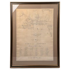
Rare 18th C. Newport Map
Located in Sandwich, MA
Rare 18th C, Map titled "A plan of the town of Newport in the province of Rhode Island". Earliest printed plan of Newport, published for the use of the British just prior to their o...
Category
Antique 1770s American Maps
Materials
Paper
$19,500 / item
Related Items
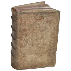
18th Century Rare European Vellum Book
Located in Chicago, IL
18th Century Rare European Vellum book found in Germany.
This book has aged beautifully with exquisite patina.
Vellum (derived from the Latin word vitulinum meaning "made fro...
Category
Antique Mid-18th Century German Books
Materials
Leather, Paper
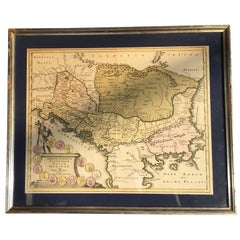
Four 18th Century Engraved and Hand-Colored Maps by Weigel
By Christoph Weigel
Located in Copenhagen, K
Small collection of four engraved maps of Italy, Balkan and of Central Asia.
Two are of Italy, one Corsica and Northern Italy and the other of the Southern Italian boot...
Category
Antique 18th Century German Maps
Materials
Paper
$450 / item
H 15.75 in W 18.12 in D 0.79 in
French 18th Century Map of Paris by Turgot
By Michel Etienne Turgot
Located in Los Angeles, CA
Complete Paris map set of etchings by Turgot. This printing is from the 1960s and have warm natural color to the paper. Frame each individually to your liking. The overall dimension ...
Category
Vintage 1960s French French Provincial Maps
Materials
Paper
Saint-Domingue (French Section): 18th Century Map from France Militaire Series
Located in Langweer, NL
This map is titled "St. Domingue (Partie Française)" and is part of the France Militaire series. It focuses on the French portion of Saint-Domingue, which corresponds to modern-day H...
Category
Antique 1790s Maps
Materials
Paper
$114 Sale Price
20% Off
H 7.17 in W 10.83 in D 0 in
California, Alaska and Mexico: 18th Century Hand-Colored Map by de Vaugondy
By Didier Robert de Vaugondy
Located in Alamo, CA
This is an 18th century hand-colored map of the western portions of North America entitled "Carte de la Californie et des Pays Nord-Ouest separés de l'Asie par le détroit d'Anian, ex...
Category
Antique 1770s French Maps
Materials
Paper
$975
H 13.75 in W 16.63 in D 0.13 in
18th Century Map of French Pyrenees Region of France
Located in Haddonfield, NJ
An antique map titled "Principatus Benearnia, La Principaute De Bearn" created by the renowned Dutch cartographer Willem Janszoon Blaeu.
It depicts the Principality of Bearn, a histo...
Category
Antique 1880s Danish Baroque Maps
Materials
Wood, Paper
Antique Rare Judaica Silver Spice Tower 18th century Germany
Located in Doha, QA
This is an extremely rare and absolutely magnificent filigrane made 18th century silver spice tower. It has been crafted in Germany and hallmarked in two places with number 12. The German and Austrian hallmark in the 18th century, which was called Lot/ Loth and was used to indicate proportion of precious metal content in any metal object.
The base of the tower is square and has an intricate ornamented leaf design, the silver ball connects the base and the main part of the tower. In the middle there is a
small movable door which opens to the outside and has an engraved Hebrew letter Tav in an old font. It’s the last letter of the Hebrew Alphabet and translates as “truth”.
It symbolises truth, perfection, and completion. The tower has six gemstones on it, four red and two dark green. The design remains filigrane and fragile from the bottom to the top on all sides and at the tip of the tower there is a flag in an arrow shape.
This rare spice tower is impressive and very finely crafted. The condition for its age is excellent. The tower comes together with a beautiful original art deco wooden leather box...
Category
Antique Late 18th Century German Religious Items
Materials
Silver
Mid-18th Century Hand Drawn English Farm Map on Vellum, circa 1740s
Located in San Francisco, CA
Mid-18th century hand drawn English farm map on Vellum circa 1740s
Henry Maxted & Isaac Terry, Surveyors.
A Map of a Farm in the Parish of Blean in the County of KENT: Belonging to Mrs Elizabeth Hodgson circa 1743.
A beautiful hand drawn map...
Category
Antique Mid-18th Century English Maps
Materials
Lambskin
Map of Saint Helena Island: Early 18th-Century Copper Engraving by F. Bernard
Located in Langweer, NL
Map of Saint Helena Island: Early 18th-Century Copper Engraving by F. Bernard
This rare and beautifully detailed copper engraving of Saint Helena Island dates from around 1722 and...
Category
Antique 1720s Maps
Materials
Paper
$142 Sale Price
20% Off
H 6.23 in W 5.12 in D 0.01 in
Rare 18th century Micromosaic Plate
Located in Paris, FR
Rare micromosaic plaque depicting an idyllic Roman landscape. The main subject of this micromosaic is the representation of buildings surrounded by cypresses and trees. Two figures i...
Category
Antique Late 18th Century French Greco Roman Models and Miniatures
Materials
Cut Glass
Antique 18th Century Map of the Province of Pensilvania 'Pennsylvania State'
Located in Philadelphia, PA
A fine antique of the colony of Pennsylvania.
Noted at the top of the sheet as a 'Map of the province of Pensilvania'.
This undated and anonymous map is thought to be from the Gentleman's Magazine, London, circa 1775, although the general appearance could date it to the 1760's.
The southern boundary reflects the Mason-Dixon survey (1768), the western boundary is placed just west of Pittsburgh, and the northern boundary is not marked.
The map has a number of reference points that likely refer to companion text and appear to be connected to boundaries. The western and southern boundaries are marked Q, R, S, for example. A diagonal line runs from the Susquehanna R to the Lake Erie P. A broken line marked by many letters A, B, N, O, etc., appears in the east.
There are no latitude or longitude markings, blank verso.
Framed in a shaped contemporary gilt wooden frame and matted under a cream colored matte.
Bearing an old Graham Arader Gallery...
Category
Antique 18th Century British American Colonial Maps
Materials
Paper
$1,250
H 10.25 in W 13.25 in D 0.5 in
18th Century Map of the Southern Balkans by Giovanni Maria Cassini
By Giovanni Maria Cassini
Located in Hamilton, Ontario
18th century map by Italian engraver Giovanni Maria Cassini (Italy 1745-1824).
Map of the Southern Balkans: Rome. Hand colored and copper engraved print done in the year 1788. It in...
Category
Antique 18th Century Italian Maps
Materials
Paper
$795 Sale Price
36% Off
H 20.75 in W 25.5 in D 0.1 in


