Items Similar to Antique Map of Cologne with the duchies of Jülich and Berg, Germany
Want more images or videos?
Request additional images or videos from the seller
1 of 6
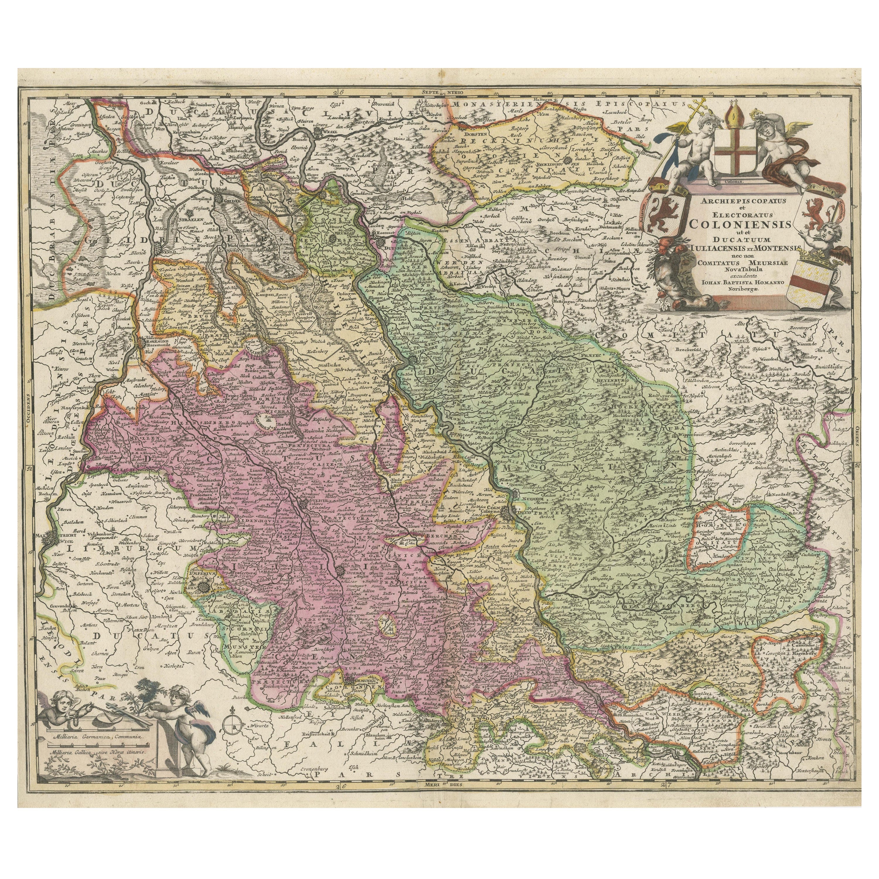
Antique Map of Cologne with the duchies of Jülich and Berg, Germany
About the Item
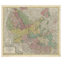
Antique map title 'Archiepiscopatus Coloniensis ducatibus Iuliacensi et Montensi (..)'. Original map of Cologne with the duchies of Jülich and Berg, Spanish Geldern and the county of Moers, Germany. With large cartouche surrounded by putti. Published by G. Valk, circa 1690.
- Dimensions:Height: 20.67 in (52.5 cm)Width: 24.02 in (61 cm)Depth: 0.02 in (0.5 mm)
- Materials and Techniques:
- Period:Late 17th Century
- Date of Manufacture:c.1690
- Condition:Repaired: Repair on folding line and bottom left corner. Right and top margin extended. Original/contemporary hand coloring. Repair on folding line and bottom left corner. Right and top margin extended. Age-related toning. Minor wear and soiling. Blank verso. Please study image carefully.
- Seller Location:Langweer, NL
- Reference Number:Seller: BG-13442-41stDibs: LU3054335139682
About the Seller
5.0
Recognized Seller
These prestigious sellers are industry leaders and represent the highest echelon for item quality and design.
Platinum Seller
Premium sellers with a 4.7+ rating and 24-hour response times
Established in 2009
1stDibs seller since 2017
2,442 sales on 1stDibs
Typical response time: 1 hour
- ShippingRetrieving quote...Shipping from: Langweer, Netherlands
- Return Policy
Authenticity Guarantee
In the unlikely event there’s an issue with an item’s authenticity, contact us within 1 year for a full refund. DetailsMoney-Back Guarantee
If your item is not as described, is damaged in transit, or does not arrive, contact us within 7 days for a full refund. Details24-Hour Cancellation
You have a 24-hour grace period in which to reconsider your purchase, with no questions asked.Vetted Professional Sellers
Our world-class sellers must adhere to strict standards for service and quality, maintaining the integrity of our listings.Price-Match Guarantee
If you find that a seller listed the same item for a lower price elsewhere, we’ll match it.Trusted Global Delivery
Our best-in-class carrier network provides specialized shipping options worldwide, including custom delivery.More From This Seller
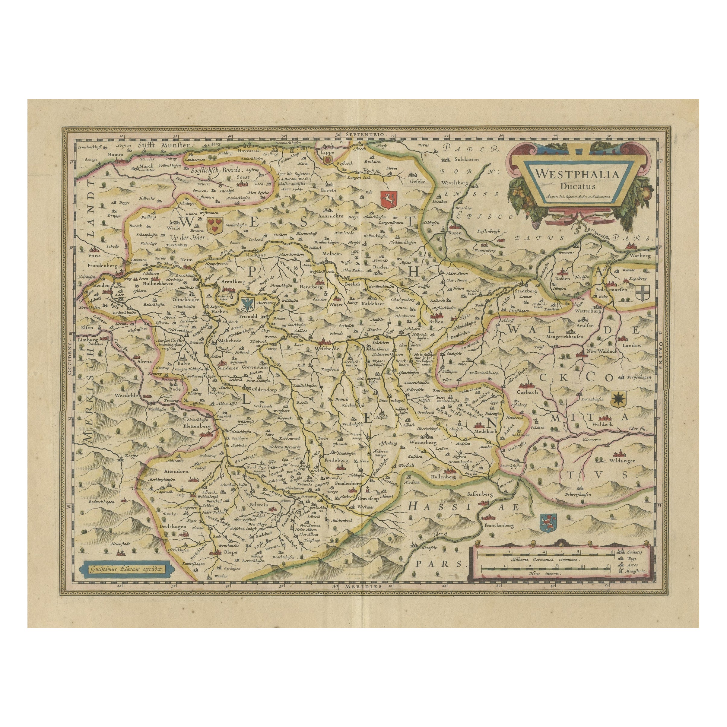
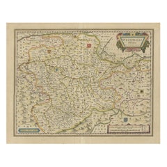
View AllAntique Map of the Duchy of Westphalia, Germany
Located in Langweer, NL
Original antique map titled 'Westphalia Ducatus'. Fine map of the Duchy of Westphalia, Germany. The map is centered on Meschede and includes Arensberg, Beelick, and Brilon. Published...
Category
Antique Mid-17th Century Maps
Materials
Paper
$685 Sale Price
20% Off
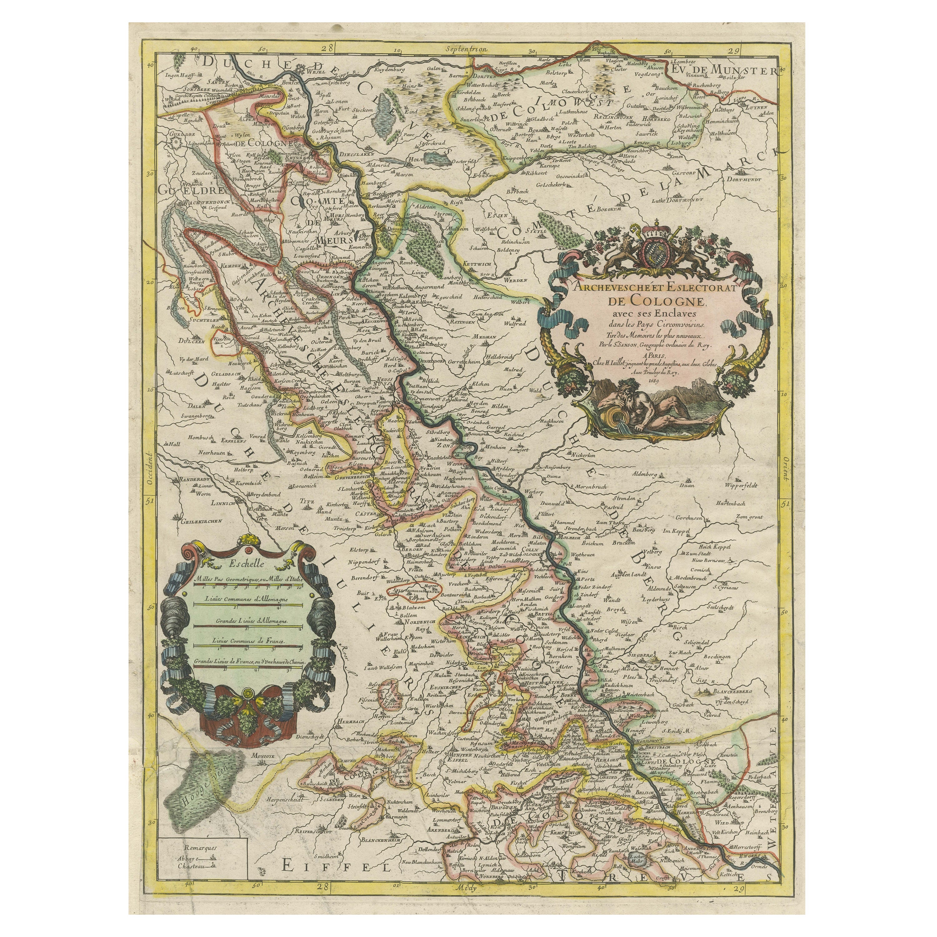
Antique Map of the Archdiocese of Cologne, Germany
Located in Langweer, NL
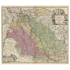
Antique map titled 'Archevesche et Eslectorat de Cologne avec ses Enclaves'. Original old map of the Archdiocese of Cologne with the course of the Rhine from Andernach to Wesel with ...
Category
Antique Late 17th Century Maps
Materials
Paper
$398 Sale Price
20% Off
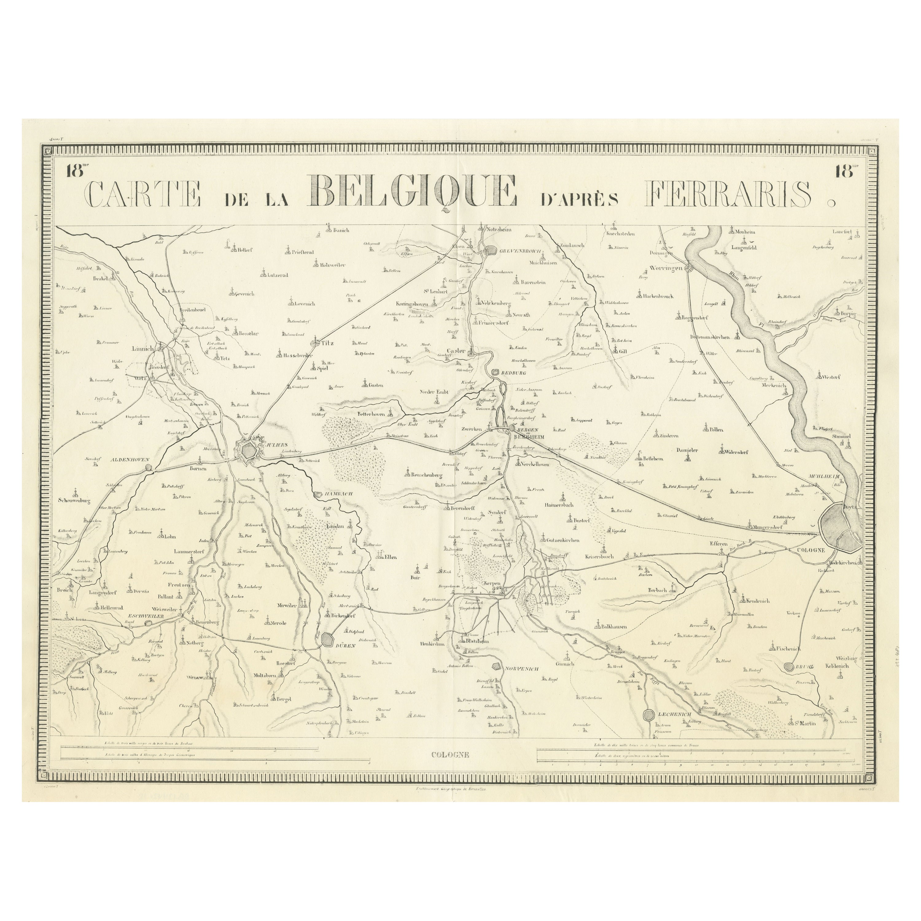
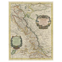
Antique Map of the Region near Cologne, Germany
Located in Langweer, NL
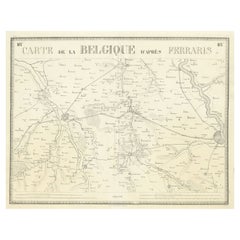
Antique map titled 'Carte de la Belgique d'après Ferraris'. Original antique map of the region near Cologne, Germany. Cologne is the largest city of the German western state of North...
Category
Antique Mid-19th Century Maps
Materials
Paper
$407 Sale Price
20% Off
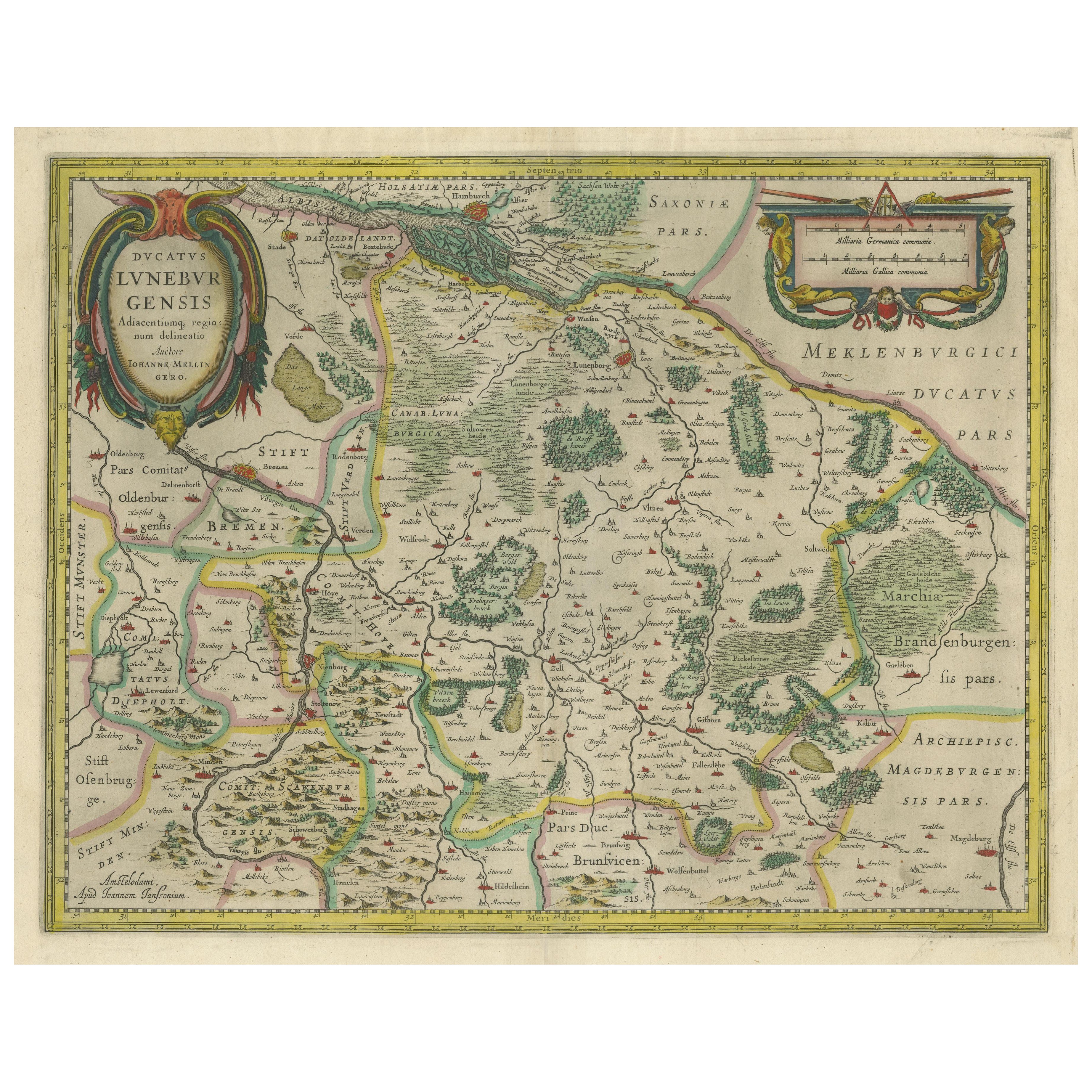
Antique Map of the Duchy of Lüneburg, Lower Saxony, Germany
Located in Langweer, NL
Antique map titled 'Ducatus Luneburgensis (..)'. Map of the Duchy of Lüneburg in Lower Saxony, Germany. Published by J. Janssonius, circa 1664.
Jan Janssonius (also known as Johann ...
Category
Antique Mid-17th Century Maps
Materials
Paper

$500 Sale Price
20% Off
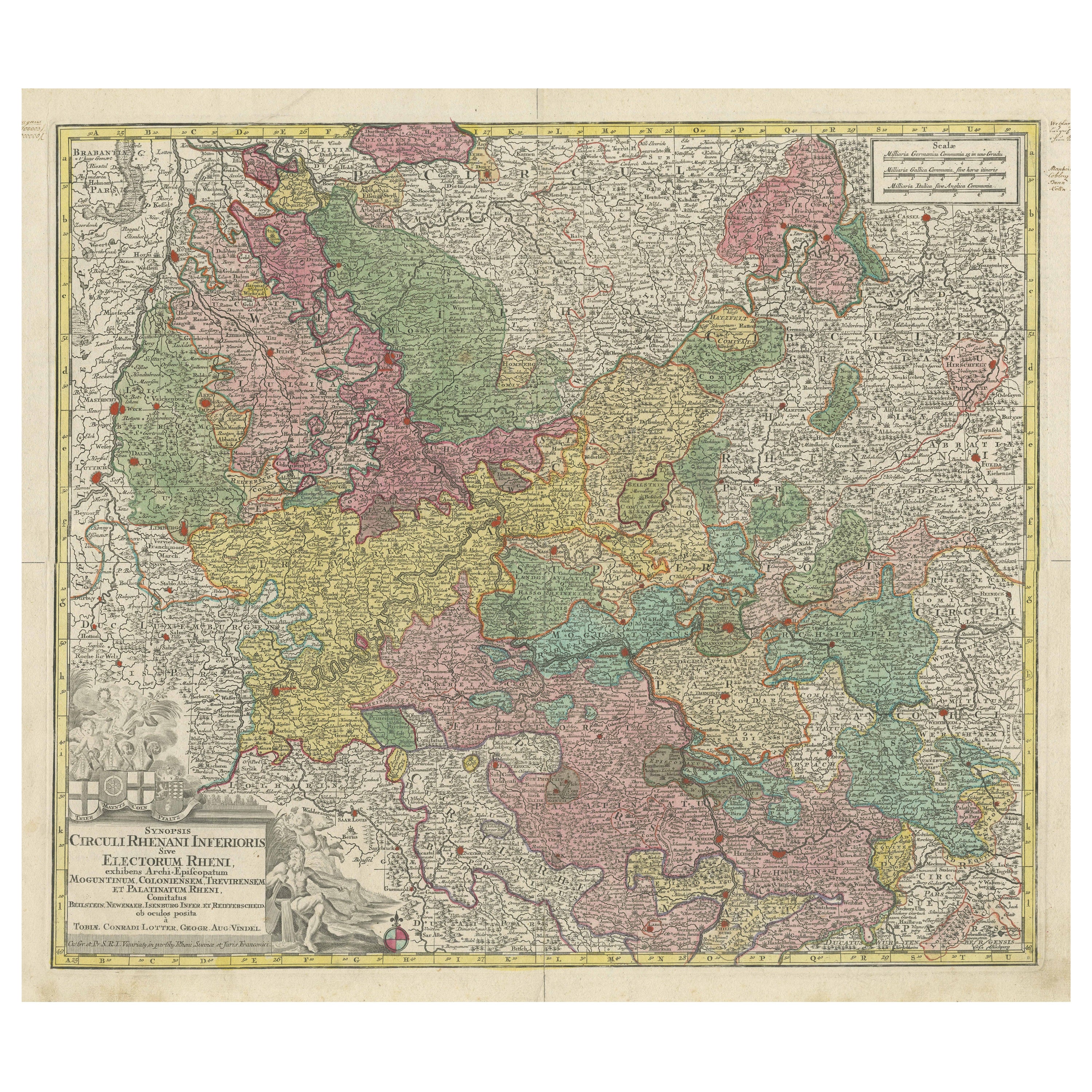
Antique Map of the region of Trier, Mainz and Cologne, Germany
Located in Langweer, NL
Antique map titled 'Synopsis Circuli Rhenani Inferioris sive Electorum Rheni (..)'. Original antique map of the region of Trier, Mainz and Cologne, Germany. Published by T.C. Lotter,...
Category
Antique Late 18th Century Maps
Materials
Paper
$444 Sale Price
20% Off
Antique Map of the Rhine centered on Cologne, Germany
Located in Langweer, NL
Antique map titled 'Archiepsiscopatus et Electoratus Coloniensis (..)'. Original antique map of the Rhine river, centered on Cologne, Germany. The Rhine River cuts across this map fr...
Category
Antique Early 18th Century Maps
Materials
Paper
$509 Sale Price
20% Off
You May Also Like
Original Antique Map of The Philippines. C.1900
Located in St Annes, Lancashire
Fabulous map of The Philippines
Original color.
Engraved and printed by the George F. Cram Company, Indianapolis.
Published, C.1900.
Unframed.
Free shipping.
Category
Antique 1890s American Maps
Materials
Paper

East German Map
By VEB Hermann Haack
Located in Baltimore, MD
A brilliantly colourful map of the Leipzig, Karl Marx Stadt and Dresden area in the former German Democratic Republic by VEB Hermann Haack of Gotha.
Category
Vintage 1970s German Maps

$295 Sale Price
25% Off
Large Original Antique Map of The Bahamas. 1894
Located in St Annes, Lancashire
Superb Antique map of The Bahamas
Published Edward Stanford, Charing Cross, London 1894
Original colour
Good condition
Unframed.
Free shipping
Category
Antique 1890s English Maps
Materials
Paper

Large Original Antique Map of the The Windward Islands. 1894
Located in St Annes, Lancashire
Superb Antique map of The Windward Islands
Published Edward Stanford, Charing Cross, London 1894
Original colour
Good condition
Unframed.
Free shipping
Category
Antique 1890s English Maps
Materials
Paper

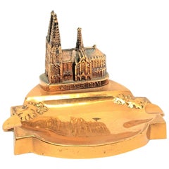
Cologne Cathedral Church Souvenir Building Ashtray Vintage, German, 1960s
Located in Nuernberg, DE
A 1960s souvenir building architectural model Ashtray. Some wear with a nice patina, but this is old-age. Made of metal. A beautiful nice desktop item or just a display item in your ...
Category
Mid-20th Century German Mid-Century Modern Architectural Models
Materials
Metal
1854 Map of Massachusetts, Connecticut and Rhode Island, Antique Wall Map
Located in Colorado Springs, CO
This striking wall map was published in 1854 by Ensign, Bridgman & Fanning and has both full original hand-coloring and original hardware. This impression is both informative and highly decorative.
The states are divided into counties, outlined in red, green, and black, and subdivided into towns. Roads, canals, and railroad lines are prominently depicted, although they are not all labeled. The mapmakers also marked lighthouses, banks, churches, and prominent buildings, with a key at right. The map is an informative and comprehensive overview of the infrastructural development of New England prior to the Civil War. Physical geographies depicted include elevation, conveyed with hachure marks, rivers and lakes. The impression features an inset map of Boston...
Category
Antique 19th Century American Maps
Materials
Paper

Recently Viewed
View AllMore Ways To Browse
Faience Oyster
Faux Stone Table
Folding Leather Dining Chairs
Four Louis Xvi Chairs
French Coupe Glass
French Library Chairs
French Silver Coffee Pot
French Style Dressing Table
Glass Knife Rest
Hanging Console Table
Hanging Tile
Hollis Lucite Coffee Table
Hollywood Regency French Chairs
Irish Cut Glass
Italian Leather Folding Chairs
Italian Liquor
Jensen Silver In Copenhagen
Kashmir Woven Rugs