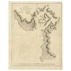
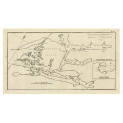
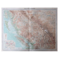
Antique Map of a Ship Cove in Nootka Sound in British Columbia in Canada, 1803
View Similar Items


Want more images or videos?
Request additional images or videos from the seller
1 of 5
Antique Map of a Ship Cove in Nootka Sound in British Columbia in Canada, 1803
About the Item
- Dimensions:Height: 11.62 in (29.5 cm)Width: 9.45 in (24 cm)Depth: 0 in (0.01 mm)
- Materials and Techniques:
- Period:
- Date of Manufacture:1803
- Condition:
- Seller Location:Langweer, NL
- Reference Number:Seller: BG-11487-371stDibs: LU3054325991672
About the Seller
5.0
Platinum Seller
These expertly vetted sellers are 1stDibs' most experienced sellers and are rated highest by our customers.
Established in 2009
1stDibs seller since 2017
1,933 sales on 1stDibs
More From This SellerView All
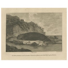
- Antique Print of a Sea Otter of Nootka Sound in British Columbia, Canada, 1801Located in Langweer, NLThe image depicts a copperplate engraving of a sea otter from Nootka Sound, located in Quadra and Vancouver Island on the North West Coast of America. This particular engraving was...Category
Antique Early 1800s Prints
MaterialsPaper
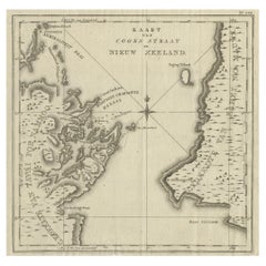
- Antique Map of Cook's Strait in New Zealand, 1803Located in Langweer, NLAntique map New Zealand titled 'Kaart van Cooks Straat in Nieuw Zeeland'. Antique map of Cook's Strait in New Zealand. Originates from 'Reizen ...Category
Antique 19th Century Maps
MaterialsPaper
 $571 Sale Price20% Off
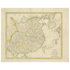
 - Antique Map of China by Wilkinson '1803'Located in Langweer, NLAntique map titled 'China, Contains 15 Subject Provinces Including the 2 Islands of Hainan, Formosa and the Tributary Kingdoms of Korea, Tonkin'. Old map depicting China, extending f...Category
Antique Early 19th Century Maps
MaterialsPaper
 $263 Sale Price20% Off
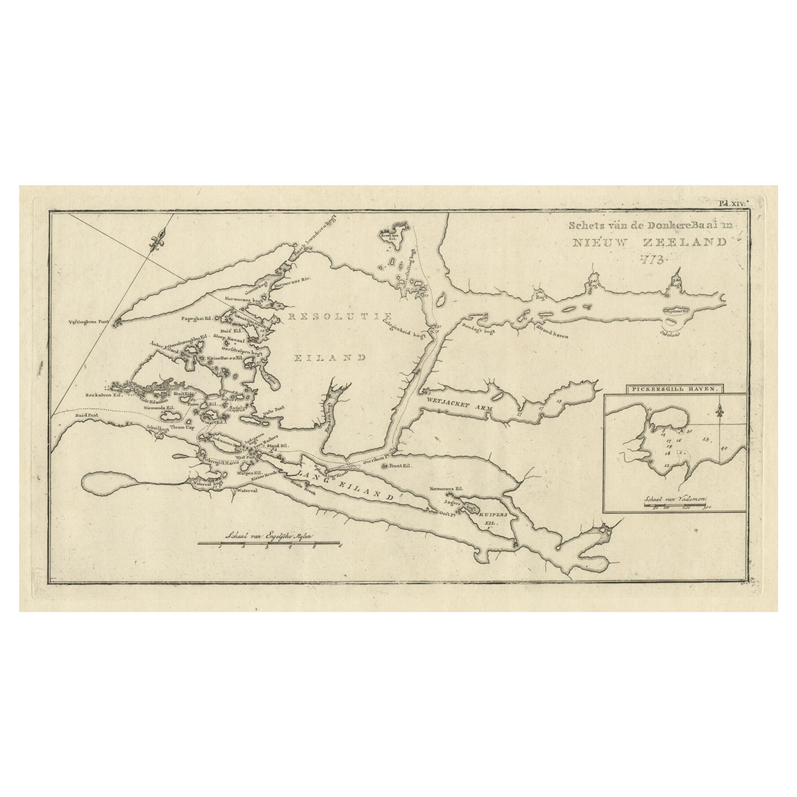
 - Antique Map of the Dusky Bay or Dusky Sound of New Zealand by Captain Cook, 1803Located in Langweer, NLAntique map New Zealand titled 'Schets van de Donkere Baai in Nieuw Zeeland 1773'. Antique map of the Dusky Bay/Dusky Sound of New Zealand....Category
Antique Early 1800s Maps
MaterialsPaper
 $518 Sale Price / item20% Off
 - Antique Map of Suffren Island by Cook, 1803Located in Langweer, NLAntique map Australia titled 'Gezigt van het Eil. Suffren'. Antique map of Suffren Island. Originates from 'Reizen Rondom de Waereld door James C...Category
Antique 19th Century Maps
MaterialsPaper
- Antique Map of the Island of Tahiti, Polynesia, 1803Located in Langweer, NLAntique map Tahiti titled 'Kaart van het Eiland Otahiti'. Antique map of the Island of Tahiti, Polynesia. Originates from 'Reizen Rondom de Waereld door James Cook (..)'. Art...Category
Antique Early 1800s Maps
MaterialsPaper
 $733 Sale Price24% Off

You May Also Like
- Original Antique Map of Canada, Arrowsmith, 1820Located in St Annes, LancashireGreat map of Canada. Drawn under the direction of Arrowsmith. Copper-plate engraving. Published by Longman, Hurst, Rees, Orme and Brown, 1820 ...Category
Antique 1820s English Maps
MaterialsPaper

- Large Original Vintage Map of British Columbia, Canada, circa 1920Located in St Annes, LancashireGreat map of British Columbia Unframed Original color By John Bartholomew and Co. Edinburgh Geographical Institute Published, circa 1920 ...Category
Vintage 1920s British Maps
MaterialsPaper
- Antique Map of Principality of MonacoBy Antonio Vallardi EditoreLocated in Alessandria, PiemonteST/619 - "Old Geographical Atlas of Italy - Topographic map of ex-Principality of Monaco" - ediz Vallardi - Milano - A somewhat special edition ---Category
Antique Late 19th Century Italian Other Prints
MaterialsPaper
 $228 Sale Price74% Off
 - Hampshire County, Britain/England: A Map from Camden's" Britannia" in 1607By John NordenLocated in Alamo, CAAn early hand-colored map of Britain's Hampshire county, published in the 1607 edition of William Camden's great historical description of the British Isles, "Britannia". This map was drawn by cartographer John Norden (c. 1547-1625) and engraved by William Hole (active 1607-1624) and William Kip...Category
Antique Early 17th Century English Maps
MaterialsPaper
- Original Antique Map of Italy. C.1780Located in St Annes, LancashireGreat map of Italy Copper-plate engraving Published C.1780 Unframed.Category
Antique Early 1800s English Georgian Maps
MaterialsPaper

- Original Antique Map of Asia. C.1780Located in St Annes, LancashireGreat map of Asia Copper-plate engraving Published C.1780 Two small worm holes to right side of map Unframed.Category
Antique Early 1800s English Georgian Maps
MaterialsPaper


Recently Viewed
View AllMore Ways To Browse
Antique Furniture Canada
Antique Canadian Furniture
Canadian Antique Furniture
Canadian Antique
Canada Antiques
19th Century Canadian Furniture
French Canadian Antique
Columbia Used Furniture
Royal Navy Antique
Ship Captain
Royal British Antiques
Britain Map
Ship Map
Map Of Britain
Antique Ship Door
Furniture In Vancouver
George Map
Antique Coving