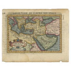
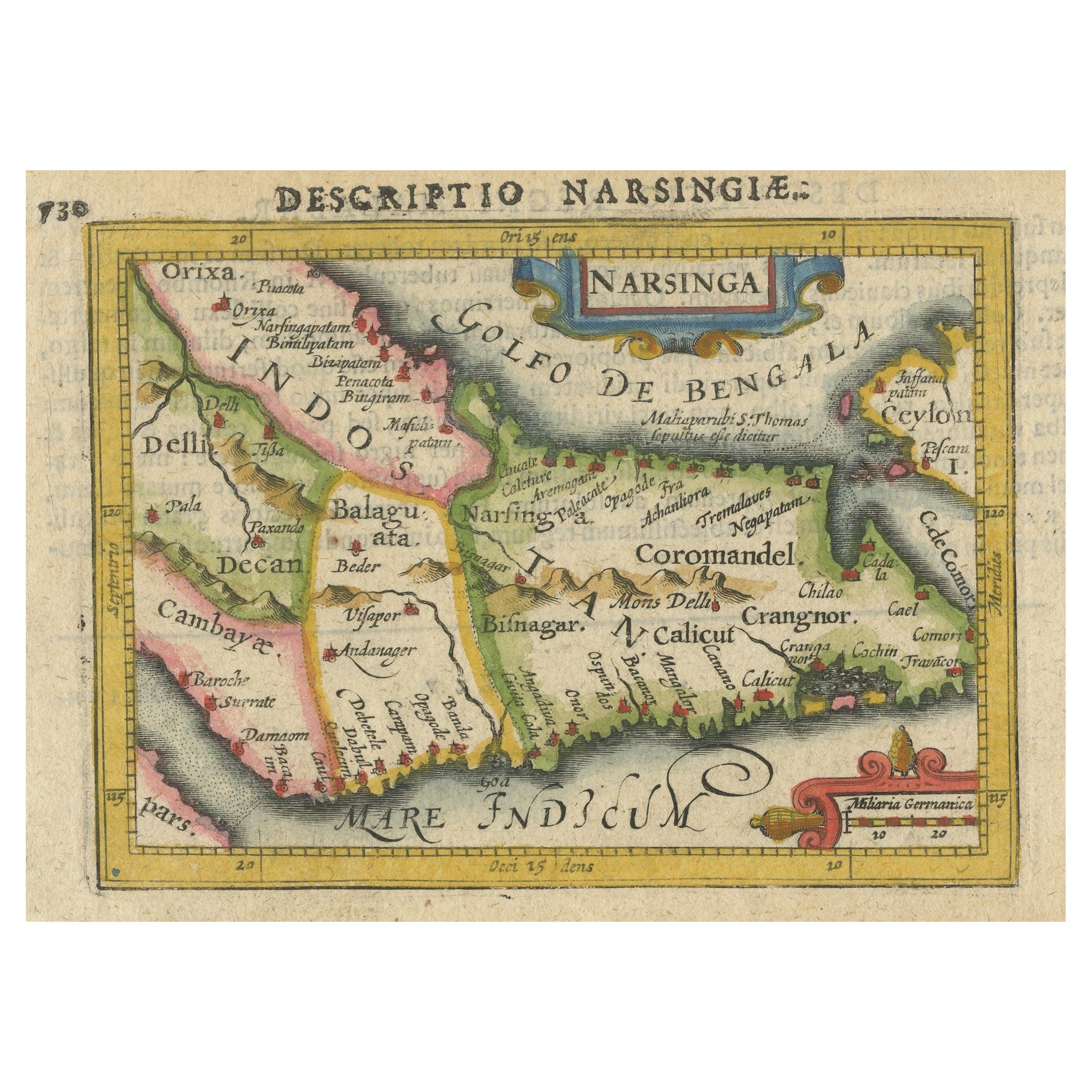
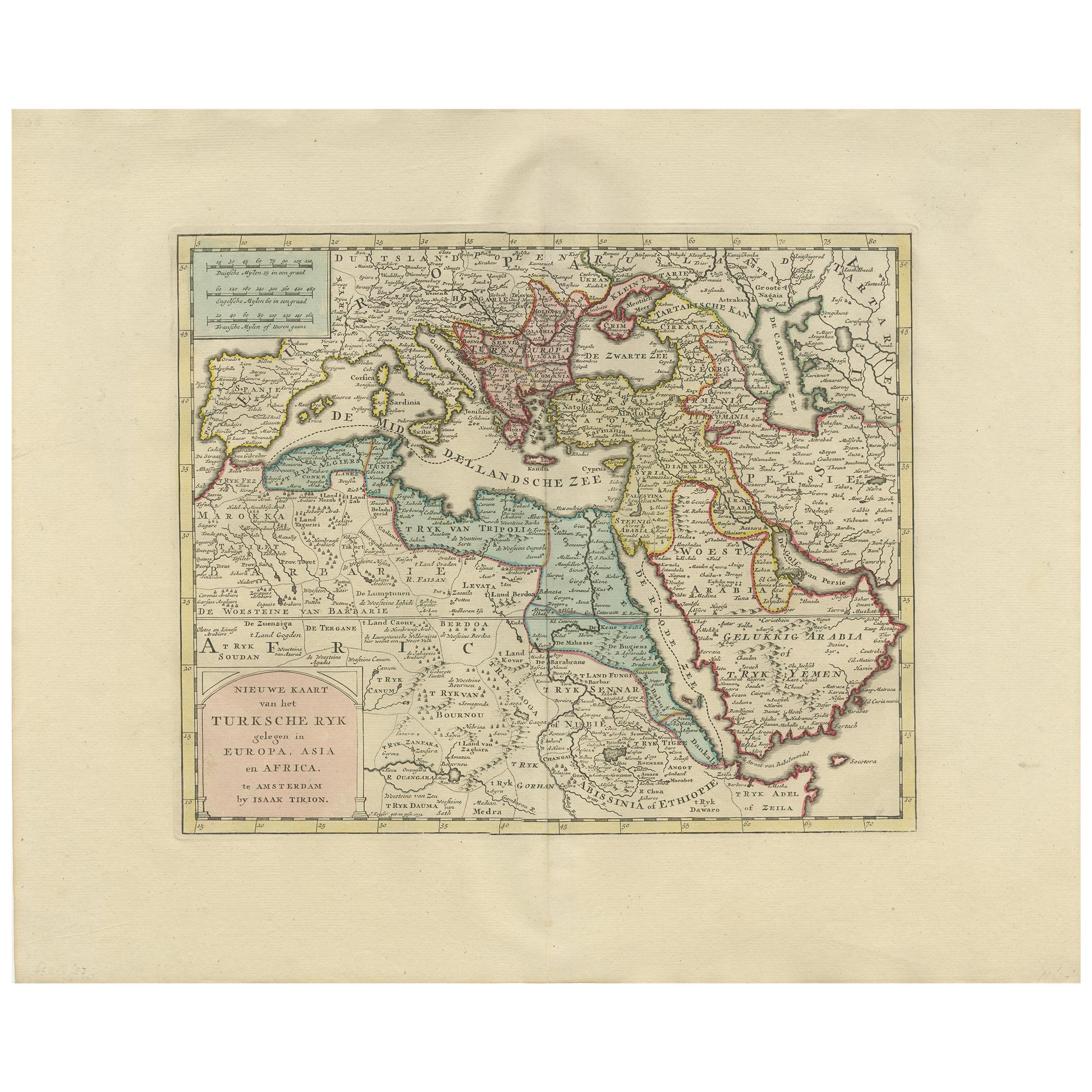
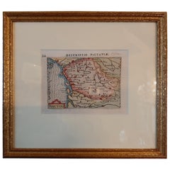
Antique Miniature Map of the Ottoman Empire by Bertius, 1618
View Similar Items


Want more images or videos?
Request additional images or videos from the seller
1 of 5
Antique Miniature Map of the Ottoman Empire by Bertius, 1618
About the Item
- Dimensions:Height: 5.01 in (12.7 cm)Width: 6.3 in (16 cm)Depth: 0.02 in (0.5 mm)
- Materials and Techniques:
- Period:Early 17th Century
- Date of Manufacture:1618
- Condition:General age-related toning. Dampstain lower left, sl. affecting image. French text on verso. Please study image carefully.
- Seller Location:Langweer, NL
- Reference Number:Seller: BG-130571stDibs: LU3054325720252
About the Seller
5.0
Platinum Seller
These expertly vetted sellers are 1stDibs' most experienced sellers and are rated highest by our customers.
Established in 2009
1stDibs seller since 2017
1,916 sales on 1stDibs
More From This SellerView All
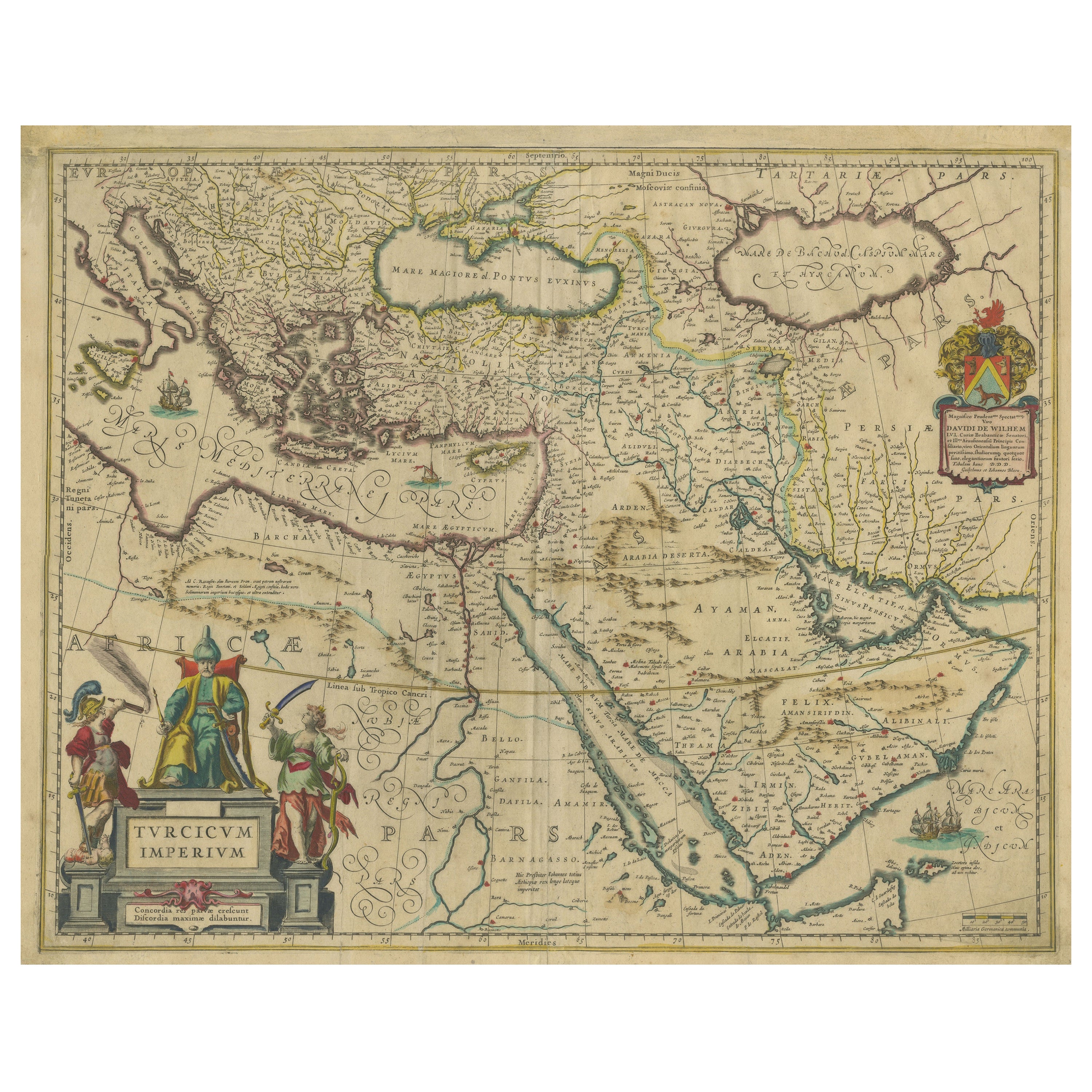
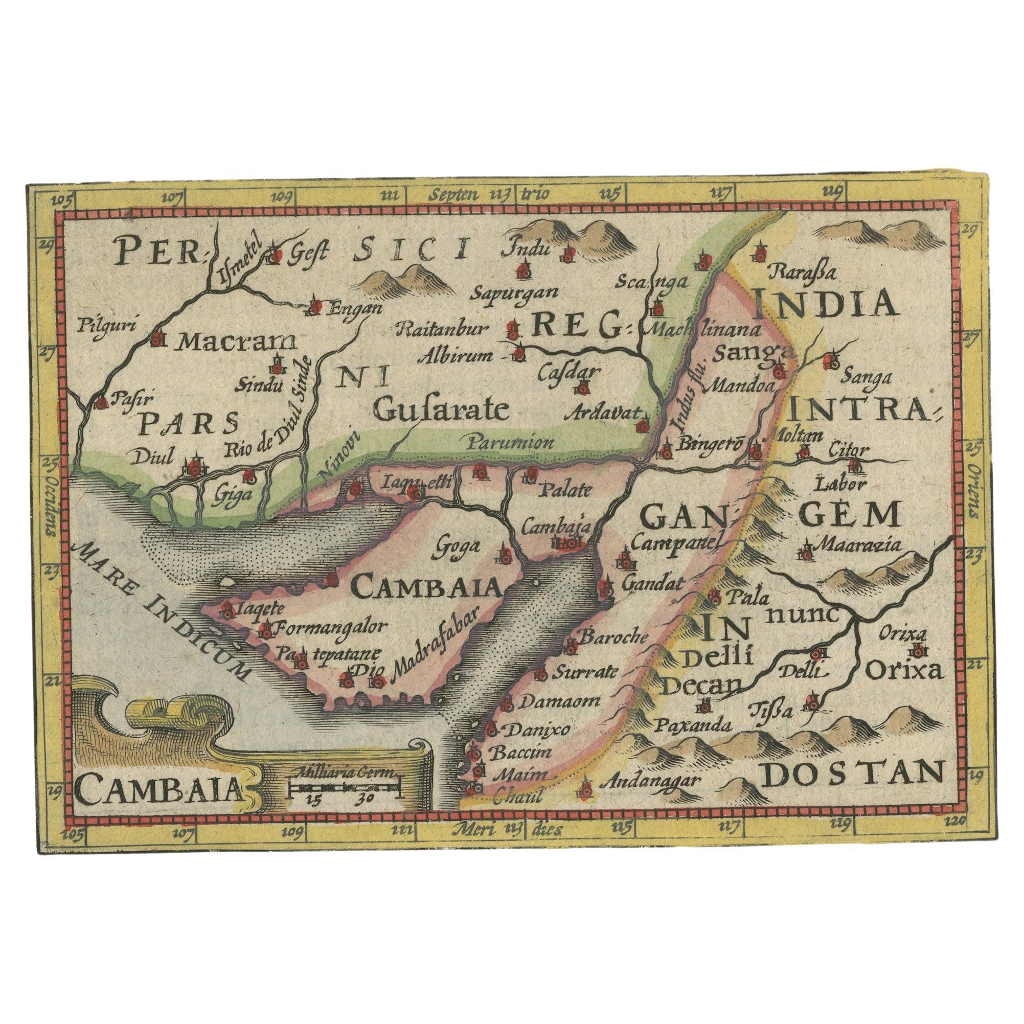
- Antique Miniature Map of the Turkish Empire by Bertius '1618'Located in Langweer, NLAntique miniature map titled 'Turcicum Imperium'. Rare miniature map of the Turkish Empire. This map originates from 'Tabularum Geographicarum Contractarum Libri septem (..)' by P. B...Category
Antique Early 17th Century Maps
MaterialsPaper
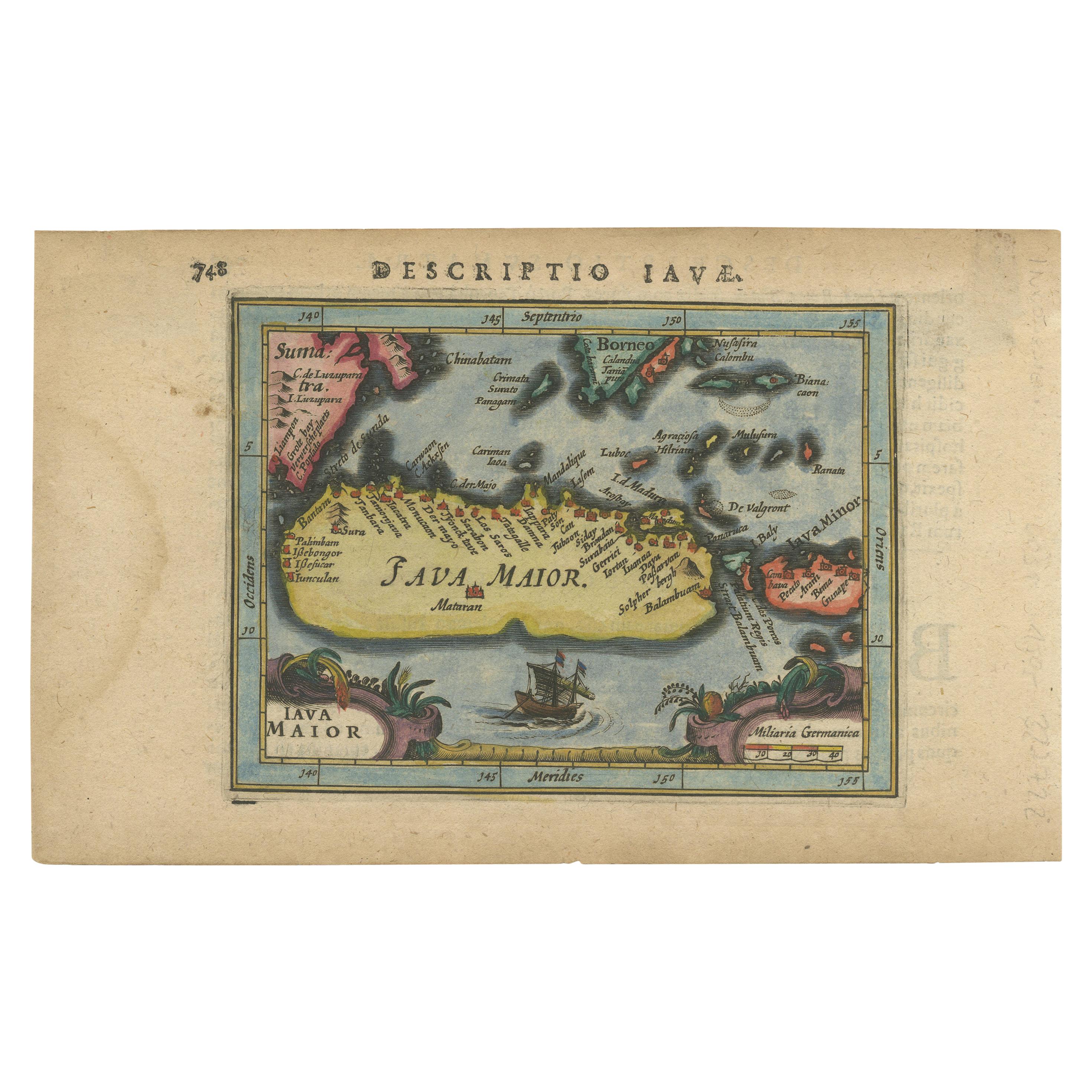
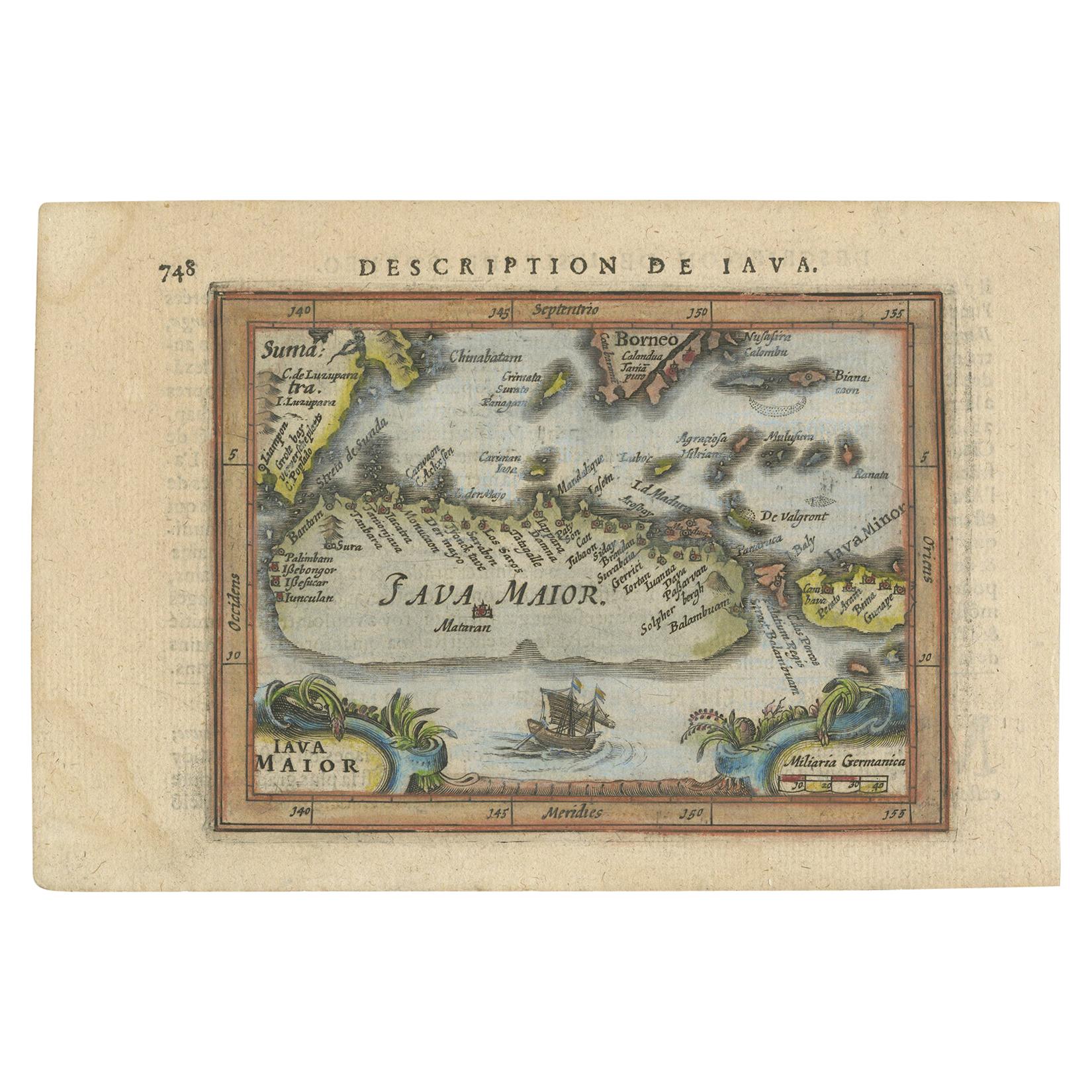
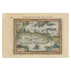
- Antique Miniature Map of Java by Bertius '1618'Located in Langweer, NLAntique miniature map titled 'Iava Maior'. Rare miniature map of Java, Indonesia. This map originates from 'Tabularum Geographicarum Contractarum Libri s...Category
Antique Early 17th Century Maps
MaterialsPaper
 $568 Sale Price20% Off
 - Antique Miniature Map of Java by Bertius/Hondius '1618'Located in Langweer, NLRare antique miniature map titled 'Iava Maior'. This map shows the northern coastline of Java (Indonesia) with numerous place names, but the southern coa...Category
Antique Early 17th Century Maps
MaterialsPaper
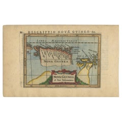
- Antique Miniature Map of New Guinea by Bertius, '1618'Located in Langweer, NLAntique miniature map titled 'Nova Guinea et Ins. Salomonis'. Rare miniature map of New Guinea (Solomon Islands). This map originates from 'Tabularum Geo...Category
Antique Early 17th Century Maps
MaterialsPaper
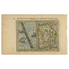
- Antique Miniature Map of Ceylon 'Sri Lanka' and the Maldives by Bertius, 1618Located in Langweer, NLAntique map titled 'Descriptio Zeilan, et Maldivarum Inss'. Rare, original antique miniature map of Ceylon/Sri Lanka and the Maldives. This map originate...Category
Antique Early 17th Century Maps
MaterialsPaper
 $437 Sale Price20% Off
 - Antique Miniature Map of the region of Poitou 'France' by Bertius, circa 1600Located in Langweer, NLAntique map titled 'Poictou'. Miniature map of the region of Poitou, France. Published by Pieter Bertius, circa 1600. Frame included. We carefully pack our framed items to ensure...Category
Antique Early 17th Century Maps
MaterialsPaper

You May Also Like
- Original Antique Map of The World by Thomas Clerk, 1817Located in St Annes, LancashireGreat map of The Eastern and Western Hemispheres On 2 sheets Copper-plate engraving Drawn and engraved by Thomas Clerk, Edinburgh. Published by Mackenzie And Dent, 1817 ...Category
Antique 1810s English Maps
MaterialsPaper
- Map of the Republic of GenoaLocated in New York, NYFramed antique hand-coloured map of the Republic of Genoa including the duchies of Mantua, Modena, and Parma. Europe, late 18th century. Dimension: 25...Category
Antique Late 18th Century European Maps
- Antique Map of Italy by Andriveau-Goujon, 1843By Andriveau-GoujonLocated in New York, NYAntique Map of Italy by Andriveau-Goujon, 1843. Map of Italy in two parts by Andriveau-Goujon for the Library of Prince Carini at Palazzo Carini i...Category
Antique 1840s French Maps
MaterialsLinen, Paper
 $3,350 / set
 - Antique Map of Principality of MonacoBy Antonio Vallardi EditoreLocated in Alessandria, PiemonteST/619 - "Old Geographical Atlas of Italy - Topographic map of ex-Principality of Monaco" - ediz Vallardi - Milano - A somewhat special edition ---Category
Antique Late 19th Century Italian Other Prints
MaterialsPaper
 $227 Sale Price74% Off
 - Antique 18th Century Map of the Province of Pensilvania 'Pennsylvania State'Located in Philadelphia, PAA fine antique of the colony of Pennsylvania. Noted at the top of the sheet as a 'Map of the province of Pensilvania'. This undated and anonymous map is thought to be from the Gentleman's Magazine, London, circa 1775, although the general appearance could date it to the 1760's. The southern boundary reflects the Mason-Dixon survey (1768), the western boundary is placed just west of Pittsburgh, and the northern boundary is not marked. The map has a number of reference points that likely refer to companion text and appear to be connected to boundaries. The western and southern boundaries are marked Q, R, S, for example. A diagonal line runs from the Susquehanna R to the Lake Erie P. A broken line marked by many letters A, B, N, O, etc., appears in the east. There are no latitude or longitude markings, blank verso. Framed in a shaped contemporary gilt wooden frame and matted under a cream colored matte. Bearing an old Graham Arader Gallery...Category
Antique 18th Century British American Colonial Maps
MaterialsPaper
- Map "Estuary- Mouth of the Thames"Located in Alessandria, PiemonteST/426 - Antique French Map of the estuary of the Thames, map dated 1769 - "Mape of the entrance of the Thames. Designed by filing of Navy cards fo...Category
Antique Mid-18th Century French Other Prints
MaterialsPaper
 $962 Sale Price20% Off


