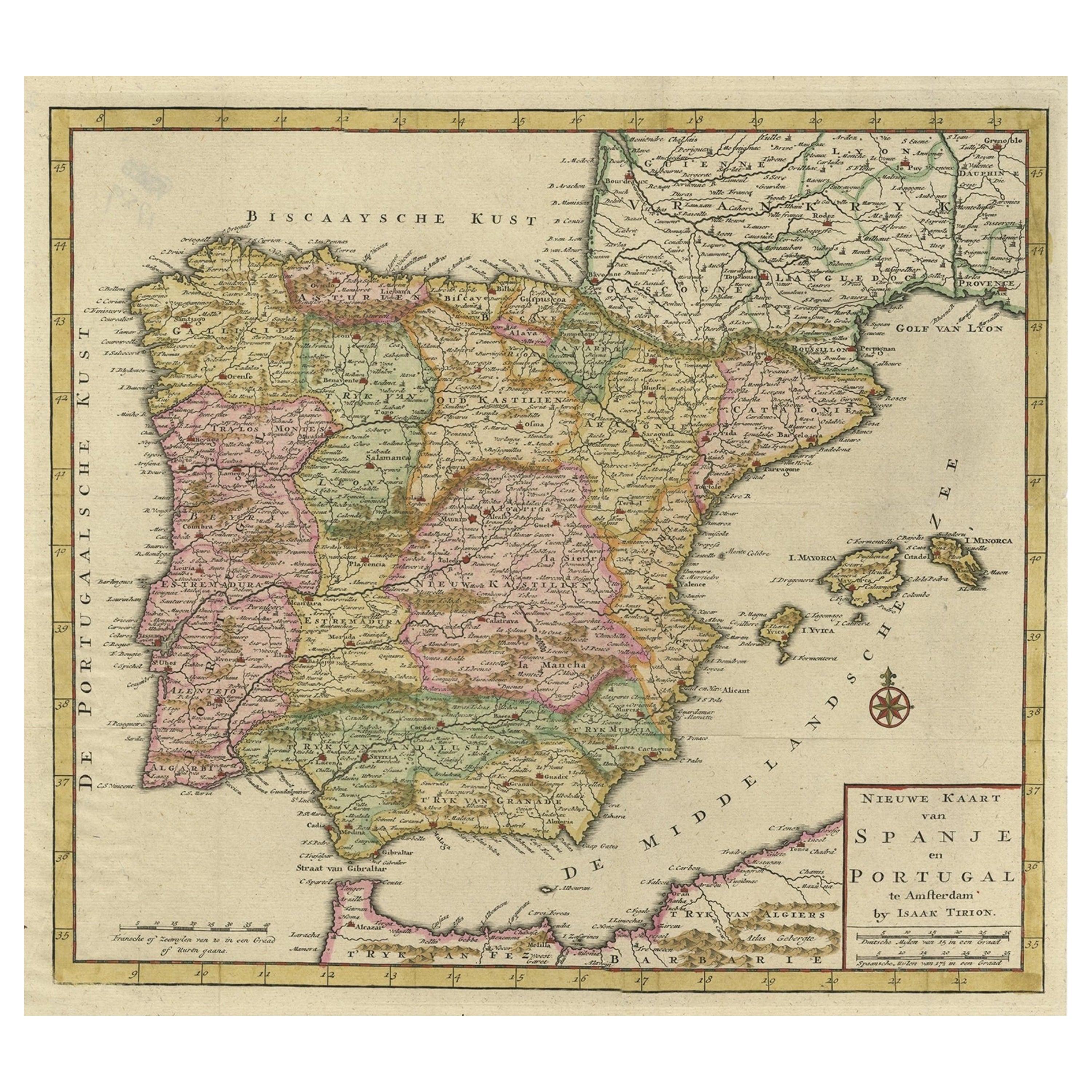
Items Similar to Detailed Old Map showing Spain and Portugal Incl. Majorca, Minorca & Ibiza, 1740
Want more images or videos?
Request additional images or videos from the seller
1 of 5
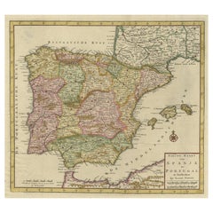
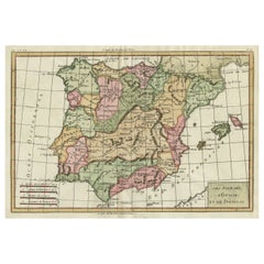
Detailed Old Map showing Spain and Portugal Incl. Majorca, Minorca & Ibiza, 1740
About the Item
Antique map titled 'Nieuwe Kaart van Spanje en Portugal.'
Attractive detailed map showing Spain and Portugal. Including Majorca, Minorca and Ibiza. Title in block-style cartouche with a simple compass rose. Source unknown, to be determined.
Artists and Engravers: Made by 'Isaak Tirion' after an anonymous artist. Made by 'Isaak Tirion' after an anonymous artist. Isaak Tirion, a Dutch publisher in Amsterdam, was born 1705. He produced serveral Atlases and Dutch town plans. The maps mainly based on those of Guillaume de l'Isle. He died in 1765.
Condition: Good, given age. Edges with small tears. A few spots in the margins. Original middle fold as issued. General age-related toning and/or occasional minor defects from handling. Please study image carefully.
- Dimensions:Height: 17.13 in (43.5 cm)Width: 21.78 in (55.3 cm)Depth: 0 in (0.02 mm)
- Materials and Techniques:
- Period:1740-1749
- Date of Manufacture:circa 1740
- Condition:Wear consistent with age and use. Condition: Good, given age. Edges with small tears. A few spots in the margins. Original middle fold as issued. General age-related toning and/or occasional minor defects from handling. Please study image carefully.
- Seller Location:Langweer, NL
- Reference Number:
About the Seller
5.0
Platinum Seller
These expertly vetted sellers are 1stDibs' most experienced sellers and are rated highest by our customers.
Established in 2009
1stDibs seller since 2017
1,933 sales on 1stDibs
Typical response time: <1 hour
- ShippingRetrieving quote...Ships From: Langweer, Netherlands
- Return PolicyA return for this item may be initiated within 14 days of delivery.
More From This SellerView All
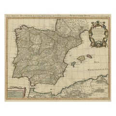
- Attractive Engraved Old Map Showing Spain, Portugal Majorca, Ibiza etc. ca.1760Located in Langweer, NLAntique map titled 'Nieuwe Kaart van Spanje en Portugal.' Attractive detailed map showing Spain and Portugal. Including Majorca, Minorca and Ibiza. Title in block-style cartouche...Category
Antique 1760s Maps
MaterialsPaper
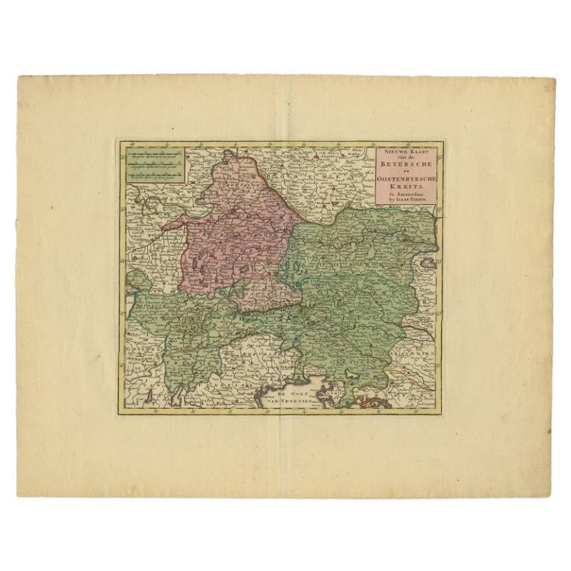
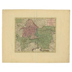
- Attractive Detailed Authentic Map Showing Bavaria, Germany and Austria, c.1740Located in Langweer, NLAntique map titled 'Nieuwe Kaart van de Beyersche en Oostenryksche Kreits (..).' Attractive detailed map showing Bavaria, Germany and Austria. Source unknown, to be determined. Ar...Category
Antique 18th Century Maps
MaterialsPaper
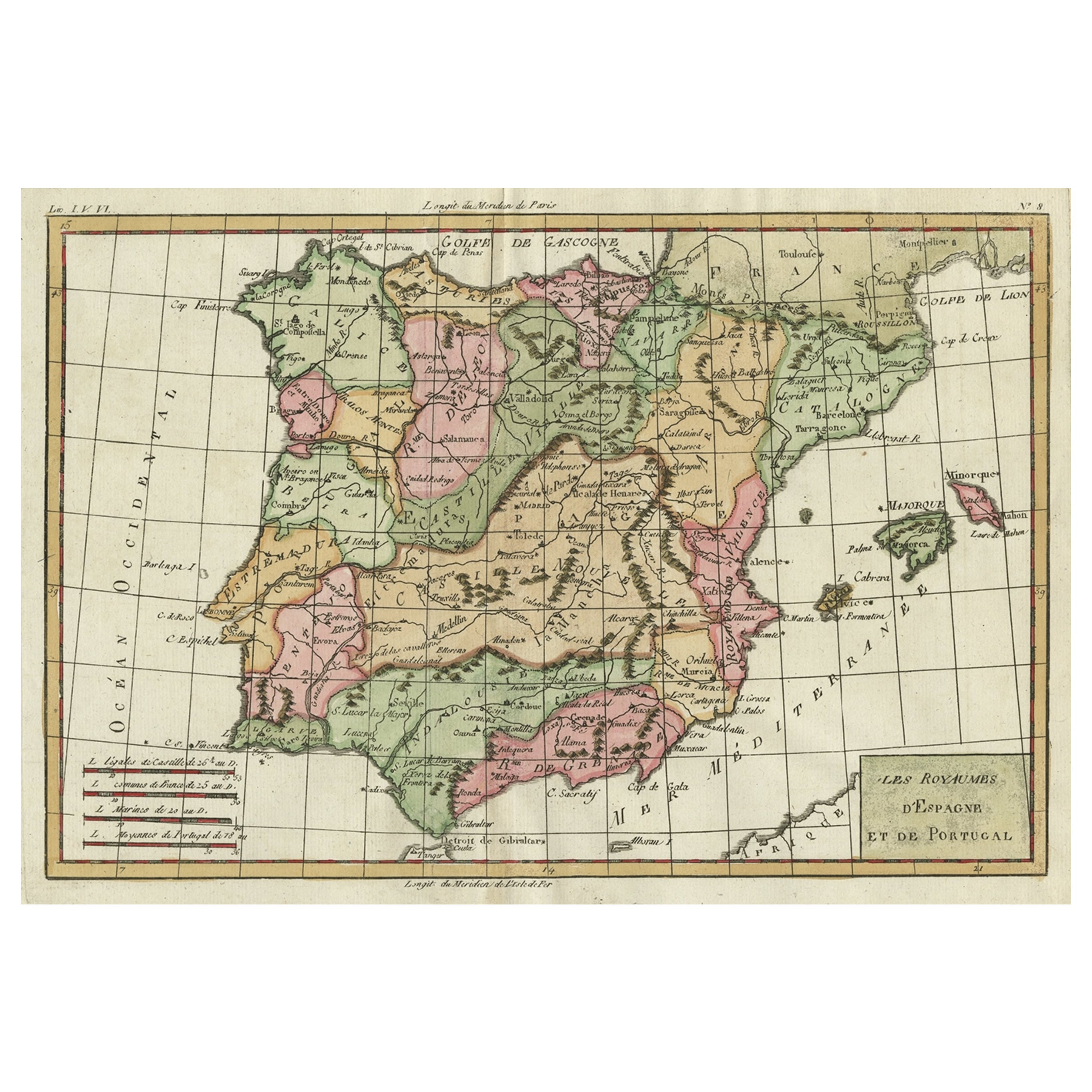
- Map of Spain & Portugal Incl. the islands of Ibiza, Minorque & Majorque, 1780Located in Langweer, NLAntique map titled 'Les Royaumes d'Espagne et de Portugal.' Map of Spain and Portugal. Includes the islands of Ibiza, Minorque, and Majorque. Shows towns, rivers, some topographi...Category
Antique 1780s Maps
MaterialsPaper
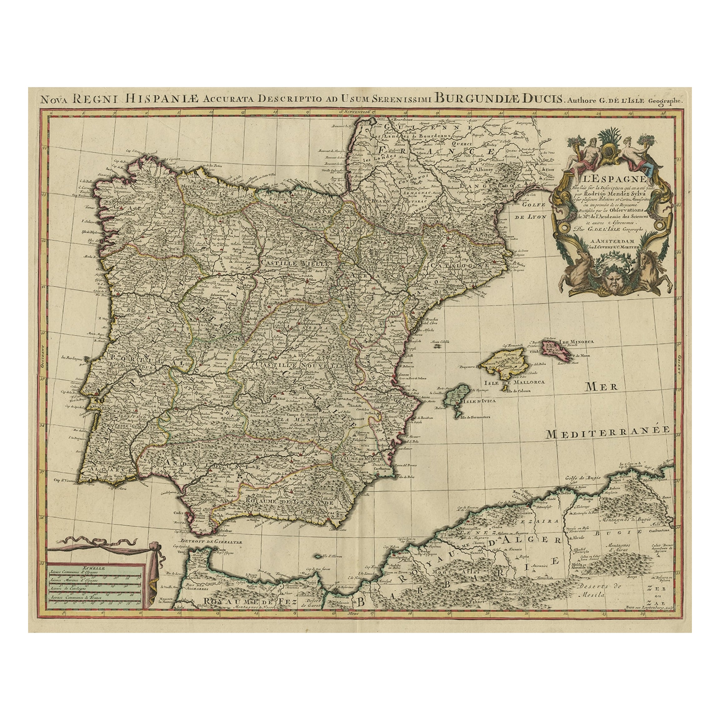
- Beautiful Old Map of Spain and Portugal With Decorative Title Cartouche, ca.1740Located in Langweer, NLAntique map Spain titled 'L’Espagne dressée sur la Description qui en a eté faite par Rodrigo Mendez Sylva (..)'. Beautiful map of Spain with dec...Category
Antique 1740s Maps
MaterialsPaper
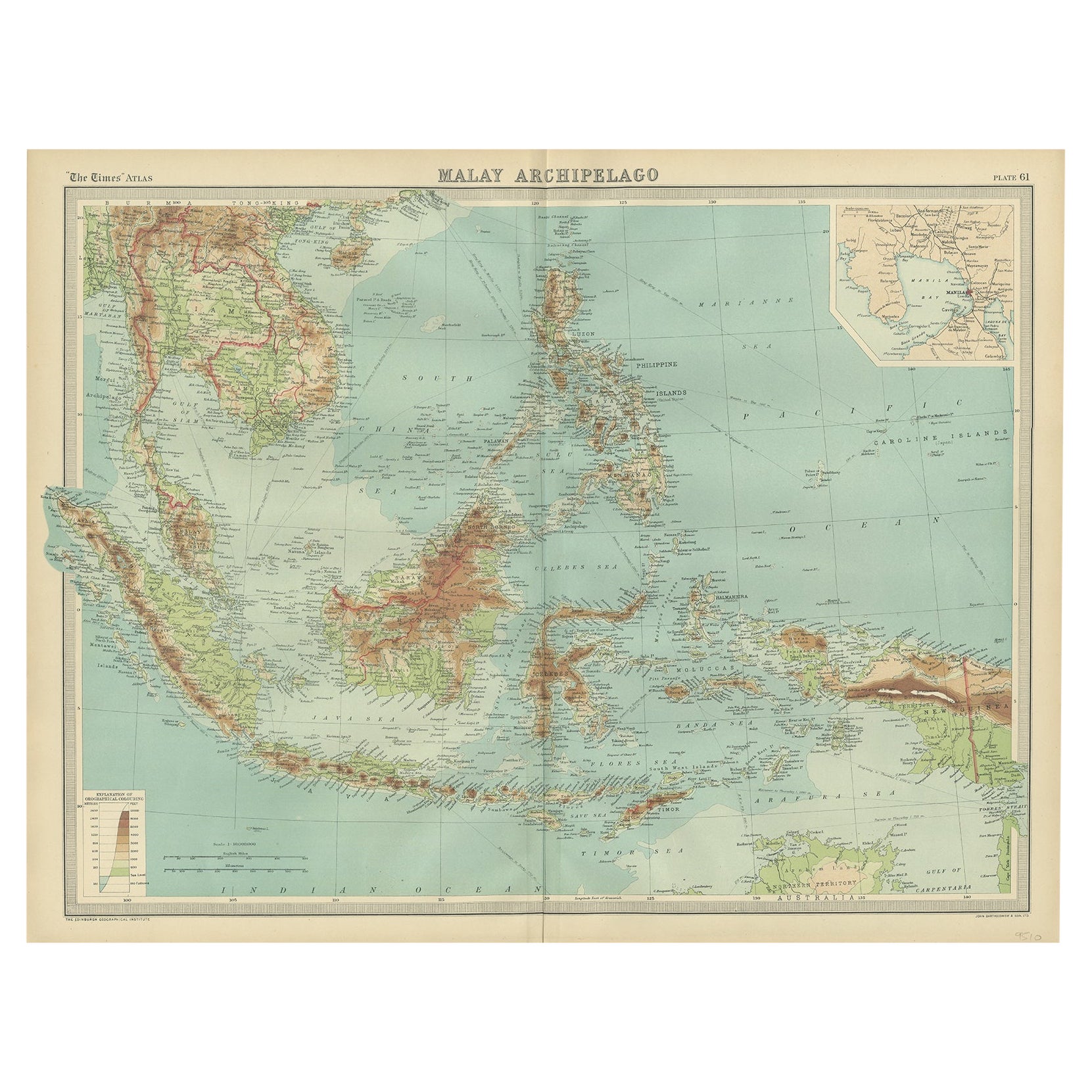
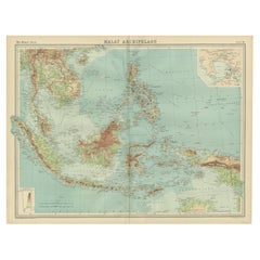
- Old Map of South East Asia Showing the Malay Archipelago, incl Borneo etc, 1922Located in Langweer, NLAntique map of South East Asia titled 'Malay Archipelago'. Old map of South East Asia depicting the Malay Archipelago including Sumatra, Java...Category
Vintage 1920s Maps
MaterialsPaper
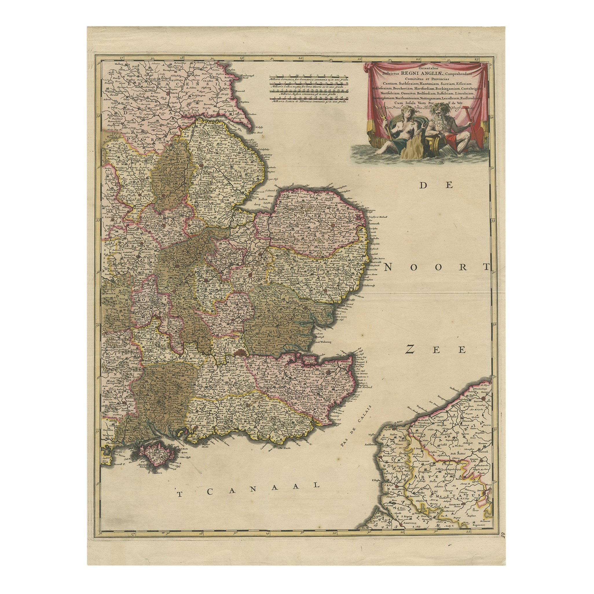
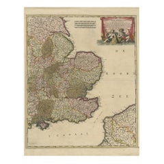
- Detailed Antique Map of Southeast England, incl Warwickshire and Hampshire, 1690Located in Langweer, NLAntique map titled 'Orientalior districtus Regni Angliae (..)'. Detailed map of southeast England encompassing the country from Lincolnshire and the Wash south and including Warw...Category
Antique 1690s Maps
MaterialsPaper
You May Also Like
- Original Antique Map of Spain and Portugal, circa 1790Located in St Annes, LancashireSuper map of Spain and Portugal Copper plate engraving by A. Bell Published, circa 1790. Unframed.Category
Antique 1790s English Other Maps
MaterialsPaper
- Original Antique Map of Spain and Portugal by Thomas Clerk, 1817Located in St Annes, LancashireGreat map of Spain and Portugal Copper-plate engraving Drawn and engraved by Thomas Clerk, Edinburgh. Published by Mackenzie And Dent, 1817 Unframed.Category
Antique 1810s English Maps
MaterialsPaper
- 18th Century Hand Colored Map of Spain and Portugal by VisscherBy Nicolaes Visscher IILocated in Alamo, CAThis is an early 18th century map of Spain and Portugal, with attractive original hand-coloring, entitled "Hispaniae et Portugalliae Regna per Nicolaum Visscher cum Privilegio Ordinu...Category
Antique Early 18th Century Dutch Maps
MaterialsPaper
- Old Nautical Map of CorsicaLocated in Alessandria, PiemonteST/556/1 - Old map of Corsica isle, surveyed by Captain Hell, of the French Royal Navy in 1824, engraved and published on 1874, with additions and corre...Category
Antique Early 19th Century English Other Prints
MaterialsPaper
- Old Horizontal Map of EnglandBy TassoLocated in Alessandria, PiemonteST/520 - Old rare Italian map of England, dated 1826-1827 - by Girolamo Tasso, editor in Venise, for the atlas of M.r Le-Sage.Category
Antique Early 19th Century Italian Other Prints
MaterialsPaper
- 18th Century Emanuel Bowen Map of County of York, c.1740By Emanuel BowenLocated in Royal Tunbridge Wells, KentAntique 18th century British rare and original Emanuel Bowen (1694-1767) map of the County of York divided into its Ridings and subdivided into wapontakes, mounted in solid wood fram...Category
Antique Early 18th Century British Maps
MaterialsPaper


