Items Similar to Large Chart of the island and sea of Java, Indonesia


Want more images or videos?
Request additional images or videos from the seller
1 of 6
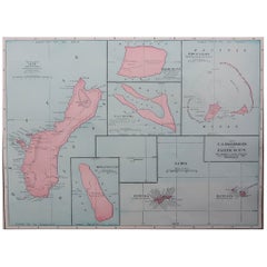
Large Chart of the island and sea of Java, Indonesia
$2,407.29
$3,009.1220% Off
£1,751.28
£2,189.1020% Off
€2,000
€2,50020% Off
CA$3,285.26
CA$4,106.5820% Off
A$3,658.44
A$4,573.0520% Off
CHF 1,904.01
CHF 2,380.0220% Off
MX$45,108.09
MX$56,385.1120% Off
NOK 24,249.08
NOK 30,311.3520% Off
SEK 22,791.78
SEK 28,489.7320% Off
DKK 15,220.93
DKK 19,026.1620% Off
Shipping
Retrieving quote...The 1stDibs Promise:
Authenticity Guarantee,
Money-Back Guarantee,
24-Hour Cancellation
About the Item
Antique map titled 'Carte Esférica de la Isla Y Mar de Java'. Large chart of the island and sea of Java, Indonesia. Beautiful nautical chart, published 1863 in Spain.
- Dimensions:Height: 27.25 in (69.2 cm)Width: 40.56 in (103 cm)Depth: 0.02 in (0.5 mm)
- Materials and Techniques:
- Period:
- Date of Manufacture:1863
- Condition:Wear consistent with age and use. General age-related toning. Few small weak spots. Stamp near title. Blank verso. Please study image carefully.
- Seller Location:Langweer, NL
- Reference Number:Seller: BG-13369-21stDibs: LU3054331885432
About the Seller
5.0
Recognized Seller
These prestigious sellers are industry leaders and represent the highest echelon for item quality and design.
Platinum Seller
Premium sellers with a 4.7+ rating and 24-hour response times
Established in 2009
1stDibs seller since 2017
2,482 sales on 1stDibs
Typical response time: <1 hour
- ShippingRetrieving quote...Shipping from: Langweer, Netherlands
- Return Policy
Authenticity Guarantee
In the unlikely event there’s an issue with an item’s authenticity, contact us within 1 year for a full refund. DetailsMoney-Back Guarantee
If your item is not as described, is damaged in transit, or does not arrive, contact us within 7 days for a full refund. Details24-Hour Cancellation
You have a 24-hour grace period in which to reconsider your purchase, with no questions asked.Vetted Professional Sellers
Our world-class sellers must adhere to strict standards for service and quality, maintaining the integrity of our listings.Price-Match Guarantee
If you find that a seller listed the same item for a lower price elsewhere, we’ll match it.Trusted Global Delivery
Our best-in-class carrier network provides specialized shipping options worldwide, including custom delivery.More From This Seller
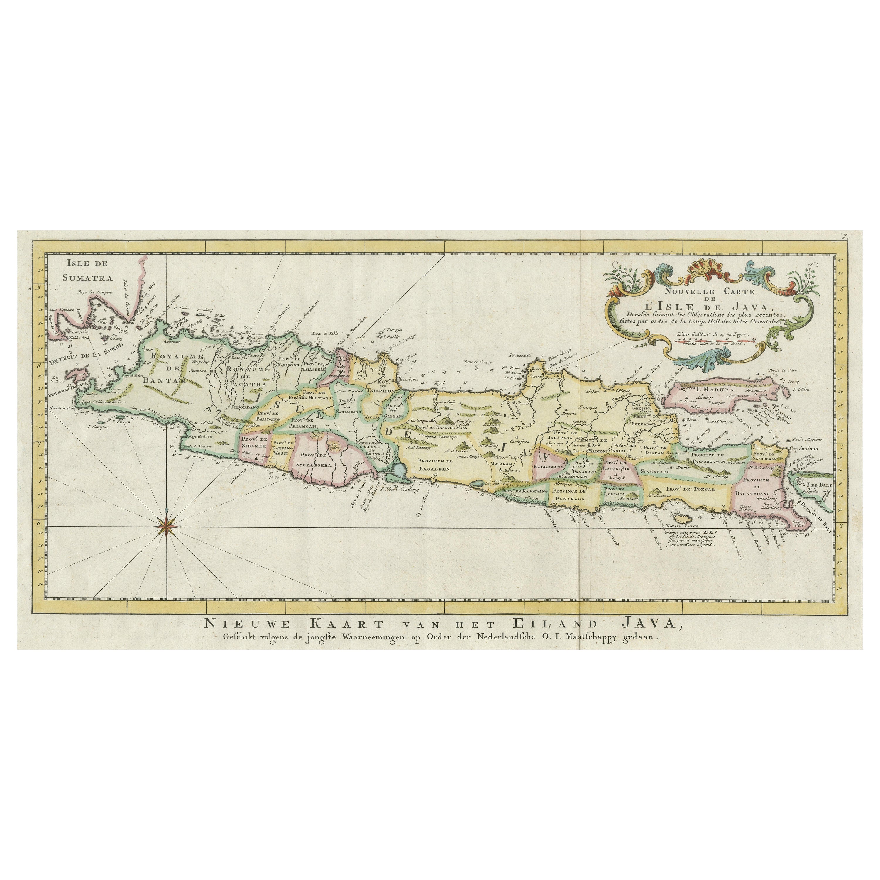
View AllAntique Map of the Island of Java, Indonesia
Located in Langweer, NL
Antique map titled 'Nouvelle Carte de l'Isle de Java (..) - Nieuwe Kaart van het Eiland Java (..)'. Chart of the island of Java, depicting soundings around the coast, all principal h...
Category
Antique Late 18th Century Maps
Materials
Paper
$433 Sale Price
20% Off
Scarce Antique Map of the Island of Java, Indonesia
Located in Langweer, NL
Title: "Kaart van 't Eyland Groot Java: Antique Map of Java, Indonesia"
Description: This antique map, titled "Kaart van 't Eyland Groot Java," offers a rare and valuable depiction ...
Category
Antique Late 18th Century Maps
Materials
Paper

$625 Sale Price
20% Off
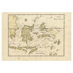
Old Original Antique Map of the Islands of East Indonesia, 1756
Located in Langweer, NL
Title: Isles Moluques.
Old and rare, this decorative map of the Maluku Islands in the period it was still controlled by the Dutch colonial power. It also shows the island of Bali, Lombok, part of Borneo (Kalimantan), Celebes (Sulawesi), Timor, The Lesser Sunda Islands, West Papua...
Category
Antique 1750s Maps
Materials
Paper
$433 Sale Price
20% Off
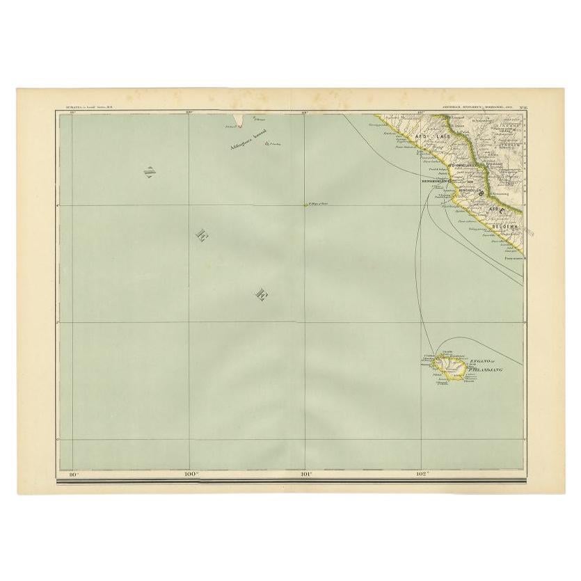
Antique Map of the Region of Bengkulu in Indonesia, 1900
Located in Langweer, NL
Antique map of the region of Benkulu, Sumatra. Also depicting Enggano Island. This map originates from 'Atlas van Nederlandsch Oost- en West-Indië' by I. Dornseiffen.
Artists and E...
Category
20th Century Maps
Materials
Paper
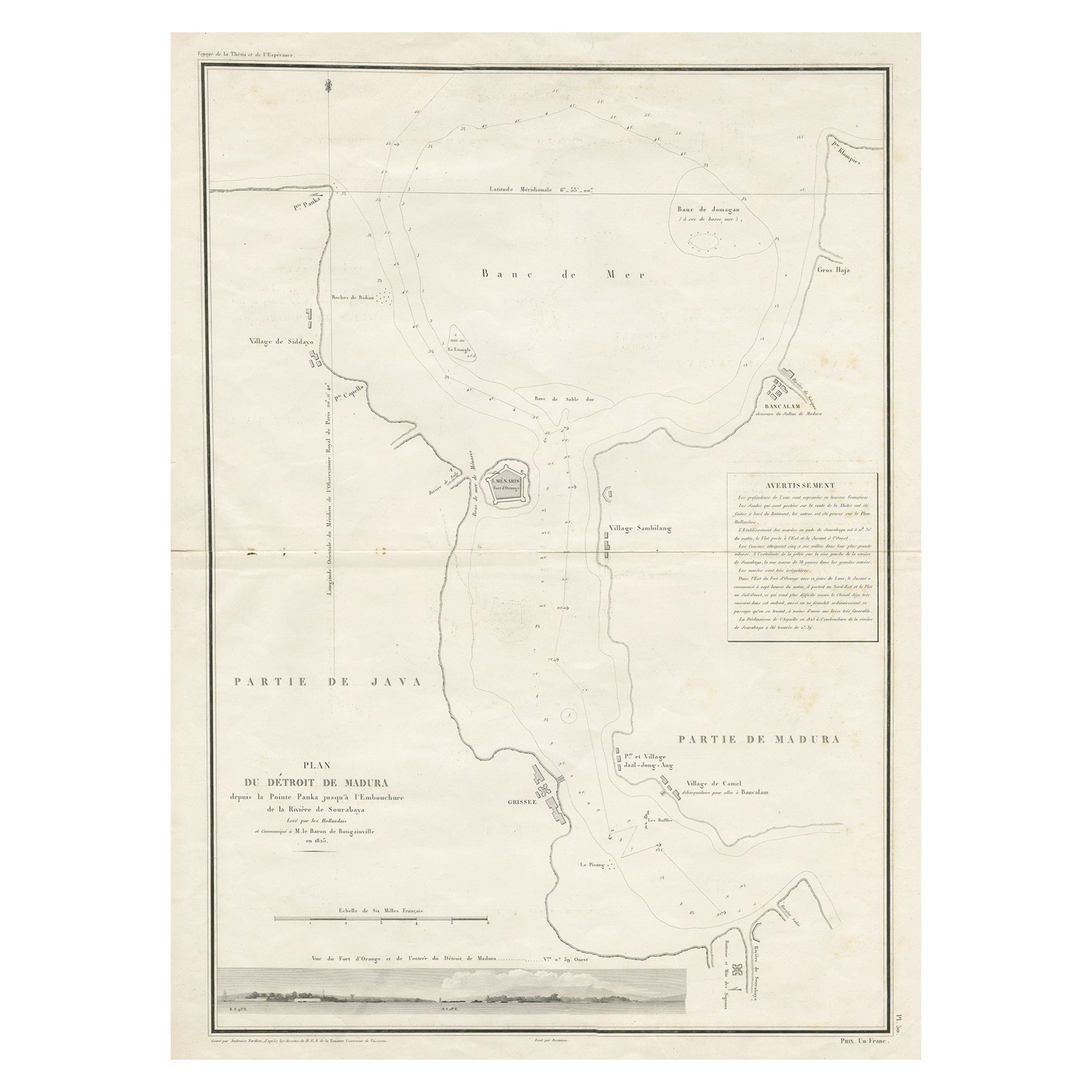
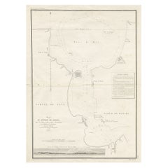
Detailed Map of the Madura Strait, between Java & Madura Island, Indonesia, 1825
Located in Langweer, NL
Antique map titled 'Plan du Détroit de Madura'.
Detailed map of the Madura Strait in Indonesia. The eastern part of the island Java with the city of Gresik and the western part o...
Category
Antique 1820s Maps
Materials
Paper
$1,129 Sale Price
24% Off
Free Shipping
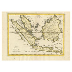
Old Original Antique Map of the Sunda Islands of Indonesia, 1756
Located in Langweer, NL
Title: Isles De La Sonde.
Attractive old decorative map of the Isles de la Sonde, Borneo, Sumatra, Java and Malacca ( Malaysia) with the Straits of Malacca. Penang is spelled as P...
Category
Antique 1750s Maps
Materials
Paper
$529 Sale Price
20% Off
You May Also Like
Antique 1803 Italian Map of Asia Including China Indoneseia India
Located in Amsterdam, Noord Holland
Antique 1803 Italian Map of Asia Including China Indoneseia India
Very nice map of Asia. 1803.
Additional information:
Type: Map
Country of Manufacturing: Europe
Period: 19th centu...
Category
Antique 19th Century European Maps
Materials
Paper

$584 Sale Price
20% Off
Large Original Vintage Map of The Pacific Islands Including Hawaii
Located in St Annes, Lancashire
Great map of The Pacific Islands
Unframed
Original color
By John Bartholomew and Co. Edinburgh Geographical Institute
Published, circa 1...
Category
Vintage 1920s British Maps
Materials
Paper

19th Century Nautical Chart of Martinique
Located in Norwell, MA
Original map of Martinique from 1887 with chartered waters around the island. Prepared from a French survey, completed in 1825, showing town, ports, rivers and tributaries. Published...
Category
Antique 19th Century Nautical Objects

Original Antique Map of US Possessions In The Pacific Ocean, C.1900
Located in St Annes, Lancashire
Fabulous map of US possessions in the Pacific Ocean
Original color.
Engraved and printed by the George F. Cram Company, Indianapolis.
Published, C.1900.
Unframed.
Free shipping.
Category
Antique 1890s American Maps
Materials
Paper
West Coast of Africa, Guinea & Sierra Leone: An 18th Century Map by Bellin
By Jacques-Nicolas Bellin
Located in Alamo, CA
Jacques Bellin's copper-plate map entitled "Partie de la Coste de Guinee Dupuis la Riviere de Sierra Leona Jusquau Cap das Palmas", depicting the coast of Guinea and Sierra Leone in ...
Category
Antique Mid-18th Century French Maps
Materials
Paper

Chart of Boston's North Shore
Located in Norwell, MA
Rarely found restrike of an 1804 chart by Nathanael Bowditch of the Harbors of Salem, Marblehead, Beverly, and Manchester.
Showing the Islands of Great Misery, Satan, Cuney, Winter,...
Category
Vintage 1980s North American Maps
Materials
Paper

More Ways To Browse
Scandinavian Partners Desk
Schumacher Toile
Scissor Leg Chair
Set Of 4 Swivel Lounge Chair
Sevres Dinner Plates
Sevres Fontainebleau
Sevres Porcelain Tea Set
Shaker Benches
Sheffield Salad Server
Sheffield Tea Urn
Shelby Williams Chairs Vintage
Shell Oil Chair
Sheraton Bureau
Sheraton Shield Back Chair
Sheridan Silver Plated
Shoji Cabinet
Side Table 32 Inches Tall
Siena Italy Plates