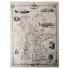
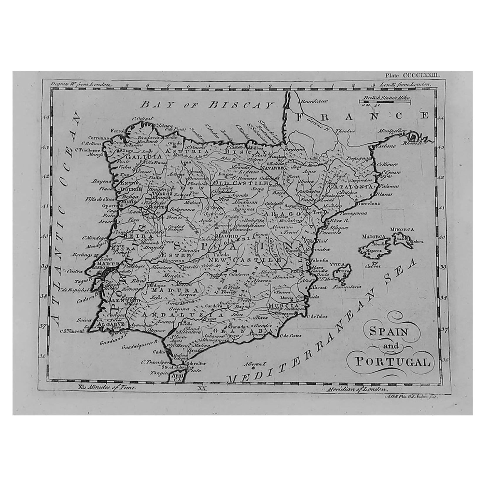
Original Antique Map of Germany by Tallis, Circa 1850
View Similar Items


Want more images or videos?
Request additional images or videos from the seller
1 of 5
Auction endedBrowse Current Auctions
Original Antique Map of Germany by Tallis, Circa 1850
About the Item
- Dimensions:Height: 13.75 in (34.93 cm)Width: 10.75 in (27.31 cm)Depth: 0.07 in (1.78 mm)
- Materials and Techniques:Paper,Other
- Place of Origin:
- Period:
- Date of Manufacture:1850
- Condition:Wear consistent with age and use.
- Seller Location:St Annes, GB
- Reference Number:1stDibs: LU1836330326762
About the Seller
4.9
Platinum Seller
Premium sellers with a 4.7+ rating and 24-hour response times
1stDibs seller since 2016
3,080 sales on 1stDibs
Typical response time: 1 hour
Associations
International Confederation of Art and Antique Dealers' Associations
Authenticity Guarantee
In the unlikely event there’s an issue with an item’s authenticity, contact us within 1 year for a full refund. DetailsMoney-Back Guarantee
If your item is not as described, is damaged in transit, or does not arrive, contact us within 7 days for a full refund. Details24-Hour Cancellation
You have a 24-hour grace period in which to reconsider your purchase, with no questions asked.Vetted Professional Sellers
Our world-class sellers must adhere to strict standards for service and quality, maintaining the integrity of our listings.Price-Match Guarantee
If you find that a seller listed the same item for a lower price elsewhere, we’ll match it.Trusted Global Delivery
Our best-in-class carrier network provides specialized shipping options worldwide, including custom delivery.More From This Seller
View AllOriginal Antique Map of Belgium by Tallis, Circa 1850
Located in St Annes, Lancashire
Great map of Belgium
Steel engraving
Many lovely vignettes
Published by London Printing & Publishing Co. ( Formerly Tallis ), C.1850
Origin...
Category
Antique 1850s English Maps
Materials
Paper

Original Antique Map / City Plan of Brussels by Tallis, circa 1850
Located in St Annes, Lancashire
Great map of Brussels.
Steel engraving.
Published by London Printing & Publishing Co. (Formerly Tallis), C.1850
Free shipping.
Category
Antique 1850s English Maps
Materials
Paper

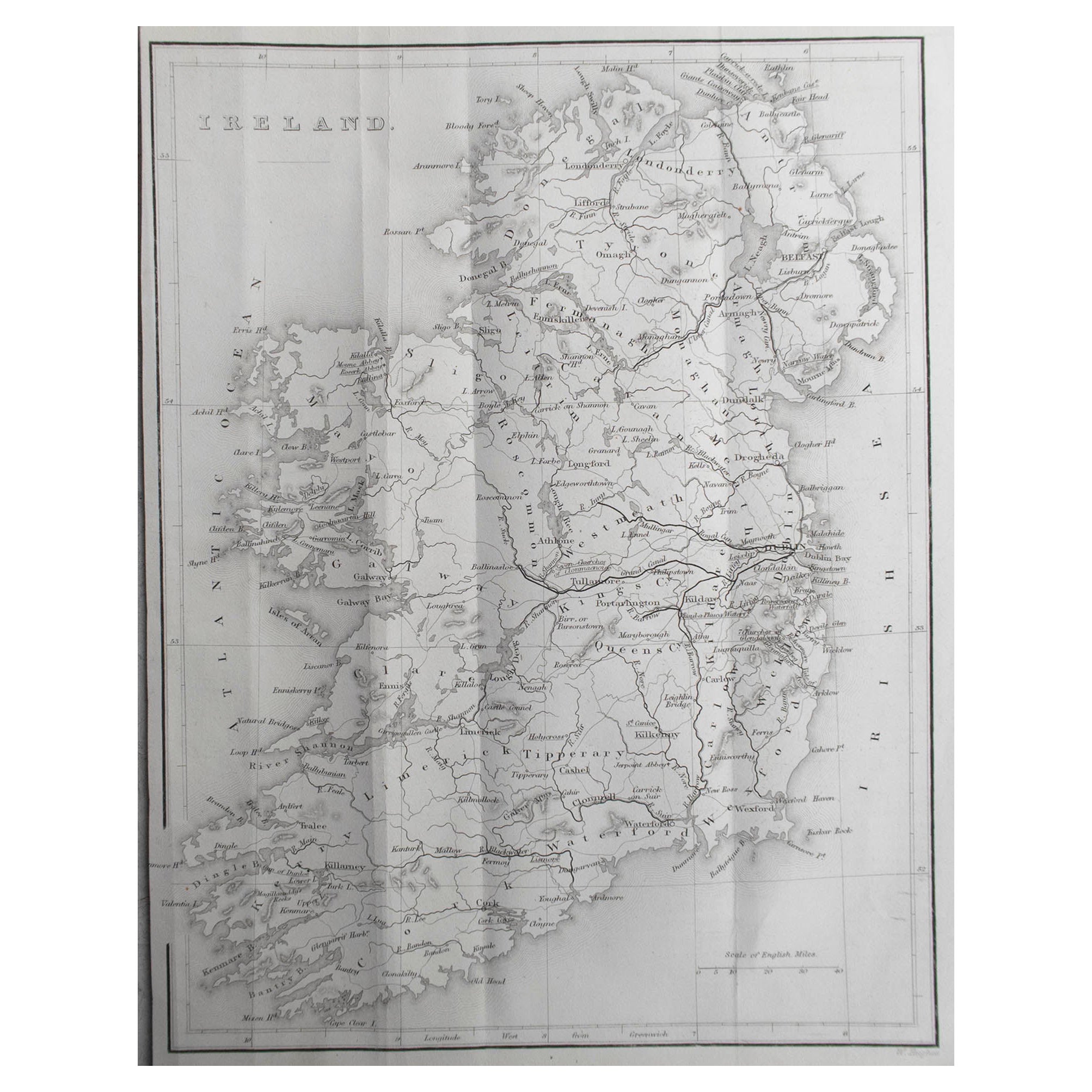
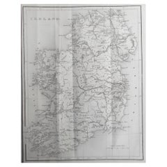
Original Antique Map of Ireland by Hughes. C.1850
Located in St Annes, Lancashire
Great map of Ireland
Engraved by W.Hughes
Published by Virtue, C.1850
Unframed.
Category
Antique 1850s Scottish Other Maps
Materials
Paper
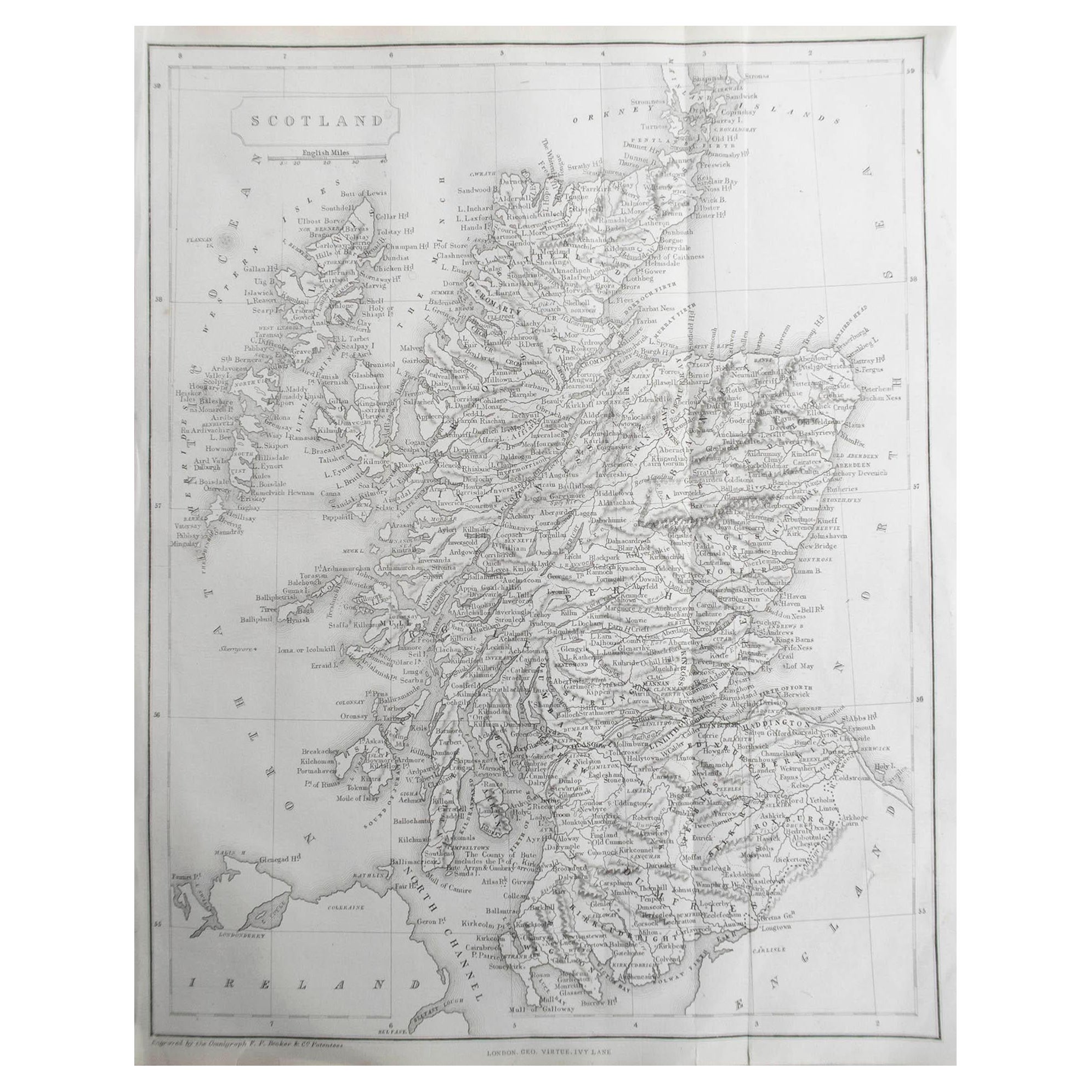
Original Antique Map of Scotland by Becker. C.1850
Located in St Annes, Lancashire
Great map of Scotland
Engraved by F.P Becker
Published by Virtue, C.1850
Unframed.
Category
Antique 1850s Scottish Other Maps
Materials
Paper

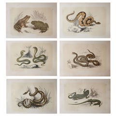
Set of 6 Original Antique Reptile Prints, Tallis, circa 1850
Located in St Annes, Lancashire
Great images of reptiles
Unframed. It gives you the option of perhaps making a set up using your own choice of frames.
Lithographs with original color.
Published by Tallis c...
Category
Antique 1850s English Folk Art Prints
Materials
Paper
$96 Sale Price / set
65% Off
Free Shipping
Original Antique Map of South America, circa 1830
Located in St Annes, Lancashire
Great map of South America
Copper plate engraving
Published by Butterworth, Livesey & Co., circa 1830
Unframed.
Category
Antique Early 1800s English Other Maps
Materials
Paper

You May Also Like
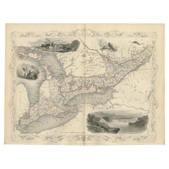
Antique Map of West Canada by Tallis 'c.1850'
Located in Langweer, NL
Antique map titled 'West Canada'. Original antique map of West Canada, with decorative vignettes titled Kingston and Falls of Niagara. This map originates from 'The History and Topog...
Category
Antique Mid-19th Century Maps
Materials
Paper
$278 Sale Price
20% Off
Antique Map of British America by Tallis 'c.1850'
Located in Langweer, NL
Antique map titled 'British America'. Decorative map of British America, with vignettes showing Whale Fishing, Montreal, Fury and Hecla ships asail. Thi...
Category
Antique Mid-19th Century Maps
Materials
Paper

$434 Sale Price
25% Off
Antique Map of Switzerland by J. Tallis, circa 1851
Located in Langweer, NL
A decorative and detailed mid-19th century map of Switzerland which was drawn and engraved by J. Rapkin (vignettes by A. H. Wray & J. B. Allen) and published in John Tallis's Illustr...
Category
Antique Mid-19th Century Maps
Materials
Paper

$255 Sale Price
20% Off
Antique Map of Belgium by J. Tallis, circa 1851
Located in Langweer, NL
A highly decorative and detailed mid-19th century map of Belgium which was drawn and engraved by J. Rapkin (vignettes by J. Marchant and J. B. Allen) an...
Category
Antique Mid-19th Century Maps
Materials
Paper

$232 Sale Price
20% Off
Antique Map of Northern Italy by J. Tallis, circa 1851
Located in Langweer, NL
A highly decorative mid-19th century map of Northern Italy which was drawn and engraved by John Rapkin (vignettes by A. H. Wray & J. B. Allen) and published in John Tallis & co.'s Th...
Category
Antique Mid-19th Century Maps
Materials
Paper

$167 Sale Price
47% Off
Antique Map of Asia Minor by J. Tallis, circa 1851
Located in Langweer, NL
A highly decorative mid-19th century map of 'Asia Minor' (modern day Turkey) which was drawn and engraved by J. Rapkin and published in John Tallis's Illust...
Category
Antique Mid-19th Century Maps
Materials
Paper

$256 Sale Price
20% Off