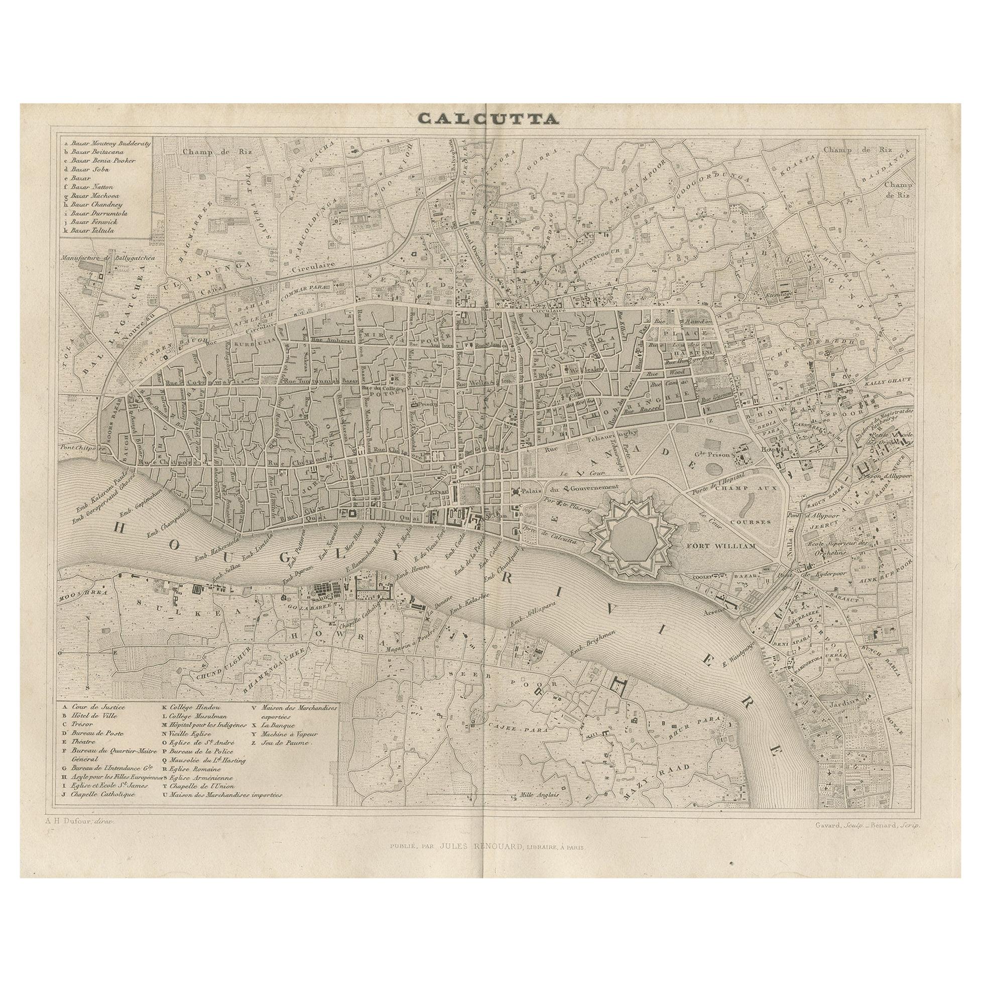
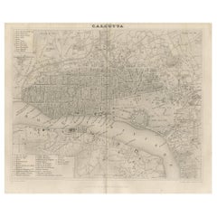
Items Similar to Rare Antique Map of Calcutta 'Kolkata' in India, 1893


Want more images or videos?
Request additional images or videos from the seller
1 of 6
Rare Antique Map of Calcutta 'Kolkata' in India, 1893
About the Item
Antique map titled 'Calcutta (India)'. Old map of Calcutta/Kolkata, India. On verso, a map of Egypt, Arabia, Upper Nubia and Abyssinia. Originates from 'The Columbian World's Fair atlas'.
Artists and Engravers: The Columbian World's Fair atlas : containing complete illustrations of the World's Fair grounds and buildings, general illustrations of the public buildings, parks, monuments, street scenes, etc. of Chicago, and maps of every state and territory of the United States and Canada, and general maps of the world. Published for: Wood Brothers Cash Store.
Condition: Good, general age-related toning. Other map on verso, see item description. Please study image carefully.
Date: 1893
Overall size: 34 x 26 cm.
Image size: 31 x 22 cm.
We sell original antique maps to collectors, historians, educators and interior decorators all over the world. Our collection includes a wide range of authentic antique maps from the 16th to the 20th centuries. Buying and collecting antique maps is a tradition that goes back hundreds of years. Antique maps have proved a richly rewarding investment over the past decade, thanks to a growing appreciation of their unique historical appeal. Today the decorative qualities of antique maps are widely recognized by interior designers who appreciate their beauty and design flexibility. Depending on the individual map, presentation, and context, a rare or antique map can be modern, traditional, abstract, figurative, serious or whimsical. We offer a wide range of authentic antique maps for any budget.
- Dimensions:Height: 10.24 in (26 cm)Width: 13.39 in (34 cm)Depth: 0 in (0.01 mm)
- Materials and Techniques:
- Period:
- Date of Manufacture:1893
- Condition:
- Seller Location:Langweer, NL
- Reference Number:Seller: BGJC-002601stDibs: LU3054326084142
About the Seller
5.0
Recognized Seller
These prestigious sellers are industry leaders and represent the highest echelon for item quality and design.
Gold Seller
Premium sellers maintaining a 4.3+ rating and 24-hour response times
Established in 2009
1stDibs seller since 2017
2,446 sales on 1stDibs
Typical response time: 1 hour
- ShippingRetrieving quote...Shipping from: Langweer, Netherlands
- Return Policy
Authenticity Guarantee
In the unlikely event there’s an issue with an item’s authenticity, contact us within 1 year for a full refund. DetailsMoney-Back Guarantee
If your item is not as described, is damaged in transit, or does not arrive, contact us within 7 days for a full refund. Details24-Hour Cancellation
You have a 24-hour grace period in which to reconsider your purchase, with no questions asked.Vetted Professional Sellers
Our world-class sellers must adhere to strict standards for service and quality, maintaining the integrity of our listings.Price-Match Guarantee
If you find that a seller listed the same item for a lower price elsewhere, we’ll match it.Trusted Global Delivery
Our best-in-class carrier network provides specialized shipping options worldwide, including custom delivery.More From This Seller
View AllAntique Map of the City of Kolkata by Balbi '1847'
Located in Langweer, NL
Antique map titled 'Calcutta'. Original antique map of the city of Kolkata, India. This map originates from 'Abrégé de Géographie (..)' by Adrien Balbi. Published 1847.
Category
Antique Mid-19th Century Maps
Materials
Paper
$138 Sale Price
20% Off
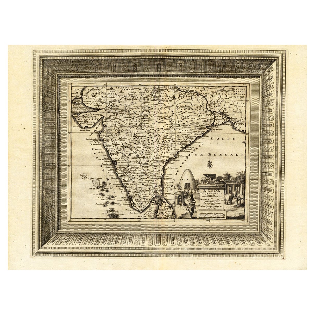
Rare Engraved Antique Map of India with Elephants in the Cartouche, c.1725
Located in Langweer, NL
Antique map titled 'L'Inde de ca le Gange suivant les nouvelles observations (..)'.
Detailed map of India, with part of Sri Lanka. Compass rose and decorative cartouche lower rig...
Category
Antique 18th Century Maps
Materials
Paper
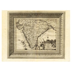
$1,250 Sale Price
20% Off
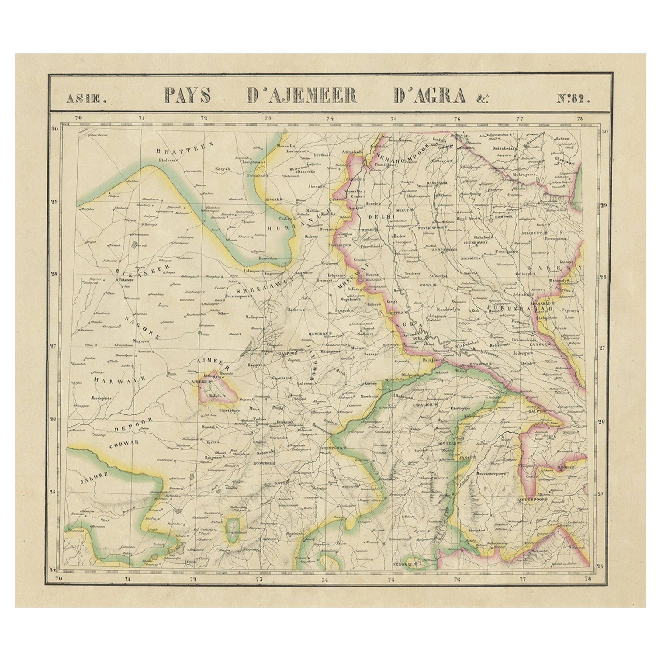
Large and Rare Antique Map of Northern India in Original Coloring, c.1825
Located in Langweer, NL
Antique map titled 'No. 82 Pays d'Ajemeer d'Agra'. Detailed map of Northern India. Originates from 'Atlas Universel' by P.M. Vandermaelen.
Artists and Engravers: Philippe Marie Van...
Category
Antique 19th Century Maps
Materials
Paper
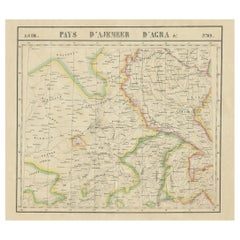
$657 Sale Price
20% Off
Original Antique Map of Northern India
By Jakob van der Schley
Located in Langweer, NL
Antique map titled 'Carte de l'Indoustan (..) - Kaart van Hindoestan (..)'. Original antique map of northern India. This map originates from 'His...
Category
Antique Mid-18th Century Maps
Materials
Paper

$203 Sale Price
20% Off
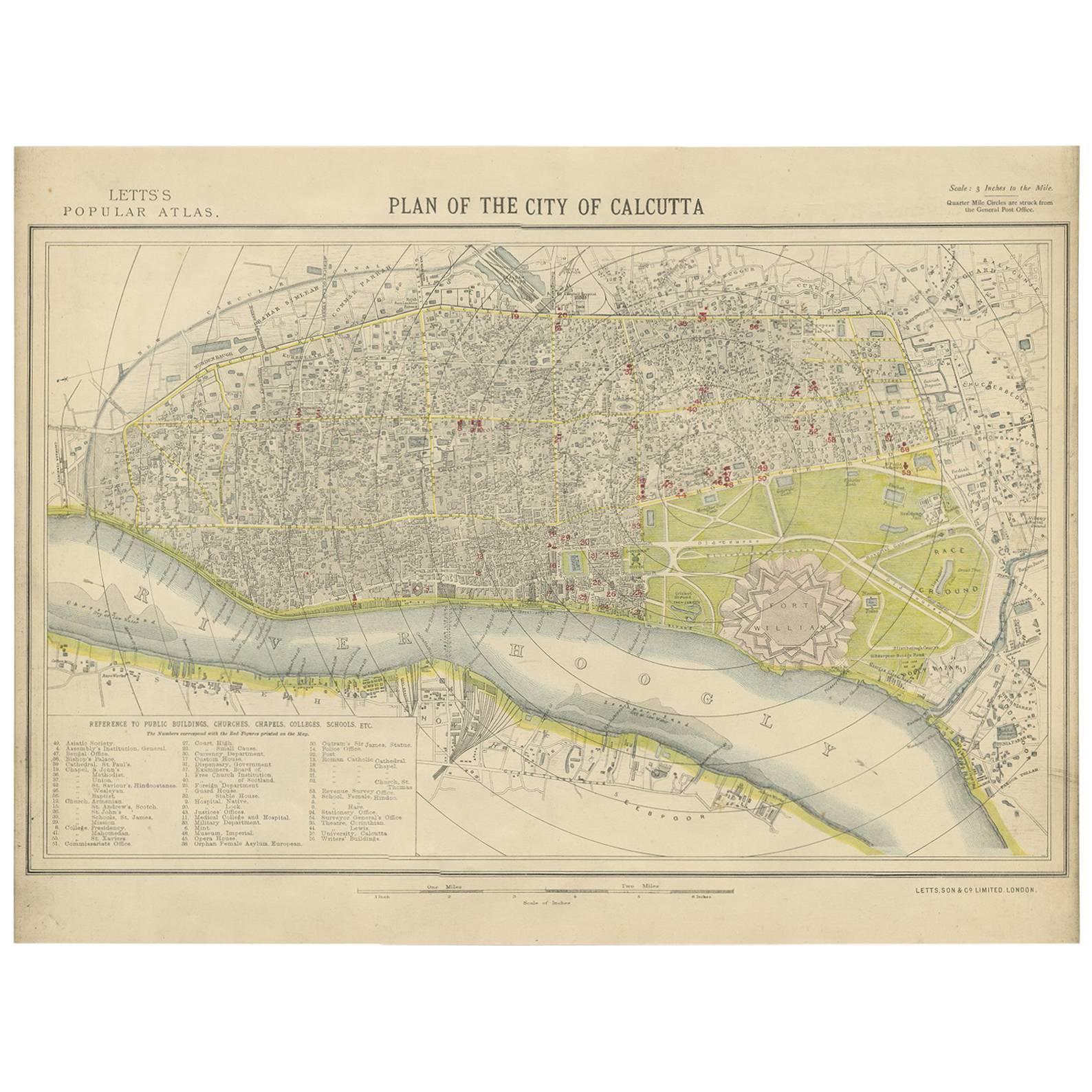
Antique Plan of the City of Calcutta 'India' by Letts, 1883
Located in Langweer, NL
Beautiful colored plan showing buildings (with key), Fort William, race ground, canals, railroads, etc. This plan originates from Letts's Popular Atlas.
Category
Antique Late 19th Century Maps
Materials
Paper

$347 Sale Price
20% Off
Rare Antique Miniature Map of Pakistan, India and Cambaia, ca.1618
Located in Langweer, NL
Old 17th century miniature antique map of 'Cambaia' , from the 1616 edition of Jadocus Hondius Atlas by Petrus Bertius.
Original copperplate engraving with hand coloring.
Carto...
Category
Antique 17th Century Maps
Materials
Paper
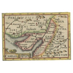
$361 Sale Price
20% Off
You May Also Like
Antique Map of Principality of Monaco
By Antonio Vallardi Editore
Located in Alessandria, Piemonte
ST/619 - "Old Geographical Atlas of Italy - Topographic map of ex-Principality of Monaco" -
ediz Vallardi - Milano -
A somewhat special edition ---
Category
Antique Late 19th Century Italian Other Prints
Materials
Paper

Original Antique Map of Europe, Arrowsmith, 1820
Located in St Annes, Lancashire
Great map of Europe
Drawn under the direction of Arrowsmith.
Copper-plate engraving.
Published by Longman, Hurst, Rees, Orme and Brown, 1820
...
Category
Antique 1820s English Maps
Materials
Paper

Original Antique Map of Ireland- Kerry. C.1840
Located in St Annes, Lancashire
Great map of Kerry
Steel engraving
Drawn under the direction of A.Adlard
Published by How and Parsons, C.1840
Unframed.
Category
Antique 1840s English Maps
Materials
Paper

Original Antique Map of South America. C.1780
Located in St Annes, Lancashire
Great map of South America
Copper-plate engraving
Published C.1780
Two small worm holes to left side of map
Unframed.
Category
Antique Early 1800s English Georgian Maps
Materials
Paper

Original Antique Map of China, Arrowsmith, 1820
Located in St Annes, Lancashire
Great map of China
Drawn under the direction of Arrowsmith
Copper-plate engraving
Published by Longman, Hurst, Rees, Orme and Brown, 1820
Unfr...
Category
Antique 1820s English Maps
Materials
Paper

Original Antique Map of Hungary, Arrowsmith, 1820
Located in St Annes, Lancashire
Great map of Hungary
Drawn under the direction of Arrowsmith.
Copper-plate engraving.
Published by Longman, Hurst, Rees, Orme and Brown, 1820
Unframed.
Category
Antique 1820s English Maps
Materials
Paper

Recently Viewed
View AllMore Ways To Browse
Antique Egyptian Old
Astrology Map
J Schwabe
Mauritius Antique Map
Tanzania Antique Map
Tartaria Map
Antique Map Puzzle
Georgetown Map
Johann Baptist Homann On Sale
John Wyld
North Carolina Native Americans 1800
Nova Hollandia
Aden Yemen
Antique Chesapeake Bay Map
Antique Town Plan Of Jerusalem
Chesapeake Bay Map
Globe Terrestre Par Felix Delamarche
Hydra Map