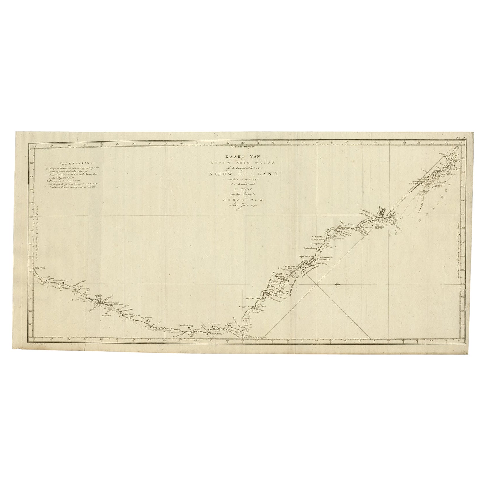
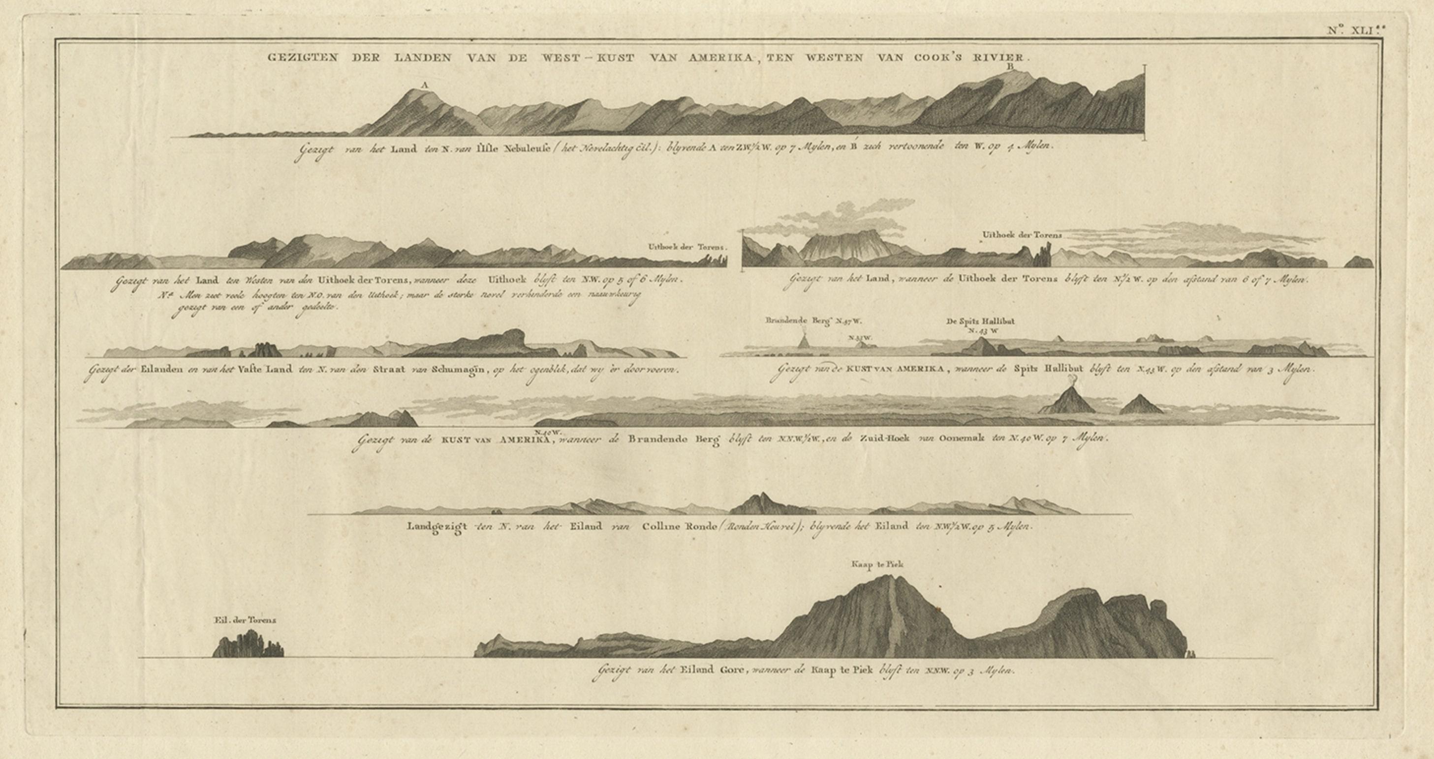
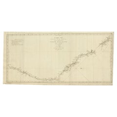
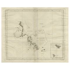
Antique Chart of The East Coast of Australia by Cook, C.1770
View Similar Items


Want more images or videos?
Request additional images or videos from the seller
1 of 5
Antique Chart of The East Coast of Australia by Cook, C.1770
About the Item
- Dimensions:Height: 11.82 in (30 cm)Width: 13.39 in (34 cm)Depth: 0 in (0.01 mm)
- Materials and Techniques:
- Period:
- Date of Manufacture:circa 1770
- Condition:
- Seller Location:Langweer, NL
- Reference Number:Seller: BG-098541stDibs: LU3054325894812
About the Seller
5.0
Platinum Seller
These expertly vetted sellers are 1stDibs' most experienced sellers and are rated highest by our customers.
Established in 2009
1stDibs seller since 2017
1,933 sales on 1stDibs
More From This SellerView All
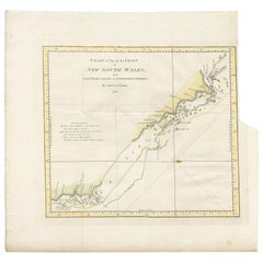
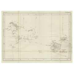
- Old Map of Cook's Discovery and Charting of the East Coast of Australia, 1803Located in Langweer, NLAntique map titled 'Kaart van Nieuw Zuid Wales of de Oostlyke Kust van Nieuw Holland ontdekt en onderzogt door den Luitenant J. Cook met het Schip de Endeavour in het Jaar 1770'. ...Category
Antique Early 1800s Maps
MaterialsPaper
 $1,537 Sale Price20% Off
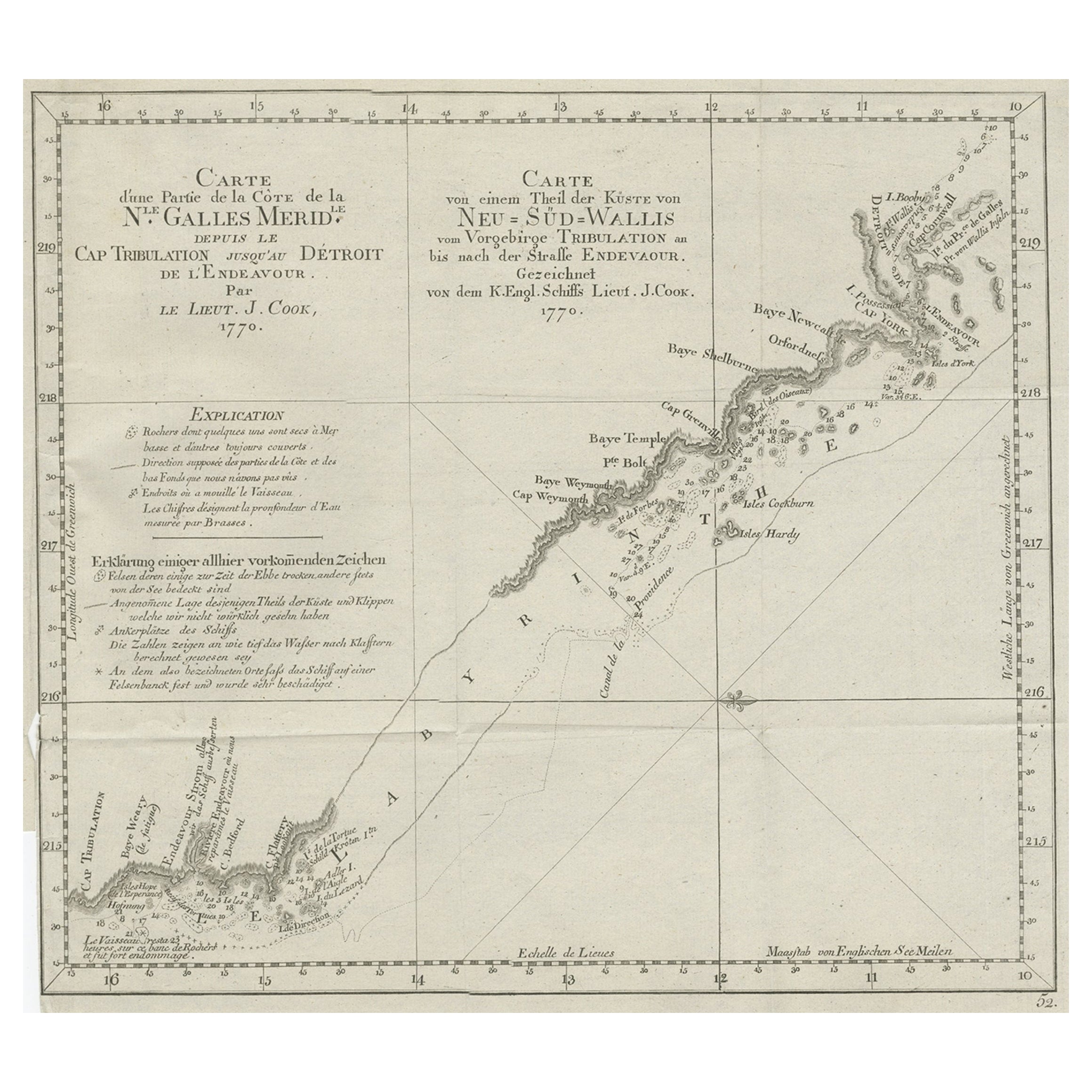
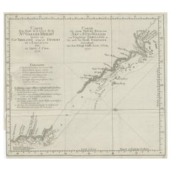
 - Old Chart of the North-Eastern Coast of Australia Discovered by Cook, 1774Located in Langweer, NLAntique print titled Carte d'une Partie de la Cote de la N.le Galles Merid etc. An interesting chart of the north-eastern coast of Australia discovered by Cook in 1770, showing th...Category
Antique 1770s Maps
MaterialsPaper
 $667 Sale Price20% Off
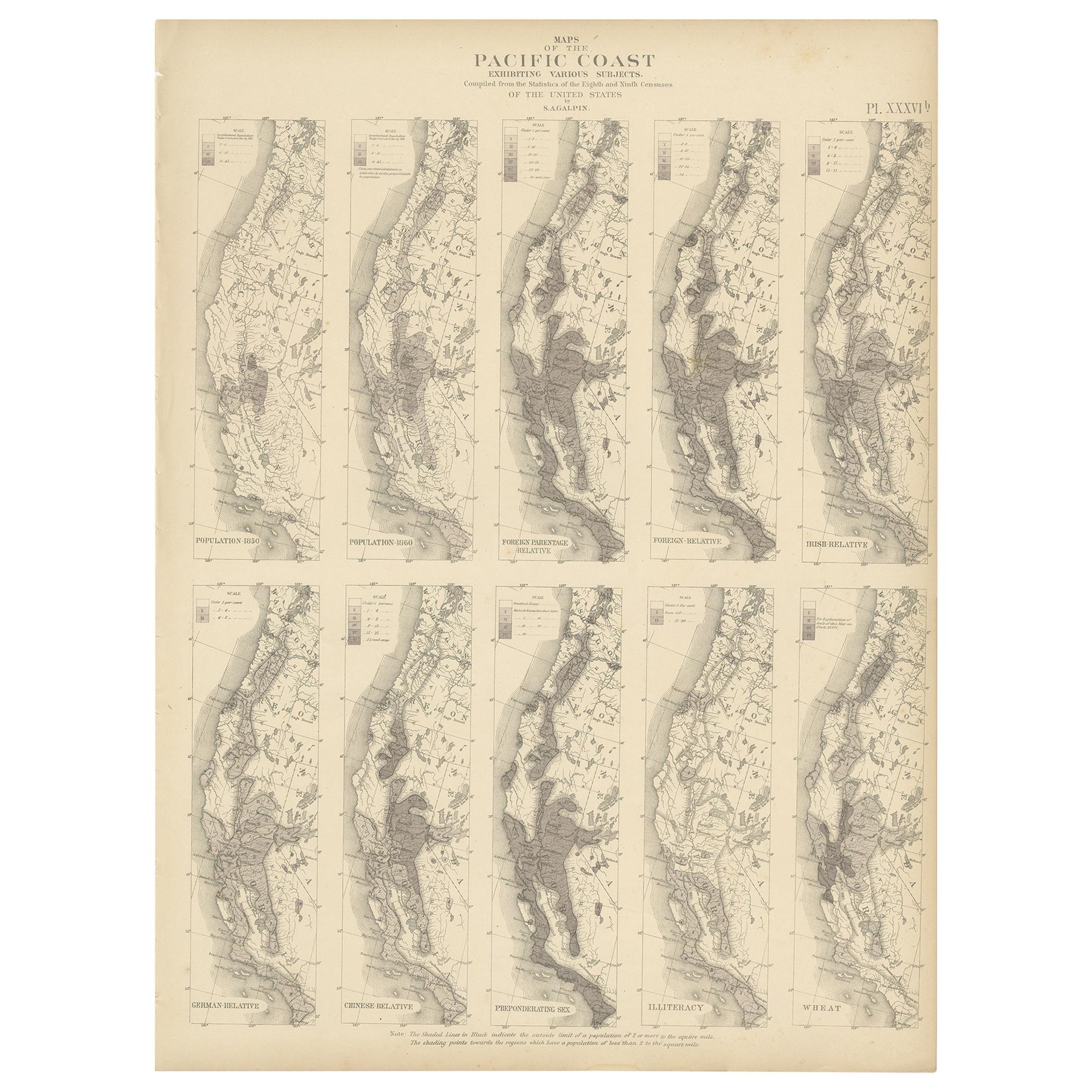
 - Antique Chart of the Pacific Coast '1874'Located in Langweer, NLAntique chart titled 'Maps of the Pacific Coast exhibiting various subjects. Compiled from the statistics of the eight and ninth census of the United Sta...Category
Antique Late 19th Century Maps
MaterialsPaper
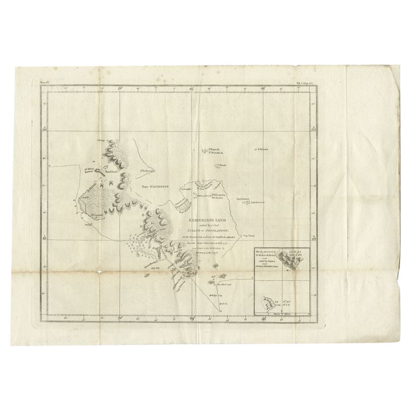
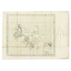
- Antique Map of Kerguelens Island Coast by Cook, 1784By James CookLocated in Langweer, NLAntique print titled 'Kerguelen's Land (..)'. Antique map of Kerguelens island coast, known today as the Desolation islands. Originates from 'A Voyage to the Pacific Ocean: Undertaken, by the Command of His Majesty, for Making Discoveries in the Northern Hemisphere (..)' published in Dublin. Artists and Engravers: James Cook...Category
Antique 18th Century Prints
MaterialsPaper
 $296 Sale Price25% Off
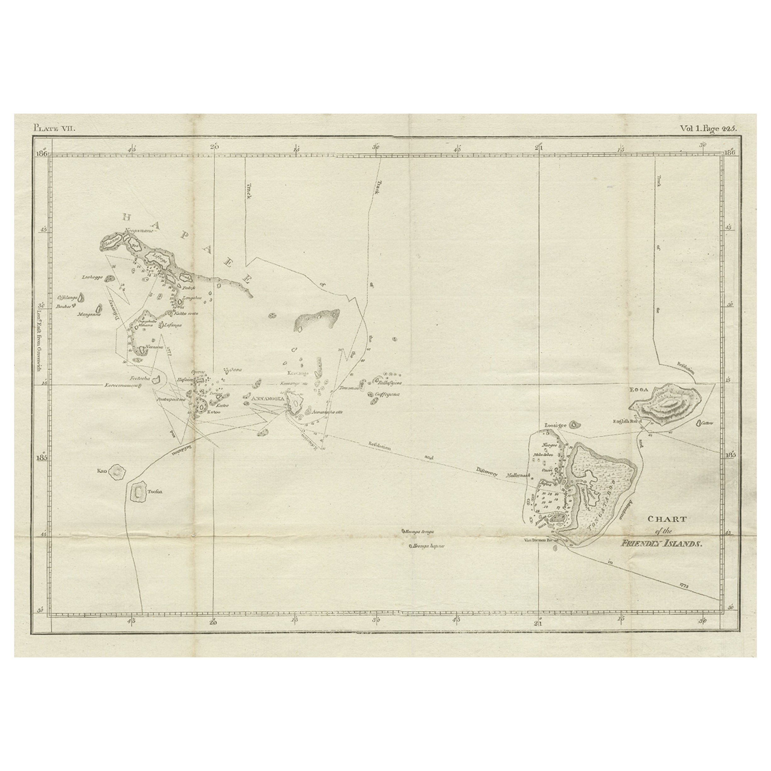
 - Antique Chart of the Friendly Islands or Nowadays Tonga, by Cook, 1784By James CookLocated in Langweer, NLAntique print titled 'Chart of the Friendly Islands'. Antique map of the Friendly Islands depicting Rotterdam or Anamocka, Middelburg or Eaoowe and Amsterdam or Tongatabu. Originates...Category
Antique 18th Century Prints
MaterialsPaper
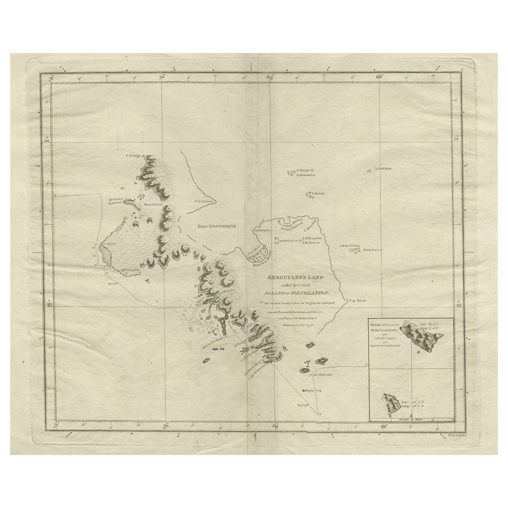
- Antique Map of Kerguelens Island Coast in the Indian Ocean by Cook, 1785By James CookLocated in Langweer, NLAntique print titled 'Kerguelen's Land (..)'. Antique map of Kerguelens island coast, known today as the Desolation islands. Originates from 'Voyage to the Pacific Ocean, undertaken ...Category
Antique 18th Century Prints
MaterialsPaper

You May Also Like
- Chart of the East Coast of EnglandLocated in Norwell, MAChart of the East Coast of England, from Dungeness to Flamborough, including the entrances to the Thames River. Drawn by hydrographer J.W. Norie in 1841. Includes Kent, Essex and Suf...Category
Antique 1840s English Nautical Objects
MaterialsPaper
- Antique Anatomical Wall Chart Depicting the Human SkeletonLocated in Berghuelen, DEA rare 19th century anatomical wall chart depicting the human skeleton. On the sides On the sides are detailed description in German language. The wall...Category
Early 20th Century German Victorian Prints
MaterialsPaper
- Original Antique Map of South East Asia by Becker, circa 1840Located in St Annes, LancashireGreat map of South East Asia Steel engraving with original color outline Engraved by Becker Published by Virtue, circa 1840. Unframed.Category
Antique 1840s English Other Maps
MaterialsPaper
- Original Antique Map of South East Asia by Thomas Clerk, 1817Located in St Annes, LancashireGreat map of South East Asia Copper-plate engraving Drawn and engraved by Thomas Clerk, Edinburgh. Published by Mackenzie And Dent, 1817 Unframed.Category
Antique 1810s English Maps
MaterialsPaper
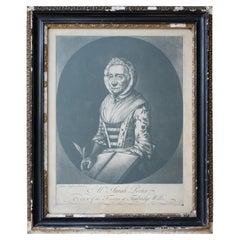
- Sarah Porter, "Queen of the Touters at Tunbridge Wells" Engraving, circa 1770Located in Lowestoft, GBAfter Vander Smissen 'Mrs Sarah Porter, Queen of the Touters at Tunbridge Wells', a mezzotint, engraved by William Pether circa 1770, glazed in ebonised, ...Category
Antique Late 18th Century English Prints
MaterialsGlass, Pine, Paper
- Antique Foldable Anatomical Wall Chart Depicting Human MusculatureLocated in Berghuelen, DEAntique Foldable Anatomical Wall Chart Depicting Human Musculature The rare 19th century anatomical wall chart depicts the human musculature and inter...Category
Early 20th Century German Victorian Prints
MaterialsWood, Paper