Items Similar to Map "Estuary- Mouth of the Thames"


Want more images or videos?
Request additional images or videos from the seller
1 of 8
Map "Estuary- Mouth of the Thames"
About the Item
ST/426 - Antique French Map of the estuary of the Thames, map dated 1769 -
"Mape of the entrance of the Thames. Designed by filing of Navy cards for the service of the king's vessels, by order of M. Berryer minister and secretary of state before the Marine Department for S.Bellin Navy engineer.
1769" (all in the cartouche).
About the Seller
4.9
Vetted Seller
These experienced sellers undergo a comprehensive evaluation by our team of in-house experts.
Established in 1984
1stDibs seller since 2015
305 sales on 1stDibs
Typical response time: 5 hours
- ShippingRetrieving quote...Ships From: Alessandria, Italy
- Return PolicyThis item cannot be returned.
More From This SellerView All
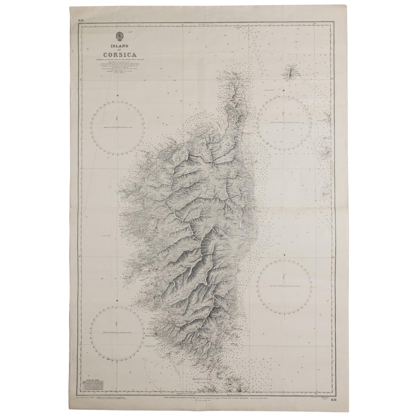
- Old Nautical Map of CorsicaLocated in Alessandria, PiemonteST/556/1 - Old map of Corsica isle, surveyed by Captain Hell, of the French Royal Navy in 1824, engraved and published on 1874, with additions and corre...Category
Antique Early 19th Century English Other Prints
MaterialsPaper
- Antique Map of Principality of MonacoBy Antonio Vallardi EditoreLocated in Alessandria, PiemonteST/619 - "Old Geographical Atlas of Italy - Topographic map of ex-Principality of Monaco" - ediz Vallardi - Milano - A somewhat special edition ---Category
Antique Late 19th Century Italian Other Prints
MaterialsPaper
- Old Horizontal Map of EnglandBy TassoLocated in Alessandria, PiemonteST/520 - Old rare Italian map of England, dated 1826-1827 - by Girolamo Tasso, editor in Venise, for the atlas of M.r Le-Sage.Category
Antique Early 19th Century Italian Other Prints
MaterialsPaper
- Geographical Antique Map of Principality of MonacoBy Bruno SantiniLocated in Alessandria, PiemonteST/609 - Interesting antique color map of Monaco Principality in French language : "Carte qui contient le Principauté de Piémont, le Monferrat et la comté de...Category
Antique Late 18th Century Italian Other Maps
MaterialsPaper
- Frontespice "The Mansions of England in the Olden Time"By Joseph NashLocated in Alessandria, PiemonteST/218-1 - Antique English print by Joseph Nash (1809-1878), famous British painter, member of the Gothic Revival Group. In 1838 he published the Revival Lithographic Collection "Medieval...Category
Antique Mid-19th Century English Other Prints
MaterialsPaper
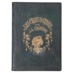
- "The Masterpieces of Engraving"By Eugene Maxime ValléeLocated in Alessandria, PiemonteO/7821 - interesting French book that I saved from ruin: they are usually dismembered to make prints to sell individually. This one is intact, with its 24 printed plates. Nice to ...Category
Antique Mid-19th Century French Other Books
MaterialsPaper


You May Also Like
- Antique Map of the Mouth of the Yangtze River 'China' by J.N. Bellin, 1764Located in Langweer, NLThis detailed regional map of China is a historical cartographic work from the mid-18th century and is attributed to Antoine-François Prévost, a prominent French cartographer and geo...Category
Antique Mid-18th Century Maps
MaterialsPaper
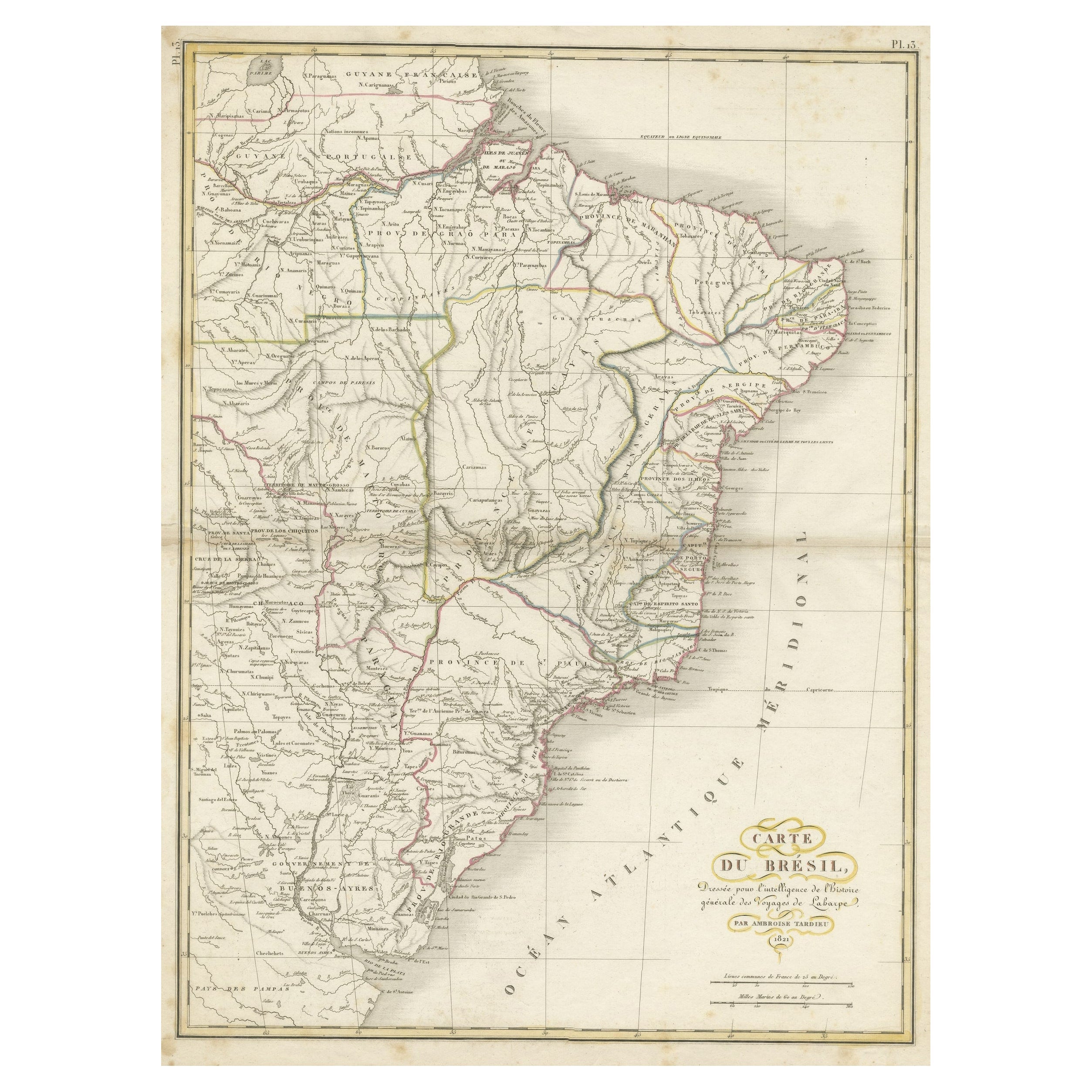
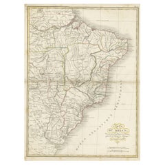
- Antique Map of Brazil Extending South to the Mouth of the Rio de la PlataLocated in Langweer, NLAntique map titled 'Carte du Brésil'. ?Beautiful map of Brazil extending south to the mouth of the Rio de la Plata and Buenos-Aires in Argentina. Published by Tardieu, 1821. Pier...Category
Antique Early 19th Century Maps
MaterialsPaper
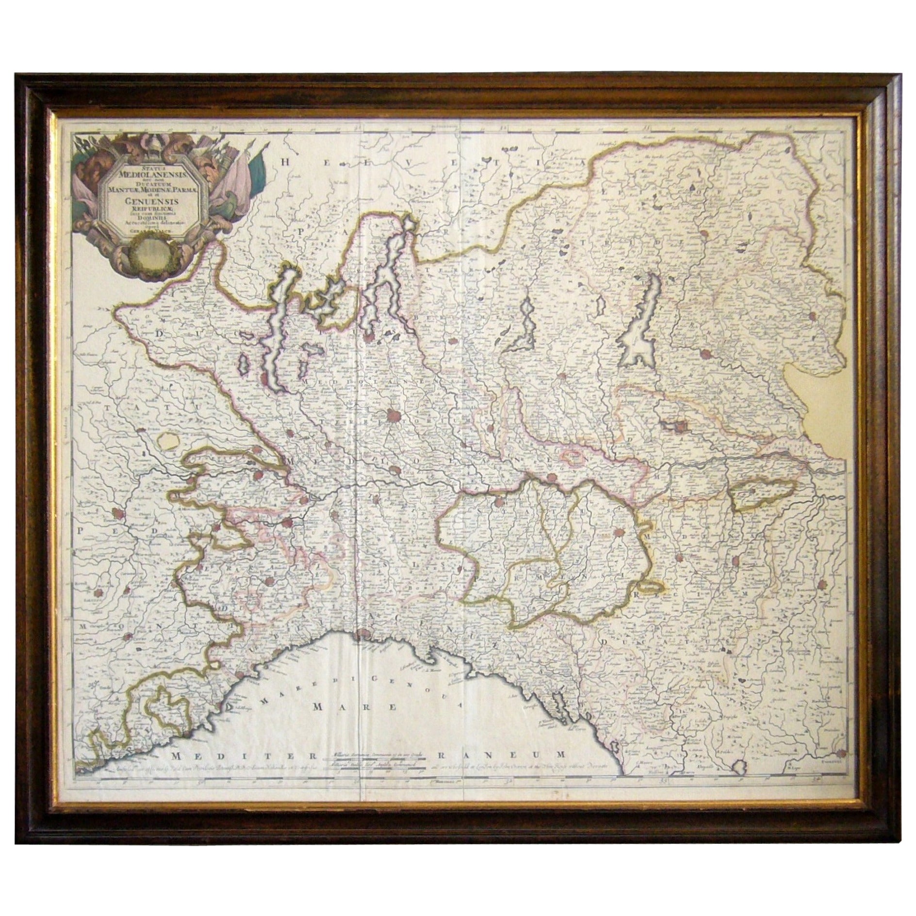
- Map of the Republic of GenoaLocated in New York, NYFramed antique hand-coloured map of the Republic of Genoa including the duchies of Mantua, Modena, and Parma. Europe, late 18th century. Dimension: 25...Category
Antique Late 18th Century European Maps
- Antique Map of the United States with inset map of the region of Mexico CityLocated in Langweer, NLAntique map titled 'Verein-Staaten von Nord-America, Mexico, Yucatan u.a.'. Very detailed map of the United States of America showing the Caribbean. With an inset map of the surround...Category
Antique Mid-19th Century Maps
MaterialsPaper
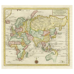
- Antique Map of the Eastern Part of the WorldLocated in Langweer, NLAntique map titled 'Nieuwe Kaart van het Oostelykste Deel der Weereld, diendende tot aanwyzing van de Scheepstogten der Nederlanderen Naar Oostindie'. This finely engraved map of the...Category
Antique Mid-18th Century Maps
MaterialsPaper
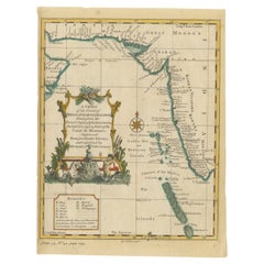
- Antique Map of the Region of the Arabian SeaLocated in Langweer, NLAntique map titled 'A Chart of the Coast of Persia, Guzarat & Malabar'. Old map centered on the Arabian Sea that shows some of the Persian Gulf and the Gulf of Oman, extending past P...Category
Antique Mid-18th Century Maps
MaterialsPaper


Recently Viewed
View AllMore Ways To Browse
French Mid Century Secretary
French Antiques Furniture Secretary
18th Century French Secretary
Antique 18th Century Secretary
Midcentury Wall Secretary
Secretary Of The Navy
Map File
Jakob van der Schley On Sale
Muramasa Kudo
Munting Botanical Framed
Wild Turkey Audubon
Denton Fish
Cabral Garcia
Atlantic Sturgeon
Kazumi Amano
Anthony Dress Shop
Inagaki Nenjiro
Gun Print By Mahler