Items Similar to Procession of Horsemen and Cardinals During the Entrance of a New Pope, ca.1700
Want more images or videos?
Request additional images or videos from the seller
1 of 5
Procession of Horsemen and Cardinals During the Entrance of a New Pope, ca.1700
About the Item
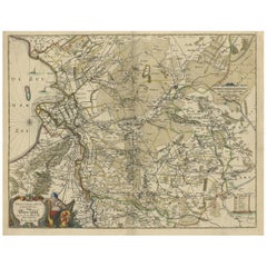
Antique print titled 'Bezitneming van St. Jan te Lateranen, met de Plegtelykste Cavalcade'.
Procession of horsemen and cardinals during the entrance of a new pope in the Saint John Lateran, the former papal residence in Rome. Source unknown, to be determined.
Artists and Engravers: Hendrik Elandt (ca. 1640-1705) was a Dutch engraver.
Condition:
Very good, general age-related toning. Please study image carefully.
- Dimensions:Height: 15.36 in (39 cm)Width: 17.92 in (45.5 cm)Depth: 0 in (0.02 mm)
- Materials and Techniques:
- Period:1700-1709
- Date of Manufacture:circa 1700
- Condition:Very good, general age-related toning. Please study image carefully.
- Seller Location:Langweer, NL
- Reference Number:
About the Seller
5.0
Platinum Seller
These expertly vetted sellers are 1stDibs' most experienced sellers and are rated highest by our customers.
Established in 2009
1stDibs seller since 2017
1,916 sales on 1stDibs
Typical response time: <1 hour
- ShippingRetrieving quote...Ships From: Langweer, Netherlands
- Return PolicyA return for this item may be initiated within 14 days of delivery.
More From This SellerView All
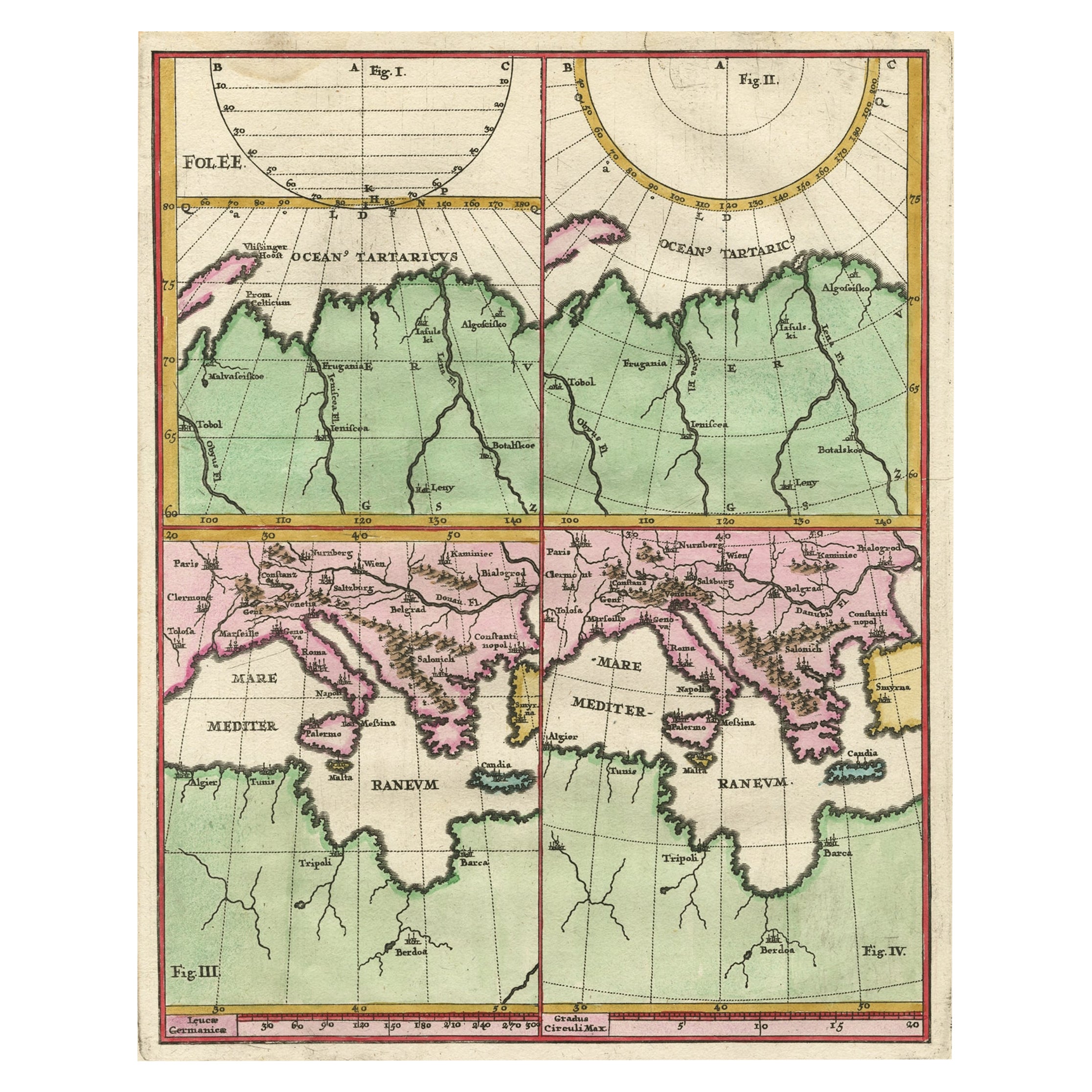
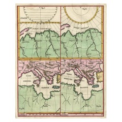
- Curious Map of the Laptev Sea 'Arctic Ocean' and the Mediterranean, ca.1700Located in Langweer, NLAntique map, untitled. Map of the Laptev Sea (Arctic Ocean) and the Mediterranean, printed for Scherer's 'Atlas Novus' (1702-1710). Scherer's 'Atlas Novus' forms an important mil...Category
Antique Early 1700s Maps
MaterialsPaper
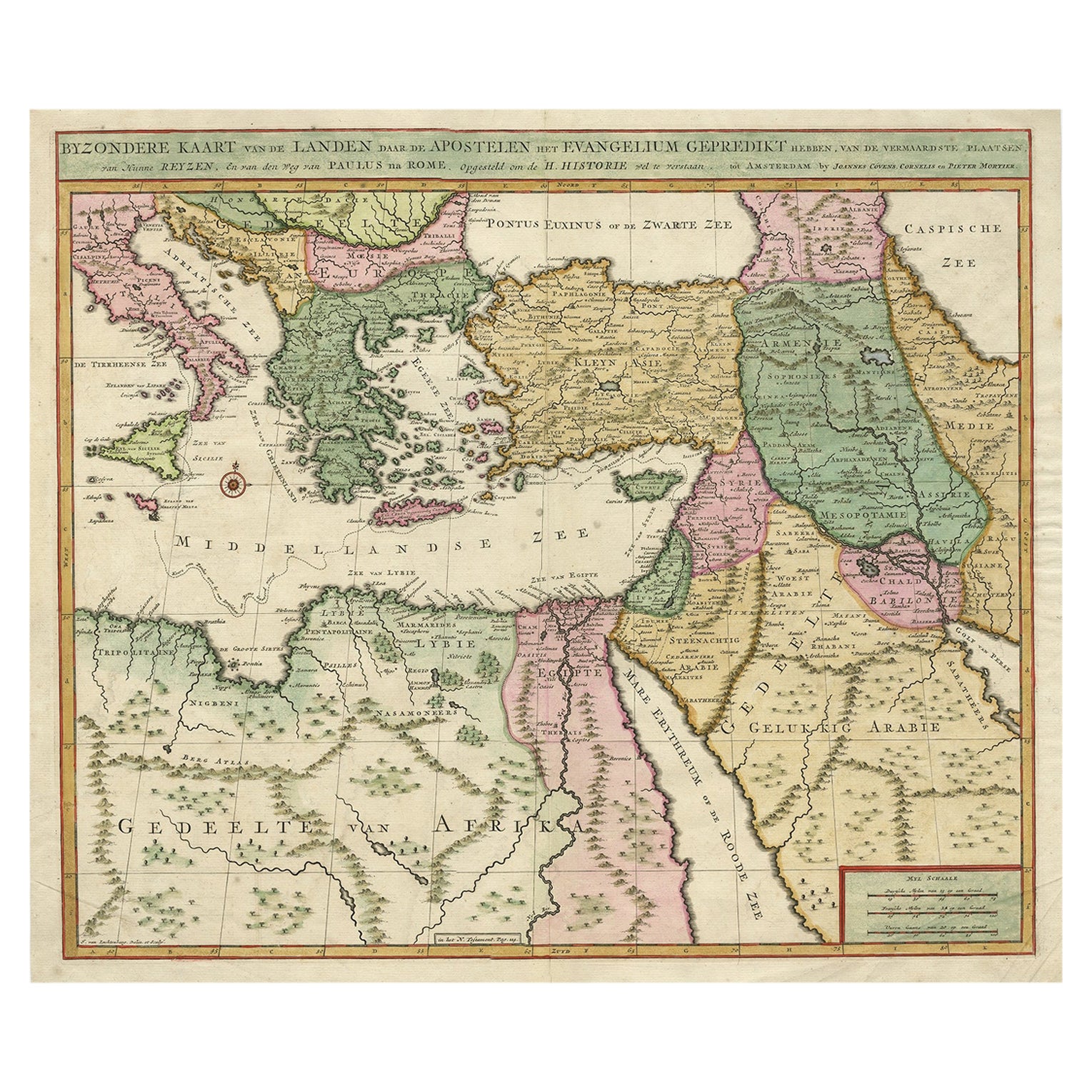
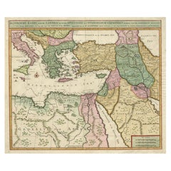
- Highly Decorative Map of The Eastern Mediterranean and The Middle East, ca.1700Located in Langweer, NLAntique map titled 'Byzondere Kaart van de Landen Daar de Apostelen Het Evangelium Gepredikt Hebben (..).' Highly decorative map of the eastern Mediterranean...Category
Antique Early 1700s Maps
MaterialsPaper
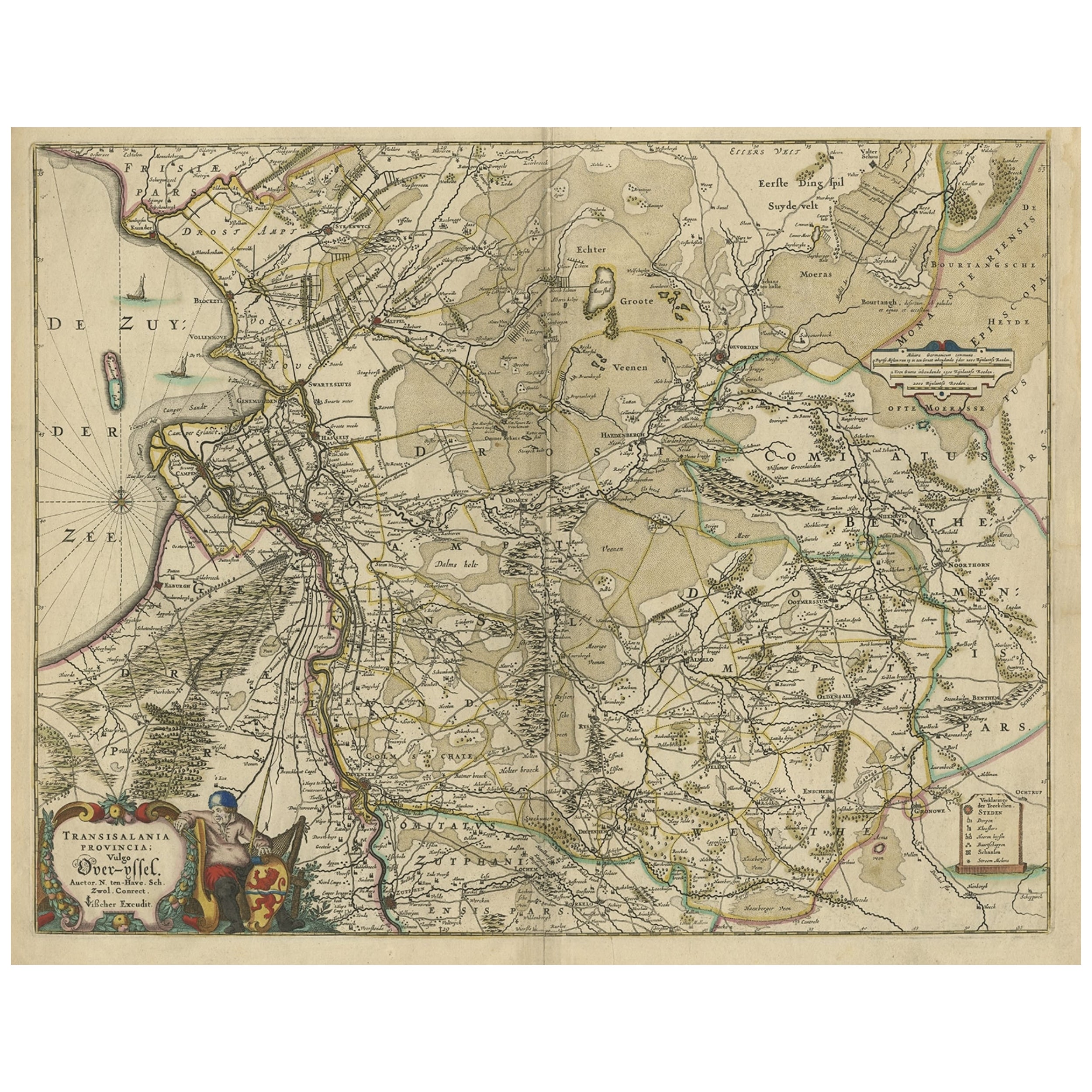
- Attractive Original Map of the Province of Overijssel, the Netherlands, Ca.1700Located in Langweer, NLAntique print, titled: 'Transisalania Provincia vulgo Over-yssel.' Attractive original handcoloured map of the province of Overijssel, The Netherlands. With beautiful title carto...Category
Antique Early 1700s Maps
MaterialsPaper
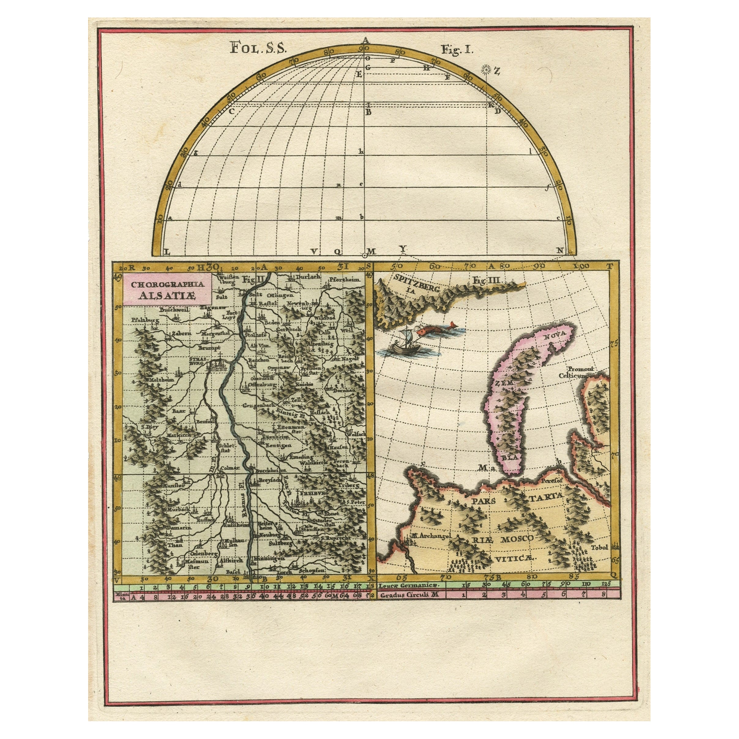
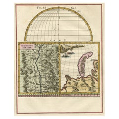
- Remarkable Map of the Alsace Region and Nova Zembla, Russia, ca.1700Located in Langweer, NLAntique map titled 'Chorographia Alsatiae.' Map of the Alsace region and Nova Zembla, printed for Scherer's 'Atlas Novus' (1702-1710). Scherer's 'Atlas Novus' forms an important ...Category
Antique Early 1700s Maps
MaterialsPaper
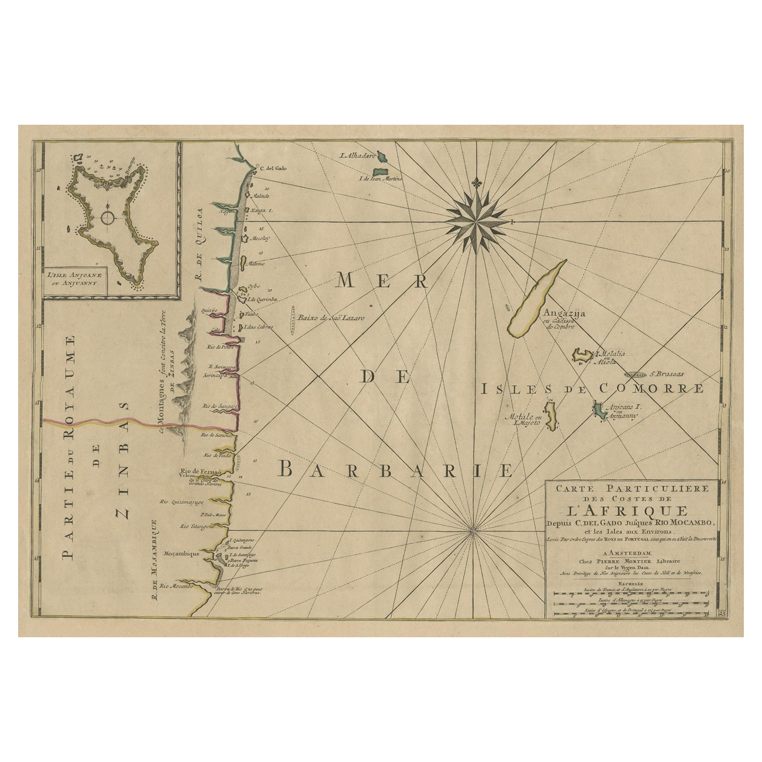
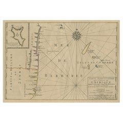
- Map of the Mozambique and Tanzania Coast & Inset Map of Anjouan Island, ca.1700Located in Langweer, NLAntique map titled 'Carte particuliere des Costes de l'Afrique'. Depicts the coasts of Mozambique and Tanzania. With an inset map of Anjouan Island. Artists and engravers: Pub...Category
Antique Early 1700s Maps
MaterialsPaper
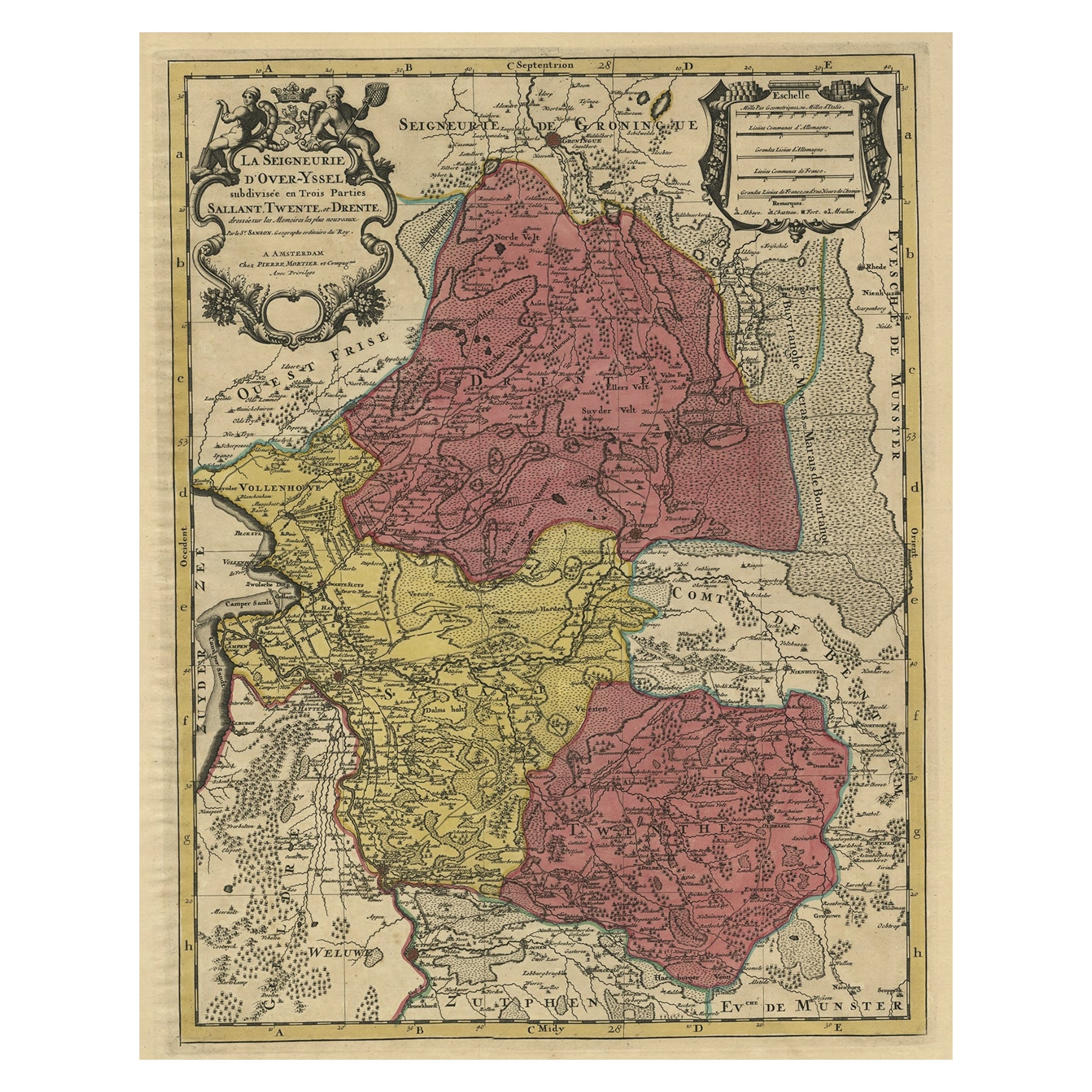
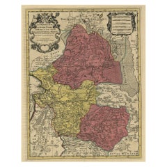
- Detailed Antique Map of the Province of Overijssel in the Netherlands, ca.1700Located in Langweer, NLAntique map titled 'La Seigneurie d'Over-Yssel subdivisee en Trois Parties, Sallant, Twente, et Drente.' Detailed map of the province of Overijssel in the Netherlands. From Jaill...Category
Antique Early 1700s Maps
MaterialsPaper
You May Also Like
- Lithographic print on paper, depicting the atlas of the hand, France 1850 ca.Located in Milan, ITAn anatomical lithographic print on paper, depicting the anatomical atlas of the hand. Black lacquered fir wood frame with golden ramin wood batting. N. H. Ja...Category
Antique Mid-19th Century French Prints
MaterialsGlass, Wood, Paper
- New Map of North America from the Latest Discoveries, 1763Located in Philadelphia, PAA fine antique 18th century map of the North American seaboard. Entitled "A New Map of North America from the Latest Discoveries 1763". By the Cartographer/Engraver - John Spil...Category
Antique Mid-18th Century English Georgian Maps
MaterialsPaper
- Lithographic Print on Paper, Depicting the Male Genital System, France 1850 CaLocated in Milan, ITAn anatomical lithographic print on paper, depicting the male genital system. Black lacquered fir wood frame with golden ramin wood batting. N. H. Jacob, Pari...Category
Antique Mid-19th Century French Prints
MaterialsGlass, Wood, Paper
- Map of the Republic of GenoaLocated in New York, NYFramed antique hand-coloured map of the Republic of Genoa including the duchies of Mantua, Modena, and Parma. Europe, late 18th century. Dimension: 25...Category
Antique Late 18th Century European Maps
- Pope Francis and the New Vatican Draper, Robert Hardcover BookLocated in North Hollywood, CAPope Francis and the New Vatican Draper, Robert hardcover book Title: Pope Francis and the New Vatican Publisher: National Geographic Publication Date: 2015 Binding: Hardcover B...Category
2010s Italian Classical Roman Books
MaterialsPaper
- “The Restaurant of the House of Representatives” Engraving by Harper's WeeklyLocated in Colorado Springs, COThis original wood engraving is titled “The Restaurant of the House of Representatives, Washington, DC.” It was published as a double-page image, in the August 12, 1893 issue of the famous 19th century newspaper Harper’s Weekly. The print was illustrated by Charles Stanley Reinhardt. The House Restaurant, a unique part of life in the Capitol, has been in the same location since the 1857 Capitol Expansion. Congressional members’ busy work schedule made the availability of food on site a necessity. But the restaurant also served as an informal meeting spot for members to continue conversations and deal making. This 1893 print illustrates the convivial atmosphere. Details including elegantly dressed tables...Category
Antique 1890s American Prints
MaterialsPaper


Recently Viewed
View AllMore Ways To Browse
Jan Hendrik
Wall Sculptures Plaque
Main Door
Metal Display Cabinet
American Antique Cabinet
Mid Century Carved Wood Door
Antique Built In Cabinet
Antique Built In Cabinets
Brass Cabinet Nightstand
Small Cupboard With Doors
Midcentury China Cabinet
Ebonized Kitchen Cabinet
Display Case 1900
Silver Midcentury Ring
Antique Jacket
Chinese Antique Cabinet With
Military Metal
Document Cabinet