Items Similar to Map Of The Island Of Cuba - Guillaume Thomas Raynal (1711-1796)


Want more images or videos?
Request additional images or videos from the seller
1 of 6
Map Of The Island Of Cuba - Guillaume Thomas Raynal (1711-1796)
$150
$30050% Off
£114.16
£228.3250% Off
€130.75
€261.4950% Off
CA$213.35
CA$426.7050% Off
A$233.80
A$467.6050% Off
CHF 122.10
CHF 244.1950% Off
MX$2,809.66
MX$5,619.3250% Off
NOK 1,526.42
NOK 3,052.8350% Off
SEK 1,439.65
SEK 2,879.3150% Off
DKK 975.88
DKK 1,951.7650% Off
About the Item
This historical map of the Island of Cuba was produced in the late 18th century and is taken from an edition of “Atlas de toutes les parties connues du globe terrestre” by the French historian Guillaume Thomas Raynal (1711–1796). The engraving was created by the renowned French mathematician and cartographer Rigobert Bonne (1727–1795), known for his precise and elegant cartographic style. The map depicts the island’s geography, settlements, and coastlines as understood during the period, providing valuable insight into contemporary European knowledge of the Caribbean. Executed on paper, the sheet shows signs of age, including moisture stains, which add historical character to the piece. Measuring 33.5 × 34 cm, this map represents a significant artifact for collectors of early modern cartography, historians, and enthusiasts of 18th-century exploration. It illustrates both the craftsmanship of Bonne’s engraving and the broader context of European geographic scholarship in the late 1700s.
- Dimensions:Height: 13.39 in (34 cm)Width: 13.39 in (34 cm)Depth: 0.79 in (2 cm)
- Materials and Techniques:
- Period:
- Date of Manufacture:18th century
- Condition:
- Seller Location:Porto, PT
- Reference Number:1stDibs: LU10523246811672
About the Seller
New to 1stDibs
Joined in the past six months.
No Reviews Yet
Vetted Professional Seller
Every seller passes strict standards for authenticity and reliability
Established in 2000
1stDibs seller since 2025
- ShippingRetrieving quote...Shipping from: Porto, Portugal
- Return Policy
Authenticity Guarantee
In the unlikely event there’s an issue with an item’s authenticity, contact us within 1 year for a full refund. DetailsMoney-Back Guarantee
If your item is not as described, is damaged in transit, or does not arrive, contact us within 7 days for a full refund. Details24-Hour Cancellation
You have a 24-hour grace period in which to reconsider your purchase, with no questions asked.Vetted Professional Sellers
Our world-class sellers must adhere to strict standards for service and quality, maintaining the integrity of our listings.Price-Match Guarantee
If you find that a seller listed the same item for a lower price elsewhere, we’ll match it.Trusted Global Delivery
Our best-in-class carrier network provides specialized shipping options worldwide, including custom delivery.More From This Seller
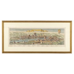
View AllMap Of Florence By F.B.Werner
Located in Porto, PT
This detailed map of Florence is a fine example of early modern cartography, printed on paper by the German geographer and cartographer F.B. Werner. Measuring 30 × 87.5 cm, the map p...
Category
Antique 18th Century Antiquities
Materials
Paper
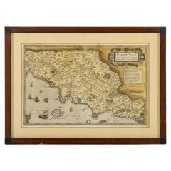
Thusciae
Located in Porto, PT
This finely printed map depicts the historical region of Tuscia, located in central Italy, known today largely as the area encompassing parts of modern Tuscany, Umbria, and Lazio. Ex...
Category
Antique 19th Century Antiquities
Materials
Paper
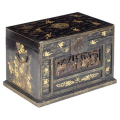
Chinese Ark - Year 1862 - With Certificate
Located in Porto, PT
This elegant piece originates from the Ching Dynasty, circa 1862, and is a remarkable example of traditional Chinese craftsmanship. Crafted from fine black lacquered wood, the surfac...
Category
Antique 19th Century Furniture
Materials
Wood
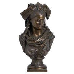
Jean-Louis Grégoire (1840-1890)
Located in Porto, PT
"Alsace 1871". Bronze sculpture. Signed and dated 1879. Dim. Height: 48 cm.
Category
Antique 19th Century French Figurative Sculptures
Materials
Bronze
19Th Century - Four Liturgical Cloths
Located in Porto, PT
This lot presents a set of four Portuguese altar cloths, dating from the 19th century, which beautifully illustrate the artistry and devotion embodied in ecclesiastical textiles of t...
Category
Antique 19th Century Decorative Art
Materials
Wood
19Th Century - Five Liturgical Cloths
Located in Porto, PT
This lot comprises five Portuguese altar cloths, dating from the 19th century, each representing the refinement and devotional artistry of ecclesiastical textiles from the period. Sk...
Category
Antique 19th Century Decorative Art
Materials
Wood
You May Also Like
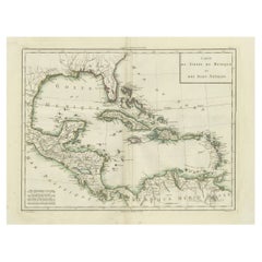
Authentic Antique Map of the Caribbean, Gulf Coast and Central America, 1787
Located in Langweer, NL
Antique map titled 'Les Isles Antilles et le Golfe du Méxique'. Original old map of the Caribbean, Gulf Coast and Central America. With inset map of Bermuda...
Category
Antique Late 18th Century Maps
Materials
Paper

$296 Sale Price
20% Off
Free Shipping
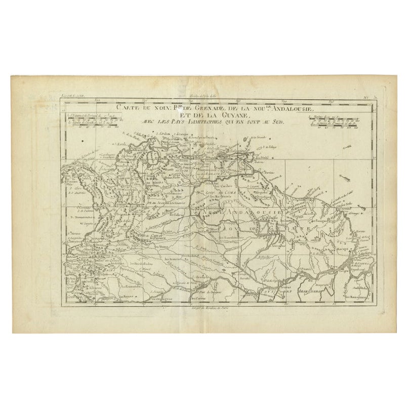
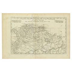
Old Map Guiana, Columbia Venezuela, Andalusia in South America by Bonne, c.1780
Located in Langweer, NL
Antique map titled 'Carte du Nouv. Rme. de Grenade, de la Nou'le Andalousie, et de la Guyane, avec les pays Limitrophes qui en sont au sud'.
Detailed map covering part of South Ame...
Category
Antique 18th Century Maps
Materials
Paper
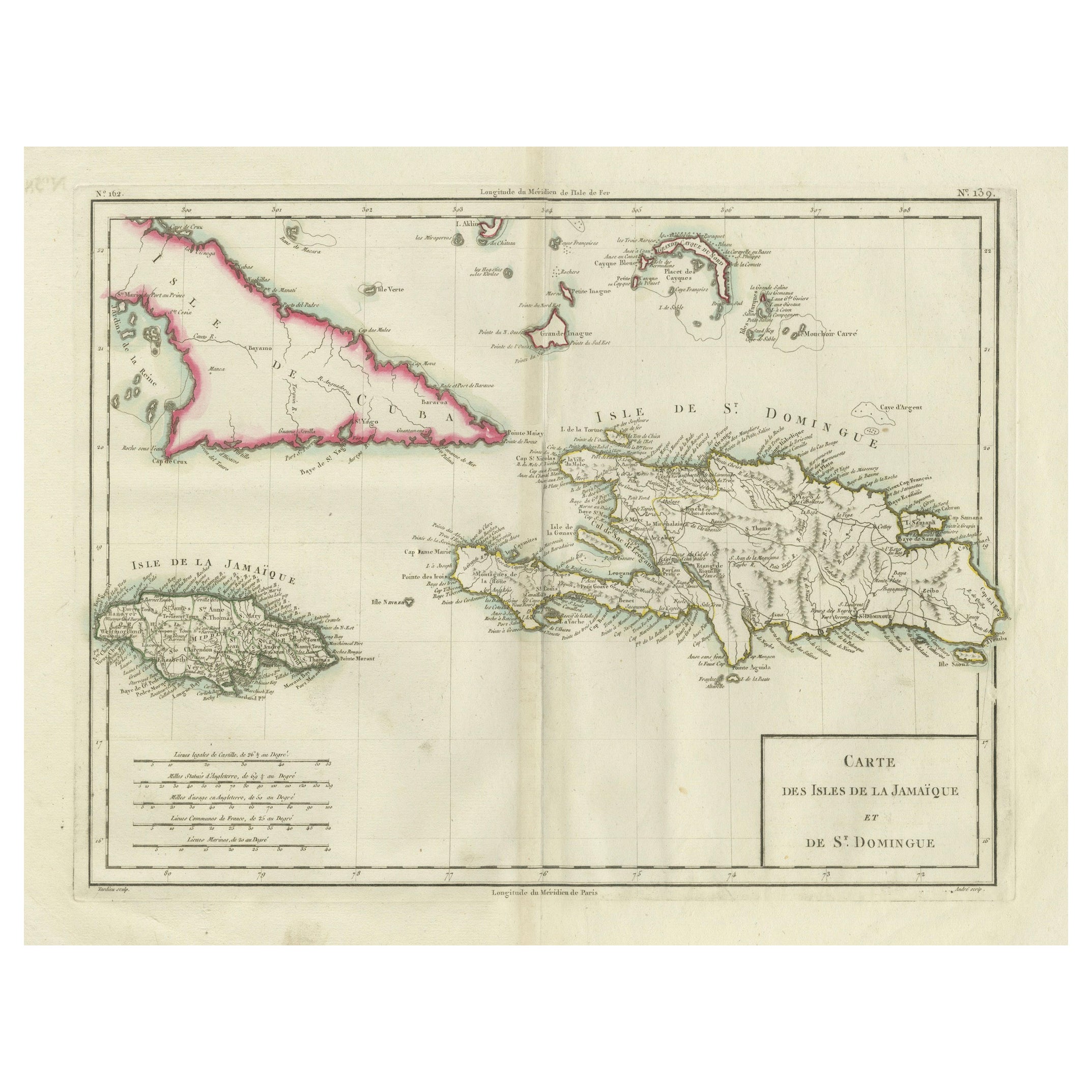
Antique Map of Jamaica and Hispaniola (Saint-Domingue and Santo Domingo), 1802
Located in Langweer, NL
This is an original antique map titled "Carte des Isles de la Jamaïque et de St. Domingue," depicting the islands of Jamaica and Saint-Domingue (modern-day Haiti and the Dominican Re...
Category
Antique Early 1800s Maps
Materials
Paper

$534 Sale Price
20% Off
Antique Map of Ambon Island in the Moluccas, Indonesia, c.1760
Located in Langweer, NL
Antique map Ambon titled 'Carte Particuliere de l 'Isle Amboine'. Old map showing Ambon, in the Moluccas Islands, better known as the Spice Islands. Ambon was the headquarters of the...
Category
Antique 18th Century Maps
Materials
Paper

$229 Sale Price
20% Off
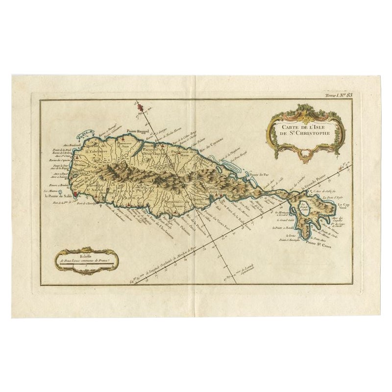
Old Map of the island of Saint Christopher or St. Kitts in the Caribbean, c.1765
Located in Langweer, NL
Antique map titled 'Carte de l'Isle de Saint-Christophe'.
A detailed map of the island of Saint Christopher or St. Kitts showing mountain ranges, port towns and parishes. This map ...
Category
Antique 18th Century Maps
Materials
Paper

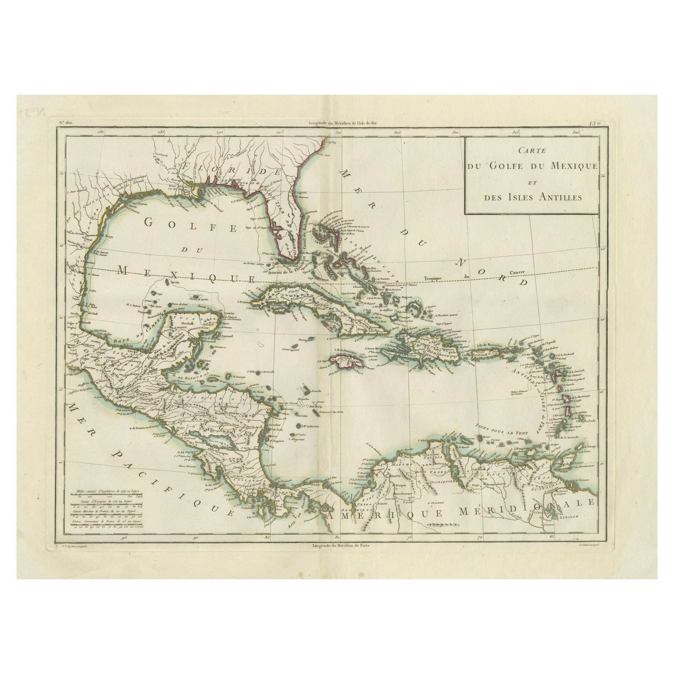
Antique Map of the Gulf of Mexico and Caribbean Islands by Tardieu, 1802
Located in Langweer, NL
This is an original antique map titled "Carte du Golfe du Mexique et des Isles Antilles," depicting the Gulf of Mexico and the Caribbean islands. Created by Pierre Antoine Tardieu, t...
Category
Antique Early 1800s Maps
Materials
Paper
$534 Sale Price
20% Off