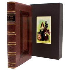
The Constitutions of the Sixteen States, Published 1797, Leather-bound
View Similar Items


Want more images or videos?
Request additional images or videos from the seller
1 of 5
The Constitutions of the Sixteen States, Published 1797, Leather-bound
About the Item
- Dimensions:Height: 7.25 in (18.42 cm)Width: 4.75 in (12.07 cm)Length: 7.25 in (18.42 cm)
- Materials and Techniques:
- Place of Origin:
- Period:1790-1799
- Date of Manufacture:1797
- Condition:Wear consistent with age and use.
- Seller Location:Colorado Springs, CO
- Reference Number:Seller: BK02891stDibs: LU909717076301
About the Seller
4.9
Platinum Seller
Premium sellers with a 4.7+ rating and 24-hour response times
Established in 2010
1stDibs seller since 2011
452 sales on 1stDibs
Typical response time: 1 hour
Authenticity Guarantee
In the unlikely event there’s an issue with an item’s authenticity, contact us within 1 year for a full refund. DetailsMoney-Back Guarantee
If your item is not as described, is damaged in transit, or does not arrive, contact us within 7 days for a full refund. Details24-Hour Cancellation
You have a 24-hour grace period in which to reconsider your purchase, with no questions asked.Vetted Professional Sellers
Our world-class sellers must adhere to strict standards for service and quality, maintaining the integrity of our listings.Price-Match Guarantee
If you find that a seller listed the same item for a lower price elsewhere, we’ll match it.Trusted Global Delivery
Our best-in-class carrier network provides specialized shipping options worldwide, including custom delivery.More From This Seller
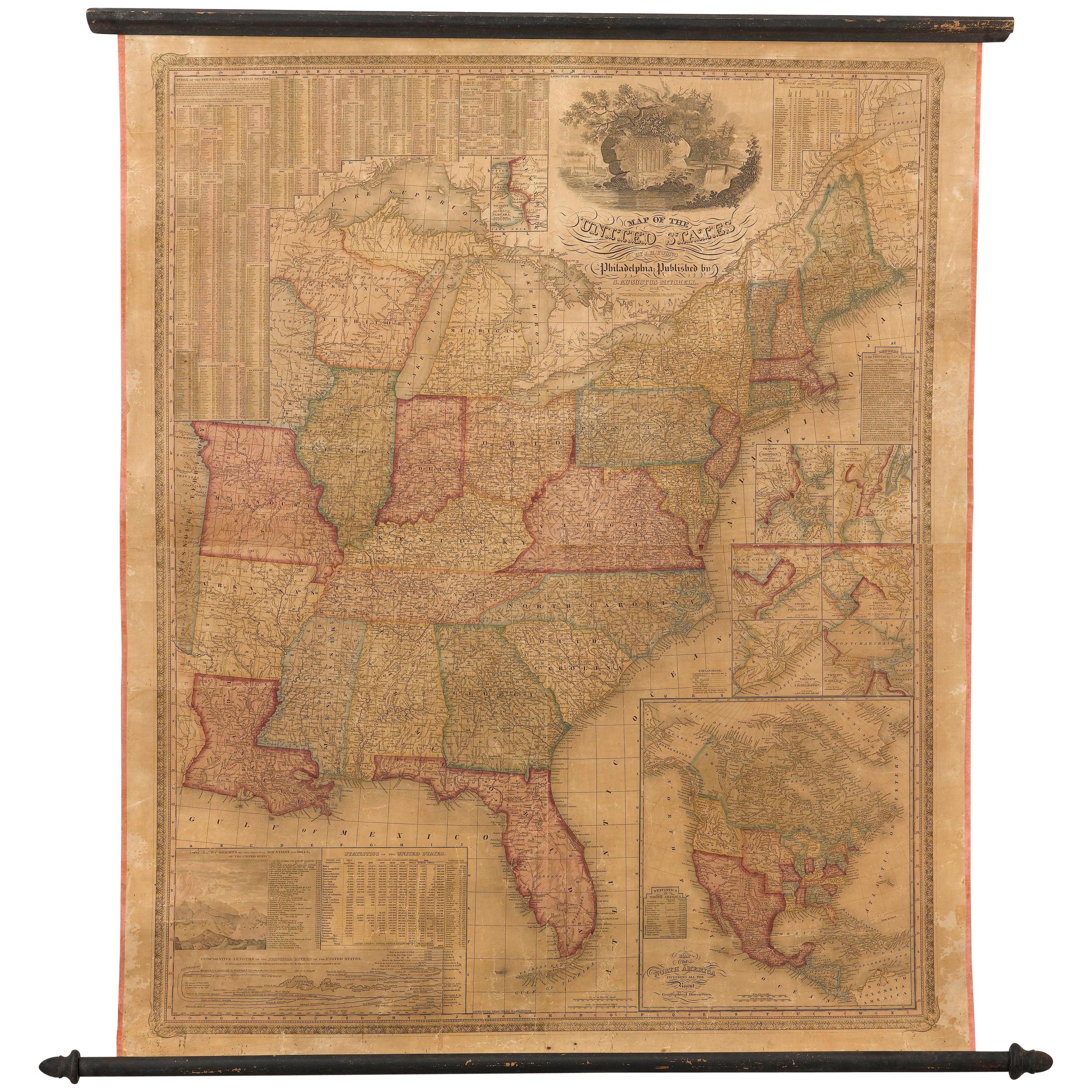
View All1842 Wall Map of the United States by J. H. Young, Published by S. A. Mitchell
Located in Colorado Springs, CO
Presented is an 1842 hanging “Map of the United States,” engraved by J. H. Young and published by Samuel Augustus Mitchell, Philadelphia. This is a beautiful example of the rare 1842...
Category
Antique 1840s American Maps
Materials
Paper

1859 "Map of the United States of America..." by J. H. Colton
By J.H. Colton
Located in Colorado Springs, CO
Presented is an 1859 “Map of the United States of America, the British Provinces, Mexico, the West Indies and Central America with Part of...
Category
Antique 1850s American Maps
Materials
Paper

1840 Map of the City of Washington Published by William M. Morrison
Located in Colorado Springs, CO
This map, printed in 1840, is a detailed representation of Washington, D.C. in the mid-19th century. The map shows block numbers, wards, and government buildings as well as details o...
Category
Antique 1840s American Federal Maps
Materials
Paper

1866 Ensign & Bridgman's Rail Road Map of the United States
Located in Colorado Springs, CO
Presented is an 1866 issue of “Ensign & Bridgeman’s Rail Road Map of the United States, showing Depots & Stations.” First published in 1856, this is the third edition, following anot...
Category
Antique 1860s American Late Victorian Maps
Materials
Paper

1847 Ornamental Map of the United States & Mexico by H. Phelps
Located in Colorado Springs, CO
Offered is an original 1847 ornamental map of the U.S. entitled "Ornamental Map of the United States & Mexico" by Humphrey Phelps. The map was issued as an act of Congress by Phelps on Fulton Street, New York. The broadside is elaborately hand-colored.
This is a very detailed and graphic propaganda map of the United States expressing U.S. dominance of the North American continent. The hand-colored map proclaims the Manifest Destiny, with the recent acquisition of Upper California and Texas at the conclusion of the Mexican-American War. The newly acquired land is boldly colored, standing in stark contrast to the rest of the U.S. The map details a potential route for a railroad running from New York City, to Buffalo, to Chicago, then west along the Oregon Trail to Oregon City. This route anticipates the construction of the transcontinental railroad by nearly 20 years.
The map includes elaborately detailed renderings of George Washington, Hernan Cortez, and Montezuma at top to represent European expansion to the Americas. At bottom are four inset designs with text showing the following: a chronological history of the U.S. beginning from settlement to the U.S. victory in the Mexican-American war; an illustration of General Zachary Taylor with details on the Oregon Territory; an illustration of the Aztec Temple of the Sun in Tenochtitlan and a chronology of the Conquest of the Aztec Empire under Cortez; a portrait of General Antonio Lopez de Santa Anna...
Category
Antique 1840s American Maps
Materials
Paper

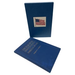
The Flag of the United States by Harrison S. Kerrick, First Edition, 1925
Located in Colorado Springs, CO
Kerrick, Harrison S. The Flag of the United States: Your Flag and Mine. Columbus: The Champlin Printing Co., 1925. First Edition, Second Printing. In original blue cloth boards, with gilt embossed title to the front board. New archival cloth slipcase.
Presented is a first edition, second printing of The Flag of the United States: Your Flag and Mine by Harrison S. Kerrick. This book was published by The Champlin Printing Co. in Columbus, Ohio. The first edition, first printing of this title was issued in February of 1925; this second printing was issued in April of 1925.
This book is a culmination of lifelong passion and respect for the American flag by the author Harrison S. Kerrick. The book begins by detailing the acts of continental and national Congresses, presidential proclamations, and Executive Orders that established the United States flag and Great Seal. He discusses the state laws pertaining to the American flag and argues the importance of a national flag code. Kerrick delves into the past history of flag design, including which European flags were popular in the early colonies, the early banners of the colonies, and the design elements that make up the stars and stripes as we know it today. He spends two chapters covering the facts and fictional myths surrounding our national flag. He then details how best to use the flag for personal and public use, inclduding how to create a flag, care for a flag, and the codes of conduct surrounding the proper display of the flag.
Lieutenant colonel Harrison Summers Kerrick (1873 – 1939) was an United States Army officer, teacher, and author. Kerrick was born in 1873 in Bloomington, Illinois, and attended Illinois Wesleyan University. In 1898, he enlisted in Company C of the 2nd Illinois Volunteer Infantry, serving in the Spanish–American War, during which he was promoted to captain. He served as a field artillery officer in the Philippine–American War and in WWI, he served in the U.S. Army Coast Artillery Corps from December 1917 to February 1918.
A lecturer and teacher, Kerrick was also the author of two books, Military and Naval America and The Flag of the United States. Passionate about American history and the symbolism of the American flag, Kerrick created the code of conduct on the proper handling and display of the United States flag, which was later adopted by the United States Congress...
Category
Vintage 1920s American Arts and Crafts Books
Materials
Paper
You May Also Like
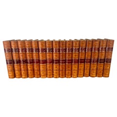
Set of Sixteen Leather Bound Book by Charles Reade
Located in Los Angeles, CA
Set of sixteen leather bound books by Charles Reade. Charles Reade was known for his novels that often combined elements of romance, social injustice, and moral earnestness. His wo...
Category
Antique 19th Century American Other Books
Materials
Leather, Paper
$2,320 Sale Price / set
20% Off
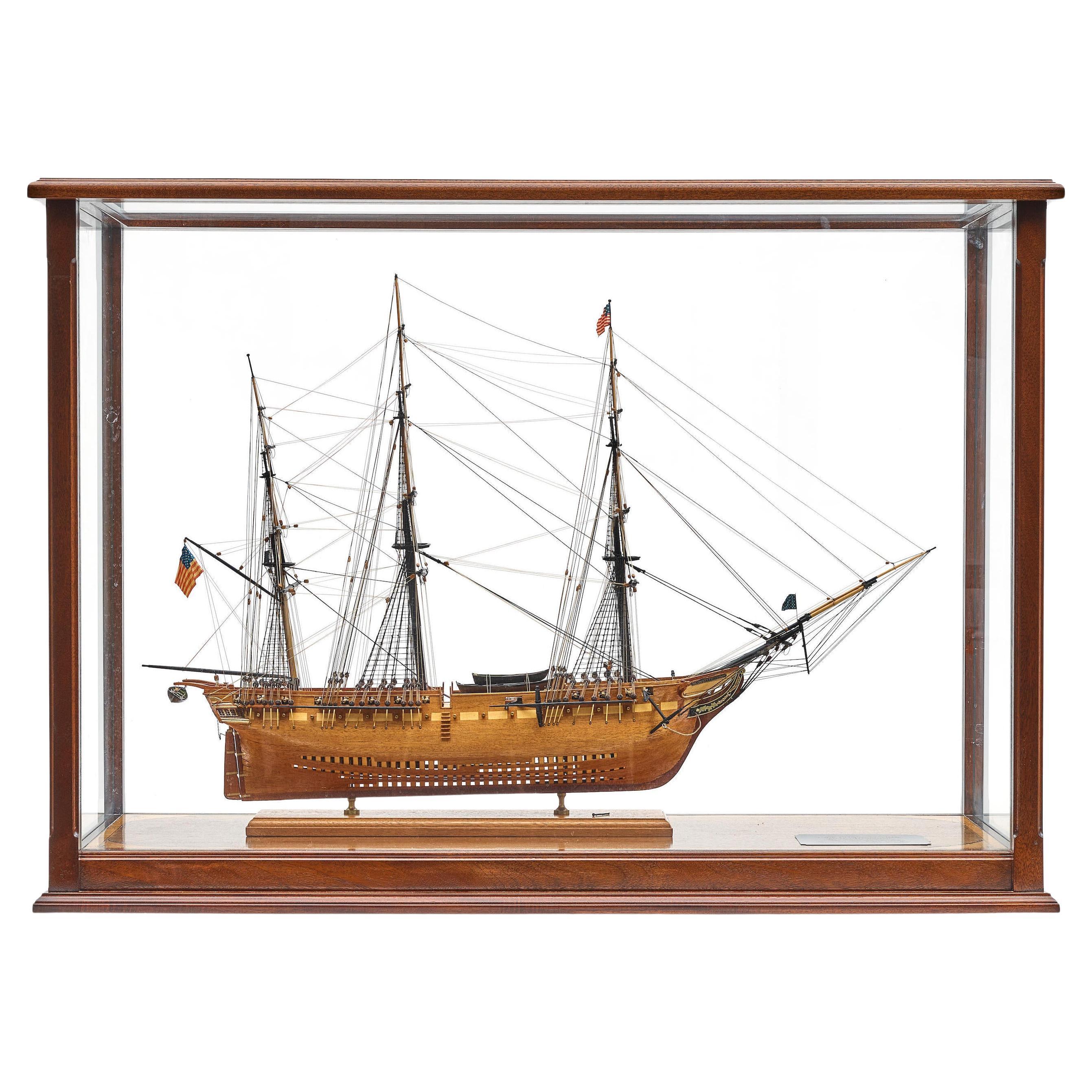
Large Model of the USS Constitution
Located in Norwell, MA
Fine scale model of the American frigate USS Constitution. Planked hull with varnish finish. Clove hitched shrouds, quarter galleries, rigged cannon etc. No case.
Weight: 26 lbs...
Category
Early 2000s North American Models and Miniatures
Materials
Wood

8 Theological Leather Bound Books, by Franz Volkmar Reinhard, Published 1808
Located in West Palm Beach, FL
8 Theological Leather Bound Books, by Franz Volkmar Reinhard,
Germany, published in 1808
We are pleased to offer a rare and historical find with this exquisite collection of eight ...
Category
Antique Early 19th Century Neoclassical Books
Materials
Leather, Paper, Parchment Paper

"The Annals of San Francisco" Leather Bound Book, 1855
Located in San Francisco, CA
"The Annals of San Francisco" Leather Bound Book, 1855
Published by Appleton & Co, NY First Edition
By Frank Soule, John H. Giron, MD, and James Nisbet
Category
Antique 1850s Books
Materials
Leather

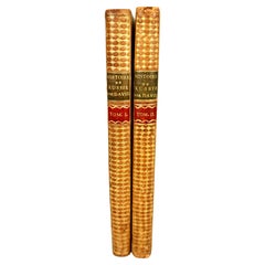
Histoire De Russie Published 1797 with 36 Engraved Plates by E.A. David
Located in San Francisco, CA
The History of Russia in 2 volumes published 1797, in French.
A lovely 2 volume first edition titled "Histoire de Russie" by Blin de Sainmore, French poet, playwright and historian (...
Category
Antique Late 18th Century French Books
Materials
Leather, Paper
Leather Bound Volume of the San Francisco News, 1940-41
Located in San Francisco, CA
Leather bound volume of San Francisco news, 1940-41 (World War II period) with hundreds of newspaper pages.
Category
Vintage 1940s American Other Books
Materials
Animal Skin, Paper

Recently Viewed
View AllMore Ways To Browse
Declaration Of Independence
Cosway Binding Books
Eileen Gray Book
Klimt Books
Michael Smith Houses Book
Pablo Picasso Coffee Table Book
Tom Taylor
William Randolph Hearst
William Sherman
American Federalist
Antique Pilgrims Progress
Antique Tools Glasgow
Djo Bourgeois
Duke Of Windsor Photograph
Helmut Newton Sumo
Ian Love Furniture
Ian Love
Jasper Conran