Items Similar to 4 Vols Vintage English Maps, John Speed, Cartography Folio, Reproduction, C.1953


Want more images or videos?
Request additional images or videos from the seller
1 of 13
4 Vols Vintage English Maps, John Speed, Cartography Folio, Reproduction, C.1953
About the Item
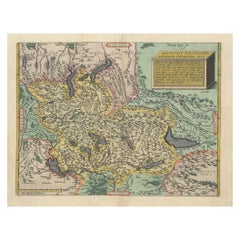
This is a vintage 4 volume compendium atlas of England by John Speed. An English, cartography folio, reproduced and presented in slip cases by John Arlott, dating to the mid 20th century, published in 1953 and 1954.
A renowned 16th and early 17th century cartographer and historian, John Speed (1552 - 1629) crafted a series of fine maps in a distinguished career. Influenced by contemporaries such as Christopher Saxton and John Norden, Speed was the first to incorporate The Hundreds administrative divisions to his cartography and established the first town plans of several locations.
Fascinating compendium of early 17th century maps, covering the counties of England
Displaying a desirable aged patina, lightly time worn with careful use
Each volume hard bound and set within a colour co-ordinated folio sleeve
Vols 1-3 feature 10 maps, with volume 4 hosting 11 maps respectively
Superb informative presentation to each, with a preface to Speed's work before the map plates
County by county information is given, adding colour to the map's significance
Likely reproduced from the 'Theatre of Great Britain' of 1627, each county replete with its descriptive key
Such details given include places of interest and historic events
Reproduced in full, vibrant colour and offering a striking visual appeal for the viewer
County emblems and town plans enhance the detail of each map
Decorative accents and descriptive texts present a fine read for the enthusiast
Maps in an intact, pleasingly clean order throughout
This is a delightful vintage 4 volume compendium of England, with a high quality reproduction of John Speed's fascinating 17th century works. Delivered ready to enjoy.
Dimensions:
Max Width: 31.5cm (12.5'')
Max Depth: 2.5cm (1'')
Max Height: 47cm (18.5'')
- Dimensions:Height: 18.51 in (47 cm)Width: 12.41 in (31.5 cm)Depth: 0.99 in (2.5 cm)
- Style:Mid-Century Modern (Of the Period)
- Materials and Techniques:
- Place of Origin:
- Period:
- Date of Manufacture:circa 1953
- Condition:Wear consistent with age and use. Presented in very good vintage condition.
- Seller Location:Hele, Devon, GB
- Reference Number:Seller: 247841stDibs: LU2645341701602
About the Seller
5.0
Platinum Seller
Premium sellers with a 4.7+ rating and 24-hour response times
Established in 2005
1stDibs seller since 2017
1,005 sales on 1stDibs
Typical response time: 1 hour
- ShippingRetrieving quote...Shipping from: Hele, Devon, United Kingdom
- Return Policy
Authenticity Guarantee
In the unlikely event there’s an issue with an item’s authenticity, contact us within 1 year for a full refund. DetailsMoney-Back Guarantee
If your item is not as described, is damaged in transit, or does not arrive, contact us within 7 days for a full refund. Details24-Hour Cancellation
You have a 24-hour grace period in which to reconsider your purchase, with no questions asked.Vetted Professional Sellers
Our world-class sellers must adhere to strict standards for service and quality, maintaining the integrity of our listings.Price-Match Guarantee
If you find that a seller listed the same item for a lower price elsewhere, we’ll match it.Trusted Global Delivery
Our best-in-class carrier network provides specialized shipping options worldwide, including custom delivery.More From This Seller
View AllLarge Antique Lithography Map, Northamptonshire, Framed Cartography, John Speed
Located in Hele, Devon, GB
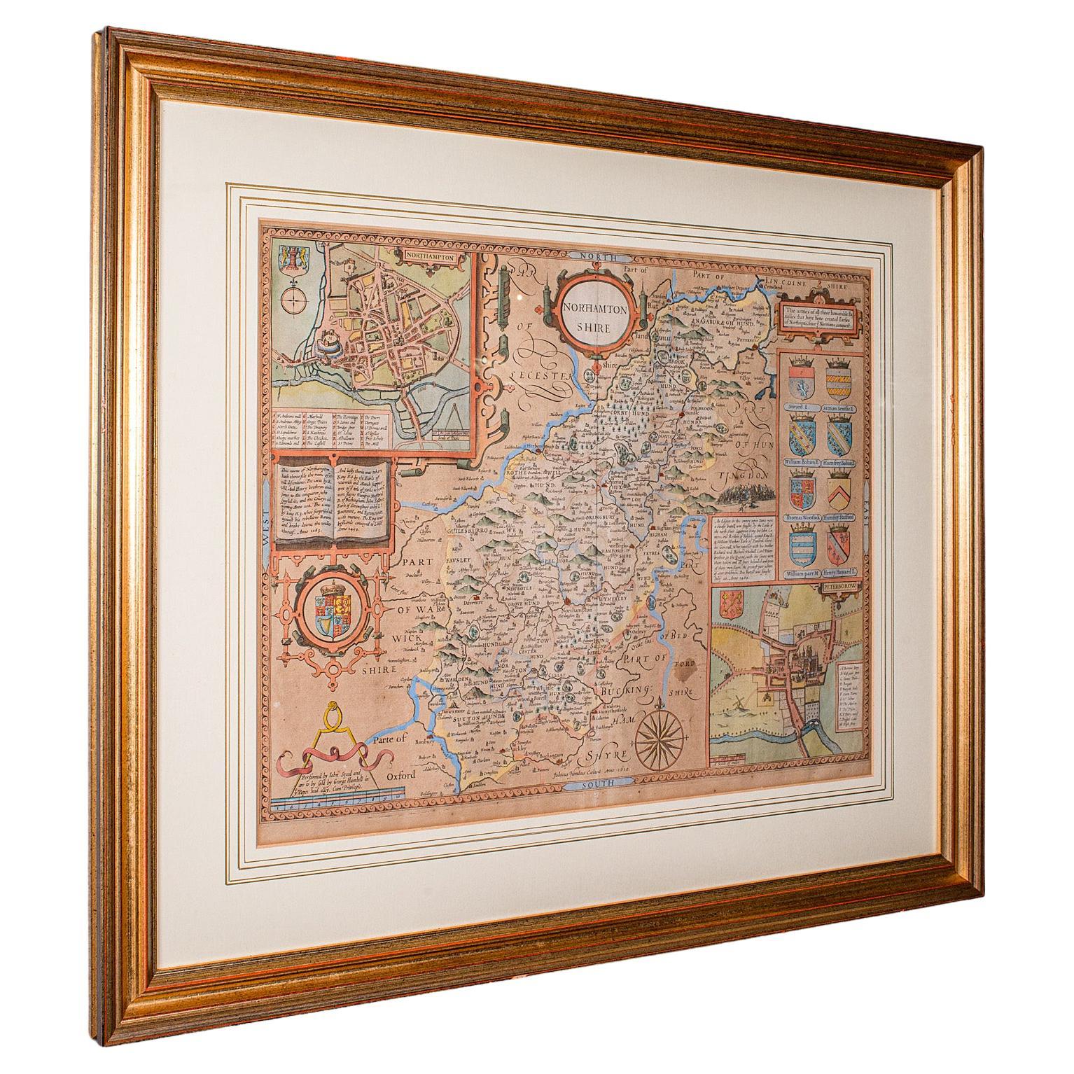
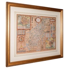
This is a large antique lithography map of Northamptonshire. An English, framed atlas engraving of cartographic interest by John Speed, dating to the early 17th century and later.
Superb lithography reproduction of Northamtonshire - place names are written in 17th century English
Displays a desirable aged patina and in very good order
Fascinating Jacobean period cartography, set within a quality, later frame
Reproduced here from its appearance in the 'Theatre of Great Britain' of 1627 published by George Humble
Marked for John Speed as cartographer and George Humbell (sic) as seller
Exceptional detail, as expected from a John Speed map...
Category
Antique Mid-17th Century British Other Maps
Materials
Glass, Wood, Paper
Vintage Reproduction 17th Century Map of Europe, American, Cartography, Blaeuw
Located in Hele, Devon, GB
This is a vintage reproduction map of Europe. An American, paper stock cartography print in frame after the work by Blaeuw, dating to the late 20t...
Category
Late 20th Century Central American Mid-Century Modern Maps
Materials
Glass, Wood, Paper

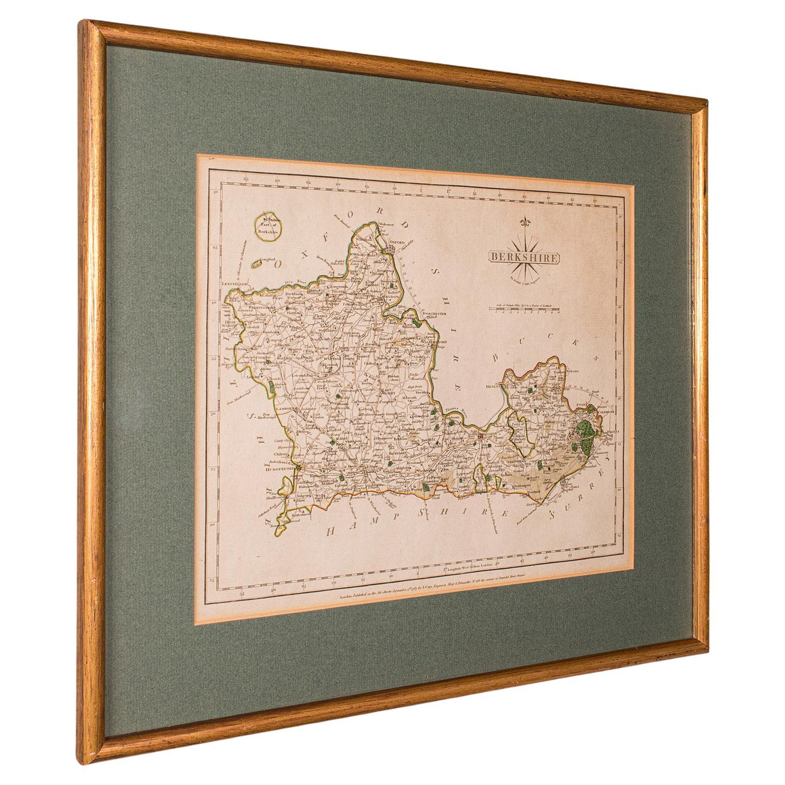
Antique County Map, Berkshire, English, Framed, Cartography, John Cary, C.1790
Located in Hele, Devon, GB
This is an antique county map of Berkshire. An English, framed atlas engraving of cartographic interest by John Cary, dating to the late 18th century and later.
Superb lithography ...
Category
Antique Late 18th Century British George III Maps
Materials
Glass, Wood, Paper

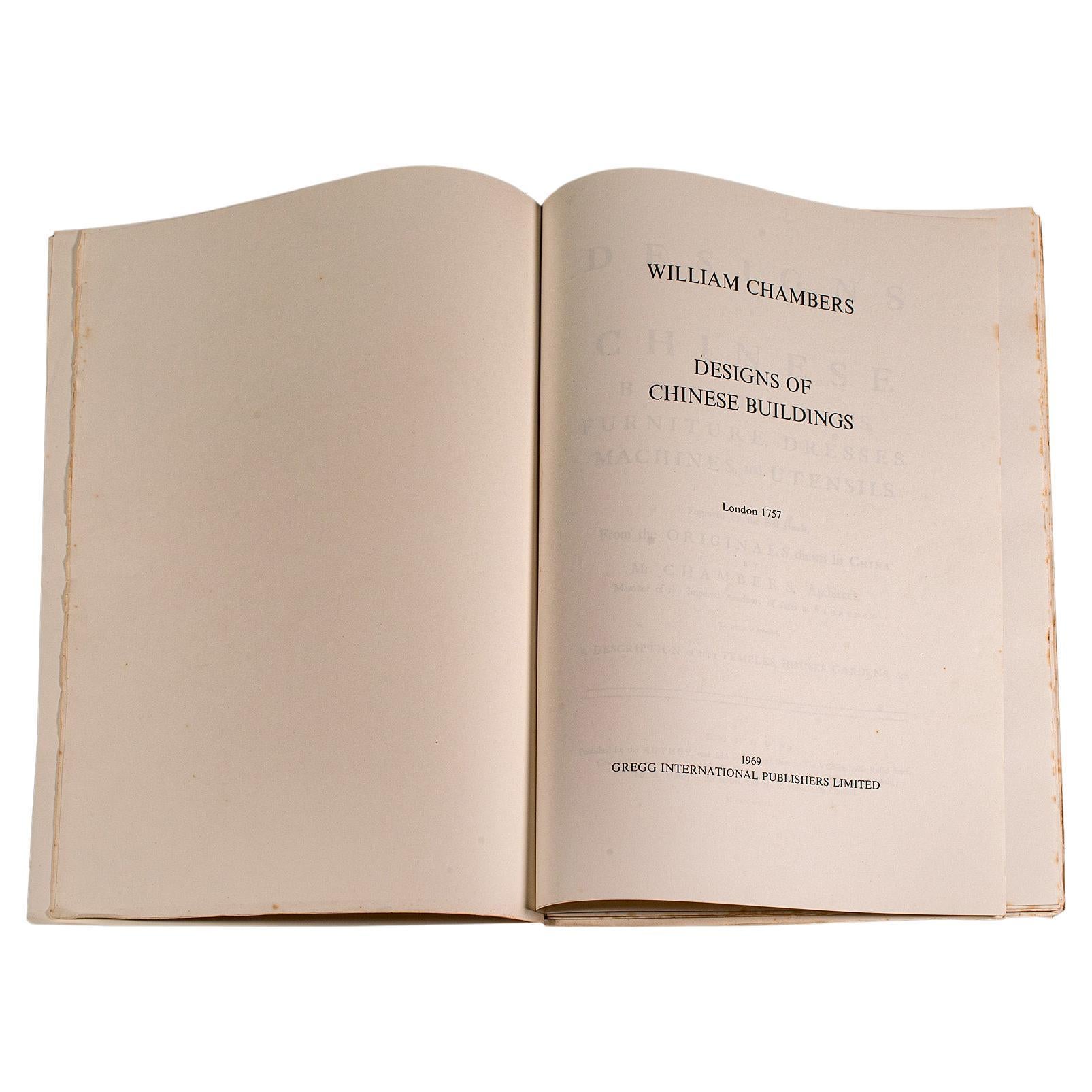
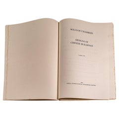
Vintage Reproduction Folio, Chinese Design, English, William Chambers, C.1969
Located in Hele, Devon, GB
This is a vintage reproduction folio, A Design of Chinese Buildings, Furniture etc. An unbound reprint of the 18th century original by Sir William...
Category
Late 20th Century British Mid-Century Modern Books
Materials
Paper
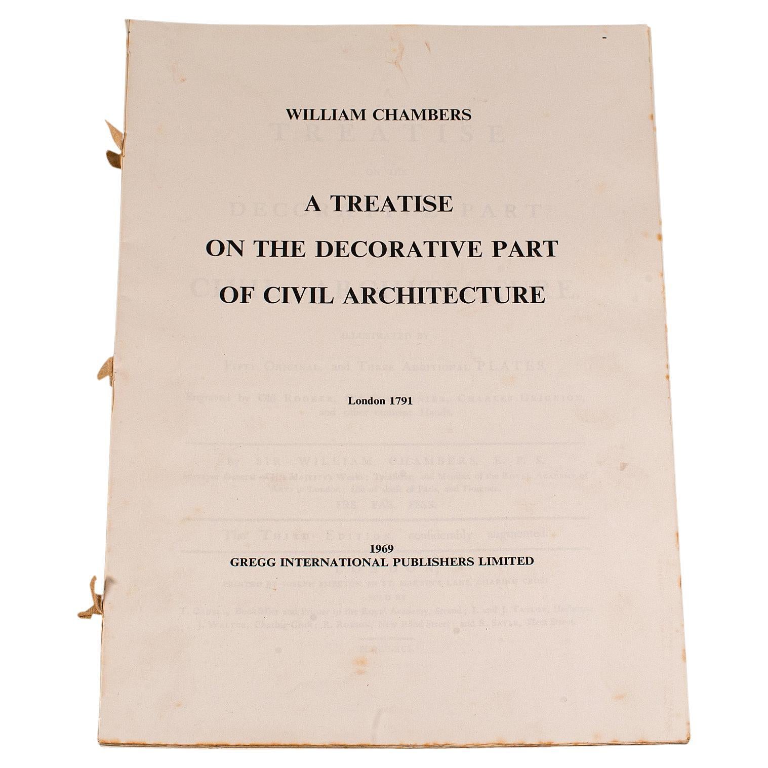
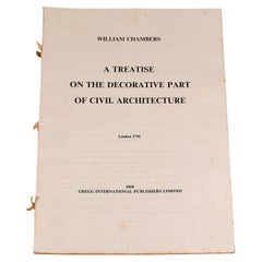
Vintage Folio, Civil Architecture, English, Sir William Chambers, Reproduction
Located in Hele, Devon, GB
This is a vintage folio A Treatise on the Decorative Part of Civil Architecture. An unbound reproduction of the 18th century original by Sir William Cham...
Category
Antique Late 19th Century British Mid-Century Modern Books
Materials
Paper
Antique Lithography Map, Northumberland, English, Framed, Engraving, Cartography
Located in Hele, Devon, GB
This is an antique lithography map of Northumberland. An English, framed atlas engraving of cartographic interest, dating to the mid 19th century a...
Category
Antique Mid-19th Century British Victorian Maps
Materials
Wood

You May Also Like
1806 John Cary Map of Hindoostan – Detailed British Cartography of India
Located in Langweer, NL
Title: 1806 John Cary Map of Hindoostan – Detailed British Cartography of India
This highly detailed map, titled "A New Map of Hindoostan from the Latest Authorities," was engraved ...
Category
Antique Early 1800s Maps
Materials
Paper
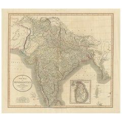
$502 Sale Price
20% Off
17th Century John Speed Map of Denbighshire, c.1610
By John Speed
Located in Royal Tunbridge Wells, Kent
Antique early 17th century British very rare and original John Speed, hand coloured map of Denbighshire, dated 1610, by John Sunbury and George Humble. John...
Category
Antique 17th Century British Maps
Materials
Wood, Paper

1584 Ortelius Map of Switzerland: A Cartographic Reversal
Located in Langweer, NL
This is a fine example of Ortelius' map of Switzerland from his *Theatrum Orbis Terrarum*, recognized as the first modern atlas of the world. The map is oriented with south at the top, which reverses the typical north-up orientation seen in most modern maps. It highlights significant geographical features such as Lake Geneva (Lemanus Lacus) to the right of the map and the Rhine river entering Switzerland near the center.
The *Theatrum Orbis Terrarum*, first published in 1570 by Abraham Ortelius in Antwerp, was groundbreaking as it compiled uniform maps with supporting text in a single volume, marking a departure from earlier collections of maps that were custom-assembled on demand. This atlas included a wealth of sixteenth-century cartographic knowledge, reflecting the extensive global explorations occurring after the discovery of America...
Category
Antique 16th Century Maps
Materials
Paper
$896 Sale Price
30% Off
Table Low Sofa Vintage 1950s Map Isle of Man John Speed 1610 Thomas Durham 1595
Located in BUNGAY, SUFFOLK
- The juxtaposition of modern design and this ancient map create a unique small table and conversation piece
- This is the first map featuring the Isle of Man on its own.
- It is also the first map of the Island based on an actual survey, undertaken by Thomas Durham 1595 and was first published by Speed in 1605-1611 and reprinted many times over the next century. This is the second state or print from 1610.
The map is inset within a fruitwood box frame with a glass top. Supported by tapering stick legs.
The map is based on a survey (and presumably a MS map) by Thomas Durham, of whom nothing is known other that he was paid by Sir Thomas Gerrard to make a survey of the Island. This survey, almost certainly for military purposes, arose from the disputed possession of the Island during which time Elizabeth had assumed control in order to prevent the Scots or the Spanish from using the Island as a base.
Speed had used the Durham Map in his slightly earlier 4-sheet wall map showing invasions and battles of c1603/4 [ref: Shirley #261] - there are some differences from this 1605/10 map - Port Eran (rather than Earn on 1605);Knockalo point (= Contrary Hd) not on 1605;Spalbrecke shown west of Calf rather than E as on 1605/10. Thus it is possible that the Durham Map had even more detail than Speed used in his derived version.
In sea are four mythical beasts with riders: to NW of Island Unicorn with Scottish flag...
Category
Antique 1610s English Mid-Century Modern Sofa Tables
Materials
Paper
17th Century John Speed Map of the Barkshire Described, c.1616
By John Speed
Located in Royal Tunbridge Wells, Kent
Antique 17th century British very rare and original John Speed (1551-1629) map of the Barkshire Described, J. Sud and Georg Humble, publication (1616 or lat...
Category
Antique 17th Century British Maps
Materials
Paper

Framed 17th Century Map of Cumberland, England by John Speed, 1610
By John Speed
Located in Middleburg, VA
A fascinating and richly detailed antique map of Cumberland County in northwest England, drawn and published by the celebrated English cartographer John Spe...
Category
Antique Early 17th Century English British Colonial Maps
Materials
Copper, Gold Leaf
Recently Viewed
View AllMore Ways To Browse
Indian Tea Table
Indian Wicker Furniture
Infinity Sofa
Ipe Wood
Iraq Map
Irish Marquetry Table
Irish Sterling 18th
Iron Greyhounds
Iron Tiered End Table
Italian Bedspread
Italian Birch Lounge Chairs
Italian Christmas Decor
Italian Drink Poster
Italian Fiberglass Dining Room Chairs
Italian Ice Tongs
Italian Lyre Chairs
Italian Olive Wood Desk
Italian Renaissance Trestle Table