Items Similar to Antique Travel Book, Baedeker’s Paris and its Environs, Maps, Guide, Victorian
Want more images or videos?
Request additional images or videos from the seller
1 of 11
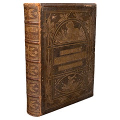
Antique Travel Book, Baedeker’s Paris and its Environs, Maps, Guide, Victorian
$553.13
£401
€472.42
CA$759.77
A$844.82
CHF 442.28
MX$10,319.68
NOK 5,557.69
SEK 5,228.12
DKK 3,526.60
About the Item
This is an antique copy of Baedeker’s Paris and its Environs, a bound and illustrated travel guide book, presented in its intact, original order with only light markings. A superb example of Baedeker’s renowned guides; admired for their clarity, detail and charm, offering a fascinating insight into Parisian life and travel in the late 19th century.
Original bound copy of Baedeker’s Paris and its Environs - this edition printed in 1888
Features 373 pages, with an additional 32 pages of addenda
Illustrated with 9 maps and 30 detailed plans, showcasing the precision cartography for which Baedeker is celebrated
Presented in intact original order, displaying only light markings consistent with age
An excellent reference work, offering both historical insight and decorative charm as a collector’s book
A fine addition to a library, study or collection of travel guides
A wonderful antique Baedeker travel guide, combining literary interest, cartographic quality and collectible appeal. Delivered ready to enjoy.
Dimensions:
Max Width: 11cm (4.25'')
Max Depth: 3cm (1.25'')
Max Height: 16cm (6.25'')
- Dimensions:Height: 6.3 in (16 cm)Width: 4.34 in (11 cm)Depth: 1.19 in (3 cm)
- Style:Late Victorian (Of the Period)
- Materials and Techniques:
- Place of Origin:
- Period:
- Date of Manufacture:Circa 1890
- Condition:Wear consistent with age and use. Presented in original, intact time-worn condition.
- Seller Location:Hele, Devon, GB
- Reference Number:Seller: 252801stDibs: LU2645346485022
About the Seller
5.0
Platinum Seller
Premium sellers with a 4.7+ rating and 24-hour response times
Established in 2005
1stDibs seller since 2017
1,037 sales on 1stDibs
Typical response time: 1 hour
- ShippingRetrieving quote...Shipping from: Hele, Devon, United Kingdom
- Return Policy
Authenticity Guarantee
In the unlikely event there’s an issue with an item’s authenticity, contact us within 1 year for a full refund. DetailsMoney-Back Guarantee
If your item is not as described, is damaged in transit, or does not arrive, contact us within 7 days for a full refund. Details24-Hour Cancellation
You have a 24-hour grace period in which to reconsider your purchase, with no questions asked.Vetted Professional Sellers
Our world-class sellers must adhere to strict standards for service and quality, maintaining the integrity of our listings.Price-Match Guarantee
If you find that a seller listed the same item for a lower price elsewhere, we’ll match it.Trusted Global Delivery
Our best-in-class carrier network provides specialized shipping options worldwide, including custom delivery.More From This Seller
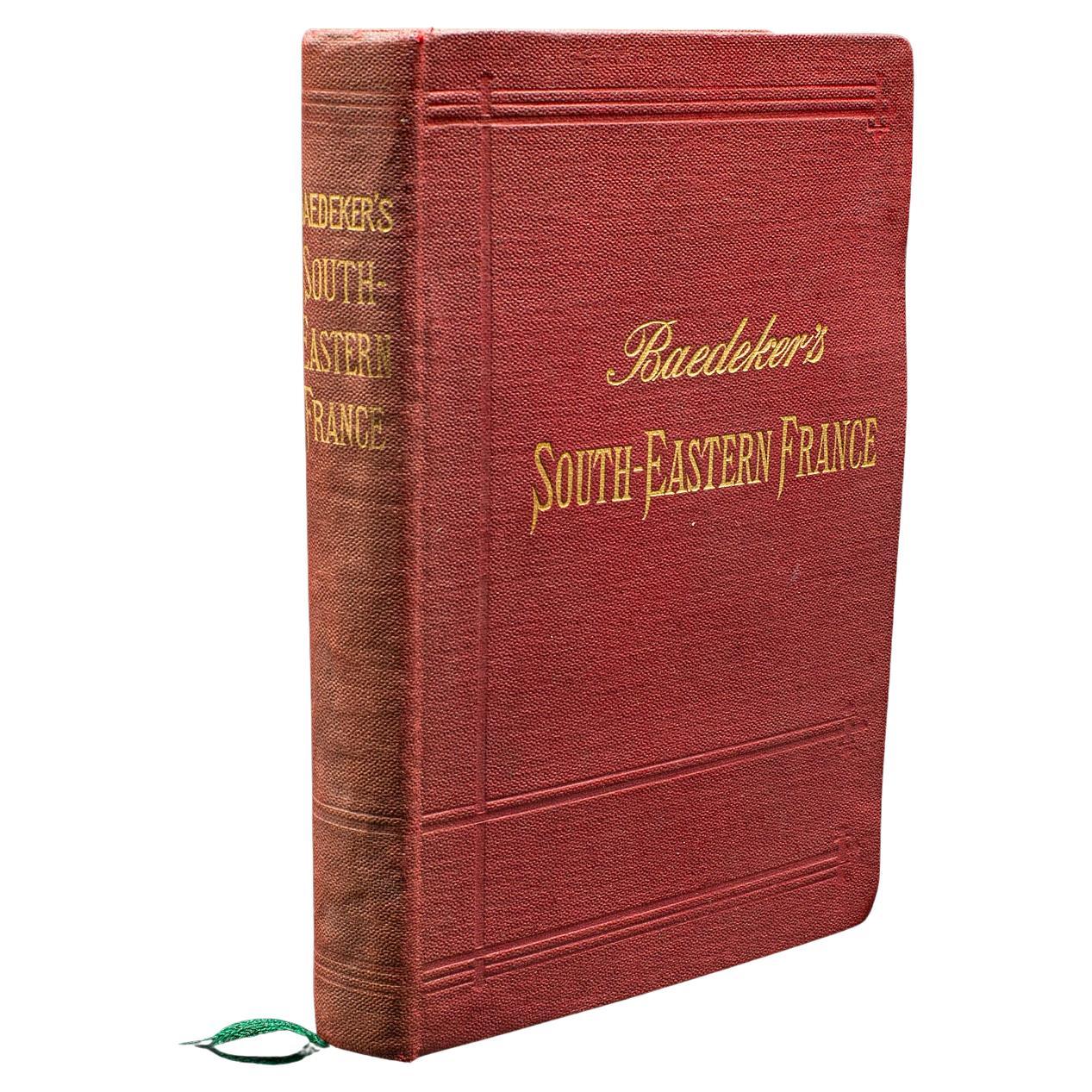
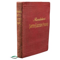
View AllSmall Antique Baedeker's South Eastern France Guide Book, Provence, Travel Maps
Located in Hele, Devon, GB
This is a delightful antique edition of Baedeker's South Eastern France guide book, complete with superb fold-out maps, centre-fold maps and informative text. A bound and intact late...
Category
Early 20th Century British Late Victorian Books
Materials
Paper
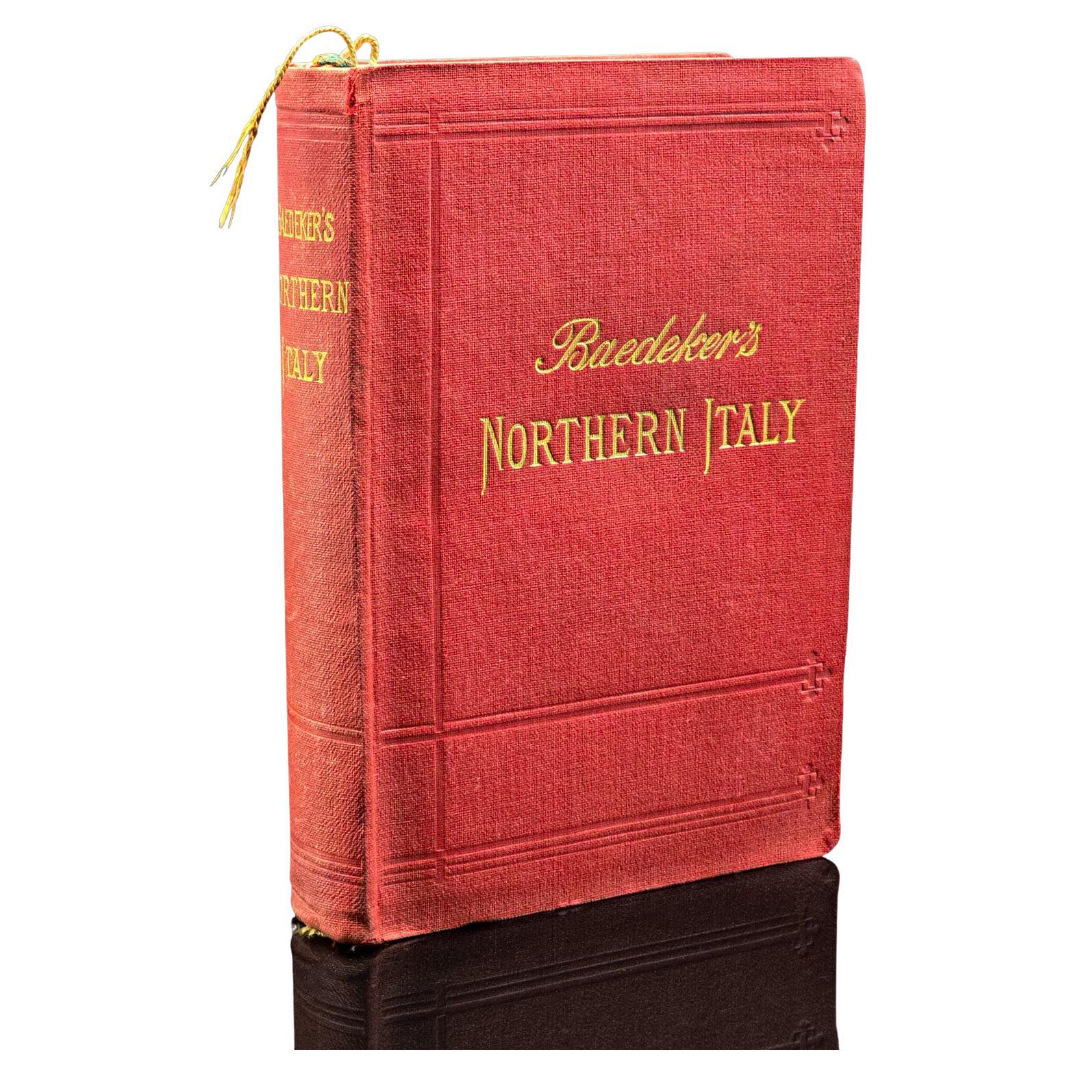
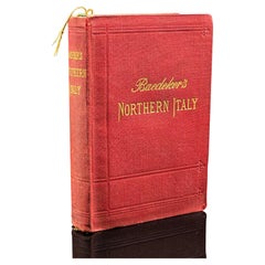
Antique Travel Book, Baedeker’s Northern Italy, Maps, Guide, Edwardian, C.1903
Located in Hele, Devon, GB
This is an antique copy of Baedeker’s Northern Italy, a bound and illustrated travel guide book, presented in its intact, original order with only light markings commensurate with ag...
Category
Early 20th Century British Edwardian Books
Materials
Paper
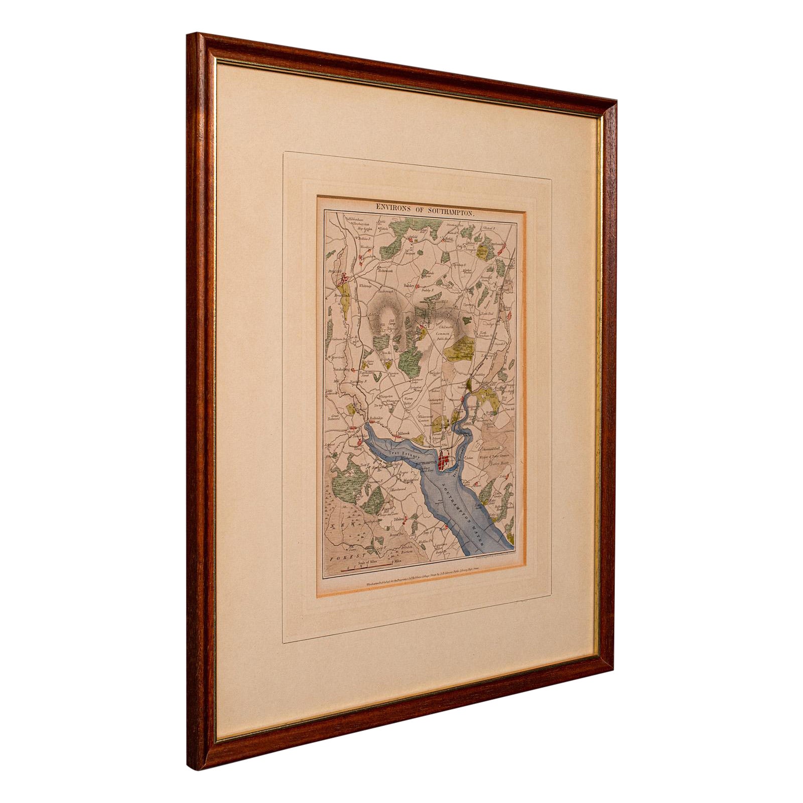
Antique Lithography Map, Environs of Southampton, English, Framed, Victorian
Located in Hele, Devon, GB
This is an antique lithography map 'The Environs of Southampton'. An English, framed town engraving of cartographic interest by John James Dower, dating to the Victorian period and ...
Category
Antique Late 19th Century British Victorian Maps
Materials
Wood

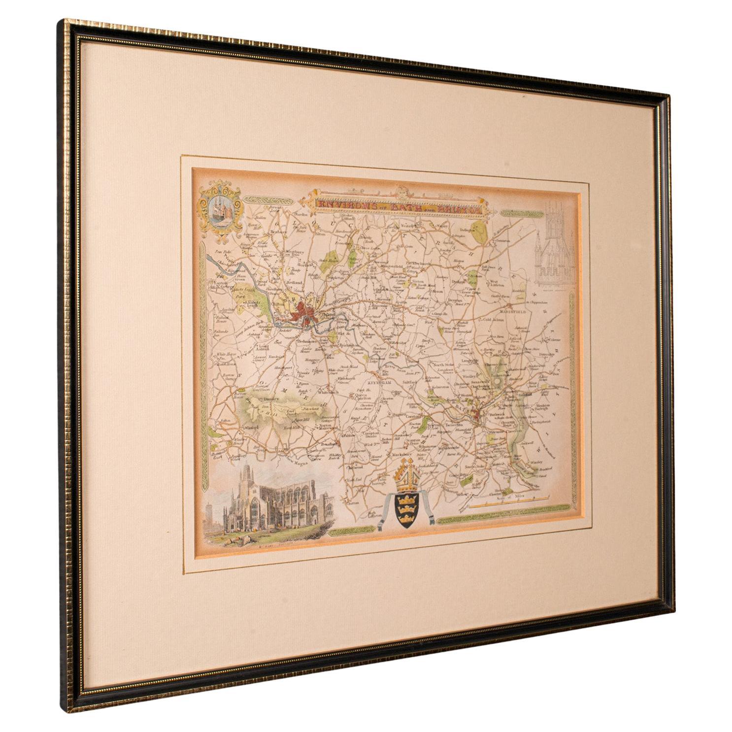
Antique Environs of Bath & Bristol Map, English, Framed Cartography, Victorian
Located in Hele, Devon, GB
This is an antique region map of Bath and Bristol. An English, framed atlas engraving of cartographic interest, dating to the mid 19th century and later.
Superb lithography of Bath...
Category
Antique Mid-19th Century British Victorian Maps
Materials
Glass, Wood, Paper
Antique Life & Explorations of Dr Livingstone Book, African Travel, Victorian
Located in Hele, Devon, GB
This is an antique copy of The Life & Explorations of Dr. Livingstone. An English language African travel and history book, dating to the Victorian period, circa 1875.
A Victorian p...
Category
Antique Late 19th Century British Victorian Books
Materials
Paper
Antique Book, Bones and I, Whyte-Melville, English, Novel, Victorian, Circa 1880
Located in Hele, Devon, GB
This is an antique book, Bones & I by George Whyte-Melville. An English language, bound novel, dating to the late Victorian period, circa 1880.
First published in 1868, Bones & I is a humorous novel written about a man - Jack Raggles - who gains possession of a human skeleton. Written by George Whyte-Melville (1821 - 1878), the book is a comedic and macabre blend of satire and class division.
Nicely presented example of this unusual title
Displays a desirable aged patina, lightly time-worn but intact
Bound with cloth over board in navy blue with gold...
Category
Antique Late 19th Century British Late Victorian Books
Materials
Paper
You May Also Like
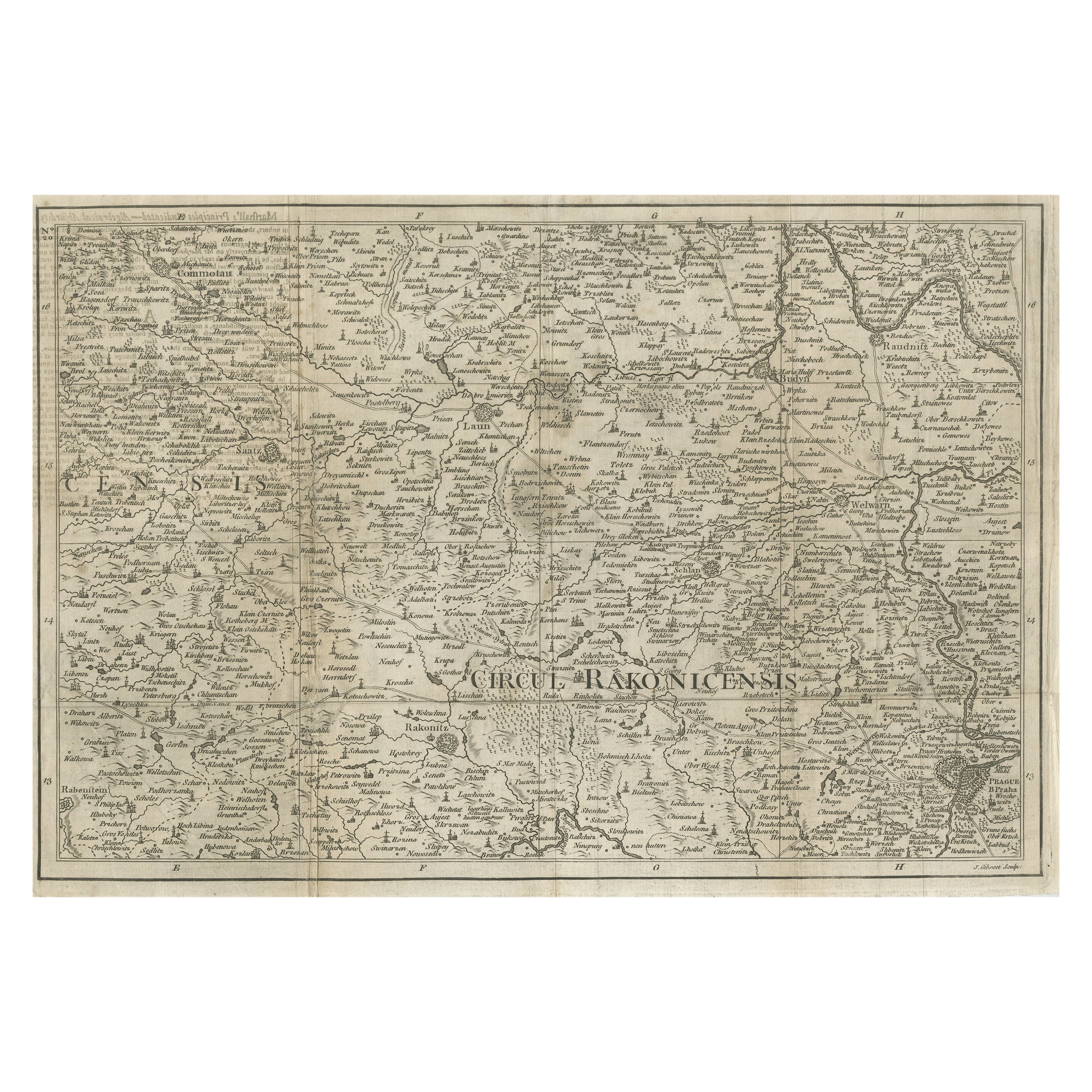
Rare Detailed Antique Map of Prague and Its North West Environs, ca.1760
Located in Langweer, NL
Description: original antique map of the environs of North West Prague. This map originates from the 'Gentlemans Magazine'. Published circa 1760.
Artists and Engravers: Engraved ...
Category
Antique 1760s Maps
Materials
Paper
$429 Sale Price
20% Off
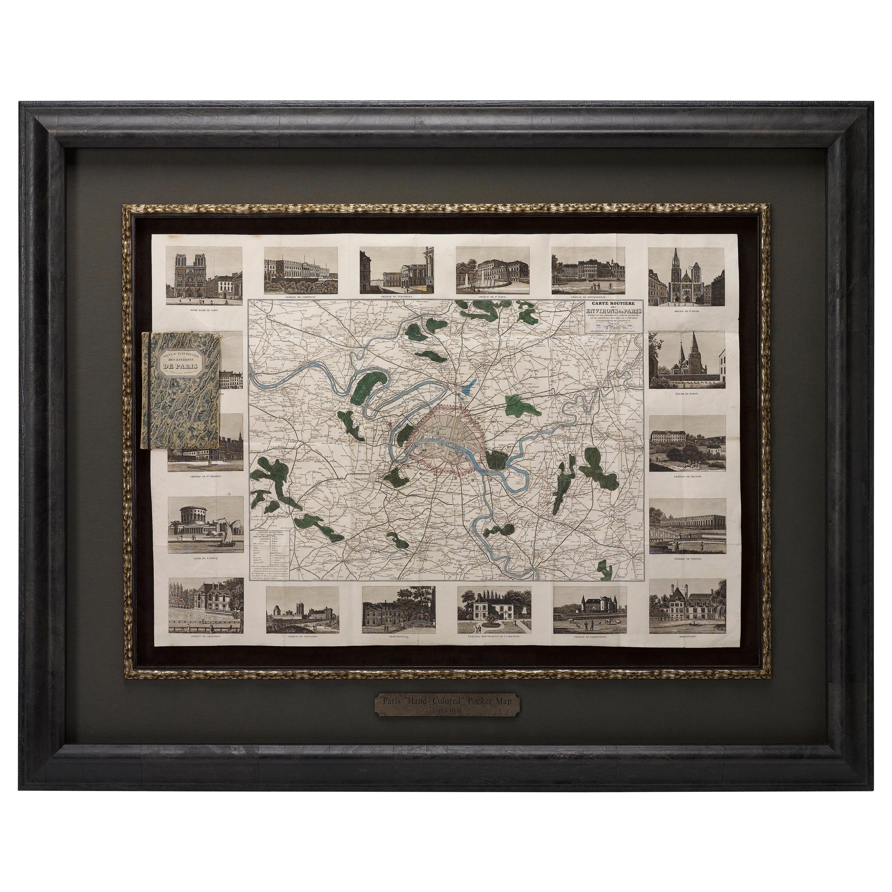
Antique Map of Paris, "Carte Routiere des Environs de Paris" 1841
Located in Colorado Springs, CO
This beautiful hand-colored road map of Paris was published in 1841. The map shows Paris and the surrounding area in a folding pocket map. Organized and detailed for travelers, this ...
Category
Antique 1840s French Maps
Materials
Paper

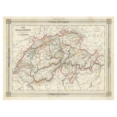
Swiss Splendor: Antique Map of Switzerland and Its Cantons, 1852
Located in Langweer, NL
The antique map titled 'Carte de la Suisse' is an attractive map of Switzerland. Here are the key details and features of the map:
1. **Geographic Coverage**:
- The map provides comprehensive coverage of Switzerland, depicting the entire country.
- It showcases the division of Switzerland by Cantons, including regions from Vaud to Grisons.
- Additionally, the map includes parts of adjacent countries, such as France, Germany, and Italy, providing context for Switzerland's geographical location.
2. **Cartographic Details**:
- The map offers detailed cartographic information, including the delineation of geographic features, rivers, mountains, and the names of Cantons and towns.
- It presents a clear and informative representation of Switzerland's topography.
3. **Origin**:
- This map originates from Maison Basset's 1852 edition of 'Atlas Illustre Destine a l'enseignement de la Geographie elementaire,' indicating its use for educational purposes, particularly in the teaching of geography.
4. **Educational Significance**:
- As part of an educational atlas, the map likely played a role in instructing students about the geography of Switzerland and its political subdivisions.
- It may have been employed as a visual aid to enhance students' understanding of Switzerland's Cantonal divisions.
5. **Aesthetic Appeal**:
- The map is described as attractive, suggesting that it possesses not only educational value but also visual appeal.
- Maps of this era often featured decorative elements that added to their aesthetic charm.
6. **Historical and Geopolitical Significance**:
- Switzerland's unique position in Europe, as a country surrounded...
Category
Antique Mid-19th Century Maps
Materials
Paper
$133 Sale Price
20% Off
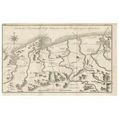
Antique Map of the Environs of Cap-Français, Saint-Domingue, c.1760
Located in Langweer, NL
Antique Map of the Environs of Cap-Français, Saint-Domingue, c.1760
This detailed 18th-century copperplate engraving, titled Carte des Environs du Cap Français et des Paroisses qui ...
Category
Antique Early 18th Century French Maps
Materials
Paper
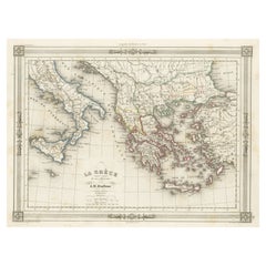
Antique Map of Greece and Its Colonies, with Frame Style Border
Located in Langweer, NL
Antique map titled 'La Grèce'. Attractive map of Greece and its Colonies. The map covers from the southern part of Italy, including Sicily, to the western parts of Asia Minor and fro...
Category
Antique Mid-19th Century Maps
Materials
Paper
$162 Sale Price
20% Off
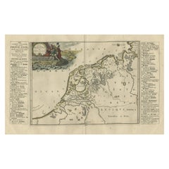
Antique Map of Friesland During Its Widest Spread, 1718
Located in Langweer, NL
Antique map Friesland titled 'Summaria descriptio Fresiae Universae (..)'. Old map of Friesland, the Netherlands. Depicts the general delineation of Friesland during its widest sprea...
Category
Antique 18th Century Maps
Materials
Paper
$210 Sale Price
20% Off