Items Similar to Cram's Commercial Atlas by the George F. Cram Company 'circa 1930'

Want more images or videos?
Request additional images or videos from the seller
1 of 7
Cram's Commercial Atlas by the George F. Cram Company 'circa 1930'
About the Item
'Cram's Commercial Atlas' published by the George F. Cram Company. Rare in this edition and condition. Num. (col.) maps and plans, orig. embossed dec. buckram, large folio. Published circa 1930.
- Dimensions:Height: 22.45 in (57 cm)Width: 16.54 in (42 cm)Depth: 1.19 in (3 cm)
- Materials and Techniques:
- Period:
- Date of Manufacture:circa 1930
- Condition:Sl. worn, overall a very good copy. Please study images carefully.
- Seller Location:Langweer, NL
- Reference Number:Seller: BG-12793-51stDibs: LU3054321943602
About the Seller
5.0
Platinum Seller
These expertly vetted sellers are 1stDibs' most experienced sellers and are rated highest by our customers.
Established in 2009
1stDibs seller since 2017
1,933 sales on 1stDibs
Typical response time: <1 hour
- ShippingRetrieving quote...Ships From: Langweer, Netherlands
- Return PolicyA return for this item may be initiated within 14 days of delivery.
Auctions on 1stDibs
Our timed auctions are an opportunity to bid on extraordinary design. We do not charge a Buyer's Premium and shipping is facilitated by 1stDibs and/or the seller. Plus, all auction purchases are covered by our comprehensive Buyer Protection. Learn More
More From This SellerView All
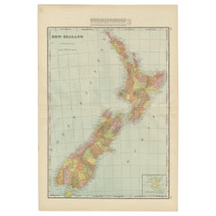
- Antique Map of New Zealand by G.F. Cram, 'circa 1906'Located in Langweer, NLAntique map titled 'New Zealand'. Large map of New Zealand with a small legend of the Chatham Islands. On the verso, a map of the North Polar regions and a map of Tasmania can be fou...Category
20th Century Maps
MaterialsPaper
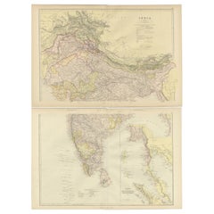
- Cartographic Elegance: The British Raj's India, 1882 Atlas by Blackie and SonLocated in Langweer, NLThese two maps are part of an 1882 atlas published by Blackie and Son, a notable publishing company in the 19th century known for their educational books and detailed atlases. The ma...Category
Antique 1880s Maps
MaterialsPaper
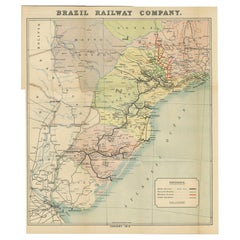
- Antique Map of the Brazil Railway Company, '1912'Located in Langweer, NLAntique map titled 'Brazil Railway Company'. This folding map is attached to the booklet titled 'The Brazil Railway Company'. It is a memorandum by A. H. A. Knox-Little, who was the ...Category
Early 20th Century Maps
MaterialsPaper
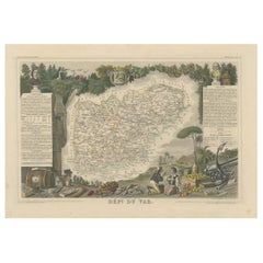
- The Illustrated Map of the Var Department from the Atlas National Illustré, 1856Located in Langweer, NLThis original hand-colored map is from the "Atlas National Illustré," a work by Victor Levasseur, a French geographer and cartographer known for his richly illustrated maps. The map...Category
Antique 1850s Maps
MaterialsPaper
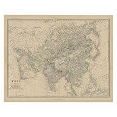
- Large Antique Map of Asia The Royal Atlas of Modern Geography by Johnston, 1882Located in Langweer, NLAntique map titled 'Asia'. Old map of the Asian continent. This map originates from 'The Royal Atlas of Modern Geography, Exhibiting, in a Series of Entirely Original and Authentic M...Category
Antique 19th Century Maps
MaterialsPaper
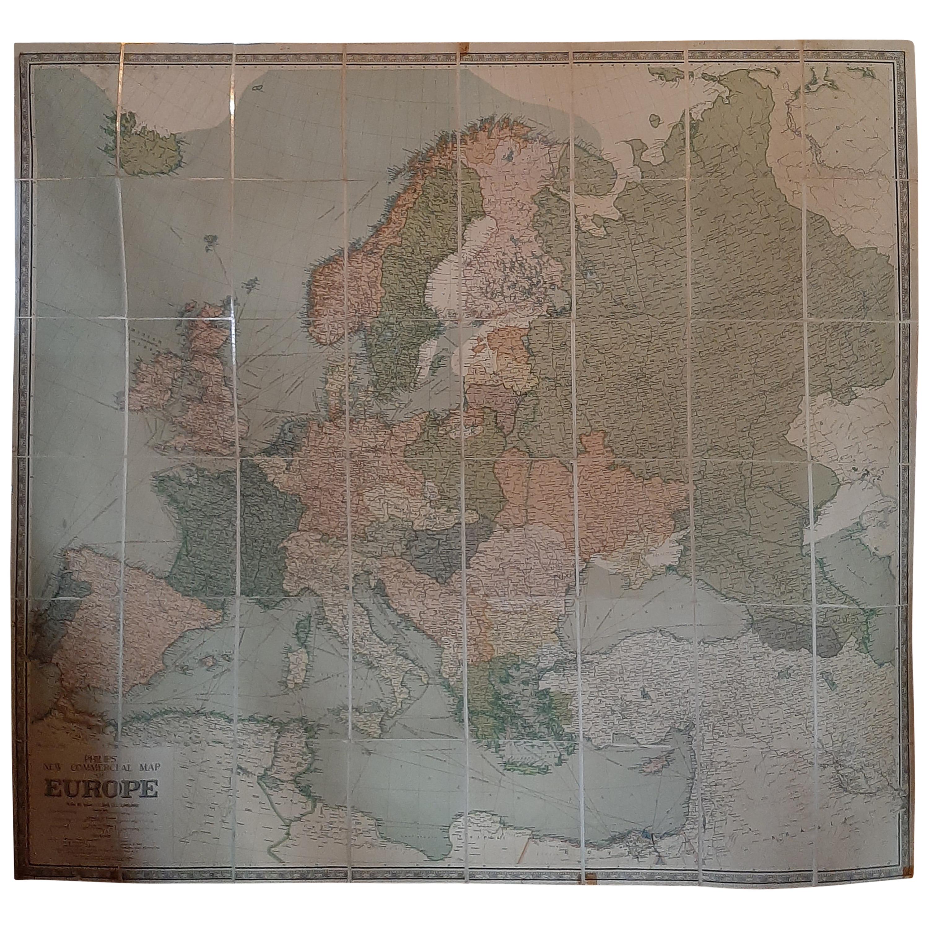
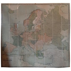
- Large Wall Map of Europe by George Philip & Son, circa 1920Located in Langweer, NLAntique map titled 'Philips' New Commercial Map of Europe'. Very large wall map of Europe including the North African coast and Turkey. Decorative bord...Category
Early 20th Century Maps
MaterialsLinen, Paper
You May Also Like
- Cram's 16" Deluxe Globe W/Daily Sun Ray and Season IndicatorLocated in San Francisco, CACram's 16" Deluxe Globe W/Daily Sun Ray and Season Indicator 1936Category
Vintage 1930s Maps
MaterialsMetal
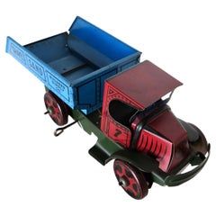
- Vintage Toy Wind-Up Dump Truck by The Marx Toy Company, N.Y. American Circa 1930By Louis Marx and CompanyLocated in Incline Village, NVOffered is a hard to find Marx floor toy dump truck with dual action. NOT diecast------made of all tin. Capability to raise and lower the bed is activated by rotating the attached a...Category
Vintage 1930s American Folk Art Toys and Dolls
MaterialsTin
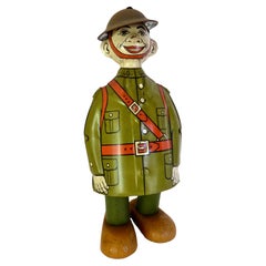
- Vintage Tin Wind-up Toy "Doughboy" by J.Chein Company. American Circa 1930By J. Chein & Co.Located in Incline Village, NVOf American manufacture, by the J. Chein Toy Company in New York City; this early 1930's vintage tin toy depicts a World War I "Doughboy" or American infantryman wearing his back pack and green "fatigues", and when wound up and released on the floor, he walks along (more like waddles along) in a "happy go lucky" manner ------works great! (see attached video). The toy is in excellent and completely all original condition with no restoration and no touch up paint. The lithography and paint is bright and shows little wear except for a couple of superficial scratches on the back (see images). Dimensions: 6" high x 2 3/4" wide x 2 3/4" deep. Provenance: From a recently acquired prominent collection of vintage tin...Category
Vintage 1930s American Folk Art Toys and Dolls
MaterialsTin
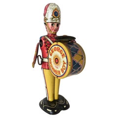
- "George The Drummer Boy" Tin windup Toy by Louis Marx, New York City. Circa 1930By Louis Marx and CompanyLocated in Incline Village, NVThis circa 1930 "George, Drummer Boy" brightly colored lithographed tin wind-up toy capitalizes on the popularity of marching bands, spawned from the military and World War I victory...Category
Vintage 1930s American Folk Art Toys and Dolls
MaterialsTin
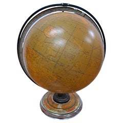
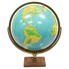
- Vintage Cram's 16" Physical Political Terrestrial Illuminated Lighted GlobeLocated in Philadelphia, PAVintage George F. Cram Co. 16" Physical Political Terrestrial Illuminated Lighted Globe. Circa Mid to Late 20th Century. Measurements: 22" H x 22" W x 16" D.Category
Mid-20th Century Art Deco Globes
MaterialsFiberglass
- "Clason's Guide Map of Montana" by The Clason Map Company, Circa 1920sLocated in Colorado Springs, COPresented is “Clason's Guide Map of Montana,” published in the early 1920s by the Clason Map Company. Issued as a folding map, this map identifies county boundaries, county seats, Na...Category
Vintage 1920s American Art Deco Maps
MaterialsPaper

Recently Viewed
View AllMore Ways To Browse
Commercial Used Furniture
Used Commercial Office Furniture
Rare Vintage Books
Vintage Coller
Atlas Furniture Company
Vintage Hardcover Books
Imperial Books
Dj Furniture
Books Food
18th Century Leather Books
Used Poetry Books
Vintage Canada Art Collectibles
Antique Bookplate
Antique Bookplates
Hemingway Furniture
Vintage Ford Collectibles
Vintage Ford Collectables
Trent University