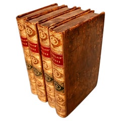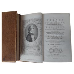
Three Volumes of James Cook's A Voyage to the Pacific Ocean, 1784
View Similar Items


Want more images or videos?
Request additional images or videos from the seller
1 of 9
Three Volumes of James Cook's A Voyage to the Pacific Ocean, 1784
About the Item
- Creator:James Cook (Artist)
- Dimensions:Height: 8.67 in (22 cm)Width: 5.52 in (14 cm)Depth: 1.19 in (3 cm)
- Sold As:Set of 3
- Materials and Techniques:
- Period:
- Date of Manufacture:1784
- Condition:Wear consistent with age and use. Occasional scattered spotting, contemporary tree calf gilt, contrasting morocco labels to spines, joints cracked and light wear mostly to spines, 8vo.
- Seller Location:Langweer, NL
- Reference Number:Seller: BG-13351-1 +21stDibs: LU3054331563442
About the Seller
5.0
Platinum Seller
These expertly vetted sellers are 1stDibs' most experienced sellers and are rated highest by our customers.
Established in 2009
1stDibs seller since 2017
1,928 sales on 1stDibs
More From This SellerView All
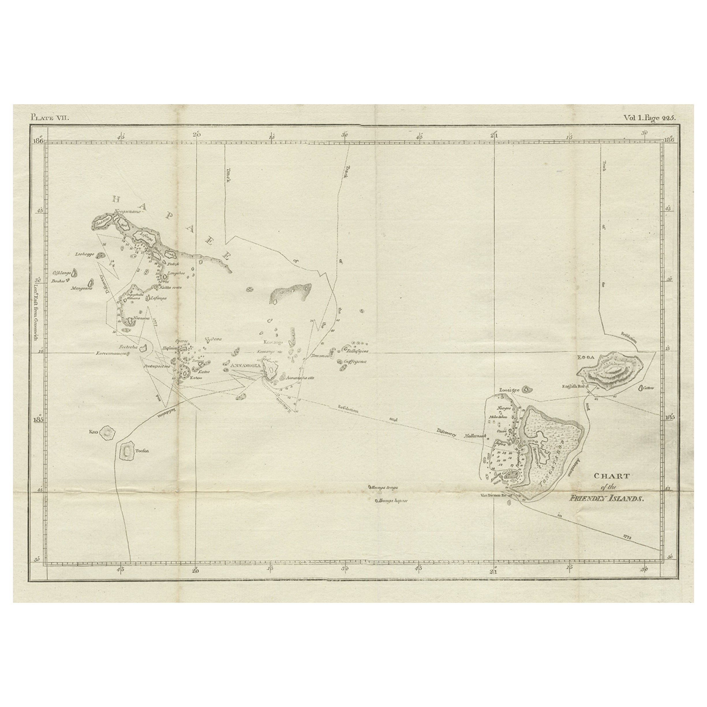
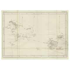
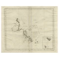
- Antique Chart of the Friendly Islands or Nowadays Tonga, by Cook, 1784By James CookLocated in Langweer, NLAntique print titled 'Chart of the Friendly Islands'. Antique map of the Friendly Islands depicting Rotterdam or Anamocka, Middelburg or Eaoowe and Amsterdam or Tongatabu. Originates...Category
Antique 18th Century Prints
MaterialsPaper
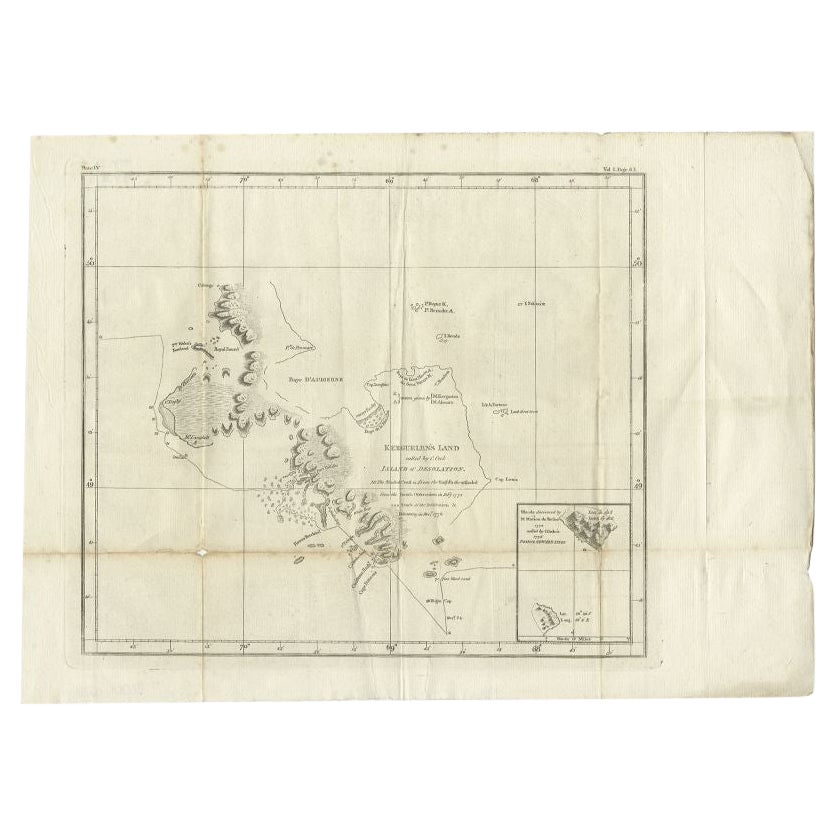
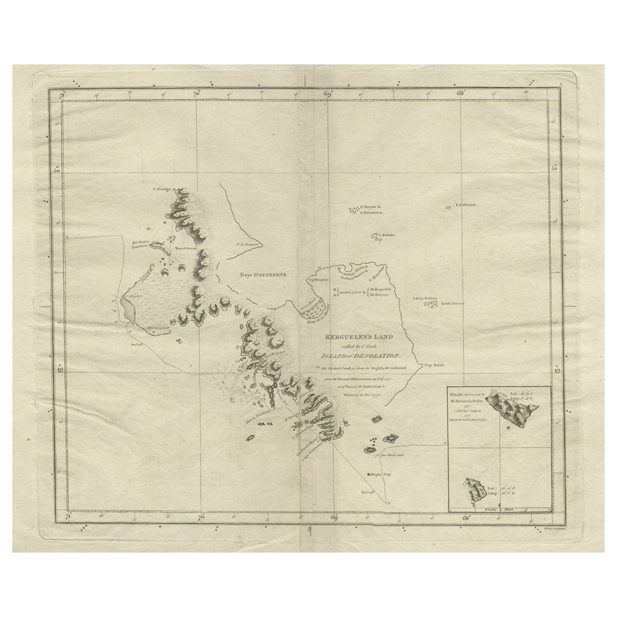
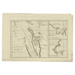
- Antique Map of Kerguelens Island Coast by Cook, 1784By James CookLocated in Langweer, NLAntique print titled 'Kerguelen's Land (..)'. Antique map of Kerguelens island coast, known today as the Desolation islands. Originates from 'A Voyage to the Pacific Ocean: Undertaken, by the Command of His Majesty, for Making Discoveries in the Northern Hemisphere (..)' published in Dublin. Artists and Engravers: James Cook...Category
Antique 18th Century Prints
MaterialsPaper
 $293 Sale Price25% Off
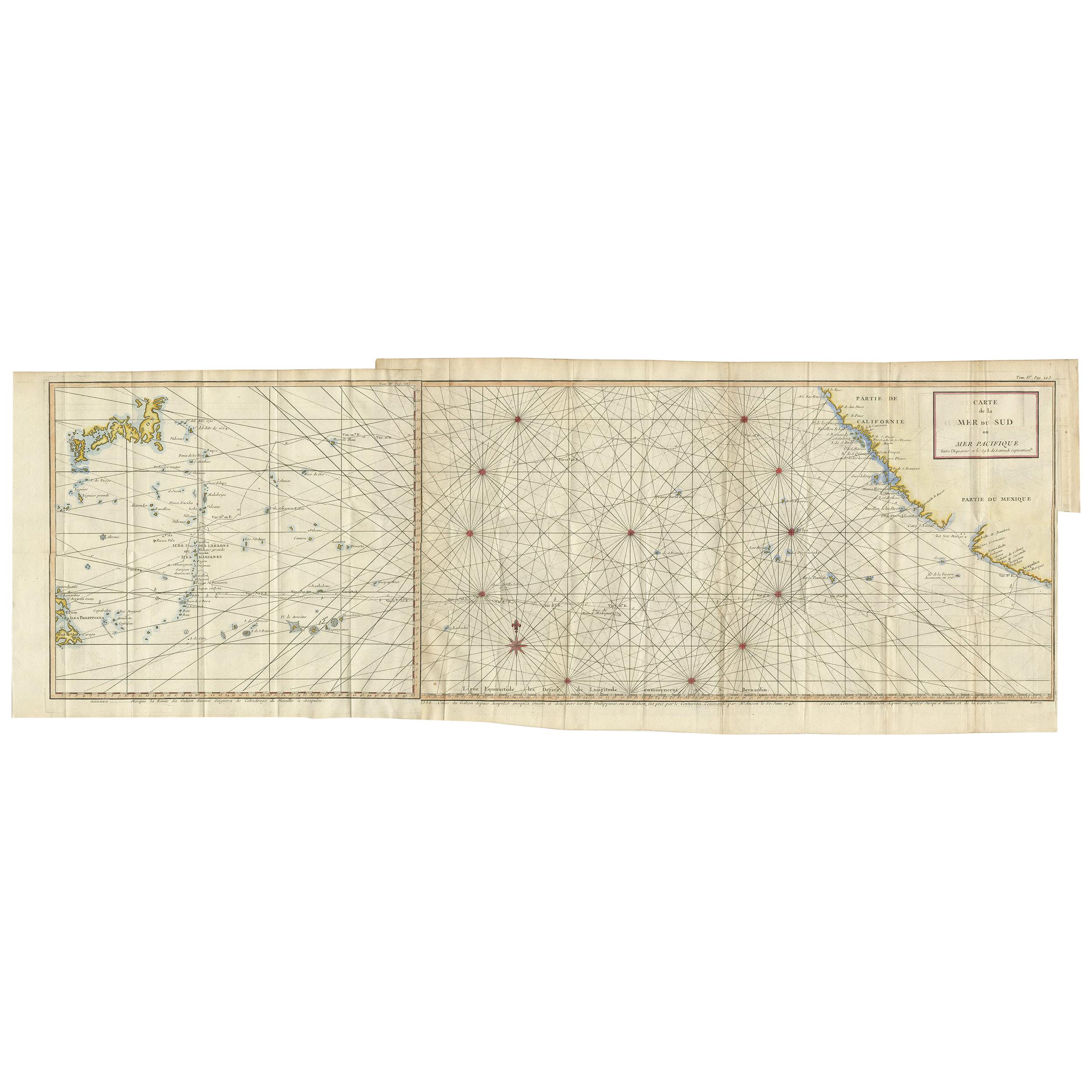
 - Antique Chart of the Mid-Pacific Ocean by Anson, 'c.1784'Located in Langweer, NLAntique map titled 'Carte de la Mer du Sud ou Mer Pacifique'. Original chart of the mid-Pacific Ocean, includes voyage tracks of Anson’s Centurion and the ship he stalked, the Spanish treasure...Category
Antique Late 18th Century Maps
MaterialsPaper
 $1,222 Sale Price25% Off
 - Detailed Map of New Zealand Showing the Route of Capt. Cook's First Voyage, 1803Located in Langweer, NLAntique map New Zealand titled 'De Rivier de Theems en Mercurius Baai in Nieuw Zeeland'. Detailed map of New Zealand showing the route of Capta...Category
Antique 19th Century Maps
MaterialsPaper
 $494 Sale Price30% Off
 - Antique Map of Kerguelens Island Coast in the Indian Ocean by Cook, 1785By James CookLocated in Langweer, NLAntique print titled 'Kerguelen's Land (..)'. Antique map of Kerguelens island coast, known today as the Desolation islands. Originates from 'Voyage to the Pacific Ocean, undertaken ...Category
Antique 18th Century Prints
MaterialsPaper
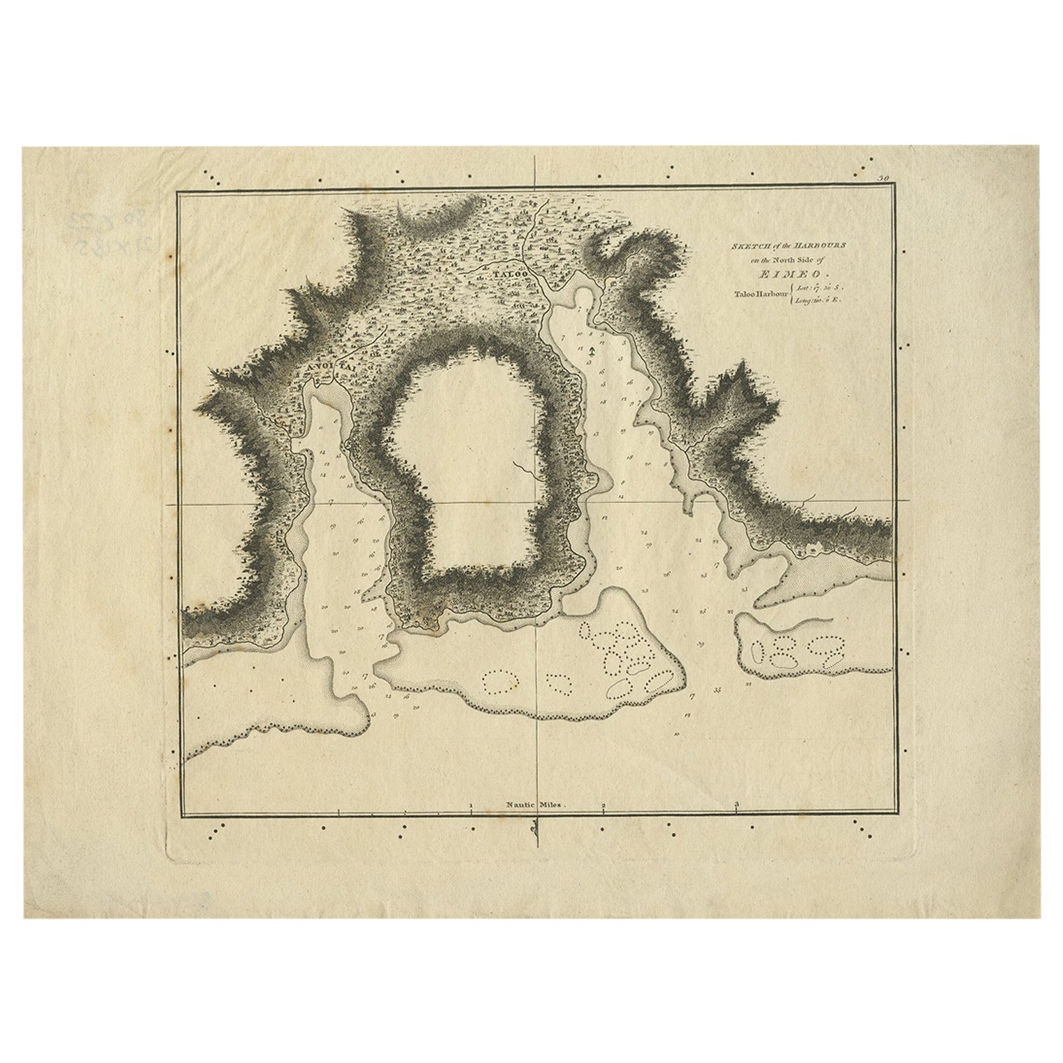
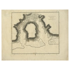
- Antique Plan of the Harbour of Taloo by Cook, 1784Located in Langweer, NLAntique map titled 'Sketch of the Harbours on the North Side of Eimeo (..)'. Plan of the harbour of Taloo in the Island of Moorea, one of the Society Islands, French Polynesia. Origi...Category
Antique 18th Century Maps
MaterialsPaper
You May Also Like
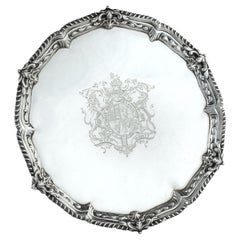
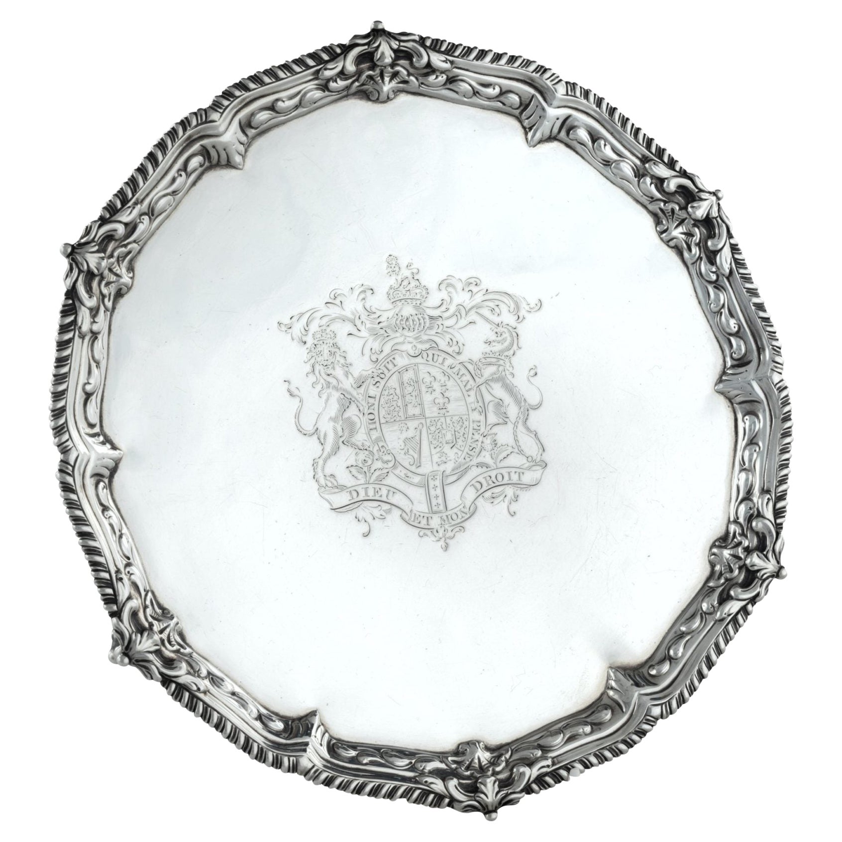
- Presentation silver to the Master Shipwright of Captain Cook’s EndeavourLocated in Lymington, HampshireA George III shaped circular silver salver, plain within a shell and scrolling wave border and outer gadrooned edge, engraved with the royal coat of arms, crest and motto (period 1714-1800) of King George III and, on the reverse with a presentation inscription: For the Launching of His Majestys sloop ‘Otter’ 14 Gunns 305 Tonns 26 October 1767 & His Majestys ship ‘Egmont’ 74 Gunns 1643 Tonns 29 August 1768 by Mr Adam Hayes Master Shipwright of his Majestys yard at Deptford; further monogrammed A*H P A*M. Hallmarked for Benjamin Cartwright, London, 1769 Adam Hayes (1710-1785) began his career as ship’s carpenter in Centurion during Commodore Anson’s famous voyage around the world...Category
Antique 1760s English George III Nautical Objects
MaterialsSilver
- The Works of Francis Rabelais in 4 Leatherbound Volumes Published In London 1784Located in San Francisco, CAThe works of Francis Rabelais, translated from the French in 4 full original calf bindings with gilt tooled spines published in London by T. Evans in the Strand in 1784. Rabelais was...Category
Antique Mid-18th Century English Georgian Books
MaterialsLeather, Paper
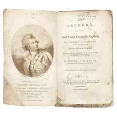
- Lunardi - Account of the First Aerial Voyage in England - 1784 - First EditionLocated in Hillsborough, NJAUTHOR: LUNARDI, Vincent. TITLE: An Account Of The First Aerial Voyage In England, In A Series Of Letters To His Guardian, Chevalier Gherardo Compagni, Written under the impressi...Category
Antique 1780s British Books
MaterialsPaper
- Captain Cook's Exploration of Tahiti 18th C. Hand-Colored Map by BellinBy Jacques-Nicolas BellinLocated in Alamo, CAThis beautiful 18th century hand-colored copper plate engraved map is entitled "Carte de l'Isle de Taiti, par le Lieutenant J. Cook" was created by Jacques Nicolas Bellin and publish...Category
Antique Mid-18th Century French Maps
MaterialsPaper
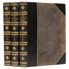
- 3Volumes, James Taylor, The Victorian EmpireLocated in New York, NY3 Volumes. James Taylor. The Victorian Empire. A Brilliant Epoch In Our National History.Bound in 3/4 blue calf, linen boards, marbled endpapers, top edges g...Category
Antique 1890s English Books
MaterialsLeather
- Large Original Antique Map of The Pacific Ocean, Fullarton, C.1870Located in St Annes, LancashireGreat map of The Pacific Ocean From the celebrated Royal Illustrated Atlas Lithograph by Swanston. Original color. Published by Fullarton,...Category
Antique 1870s Scottish Maps
MaterialsPaper