1860s Historical Memorabilia
Period: 1860s
Color: Beige
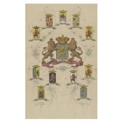
Coat of Arms of the Netherlands, Including Coats of Arms of the Provinces, 1864
Located in Langweer, NL
Antique print titled 'Je Mantiendrai'. Coat of arms of the Netherlands, also includes coats of arms of the individual Dutch provinces. This print origi...
Category
Antique 1860s Historical Memorabilia
Materials
Paper
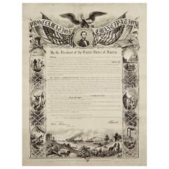
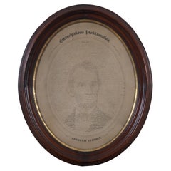
1864 Abraham Lincoln's Emancipation Proclamation, Antique Engraving by W Roberts
Located in Colorado Springs, CO
Presented is a Proclamation of Emancipation wood engraving by W. Roberts. The engraving was published in 1864, just one year after President Abraham Lincoln signed the original Proclamation. W. Roberts was the artist and engraver and Corydon Alexis Alvord was the printer. The engraving was published by R. A Dimmick, in New York, 1864.
The text of the Proclamation is set in a variety of typefaces, which is encased in a pictorial border. The border is decorated with a portrait of Abraham Lincoln and seven other vignettes, including the horrors of slavery at left, the bombardment of Fort Sumter at bottom, and scenes from a prosperous and united nation at right.
On September 22, 1862, five days after the Union victory at the Battle of Antietam, Lincoln issued a preliminary decree stating that, unless the rebellious states returned to the Union by January 1, freedom would be granted to slaves within those states. No Confederate states took the offer, and on January 1, 1863 Lincoln presented the Emancipation Proclamation...
Category
American Antique 1860s Historical Memorabilia
Materials
Paper
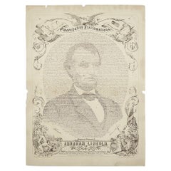
1865 Emancipation Proclamation with Abraham Lincoln Portrait, Antique Engraving
Located in Colorado Springs, CO
Presented is an elaborate engraved broadside presentation of both the preliminary and final Emancipation Proclamations, dated September 22, 1...
Category
American Antique 1860s Historical Memorabilia
Materials
Paper
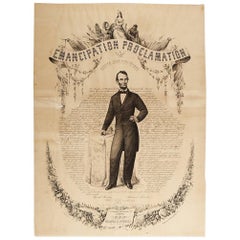
1865 Emancipation Proclamation, Antique Lithograph by P.S. Duval and Son
Located in Colorado Springs, CO
Presented is a lithographic broadside of the text of the Emancipation Proclamation issued on January 1, 1863. This broadside was published in...
Category
American Antique 1860s Historical Memorabilia
Materials
Paper
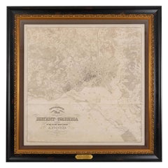
1861 Topographical Map of the District of Columbia, by Boschke, Antique Map
Located in Colorado Springs, CO
Presented is an original map of Albert Boschke's extremely sought-after "Topographical Map of the District of Columbia Surveyed in the Years 1856 ...
Category
American Antique 1860s Historical Memorabilia
Materials
Paper
1864 "Proclamation of Emancipation, " Antique Engraving by Charles Shober
Located in Colorado Springs, CO
This 1865 engraving features the Emancipation Proclamation in elaborate calligraphic text, with five patriotic vignettes and a small portrait...
Category
American Antique 1860s Historical Memorabilia
Materials
Paper
Colt Distributors Quill Letter to Governor Beginning of Civil War, 1861
Located in Coeur d'Alene, ID
This handwritten (it appears with quill) letter was addressed to the Governor of the state of Ohio in 1861- the beginning of the Civil War. Tyler Davidson, one of the major Colt distributors, is offering the Ohio Militia one to two thousand Colt Navy revolvers. They "can provide 100 per day at a cost of $22.50 each." This document from the files of Civil War General...
Category
American Antique 1860s Historical Memorabilia
Materials
Other
Colorful Civil War Recruitment Broadside for the "Manhattan Rifles"
Located in York County, PA
MASSIVE & COLORFUL CIVIL WAR RECRUITMENT BROADSIDE FOR THE "MANHATTAN RIFLES,” WHICH MUSTERED INTO 43RD AND THE 57TH NEW YORK INFANTRY DIVISIONS ...
Category
American Antique 1860s Historical Memorabilia
Materials
Paper
13 Star, 3rd MD Pattern, Hand-Sewn Antique American Flag, Civil War Era, 1861-65
Located in York County, PA
13 LARGE STARS WITH AN EVEN LARGER CENTER STAR, IN A CIRCULAR VERSION OF WHAT IS KNOWN AS THE 3RD MARYLAND PATTERN, ENTIRELY HAND-SEWN, MADE SOMETIME BETWEEN 1850 AND THE CIVIL WAR (...
Category
American Antique 1860s Historical Memorabilia
Materials
Wool
Related Items
1865 W.H. Pratt German Calligraphic Emancipation Proclamation Lincoln Portrait
Located in Dayton, OH
Antique 1865 German language version of W.H. Pratt’s calligraphic portrait of U.S. President Abraham Lincoln within the text of the 1863 Emancipat...
Category
American Victorian Antique 1860s Historical Memorabilia
Materials
Paper
H 17.75 in W 15 in D 1.5 in
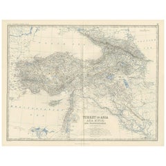
Antique Map of Turkey in Asia by A.K. Johnston, 1865
Located in Langweer, NL
Antique map titled 'Turkey in Asia (Asia Minor) and Transcaucasia'. This map originates from the ‘Royal Atlas of Modern Geography’ by Alexander Keith Johnston. Published by William B...
Category
Antique 1860s Historical Memorabilia
Materials
Paper
Antique Map of Scotland 'South' by A.K. Johnston, 1865
Located in Langweer, NL
Antique map titled 'Scotland (Southern Sheet)'. This map originates from the ‘Royal Atlas of Modern Geography’ by Alexander Keith Johnston. Published by William Blackwood and Sons, E...
Category
Antique 1860s Historical Memorabilia
Materials
Paper
Lithograph Depicting the Horse Winner of the Italian Derby in 1988
Located in Milan, IT
Lithograph on paper made in the 1990s by the Salomone typography in Rome from a painting depicting Tisserand winner of the 1988 Italian Derby, ridden by V. Mezzatesta. With frame 66....
Category
Italian 1860s Historical Memorabilia
Materials
Wood, Paper
Antique 18th Century Map of the Province of Pensilvania 'Pennsylvania State'
Located in Philadelphia, PA
A fine antique of the colony of Pennsylvania.
Noted at the top of the sheet as a 'Map of the province of Pensilvania'.
This undated and anonymous map is thought to be from the Gentleman's Magazine, London, circa 1775, although the general appearance could date it to the 1760's.
The southern boundary reflects the Mason-Dixon survey (1768), the western boundary is placed just west of Pittsburgh, and the northern boundary is not marked.
The map has a number of reference points that likely refer to companion text and appear to be connected to boundaries. The western and southern boundaries are marked Q, R, S, for example. A diagonal line runs from the Susquehanna R to the Lake Erie P. A broken line marked by many letters A, B, N, O, etc., appears in the east.
There are no latitude or longitude markings, blank verso.
Framed in a shaped contemporary gilt wooden frame and matted under a cream colored matte.
Bearing an old Graham Arader Gallery...
Category
British American Colonial Antique 1860s Historical Memorabilia
Materials
Paper
H 10.25 in W 13.25 in D 0.5 in
Original Antique Map of The Netherlands, Engraved by Barlow, Dated 1807
Located in St Annes, Lancashire
Great map of Netherlands
Copper-plate engraving by Barlow
Published by Brightly & Kinnersly, Bungay, Suffolk.
Dated 1807
Unframed.
Category
English Antique 1860s Historical Memorabilia
Materials
Paper
No Reserve
H 8 in W 10 in D 0.07 in
Antique Map of China and Japan by A.K. Johnston, 1865
Located in Langweer, NL
Antique map titled 'China and Japan'. Depicting Eastern China, the Islands of Japan and more. This map originates from the ‘Royal Atlas of Modern Geography’ by Alexander Keith Johnst...
Category
Antique 1860s Historical Memorabilia
Materials
Paper
Antique Map of Belgium and The Netherlands by A.K. Johnston, 1865
Located in Langweer, NL
Antique map titled 'Belgium and The Netherlands'. This map originates from the ‘Royal Atlas of Modern Geography’ by Alexander Keith Johnston. Published by William Blackwood and Sons,...
Category
Antique 1860s Historical Memorabilia
Materials
Paper
No Reserve
H 24.41 in W 19.1 in D 0.02 in
Antique Map of Sweden & Norway by A.K. Johnston '1865'
Located in Langweer, NL
Antique map titled 'Sweden & Norway (Scandinavia)'. With an inset map of Stockholm and environments. This map originates from the ‘Royal Atlas of Modern Geography’ by Alexander Keith...
Category
Antique 1860s Historical Memorabilia
Materials
Paper
18th Century Antique Engraving of the Southern Hemisphere by G. de L'Isle
Located in Langweer, NL
Antique map titled 'Hemisphere Meridional pour voir plus distinctement Les Terres Australes'. Hemispherical map of the southern hemisphere centered on ...
Category
Antique 1860s Historical Memorabilia
Materials
Paper
H 21.58 in W 29.93 in D 0.02 in
Rare Antique Engraving with Three Unique Views of Iran, 1711
Located in Langweer, NL
Antique print titled 'Karavane by het dorp Coraming - Brug over de rivier Kiesilosan - Het Dorp 't Sargabrand'. Old print with three views, two of which unidentified villages in Iran, and a bridge over the Kiesilosan river. This print originates from 'Cornelis de Bruins...
Category
Antique 1860s Historical Memorabilia
Materials
Paper
Large Antique Map of the State of Texas, 1861
Located in Langweer, NL
Antique map titled 'Johnson's New Map of the State of Texas' Large map of Texas, shows railroads, wagon roads, the U.S. Mail Route, rivers, ports, ...
Category
Antique 1860s Historical Memorabilia
Materials
Paper
Previously Available Items
Charles Dickens Handwritten Signed Letter
Located in Jersey, GB
A handwritten signed letter by the renowned English author Charles Dickens
Charles John Huffman Dickens (1812-1870) is regarded as the greatest English writer of his age. His broad ...
Category
Antique 1860s Historical Memorabilia
Materials
Paper
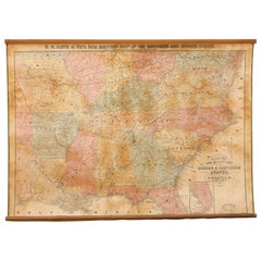
1862 Lloyd's New Military Map of the Border & Southern States
Located in Colorado Springs, CO
This hanging military wall map of the eastern half of United States was published by H.H. Lloyd & Co., in New York, in 1862. The map shows America during...
Category
American Antique 1860s Historical Memorabilia
Materials
Paper
Map of Appomattox Court House, Antique Map from Surveys, 1867
Located in Colorado Springs, CO
Appomattox Court House from Surveys under the Direction of Bvt. Brig. Gen. N. Michler, Maj. of Engineers. By Command of Bvt. Maj. Gen. A.A. Humphreys, Brig. Gen. & Chief of Engineers, 1867. Surveyed and drawn by Maj. J. E. Weyss, assisted by F. Theilkuhl, J. Strasser & O. Thompson. Published by NY Lithographing, Engraving & Printing Co. Lithographed by Julius Bien.
This is a scarce large format plan of the battlefield and region around the famed Appomattox Court House, published by the U.S. War Department in 1867. This extensively surveyed and informative map extends south to Evergreen Station and north to the Bent Creek Bridge area. Noteworthy for a map of this time is the inclusion of dozens of landowners on the map, including Wilmer McLean. The map also identifies roads, bridges, railroads, drainage and woodlands, giving viewers a comprehensive impression of the battlefield. The map is drawn on a scale of 3 inches to 1 mile.
In April 1865, General Robert E. Lee and his army found themselves in Virginia, harassed mercilessly by Federal troops and continually cut off from turning south to reach Gen. Johnston's army in North Carolina. After a defeat at Five Forks, Lee’s only defensive move was to escape with his troops west along the Appomattox River, eventually arriving in Appomattox County on April 8th. His objective was the South Side Railroad at Appomattox Station where food supplies awaited. Union cavalry under Brig. Gen. George A. Custer reached them first, capturing and subsequently burning three supply trains. Lee hoped for more supplies further west at Lynchburg, so he refused written requests by Grant to surrender his army.
On the morning of April 9th, Confederate Maj. Gen. John B. Gordon’s corps attacked the Union cavalry blocking the road toward the railroad. Initially, Gordon had success in clearing cavalry from the road, but Union infantry moved in and he was unable to make further progress. Gordon sent word to Lee around 8:30 a.m. that he needed Lt. Gen. James Longstreet’s support to make additional headway. Upon receiving this request—and having watched the battle through field glasses—Lee then said, "Then there is nothing left for me to do but go and see General Grant, and I would rather die a thousand deaths." Messages were soon exchanged and Lee and Grant agreed to meet at the Wilmer McLean home at Appomattox Courthouse that afternoon. There, the surrender of the Army of Northern Virginia was signed. Three days later, a formal ceremony marked the disbanding of Lee's army and the parole of his men, ending the war in Virginia. The events here triggered similar surrenders across the south, ending the fighting of the Civil War.
Mounted in the frame along with the map is a print of Matthew Brady...
Category
American Antique 1860s Historical Memorabilia
Materials
Paper
Antique Civil War Map of Virginia, "Seat of War in Virginia Sheet 2" 1862
Located in Colorado Springs, CO
This informative map of the Seat of War in Virginia, &c., sheet 2 covers the area in northern Virginia between the Maryland border to just south of Harrisonburg and Fairfax. A British published map, this was one in a series of three maps of the Virginia and Maryland area. The series was produced in response to the British demand for information about the Civil War.
Between 1857 and 1863, the British newspaper the weekly dispatch published a series of maps. Over 100 maps were produced, and in the early 1860s, the maps were gathered together to form The Dispatch Atlas. The atlas contained county and country maps, as well as several city maps. Each of the maps featured a distinctive image of a half-globe with a winged mercury...
Category
British Antique 1860s Historical Memorabilia
Materials
Paper
H 23 in W 17.88 in D 1.25 in
Antique Civil War Map of Virginia, "Seat of War in Virginia Sheet 3" 1862
Located in Colorado Springs, CO
This informative map of the Seat of War in Virginia, sheet 3 spans the area from Petersburg and Richmond, reaching west to Lynchburg and Staunton. A Britis...
Category
British Antique 1860s Historical Memorabilia
Materials
Paper
H 16.38 in W 23.75 in D 1.75 in
1860 Map of South Central United States by Swanston, Antique Hand-Colored Map
Located in Colorado Springs, CO
"United States. North America. The South Central Section. Comprising Texas, Louisiana, Mississippi, Arkansas, Western Territory, and Part of Missouri.” By G. H. Swanston. Published b...
Category
British Antique 1860s Historical Memorabilia
Materials
Paper
H 28.5 in W 24 in D 1 in
1865 Military Map Showing the Marches of the U.S. Forces under W. T. Sherman
Located in Colorado Springs, CO
This is an 1865 issue of “Military Map Showing the Marches of the United States Forces under the Command of Maj. Gen. W.T. Sherman” which covers the years...
Category
American Antique 1860s Historical Memorabilia
Materials
Paper
H 39 in W 57 in D 2.25 in
U.S. Navy Commissioning Pennant with 7 Stars
Located in York County, PA
U.S. Navy Commissioning Pennant with 7 stars, possibly made aboard ship, circa 1864-1865.
Commissioning pennants are the distinguishing mark ...
Category
Antique 1860s Historical Memorabilia
31 Star in a Rare Pentagon Medallion Made for the Campaign Candidate John Bell
Located in York County, PA
31 stars in a rare pentagon medallion, made for the 1860 campaign of independent candidate john bell, who ran against Abraham Lincoln on the constitutional union ticket, probably made by H.C. Howard in Philadelphia:
31 star American parade flag, printed on glazed cotton, made for the 1860 campaign of John Bell and Edward Everett, who ran as independents on the Constitutional Union Party ticket.
The 1850-1865 era marked a pivotal time in American party politics. It bore witness to the birth of the Republican Party in 1854, and the end of both the Whigs and the American Party (Know-Nothings), had basically disappeared by 1860. Lincoln was the Republican candidate, running on the anti-slavery platform. He was hardly the favorite in the beginning of the campaign, winning the party’s nomination from the 3rd ticket.
When the Democrats convened in Charleston in 1860 to nominate a presidential candidate, Douglas succeeded in adding his moderate planks to the party platform. Several Southerners stormed out of the convention, breaking off to form their own party with John Breckinridge and Joseph Lane...
Category
American Antique 1860s Historical Memorabilia
H 17.25 in W 21.25 in D 2.5 in
Recently Viewed
View AllMore Ways To Browse
Antique British Coins
Service Bell Vintage
Yellow Campaign Furniture
Victorian Christmas
Neil Armstrong
The Battle Of Trafalgar
Vintage Air Fan
Wwii Photographs
Vintage Tickets Collectibles
Antique And Collectible Outdoor
Antique Ship Horn
General Lee
Signing Declaration Independence
James Harrison
Brass Red Horn
George Washington Signature
United States Civil War Map
19th Century Coat Men
