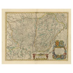
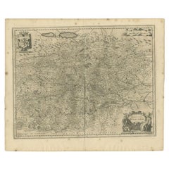
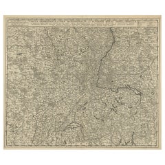
1644 Janssonius Original Wine Regions Map: The Ducal and Comital Burgundy
View Similar Items

Want more images or videos?
Request additional images or videos from the seller
1 of 8
1644 Janssonius Original Wine Regions Map: The Ducal and Comital Burgundy
About the Item
- Dimensions:Height: 19.1 in (48.5 cm)Width: 22.84 in (58 cm)Depth: 0 in (0.02 mm)
- Materials and Techniques:Paper,Engraved
- Period:1640-1649
- Date of Manufacture:1644
- Condition:Condition: Good, given age, general age-related soiling and toning. Folding line as issued. Dutch text on the reverse. Please study scan carefully.
- Seller Location:Langweer, NL
- Reference Number:Seller: BG-13706-11stDibs: LU3054338199852
About the Seller
5.0
Recognized Seller
These prestigious sellers are industry leaders and represent the highest echelon for item quality and design.
Gold Seller
Premium sellers maintaining a 4.3+ rating and 24-hour response times
Established in 2009
1stDibs seller since 2017
2,467 sales on 1stDibs
Typical response time: 1 hour
Authenticity Guarantee
In the unlikely event there’s an issue with an item’s authenticity, contact us within 1 year for a full refund. DetailsMoney-Back Guarantee
If your item is not as described, is damaged in transit, or does not arrive, contact us within 7 days for a full refund. Details24-Hour Cancellation
You have a 24-hour grace period in which to reconsider your purchase, with no questions asked.Vetted Professional Sellers
Our world-class sellers must adhere to strict standards for service and quality, maintaining the integrity of our listings.Price-Match Guarantee
If you find that a seller listed the same item for a lower price elsewhere, we’ll match it.Trusted Global Delivery
Our best-in-class carrier network provides specialized shipping options worldwide, including custom delivery.More From This Seller
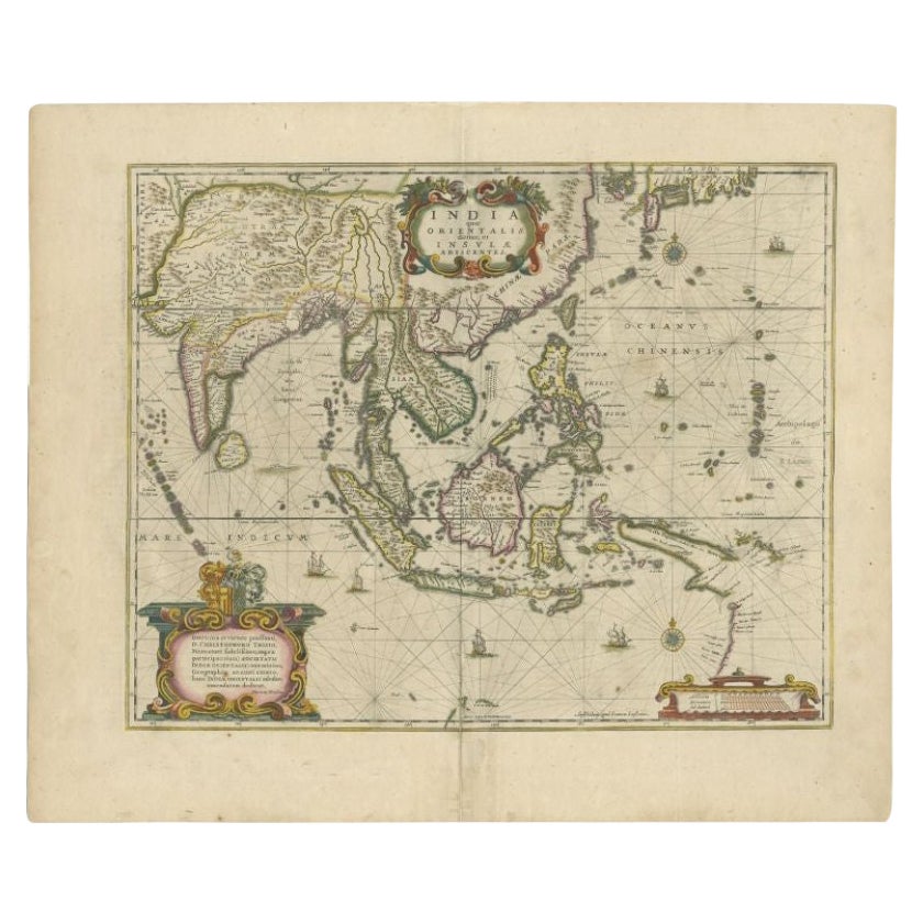
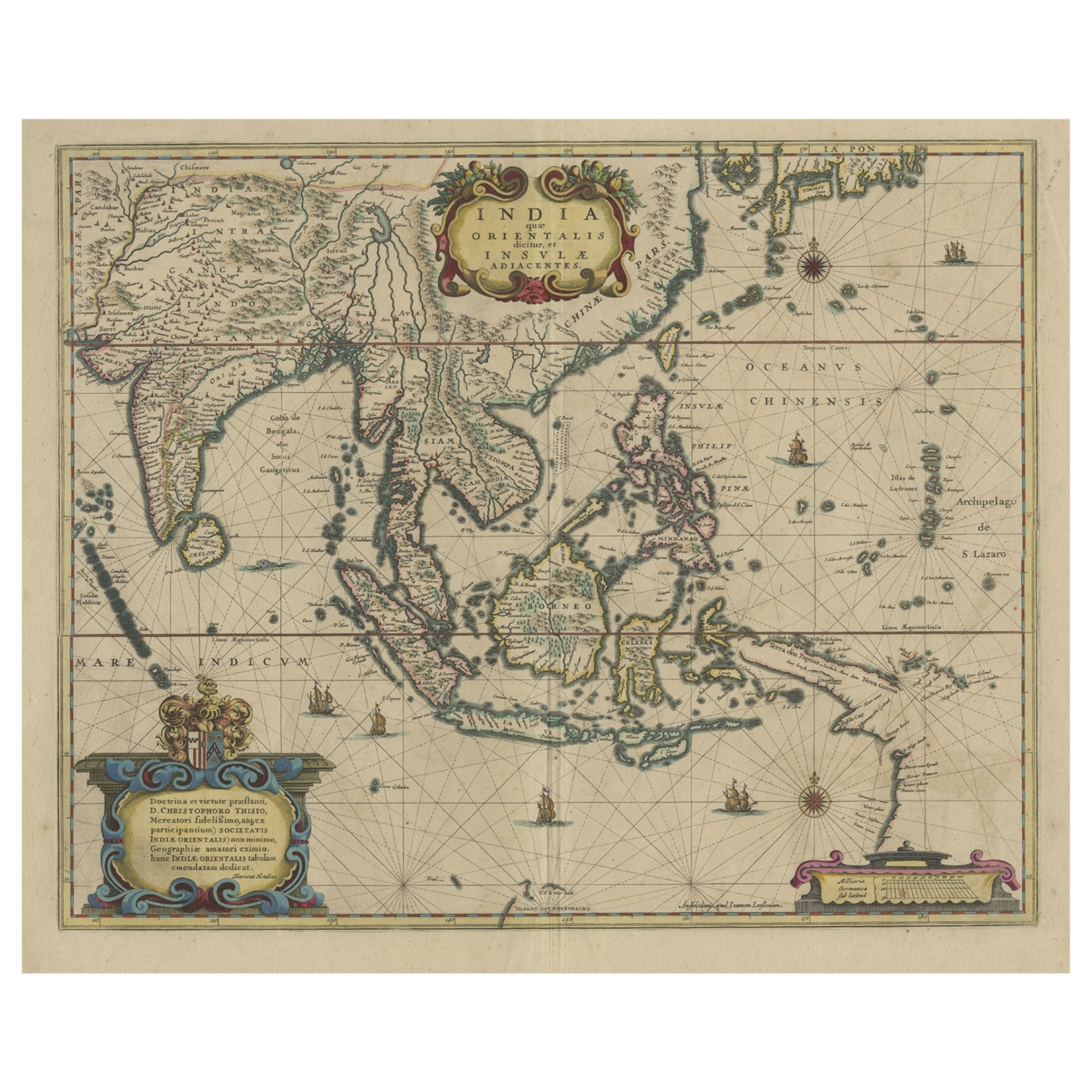
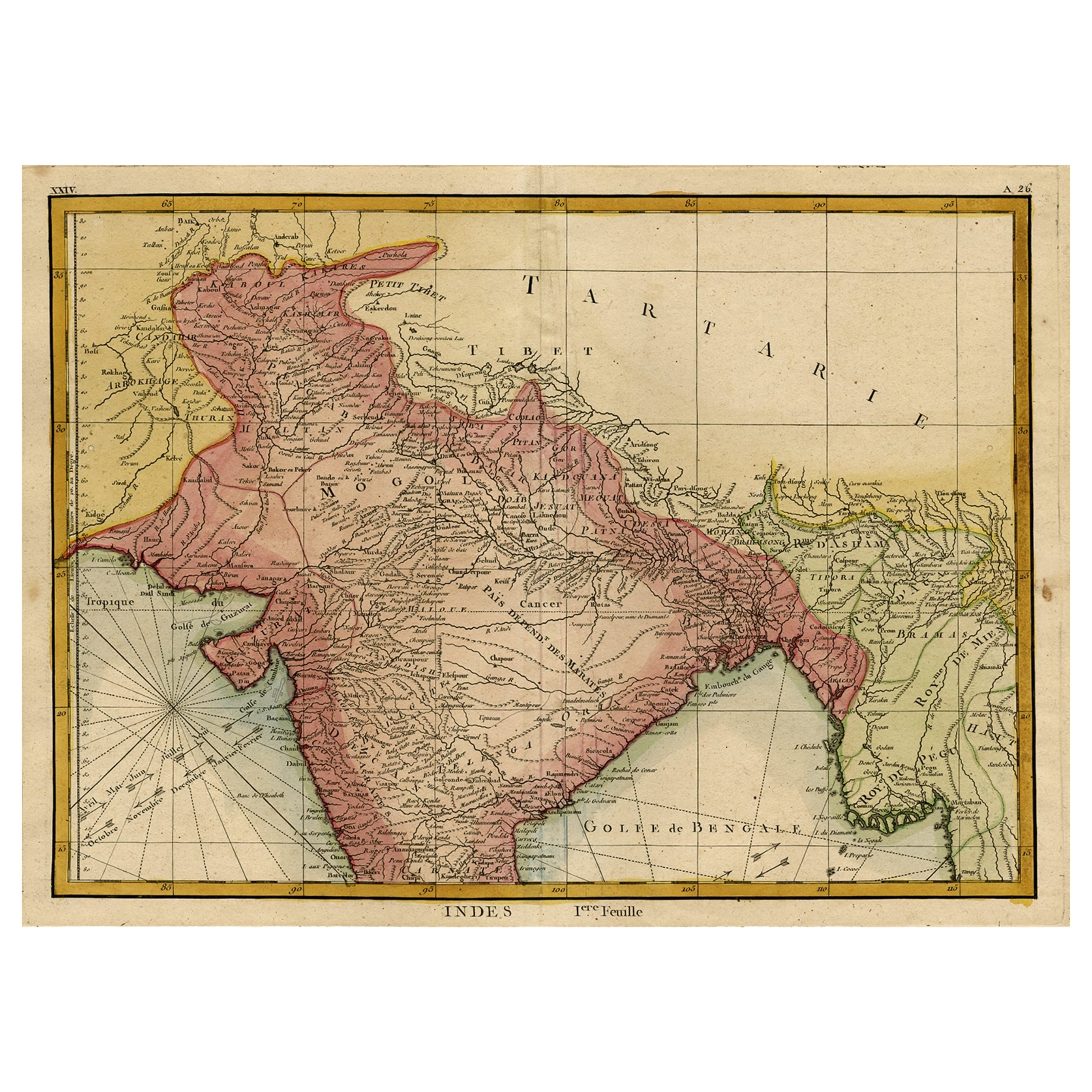
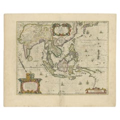
View AllOriginal Antique Map of the East Indies (Indonesia) by Janssonius, c.1644
By Johannes Janssonius
Located in Langweer, NL
Antique map titled 'India quae Orientalis dicitur, et Insulae adiacentes'. Old map of the East Indies and Southeast Asia showing the area between India in the West and parts of Japan...
Category
Antique 17th Century Maps
Materials
Paper

$2,326 Sale Price
20% Off
Antique Map of the East Indies by Janssonius, c.1644
By Johannes Janssonius
Located in Langweer, NL
Antique map titled 'India quae Orientalis dicitur, et Insulae adiacentes'. Old map of the East Indies and Southeast Asia showing the area between India in the West and parts of Japan...
Category
Antique 17th Century Maps
Materials
Paper
$2,465 Sale Price
20% Off
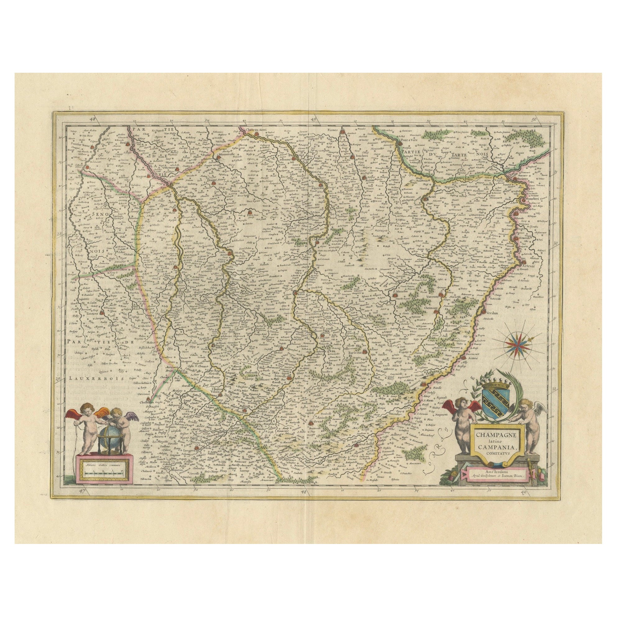
Authentic 1644 Janssonius Map of the Champagne Region (Campania) in France
Located in Langweer, NL
"1644 Janssonius Map of Champagne, France"
This meticulously detailed original antique map, engraved in 1644, is a work by the esteemed cartographer Johannes Janssonius. It depicts the historic province of Champagne, situated in the northeastern part of France. The map is notable for its high level of detail, with meticulously drawn boundaries, city markers, and river courses. It features a beautifully rendered cartouche adorned with the provincial coat of arms, flanked by classical figures, indicative of the region's cultural significance. In the lower left corner, a pair of cherubs are engaged in surveying, symbolizing the scientific endeavor of cartography. The elaborate compass rose and the scale bar further complement the map's utility and artistic merit.
Champagne is renowned globally for its viticultural heritage, being the birthplace of the eponymous Champagne sparkling wine. The region's unique terroir, with its chalky soil and cool climate, is ideal for the production of the grapes used in champagne-making. The historical significance of Champagne extends beyond winemaking; it has been the site of pivotal battles and royal coronations, which shaped the course of French and European history. This map is not only a navigational tool but also a snapshot of a region rich in history and tradition, an artifact that embodies the geographical and cultural prestige of Champagne.
This description provides a detailed visual and contextual presentation of the map, suitable for a catalog entry, emphasizing both its artistic features and the historical and cultural importance of the Champagne region.
THE WINE AREAS:
The Champagne region, known primarily for its production of the sparkling wine that bears its name, encompasses several important cities and sites of historical and cultural significance:
1. **Reims**: Often considered the unofficial capital of the Champagne region, Reims is renowned for its grand cathedral, Notre-Dame de Reims, where French kings were historically crowned...
Category
Antique 1640s Maps
Materials
Paper
$596 Sale Price
20% Off
Free Shipping
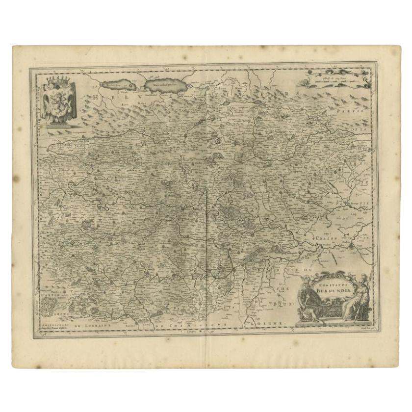
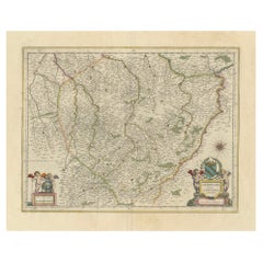
Antique Map of the Burgundy-franche-Comté Region by Janssonius, 1657
Located in Langweer, NL
Antique map of France titled 'Comitatus Burgundiae'. Decorative map of the Burgundy-Franche-Comté region. This map originates from 'Atlas Novus, Sive Theatrum Orbis Orbis Terrarum: I...
Category
Antique 17th Century Maps
Materials
Paper
$297 Sale Price
20% Off
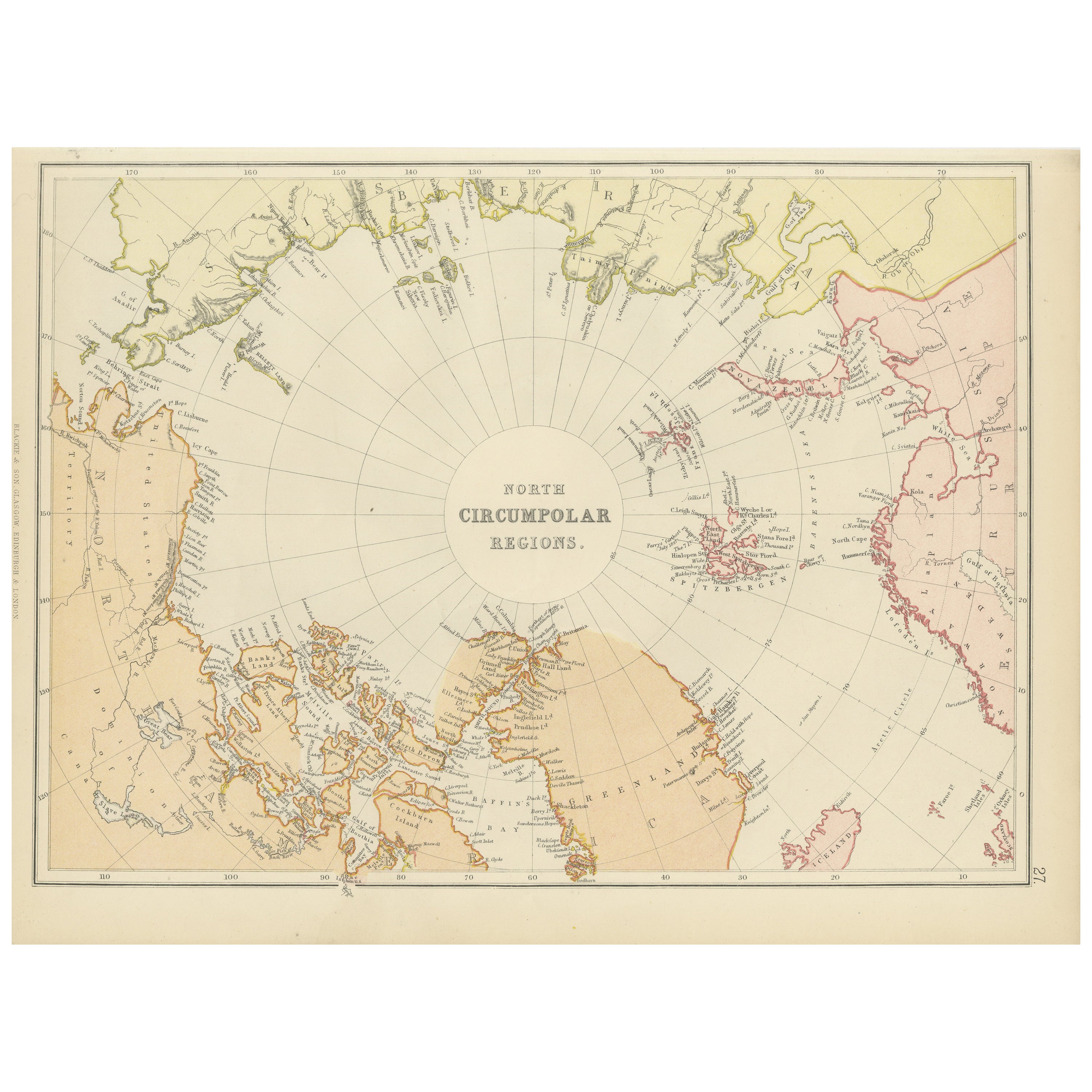
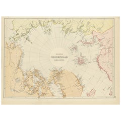
Arctic Exploration: An Original Map of the North Circumpolar Regions, 1882
Located in Langweer, NL
This map, extracted from the 1882 atlas by Blackie & Son, presents the North Circumpolar Regions in a projection centered on the North Pole, offering a unique view of the Arctic territories. The map's radial lines emanate from the pole, focusing on the northernmost parts of continents and the intricate archipelagos that are scattered across the Arctic Ocean.
The territories of Canada, Greenland, Northern Europe, Russia, and the northern extremities of Asia are portrayed with careful detail, highlighting the geography known to Victorian explorers. Notably, the map's color palette is subdued, with the cold regions depicted in pale hues, while coastlines and political boundaries are traced in warmer tones, providing a stark contrast that emphasizes the frigid environment.
The map likely served purposes both educational and navigational, capturing the extent of polar exploration at the time. Names of seas, straits, and islands honor explorers and patrons of the age of Arctic exploration, and the map also hints at the incomplete knowledge of the era, with some areas less detailed than others, reflecting the limits of exploration and cartographic knowledge of the Arctic region at that time.
Moreover, the map includes longitudinal and latitudinal markers, which would have been crucial for navigation and expedition planning. The inclusion of such detail illustrates the growing interest in polar exploration during the late 19th century...
Category
Antique 1880s Maps
Materials
Paper
$260 Sale Price
20% Off
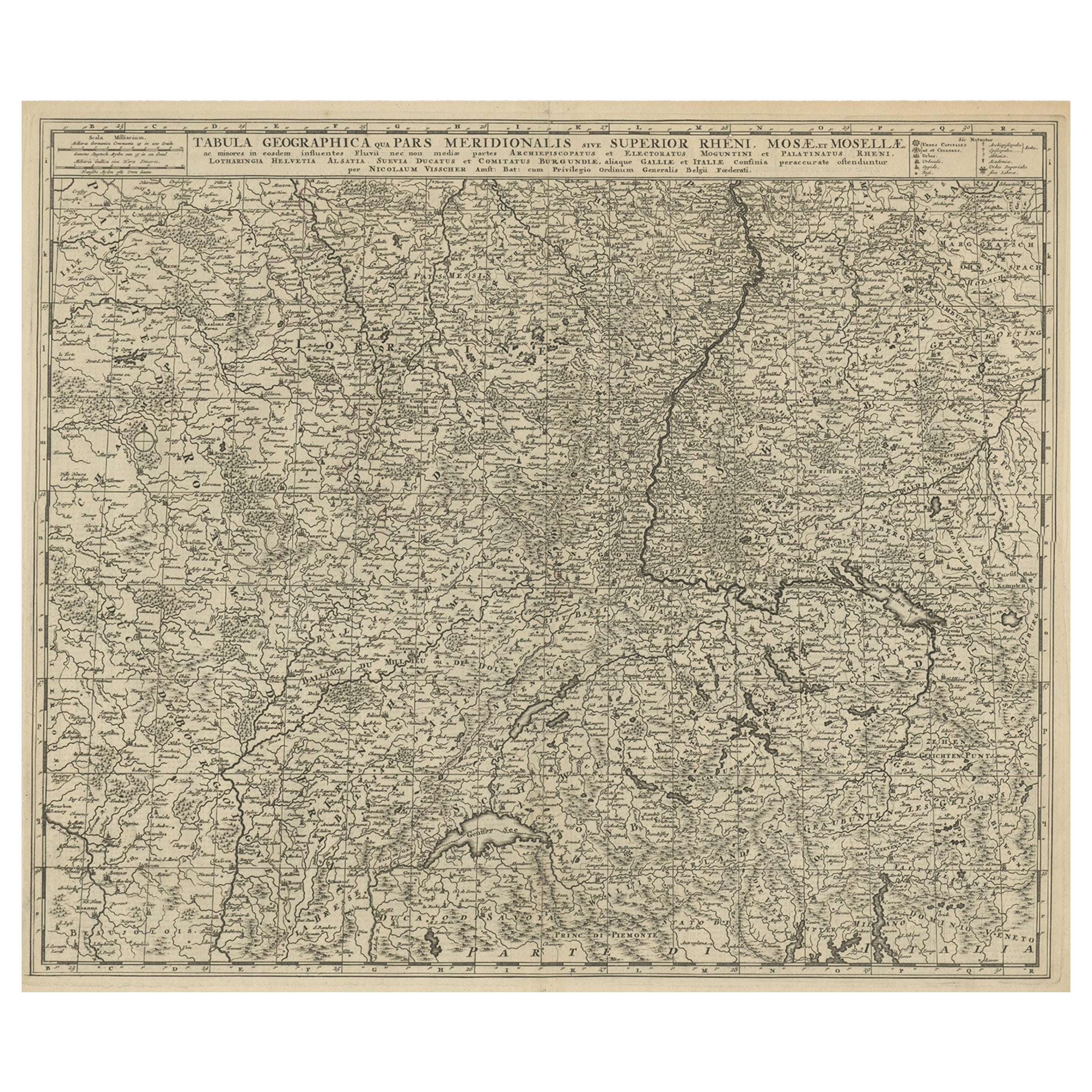
Original Antique Detailed Map of the Rhine and Moselle River Regions, ca.1680
Located in Langweer, NL
Antique map titled 'Tabula Geographica qui Pars Meridionalis sive Superior Rheni, Mosae et Mosellae (..).'
Detailed map of the Rhine and Moselle River regions and contigous parts...
Category
Antique 1680s Maps
Materials
Paper
$511 Sale Price
20% Off
You May Also Like
1657 Janssonius Map of Vermandois and Cappelle, Ric. A-004
Located in Norton, MA
1657 Janssonius map of
Vermandois and Cappelle
Ric.a004
Description: Antique map of France titled 'Descriptio Veromanduorum - Gouvernement de la Cappelle'. Two detailed maps o...
Category
Antique 17th Century Unknown Maps
Materials
Paper

Discovering Italian wines food travel through the 19 producing regions of Italy
Located in North Hollywood, CA
Discovering Italian wines;: An authoritative compendium of wines, food, and travel through the nineteen producing regions of Italy Unbound.
Balzar, Robert Lawrence (Introduction) & R...
Category
Late 20th Century Italian Expressionist Books
Materials
Paper
Antique County Map, Buckinghamshire, Bedfordshire, Dutch, Framed, Janssonius
Located in Hele, Devon, GB
This is an antique county map of Buckinghamshire and Bedfordshire. A Dutch, framed atlas engraving by Johannes Janssonius, dating to the 17th century and later.
A treat for the col...
Category
Antique Mid-17th Century Dutch Maps
Materials
Paper

Antique County Map of Cheshire, Dutch, Framed, Cartography, Janssonius, C.1660
Located in Hele, Devon, GB
This is an antique county map of Cheshire. A Dutch, framed atlas engraving by Johannes Janssonius, dating to the 17th century and later.
A treat for the collector or county native,...
Category
Antique Mid-17th Century Dutch Charles II Maps
Materials
Glass, Wood, Paper

Original Antique Map of The Philippines. C.1900
Located in St Annes, Lancashire
Fabulous map of The Philippines
Original color.
Engraved and printed by the George F. Cram Company, Indianapolis.
Published, C.1900.
Unframed.
Free shipping.
Category
Antique 1890s American Maps
Materials
Paper

Prussia, Poland, N. Germany, Etc: A Hand-colored 17th Century Map by Janssonius
By Johannes Janssonius
Located in Alamo, CA
This is an attractive hand-colored copperplate engraved 17th century map of Prussia entitled "Prussia Accurate Descripta a Gasparo Henneberg Erlichensi", published in Amsterdam by Joannes Janssonius in 1664. This very detailed map from the golden age of Dutch cartography includes present-day Poland, Latvia, Lithuania, Estonia and portions of Germany. This highly detailed map is embellished by three ornate pink, red, mint green and gold...
Category
Antique Mid-17th Century Dutch Maps
Materials
Paper

Recently Viewed
View AllMore Ways To Browse
6 Cherry Wood Chairs
747 Model
771 Table
84 Trestle Table
905 Chair
A Fabiano
A K France Porcelain
Aarhus City Hall
Abalone Shell Top Table
Aboriginal Bark Painting
Adjustable Table E1027
Adrian Pearsall Cloud Sofa
African Gourd
Airplane Sculpture Art Deco
Albers Interaction Of Color
Aldo Jacober Folding Chairs
Alligator Leather Chair
Alvar Aalto Fan Leg