Items Similar to 1821 Map of the Rhine River Region by Vandermaelen – from Duisburg to Wesel

Want more images or videos?
Request additional images or videos from the seller
1 of 11
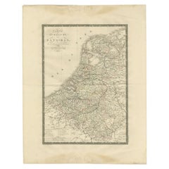
1821 Map of the Rhine River Region by Vandermaelen – from Duisburg to Wesel
$404.32
$505.4120% Off
£299.34
£374.1820% Off
€336
€42020% Off
CA$559.82
CA$699.7720% Off
A$611.18
A$763.9820% Off
CHF 320.42
CHF 400.5220% Off
MX$7,423.07
MX$9,278.8420% Off
NOK 4,001.51
NOK 5,001.8920% Off
SEK 3,778.49
SEK 4,723.1220% Off
DKK 2,558.04
DKK 3,197.5520% Off
About the Item
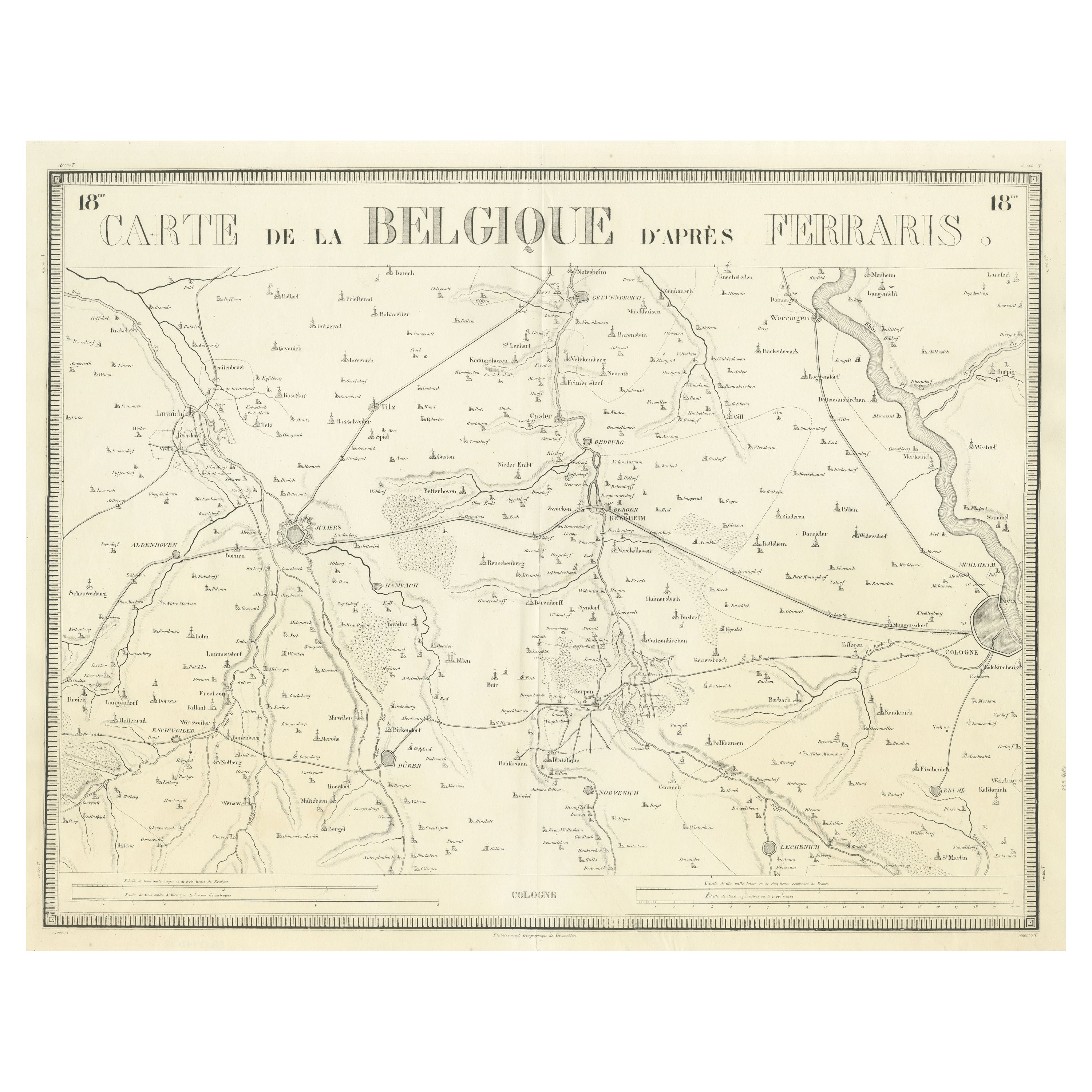
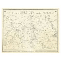
This is an antique map titled "Carte de la Belgique d'après Ferraris", which translates to "Map of Belgium according to Ferraris." The map, created around 1821, covers the course of the Rhine River from Duisburg to Wesel, showing the areas on both sides of the river, including cities such as Xanten, Dorsten, Straelen, and Oberhausen.
The map is based on the original cartography of Joseph de Ferraris, who created an extensive survey of the Austrian Netherlands (which included modern Belgium) between 1771 and 1778. The map was lithographed by Philippe Marie Guillaume Vandermaelen, a notable Belgian cartographer and publisher active during the early 19th century. His works were known for their precision and comprehensive geographical detail.
Features:
- Geographical Focus: The map emphasizes the layout of cities and topographical features along the Rhine River in the regions bordering Belgium and Germany.
- Style: The map is cleanly rendered with detailed lines and clear labeling of towns, rivers, and borders, reflecting early 19th-century cartographic methods.
- Lithography: Vandermaelen's lithographic technique showcases the high level of craftsmanship in the reproduction of maps during this period.
Despite being published in the early 19th century, this map reflects the detailed and precise cartographic traditions that began in the late 18th century, making it a valuable historical resource for understanding the geography of the Rhine region during this period.
- Dimensions:Height: 21.97 in (55.8 cm)Width: 27.84 in (70.7 cm)Depth: 0.02 in (0.5 mm)
- Materials and Techniques:
- Period:
- Date of Manufacture:c.1821
- Condition:Shows overall toning. Original folding line with splits. Some wear and small tears in margins. Blank verso. Please study image carefully.
- Seller Location:Langweer, NL
- Reference Number:Seller: BG-13442-191stDibs: LU3054339046082
About the Seller
5.0
Recognized Seller
These prestigious sellers are industry leaders and represent the highest echelon for item quality and design.
Platinum Seller
Premium sellers with a 4.7+ rating and 24-hour response times
Established in 2009
1stDibs seller since 2017
2,641 sales on 1stDibs
Typical response time: <1 hour
- ShippingRetrieving quote...Shipping from: Langweer, Netherlands
- Return Policy
Authenticity Guarantee
In the unlikely event there’s an issue with an item’s authenticity, contact us within 1 year for a full refund. DetailsMoney-Back Guarantee
If your item is not as described, is damaged in transit, or does not arrive, contact us within 7 days for a full refund. Details24-Hour Cancellation
You have a 24-hour grace period in which to reconsider your purchase, with no questions asked.Vetted Professional Sellers
Our world-class sellers must adhere to strict standards for service and quality, maintaining the integrity of our listings.Price-Match Guarantee
If you find that a seller listed the same item for a lower price elsewhere, we’ll match it.Trusted Global Delivery
Our best-in-class carrier network provides specialized shipping options worldwide, including custom delivery.More From This Seller
View AllAntique Map of the Region near Cologne, Germany
Located in Langweer, NL
Antique map titled 'Carte de la Belgique d'après Ferraris'. Original antique map of the region near Cologne, Germany. Cologne is the largest city of the German western state of North...
Category
Antique Mid-19th Century Maps
Materials
Paper
$423 Sale Price
20% Off
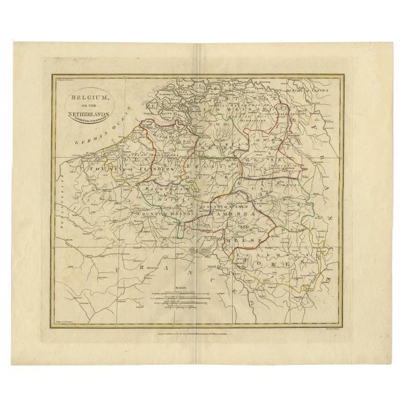
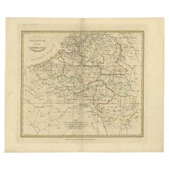
Antique Map of Belgium and Part of the Southern Netherlands, 1810
Located in Langweer, NL
Antique map titled 'Belgium, or the Netherlands divided into Departments'. Original antique map of Belgium and the southern part of the Netherlands. This map originates from 'The Mod...
Category
Antique 19th Century Maps
Materials
Paper
$240 Sale Price
20% Off
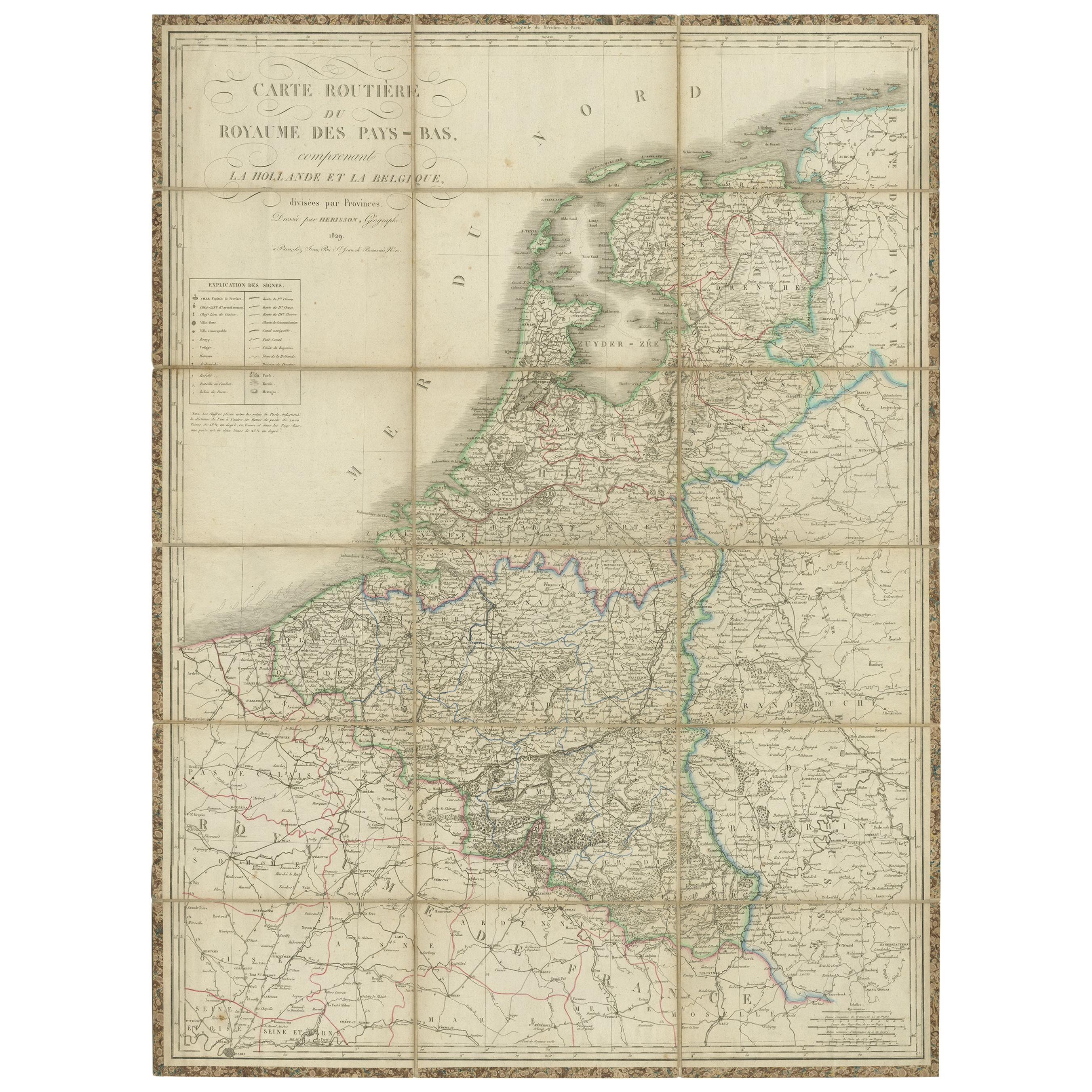
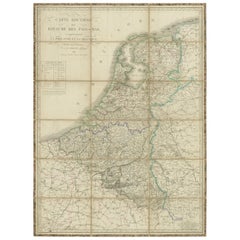
Antique Map of the Netherlands and Belgium by Hérisson, 1829
Located in Langweer, NL
Title: 'Carte Routière du Royaume des Pays-Bas comprenant la Hollande et la Belgique'
**Publisher**: Eustache Hérisson
**Publication Year**: 1829
This original antique map is a detailed depiction of the Netherlands and Belgium, dating back to 1829. As a 'Carte Routière', it focuses on the road networks of the region, providing valuable historical insights into the transportation and geographical understanding of the early 19th century. The map's delineation of the Kingdom of the Netherlands, including both Holland and Belgium, is particularly noteworthy as it represents the political geography of the period shortly before Belgium's independence in 1830.
The map is sectionalised and laid on linen, a common practice in the 19th century for preserving and reinforcing maps, making them more durable and portable. This method of mounting also suggests that the map was intended for practical use, possibly by travelers or for educational purposes.
**Artist and Publisher**: Eustache Hérisson, the publisher of this map, was a known figure in the cartographic and publishing world of the early 19th century. His work is characterized by attention to detail and accuracy, making this map not only a beautiful piece of art but also a reliable historical document.
This map is a valuable historical artifact, offering insights into the geographical and political landscape of the Netherlands...
Category
Antique Mid-19th Century Maps
Materials
Paper
$722 Sale Price
20% Off
Antique Map of the Low Countries by Brué, 1822
Located in Langweer, NL
Antique map titled 'Carte du Royaume des Pays-Bas'. Large format map of the Low Countries. This map originates from 'Atlas Universel', published 1822...
Category
Antique 19th Century Maps
Materials
Paper
$166 Sale Price
20% Off
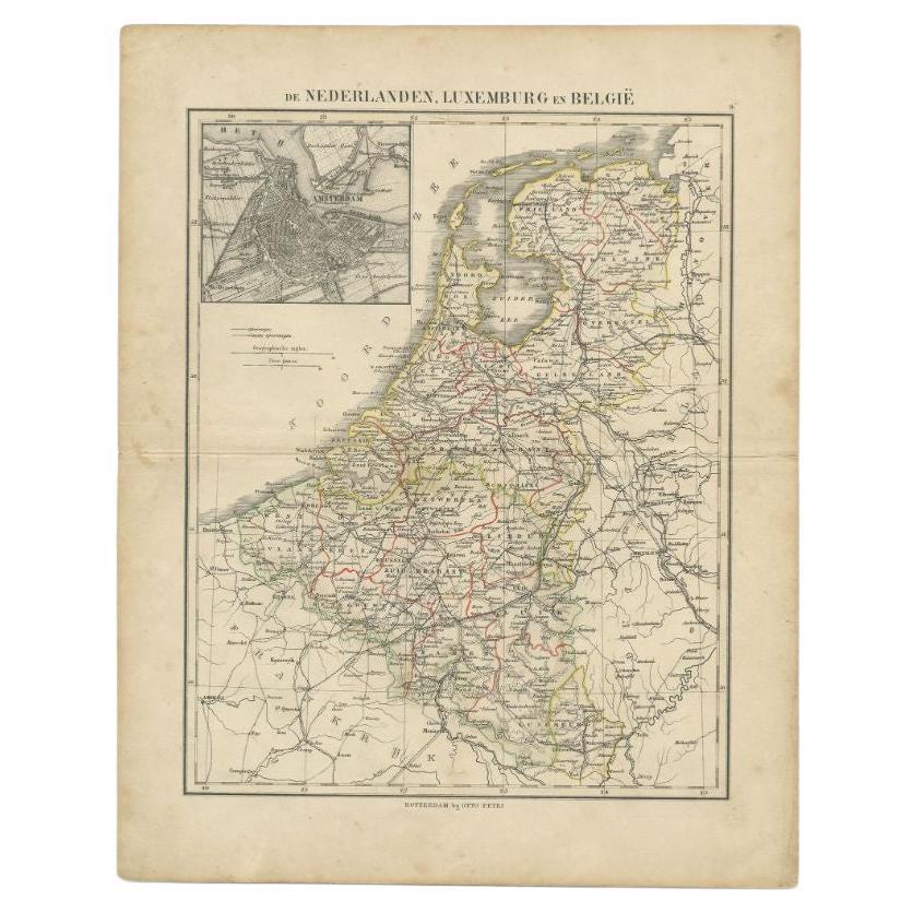
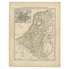
Antique Map of the Netherlands, Belgium and Luxembourg by Petri, c.1873
Located in Langweer, NL
Antique map titled 'De Nederlanden, Luxemburg en België'. Old map depicting the Netherlands, Luxembourg and Belgium. With an inset map of Amsterdam. T...
Category
Antique 19th Century Maps
Materials
Paper
$112 Sale Price
20% Off
Antique Map of Belgium by J. Tallis, circa 1851
Located in Langweer, NL
A highly decorative and detailed mid-19th century map of Belgium which was drawn and engraved by J. Rapkin (vignettes by J. Marchant and J. B. Allen) an...
Category
Antique Mid-19th Century Maps
Materials
Paper

$240 Sale Price
20% Off
You May Also Like
1839 Map of Karte Des "Russischen Reiches in Europa Und Asien" Ric.R0013
Located in Norton, MA
1839 map of Karte Des
"Russischen Reiches in Europa and Asien"
Ric.r013
Map of the European and Asian parts of Russian Empire. Karte der Russischen Reiches in Europa und Asien...
Category
Antique 19th Century Unknown Maps
Materials
Paper

1752 Vaugoundy Map of Flanders : Belgium, France, and the Netherlands, Ric.a002
Located in Norton, MA
Large Vaugoundy Map of Flanders:
Belgium, France, and the Netherlands
Colored -1752
Ric.a002
Description: This is a 1752 Didier Robert de Vaugondy map of Flanders. The map de...
Category
Antique 17th Century Unknown Maps
Materials
Paper

1771 Bonne Map of Poitou, Touraine and Anjou, France, Ric.a015
Located in Norton, MA
1771 Bonne Map of Poitou,
Touraine and Anjou, France
Ric.a015
1771 Bonne map of Potiou, Touraine and Anjou entitled "Carte des Gouvernements D'Anjou et du Saumurois, de la Touraine, du Poitou,du Pays d'aunis, Saintonge?Angoumois,"
Carte des gouvernements d'Anjou et du Saumurois, de la Touraine, du Poitou, du Pays d'Aunis, Saintonge-Angoumois. Projettee et assujettie au ciel par M. Bonne, Hyd. du Roi. A Paris, Chez Lattre, rue St. Jacques a la Ville de Bord(ea)ux. Avec priv. du Roi. 1771. Arrivet inv. & sculp., Atlas moderne ou collection de cartes sur toutes...
Category
Antique 17th Century Unknown Maps
Materials
Paper

1853 Map of "Russia in Europe Including Poland" Ric.r016
Located in Norton, MA
Description
Russia in Europe incl. Poland by J Wyld c.1853
Hand coloured steel engraving
Dimension: Paper: 25 cm W x 33 cm H ; Sight: 22 cm W x 28 cm H
Condition: Good ...
Category
Antique 19th Century Unknown Maps
Materials
Paper

Large 19th Century Map of France
Located in Pease pottage, West Sussex
Large 19th Century Map of France.
Remarkable condition, with a pleasing age worn patina.
Recently framed.
France Circa 1874.
Category
Antique Late 19th Century French Maps
Materials
Linen, Paper

Bas Rhin, France. Antique map of a French department, 1856
By Victor Levasseur
Located in Melbourne, Victoria
'Dept. du Bas Rhin', steel engraving with original outline hand-colouring., 1856, from Levasseur's Atlas National Illustre.
Part of the Alsace wine region surrounding Strasbourg. T...
Category
19th Century Naturalistic Landscape Prints
Materials
Engraving

More Ways To Browse
19th Century Lithography
Mid Century Modern Danish Teak Dining Tables
Long Rug Runners
Pair Arm Chairs
Sterling Silver Dinner Sets
United Chair Company
Italian Beech Chairs
Shirvan Rugs
Spain Marble
Vintage Danish Tables And Chairs
1960s Glass Top Coffee Table
Black Glass Coffee Tables
Burnt Wood
Mid Century Wrought Iron Chairs
Earth Toned Rug
Black Marble Table Vintage
Goblets
Mid Century Modern Yellow Chair