Items Similar to 1822 French Map "Carte Générale de l'Egypte et de l'Arabie Pétrée" by Adriane Hu

Want more images or videos?
Request additional images or videos from the seller
1 of 5
1822 French Map "Carte Générale de l'Egypte et de l'Arabie Pétrée" by Adriane Hu
About the Item
1822 Map "Carte Générale de l'Egypte et de l'Arabie Pétrée", French. By Adrian Hubert Brué (France, 1786-1832), published in Paris, 1822. Copper engraved map with original outline coloring. Very good condition. Provenance: The Old Print Shop, New York, NY. Handsomely & correctly framed, floating on fabric. See obverse: Edward Wright handcrafted frame. Image: 19 7/8" x 14 1/4" plus margins.
Frame: 27.5" x 22".
We are a family business that has been a major source for the selective buyer for over 90 years. We are one the finest antiques shop in the South and Mid-Atlantic, proclaimed the “Best Antiques Shop in the Mid-Atlantic” by Mid-Atlantic Antiques Magazine. With over 7,500 square feet of show room space in an impressive Italianate Villa setting, we are a must visit spot for antiques collectors, dealers and decorators alike!
We specialize in period 18th and 19th century English and Country French furniture, fine art, silver, porcelain, lighting, and all appropriate decorative accessories. You will also find pieces of American origin, from Continental Europe, Asia, and the Middle East and ranging in date and style from Baroque to Mid-Century Modern. In short, we are a treasure trove of unique items with an unprecedented selection for your home or collection!
- Dimensions:Height: 22 in (55.88 cm)Width: 27.5 in (69.85 cm)Depth: 1 in (2.54 cm)
- Style:Victorian (Of the Period)
- Materials and Techniques:
- Place of Origin:
- Period:
- Date of Manufacture:1822
- Condition:Wear consistent with age and use.
- Seller Location:Chapel Hill, NC
- Reference Number:Seller: WP-2534z1stDibs: LU6458241944452
About the Seller
4.9
Platinum Seller
Premium sellers with a 4.7+ rating and 24-hour response times
Established in 1930
1stDibs seller since 2022
296 sales on 1stDibs
Typical response time: 1 hour
- ShippingRetrieving quote...Shipping from: Chapel Hill, NC
- Return Policy
Authenticity Guarantee
In the unlikely event there’s an issue with an item’s authenticity, contact us within 1 year for a full refund. DetailsMoney-Back Guarantee
If your item is not as described, is damaged in transit, or does not arrive, contact us within 7 days for a full refund. Details24-Hour Cancellation
You have a 24-hour grace period in which to reconsider your purchase, with no questions asked.Vetted Professional Sellers
Our world-class sellers must adhere to strict standards for service and quality, maintaining the integrity of our listings.Price-Match Guarantee
If you find that a seller listed the same item for a lower price elsewhere, we’ll match it.Trusted Global Delivery
Our best-in-class carrier network provides specialized shipping options worldwide, including custom delivery.More From This Seller
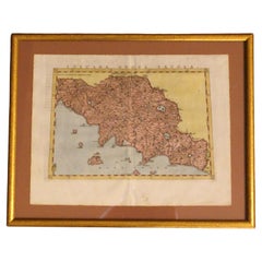
View All1562 Map of Toscana Nuova Tavola by Girolamo Ruscelli
Located in Chapel Hill, NC
A 1562 map of Toscana Nuova Tavola by Girolamo Ruscelli. Tuscany is the heart of Italy & birthplace of the Italian language. Early hand-coloring. Copper plate engraving. Interestingl...
Category
Antique 16th Century Italian Renaissance Maps
Materials
Paper
1597 German Map of Alexandria by Georg Braun and Frans Hogenberg
By Georg Braun and Frans Hogenberg
Located in Chapel Hill, NC
1597 Map of Alexandria by Georg Braun and Frans Hogenberg, Germany. From "Civitas Orbis Terrarum", part 2, published in Cologne by Bertram Buchholz. Printed in 2 parts. Title: "Alexa...
Category
Antique 16th Century German Renaissance Maps
Materials
Paper

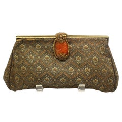
Circa 1930s French Silk Brocade Clutch
Located in Chapel Hill, NC
Circa 1930s French silk brocade clutch with gilt brass & carved carnelian in woven brass clasp. Back with hand grip. Some losses near the top on both sides...
Category
Vintage 1930s European Ceramics
Materials
Silk, Brocade
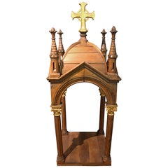
Circa 1880 French Gothic Style Baldachin or Statuary Niche
Located in Chapel Hill, NC
Circa 1880 French Gothic style Baldachin or Statuary Niche. Derived from canopies for processions, the term has come to signify all such coverings, most famously the Bernini high alt...
Category
Antique 1880s French Gothic Revival Religious Items
Materials
Gold Leaf
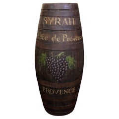
Circa 1900 or Earlier French Oak Syrah Wine Barrel
Located in Chapel Hill, NC
Circa 1900 or earlier oak Syrah wine barrel, French. Top carved "639, ARLDA", the tap holes closed. Staved with heavy iron straps. Painted with grapes & "Syrah Cote de Provence, Prov...
Category
Antique Early 1900s French French Provincial Historical Memorabilia
Materials
Iron
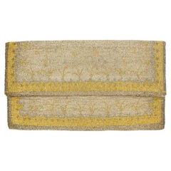
Circa 1950s Evening Clutch by Tribout of Paris
Located in Chapel Hill, NC
Circa 1950s evening clutch by Tribout of Paris, made in France. Woven microscopic silver, gold & platinum beads. Silk lined. Lightly tarnished except under flap. Wear commensurate wi...
Category
Vintage 1950s French Collectible Jewelry
Materials
Gold, Platinum, Silver
You May Also Like
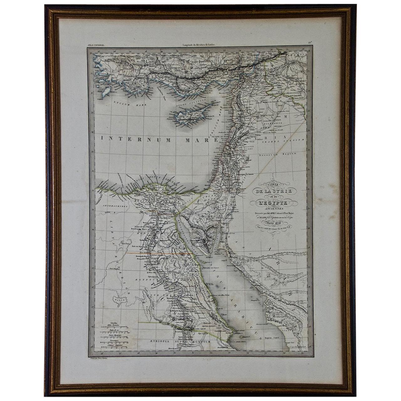
Map of the Holy Land "Carte de la Syrie et de l'Egypte" by Pierre M. Lapie
By Pierre M. Lapie
Located in Alamo, CA
An early 19th century map of ancient Syria and Egypt entitled "Carte de la Syrie et de l'Egypte anciennes/dressée par M. Lapie, Colonel d'Etat Major, et...
Category
Antique Early 19th Century French Maps
Materials
Paper

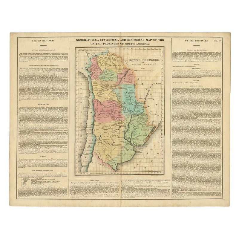
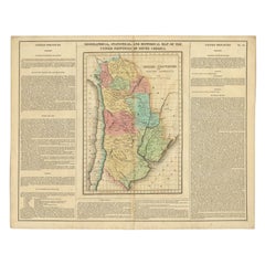
Antique Map of South America by Finlayson, 1822
Located in Langweer, NL
Antique map titled 'Geographical, Statistical and Historical Map of the United Provinces of South America'. This map depicts part of South America (including part of Brazil and Chili...
Category
Antique 19th Century Maps
Materials
Paper
$249 Sale Price
20% Off
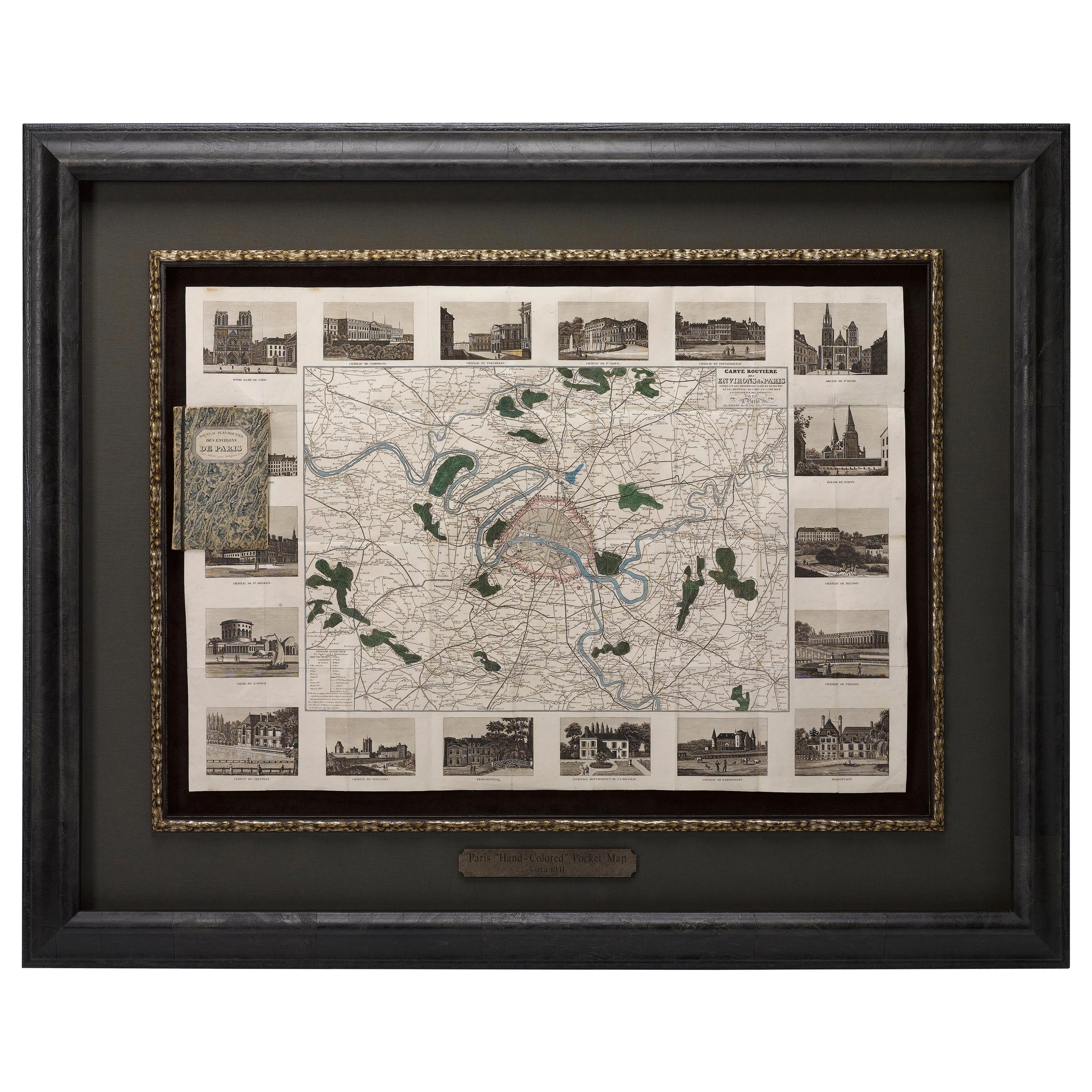
Antique Map of Paris, "Carte Routiere des Environs de Paris" 1841
Located in Colorado Springs, CO
This beautiful hand-colored road map of Paris was published in 1841. The map shows Paris and the surrounding area in a folding pocket map. Organized and detailed for travelers, this ...
Category
Antique 1840s French Maps
Materials
Paper

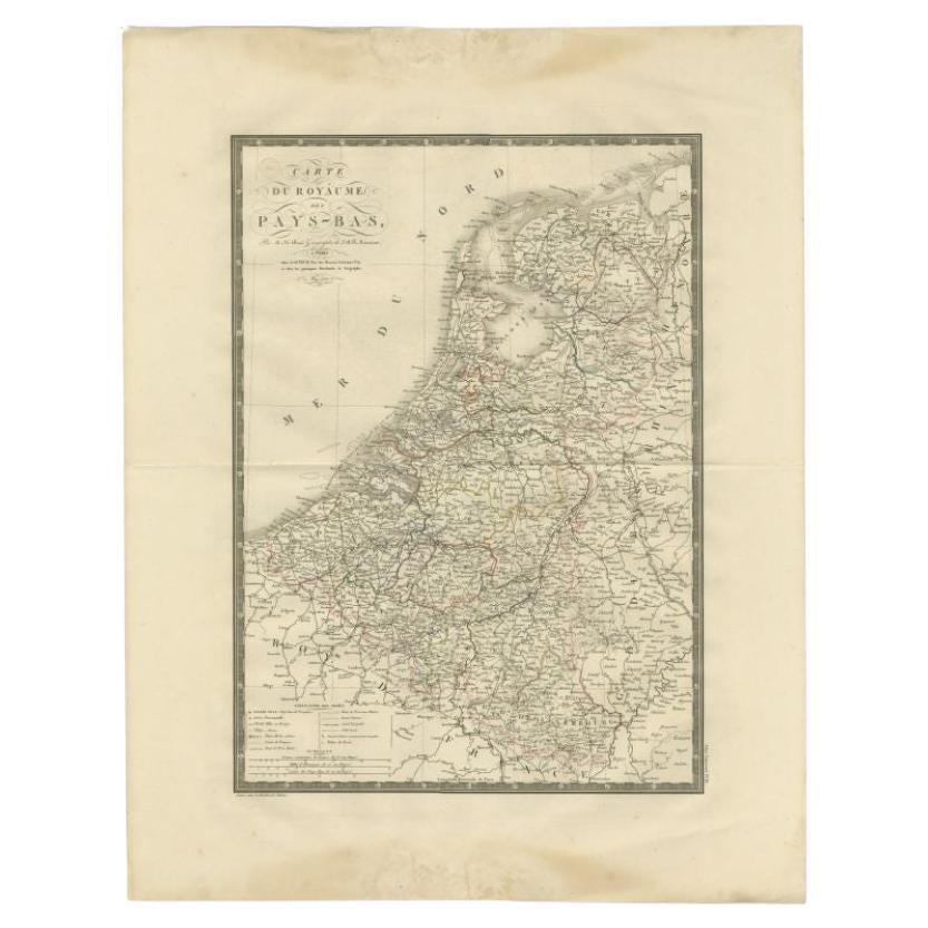
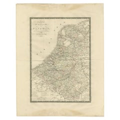
Antique Map of the Low Countries by Brué, 1822
Located in Langweer, NL
Antique map titled 'Carte du Royaume des Pays-Bas'. Large format map of the Low Countries. This map originates from 'Atlas Universel', published 1822...
Category
Antique 19th Century Maps
Materials
Paper
$160 Sale Price
20% Off
1860 Large Map "Carte De La Siberie Russie D'asie, " Ric.R0001
Located in Norton, MA
Large 1860 map "Carte De La Siberie Russie D'Asie," R-0001
" Authentic" - 1860 map "Carte De La Siberie Russie D'Asie,"
Dimension: Paper: 68 cm W x 51 cm H ; Sight: 51cm W x 4...
Category
Antique 19th Century Unknown Maps
Materials
Paper

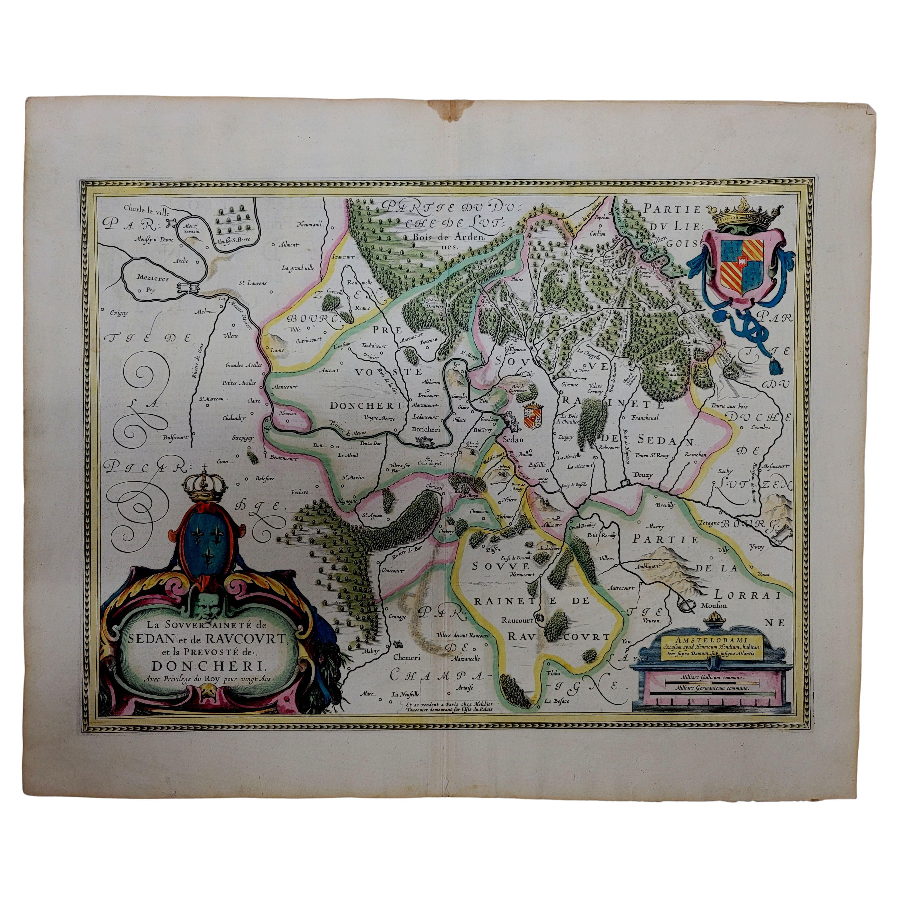
1633 Map "La Souverainete De Sedan Et De Raucourt, Et La Prevoste Ric0011
Located in Norton, MA
1653 map entitled
"La Souverainete de Sedan et de Raucourt, et la Prevoste de Doncheri,"
Ric0011
Description:
Lovely map centered on Sedan and Doncheri and the Meuze River fr...
Category
Antique 17th Century Dutch Maps
Materials
Paper

Recently Viewed
View AllMore Ways To Browse
French Baroque Fabric
Art Deco Mobel
Art Deco Shutter
Art Deco Speed Chair
Art Deco Tea Cart
Art Nouveau Flask
Art Nouveau Ice Bucket
Art Nouveau Metal Armchairs
Art Nouveau Wooden Pedestal
Arte And Cuoio
Arte Vetraria Muranese (AVEM) On Sale
Arthur Armour
Artona Afra E Tobia Scarpa
Ashford Marble
Asian Demilune
Asparagus Tureen
Atomic Coat Rack
Australian Daybill Movie Posters