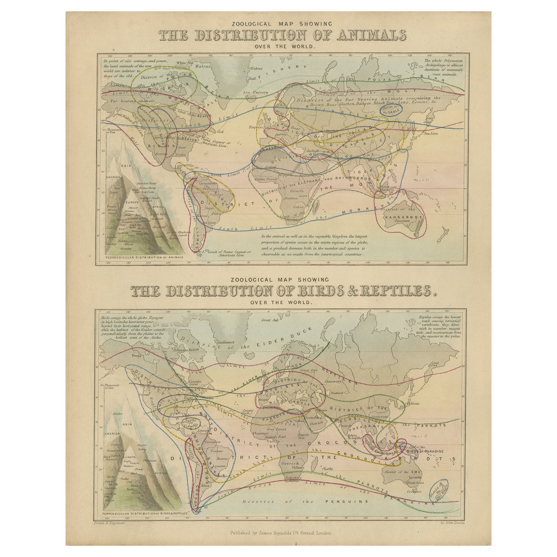
1843 London "Metropolis" Hand-Colored Pocket Map by John Arrowsmith
View Similar Items


Want more images or videos?
Request additional images or videos from the seller
1 of 2
1843 London "Metropolis" Hand-Colored Pocket Map by John Arrowsmith
About the Item
- Dimensions:Height: 30 in (76.2 cm)Width: 36 in (91.44 cm)Depth: 2 in (5.08 cm)
- Period:
- Date of Manufacture:1843
- Condition:Wear consistent with age and use. Minor fading.
- Seller Location:Colorado Springs, CO
- Reference Number:Seller: M0431stDibs: LU90978887993
About the Seller
4.9
Platinum Seller
These expertly vetted sellers are 1stDibs' most experienced sellers and are rated highest by our customers.
Established in 2010
1stDibs seller since 2011
400 sales on 1stDibs
More From This SellerView All
- 1864 Map of North America, Antique Hand-Colored Map, by Adolphe Hippolyte DufourLocated in Colorado Springs, COOffered is a map of North America entitled Amerique du Nord from 1864. This rare, separately published wall map was produced by Adolphe Hippolyte Dufour. This map includes vibrant an...Category
Antique 1860s French Maps
MaterialsPaper
- 1847 “World at One View” Antique Hand-Colored Wall Map of the WorldLocated in Colorado Springs, COThis is a highly desirable hanging wall map of the "World at One View", published in 1847 by Ensign and Thayer, New York. This pictorial map was printed as a broadside and features...Category
Antique 19th Century American Maps
MaterialsPaper
- 1837 Mitchell's "Tourist's Pocket Map of the State of Virginia" by J.H. YoungLocated in Colorado Springs, COThis is J. H. Young's pocket map of the Virginia, which shows county development current to 1835. The map was engraved by E. Yeager and F. Dankworth and published by S. A. Mitchell. ...Category
Antique 1830s American Maps
MaterialsPaper
- 1907 Map of Colorado, Antique Topographical Map, by Louis NellLocated in Colorado Springs, COThis highly detailed pocket map is a topographical map of the state of Colorado by Louis Nell from 1907. The map "has been complied from all availabl...Category
Antique Early 1900s American Maps
MaterialsPaper
- "Raising the Liberty Pole" Hand-Colored Antique Print, 1875Located in Colorado Springs, COThis nineteenth-century engraving shows a liberty pole being raised in a town square in 1776, while a sign bearing the face of King George III is removed in the background. The rioto...Category
Antique 1870s American Historical Memorabilia
MaterialsPaper
- 1861 Topographical Map of the District of Columbia, by Boschke, Antique MapLocated in Colorado Springs, COPresented is an original map of Albert Boschke's extremely sought-after "Topographical Map of the District of Columbia Surveyed in the Years 1856 ...Category
Antique 1860s American Historical Memorabilia
MaterialsPaper


You May Also Like
- Antique Map of New Zealand by Arrowsmith '1844'Located in Langweer, NLAntique map titled 'Map of the colony of New Zealand from official documents'. A scarce map of New Zealand. First issued in the 1830s, this state sh...Category
Antique Mid-19th Century Maps
MaterialsPaper
 $1,436 Sale Price24% Off
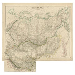
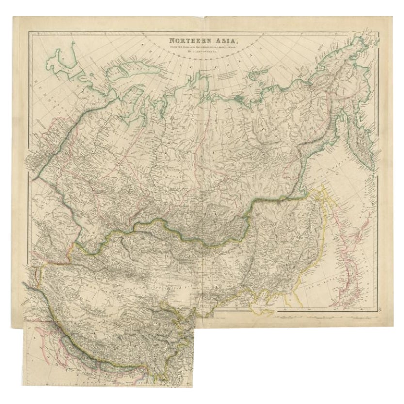
 - Antique Map of Northern Asia by Arrowsmith, 1834Located in Langweer, NLAntique map titled 'Northern Asia, from the Himalaya Mountains to the Arctic Ocean'. Large and detailed map of Northern Asia, taking in Mongolia, Tibet, Bhutan, Tartary, Siberia and ...Category
Antique 19th Century Maps
MaterialsPaper
- Original Antique Map of Russia By Arrowsmith. 1820Located in St Annes, LancashireGreat map of Russia Drawn under the direction of Arrowsmith Copper-plate engraving Published by Longman, Hurst, Rees, Orme and Brown, 1820 Unframed.Category
Antique 1820s English Maps
MaterialsPaper

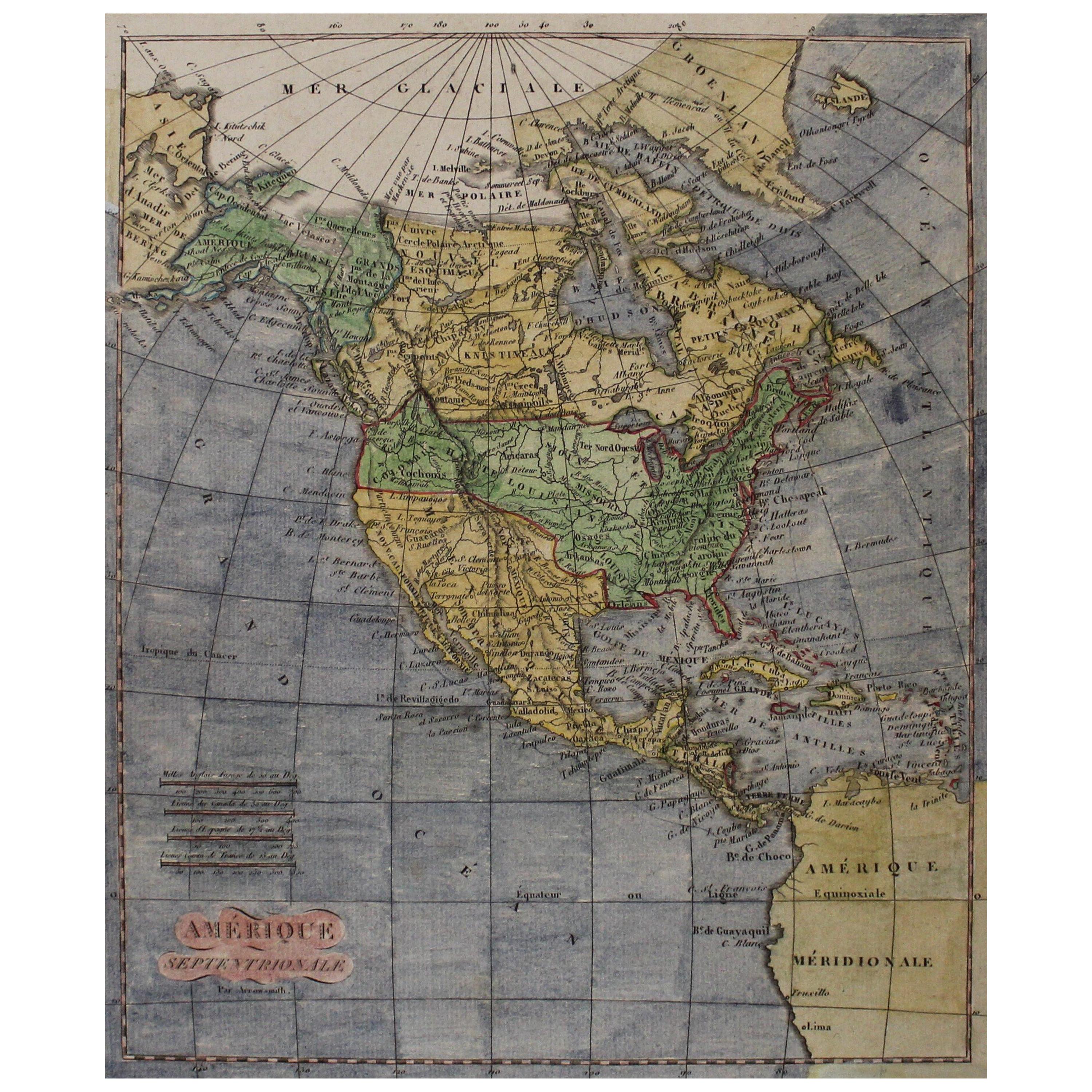
- Early 19th Century Hand Coloured Map of North America by Aaron ArrowsmithBy Aaron ArrowsmithLocated in Hamilton, OntarioHand coloured map in French by English cartographer Aaron Arrowsmith (1750–1823) titled "Amerique Septentionale" (North America). Map size: 9.5" x 8" Mat size: 20.5" x 14.25".Category
Antique Early 19th Century English Maps
MaterialsPaper
 $795 Sale Price36% Off
 - Original Antique Map of China, Arrowsmith, 1820Located in St Annes, LancashireGreat map of China Drawn under the direction of Arrowsmith Copper-plate engraving Published by Longman, Hurst, Rees, Orme and Brown, 1820 Unfr...Category
Antique 1820s English Maps
MaterialsPaper

- Original Antique Map of Hungary, Arrowsmith, 1820Located in St Annes, LancashireGreat map of Hungary Drawn under the direction of Arrowsmith. Copper-plate engraving. Published by Longman, Hurst, Rees, Orme and Brown, 1820 Unframed.Category
Antique 1820s English Maps
MaterialsPaper