Items Similar to 1853 Wyld Map of Turkey in Asia, the Balkans, and the Ottoman Empire


Want more images or videos?
Request additional images or videos from the seller
1 of 10
1853 Wyld Map of Turkey in Asia, the Balkans, and the Ottoman Empire
$1,339.95
£996.16
€1,130
CA$1,856.93
A$2,070.12
CHF 1,079.65
MX$25,032.50
NOK 13,571.74
SEK 12,841.57
DKK 8,602.98
About the Item
James Wyld's 1853 Map of the Ottoman Empire and Adjacent Regions
James Wyld's 1853 map, "Map of the Ottoman Empire, The Black Sea and the Frontiers of Russia and Persia," offers a meticulously detailed portrayal of a region at the heart of geopolitical shifts in the mid-19th century. Measuring 435 x 635 mm (17 1/8 x 25 in), this engraved map is notable for its fine original hand-colouring which enhances its visual appeal and clarity.
The map spans a critical area including the entire Ottoman Empire, parts of the neighboring Russian and Persian territories, and detailed insets of strategically important locations such as the Dardanelles, the Bosphorus, Sebastopol, Odessa, and Batoum. These insets provide valuable insights into key maritime passages and port cities that were central to trade and military movements during this period.
Description:
This historically significant map, created by James Wyld in 1853, delineates the strategic landscapes of the Ottoman Empire, the Black Sea, and the adjoining Russian and Persian frontiers during the outset of the Crimean War. The map extends from Vienna and the Adriatic Sea eastward to the Caspian Sea, and from Eastern Europe southward to Cyprus and Syria, encapsulating a region pivotal in 19th-century geopolitics.
Published on November 9th, 1853—shortly after the war began—the map illustrates key territorial changes and conflicts, including areas like Crimea and Bessarabia, which had been acquired by Russia between 1774 and 1812. The notation along the eastern Black Sea, suggesting that Russian control was limited to coastal forts and lacked local support, reflects the British perspective during this period.
Insets detail critical strategic zones such as the Bosporus, the Dardanelles, and important Black Sea ports including Odessa, Sevastopol, and Batoum. These insets underscore the regions' military and maritime importance, particularly in relation to the war efforts and naval logistics of the time.
The Crimean War, framed here, was a complex conflict involving an alliance of the Ottoman Empire, Britain, France, and Sardinia against the Russian Empire. The war was primarily provoked by disputes over religious rights in the Holy Land and broader concerns about Russian expansion at the expense of the declining Ottoman Empire. The map captures this tumultuous period, where initial hostilities led to significant military engagements and a protracted siege of Sevastopol.
Wyld's map serves not only as a geographic representation but also as a contemporary artifact of military and political strategy, reflecting the urgent cartographic needs during a major international conflict. Well-represented in institutional collections, this map is a crucial document for understanding the spatial dynamics and historical context of the Crimean War.
The map is dissected and mounted on linen, ensuring its preservation and ease of folding. It retains its original brown cloth boards which, though scuffed, add to the item's historical value. A printed label on the upper cover provides authenticity and context.
Minor spotting is present on the map, typical of its age and usage, but does not detract from its overall legibility or aesthetic value. This map not only serves as a geographical document but also as a historical artifact, reflecting the complex political landscape of the Ottoman Empire and its neighbors during a time of intense rivalry and empire-building. Collectors and historians of cartography or 19th-century geopolitical history will find this map a compelling addition to their collections.
Inset maps include:
The Bosphorus (Constantinople / Istanbul and its strategic strait)
The Dardanelles
Scutari (Üsküdar) and environs
Borders are hand-colored to distinguish political frontiers, with dates of major treaties and boundary changes annotated (e.g. 1774, 1812, 1829). Cities, fortresses, rivers, and mountain ranges are carefully engraved, providing a detailed record of the region’s strategic geography.
Wyld was renowned for producing up-to-date maps for the British public, often tied to current events. This map is a fine example of such “event cartography,” reflecting Britain’s military and diplomatic concerns during the Crimean War.
Condition: Good. Original hand color. Age toning and some foxing, mainly at folds. Old linen backing with panel folds as issued. Overall strong and attractive impression.
Framing tips: This large-format folding map is well suited to float-mounting in a wide frame, allowing the linen backing and original folds to remain visible. A dark frame with cream mat will enhance the contrast of the hand coloring.
Technique: Engraving with original hand color, dissected and mounted on linen
Maker: James Wyld, London, 1853
- Dimensions:Height: 17.13 in (43.5 cm)Width: 25.01 in (63.5 cm)Depth: 0 in (0.02 mm)
- Materials and Techniques:
- Place of Origin:
- Period:
- Date of Manufacture:1853
- Condition:Good condition, considering age. Minor spotting is present on the map, typical of its age and usage, but does not detract from its overall legibility or aesthetic value. Please study the images carefully.
- Seller Location:Langweer, NL
- Reference Number:Seller: BG-13846-21stDibs: LU3054341172722
About the Seller
5.0
Recognized Seller
These prestigious sellers are industry leaders and represent the highest echelon for item quality and design.
Platinum Seller
Premium sellers with a 4.7+ rating and 24-hour response times
Established in 2009
1stDibs seller since 2017
2,589 sales on 1stDibs
Typical response time: <1 hour
- ShippingRetrieving quote...Shipping from: Langweer, Netherlands
- Return Policy
Authenticity Guarantee
In the unlikely event there’s an issue with an item’s authenticity, contact us within 1 year for a full refund. DetailsMoney-Back Guarantee
If your item is not as described, is damaged in transit, or does not arrive, contact us within 7 days for a full refund. Details24-Hour Cancellation
You have a 24-hour grace period in which to reconsider your purchase, with no questions asked.Vetted Professional Sellers
Our world-class sellers must adhere to strict standards for service and quality, maintaining the integrity of our listings.Price-Match Guarantee
If you find that a seller listed the same item for a lower price elsewhere, we’ll match it.Trusted Global Delivery
Our best-in-class carrier network provides specialized shipping options worldwide, including custom delivery.More From This Seller
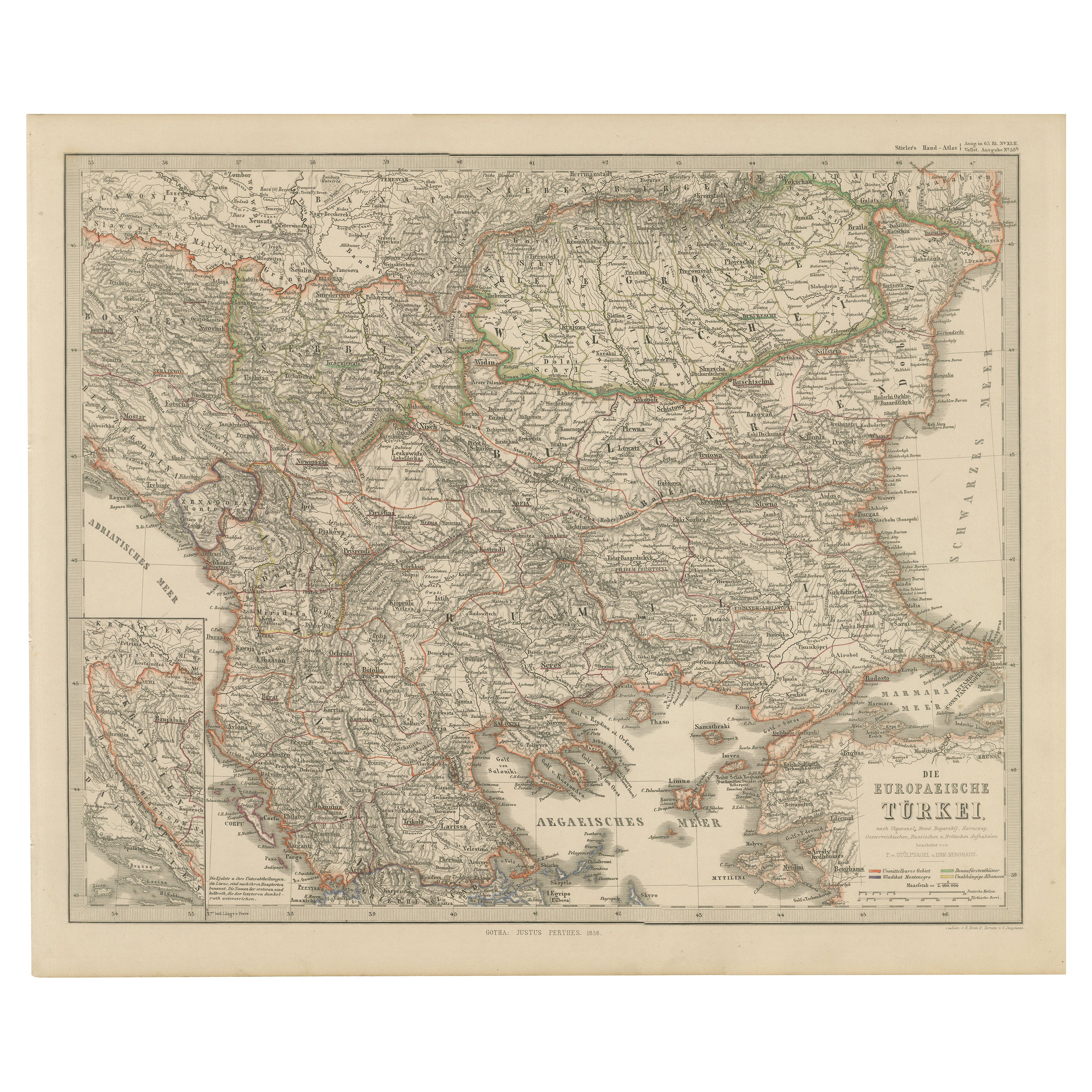
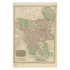
View AllEuropean Turkey Map – Detailed Balkan Ottoman Provinces 1858
Located in Langweer, NL
European Turkey and Greece Map – Balkans and Ionian Islands 1857
This detailed antique print shows “Die Europäische Türkei, Griechenland und die Ionische...
Category
Antique Mid-19th Century German Maps
Materials
Paper

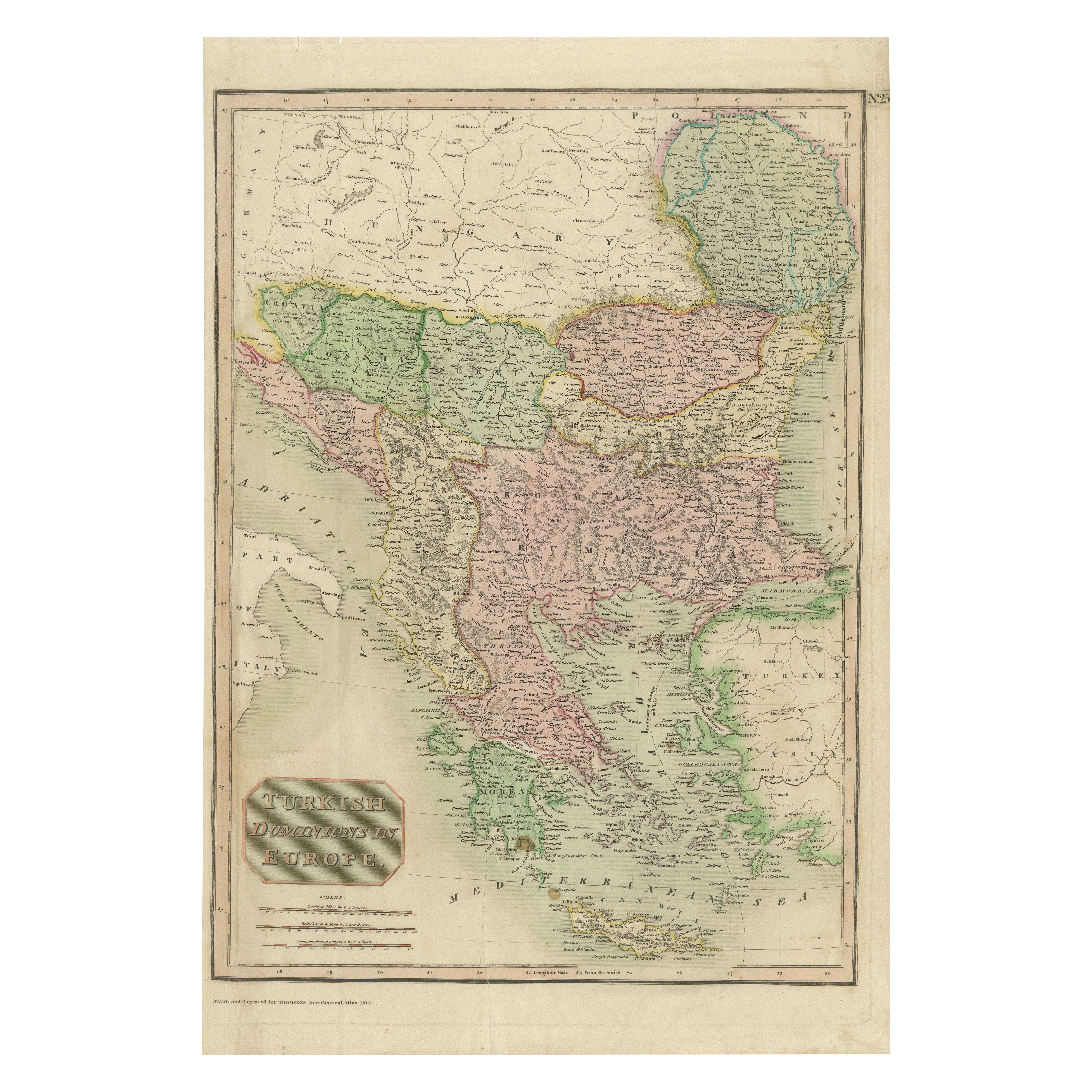
Map of Turkish Dominions in Europe, Ottoman Balkan Territories 1813
Located in Langweer, NL
Map of Turkish Dominions in Europe, Ottoman Balkan Territories 1814
This antique map titled "Turkish Dominions in Europe" provides a detailed depiction of the Balkan Peninsula and a...
Category
Antique 1810s Maps
Materials
Paper
Antique Map of Turkey in Asia by Wyld '1845'
Located in Langweer, NL
Antique map titled 'Map of Turkey in Asia'. Original antique map of Turkey in Asia. This map originates from 'An Atlas of the World, Comprehendin...
Category
Antique Mid-19th Century Maps
Materials
Paper

$189 Sale Price
20% Off
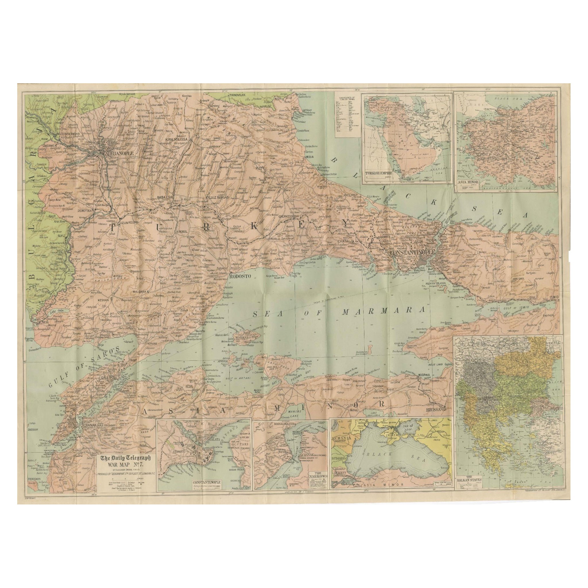
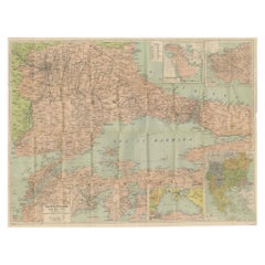
Daily Telegraph War Map 1877 – Ottoman Empire, Balkans & Constantinople Antique
Located in Langweer, NL
Daily Telegraph War Map 1877 – Ottoman Empire, Balkans & Constantinople Antique Map
This large lithographed folding map was published as War Map No. 7 by The Daily Telegraph, London...
Category
Antique 1870s English Maps
Materials
Paper
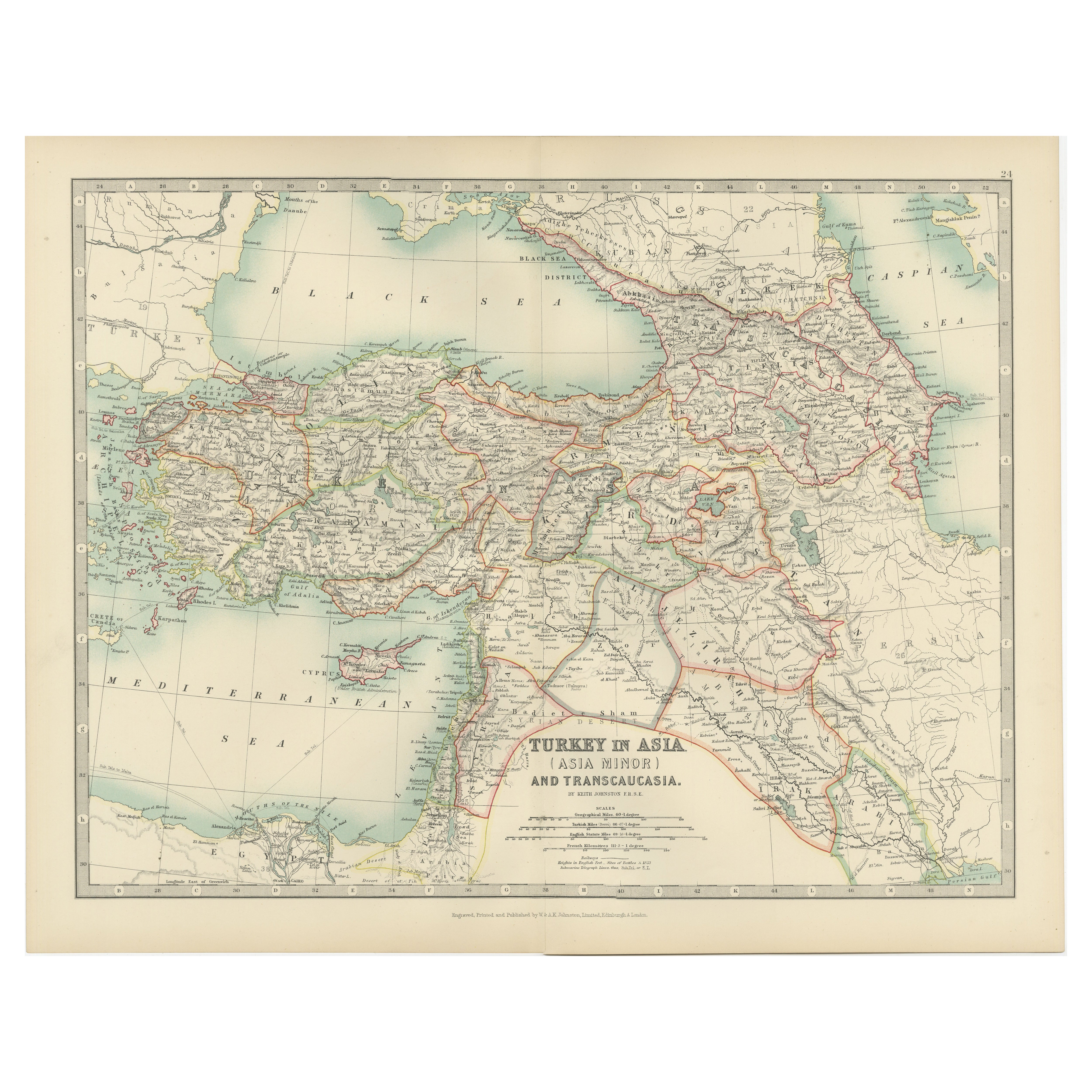
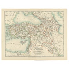
Antique Map of Turkey in Asia (Asia Minor and Transcaucasia), 1903
Located in Langweer, NL
Antique Map of Turkey in Asia (Asia Minor and Transcaucasia), 1903, with Intricate Provincial Borders
This antique map, titled "Turkey in Asia (Asia Minor) and Transcaucasia," was e...
Category
Early 20th Century Maps
Materials
Paper
Antique Map of Turkey in Europe by Wyld, '1845'
Located in Langweer, NL
Antique map titled 'Turkey in Europe'. Original antique map of Turkey in Europe. This map originates from 'An Atlas of the World, Comprehending S...
Category
Antique Mid-19th Century Maps
Materials
Paper

$189 Sale Price
20% Off
You May Also Like
Map of Eastern Roman Empire -Vintage Offset Print - Early 20th Century
Located in Roma, IT
This map of Eastern Roman Empire is a vintage offset print realized in the early 20th Century.
The state of preservation of the artwork is aged with dif...
Category
Early 20th Century Figurative Prints
Materials
Offset

Antique 1803 Italian Map of Asia Including China Indoneseia India
Located in Amsterdam, Noord Holland
Antique 1803 Italian Map of Asia Including China Indoneseia India
Very nice map of Asia. 1803.
Additional information:
Type: Map
Country of Manufacturing: Europe
Period: 19th centu...
Category
Antique 19th Century European Maps
Materials
Paper

$584 Sale Price
20% Off
Original Antique Map of Ancient Greece, Achaia, Corinth, 1786
Located in St Annes, Lancashire
Great map of Ancient Greece. Showing the region of Thessaly, including Mount Olympus
Drawn by J.D. Barbie Du Bocage
Copper plate engraving by P.F Tardieu
Original hand color...
Category
Antique 1780s French Other Maps
Materials
Paper

Russia, Western and Southern Part. Century Atlas antique vintage map
Located in Melbourne, Victoria
'The Century Atlas. Russia, Western and Southern Part'
Original antique map, 1903.
Inset map tilted 'St Petersburg and Environs'.
Central fold as issued. Map name and number printe...
Category
Early 20th Century Victorian More Prints
Materials
Lithograph

Large1852 Map "Russian Empire" Ric.r0011
Located in Norton, MA
Large
1852 map "Russian Empire"
George Phillips & Son 1852
Ric.r0011
Dimension: Paper: 67 cm W x 52 cm H ; Sight: 60cm W x 50 cm H
Condition: Good Condition with aged tonin...
Category
Antique 19th Century Unknown Maps
Materials
Paper

Original Antique Map of The Eastern Hemisphere by Dower, circa 1835
Located in St Annes, Lancashire
Nice map of the Eastern Hemisphere
Drawn and engraved by J.Dower
Published by Orr & Smith. C.1835
Unframed.
Free shipping
Category
Antique 1830s English Maps
Materials
Paper
