Items Similar to 1855 Relief Map of Germany and the Alps Showing Rivers and Terrain

Video Loading
Want more images or videos?
Request additional images or videos from the seller
1 of 11
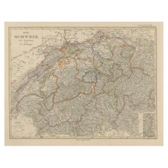
1855 Relief Map of Germany and the Alps Showing Rivers and Terrain
$345.44
£258.68
€290
CA$481.44
A$528.02
CHF 276.14
MX$6,379.96
NOK 3,464.82
SEK 3,266.02
DKK 2,207.71
About the Item
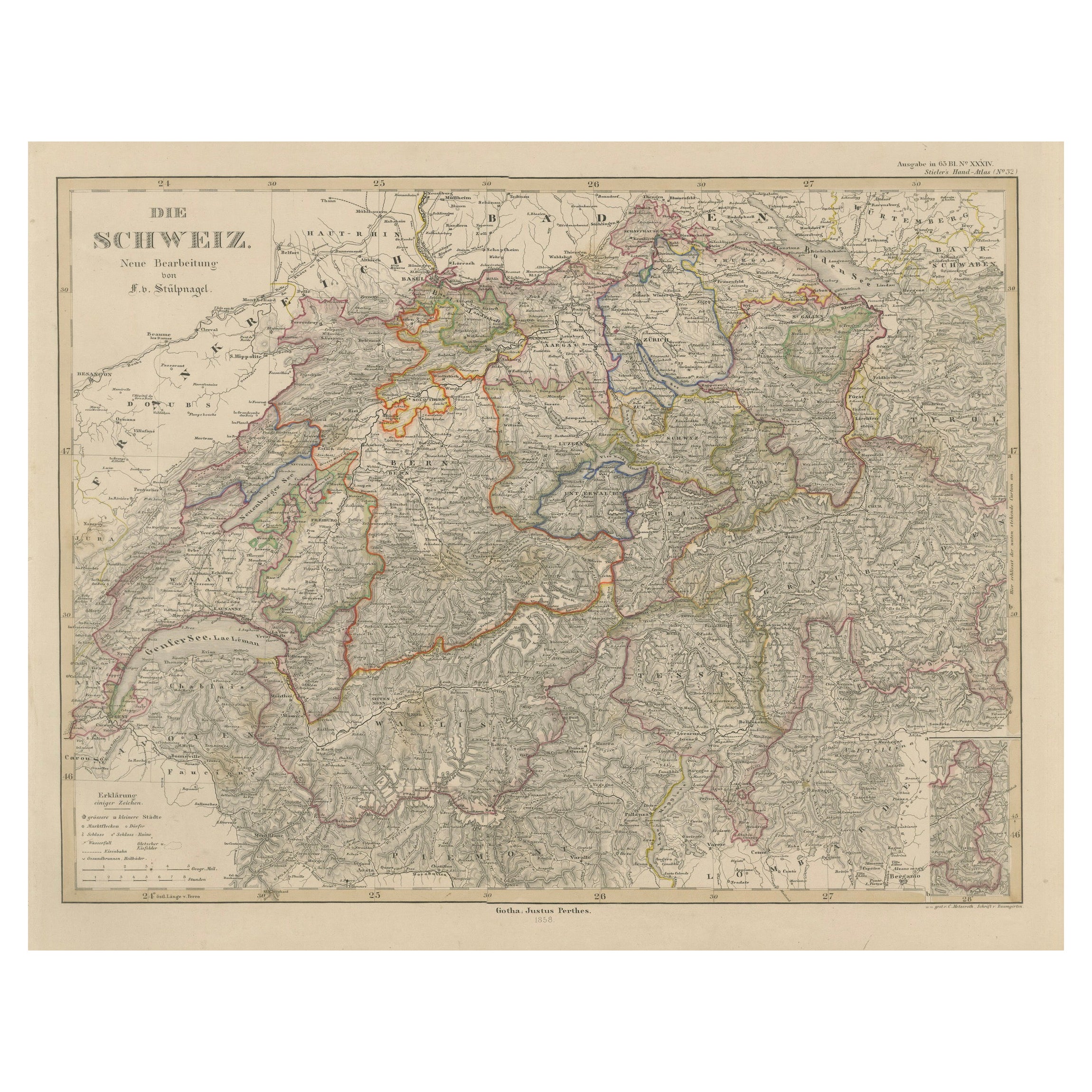
1855 Engraved Map of Switzerland with Cantonal Borders by Stülpnagel
This finely detailed antique map of Switzerland, titled "Die Schweiz," was published in 1855 by the renowned German cartographer Freiherr F. von Stülpnagel and printed by Justus Perthes of Gotha. It presents a beautifully engraved and meticulously labeled depiction of mid-19th-century Switzerland, highlighting the diverse topography and administrative divisions of the Swiss Confederation.
Each canton is outlined in vibrant original hand-coloring, clearly distinguishing the regional boundaries in this alpine nation. The map includes major towns, rivers, lakes, roads, and mountain passes, making it not only a decorative piece but also an informative historical reference. The depiction of the rugged terrain is particularly well executed, with dense hachuring techniques used to convey the mountainous relief of the Alps and the Jura range.
Important cities such as Bern, Zürich, Geneva, Lausanne, Basel, and Lucerne are prominently marked, and the extensive labeling extends even to smaller towns and villages. Lake Geneva (“Genfersee”) and Lake Constance (“Bodensee”) are included in fine detail, along with other significant geographical features like the Rhône and Rhine rivers.
The map also features a legend (Erklärung) identifying political borders, cantonal seats, forts, and roads, offering a deeper understanding of Swiss infrastructure and governance during the period. A small inset map in the lower right corner shows a magnified area, likely one of the cantons, providing added geographic clarity.
Stülpnagel’s work is highly regarded for its precision and aesthetic appeal, and this map reflects the cartographic quality and educational intent typical of Justus Perthes’ publishing output.
Condition report:
Very good condition. Crisp impression with vibrant original hand-coloring outlining the cantonal borders. Minor toning and light foxing in the margins consistent with age. No tears or repairs. Please study the image for details.
Framing tips:
A natural wood or walnut frame with a light cream or stone-colored mat would enhance the warm tones and fine engraving of this piece. For a formal setting, a gold frame can underscore the historical significance and decorative appeal.
Technique: Engraving with original hand-coloring
Maker: Freiherr F. von Stülpnagel, published by Justus Perthes, Gotha, 1855
- Dimensions:Height: 14.77 in (37.5 cm)Width: 17.88 in (45.4 cm)Depth: 0.01 in (0.2 mm)
- Materials and Techniques:Paper,Engraved
- Place of Origin:
- Period:
- Date of Manufacture:1855
- Condition:Very good condition. Crisp impression with vibrant original hand-coloring outlining the cantonal borders. Minor toning and light foxing in the margins consistent with age. No tears or repairs. Please study the image for details.
- Seller Location:Langweer, NL
- Reference Number:Seller: BG-05552-251stDibs: LU3054346115792
About the Seller
5.0
Recognized Seller
These prestigious sellers are industry leaders and represent the highest echelon for item quality and design.
Platinum Seller
Premium sellers with a 4.7+ rating and 24-hour response times
Established in 2009
1stDibs seller since 2017
2,647 sales on 1stDibs
Typical response time: <1 hour
- ShippingRetrieving quote...Shipping from: Langweer, Netherlands
- Return Policy
Authenticity Guarantee
In the unlikely event there’s an issue with an item’s authenticity, contact us within 1 year for a full refund. DetailsMoney-Back Guarantee
If your item is not as described, is damaged in transit, or does not arrive, contact us within 7 days for a full refund. Details24-Hour Cancellation
You have a 24-hour grace period in which to reconsider your purchase, with no questions asked.Vetted Professional Sellers
Our world-class sellers must adhere to strict standards for service and quality, maintaining the integrity of our listings.Price-Match Guarantee
If you find that a seller listed the same item for a lower price elsewhere, we’ll match it.Trusted Global Delivery
Our best-in-class carrier network provides specialized shipping options worldwide, including custom delivery.More From This Seller
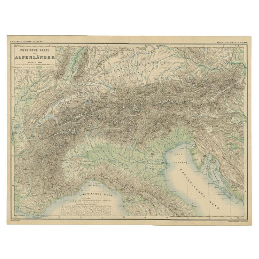
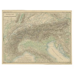
View AllAntique Map of the Alpine Countries, Published in Germany, c.1870
Located in Langweer, NL
Antique map titled 'Physische Karte der Alpenländer'. Old map of the Alpine countries. This map originates from 'H. Kiepert's Kleiner Atlas der Neueren Geographie für Schule und Haus...
Category
Antique 19th Century Maps
Materials
Paper
$104 Sale Price
34% Off
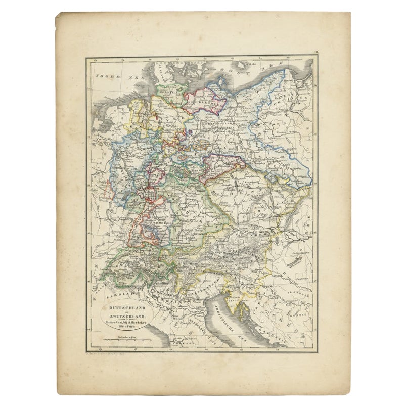
Antique Map of Germany and Switzerland from an Old Dutch School Atlas, 1852
Located in Langweer, NL
Antique map titled 'Duitschland en Zwitersland'. Map of Germany and Switzerland. This map originates from 'School-Atlas van alle deelen der Aarde' by Otto Petri. Artists and Engraver...
Category
Antique 19th Century Maps
Materials
Paper
$114 Sale Price
20% Off
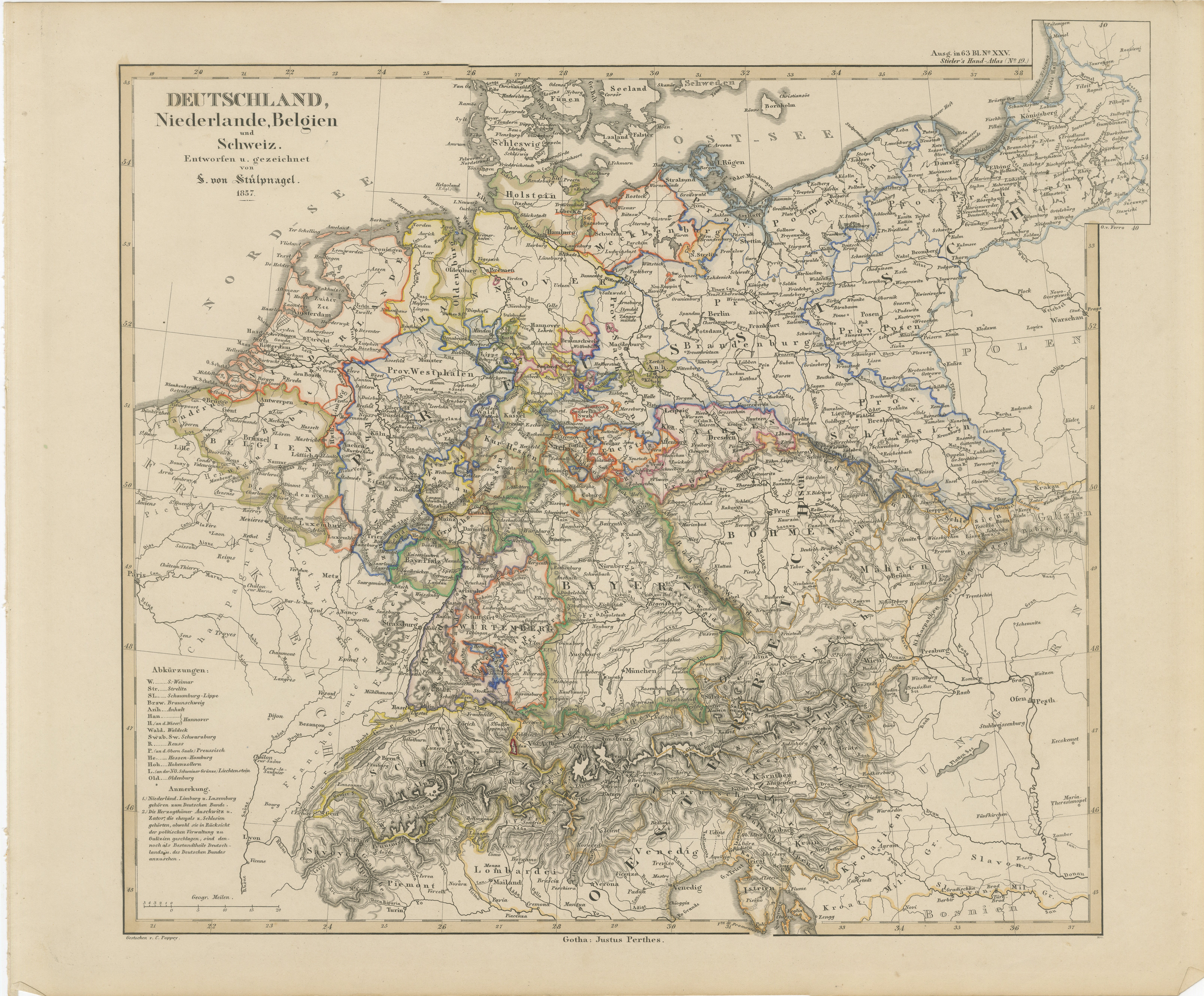
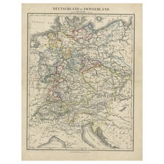
Antique Map of Germany, Netherlands, Belgium & Switzerland – Stülpnagel, 1857
Located in Langweer, NL
Antique Map of Germany, Netherlands, Belgium & Switzerland – Stülpnagel, 1857
Fine mid-19th century map of Central Europe titled "Deutschland, Niederlande, Belgien, Schweiz", drawn ...
Category
Antique Mid-19th Century German Maps
Materials
Paper

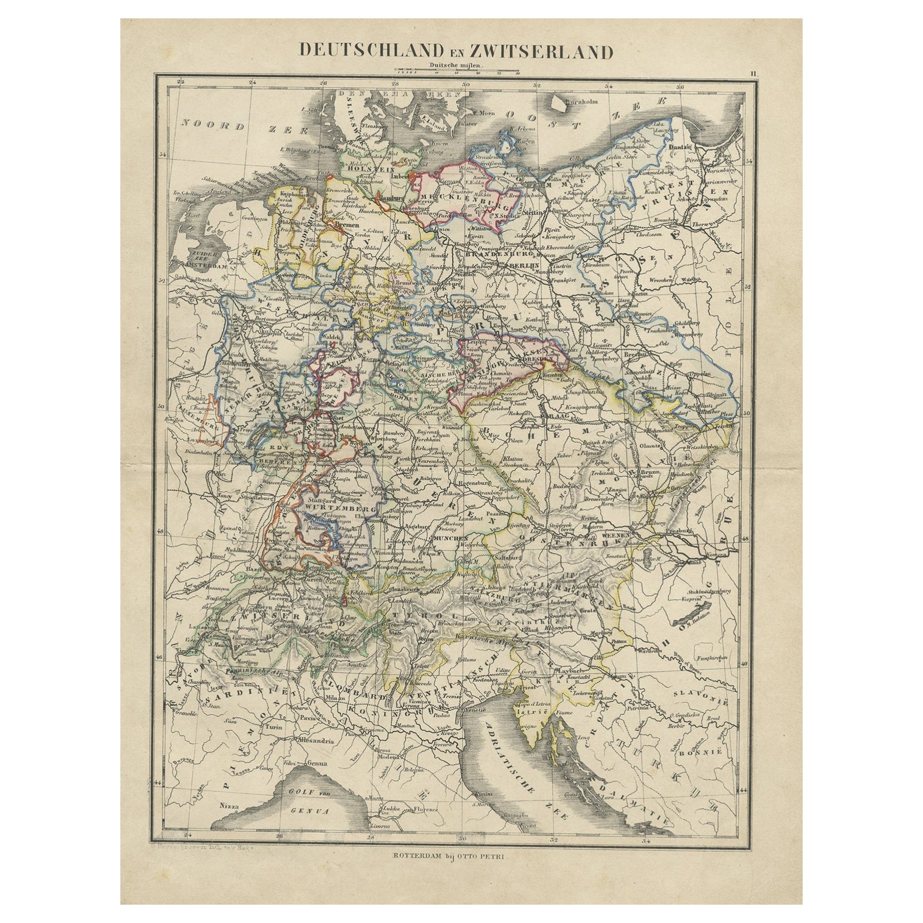
Antique Map of Germany and Switzerland from an Old Dutch School Atlas, c.1873
Located in Langweer, NL
Antique map titled 'Deutschland en Zwitserland'. Old map depicting Germany and Switzerland. This map originates from 'School-Atlas van alle Deelen der Aarde'. Artists and Engravers: ...
Category
Antique 19th Century Maps
Materials
Paper
$104 Sale Price
20% Off
Antique Map of Switzerland by Lapie, 1842
Located in Langweer, NL
Antique map titled 'Carte de la Suisse ou Helvetie'. Map of Switzerland. This map originates from 'Atlas universel de géographie ancienne et moderne...
Category
Antique Mid-19th Century Maps
Materials
Paper

$476 Sale Price
20% Off
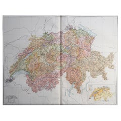
1856 Engraved Map of Switzerland with Cantonal Borders by Stülpnagel
Located in Langweer, NL
1856 Engraved Map of Switzerland with Cantonal Borders by Stülpnagel
This finely detailed antique map of Switzerland, titled "Die Schweiz," was published in 1856 by the renowned Ger...
Category
Antique Mid-19th Century German Maps
Materials
Paper
You May Also Like
Large Original Vintage Map of Switzerland, circa 1920
Located in St Annes, Lancashire
Great map of Switzerland
Original color.
Good condition
Published by Alexander Gross
Unframed.
Category
Vintage 1920s English Maps
Materials
Paper
Hautes Alpes, France. Antique map of a French department, 1856
By Victor Levasseur
Located in Melbourne, Victoria
'Dept. des Hautes Alpes', steel engraving with original outline hand-colouring., 1856, from Levasseur's 'Atlas National Illustre'.
This area of France i...
Category
19th Century Naturalistic Landscape Prints
Materials
Engraving

German Empire, Northern Part. Century Atlas antique vintage map
Located in Melbourne, Victoria
'The Century Atlas. German Empire, Northern Part.'
Original antique map, 1903.
Central fold as issued. Map name and number printed on the reverse corne...
Category
Early 20th Century Victorian More Prints
Materials
Lithograph

German Empire, Southwestern Part. Century Atlas antique vintage map
Located in Melbourne, Victoria
'The Century Atlas. German Empire, Southwestern Part'
Original antique map, 1903.
Central fold as issued. Map name and number printed on the reverse co...
Category
Early 20th Century Victorian More Prints
Materials
Lithograph

1853 Map of "Russia in Europe Including Poland" Ric.r016
Located in Norton, MA
Description
Russia in Europe incl. Poland by J Wyld c.1853
Hand coloured steel engraving
Dimension: Paper: 25 cm W x 33 cm H ; Sight: 22 cm W x 28 cm H
Condition: Good ...
Category
Antique 19th Century Unknown Maps
Materials
Paper

Vintage Swedish Topographic School Map of European Alps, Made in Sweden 1922
Located in Los Angeles, CA
Vintage Swedish Topographic School map of European Alps, Made in Sweden 1922
This vintage Swedish school map is so unique and a great example of why t...
Category
Vintage 1920s Swedish Maps
Materials
Linen, Wood, Paper
More Ways To Browse
Alps Furniture
Beni Ourain Rugs
Glass Top Wood Base Coffee Tables
T Chair
Pair Of Danish Chairs
Veneer Dining Tables
1970 Italian Armchair
Furniture Uk
House Of Denmark Table And Chairs
Louis Marble Top Side Table
Antique Russian Rugs
Baker Furniture By
For Kids
Sterling Silver Flatware Set Service For 12
Tufted Bar
Pair Of French Antique Armchairs
1970s Brass Glass Coffee Table
Antique Column Base