Items Similar to 1904 "Nell's Topographical Map of the State of Colorado"
Want more images or videos?
Request additional images or videos from the seller
1 of 9
1904 "Nell's Topographical Map of the State of Colorado"
$6,950
£5,251.70
€6,078.40
CA$9,750.51
A$10,845.36
CHF 5,689.46
MX$132,338.05
NOK 71,409.93
SEK 67,295.20
DKK 45,372.68
About the Item
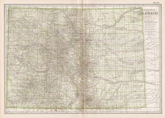
This highly detailed pocket map is a topographical map of the state of Colorado by Louis Nell from 1904. The map "has been compiled from all available surveys in existence... [I]t is consequently the most complete and accurate one ever published, and shows all the information useful to settlers, miners and travelers."
The map is fully engraved with virtually no area left untouched by the engraver. The map is colored to indicate Forest Reserves, agricultural lands, timber reserves, watersheds, and creeks. Towns, villages, settlements, mining areas, railroads and townships are also highlighted. The map is drawn on a scale of 10 miles to every 1 inch. A legend in the upper border outlines the various colors and symbols used within the delicately engraved image.
Louis Nell traveled to Colorado in the mid-1870s as a topographical assistant to leading cartographer George Wheeler. Nell enjoyed the area so much that he settled there and published a series of maps of the state between the years 1880 and 1907. He formed one of the most continuous cartographic records available for the period immediately following Colorado statehood. His intensely detailed maps captured the rapid development of the state, including the great Silver Boom during the late 19th century.
The map was published in Denver by the Kendrick Book & Stationery Company in 1904. The publisher's label on the front endpaper, opposite a 12-page index of towns and their respective populations, summarizes the production nicely in great contemporary language. "This Map of Colorado has been compiled from all available surveys in existence, it is consequently the most complete and accurate one ever published, and shows all the information useful to settlers, miners and travelers, viz: The New Mining Camps, the latest Land Office Surveys, all the modes of transportation, as railroads, roads, and practicable mountain trails, the United States Timber Reserves, the principal irrigation canals in south-eastern Colorado and the more important ranches in those parts where villages are scarce. This is the only map published showing the wagon roads, mountain trails and passes as well as the railroads, and may be safely taken as a guide to travelers, wheelmen, hunters, and prospectors. The map exhibits over 2,000 altitudes of mountains, passes, railroad stations and other towns in feet above sea level, and the approximate height of any location can be found by interpolation between the nearest enclosing contour lines representing vertical intervals of 1,000 feet."
CONDITION:
Overall very good condition. Pocket map that folds into 45 panels and remains affixed to original brown cloth gilt boards. A few small spots of separation along fold lines, since stabilized, and very faint scattered spotting confined to the margins. Printed color is bold.
The map has been framed according to the highest conservation standards, with its original booklet.
Framed Dimensions: 41" H x 50 3/4"W x 2 1/4"D.
Accompanied by our company's letter of authenticity.
- Dimensions:Height: 41 in (104.14 cm)Width: 50.75 in (128.91 cm)Depth: 2.25 in (5.72 cm)
- Materials and Techniques:
- Place of Origin:
- Period:1900-1909
- Date of Manufacture:1904
- Condition:Repaired: A few small spots of separation along fold lines, since stabilized by Art Source International in Boulder, CO, in January of 2025. Additions or alterations made to the original: Framed by Art Source International in Boulder, CO, in January of 2025. Wear consistent with age and use. Minor structural damages. Minor fading.
- Seller Location:Colorado Springs, CO
- Reference Number:Seller: M3701stDibs: LU909743537342
About the Seller
4.9
Platinum Seller
Premium sellers with a 4.7+ rating and 24-hour response times
Established in 2010
1stDibs seller since 2011
463 sales on 1stDibs
- ShippingRetrieving quote...Shipping from: Colorado Springs, CO
- Return Policy
Authenticity Guarantee
In the unlikely event there’s an issue with an item’s authenticity, contact us within 1 year for a full refund. DetailsMoney-Back Guarantee
If your item is not as described, is damaged in transit, or does not arrive, contact us within 7 days for a full refund. Details24-Hour Cancellation
You have a 24-hour grace period in which to reconsider your purchase, with no questions asked.Vetted Professional Sellers
Our world-class sellers must adhere to strict standards for service and quality, maintaining the integrity of our listings.Price-Match Guarantee
If you find that a seller listed the same item for a lower price elsewhere, we’ll match it.Trusted Global Delivery
Our best-in-class carrier network provides specialized shipping options worldwide, including custom delivery.More From This Seller
View All1890 "Map of Oregon, Kansas, California, and the Territories" by S. A. Mitchell
By Samuel Augustus Mitchell 1
Located in Colorado Springs, CO
Presented is an 1890 map "Map of Oregon, Kansas, California, and the Territories" by S. A. Mitchell Jr. The map was issued in the atlas “Mitchell's New Intermediate Geography” publis...
Category
Antique 1890s American Victorian Maps
Materials
Paper

1864 Map of North America, Antique Hand-Colored Map, by Adolphe Hippolyte Dufour
Located in Colorado Springs, CO
Offered is a map of North America entitled Amerique du Nord from 1864. This rare, separately published wall map was produced by Adolphe Hippolyte Dufour. This map includes vibrant an...
Category
Antique 1860s French Maps
Materials
Paper

1873 "Map of the States of California and Nevada" by Chas. Drayton Gibbes
Located in Colorado Springs, CO
Presented is Warren Holt and Charles Drayton Gibbes' 1873 “Map of California and Nevada.” This map is considered to be one of the finest large-scale ...
Category
Antique 1870s American Maps
Materials
Paper

1859 "Map of the United States of America..." by J. H. Colton
By J.H. Colton
Located in Colorado Springs, CO
Presented is an 1859 “Map of the United States of America, the British Provinces, Mexico, the West Indies and Central America with Part of...
Category
Antique 1850s American Maps
Materials
Paper

1927 "Texas" Map by C.S. Hammond
Located in Colorado Springs, CO
Presented is a very detailed map of Texas, printed in 1927. The map was featured in The Literary Digest Atlas of the World and Gazetteer, published by Funk & Wagnalls. The map is sma...
Category
Vintage 1920s American Maps
Materials
Paper
1846 "North America" Map, Engraved by I. Dower
Located in Colorado Springs, CO
Presented is an original 1846 map of “North America.” The map was drawn and engraved by I. Dower and published in London by Orr & Company. The map depicts North America, to include G...
Category
Antique 1840s English Victorian Maps
Materials
Paper

You May Also Like
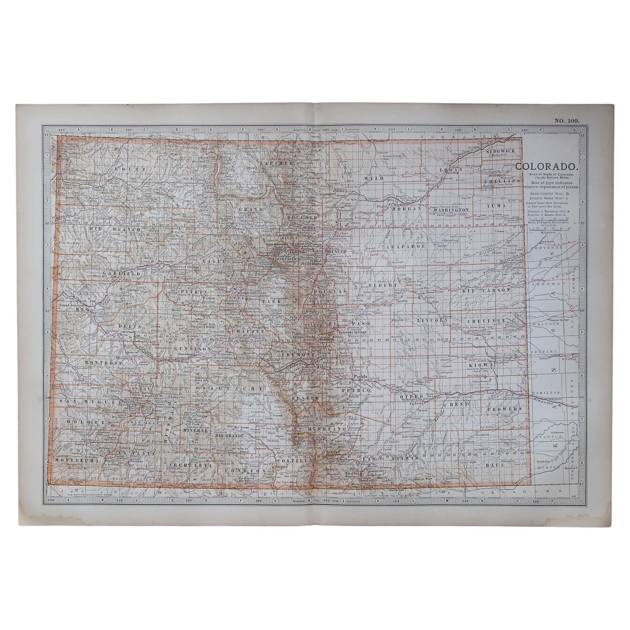
Original Antique Map of the American State of Colorado, 1903
Located in St Annes, Lancashire
Antique map of Colorado
Published By A & C Black. 1903
Original colour
Good condition
Unframed.
Free shipping
Category
Antique Early 1900s English Maps
Materials
Paper

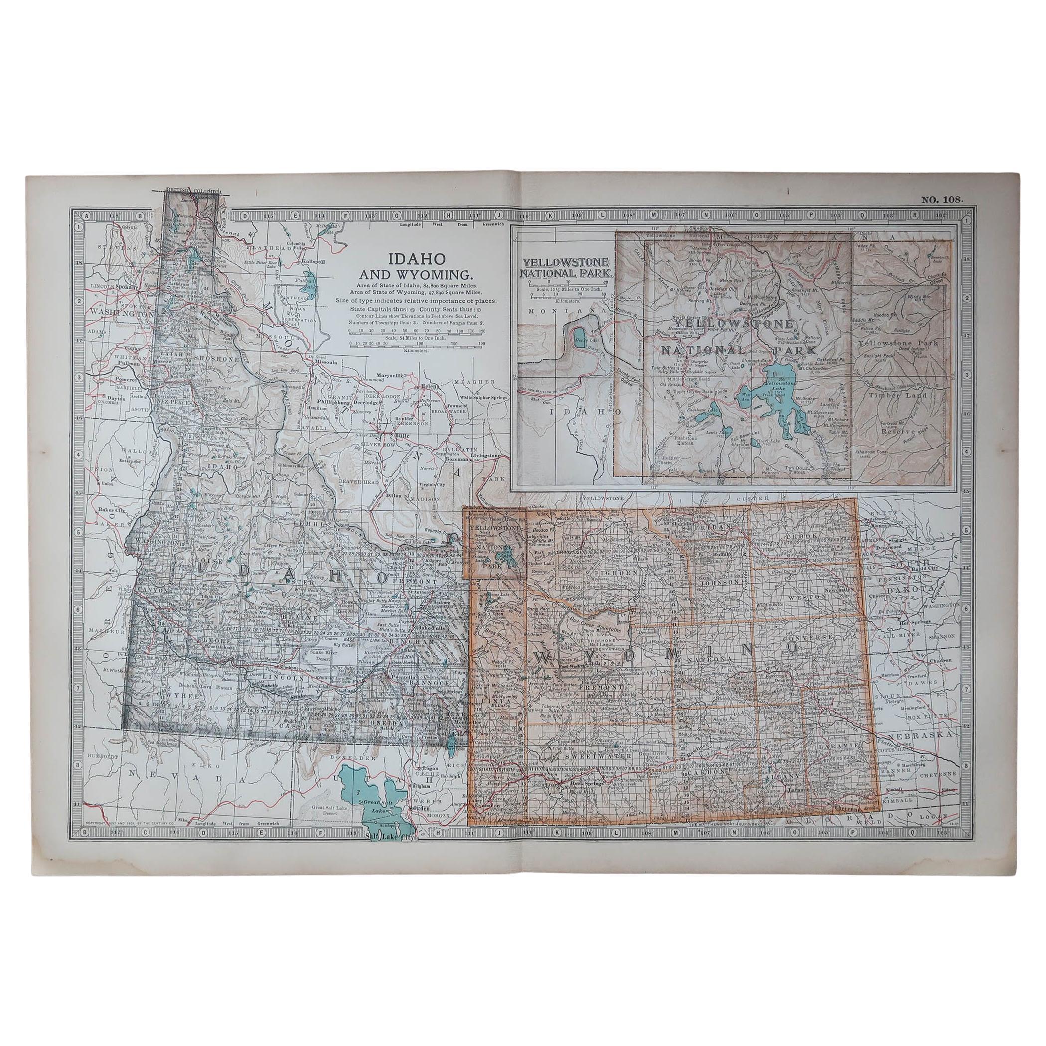
Original Antique Map of the American State of Idaho & Wyoming, 1903
Located in St Annes, Lancashire
Antique map of Idaho and Wyoming
Published By A & C Black. 1903
Original colour
Good condition
Unframed.
Free shipping
Category
Antique Early 1900s English Maps
Materials
Paper

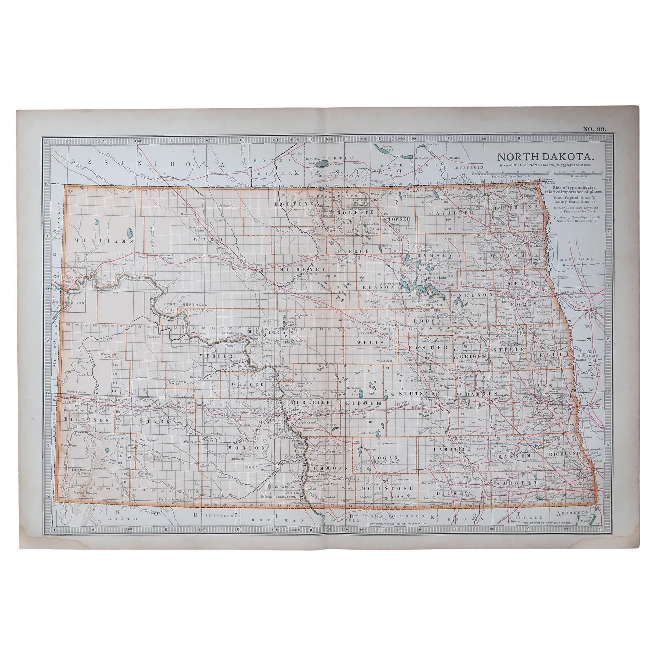
Original Antique Map of the American State of North Dakota, 1903
Located in St Annes, Lancashire
Antique map of North Dakota
Published By A & C Black. 1903
Original colour
Good condition
Unframed.
Free shipping
Category
Antique Early 1900s English Maps
Materials
Paper
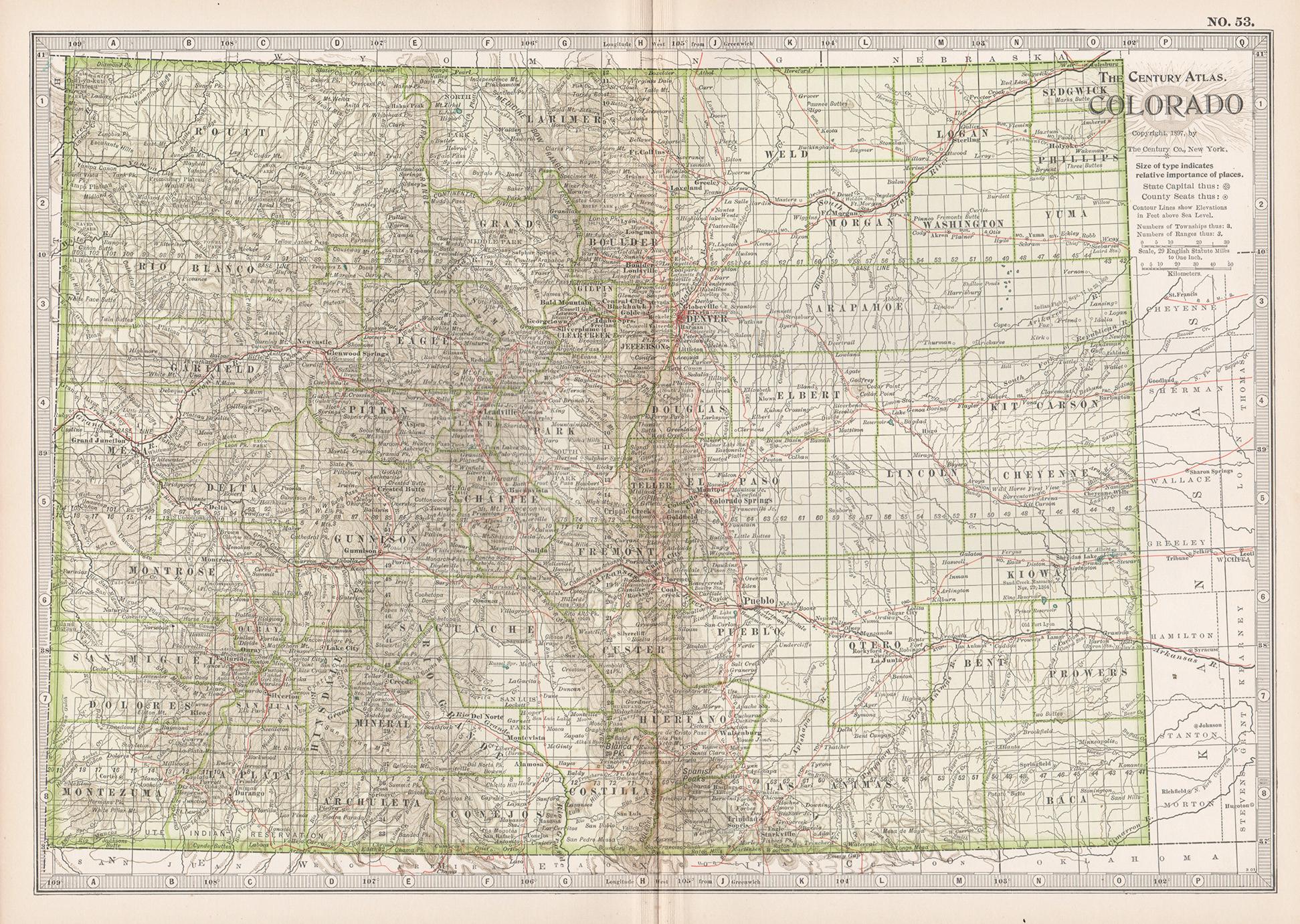
Colorado. USA. Century Atlas state antique vintage map
Located in Melbourne, Victoria
'The Century Atlas. Colorado.'
Original antique map, 1903.
Central fold as issued. Map name and number printed on the reverse corners.
Sheet 29.5cm by 40cm.
Category
Early 20th Century Victorian More Prints
Materials
Lithograph
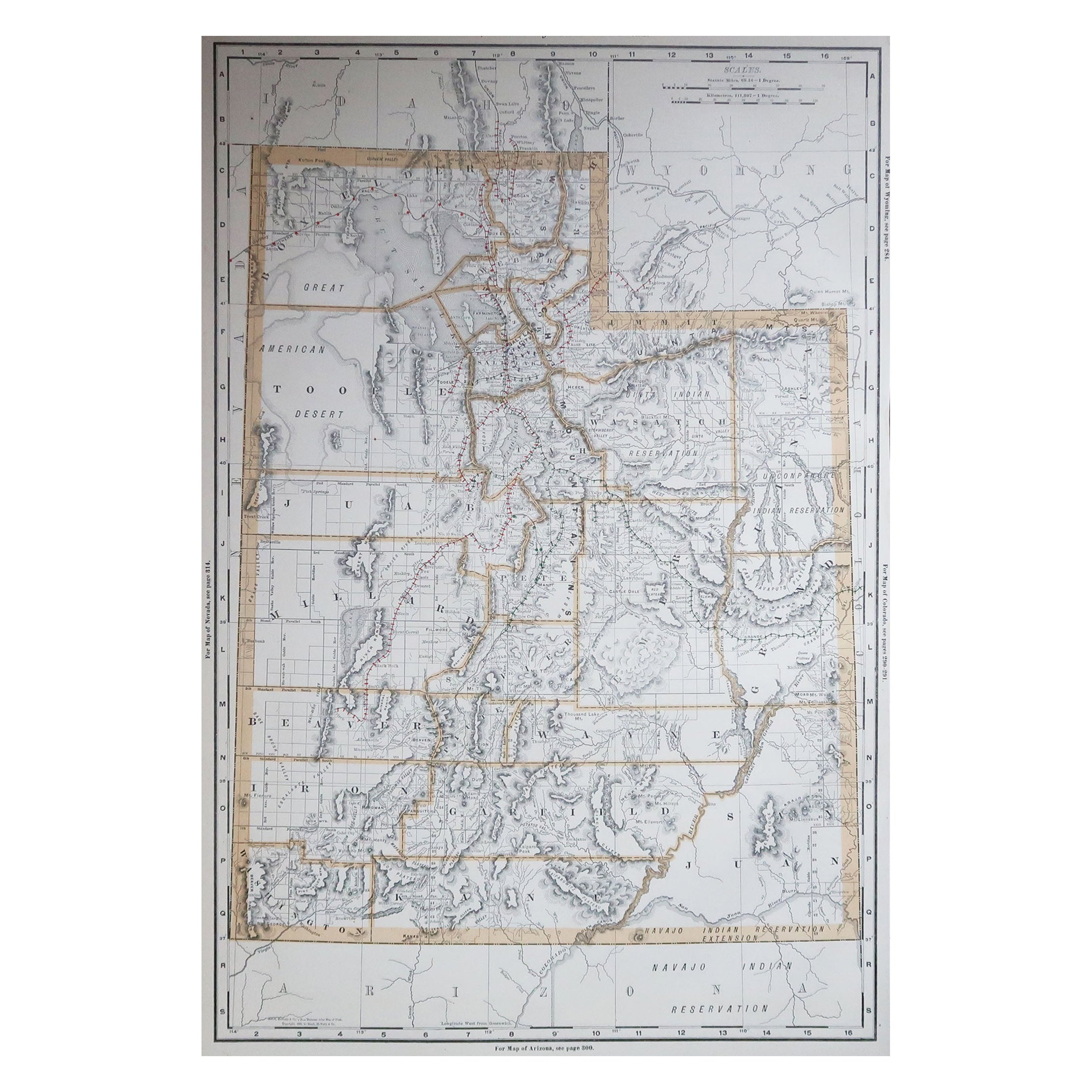
Large Original Antique Map of Utah, USA, 1894
By Rand McNally & Co.
Located in St Annes, Lancashire
Fabulous map of Utah
Original color
By Rand, McNally & Co.
Published, 1894
Unframed
Free shipping.
Category
Antique 1890s American Maps
Materials
Paper

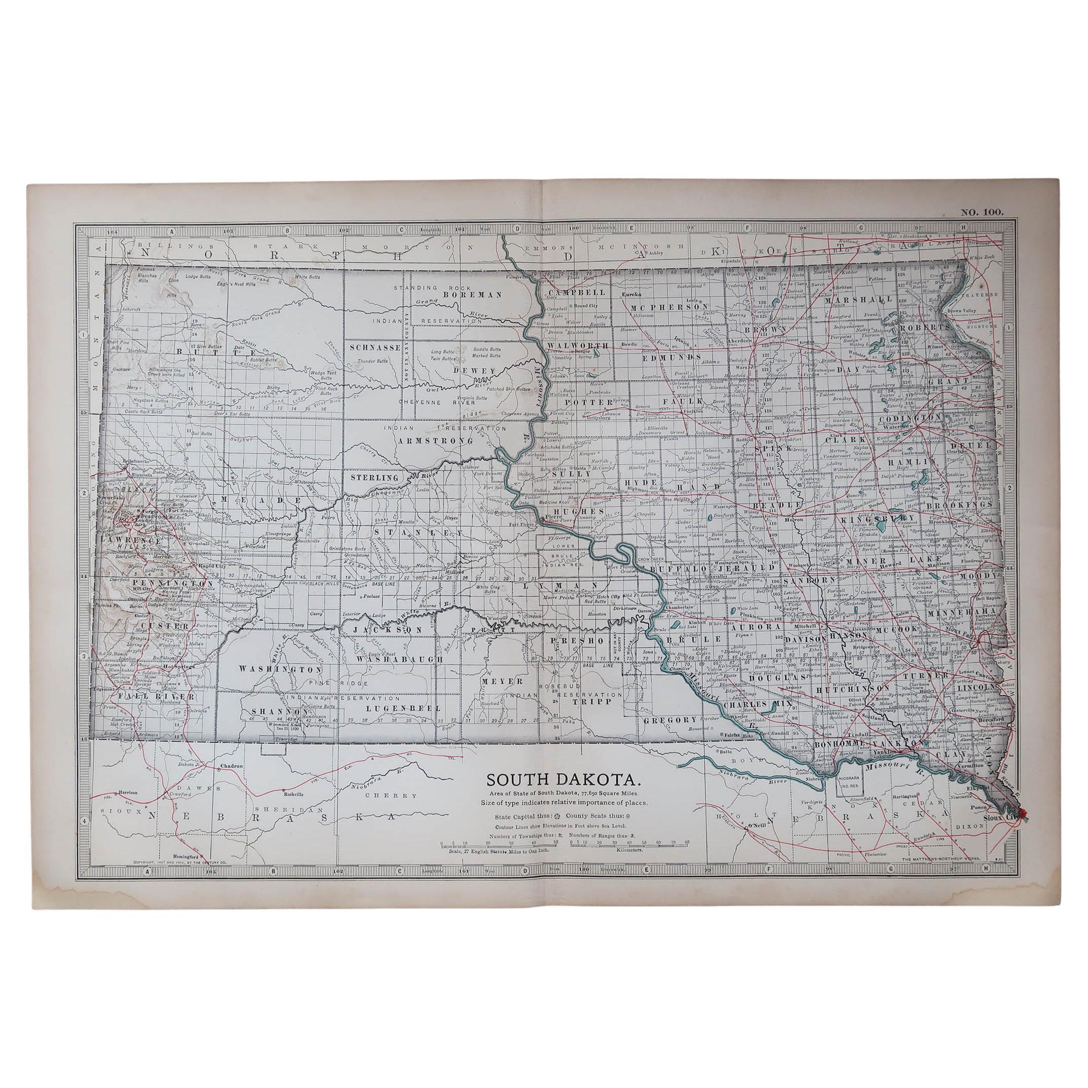
Original Antique Map of the American State of South Dakota, 1903
Located in St Annes, Lancashire
Antique map of South Dakota
Published By A & C Black. 1903
Original colour
Good condition
Unframed.
Free shipping
Category
Antique Early 1900s English Maps
Materials
Paper

More Ways To Browse
Colorado Used Furniture
Antique Letter T
Antique 3 Wheeler
Antique Miners
Letter Scales
Wagon Wheel Furniture
Post Modern High Chairs
Vintage Vine Rug
Silver Metal Chair
Swedish Kilim
Vintage Scandanavian Chairs
Vintage Tropical Furniture
19th Century Red Glass
Antique French Console Table Tables
French 50s
Rusted Metal Art
Silver Bowl Large
Antique French Silk