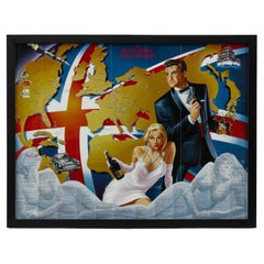
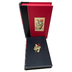
1987 "the Ian Fleming Thriller Map" by Aaron Silverman and Molly Maguire
View Similar Items

Want more images or videos?
Request additional images or videos from the seller
1 of 6
1987 "the Ian Fleming Thriller Map" by Aaron Silverman and Molly Maguire
About the Item
- Dimensions:Height: 22.5 in (57.15 cm)Width: 29 in (73.66 cm)Depth: 0.75 in (1.91 cm)
- Sold As:Set of 2
- Materials and Techniques:
- Place of Origin:
- Period:1980-1989
- Date of Manufacture:1987
- Condition:Additions or alterations made to the original: Framed by Rio Grande Framing, in Colorado Springs, Colorado in June of 2022. Wear consistent with age and use.
- Seller Location:Colorado Springs, CO
- Reference Number:Seller: M3161stDibs: LU909731391532
About the Seller
4.9
Platinum Seller
These expertly vetted sellers are 1stDibs' most experienced sellers and are rated highest by our customers.
Established in 2010
1stDibs seller since 2011
400 sales on 1stDibs
More From This SellerView All
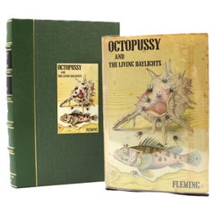
- Octopussy and the Living Daylights by Ian Fleming, First Edition, 1966By Ian FlemingLocated in Colorado Springs, COFleming, Ian. Octopussy and The Living Daylights. London: Jonathan Cape, 1966. First edition, first impression. Octavo. Presented in the publisher's original dust jacket and dark bro...Category
Vintage 1960s American Books
MaterialsPaper
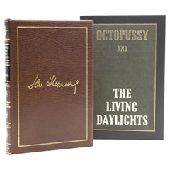
- Octopussy and The Living Daylights by Ian Fleming, First UK Edition, 1966Located in Colorado Springs, COFleming, Ian. Octopussy and The Living Daylights. London: Jonathan Cape, 1966. First UK edition. Octavo. Rebound in full leather with gilt facsimi...Category
Vintage 1960s English Books
MaterialsPaper
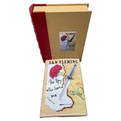
- The Spy Who Loved Me by Ian Fleming, First Us Edition, 1962Located in Colorado Springs, COFleming, Ian. The Spy Who Loved Me. New York: The Viking Press, Inc., 1962. First US edition, first printing. Octavo. Presented in the publisher's original dust jacket and original cloth boards. With new archival quarter leather and cloth clamshell archival case. This is the first US edition of Ian Fleming’s tenth James Bond thriller, The Spy Who Loved Me. The book is presented in the publisher’s original boards and dust jacket, with Richard Chopping’s classic artwork...Category
Vintage 1960s Books
MaterialsPaper
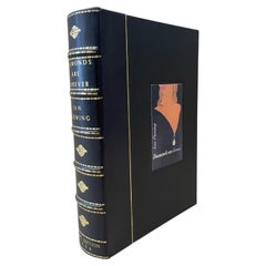
- Diamonds Are Forever by Ian Fleming, First Edition, 1956By Ian FlemingLocated in Colorado Springs, COFleming, Ian. Diamonds are Forever. London: Jonathan Cape, 1956. First edition, first printing. Octavo. Rebound in full black calf leather, with diamond stamped boards, gilt tooling, gilt titles, and raised bands to spine, and a spectacular quarter leather clamshell case. This is the first edition, first printing of Ian Fleming’s fourth James Bond novel, Diamonds are Forever. The book was published by Jonathan Cape in London on March 26, 1956. The book tracks 007 as he infiltrates the deadly world of diamond smuggling, tracking smugglers from Sierra Leone to the United States. Fleming wrote the story at his Goldeneye estate in Jamaica, inspired by a Sunday Times article on diamond smuggling. As with the three previous Bond books, the first edition of 12,500 copies sold out quickly. The novel was serialized in The Daily Express newspaper in April 1956 onwards. It was the first novel Fleming sold to the newspaper, a decision that led to an overall rise in the novel’s sales. Book sales were also assisted by the press in November 1956, following the visit of Prime Minister Sir Anthony Eden...Category
Vintage 1950s English Books
MaterialsLeather, Paper
- From Russia, With Love by Ian Fleming, First Edition, 1957By Ian FlemingLocated in Colorado Springs, COFleming, Ian. From Russia, With Love. London: Jonathan Cape, 1957. First edition. Octavo. Rebound in full black calf leather, with custom gilt and red gun and rose embossed stamp to front, gilt tooling and titles to spine, and matching black quarter leather and red cloth archival clamshell. Presented is the first edition of Ian Fleming...Category
Vintage 1950s English Books
MaterialsPaper
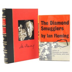
- Diamond Smugglers by Ian Fleming, First Edition, in Dust Jacket, 1957By Ian FlemingLocated in Colorado Springs, COFleming, Ian. The Diamond Smugglers. London: Jonathan Cape, 1957. Octavo. First edition, first impression. In the original dust jacket and original black cloth-textured boards. Prese...Category
Vintage 1950s American Books
MaterialsPaper
You May Also Like
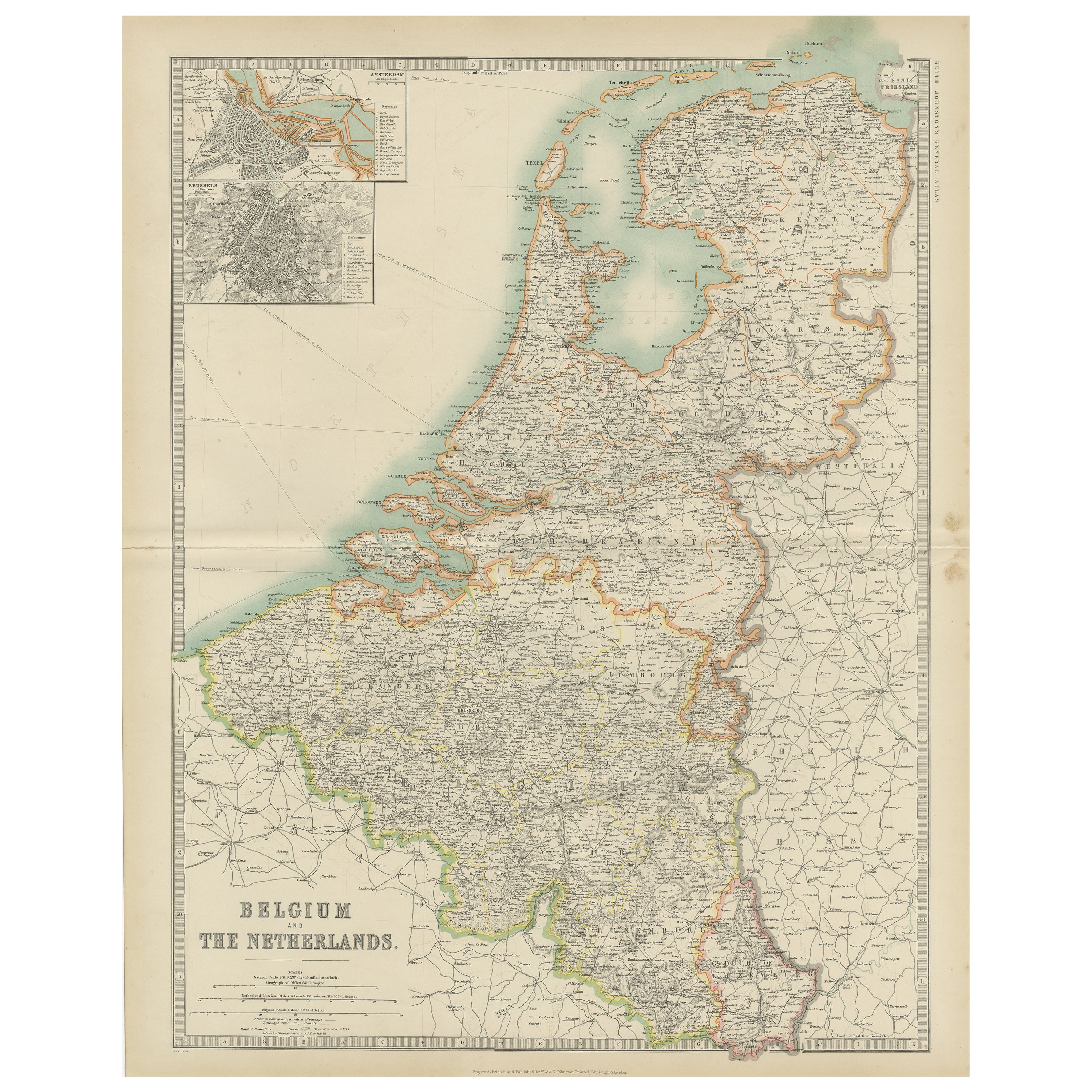
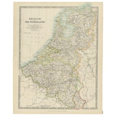
- Antique Map of Belgium and the Netherlands by Johnston '1909'Located in Langweer, NLAntique map titled 'Belgium and The Netherlands'. Original antique map of Belgium and the Netherlands. With inset maps of Amsterdam and Brussels. This m...Category
Early 20th Century Maps
MaterialsPaper
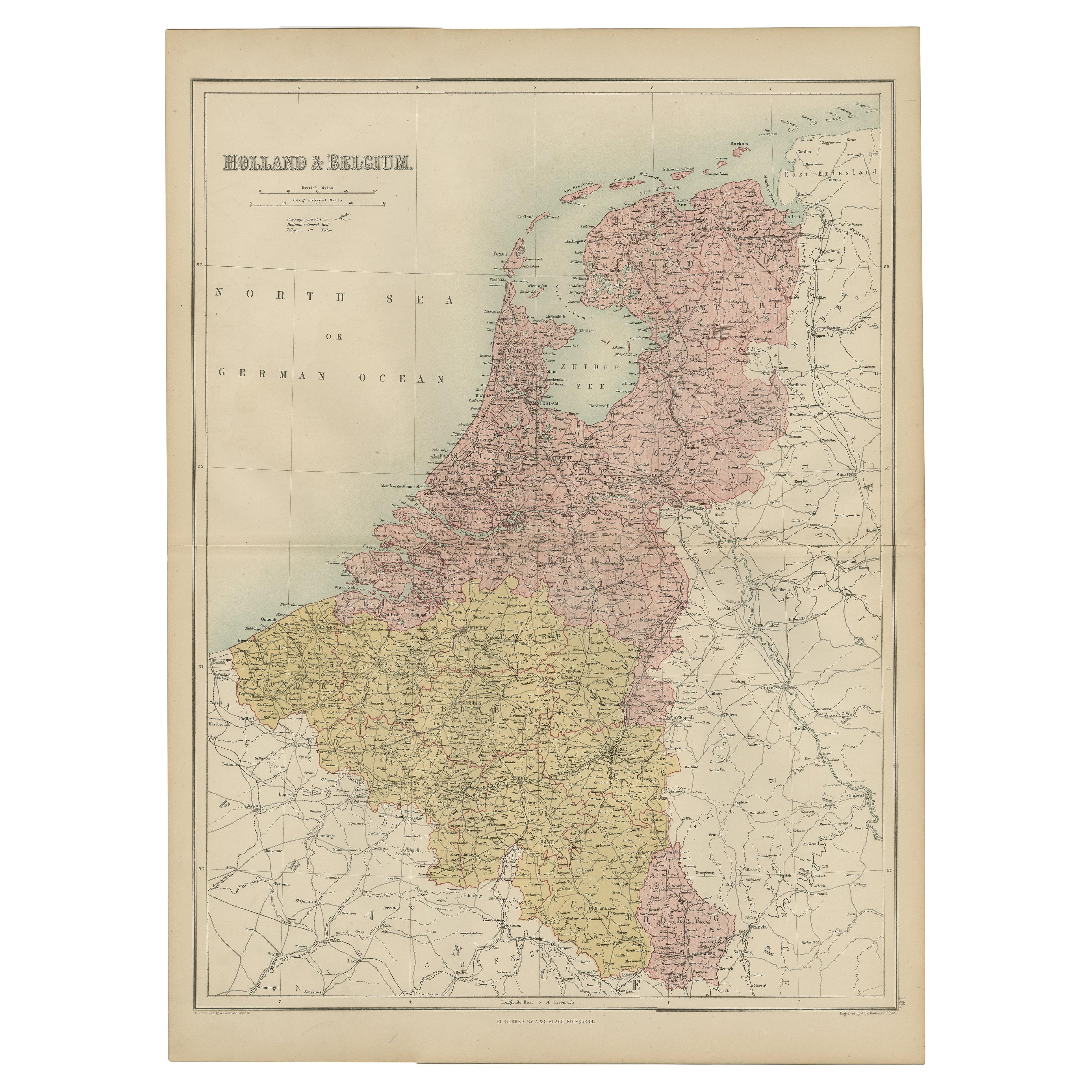
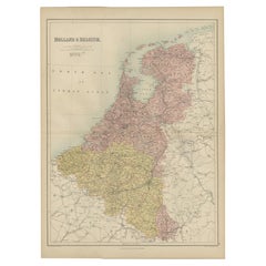
- Antique Map of The Netherlands and Belgium by A & C, Black, 1870Located in Langweer, NLAntique map titled 'Holland & Belgium'. Original antique map of Map of The Netherlands and Belgium. This map originates from ‘Black's General Atlas of The World’. Published by A & C....Category
Antique Late 19th Century Maps
MaterialsPaper
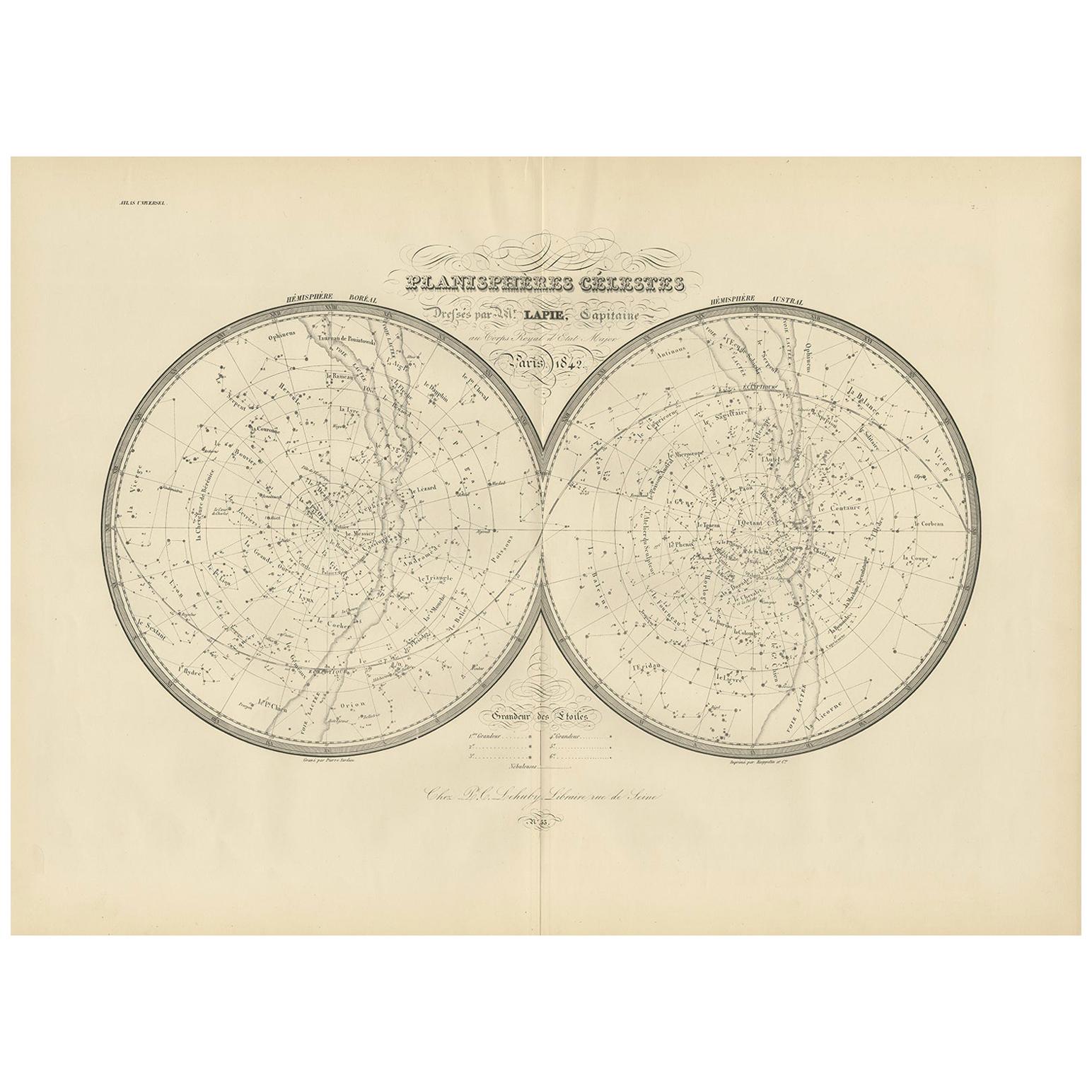
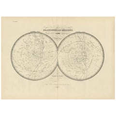
- Antique Map of the Stars and Constellations by Lapie, 1842Located in Langweer, NLAntique map titled 'Planisheres Célestes'. Two hemispheres depicting the stars and constellations. This map originates from 'Atlas universel de géographie ancienne et moderne (..)' b...Category
Antique Mid-19th Century Maps
MaterialsPaper
 $655 Sale Price20% Off
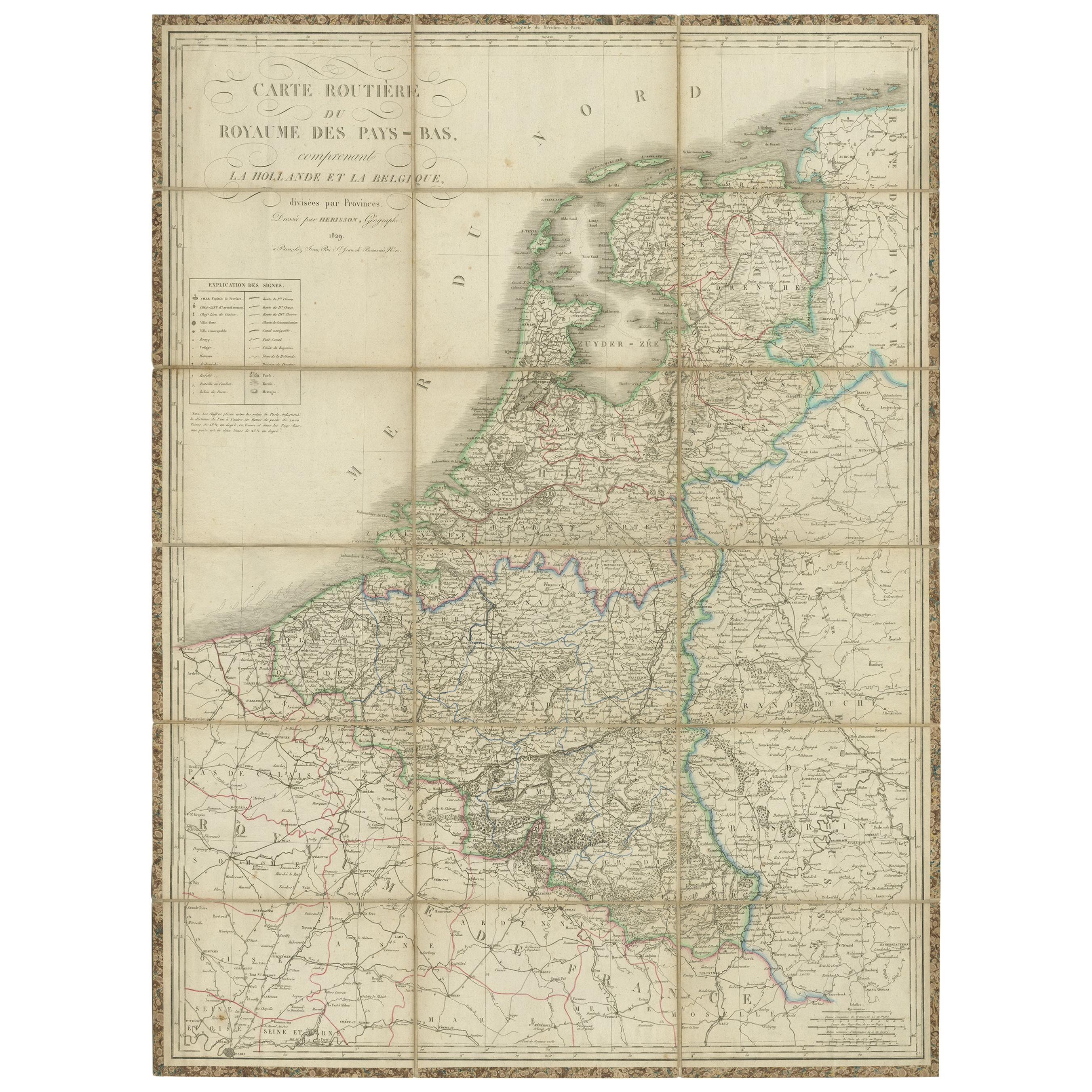
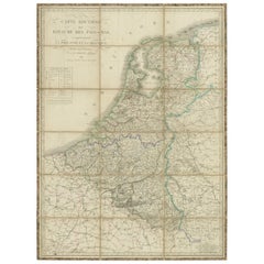
 - Antique Map of the Netherlands and Belgium by Hérisson, 1829Located in Langweer, NLFor your online catalogue, here is a detailed description of the antique map titled 'Carte Routière du Royaume des Pays-Bas comprenant la Hollande et la Belgique,' published by Eustache Hérisson in 1829: **Title**: 'Carte Routière du Royaume des Pays-Bas comprenant la Hollande et la Belgique' **Publisher**: Eustache Hérisson **Publication Year**: 1829 This original antique map is a detailed depiction of the Netherlands and Belgium, dating back to 1829. As a 'Carte Routière', it focuses on the road networks of the region, providing valuable historical insights into the transportation and geographical understanding of the early 19th century. The map's delineation of the Kingdom of the Netherlands, including both Holland and Belgium, is particularly noteworthy as it represents the political geography of the period shortly before Belgium's independence in 1830. The map is sectionalised and laid on linen, a common practice in the 19th century for preserving and reinforcing maps, making them more durable and portable. This method of mounting also suggests that the map was intended for practical use, possibly by travelers or for educational purposes. **Artist and Publisher**: Eustache Hérisson, the publisher of this map, was a known figure in the cartographic and publishing world of the early 19th century. His work is characterized by attention to detail and accuracy, making this map not only a beautiful piece of art but also a reliable historical document. This map is a valuable historical artifact, offering insights into the geographical and political landscape of the Netherlands...Category
Antique Mid-19th Century Maps
MaterialsPaper
 $655 Sale Price20% Off
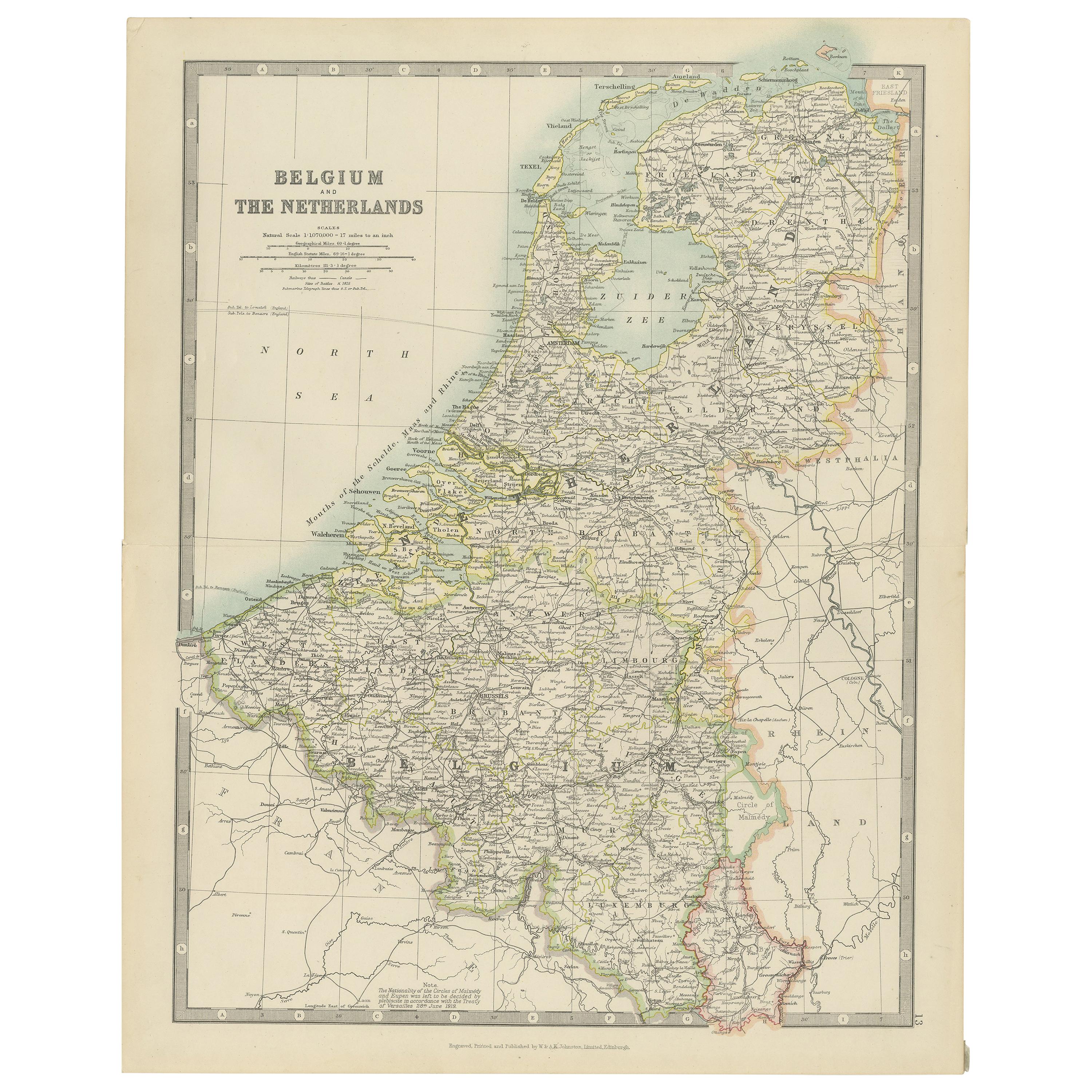
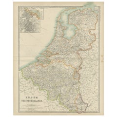
 - Antique Map of Belgium and the Netherlands by Johnston 'c.1920'Located in Langweer, NLAntique map titled 'Belgium and the Netherlands'. Original antique map of Belgium and the Netherlands. Published by W. & A.K. Johnston, circa 1920.Category
20th Century Maps
MaterialsPaper
 $131 Sale Price40% Off
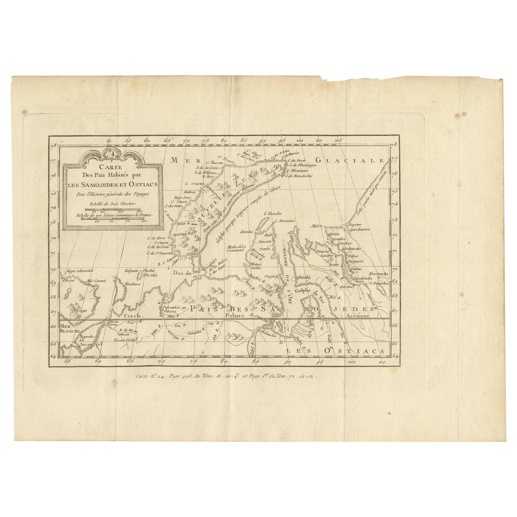
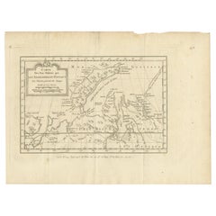
 - Antique Map of the Country Inhabited by the Samoyedic and Khanty People '1768'Located in Langweer, NLAntique map titled 'Carte des Païs Habités par les Samojedes et Ostiacs'. Original antique map of the country inhabited by the Samoyedic and Khanty (Ostyak) peoples. Engraved by J.N....Category
Antique Mid-18th Century Maps
MaterialsPaper
Recently Viewed
View AllMore Ways To Browse
Retro Maps Of The United States
James Martin Furniture
1987 Vintage Champagne
Bubble Champagne Glasses
John Lewis Glass
Retro Address Book
Aston Martin
John Lewis Vintage Furniture
James Blake
Champagne Bottle Jewelry
Aston Vintage
Vintage Bottle Illustration
Martini Glass Two
Spy Glass
Martini Glasses Large
Custom Vintage Maps
Vintage Style Martini Glasses
Ian Martin