Maps
9
to
9
9
9
9
48
34
15
9
7
6
5
4
4
2
1
1
1
9
9
9
8
7
Maps For Sale
Style: Baroque
Style: Rococo
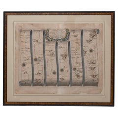
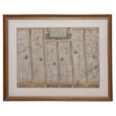
Road Map John Ogilby London St David's Britannia No 15 Abingdon Monmouth Framed
By John Ogilby
Located in BUNGAY, SUFFOLK
John Ogilby (British 1600-1676) Cosmographer and Geographick Printer to Charles II. A road map from Britannia, 1675/6. No 15.
The continuation of the r...
Category
1670s English Baroque Antique Maps
Materials
Paper
Map Road John Ogilby Britannia No 74 Ipswich to Norwich Cromer Framed
By John Ogilby
Located in BUNGAY, SUFFOLK
The Road from Ipswich com Suffolk to Norwich and thence to cromer on the sea coast com Norfolk. By John Ogilby, Esq, His Majesties Cosmographer. Containing...
Category
1670s English Baroque Antique Maps
Materials
Paper
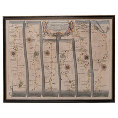
Road Map, John Ogilby, No 54, London, Yarmouth, Britannia
By John Ogilby
Located in BUNGAY, SUFFOLK
The Road from London to Yarmouth com. Norfolk. By John Ogilby, His Majesties Cosmographer. Containing 122 miles, 5 furlongs. No 54.
From Standard in Co...
Category
1670s English Baroque Antique Maps
Materials
Paper
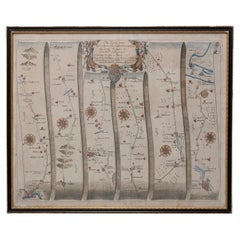
Road Map John Ogilby No 75 Kings Lyn Harwich, Britannia Framed Wallhanging
By John Ogilby
Located in BUNGAY, SUFFOLK
The Road from Kings Lyn Co Norfolk to Harwich Co Essex. By John Ogilby His Majesties Cosmographer. Containing 76 miles, 1 furlong.
From Lyn to Swaffam, to Stanford, to Thetford, To Icksworth, to Stowmarket, to Ipswich and to Harwich including ye Ferry, No 75, inscribed in pencil 1698
Hand colored and floated in the original black and gold frame, c1961. Some creasing commensurate with age. The back of the frame inscribed May 1961.
Provenance : Private Collection, acquired c1961, along with No 74 Ipswich to Norwich & No 54 London to Yarmouth. All in the original black and gold frames.
Sheet width 45cm., 17 ¾”., height 34.5cm., 13 ½“
Frame width 50cm 19 ¾”., height 40cm., 15 ¾”
Literature: In a remarkable life John Ogilby pursued, several careers, each ending in misfortune, and yet he always emerged undeterred, to carry on. His modern reputation is based on his final career, started in his sixty-sixth year, as a publisher of maps and geographical accounts.
Ogilby was born outside Dundee, in 1600, the son of a Scottish gentleman. While he was still a child, the family moved to London. When the elder Ogilby was imprisoned for debt, the young John invested his savings in a lottery, won a minor prize, and settled his father's debts. Unfortunately, not enough money was left to secure John a good apprenticeship; instead, he was apprenticed to a dance master. Ogilby was soon dancing in masques at court but, one day, while executing a particularly ambitious leap, he landed badly. The accident left him with a permanent limp, and ended his dancing career. However, he had come to the attention of Thomas Wentworth, later Earl of Strafford, Charles I's most senior minister. Ever one to exploit his contacts, Ogilby became a dance instructor in Strafford's household.
When Strafford was sent to Ireland, Ogilby accompanied him as Deputy-Master of the Kings Revels, and then Master of Revels. In Dublin, he built the New Theatre, in St. Werburgh Street, which prospered at first, but the Irish Rebellion, in 1641, cost Ogilby his fortune, which he estimated at £2,000, and almost his life. After brief service as a soldier, he returned to England, survived shipwreck on the way, and arrived back penniless.
On his return, Ogilby turned his attention to the Latin classics, as a translator and publisher. His first faltering attempt, in 1649, was a translation of the works of Virgil, but after his marriage to a wealthy widow the same year, his publishing activities received a considerable boost. One means by which Ogilby financed these volumes was by subscription, securing advance payments from his patrons, in return for including their name and coats-of-arms on the plates of illustrations. Another approach was to secure a patron, preferably in the court circle. Ogilby's first patron was Strafford, who found out too late that all leading ministers are dispensable when Charles I assented to his execution in 1641. As he re-established himself, Ogilby sought a new patron, the King himself.
In 1661, Ogilby was approached to write poetry for Charles II's coronation procession; he later published 'The Relation of His Majesties Entertainment Passing Through the City of London', and a much enlarged edition the following year, which included a Fine set of plates depicting the procession. Royal favour was bestowed in 1674 when John Ogilby received the title of 'His Majesty's Cosmographer and Geographick Printer' with a salary of £13.6s.8d per annum.
In 1665, Ogilby left London to avoid the Plague then ravaging the capital. The following year, in the Great Fire of London, Ogilby claimed that he lost his entire stock of books valued at some £3,000, as well as his shop and house, leaving him worth just £5.
As he sought to restore his fortunes, Ogilby was already looking in new directions. The initial opportunity he seized on was the reconstruction of London's burnt-out centre. He secured appointment as a 'sworn viewer', whose duty was to establish the property boundaries as they existed before the Fire. Ogilby was assisted in the project by his step-grandson, William Morgan...
Category
1670s European Baroque Antique Maps
Materials
Paper
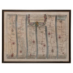
Road Map, John Ogilby, London, Barwick, York, Chester, Darlington, Durham Framed
By John Ogilby
Located in BUNGAY, SUFFOLK
The continuation of the road from London to Barwick beginning at York and extending to Chester in ye Street. Plate ye 4th continuing 76 ½ miles. No 8.
York to Burrowbridge, to Top...
Category
1670s English Baroque Antique Maps
Materials
Paper
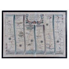
Map Road Strip Britannia Sheet 2 John Ogilby London Aberistwith Islip Bramyard
By John Ogilby
Located in BUNGAY, SUFFOLK
From John Ogilby's, 'Britannia, an Illustration of the Kingdom of
England and Dominion of Wales'. First published in 1675 it remains the greatest advance ...
Category
17th Century English Baroque Antique Maps
Materials
Paper
Buckingham Both Shyre and Shire John Speed 1610 Gilded Frame
Located in BUNGAY, SUFFOLK
Just purchased more information to follow.
In unrestored condition, the sheet can be cleaned.
Category
17th Century English Baroque Antique Maps
Materials
Paper
Map Holy Promise Land Canaan Richard Palmer Richard Blome 1687 Joseph Moxon
Located in BUNGAY, SUFFOLK
Canaan comonly called the Holy Land or the Land of Promise, being the Possesion of the Israelites & travelled through by Our Lord & Saviour Iesus Christ and his Apostles. Engraven by Richard Palmer for Richard Blome. 1687
Blome, Richard, 1641-1705. London. 283 x 452 mm. Copperplate.
Probably from an English Bible...
Category
17th Century British Baroque Antique Maps
Materials
Paper
Countye of Monmouth, Dated 1610
By John Speed
Located in BUNGAY, SUFFOLK
The countye of Monmouth with the situation of the townshire described Anno, 1610
The reverse with Monmouthshire, Chapter VI and an alphabetical list of towns.
In a beautiful Flemish oak polished and gilded frame
Cartographer: John Speed...
Category
1610s English Baroque Antique Maps
Materials
Paper
Related Items
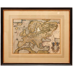
Antique Hand Colored Framed Map of Europe
Located in West Palm Beach, FL
Antique reproduction copied from an edition dated 1595 by Ortelius.
Category
Late 19th Century Antique Maps
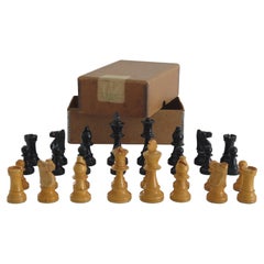
Weighted Club Chess Set Kings Staunton Pattern No. 5 Boxed, Circa 1930
Located in Lincoln, Lincolnshire
This is a very good, high quality vintage English handmade, boxwood "weighted" chess set club game of 32 pieces, Staunton Pattern No. 5 all in its original box and retailed by The British Chess...
Category
Early 20th Century British Victorian Maps
Materials
Hardwood
Jimmie Durham (Phaidon Contemporary Artists Series)
Located in New York City, NY
An updated edition of the first - and still most authoritative - book on the legendary American iconoclast
Twenty years ago, Phaidon published what has become the definitive study of Arkansas-born Jimmie Durham...
Category
21st Century and Contemporary Maps
Materials
Paper
Sotheby's London; The John Gielgud Collection, 2001
Located in valatie, NY
Sotheby's London; The John Gielgud Collection, 2001. London: Sotheby's, 2001. Soft cover. 216 pp. An auction catalogue for the property of the late Sir Jo...
Category
21st Century and Contemporary English Maps
Materials
Paper
Antique Map of the City of London by Balbi '1847'
Located in Langweer, NL
Antique map titled 'London'. Original antique map of the city of London. This map originates from 'Abrégé de Géographie (..)' by Adrien Balbi. Published 1847.
Category
Mid-19th Century Antique Maps
Materials
Paper
Antique Map of London by Tirion '1754'
Located in Langweer, NL
Antique map titled 'Kaart van Londen enz. en van het naby gelegen land ruim een Uur gaans rondsom dezelve Stad; getrokken uit de groote gemeeten Kaart van Hr. John Rocque'. In the se...
Category
Mid-18th Century Antique Maps
Materials
Paper
Antique Coaching Road Map, Devon, English, Regional Cartography, Georgian, 1720
Located in Hele, Devon, GB
This is an antique coaching road map of Devon. An English, framed lithograph engraving of regional interest, dating to the early 18th century and later.
Fascinating 18th century hig...
Category
Early 18th Century British Georgian Antique Maps
Materials
Wood
H 12.21 in W 9.65 in D 0.6 in
John Cary Travel Celestial Globe in Box Marked Cary & Co London, No. 21540
By John Cary
Located in GB
We are delighted to offer for sale this lovely John Cary Travel Celestial Globe in Box marked Cary & Co London, No. 21540
This globe I believe is classed as a 14 inch which is the...
Category
19th Century English Victorian Antique Maps
Materials
Brass
H 8.47 in W 8.08 in D 8.08 in
17th Century John Speed Map of Denbighshire, c.1610
By John Speed
Located in Royal Tunbridge Wells, Kent
Antique early 17th century British very rare and original John Speed, hand coloured map of Denbighshire, dated 1610, by John Sunbury and George Humble. John...
Category
17th Century British Antique Maps
Materials
Wood, Paper
Vintage Road Map of the Netherlands '1928'
Located in Langweer, NL
Vintage map titled 'Volgens het vijfjarig Werkplan te verbeteren Rijkswegen en nieuw aan te leggen wegen welke voorkomen op het Rijkswegenplan'. Map of the Netherlands...
Category
20th Century Maps
Materials
Paper
Large Antique Map of New York State with Inset Maps
Located in Langweer, NL
Antique map titled 'Johnson's New York' Large map of New York State. With insets of Albany, Oswego, Buffalo, Rochester, Syracuse, Troy and NYC. Published by Johnson and Browning, 186...
Category
Mid-19th Century Antique Maps
Materials
Paper
EXQUISiTE 54.5CM CONCORDE AQUILA WORLD CHAMPION 1990 ROAD BIKE CAMPAGNOLO CHORUS
Located in GB
Royal House Antiques
Royal House Antiques is delighted to offer for sale this stunning Concorde Aquila World Champion 1990 54.5cm Road bike with full Campagnolo Chorus Groupset in exquisite condition throughout
HISTORY
I am selling my entire bike collection which comprises of 16 bikes, all luxury high end pieces, there are Colnagos, Cervelo’s, Lemon’s, Specialized, with Carbon Titanium or Columbus steel frames and some of the most expensive parts in the world, there are also some frames, again Titanium and Colnago, Bianchi etc, some wheels Zipp 303’s, Campaganolo Hyperion carbons etc, and then a few parts. I also have a NOS in the case Dura Ace 25th Anniversary groupset. These are all that is left over from my bike shop, I have kept them for years hanging around my furniture workshop as pieces of art and to remember the good old days, my new warehouse doesn’t have the same hanging space so these all need to go!
DESCRIPTION
This bike is pretty much the finest example of this bike you will ever seen, it is factory original down to the pedals with a complete 1990 Campagnolo Chorus groupset, I was offered quite a chunk of change for the groupset from a friend building a 90's Arabesque but I said no, the bike is totally original and should stay as such
SPECIFICATION
FRAME FORKS & HEADSET:- Aquila Columbus SLX World Champion 1990 steel, top tube 55.5cm C-T-C, seat post tube 52.5cm C-T-C, 54cm C-T-T head tube 112mm, headset Campagnolo Chorus
WHEELSET:- Campagnolo Chorus front and rear hubs and skewers with Campagnolo Ypsilon Straded Oxide rims, tyres Continental Gran Prix...
Category
1990s Other Maps
Materials
Steel
H 21.46 in W 0.4 in D 0.4 in
Previously Available Items
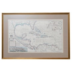
West-Indies Herman Moll William Paterson Spanish Trade Routes Gold
By Herman Moll
Located in BUNGAY, SUFFOLK
A rare map of the West-Indies or the islands of America in the North Sea with ye adjacent countries explaining what belongs to Spain, England, France, Holland &c also ye Trade Winds and ye several Tracts made by ye Galeons and flota from place to place.
Wil Paterson this map of the West-Indies is most humbly dedicated by Her. Moll geographer.
According to ye newest and most exact observations by Herman Moll Geographer.
Map of the Caribbean islands including southern North America, Mexico, Central America, and northern South America.
Inset at lower left: The City of Mexico in New Spain. Derived from a view in an unpublished atlas by Johannes Vingboons 1628. This image was probably copied from a map by Juan Gomez de Trasmonte, supervisor of the construction of a drainage system for Mexico city in 1628. Kagan, Urban images of the Hispanic world, fig. 4.23
Insets at upper right: La Vera Cruz; A Draught of the Bay and Citty of Havana Cuba; The Bay of Porto Bella; A Draught of ye Citty of Cartagena; A Draught of St. Augustin Saint Augustine, Florida.
Artist : Herman Moll d. 1732.
Bibliography : A new and compleat atlas, London, 1708-1720 Hermand Moll.
Provenance: Private collection.
In a buff mount and gilded frame with green highlight. Maps are generally framed in insigificant frames so that the attention is soley on the map. This map could easily be reframed depending on how and where it will be hung and there are many different choices.
Frame size height 56 cm., 22" length 84 cm., 33".
This is a map that reveals Moll both as an astute political observer and thinker, and tactian. This map of the West Indies is full of commercially sensitive information about the Spanish gold runs, and it is entirely feasible that the map was deliberately suited as a guide to English piracy and privateering in the West Indies. Through his London connections, Moll knew of two prominent English pirates or privateers: Woodes Rogers and William Dampier...
Category
18th Century Central American Baroque Antique Maps
Materials
Paper
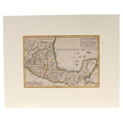
Antique 18th Century Map of Mexico and Central America by Robert DeVaugody
Located in Philadelphia, PA
A fine antique printed & hand colored map.
By Robert DeVaugody,
Published in the Atlas Portrait Universel, Paris, 1749
Matted and ready for framing.
Simply a wonderful 18th Century Mexican map...
Category
1740s French Baroque Antique Maps
Materials
Paper
H 11.5 in W 14.5 in D 0.13 in
Antique Framed Hand Colored Map of the Americas by Frederick De Wit, circa 1675
Located in Morristown, NJ
Frederick De Wit (Dutch, 1629-1706), "Novissima et Accuratissima totius Americae Descriptio", hand-colored map engraving of North and South America with California depicted as an island, decorated with images of Native Americans and indigenous flora and fauna, framed under glass, 19.5"h x 23"l (sheet), 22.5"h x 1.75"d x 26"w (frame), From the collection of an NY corporation.
A fine example of De Wit’s map of the Americas, first published ca. 1675. This map is fascinating. It was the first Dutch map to include all five Great Lakes; Lac Superieur (Lake Superior), Lac des Puans (Lake Michigan), Mare Dulce (Lake Huron...
Category
1670s Dutch Baroque Antique Maps
Materials
Glass, Wood, Giltwood, Paint, Paper
H 22.5 in W 26 in D 1.75 in
Celestial Maps, Set of Four, Ignace Gaston Pardies
By Ignace Gaston Pardies
Located in Pasadena, CA
This is a rare set of four of a complete set of six 17th century Gaston Ignace Pardies*** (1636-1673) Celestial Maps. The folios were colored contemporan...
Category
17th Century French Baroque Antique Maps
Materials
Paper
Hand-Colored Astronomical Engravings by Louis Charles Desnos, 1766
By Louis Charles Desnos
Located in Kinderhook, NY
Collection of three hand-colored astronomical map engravings illustrating celestial spheres in ornate rococo borders by Louis Brion de la Tour (1743-...
Category
Mid-18th Century French Rococo Antique Maps
Materials
Glass, Wood, Paper
Rare 17th Century American Map of Virginia and Florida by Jan Janssonius
Located in Wiscasset, ME
In the 1630s, Janssonius formed a partnership with his brother in law Henricus Hondius, and together they published atlases as Mercator/Hondius/Janssonius. Under the leadership of Ja...
Category
18th Century and Earlier Dutch Rococo Antique Maps
H 25.25 in W 30.25 in D 2 in
Recently Viewed
View AllMore Ways To Browse
Antique Sailing Map
Antique Sailing Maps
Bay Area Antique Furniture
West Coat Of Arms
Greek Asia Minor
Hemisphere World Map
Speed Map
Antique Maps Canada
Antique Map Canada
Canada Antique Map
Malaysian Antique
West Indies Map
Blaeu World Map
Charing Cross
Antique Maps Of Canada
Bali Map
Antique Portuguese Plates
Map Of Brazil
