Maps
2
to
1
1
1
2
2
2
48
34
16
9
7
6
5
4
4
2
1
1
1
2
1
1
2
1
1
1
1
1
Maps For Sale
Style: Folk Art
Style: Rococo
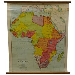
Large University Chart “Physical Map of Africa” by Bacon
Located in Chillerton, Isle of Wight
Large university chart “Physical Map of Africa” by Bacon
W&A K Johnston’s Charts of Physical Maps By G W Bacon,
This is colorful Physical map of North America, it is large lithograph set...
Category
Early 20th Century Folk Art Maps
Materials
Linen
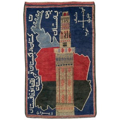
Vintage Afghan Pictorial Map Rug
Located in New York, NY
A vintage Afghan Pictorial map rug from the mid-20th century.
Measures: 3' 0" x 4' 10"
Category
Mid-20th Century Afghan Folk Art Maps
Materials
Wool
Related Items
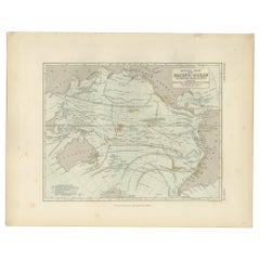
Antique Physical Chart of the Pacific Ocean by Johnston, '1850'
Located in Langweer, NL
Antique map titled 'Physical Chart of the Pacific Ocean showing the currents and temperature of the ocean'. Original antique chart of the Pacific Ocean. This map originates from 'The...
Category
Mid-19th Century Antique Maps
Materials
Paper
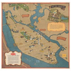
Pictorial Vintage Map of New York City Showing Numerous Landmarks, 1939
Located in Langweer, NL
This pictorial souvenir map focuses on New York City and the site of the 1939 World's Fair. It was drawn by graphic artist George Annand and published by Sinclair Oil...
Category
1930s Vintage Maps
Materials
Paper
Bobyrug’s Vintage Baluch Afghan Rug
Located in Saint Ouen, FR
Nice little Turkmen Baluch rug with geometrical design and beautiful colors, entirely and finely hand knotted with wool velvet on wool foundation.
✨✨✨
"Experience the epitome of lux...
Category
Mid-20th Century Afghan Tribal Maps
Materials
Wool
Tibetan Pictorial Rug
Located in New York, NY
Scatter size Pictorial Motif Tibetan rug from the 2nd quarter of the 20th century.
Measure: 3'5'' x 5'6''.
Category
1930s Folk Art Vintage Maps
Materials
Wool
Vintage Baluch Afghan Rug
Located in Saint Ouen, FR
Beautiful Turkmen Baluch Afghan rug, with a geometrical design and red and black colors, entirely hand knotted with wool velvet on wool foundation.
Category
Mid-20th Century Tribal Maps
Materials
Wool
Blue Chinese Animal Pictorial Rug
Located in New York, NY
An early 20th-century Chinese Pictorial rug with an animal motif in light blue, navy and ivory
Measures: 2'3' x 4'5''.
Category
Early 20th Century Chinese Folk Art Maps
Materials
Wool
Large Rollable Map Central America Northern South America Wall Chart Poster
Located in Berghuelen, DE
A fantastic pull-down wall chart depicting a map of Central America and Northern South America. Used as teaching material in German schools. Colorful print on paper reinforced with c...
Category
Mid-20th Century German Country Maps
Materials
Canvas, Wood, Paper
H 60.24 in W 96.86 in D 0.79 in
Vintage Afghan Tribal Kilim Rug
Located in Miami, FL
An approximately 16 x 10 handwoven Kilim rug made of vegetable dyed hand spun wool. A peachy pastel pink background features yellow, blue, off-white, gray and brown geometric and tri...
Category
20th Century Afghan Kilim Maps
Materials
Wool
Little Vintage Baluch Afghan Rug
Located in Saint Ouen, FR
Nice tribal Baluch Afghan rug with geometrical design and nice colors, entirely hand knotted with wool velvet on wool foundation.
Category
Mid-20th Century Afghan Tribal Maps
Materials
Wool
East German Map
By VEB Hermann Haack
Located in Baltimore, MD
A brilliantly colourful map of the Leipzig, Karl Marx Stadt and Dresden area in the former German Democratic Republic by VEB Hermann Haack of Gotha.
Category
1970s German Vintage Maps
Set of 10 Large Scale Vintage Maps of The United Kingdom, circa 1900
Located in St Annes, Lancashire
Great set of maps of the UK
Lithographs. By John Bartholomew & Co.
Published by The Edinburgh Geographical Institute
Unframed.
The measurement ...
Category
Early 1900s English Antique Maps
Materials
Paper
No Reserve
H 18 in W 23.5 in D 0.13 in
Medical Anatomy Chart Titled 'Thin Man'
Located in Hamilton, Ontario
This is a fantastic double-sided anatomy chart with four separate overlays showing the human body in various layers. Titled the Thin Man this piece was p...
Category
Mid-20th Century American Maps
Previously Available Items
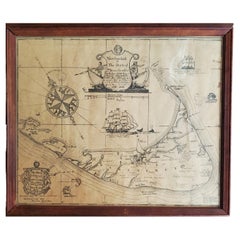
Map of Nantucket by Austin Strong '1881-1952', circa 1925
Located in Nantucket, MA
Map of Nantucket by Austin Strong (1881 - 1952), circa 1925, an original print on paper whimsical map of Nantucket Island by Robert Louis Stevenson's...
Category
1920s American Folk Art Vintage Maps
Materials
Paper
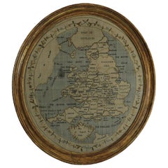
Georgian Map of UK Sampler by Elizabeth Kifft, 1797
Located in Chelmsford, Essex
1797 England & Wales Map Sampler by Elizabeth Kifft, Leacock School. The sampler is worked in silk on linen ground, in a variety of stitches. Meandering floral border. Titled, 'Map o...
Category
1790s English Folk Art Antique Maps
Materials
Linen, Silk
Rare Chart of the Caribbean Islands Published by James Imray & Son, London, 1866
Located in Stamford, CT
Rare chart of the Caribbean Islands published by James Imray & Son, London, 1866.
FW 1370.
Category
Mid-19th Century English Folk Art Antique Maps
Materials
Paper
H 44 in W 30 in D 1.5 in
Hand-Colored Astronomical Engravings by Louis Charles Desnos, 1766
By Louis Charles Desnos
Located in Kinderhook, NY
Collection of three hand-colored astronomical map engravings illustrating celestial spheres in ornate rococo borders by Louis Brion de la Tour (1743-...
Category
Mid-18th Century French Rococo Antique Maps
Materials
Glass, Wood, Paper
Rare 17th Century American Map of Virginia and Florida by Jan Janssonius
Located in Wiscasset, ME
In the 1630s, Janssonius formed a partnership with his brother in law Henricus Hondius, and together they published atlases as Mercator/Hondius/Janssonius. Under the leadership of Ja...
Category
18th Century and Earlier Dutch Rococo Antique Maps
H 25.25 in W 30.25 in D 2 in
Recently Viewed
View AllMore Ways To Browse
Antique Sailing Map
Antique Sailing Maps
Bay Area Antique Furniture
West Coat Of Arms
Greek Asia Minor
Hemisphere World Map
Speed Map
Antique Maps Canada
Antique Map Canada
Canada Antique Map
Malaysian Antique
West Indies Map
Blaeu World Map
Charing Cross
Antique Maps Of Canada
Bali Map
Antique Portuguese Plates
Map Of Brazil
