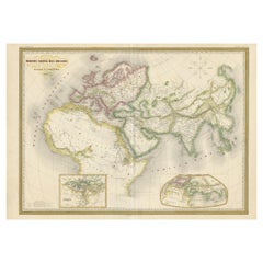
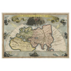
Antique Map of the Ancient World 'c.1860'
View Similar Items


Want more images or videos?
Request additional images or videos from the seller
1 of 5
Antique Map of the Ancient World 'c.1860'
About the Item
- Dimensions:Height: 24.02 in (61 cm)Width: 33.08 in (84 cm)Depth: 0.02 in (0.5 mm)
- Materials and Techniques:
- Period:
- Date of Manufacture:circa 1860
- Condition:General age-related toning. Original folding line. Blank verso. Please study image carefully.
- Seller Location:Langweer, NL
- Reference Number:Seller: BG-12996-11stDibs: LU3054324425042
About the Seller
5.0
Platinum Seller
These expertly vetted sellers are 1stDibs' most experienced sellers and are rated highest by our customers.
Established in 2009
1stDibs seller since 2017
1,947 sales on 1stDibs
More From This SellerView All
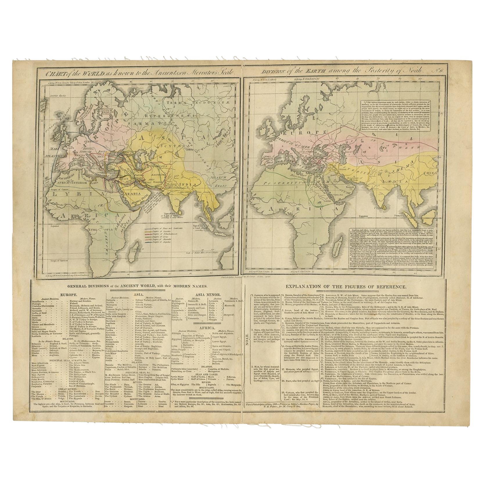
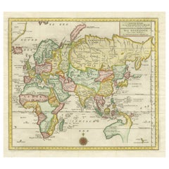
- Maps of the Ancient World and the Posterity of Noah, 1820Located in Langweer, NLTwo maps on one sheet. Hhand colored engraved lithograph, depicting the world as known to the Ancients on Mercator's projection and the Posterity of Noah. The first showns the Empire...Category
Antique 19th Century Prints
MaterialsPaper
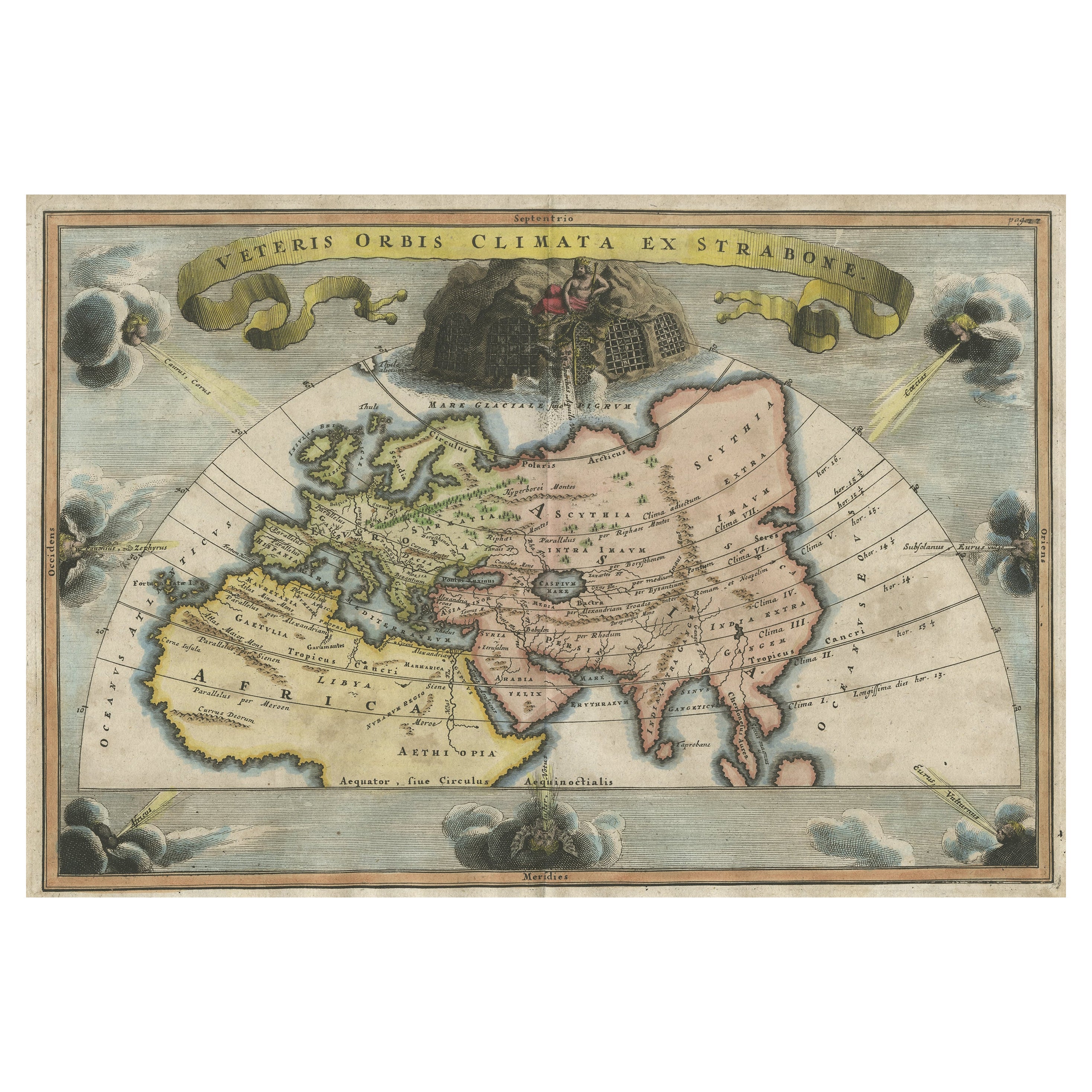
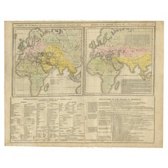
- Decorative Ancient World Map with Large Parts of the World Still Unknown, c 1731Located in Langweer, NLInteresting ancient map of the world, based upon Strabo. The Southern tip of Africa is undiscovered. No sign of Japan, the Korean Peninsula or Australia and Oceana. Excellent NE Pass...Category
Antique 1730s Maps
MaterialsPaper
 $395 Sale Price20% Off
 - Antique Map of the Eastern Part of the WorldLocated in Langweer, NLAntique map titled 'Nieuwe Kaart van het Oostelykste Deel der Weereld, diendende tot aanwyzing van de Scheepstogten der Nederlanderen Naar Oostindie'. This finely engraved map of the...Category
Antique Mid-18th Century Maps
MaterialsPaper
- Antique Map of the World by Balbi '1847'Located in Langweer, NLAntique map titled 'Planisphère'. Original antique map of the world. This map originates from 'Abrégé de Géographie (..)' by Adrien Balbi. Pub...Category
Antique Mid-19th Century Maps
MaterialsPaper
 $219 Sale Price20% Off
 - Antique Map of the World by A. Vuillemin, 1854By Victor LevasseurLocated in Langweer, NLThis map originates from ‘Atlas National de la France Illustré’. Published by A. Combette, Paris, 1854.Category
Antique Mid-19th Century Maps
MaterialsPaper
 $308 Sale Price25% Off
 - Antique Map of the World by Ferrario '1831'Located in Langweer, NLOriginal antique map of the world. This print originates from 'Costume Antico e Moderno: Palestine, China, India, Oceania' by Ferrario. Publis...Category
Antique Mid-19th Century Prints
MaterialsPaper
 $175 Sale Price20% Off
You May Also Like
- Original Antique Map of The World by Thomas Clerk, 1817Located in St Annes, LancashireGreat map of The Eastern and Western Hemispheres On 2 sheets Copper-plate engraving Drawn and engraved by Thomas Clerk, Edinburgh. Published by Mackenzie And Dent, 1817 ...Category
Antique 1810s English Maps
MaterialsPaper
- Original Antique Map of Ancient Greece, Achaia, Corinth, 1786Located in St Annes, LancashireGreat map of Ancient Greece. Showing the region of Thessaly, including Mount Olympus Drawn by J.D. Barbie Du Bocage Copper plate engraving by P.F Tardieu Original hand color...Category
Antique 1780s French Other Maps
MaterialsPaper
- Original Antique Map of Ancient Greece- Boeotia, Thebes, 1787Located in St Annes, LancashireGreat map of Ancient Greece. Showing the region of Boeotia, including Thebes Drawn by J.D. Barbie Du Bocage Copper plate engraving by P.F T...Category
Antique 1780s French Other Maps
MaterialsPaper
- Original Antique Map of Ancient Greece, Phocis, Gulf of Corinth, 1787Located in St Annes, LancashireGreat map of Ancient Greece. Showing the region of Phocis, including the Gulf of Corinth Drawn by J.D. Barbie Du Bocage Copper plate engraving by P.F Tardieu Original hand c...Category
Antique 1780s French Other Maps
MaterialsPaper
- Map of the Republic of GenoaLocated in New York, NYFramed antique hand-coloured map of the Republic of Genoa including the duchies of Mantua, Modena, and Parma. Europe, late 18th century. Dimension: 25...Category
Antique Late 18th Century European Maps
- Antique Map of Principality of MonacoBy Antonio Vallardi EditoreLocated in Alessandria, PiemonteST/619 - "Old Geographical Atlas of Italy - Topographic map of ex-Principality of Monaco" - ediz Vallardi - Milano - A somewhat special edition ---Category
Antique Late 19th Century Italian Other Prints
MaterialsPaper
 $228 Sale Price74% Off


