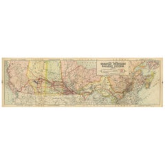
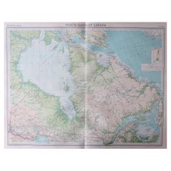
Antique Map of the Canadian Northern Railway, 1911
View Similar Items


Want more images or videos?
Request additional images or videos from the seller
1 of 5
Antique Map of the Canadian Northern Railway, 1911
About the Item
- Dimensions:Height: 10.83 in (27.5 cm)Width: 34.65 in (88 cm)Depth: 0.02 in (0.5 mm)
- Materials and Techniques:
- Period:
- Date of Manufacture:1911
- Condition:Splits on folding lines. General age-related toning, blank verso. Repaired tear in British Colombia, please study images carefully.
- Seller Location:Langweer, NL
- Reference Number:Seller: BG-12367-51stDibs: LU3054317689171
About the Seller
5.0
Platinum Seller
These expertly vetted sellers are 1stDibs' most experienced sellers and are rated highest by our customers.
Established in 2009
1stDibs seller since 2017
1,933 sales on 1stDibs
More From This SellerView All
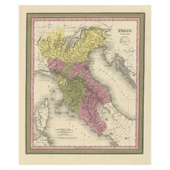
- Old Antique Colourful Decorative Map of Northern Italy, 1846Located in Langweer, NLDescription: Antique map titled 'Italy North Part'. Old map of Northern Italy. This map originates from 'A New Universal Atlas Containing Maps of the various Empires, Kingdoms, S...Category
Antique 1840s Maps
MaterialsPaper
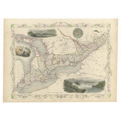
- Beautiful Decorative Hand-Colored Antique Map of West Canada, 1851Located in Langweer, NLDescription: Antique map of Canada titled 'West Canada'. With decorative vignettes titled Kingston and Falls of Niagara. Originates from 'The Illustrated Atlas, And Modern History Of The World Geographical, Political, Commercial & Statistical, Edited By R. Montgomery Martin'. Published; John Tallis London, New York, Edinburgh & Dublin. 1851. Drawn and Engraved by J. Rapkin. Artists and Engravers: John Tallis (1817-1876) was a British map...Category
Antique 1850s Maps
MaterialsPaper
- Antique Map of the Region Near the Gulf of Zula, 1870Located in Langweer, NLAntique map titled 'Map of the Country between Annesley Bay and the Plain of Salt'. Lithographed map of the region near the Gulf of Zula, also known as Annesley Bay, Baia di Arafali ...Category
Antique Mid-19th Century Maps
MaterialsPaper
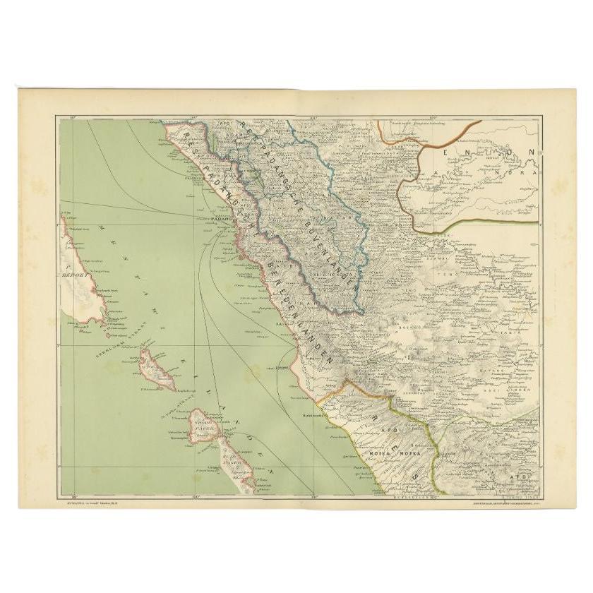
- Antique Map of the Mentawai Islands, Sumatra, 1900Located in Langweer, NLAntique map of the Mentawai Islands, Sumatra. Also depicting the region of Padang. This map originates from 'Atlas van Nederlandsch Oost- en West-Indië' by I. Dornseiffen. Artists ...Category
20th Century Maps
MaterialsPaper
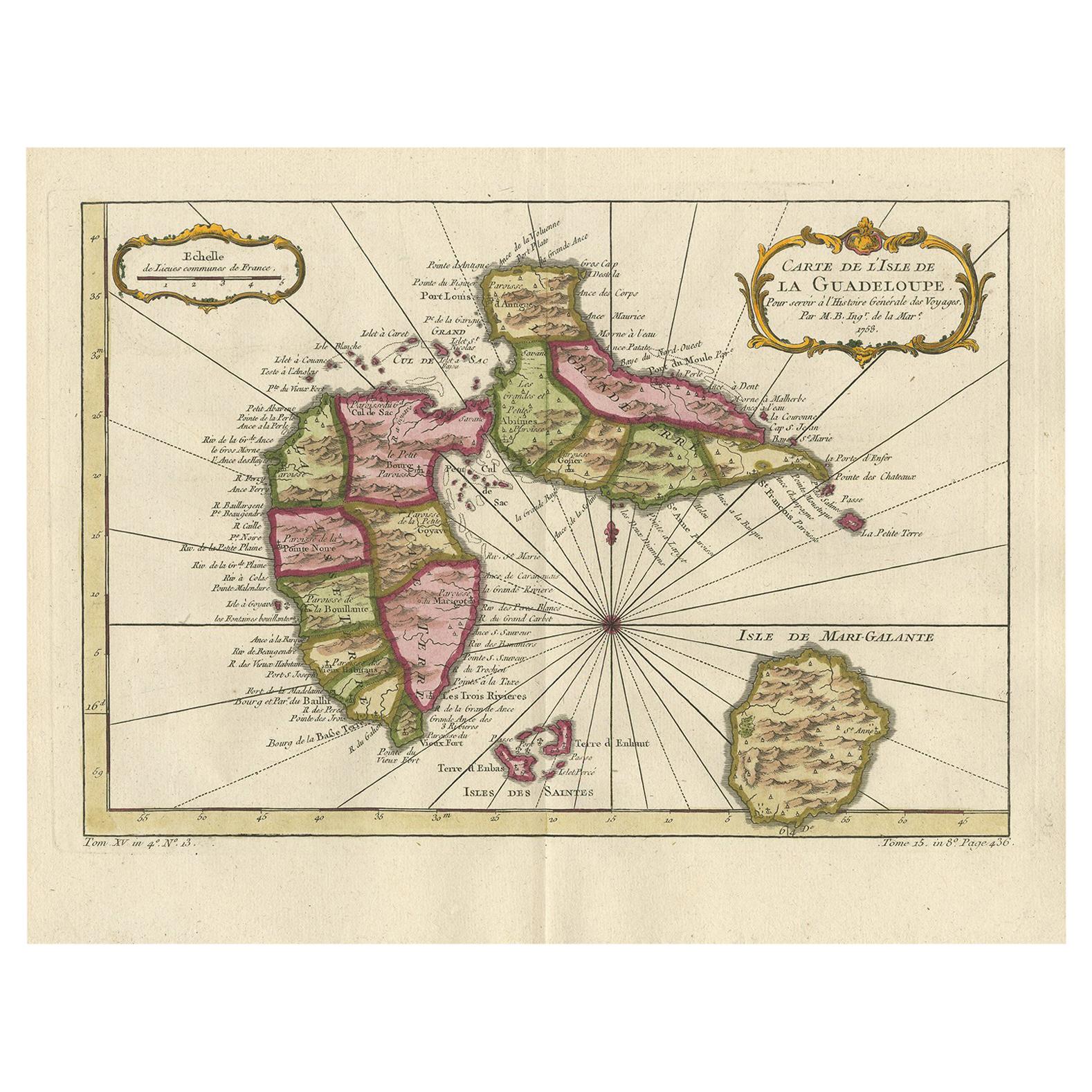
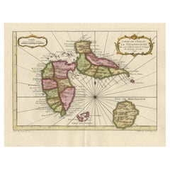
- Antique Map of Guadelupe in the Caribbean, 1759By Jacques-Nicolas BellinLocated in Langweer, NLAntique map titled 'Carte De L'Isle De La Guadeloupe'. Detailed map of Guadalupe, Mari-Galante and the Isles de Saintes. Produced by Nichlas Bellin for Prevost d'Exiles influential t...Category
Antique Mid-18th Century French Maps
MaterialsPaper
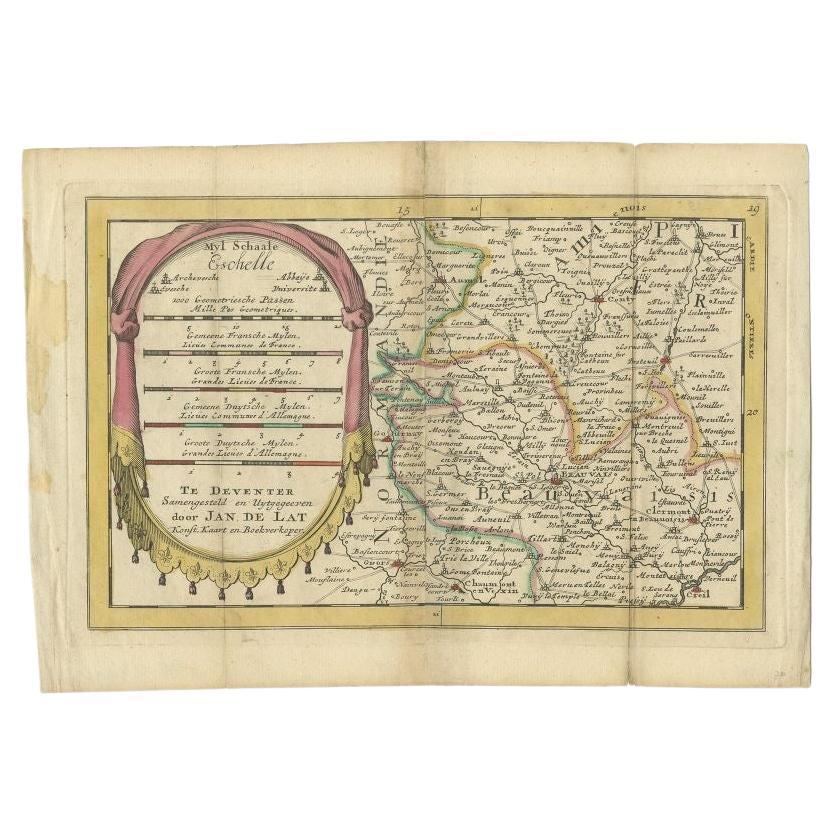
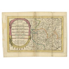
- Antique Map of the Region of Beauvais in France, 1737Located in Langweer, NLUntitled map of the region of Beauvais, France. This map originates from 'Nieuw en beknopt Kaart-Boekje vertoonende de XVII. Nederlandse Provintien (..)'. Artists and Engravers: Au...Category
Antique 18th Century Maps
MaterialsPaper


You May Also Like
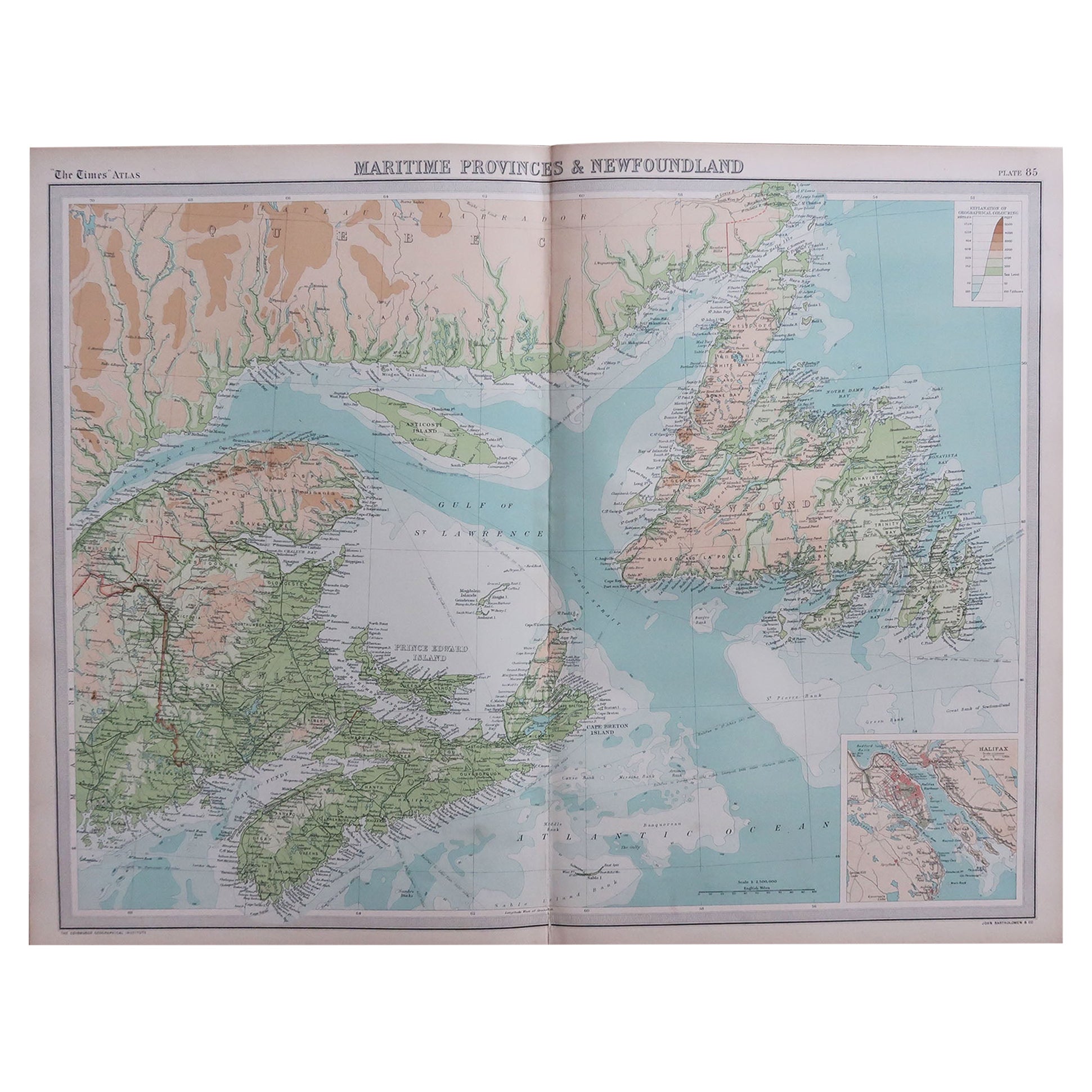
- Large Original Vintage Map of the Maritimes, Canada, circa 1920Located in St Annes, LancashireGreat map of The Maritime provinces Unframed Original color By John Bartholomew and Co. Edinburgh Geographical Institute Published, circa 1920 Free shipping.Category
Vintage 1920s British Maps
MaterialsPaper
- Large Original Vintage Map of the Great Lakes, Canada, circa 1920Located in St Annes, LancashireGreat map of The Great Lakes. Unframed. Original color. By John Bartholomew and Co. Edinburgh Geographical Institute Published, circa 1920 ...Category
Vintage 1920s British Maps
MaterialsPaper
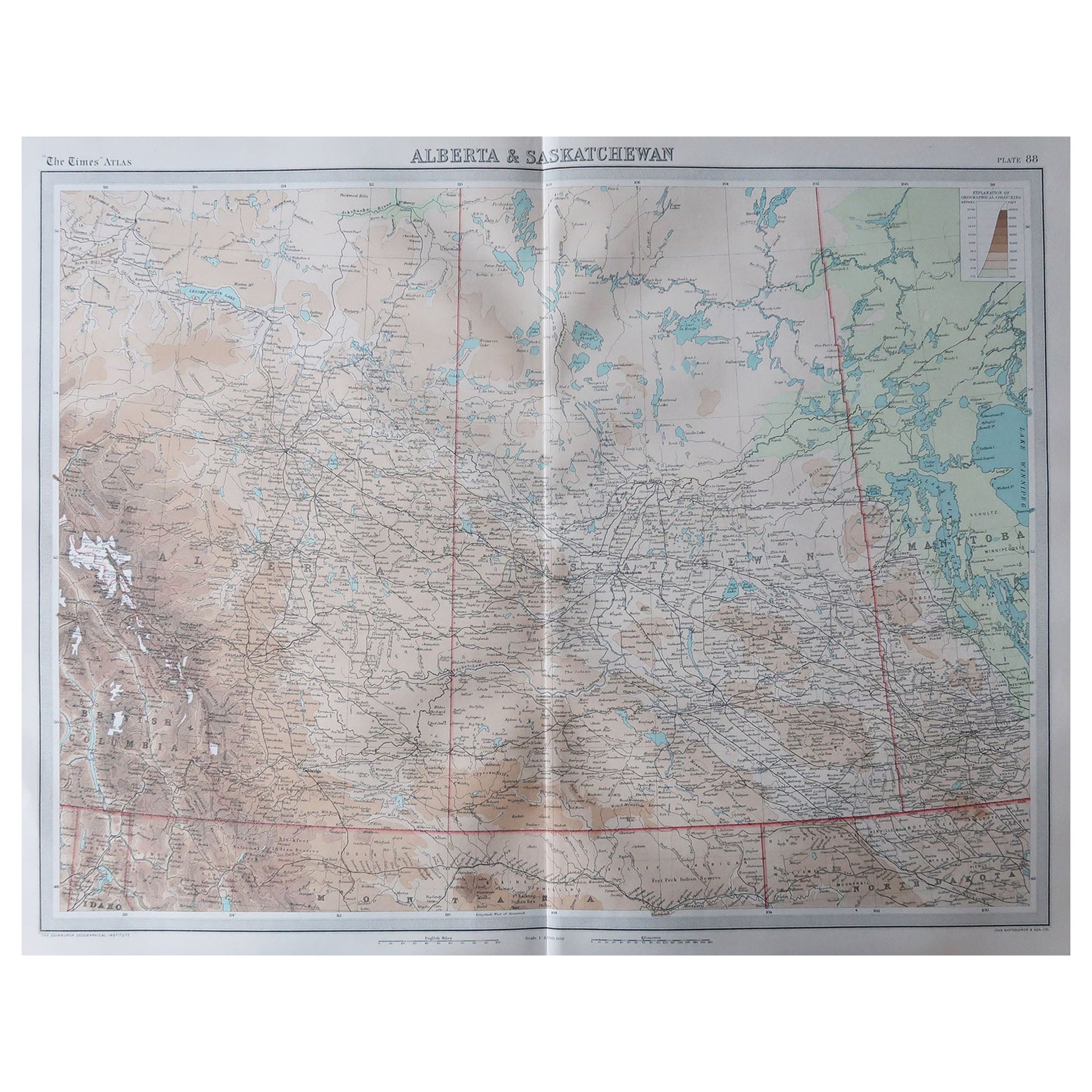
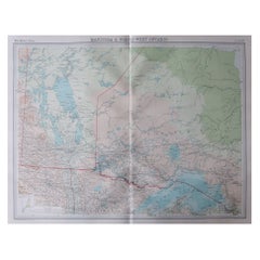
- Large Original Vintage Map of Alberta & Saskatchewan, Canada, C.1920Located in St Annes, LancashireGreat maps of Alberta and Saskatchewan Unframed Original color By John Bartholomew and Co. Edinburgh Geographical Institute Published, circa 1920 Free shipping.Category
Vintage 1920s British Maps
MaterialsPaper
- Large Original Vintage Map of Manitoba, Canada, circa 1920Located in St Annes, LancashireGreat map of Manitoba and part of Ontario Unframed Original color By John Bartholomew and Co. Edinburgh Geographical Institute Published, circa 1920 Free shipping.Category
Vintage 1920s British Maps
MaterialsPaper
- Large Original Vintage Map of Western Canada, circa 1920Located in St Annes, LancashireGreat map of Western Canada Unframed Original color By John Bartholomew and Co. Edinburgh Geographical Institute Published, circa 1920 Fr...Category
Vintage 1920s British Maps
MaterialsPaper
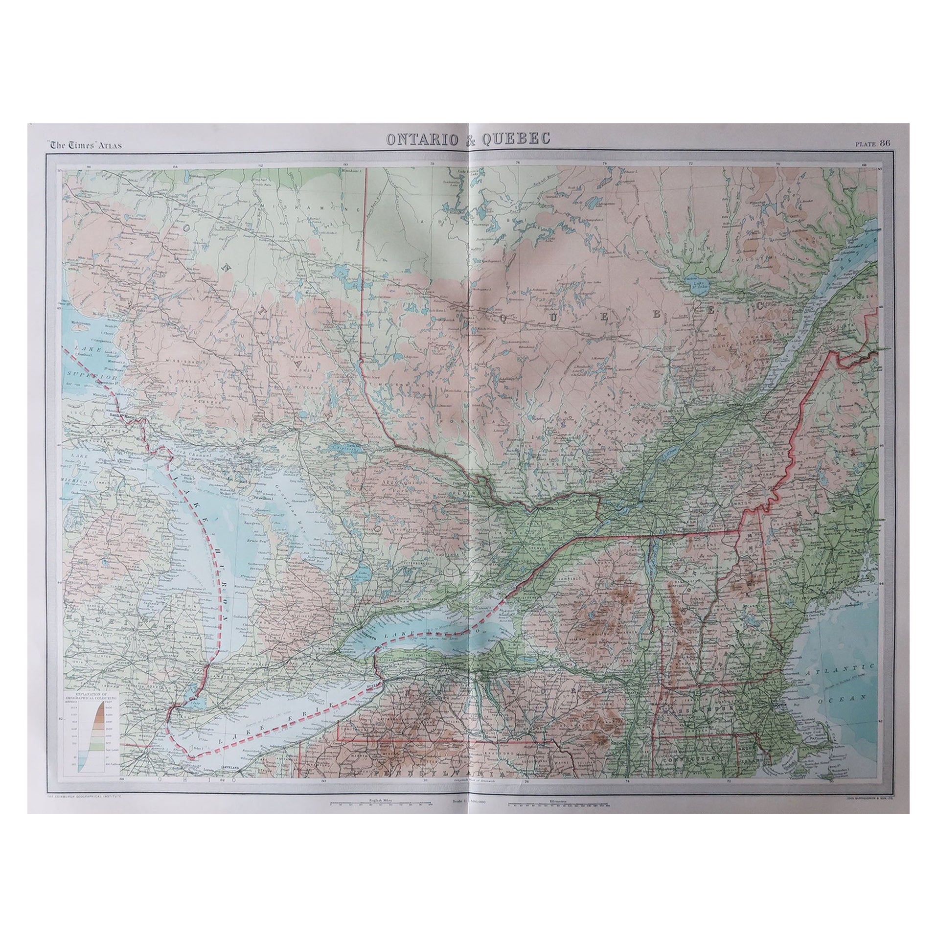
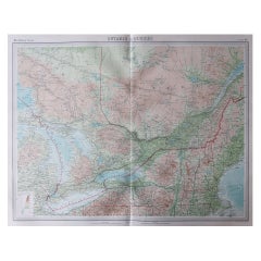
- Large Original Vintage Map of Quebec & Ontario, Canada, circa 1920Located in St Annes, LancashireGreat map of Quebec and Ontario. Unframed Original color By John Bartholomew and Co. Edinburgh Geographical Institute Published, circa 1920 ...Category
Vintage 1920s British Maps
MaterialsPaper


Recently Viewed
View AllMore Ways To Browse
Antique Furniture Ontario Canada
Map Of Canada
Antique Railroad Maps
Map Railroad
Used Furniture Nova Scotia
Antique Maps Canada
Antique Map Canada
Antique New Brunswick
Canada Antique Map
Antique Maps Of Canada
Used Furniture Alberta
Antique Furniture Nova Scotia Furniture
Nova Scotia Antique Furniture
Antique Nova Scotia Furniture
Antique Furniture Furniture Nova Scotia
Antique Furniture Nova Scotia
Antique Alberta
Antique Furniture New Brunswick