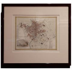
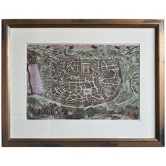
Antique Map of the City of Rome by Dower 'circa 1836'
View Similar Items


Want more images or videos?
Request additional images or videos from the seller
1 of 5
Antique Map of the City of Rome by Dower 'circa 1836'
About the Item
- Dimensions:Height: 15.16 in (38.5 cm)Width: 16.93 in (43 cm)Depth: 0.6 in (1.5 cm)
- Materials and Techniques:
- Period:
- Date of Manufacture:circa 1836
- Condition:General age-related toning, original folding line. Frame included, lightly used. Please study images carefully.
- Seller Location:Langweer, NL
- Reference Number:Seller: BG-073001stDibs: LU3054321451232
About the Seller
5.0
Platinum Seller
These expertly vetted sellers are 1stDibs' most experienced sellers and are rated highest by our customers.
Established in 2009
1stDibs seller since 2017
1,946 sales on 1stDibs
More From This SellerView All
- Antique Map of South America by Dower, ‘circa 1845’Located in Langweer, NLAntique map titled 'South America'. Old map of South America. Published by Orr & Company, Amen Corner, Paternoster Row, London.Category
Antique Mid-19th Century Maps
MaterialsPaper
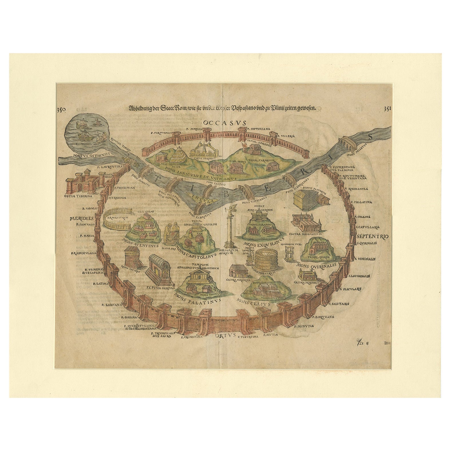
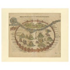
- Antique Print of the City of Rome, Italy by Münster, C.1580Located in Langweer, NLAntique print titled 'Abbildung der Statt Rom/wie sie under Keyser Vespasiano und zu Plinii zeiten gewesen'. Woodcut of ancient Rome. This print originates from Munster's Cosmographi...Category
Antique 16th Century Prints
MaterialsPaper
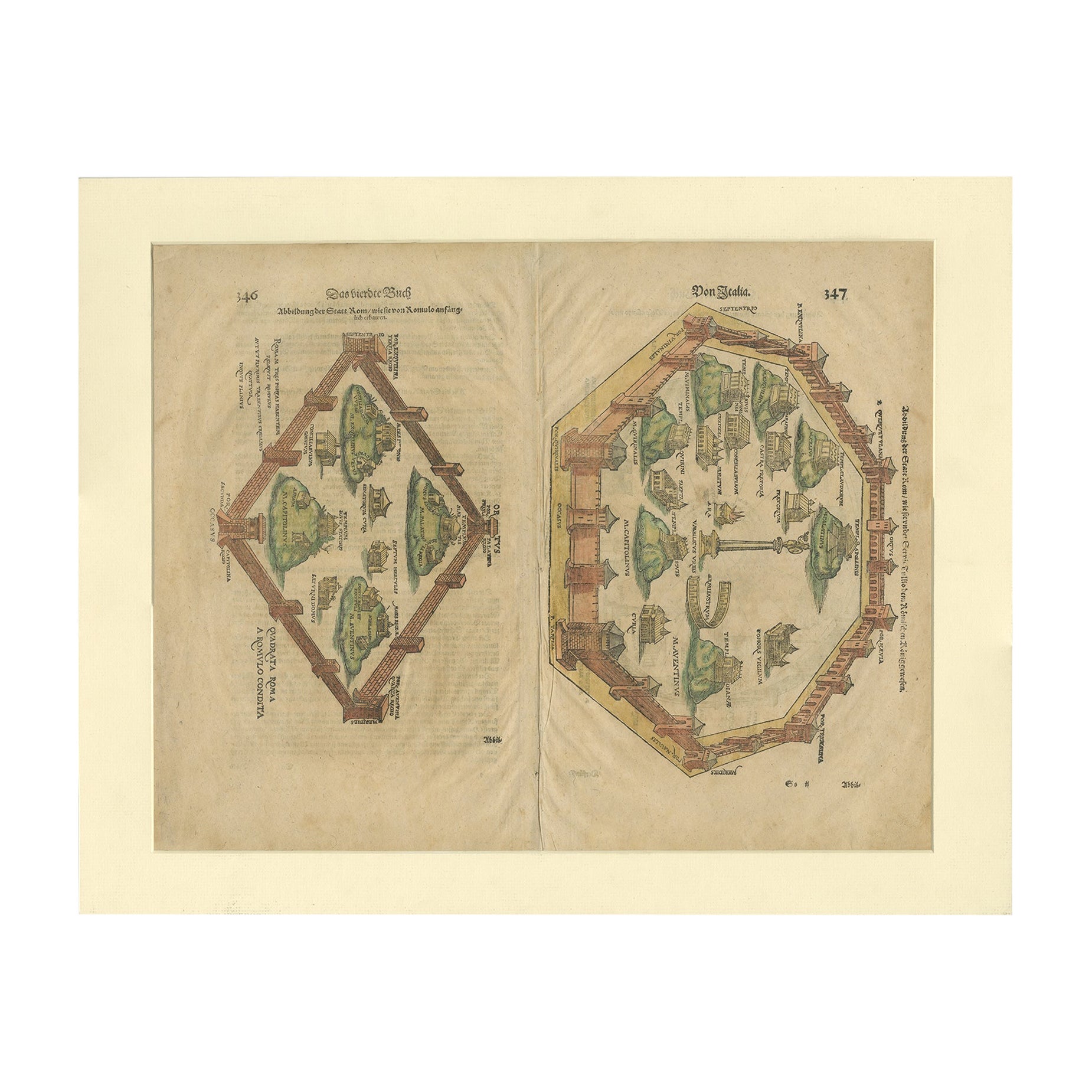
- Antique Print of the City of Rome, Italy by Münster, C.1580Located in Langweer, NLAntique print titled 'Abbildung der Statt Rom/wie sie von Romulo anfänge - Von Italia'. Woodcut of ancient Rome. This print originates from Munster's Cosmographia, one of the most in...Category
Antique 16th Century Prints
MaterialsPaper
- Antique Map of the City of Paris by Tirion '1763'Located in Langweer, NLAntique map titled 'Nieuwe Kaart der platte Grond van de Stad Parys (..)'. Beautiful city plan of Paris, France. This map originates from 'Nieuwe en Beknopte Hand-Atlas, bestaande in...Category
Antique Mid-18th Century Maps
MaterialsPaper
 $1,055 Sale Price20% Off
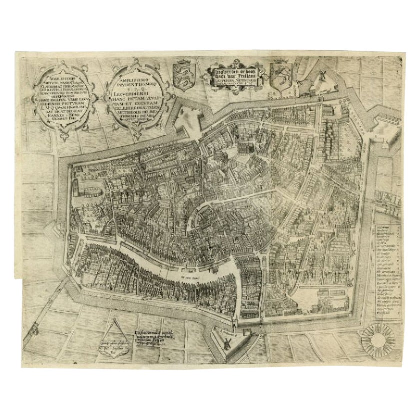
 - Antique Map of the City of Leeuwarden by Bast, 1603Located in Langweer, NLAntique map titled 'Leeuwerden de hooft stadt van Frislant. Leoverdia Metropolis Frisiae (…) 1603.' Very rare plan of Leeuwarden, Friesland, The Netherlands. With several carouches a...Category
Antique 17th Century Maps
MaterialsPaper
 $2,396 Sale Price20% Off
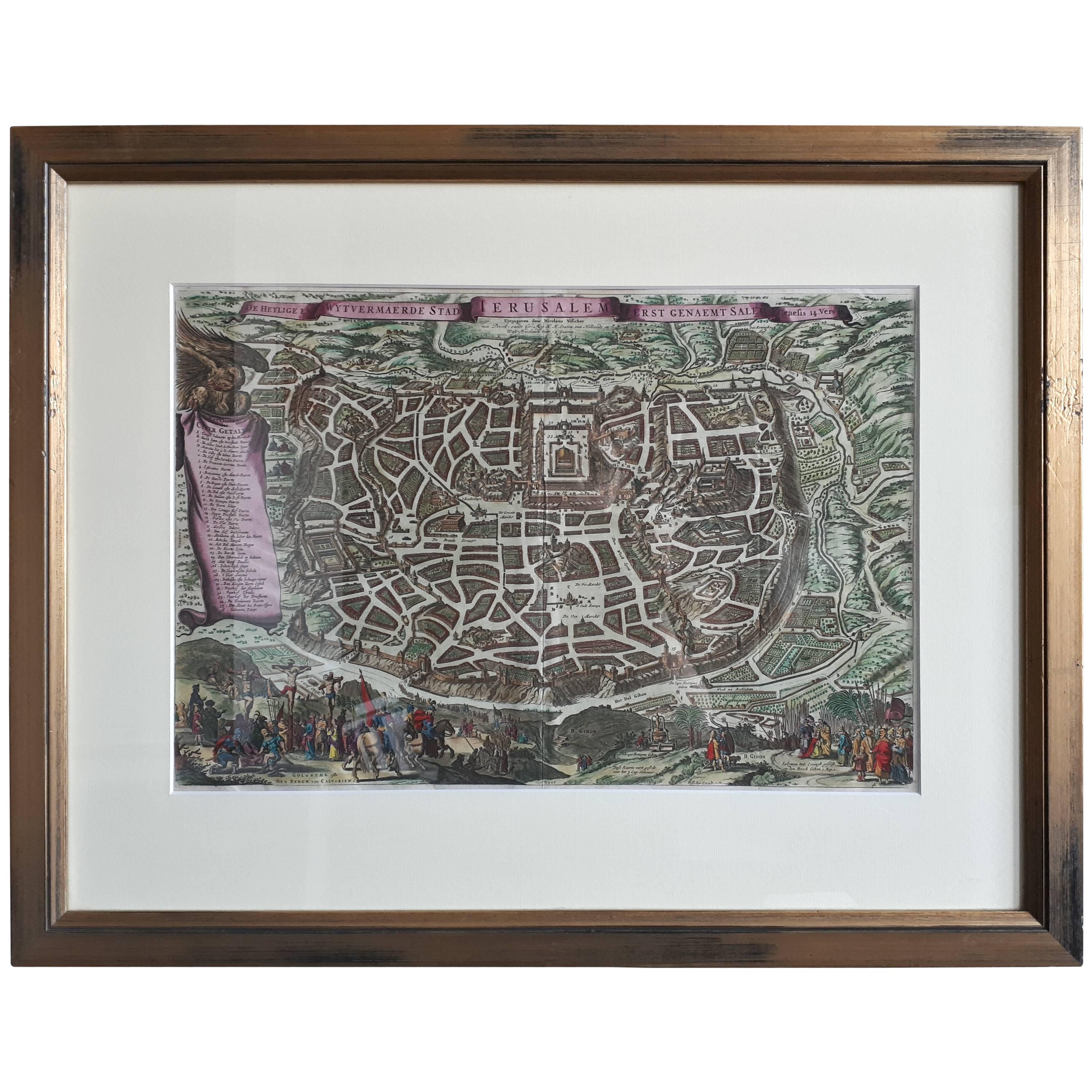
 - Antique Map of the City of Jerusalem by N. Visscher, 1702Located in Langweer, NLAntique map titled 'Die Heylige en Wytvermaerde stadt Jerusalem Eerst Genaemt Salem, Genesis 14 vers 18'. This map originates from 'Biblia. Ouden ende Nieuwen Testaments (..)'. Publi...Category
Antique Early 18th Century Maps
MaterialsPaper
 $2,655 Sale Price30% Off

You May Also Like
- Original Antique Map / City Plan of Brussels by Tallis, circa 1850Located in St Annes, LancashireGreat map of Brussels. Steel engraving. Published by London Printing & Publishing Co. (Formerly Tallis), C.1850 Free shipping.Category
Antique 1850s English Maps
MaterialsPaper
- Original Antique Map of Belgium by Tallis, Circa 1850Located in St Annes, LancashireGreat map of Belgium Steel engraving Many lovely vignettes Published by London Printing & Publishing Co. ( Formerly Tallis ), C.1850 Origin...Category
Antique 1850s English Maps
MaterialsPaper
- Original Antique Map of The World by Thomas Clerk, 1817Located in St Annes, LancashireGreat map of The Eastern and Western Hemispheres On 2 sheets Copper-plate engraving Drawn and engraved by Thomas Clerk, Edinburgh. Published by Mackenzie And Dent, 1817 ...Category
Antique 1810s English Maps
MaterialsPaper
- Original Antique Map of South America, circa 1830Located in St Annes, LancashireGreat map of South America Copper plate engraving Published by Butterworth, Livesey & Co., circa 1830 Unframed.Category
Antique Early 1800s English Other Maps
MaterialsPaper

- Original Antique Map of The Netherlands, Engraved by Barlow, Dated 1807Located in St Annes, LancashireGreat map of Netherlands Copper-plate engraving by Barlow Published by Brightly & Kinnersly, Bungay, Suffolk. Dated 1807 Unframed.Category
Antique Early 1800s English Maps
MaterialsPaper
- Map of the Republic of GenoaLocated in New York, NYFramed antique hand-coloured map of the Republic of Genoa including the duchies of Mantua, Modena, and Parma. Europe, late 18th century. Dimension: 25...Category
Antique Late 18th Century European Maps


Recently Viewed
View AllMore Ways To Browse
Antique Furniture Rome
Antique City Views
Law Office
Antique City Map
Antique City Maps
Antique Maps Of Cities
Map Of Italy
Original City Map
Framed Map
Framed Maps
City Of Rome Furniture
Antique Map Framed
Antique Maps Framed
Antique Map Framers
Antique Framed Maps
Antique Map Framing
Framed Antique Maps
Framed Antique Map