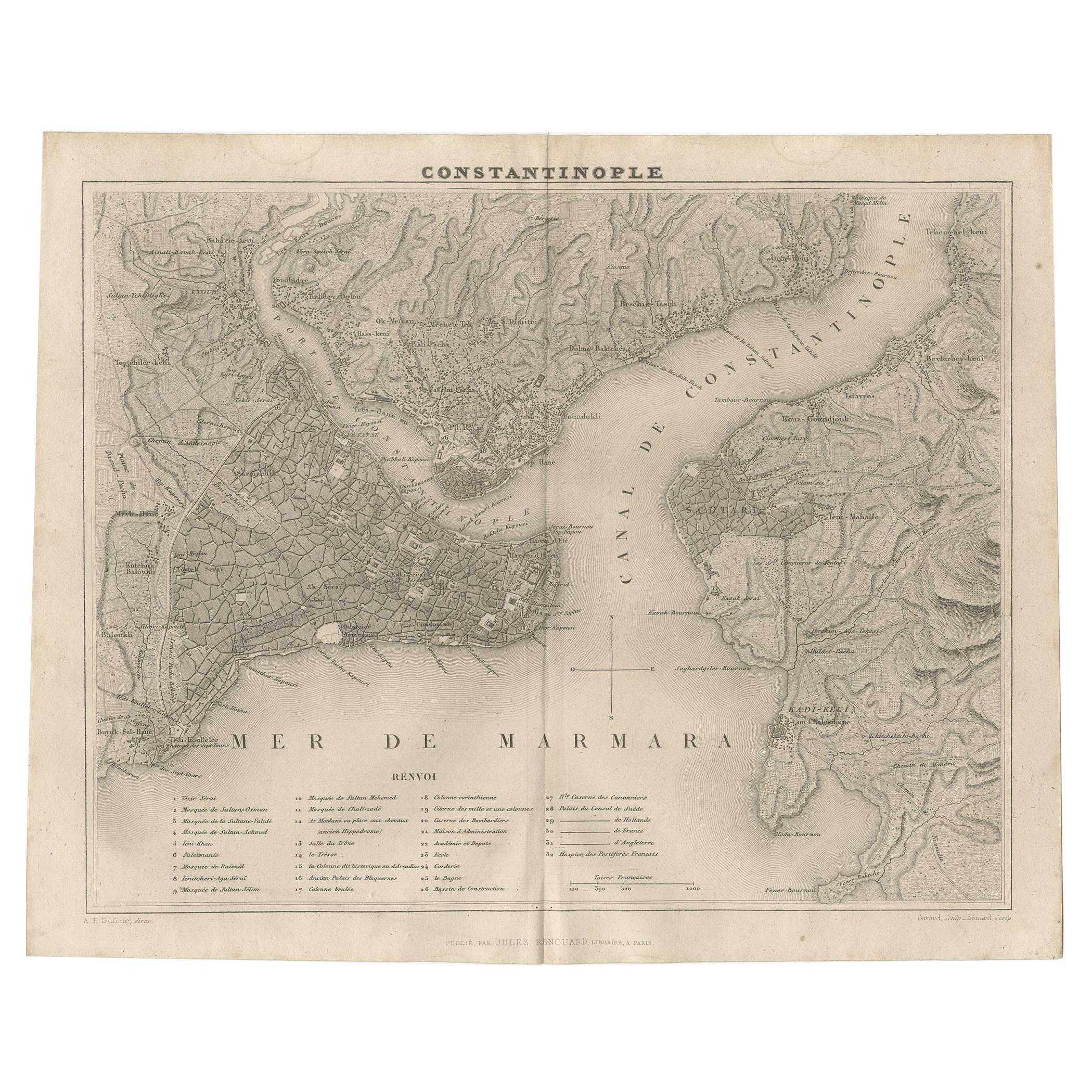
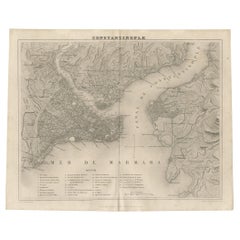
Antique Map of Constantinople 'Istanbul' by J. Lodge, 1770
View Similar Items
Want more images or videos?
Request additional images or videos from the seller
1 of 5
Antique Map of Constantinople 'Istanbul' by J. Lodge, 1770
About the Item
- Creator:J. Lodge (Artist)
- Dimensions:Height: 8.47 in (21.5 cm)Width: 10.44 in (26.5 cm)Depth: 0.02 in (0.5 mm)
- Materials and Techniques:Paper,Engraved
- Place of Origin:
- Period:
- Date of Manufacture:1770
- Condition:Please study image carefully.
- Seller Location:Langweer, NL
- Reference Number:Seller: BG-079931stDibs: LU3054312223573
About the Seller
5.0
Platinum Seller
These expertly vetted sellers are 1stDibs' most experienced sellers and are rated highest by our customers.
Established in 2009
1stDibs seller since 2017
1,947 sales on 1stDibs
More From This SellerView All
- Antique Map of Constantinople and Surroundings by Balbi '1847'Located in Langweer, NLAntique map titled 'Constantinople'. Original antique map of Constantinople and surroundings. This map originates from 'Abrégé de Géographie (..)...Category
Antique Mid-19th Century Maps
MaterialsPaper
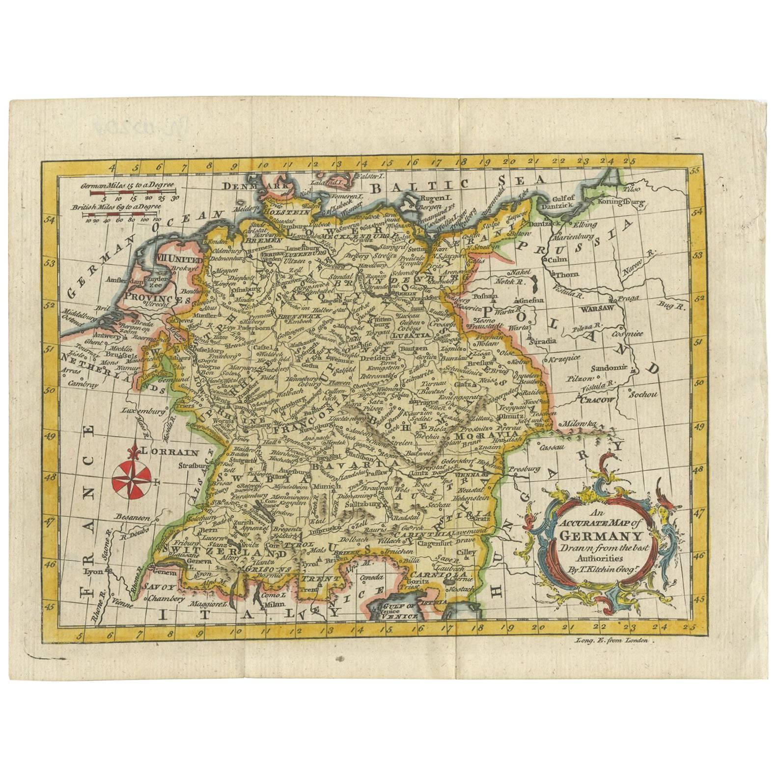
- Antique Map of Germany by T. Kitchin, circa 1770Located in Langweer, NLAntique map titled 'An Accurate Map of Germany (..) '. Drawn from the best Authorities by T.Kitchin Geogr." Rare edition, drawn and etched by Thomas Kitchin, published, circa 1770.Category
Antique Mid-18th Century Maps
MaterialsPaper
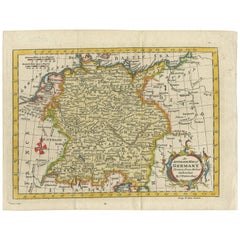 $164 Sale Price37% Off
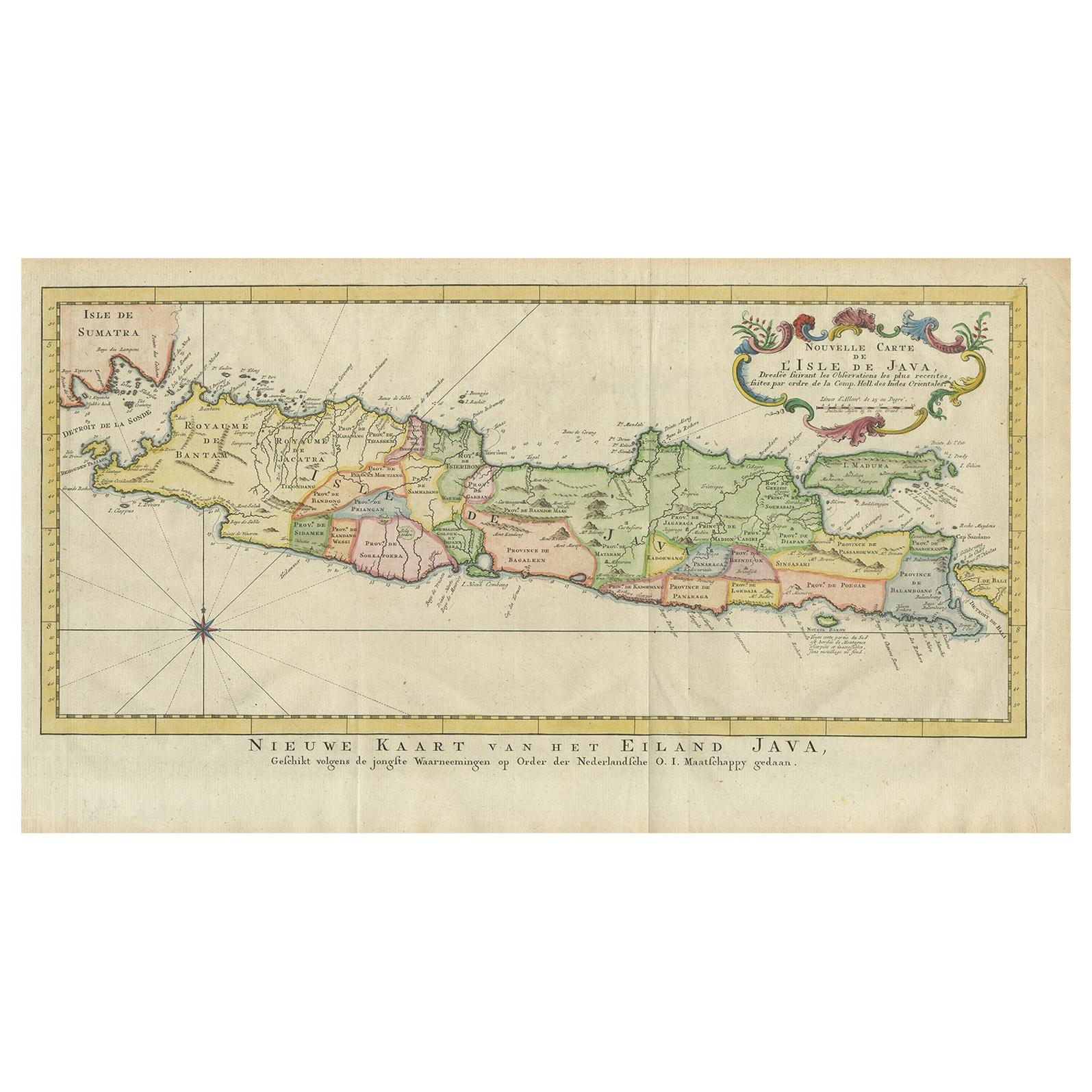
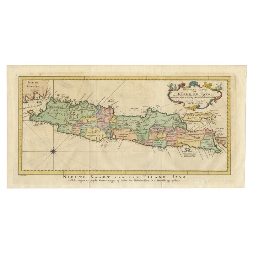
 - Antique Map of Java, Indonesia, circa 1770By Jakob van der SchleyLocated in Langweer, NLAntique map Indonesia titled 'Nouvelle Carte de l'Isle de Java - Nieuwe kaart, van het Eiland Java'. Chart of the island of Java, depicting soun...Category
Antique Mid-18th Century Maps
MaterialsPaper
 $509 Sale Price20% Off
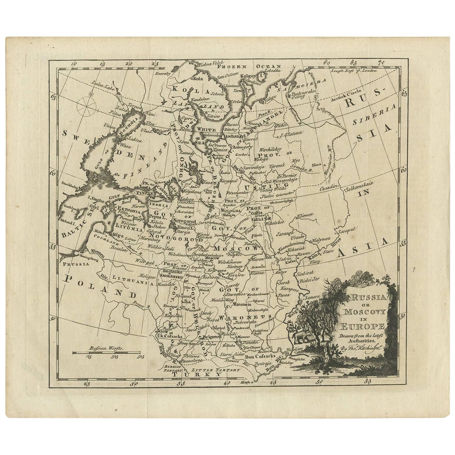
 - Antique Map of Russia in Europe by T. Kitchin, circa 1770Located in Langweer, NLAntique map titled 'Russia or Moscovy in Europe, drawn from the latest authorities (..)'. An interesting and attractive early 19th century map of Russia in Europe which was engraved ...Category
Antique Late 18th Century Maps
MaterialsPaper
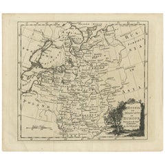 $131 Sale Price25% Off
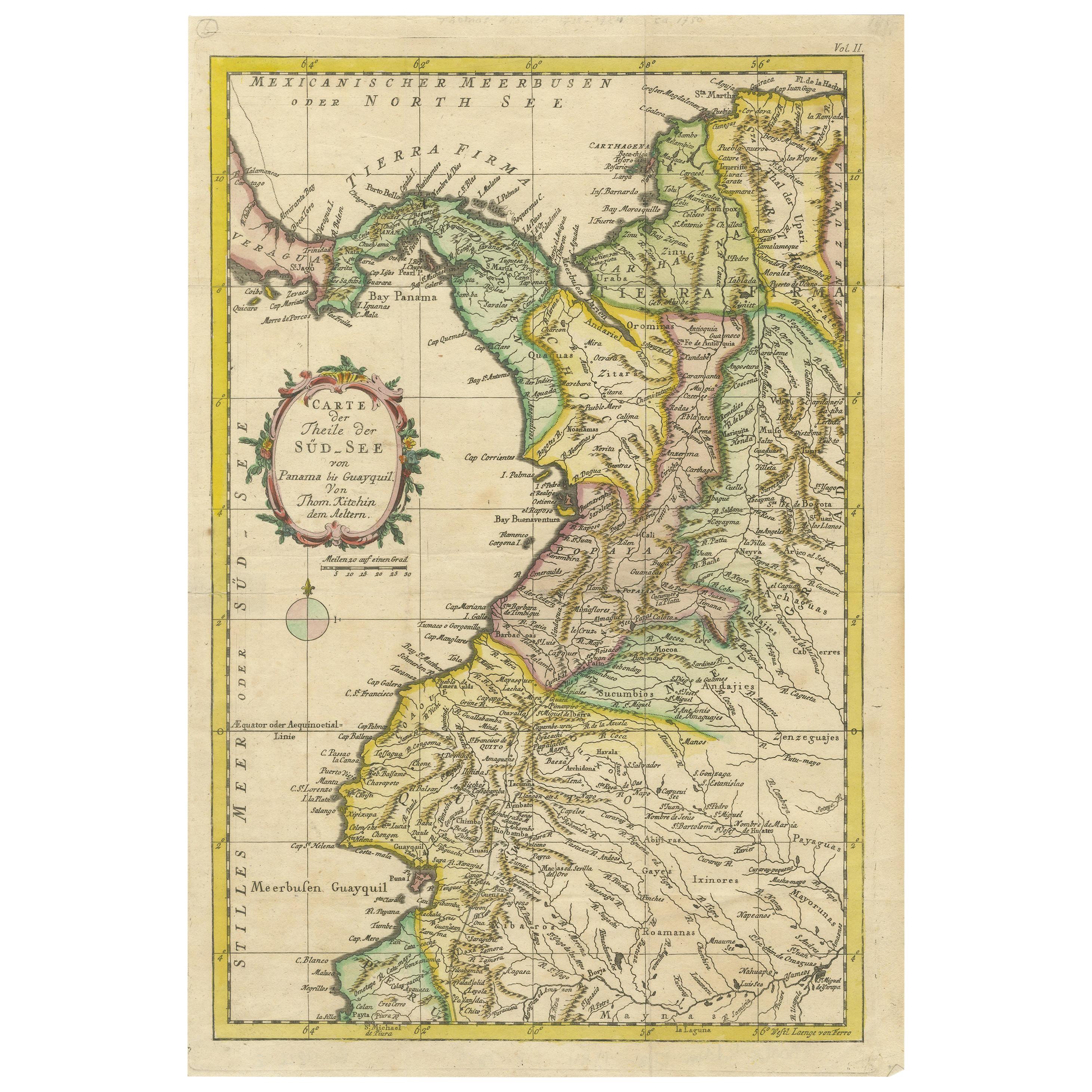
 - Antique Map of Part of South America by Kitchin, circa 1770Located in Langweer, NLAntique map titled 'Carte der Theile der Süd-See (..)'. Map of part of South America including the modern states of Panama, Colombia and Ecuador. Engraved by T. Kitchin, circa 1770.Category
Antique Late 18th Century Maps
MaterialsPaper
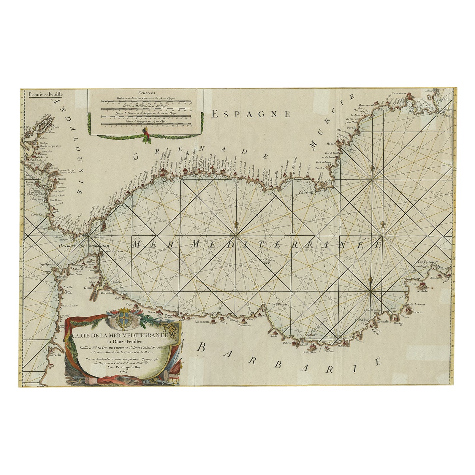
- Large Decorative Antique Map of the Mediterranean, ca.1770Located in Langweer, NLAntique map titled 'Carte de la Mer Mediterranee en Douze Feuilles'. First map out of twelve fine engraved double-page and folding maps that join to create a large wall map...Category
Antique 1770s Maps
MaterialsPaper
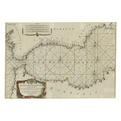 $1,002 Sale Price20% Off

You May Also Like
- Antique Map of Italy by Andriveau-Goujon, 1843By Andriveau-GoujonLocated in New York, NYAntique Map of Italy by Andriveau-Goujon, 1843. Map of Italy in two parts by Andriveau-Goujon for the Library of Prince Carini at Palazzo Carini i...Category
Antique 1840s French Maps
MaterialsLinen, Paper
 $3,350 / set
 - Antique Map of Principality of MonacoBy Antonio Vallardi EditoreLocated in Alessandria, PiemonteST/619 - "Old Geographical Atlas of Italy - Topographic map of ex-Principality of Monaco" - ediz Vallardi - Milano - A somewhat special edition ---Category
Antique Late 19th Century Italian Other Prints
MaterialsPaper
 $228 Sale Price74% Off
 - Original Antique Map of Russia By Arrowsmith. 1820Located in St Annes, LancashireGreat map of Russia Drawn under the direction of Arrowsmith Copper-plate engraving Published by Longman, Hurst, Rees, Orme and Brown, 1820 Unframed.Category
Antique 1820s English Maps
MaterialsPaper

- Original Antique Map of Sweden, Engraved by Barlow, 1806Located in St Annes, LancashireGreat map of Sweden Copper-plate engraving by Barlow Published by Brightly & Kinnersly, Bungay, Suffolk. 1806 Unframed.Category
Antique Early 1800s English Maps
MaterialsPaper
- Original Antique Map of China by Thomas Clerk, 1817Located in St Annes, LancashireGreat map of China Copper-plate engraving Drawn and engraved by Thomas Clerk, Edinburgh. Published by Mackenzie And Dent, 1817 Unframed.Category
Antique 1810s English Maps
MaterialsPaper

- Original Antique Map of Belgium by Tallis, Circa 1850Located in St Annes, LancashireGreat map of Belgium Steel engraving Many lovely vignettes Published by London Printing & Publishing Co. ( Formerly Tallis ), C.1850 Origin...Category
Antique 1850s English Maps
MaterialsPaper

