Items Similar to Antique Map of Cyprus (Cypern) from Meyer's Lexikon, Leipzig, circa 1890
Want more images or videos?
Request additional images or videos from the seller
1 of 10
Antique Map of Cyprus (Cypern) from Meyer's Lexikon, Leipzig, circa 1890
$131.30
£97.97
€110
CA$183.09
A$200.64
CHF 104.78
MX$2,411.10
NOK 1,309.89
SEK 1,235.43
DKK 837.45
About the Item
Antique Map of Cyprus (Cypern) from Meyer's Lexikon, Leipzig, circa 1890
This finely detailed antique map titled "Cypern" presents the island of Cyprus as it appeared in the late 19th century. It was published around 1890 by the Bibliographisches Institut in Leipzig as part of Meyers Konversations-Lexikon, one of the most comprehensive German-language encyclopedias of the time.
Printed in chromolithography, this map is visually striking with soft pastel colors and clear typography. It shows the full extent of Cyprus with excellent geographic accuracy for the period. Key cities and towns such as Nikosia (Lefkosia), Larnaka, Limassol, Famagusta, and Kyrenia are labeled, along with smaller villages and significant mountain ranges such as the Troodos. District capitals are underlined per the legend in the upper left, and the topography is carefully rendered with hill shading to illustrate elevation.
The map is marked with latitude and longitude (based on Greenwich and Paris meridians) and features both German and transliterated Greek place names, reflecting the cartographic conventions of the time. Water bodies like Bai von Morphu, Bai von Famagusta, and Bai von Akrotiri are also indicated. A precise scale is provided in both English miles and kilometers (1:1,150,000), and a legend clarifies typographic conventions.
This map is an excellent example of late 19th-century European geographical scholarship, capturing Cyprus during the British administration (which began in 1878) while still retaining German naming conventions from its continental publication.
Publisher:
Bibliographisches Institut, Leipzig
Source: Meyers Konversations-Lexikon, Supplement Volume I
Date: Circa 1890
Technique: Chromolithograph
Language: German
Condition report:
Good condition. Bright original coloring, minimal age toning. Clean margins and sharp impression. Verso blank. Slight edge toning consistent with age.
Framing suggestion:
Frame with a classic dark wood or walnut frame and a light cream archival mat. The soft colors pair well with natural finishes, and a UV-filtering glass will protect the paper's integrity for years.
- Dimensions:Height: 5.91 in (15 cm)Width: 9.26 in (23.5 cm)Depth: 0.01 in (0.2 mm)
- Materials and Techniques:
- Period:
- Date of Manufacture:circa 1890
- Condition:Good condition. Bright original coloring, minimal age toning. Clean margins and sharp impression. Verso blank. Slight edge toning consistent with age.
- Seller Location:Langweer, NL
- Reference Number:Seller: BG-033501stDibs: LU3054344978782
About the Seller
5.0
Recognized Seller
These prestigious sellers are industry leaders and represent the highest echelon for item quality and design.
Platinum Seller
Premium sellers with a 4.7+ rating and 24-hour response times
Established in 2009
1stDibs seller since 2017
2,654 sales on 1stDibs
Typical response time: <1 hour
- ShippingRetrieving quote...Shipping from: Langweer, Netherlands
- Return Policy
Authenticity Guarantee
In the unlikely event there’s an issue with an item’s authenticity, contact us within 1 year for a full refund. DetailsMoney-Back Guarantee
If your item is not as described, is damaged in transit, or does not arrive, contact us within 7 days for a full refund. Details24-Hour Cancellation
You have a 24-hour grace period in which to reconsider your purchase, with no questions asked.Vetted Professional Sellers
Our world-class sellers must adhere to strict standards for service and quality, maintaining the integrity of our listings.Price-Match Guarantee
If you find that a seller listed the same item for a lower price elsewhere, we’ll match it.Trusted Global Delivery
Our best-in-class carrier network provides specialized shipping options worldwide, including custom delivery.More From This Seller
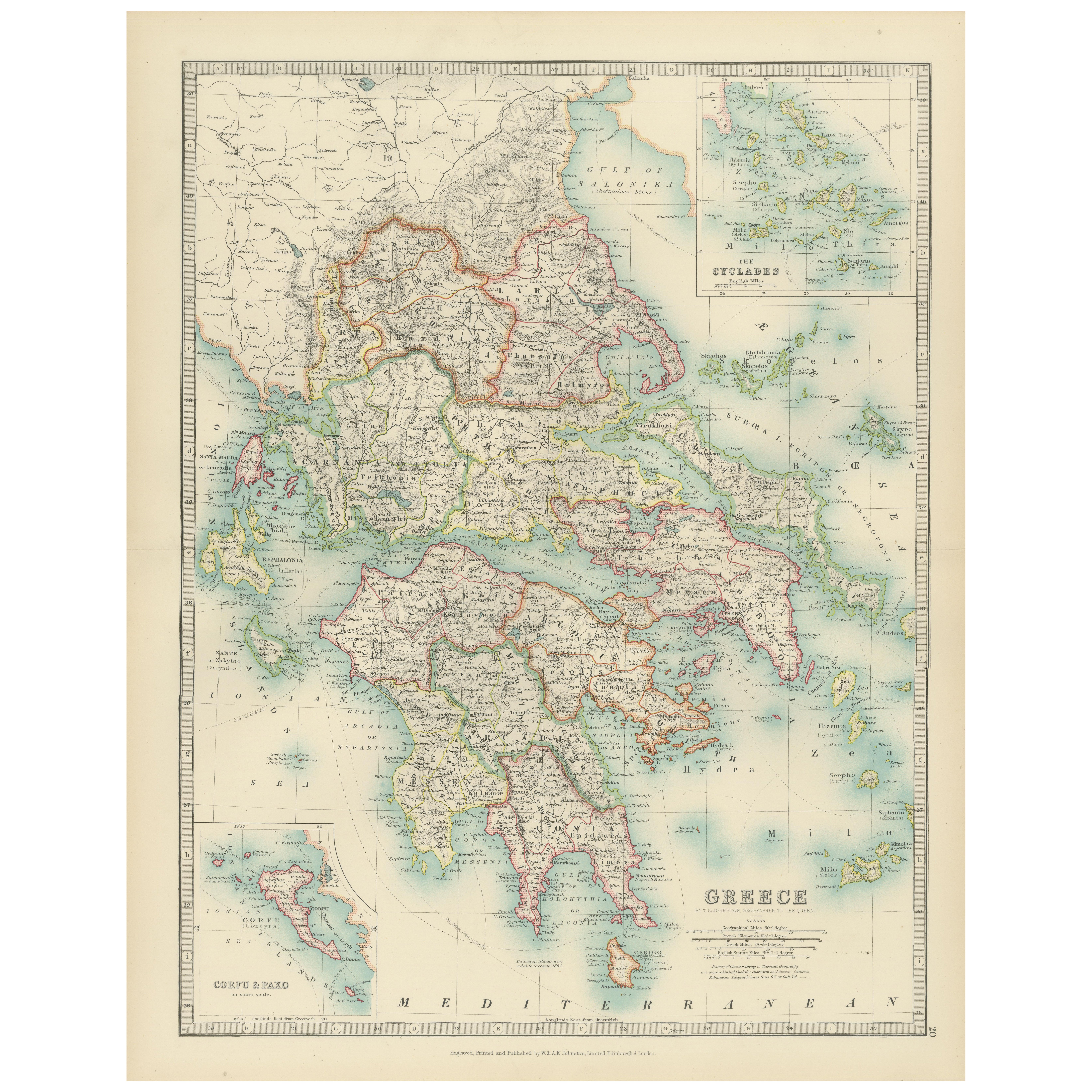
View AllAntique Map of Greece and the Cyclades, 1903, with Many Details and Inset Maps
Located in Langweer, NL
Title: Antique Map of Greece and the Cyclades, 1903, with Intricate Detail and Inset Maps
Description: This antique map, titled "Greece with Its Islands, Including the Cyclades," wa...
Category
Early 20th Century Maps
Materials
Paper
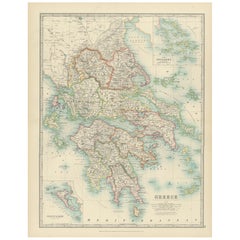
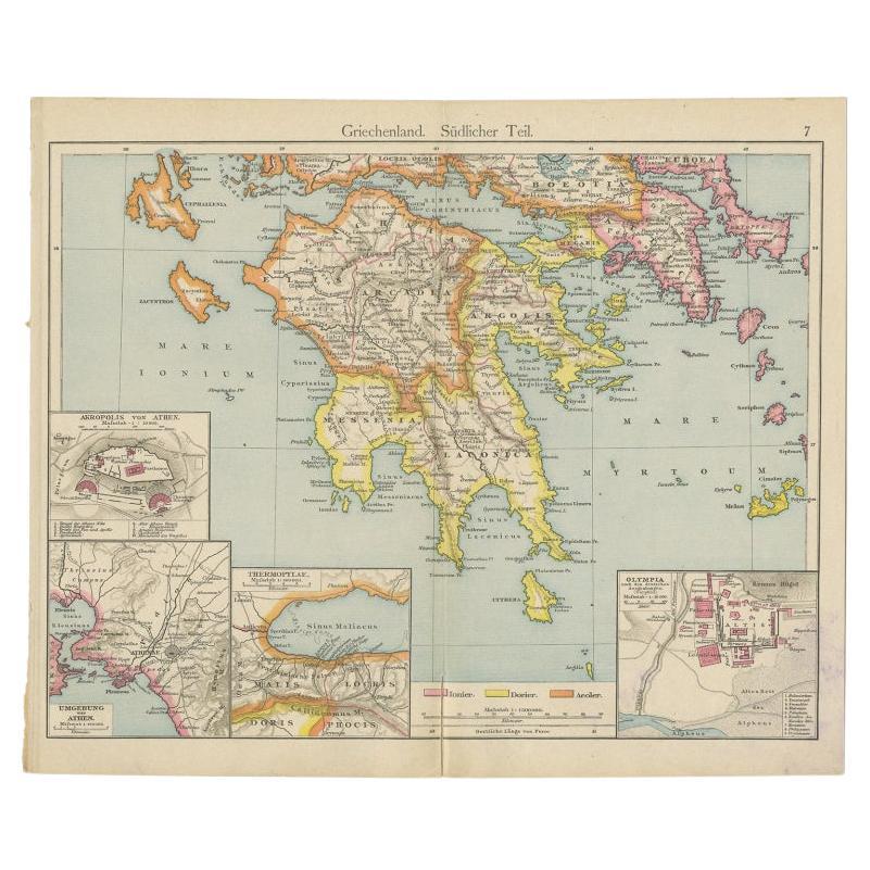
Antique Map of Southern Greece, 1892
Located in Langweer, NL
Antique map of Greece titled 'Griechenland. Südlicher Theil'. Old map of Southern Greece with inset maps of the Acropolis of Athens, the region of Athens, Thermopylae and Olympia. So...
Category
Antique 19th Century Maps
Materials
Paper

$81 Sale Price
20% Off
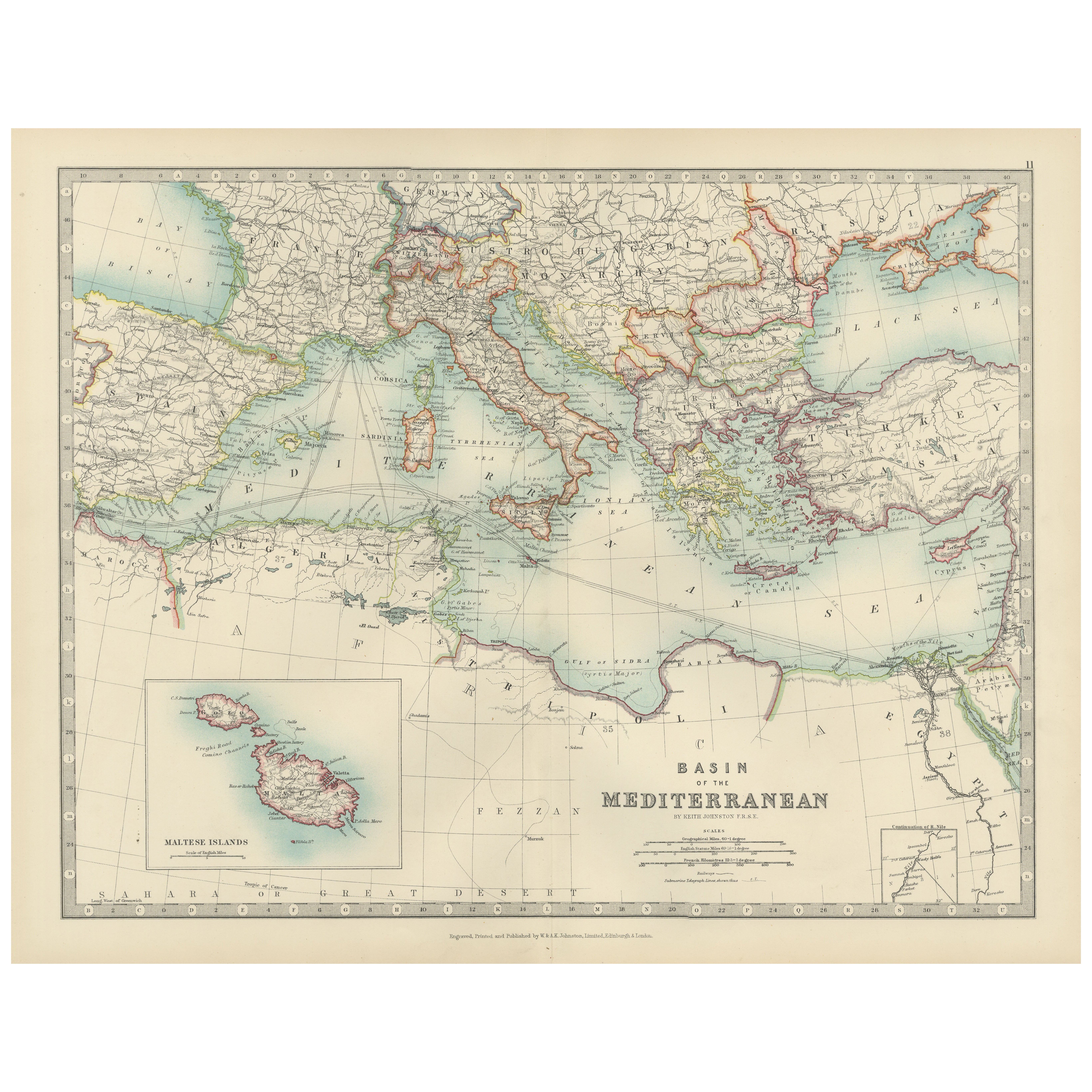
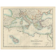
Antique Map of the Mediterranean Basin, 1903, with Detailed Coastal and Inland
Located in Langweer, NL
Title: Antique Map of the Mediterranean Basin, 1903, with Detailed Coastal and Inland Geography
Description: This antique map, titled "Basin of the Mediterranean," was engraved and ...
Category
Early 20th Century Maps
Materials
Paper
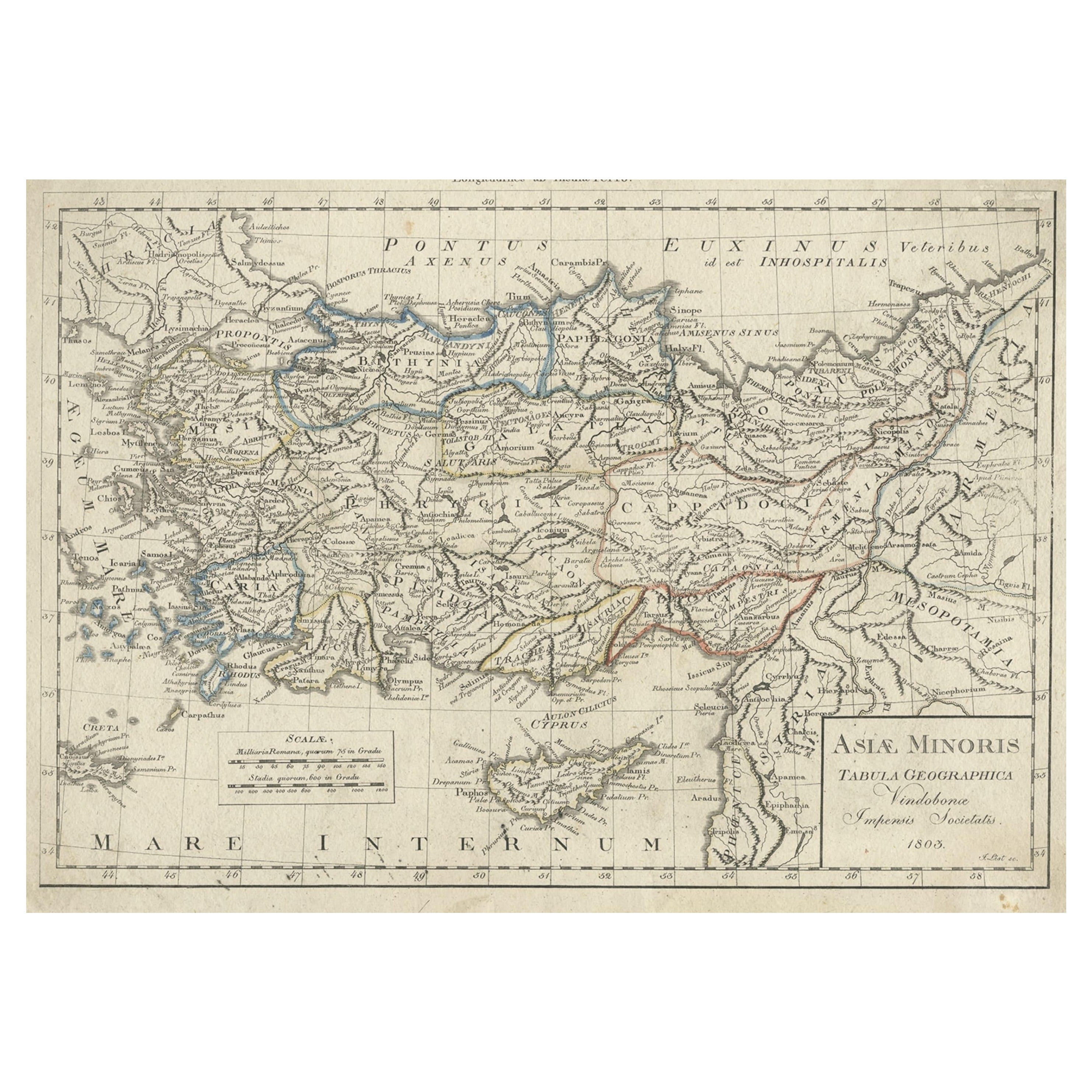
Antique Map of Asia Minor, Present-day Turkey and Cyprus, 1803
Located in Langweer, NL
Antique map titled 'Asiae Minoris Tabula Geographica'. Uncommon antique map of Asia minor, comprising most of what is present-day Turkey. Source unknown, to be determined.
Artists...
Category
Antique 19th Century Maps
Materials
Paper
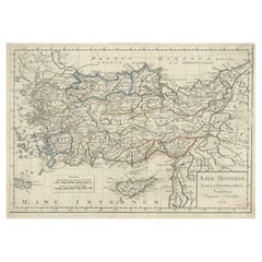
$171 Sale Price
20% Off
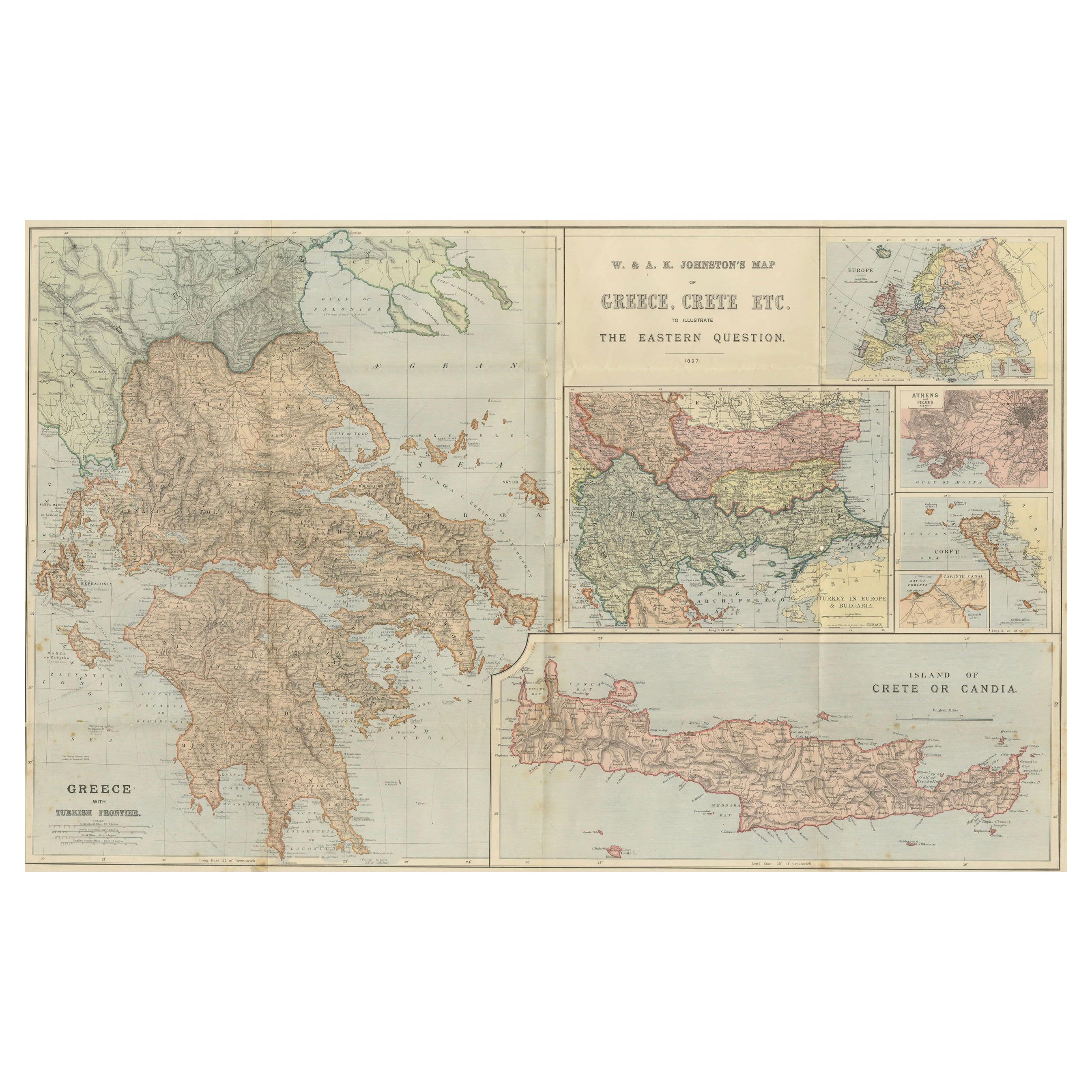
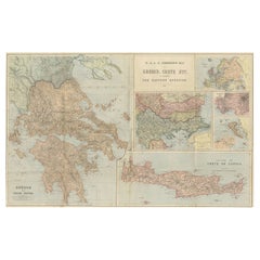
Johnston Map of Greece & Crete 1897 – The Eastern Question Antique Map
Located in Langweer, NL
Here’s a catalogue entry for your **Johnston map of Greece and Crete**:
---
**Main Title**
Antique Map of Greece & Crete – Johnston’s Eastern Question Map, 1887
**SEO Alternative ...
Category
Antique Late 19th Century Scottish Maps
Materials
Paper
Small Antique Map of the European Turkey, Greece & Ionian Islands – c.1860
Located in Langweer, NL
Antique Map of the European Turkey, Greece & Ionian Islands – Stieler, c.1860
Original antique map titled *Die Europaeische Türkei, Griechenland und die ...
Category
Antique 1860s Maps
Materials
Paper

$114 Sale Price
20% Off
You May Also Like
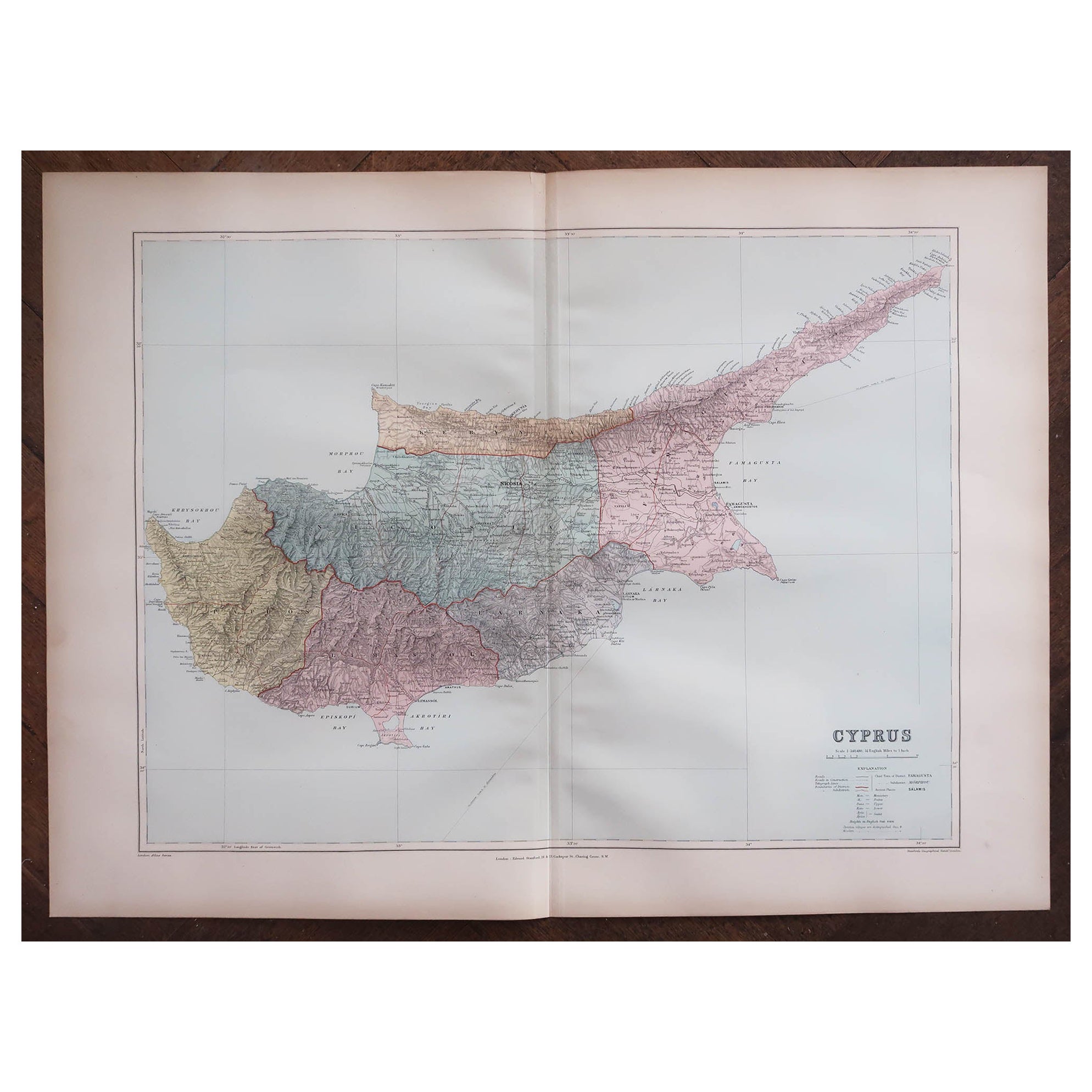
Large Original Antique Map of Cyprus. 1894
Located in St Annes, Lancashire
Superb Antique map of Cyprus
Published Edward Stanford, Charing Cross, London 1894
Original colour
Good condition
Unframed.
Free shipping
Category
Antique 1890s English Maps
Materials
Paper

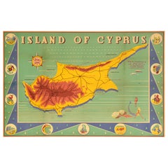
Original Vintage Travel Poster Island Of Cyprus Illustrated Map Mediterranean
Located in London, GB
Original vintage travel poster for the Island of Cyprus featuring a map of the ancient historic island country in the Mediterranean Sea marking various towns, the mountain ranges and...
Category
Vintage 1930s British Posters
Materials
Paper
Map of Greece - Etching on Paper 19th Century
Located in Roma, IT
Image dimensions: 22.2 x 27.8 cm.
Grecia is an interesting hand-colored etching on paper, realized by an anonymous artist in the first half of the XIX century.
With the inscriptions in Italian, this original print describes the geography of Greece with the great charisma of the antique maps.
In very good conditions, except for a usual yellowing of the paper at the edges and minor defects and signs of the time, and some light yellow strips...
Category
19th Century Modern Figurative Prints
Materials
Etching

$223 Sale Price
25% Off
Italy, Central and Southern Part. Century Atlas antique map
Located in Melbourne, Victoria
'The Century Atlas. Italy, Central and Southern Part.'
Original antique map, 1903.
Inset maps of Sicily and Naples.
Central fold as issued. Map name an...
Category
Early 20th Century Victorian More Prints
Materials
Lithograph

Large Original Antique Map of The Greek Islands. 1894
Located in St Annes, Lancashire
Superb Antique map of The Greek Islands
Published Edward Stanford, Charing Cross, London 1894
Original colour
Good condition
Unframed.
Free shipping
Category
Antique 1890s English Maps
Materials
Paper

Large Original Antique Map of The Canary Islands. 1894
Located in St Annes, Lancashire
Superb Antique map of The Canary Islands
Published Edward Stanford, Charing Cross, London 1894
Original colour
Good condition
Unframed.
Free shipping
Category
Antique 1890s English Maps
Materials
Paper

More Ways To Browse
Antique Encyclopedias
Encyclopedia Antique
Cyprus Furniture
Antique Furniture Cyprus
Round Table Base
Cream Soup
Early English Silver
James Bond
Paisley Rugs and Carpets
Antique Pagoda
Black And Chrome Lounge Chair
Ceramic 1960s Italy
Vintage 1930 Dining Room Set
Antique Brass And Copper
Antique Cow
Antique Harvest
Antique Victorian Dining Tables
Environment Furniture