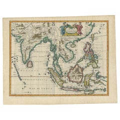
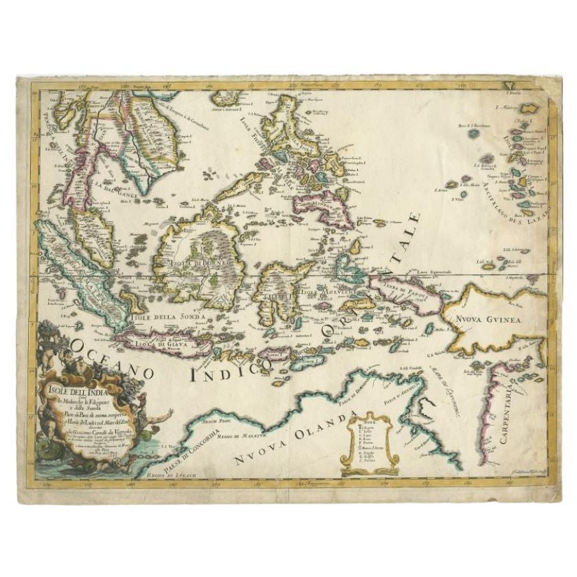
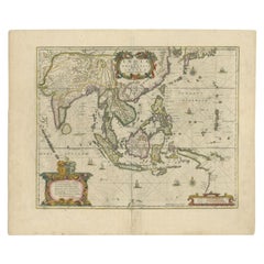
Antique Map of the East Indies by Speed '1676'
View Similar Items


Want more images or videos?
Request additional images or videos from the seller
1 of 5
Antique Map of the East Indies by Speed '1676'
About the Item
- Dimensions:Height: 17.33 in (44 cm)Width: 22.45 in (57 cm)Depth: 0.02 in (0.5 mm)
- Materials and Techniques:
- Period:Mid-17th Century
- Date of Manufacture:1676
- Condition:General age-related toning. English text on verso, minor wear. Please study images carefully.
- Seller Location:Langweer, NL
- Reference Number:Seller: BGJC-3511stDibs: LU3054317506211
About the Seller
5.0
Platinum Seller
These expertly vetted sellers are 1stDibs' most experienced sellers and are rated highest by our customers.
Established in 2009
1stDibs seller since 2017
1,933 sales on 1stDibs
More From This SellerView All
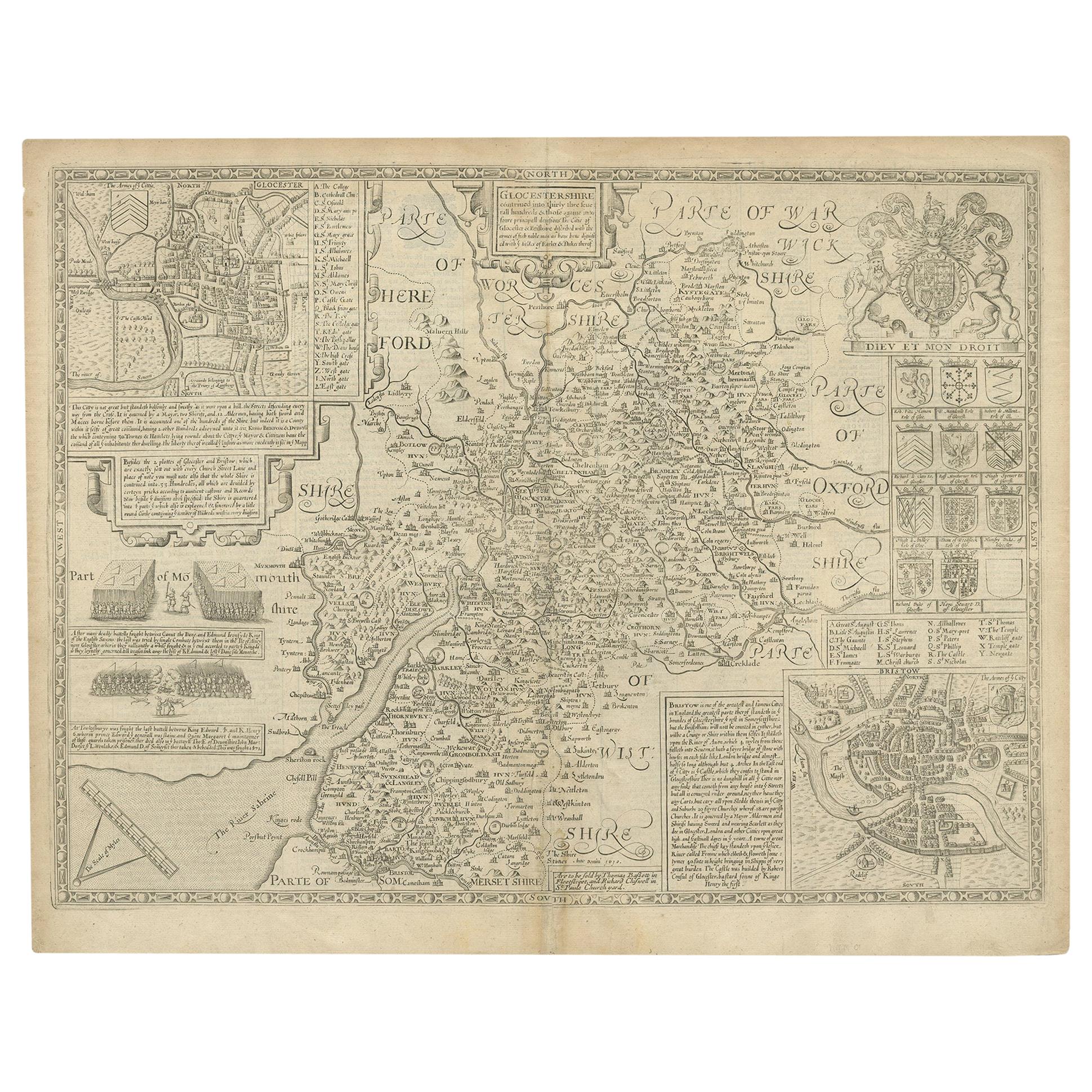
- Antique Map of Gloucestershire by John Speed, '1676'Located in Langweer, NLAntique map titled 'Glocestershire'. Original 17th century map of Gloucestershire, South West England, by John Speed. With inset town plans of G...Category
Antique Mid-17th Century Maps
MaterialsPaper
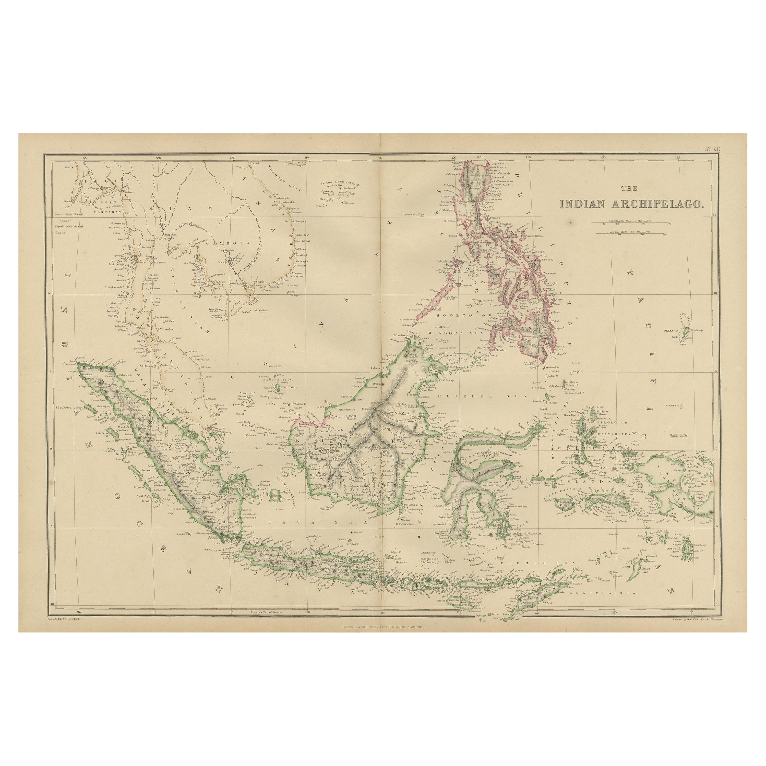
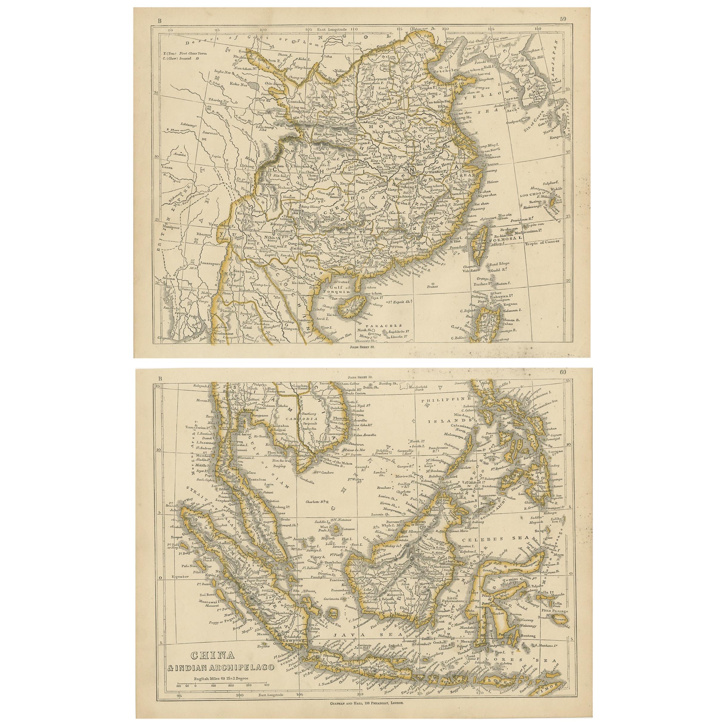
- Antique Map of the East Indies by W. G. Blackie, 1859Located in Langweer, NLAntique map titled 'The Indian Archipelago'. Original antique map of the East Indies. This map originates from ‘The Imperial Atlas of Modern Geography’. Published by W. G. Blackie, 1...Category
Antique Mid-19th Century Maps
MaterialsPaper
- Antique Map of the East Indies by A & C. Black, 1870Located in Langweer, NLAntique map titled 'Indian Archipelago and Further India including Burmah, Siam, Anam &c'. Original antique map of Indian Archipelago and Further India. This map originates from ‘Bla...Category
Antique Late 19th Century Maps
MaterialsPaper
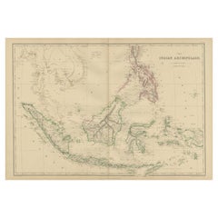
- Antique Map of the East Indies by Wyld '1845'Located in Langweer, NLAntique map titled 'Archipelago of the Indian Ocean'. Original antique map of the East Indies. This map originates from 'An Atlas of the World, Comprehending Separate Maps of its Var...Category
Antique Mid-19th Century Maps
MaterialsPaper
 $307 Sale Price20% Off
 - Antique Map of the East Indies by Levasseur, '1875'Located in Langweer, NLAntique map titled 'Carte de la Malaisie'. Large map of the East Indies. This map originates from 'Atlas de Géographie Moderne Physique et Politique' by A. Levasseur. Published 1875.Category
Antique Late 19th Century Maps
MaterialsPaper
 $411 Sale Price25% Off
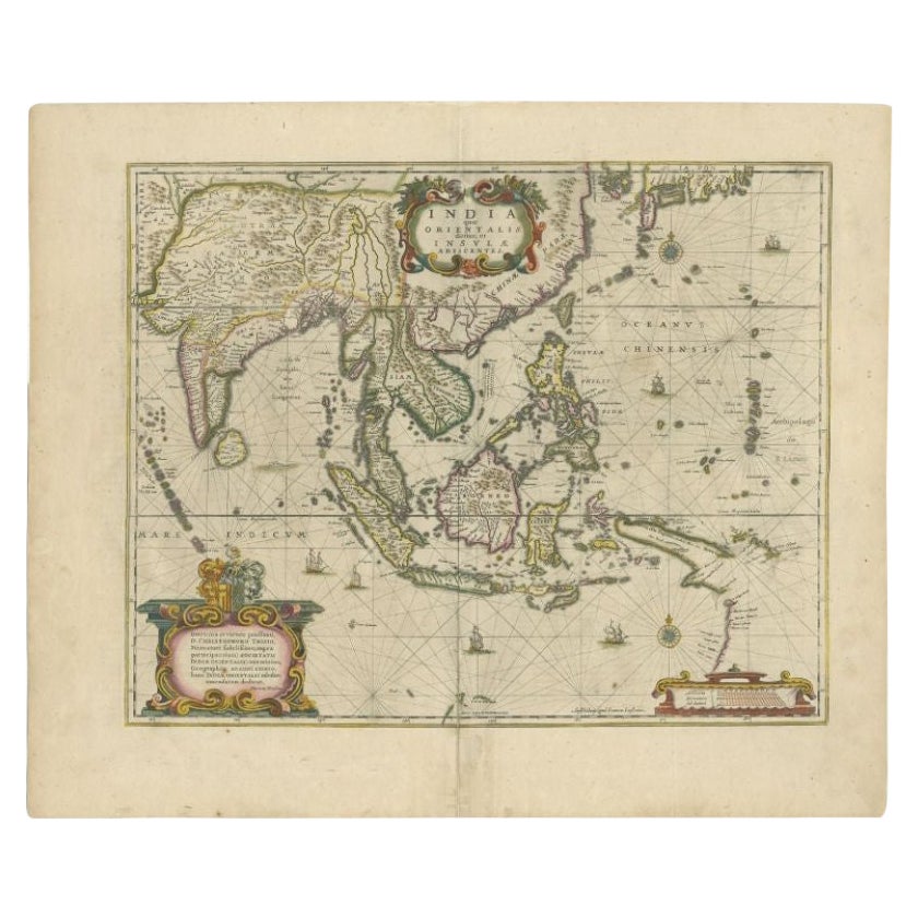
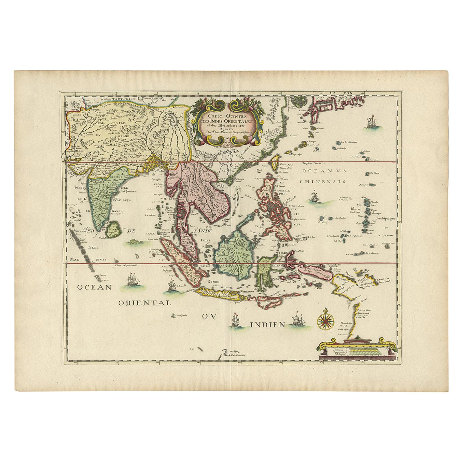
 - Antique Map of the East Indies by Janssonius, c.1644By Johannes JanssoniusLocated in Langweer, NLAntique map titled 'India quae Orientalis dicitur, et Insulae adiacentes'. Old map of the East Indies and Southeast Asia showing the area between India in the West and parts of Japan...Category
Antique 17th Century Maps
MaterialsPaper
 $2,328 Sale Price20% Off

You May Also Like
- Original Antique Map of South East Asia by Becker, circa 1840Located in St Annes, LancashireGreat map of South East Asia Steel engraving with original color outline Engraved by Becker Published by Virtue, circa 1840. Unframed.Category
Antique 1840s English Other Maps
MaterialsPaper
- Original Antique Map of South East Asia by Thomas Clerk, 1817Located in St Annes, LancashireGreat map of South East Asia Copper-plate engraving Drawn and engraved by Thomas Clerk, Edinburgh. Published by Mackenzie And Dent, 1817 Unframed.Category
Antique 1810s English Maps
MaterialsPaper
- Original Antique Map of South East Asia, Arrowsmith, 1820Located in St Annes, LancashireGreat map of South East Asia Drawn under the direction of Arrowsmith Copper-plate engraving Published by Longman, Hurst, Rees, Orme and Brown, 1820 Unframed.Category
Antique 1820s English Maps
MaterialsPaper
- Original Antique Map of The World by Thomas Clerk, 1817Located in St Annes, LancashireGreat map of The Eastern and Western Hemispheres On 2 sheets Copper-plate engraving Drawn and engraved by Thomas Clerk, Edinburgh. Published by Mackenzie And Dent, 1817 ...Category
Antique 1810s English Maps
MaterialsPaper
- Original Antique Map of The Netherlands, Engraved by Barlow, Dated 1807Located in St Annes, LancashireGreat map of Netherlands Copper-plate engraving by Barlow Published by Brightly & Kinnersly, Bungay, Suffolk. Dated 1807 Unframed.Category
Antique Early 1800s English Maps
MaterialsPaper
- Map of the Republic of GenoaLocated in New York, NYFramed antique hand-coloured map of the Republic of Genoa including the duchies of Mantua, Modena, and Parma. Europe, late 18th century. Dimension: 25...Category
Antique Late 18th Century European Maps


Recently Viewed
View AllMore Ways To Browse
Taiwan Map
Taiwan Antique Map
Speed Antique Map
Cartier 1730
Christoph Weigel On Sale
Dao Antique Map
Devonia Antique
Eso Antique Map
Eso Antique Maps
J Karte
M S Merian
Nicolaes Visscher II On Sale
W. & A.K. Johnston On Sale
Willem Blaeu On Sale
Yemen 1789
Andalusia Map
Atlas School Supply On Sale
Old Teak Petite Artisan