Want more images or videos?
Request additional images or videos from the seller
1 of 5
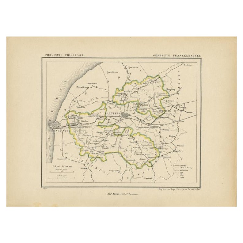
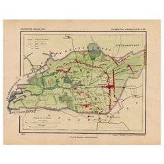
Antique Map of Franeker by Kuyper, 1868
About the Item
Antique map titled 'Provincie Friesland - Gemeente Franeker'. Map of the township of Franeker, Friesland. This map originates from 'Gemeente-Atlas van Nederland' by J. Kuyper. Artists and Engravers: Published by H. Suringar.
Artist: Published by H. Suringar.
Condition: Good, general age-related toning. Minor wear, blank verso. Please study image carefully.
Date: 1868
Overall size: 0.001 x 26.5 x 20 cm.
Image size: 20 x 15 cm.
We sell original antique maps to collectors, historians, educators and interior decorators all over the world. Our collection includes a wide range of authentic antique maps from the 16th to the 20th centuries. Buying and collecting antique maps is a tradition that goes back hundreds of years. Antique maps have proved a richly rewarding investment over the past decade, thanks to a growing appreciation of their unique historical appeal. Today the decorative qualities of antique maps are widely recognized by interior designers who appreciate their beauty and design flexibility. Depending on the individual map, presentation, and context, a rare or antique map can be modern, traditional, abstract, figurative, serious or whimsical. We offer a wide range of authentic antique maps for any budget.
- Dimensions:Height: 7.88 in (20 cm)Width: 10.44 in (26.5 cm)Depth: 0 in (0.01 mm)
- Materials and Techniques:
- Period:
- Date of Manufacture:1868
- Condition:
- Seller Location:Langweer, NL
- Reference Number:
About the Seller
5.0
Platinum Seller
These expertly vetted sellers are 1stDibs' most experienced sellers and are rated highest by our customers.
Established in 2009
1stDibs seller since 2017
1,933 sales on 1stDibs
Typical response time: <1 hour
- ShippingRetrieving quote...Ships From: Langweer, Netherlands
- Return PolicyA return for this item may be initiated within 14 days of delivery.
More From This SellerView All
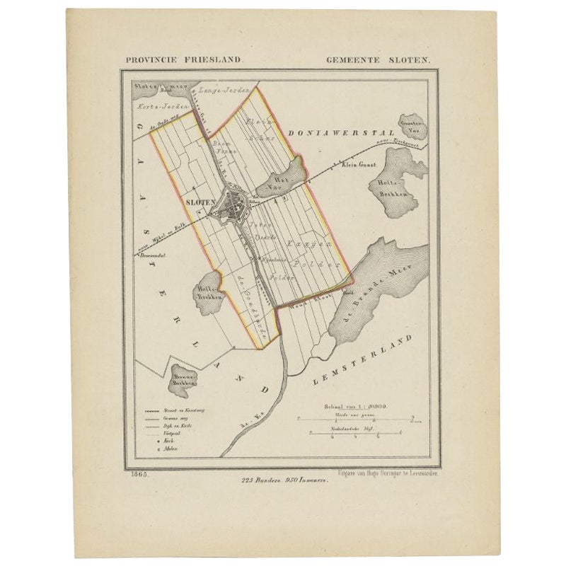
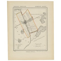
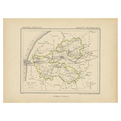
- Antique Map of Sloten by Kuyper, 1868Located in Langweer, NLAntique map titled 'Provincie Friesland - Gemeente Sloten'. Map of the township of Sloten, Friesland. This map originates from 'Gemeente-Atlas van Nederland' by J. Kuyper. Artists an...Category
Antique 19th Century Maps
MaterialsPaper
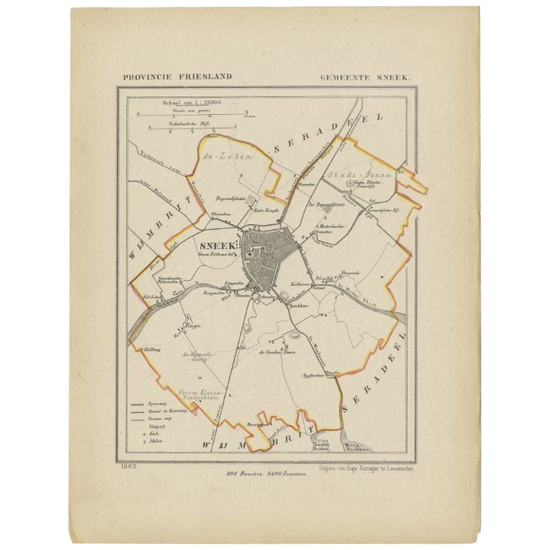
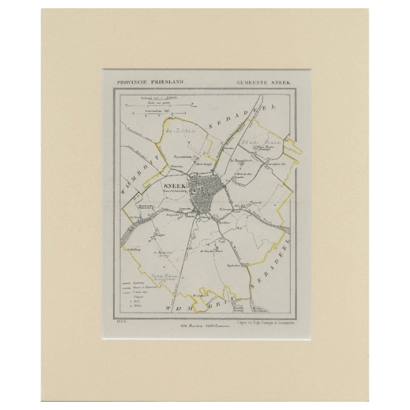
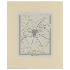
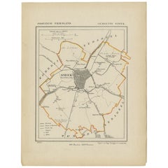
- Antique Map of Sneek by Kuyper, 1868Located in Langweer, NLAntique map titled 'Provincie Friesland - Gemeente Sneek'. Map of the township of Sneek, Friesland. This map originates from 'Gemeente-Atlas van Nederland' by J. Kuyper. Artists and ...Category
Antique 19th Century Maps
MaterialsPaper
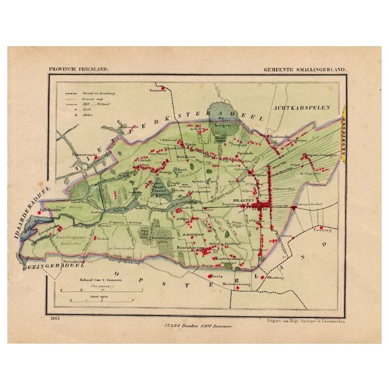
- Antique Map of Smallingerland by Kuyper, 1868Located in Langweer, NLAntique map titled 'Provincie Friesland - Gemeente Smallingerland'. Map of the township of Smallingerland including Drachten, Opeinde and many other villages. This map originates fro...Category
Antique 19th Century Maps
MaterialsPaper
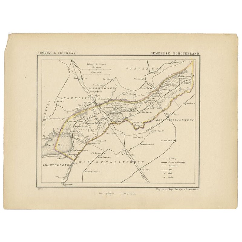
- Antique Map of Schoterland by Kuyper, 1868Located in Langweer, NLAntique map titled 'Provincie Friesland - Gemeente Schoterland'. Map of the township of Schoterland including Rottum, Oudeschoot, Mildam and many other villages. This map originates ...Category
Antique 19th Century Maps
MaterialsPaper
- Antique Map of Sneek by Kuyper, 1868Located in Langweer, NLAntique map titled 'Provincie Friesland - Gemeente Sneek'. Map of the township of Sneek, Friesland. This map originates from 'Gemeente-Atlas van Nederland' by J. Kuyper. Artists and ...Category
Antique 19th Century Maps
MaterialsPaper
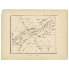
- Antique Map of Franekeradeel by Kuyper, 1868Located in Langweer, NLAntique map titled 'Provincie Friesland - Gemeente Franekeradeel'. Map of the township of Franekeradeel including Franeker, Achlum, Dongjum, Midlum and many other villages. This map ...Category
Antique 19th Century Maps
MaterialsPaper
You May Also Like
- 1861 Topographical Map of the District of Columbia, by Boschke, Antique MapLocated in Colorado Springs, COPresented is an original map of Albert Boschke's extremely sought-after "Topographical Map of the District of Columbia Surveyed in the Years 1856 ...Category
Antique 1860s American Historical Memorabilia
MaterialsPaper
- 1907 Map of Colorado, Antique Topographical Map, by Louis NellLocated in Colorado Springs, COThis highly detailed pocket map is a topographical map of the state of Colorado by Louis Nell from 1907. The map "has been complied from all availabl...Category
Antique Early 1900s American Maps
MaterialsPaper
- 1868 Map of the Upper Part of the Island of Manhattan Above 86th StreetBy Wm. Rogers Mfg. Co.Located in San Francisco, CAThis wonderful piece of New York City history is over 150 years old. It depicts 86th street and above. It was lithographed by WC Rogers and company. It was made to show what was the Battle of Harlem during the Revolutionary war...Category
Antique 1860s American American Colonial Maps
MaterialsPaper
- Antique Map of Italy by Andriveau-Goujon, 1843By Andriveau-GoujonLocated in New York, NYAntique Map of Italy by Andriveau-Goujon, 1843. Map of Italy in two parts by Andriveau-Goujon for the Library of Prince Carini at Palazzo Carini i...Category
Antique 1840s French Maps
MaterialsLinen, Paper
- Antique Map of Principality of MonacoBy Antonio Vallardi EditoreLocated in Alessandria, PiemonteST/619 - "Old Geographical Atlas of Italy - Topographic map of ex-Principality of Monaco" - ediz Vallardi - Milano - A somewhat special edition ---Category
Antique Late 19th Century Italian Other Prints
MaterialsPaper
- Original Antique Map of Russia By Arrowsmith. 1820Located in St Annes, LancashireGreat map of Russia Drawn under the direction of Arrowsmith Copper-plate engraving Published by Longman, Hurst, Rees, Orme and Brown, 1820 Unframed.Category
Antique 1820s English Maps
MaterialsPaper


Recently Viewed
View AllMore Ways To Browse
Netherlands 16th Century
Antique Furniture In Texas
Antique Map Of England
Antique Maps Of England
Antique Furniture North East
Natural History Curiosities
Antique Map United States
United States Map Antique
Antique United States Map
Antique United States Maps
Antique Railroad
Antique Western Collectibles
Railroad Antique
Antique Maps Of United States
Antique Collectible Bears
United States Map Vintage
United States Vintage Map
Amsterdam Map