Items Similar to Antique Map of Java, Indonesia (circa 1770) - Dutch Cartography


Want more images or videos?
Request additional images or videos from the seller
1 of 6
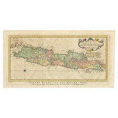
Antique Map of Java, Indonesia (circa 1770) - Dutch Cartography
About the Item
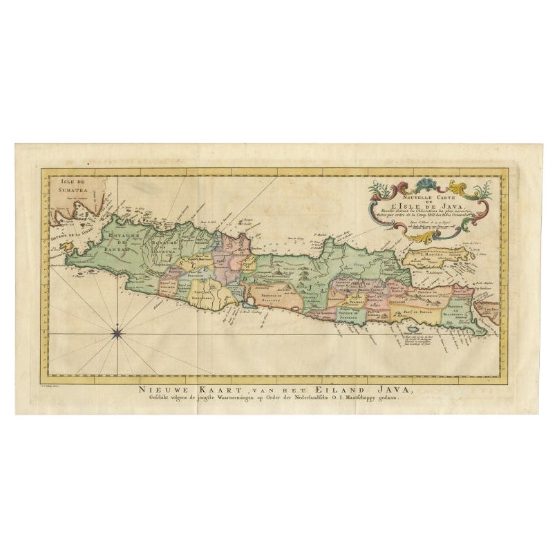
Antique map Indonesia titled 'Nouvelle Carte de l'Isle de Java - Nieuwe kaart, van het Eiland Java'. Chart of the island of Java, depicting soundings around the coast, all principal harbors, rivers and elevations, bays and points, settlements and provinces. Included are Madura, Bali, Sunda Strait and the southeastern tip of Sumatra. This map originates from the Dutch edition of 'Histoire generale des voyages, ou nouvelle collection de toutes les relations de voyages (..)'.
1. **Layout and Design**:
- The map depicts the island of Java in Indonesia, showcasing its various regions and geographical features.
- It includes detailed illustrations of mountains, rivers, and coastal areas, with color-coded regions indicating different provinces or kingdoms.
2. **Geographical Features**:
- The western part of the island is labeled "Royaume de Bantan" (Kingdom of Banten).
- The central and eastern parts are divided into various provinces, each marked with different colors for distinction.
3. **Text and Labels**:
- The map is titled "Nouvelle Carte de l'Isle de Java" (New Map of the Island of Java) and includes both French and Dutch text.
- Labels for regions, towns, and significant geographical features are provided in French.
4. **Decorative Elements**:
- The map features a decorative cartouche in the top right corner, containing the title and additional information.
- A compass rose is located in the bottom left corner, indicating directions.
5. **Surrounding Areas**:
- The map also shows parts of the surrounding islands, including the western tip of Sumatra.
### Interesting Aspects
1. **Historical Context**:
- This map dates back to circa 1770, a period when European colonial powers, particularly the Dutch, were expanding their influence in Southeast Asia.
- Java was a crucial part of the Dutch East Indies, and maps like this were essential for navigation and administration.
2. **Cartographic Style**:
- The map is hand-drawn and colored, typical of 18th-century cartography.
- The use of detailed illustrations and decorative elements reflects the artistic and functional aspects of map-making during this era.
3. **Cultural Significance**:
- The map provides insights into the political divisions and colonial perceptions of Java at the time.
- It highlights the importance of Java as a hub of trade, culture, and colonial administration.
### About the Maker
- **Maker**: The map is attributed to Dutch cartographers, likely produced under the supervision or commission of the Dutch East India Company (VOC).
- **Publication Context**: The VOC was instrumental in creating detailed maps for navigation and trade purposes. Their maps were renowned for accuracy and artistic quality.
- **Techniques**: The map was created using copperplate engraving, a common technique in the 18th century for producing detailed and durable prints.
- Creator:Jakob van der Schley (Artist)
- Dimensions:Height: 10.44 in (26.5 cm)Width: 18.51 in (47 cm)Depth: 0.02 in (0.5 mm)
- Materials and Techniques:
- Period:
- Date of Manufacture:circa 1770
- Condition:Great condition, please study images carefully.
- Seller Location:Langweer, NL
- Reference Number:Seller: BGJC-3341stDibs: LU3054315057661
About the Seller
5.0
Recognized Seller
These prestigious sellers are industry leaders and represent the highest echelon for item quality and design.
Platinum Seller
Premium sellers with a 4.7+ rating and 24-hour response times
Established in 2009
1stDibs seller since 2017
2,439 sales on 1stDibs
Typical response time: 1 hour
- ShippingRetrieving quote...Shipping from: Langweer, Netherlands
- Return Policy
Authenticity Guarantee
In the unlikely event there’s an issue with an item’s authenticity, contact us within 1 year for a full refund. DetailsMoney-Back Guarantee
If your item is not as described, is damaged in transit, or does not arrive, contact us within 7 days for a full refund. Details24-Hour Cancellation
You have a 24-hour grace period in which to reconsider your purchase, with no questions asked.Vetted Professional Sellers
Our world-class sellers must adhere to strict standards for service and quality, maintaining the integrity of our listings.Price-Match Guarantee
If you find that a seller listed the same item for a lower price elsewhere, we’ll match it.Trusted Global Delivery
Our best-in-class carrier network provides specialized shipping options worldwide, including custom delivery.More From This Seller
View AllAntique Map of Java, Madura, Bali and the Sunda Strait, Indonesia, c.1770
Located in Langweer, NL
Antique map Indonesia titled 'Nouvelle Carte de l'Isle de Java - Nieuwe kaart, van het Eiland Java'. Chart of the island of Java, depicting soun...
Category
Antique 18th Century Maps
Materials
Paper
$415 Sale Price
20% Off
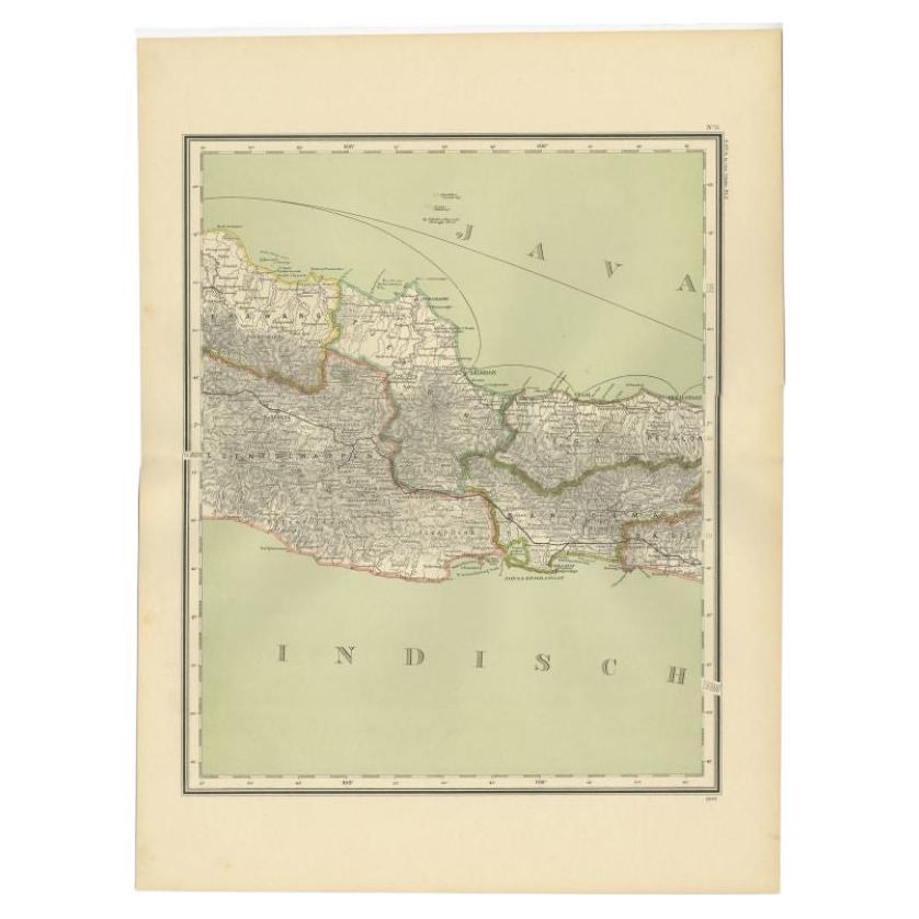
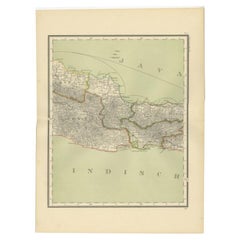
Antique Map of Part of Java, Indonesia, 1900
Located in Langweer, NL
Antique map of West Java. This map originates from 'Atlas van Nederlandsch Oost- en West-Indië' by I. Dornseiffen.
Artists and Engravers: Published by Seyffardt's Boekhandel, Amste...
Category
20th Century Maps
Materials
Paper
Antique Map of Banten Bay, Java, Indonesia, c.1725
Located in Langweer, NL
A small early 18th century map of Banten Bay showing the islands of Pulo Dua and Pulo Batto together with soundings within the Bay and profiles of hills on the islands published by C...
Category
Antique 18th Century Maps
Materials
Paper

$138 Sale Price
20% Off
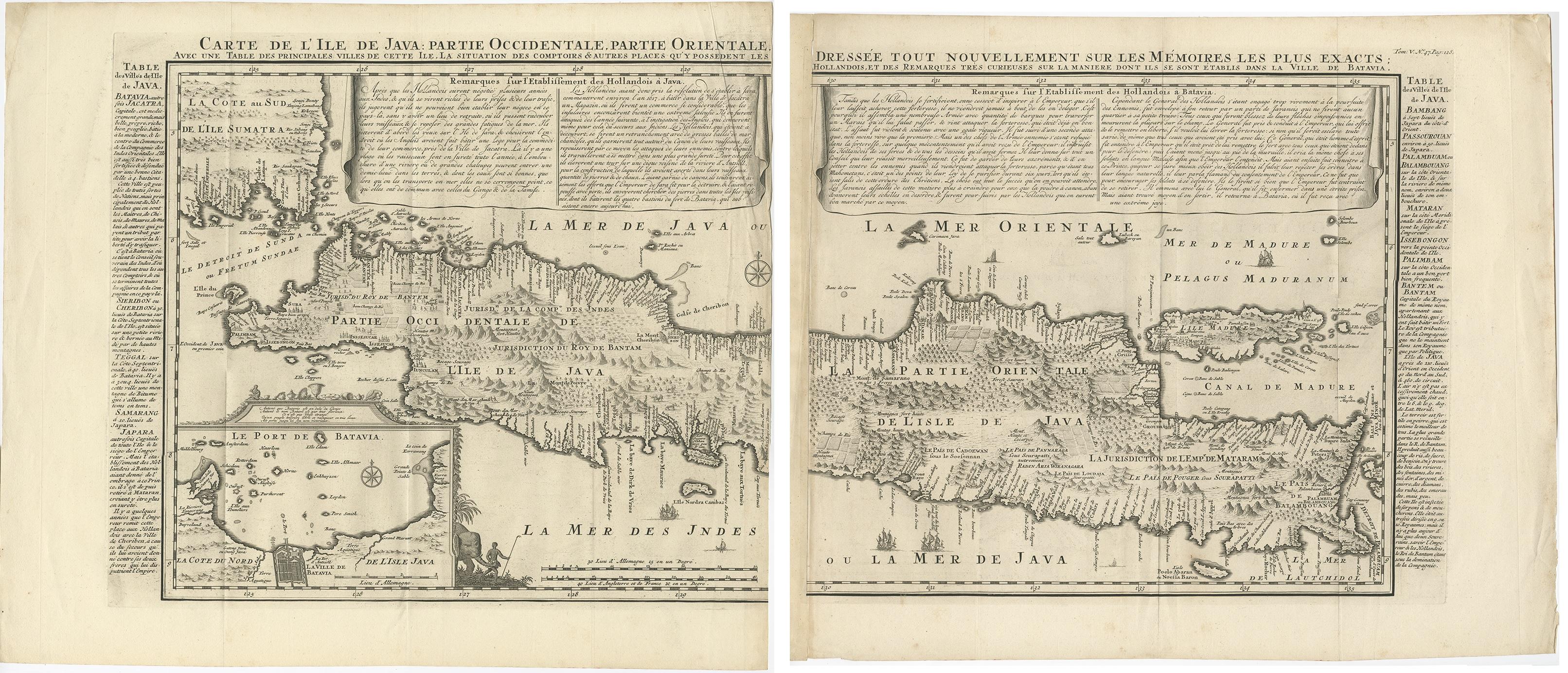
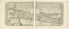
Antique Map of Java 'Indonesia' by Chatelain, 1719
Located in Langweer, NL
Antique map titled 'Carte de l'Ile de Java: Partie Occidentale, Partie Orientale, Dressee tout Nouvellement Sur Les Memoires Les Plus Exacts (..)'. This beautiful map of Java exists ...
Category
Antique Early 18th Century Maps
Materials
Paper
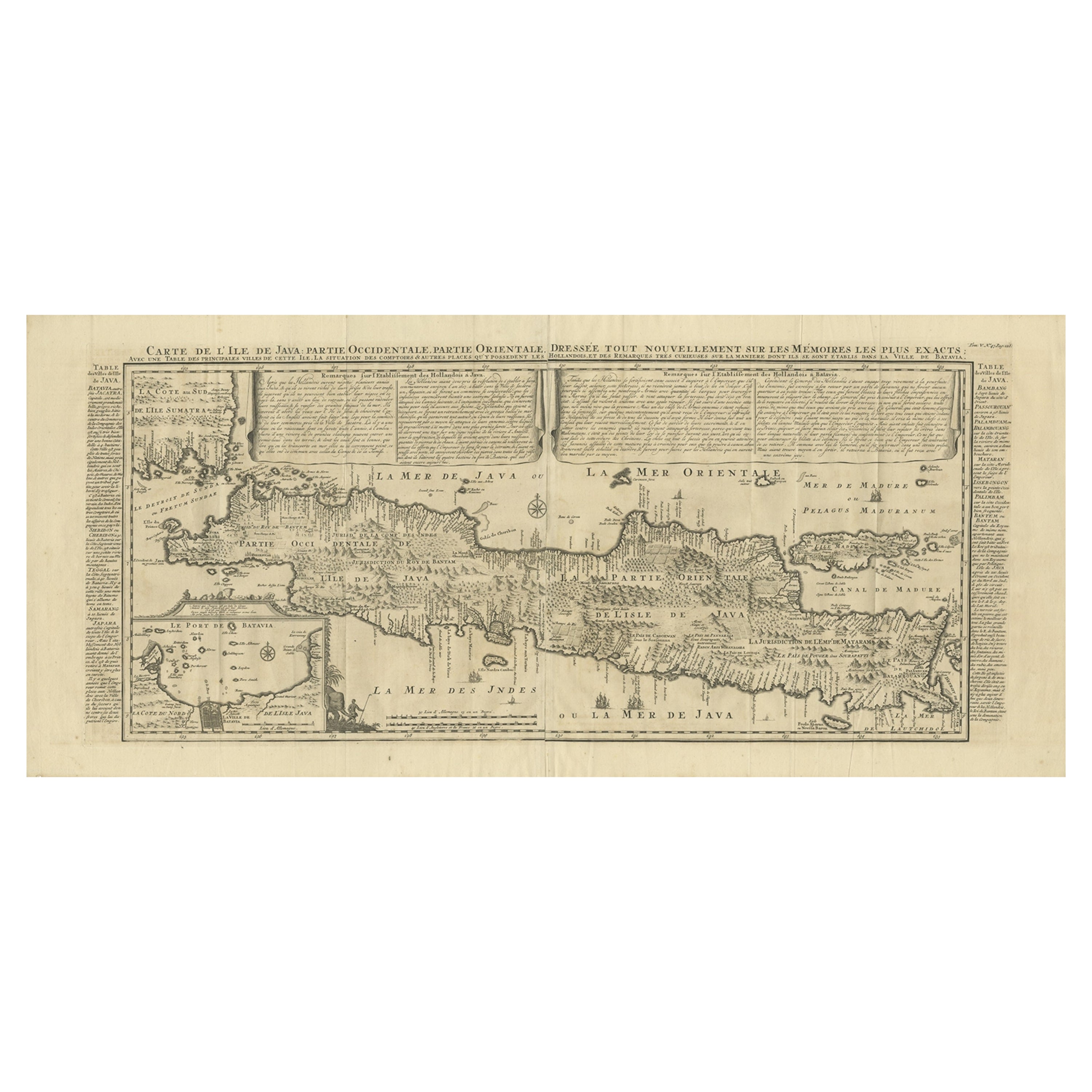
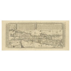
Antique Decorative French Map of Java, Indonesia, 1718
Located in Langweer, NL
Antique map of Java titled 'Carte de l'Ile de Java: Partie Occidentale, Partie Orientale, Dressee tout Nouvellement (..)'.
Decorative large format map...
Category
Antique 18th Century Maps
Materials
Paper
$2,445 Sale Price
20% Off
Antique Map of the Island Java, Indonesia, c.1650
Located in Langweer, NL
Antique map titled 'Insulae Iavae cum parte insularum Boreno Sumatrae (..)'.
Beautiful map of the island of Java and part of Borneo, Bali, Madura and Sumatra. With decorative carto...
Category
Antique 17th Century Maps
Materials
Paper

$2,998 Sale Price
20% Off
You May Also Like
Antique County Map of Cheshire, Dutch, Framed, Cartography, Janssonius, C.1660
Located in Hele, Devon, GB
This is an antique county map of Cheshire. A Dutch, framed atlas engraving by Johannes Janssonius, dating to the 17th century and later.
A treat for the collector or county native,...
Category
Antique Mid-17th Century Dutch Charles II Maps
Materials
Glass, Wood, Paper

Original Antique Map of Spain and Portugal, circa 1790
Located in St Annes, Lancashire
Super map of Spain and Portugal
Copper plate engraving by A. Bell
Published, circa 1790.
Unframed.
Category
Antique 1790s English Other Maps
Materials
Paper

Antique Map of Principality of Monaco
By Antonio Vallardi Editore
Located in Alessandria, Piemonte
ST/619 - "Old Geographical Atlas of Italy - Topographic map of ex-Principality of Monaco" -
ediz Vallardi - Milano -
A somewhat special edition ---
Category
Antique Late 19th Century Italian Other Prints
Materials
Paper

Original Antique Map of Europe, Arrowsmith, 1820
Located in St Annes, Lancashire
Great map of Europe
Drawn under the direction of Arrowsmith.
Copper-plate engraving.
Published by Longman, Hurst, Rees, Orme and Brown, 1820
...
Category
Antique 1820s English Maps
Materials
Paper

Original Antique Map of Ireland- Kerry. C.1840
Located in St Annes, Lancashire
Great map of Kerry
Steel engraving
Drawn under the direction of A.Adlard
Published by How and Parsons, C.1840
Unframed.
Category
Antique 1840s English Maps
Materials
Paper

Original Antique Map of South America. C.1780
Located in St Annes, Lancashire
Great map of South America
Copper-plate engraving
Published C.1780
Two small worm holes to left side of map
Unframed.
Category
Antique Early 1800s English Georgian Maps
Materials
Paper

Recently Viewed
View AllMore Ways To Browse
Antique Map Of Middle East
An Accurate Map Of Europe
Marine Charts
Antique Galleon
South Africa Antique Map
Biblical Maps
Hemisphere World Map
Cape Verde
Pirate Antique
West Indies Map
Antique Nautical Charts
Caribbean Map
Antique Linen Map
Antique Maps Venice
Medieval Capital
Miniature Antique Print
Antique Map Of Venice
Antique Maps Of Canada