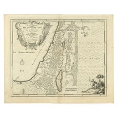
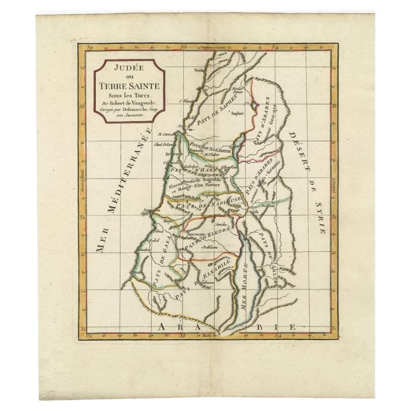
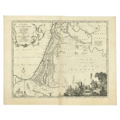
Antique Map of the Jewish Land by Lindeman, 1761
View Similar Items


Want more images or videos?
Request additional images or videos from the seller
1 of 5
Antique Map of the Jewish Land by Lindeman, 1761
About the Item
- Dimensions:Height: 15.6 in (39.6 cm)Width: 19.18 in (48.7 cm)Depth: 0 in (0.01 mm)
- Materials and Techniques:
- Period:
- Date of Manufacture:1761
- Condition:
- Seller Location:Langweer, NL
- Reference Number:Seller: PCT-614511stDibs: LU3054327826852
About the Seller
5.0
Recognized Seller
These prestigious sellers are industry leaders and represent the highest echelon for item quality and design.
Gold Seller
Premium sellers maintaining a 4.3+ rating and 24-hour response times
Established in 2009
1stDibs seller since 2017
2,446 sales on 1stDibs
Typical response time: 1 hour
Authenticity Guarantee
In the unlikely event there’s an issue with an item’s authenticity, contact us within 1 year for a full refund. DetailsMoney-Back Guarantee
If your item is not as described, is damaged in transit, or does not arrive, contact us within 7 days for a full refund. Details24-Hour Cancellation
You have a 24-hour grace period in which to reconsider your purchase, with no questions asked.Vetted Professional Sellers
Our world-class sellers must adhere to strict standards for service and quality, maintaining the integrity of our listings.Price-Match Guarantee
If you find that a seller listed the same item for a lower price elsewhere, we’ll match it.Trusted Global Delivery
Our best-in-class carrier network provides specialized shipping options worldwide, including custom delivery.More From This Seller
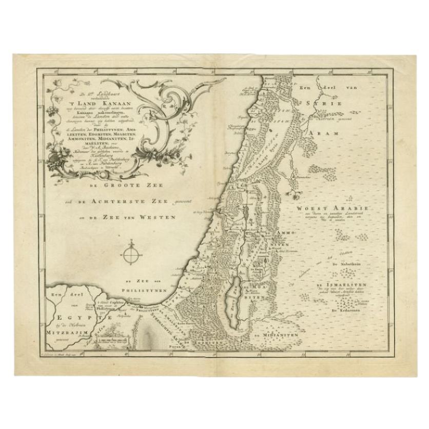
View AllAntique Map of the Biblical Land of Canaan by Lindeman, c.1758
Located in Langweer, NL
Antique map titled 'De IIde Landkaart verbeeldende t'Land Kanaan nog bewoond door deszelfs eerste bezitters (..).' - Map of the biblical Land of Canaan. With large title cartouche, c...
Category
Antique 18th Century Maps
Materials
Paper
$186 Sale Price
20% Off
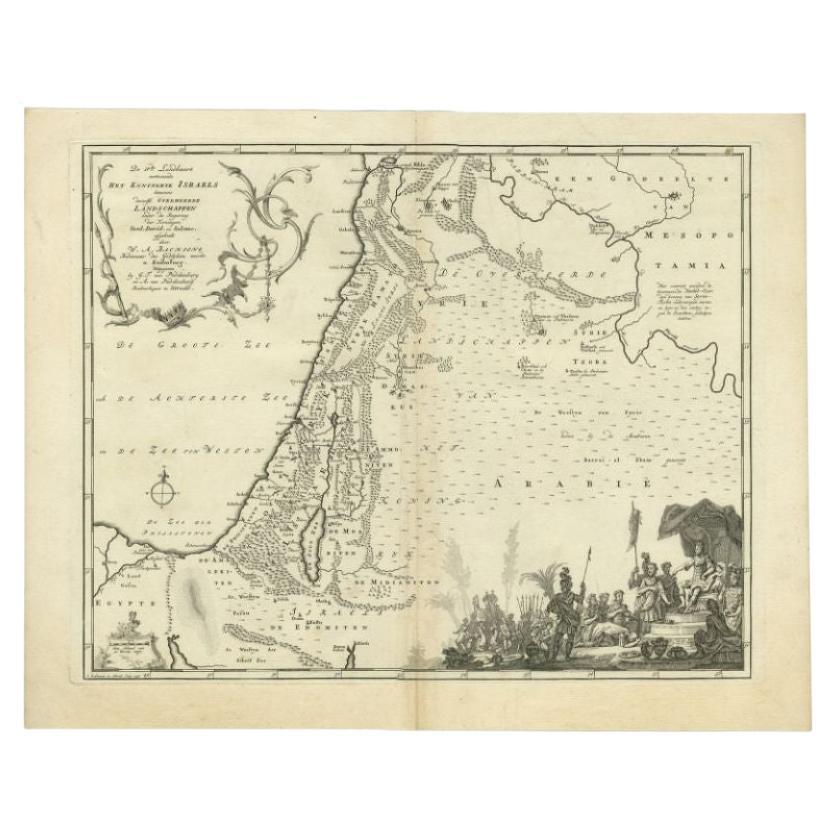
Antique Map of the Biblical Kingdom of Israel by Lindeman, c.1758
Located in Langweer, NL
Antique map titled 'De IVde Landkaart vertoonende het Koningryk Israels benevens deszelfs overheerde Landschappen (..).' Map of the biblical Kingdom of Israel under the Kings Saul, D...
Category
Antique 18th Century Maps
Materials
Paper
$231 Sale Price
20% Off
Antique Map of the Holy Land, c.1717
Located in Langweer, NL
Antique map Israel titled 'Tabula Geographica Terrae Sanctae'. Rare edition made after a map of the Holy Land by J. Bonfrerius. The map is oriented ...
Category
Antique 18th Century Maps
Materials
Paper

$363 Sale Price
20% Off
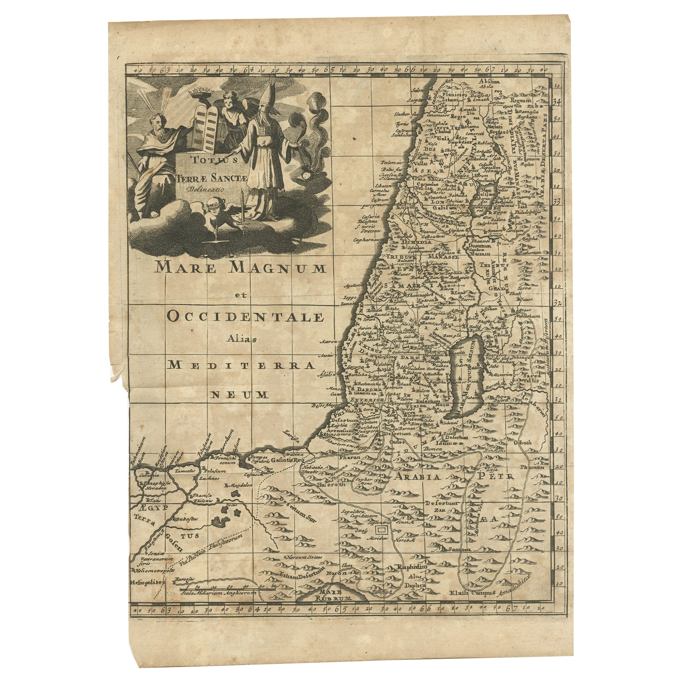
Antique Map of the Holy Land, c.1710
Located in Langweer, NL
Antique map titled 'Totius Terrae Sanctae Delineatio'. Map of the Holy Land extending to Egypt and showing the route of the Children of Israel in their e...
Category
Antique 18th Century Maps
Materials
Paper

$111 Sale Price
20% Off
Antique Map of the Holy Land by Schut, 1710
Located in Langweer, NL
Antique map of the Holy Land titled 'Het Beloofde Landt Canaan.' Very detailed and decorative map of the Holy Land embellished with sailing ships and com...
Category
Antique 18th Century Maps
Materials
Paper

$391 Sale Price
20% Off
Antique Map of the Holy Land by Keur, 1748
Located in Langweer, NL
Antique Map Holy Land titled 'De Gelegentheyd van t'Paradys ende t'Landt Canaan, Mitsgaders d'eerst bewoonde Landen der Patriarchen'. Includes five decorative vignettes, including No...
Category
Antique 18th Century Maps
Materials
Paper

$324 Sale Price
20% Off
You May Also Like
The Holy Land at the Time of Jesus: A 17th Century Dutch Map by Visscher
By Nicolaes Visscher II
Located in Alamo, CA
This detailed Dutch map entitled "Het Beloofe de Landt Canaan door wandelt van onsen Salichmaecker Iesu Christo, nessens syne Apostelen" by Nicolaes Visscher was published in Amsterd...
Category
Antique Mid-17th Century Dutch Maps
Materials
Paper

The Jewish Cookbook
Located in New York, NY
A rich trove of contemporary global Jewish cuisine, featuring hundreds of stories and recipes for home cooks everywhere
The Jewish Cookbook is an inspiring celebration of the divers...
Category
21st Century and Contemporary European Books
Materials
Paper
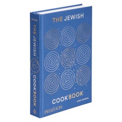
$50 / item
Map of the Holy Land "Carte de la Syrie et de l'Egypte" by Pierre M. Lapie
By Pierre M. Lapie
Located in Alamo, CA
An early 19th century map of ancient Syria and Egypt entitled "Carte de la Syrie et de l'Egypte anciennes/dressée par M. Lapie, Colonel d'Etat Major, et...
Category
Antique Early 19th Century French Maps
Materials
Paper

Original Antique Map of The Philippines. C.1900
Located in St Annes, Lancashire
Fabulous map of The Philippines
Original color.
Engraved and printed by the George F. Cram Company, Indianapolis.
Published, C.1900.
Unframed.
Free shipping.
Category
Antique 1890s American Maps
Materials
Paper

Original Antique Map of The World by Thomas Clerk, 1817
Located in St Annes, Lancashire
Great map of The Eastern and Western Hemispheres
On 2 sheets
Copper-plate engraving
Drawn and engraved by Thomas Clerk, Edinburgh.
Published by Mackenzie And Dent, 1817
...
Category
Antique 1810s English Maps
Materials
Paper

Large Original Antique Map of The Bahamas. 1894
Located in St Annes, Lancashire
Superb Antique map of The Bahamas
Published Edward Stanford, Charing Cross, London 1894
Original colour
Good condition
Unframed.
Free shipping
Category
Antique 1890s English Maps
Materials
Paper
