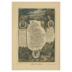
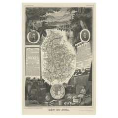
Antique Map of Jura, a Famous Wine Area in France, c. 1852
View Similar Items


Want more images or videos?
Request additional images or videos from the seller
1 of 5
Antique Map of Jura, a Famous Wine Area in France, c. 1852
About the Item
- Dimensions:Height: 20.28 in (51.5 cm)Width: 14.38 in (36.5 cm)Depth: 0 in (0.01 mm)
- Materials and Techniques:
- Place of Origin:
- Period:
- Date of Manufacture:1852
- Condition:Wear consistent with age and use. General age-related toning. Please study image carefully.
- Seller Location:Langweer, NL
- Reference Number:Seller: BG-13216-21stDibs: LU3054328347942
About the Seller
5.0
Recognized Seller
These prestigious sellers are industry leaders and represent the highest echelon for item quality and design.
Platinum Seller
Premium sellers with a 4.7+ rating and 24-hour response times
Established in 2009
1stDibs seller since 2017
2,434 sales on 1stDibs
Typical response time: 1 hour
Authenticity Guarantee
In the unlikely event there’s an issue with an item’s authenticity, contact us within 1 year for a full refund. DetailsMoney-Back Guarantee
If your item is not as described, is damaged in transit, or does not arrive, contact us within 7 days for a full refund. Details24-Hour Cancellation
You have a 24-hour grace period in which to reconsider your purchase, with no questions asked.Vetted Professional Sellers
Our world-class sellers must adhere to strict standards for service and quality, maintaining the integrity of our listings.Price-Match Guarantee
If you find that a seller listed the same item for a lower price elsewhere, we’ll match it.Trusted Global Delivery
Our best-in-class carrier network provides specialized shipping options worldwide, including custom delivery.More From This Seller
View AllAntique Map of Jura, a Famous Wine Area in France, 1854
Located in Langweer, NL
Antique map titled 'Dépt. du Jura'. Map of the French department Jura, France.
Jura is a department in the Bourgogne-Franche-Comté region in Eastern France. Named after the Jura Mo...
Category
Antique 19th Century Maps
Materials
Paper
$241 Sale Price
20% Off
Antique Map of Jura ‘France’ by V. Levasseur, 1854
By Victor Levasseur
Located in Langweer, NL
Antique map titled 'Dépt. du Jura'. Map of the French department Jura, France. The Jura wines are very distinctive and unusual, such as Vin Jaune, which is made by a similar process ...
Category
Antique Mid-19th Century Maps
Materials
Paper

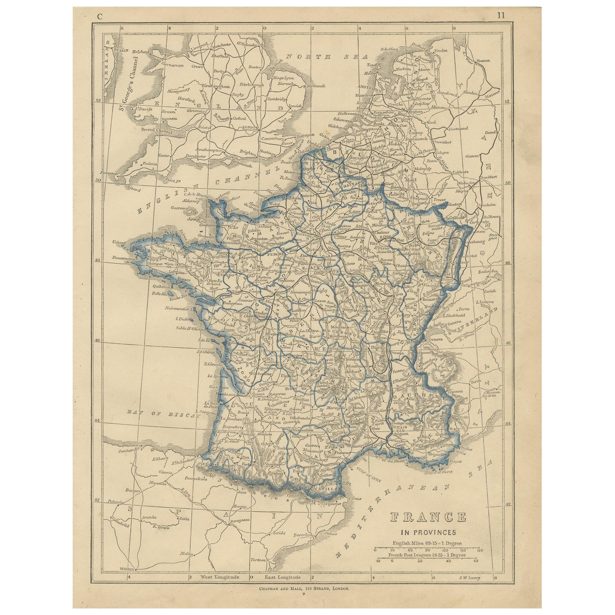
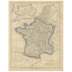
Antique Map of France by Lowry, '1852'
Located in Langweer, NL
Antique map titled 'France in Provinces'. Original map of France. This map originates from 'Lowry's Table Atlas constructed and engraved from the most recent Authorities' by J.W. Low...
Category
Antique Mid-19th Century Maps
Materials
Paper
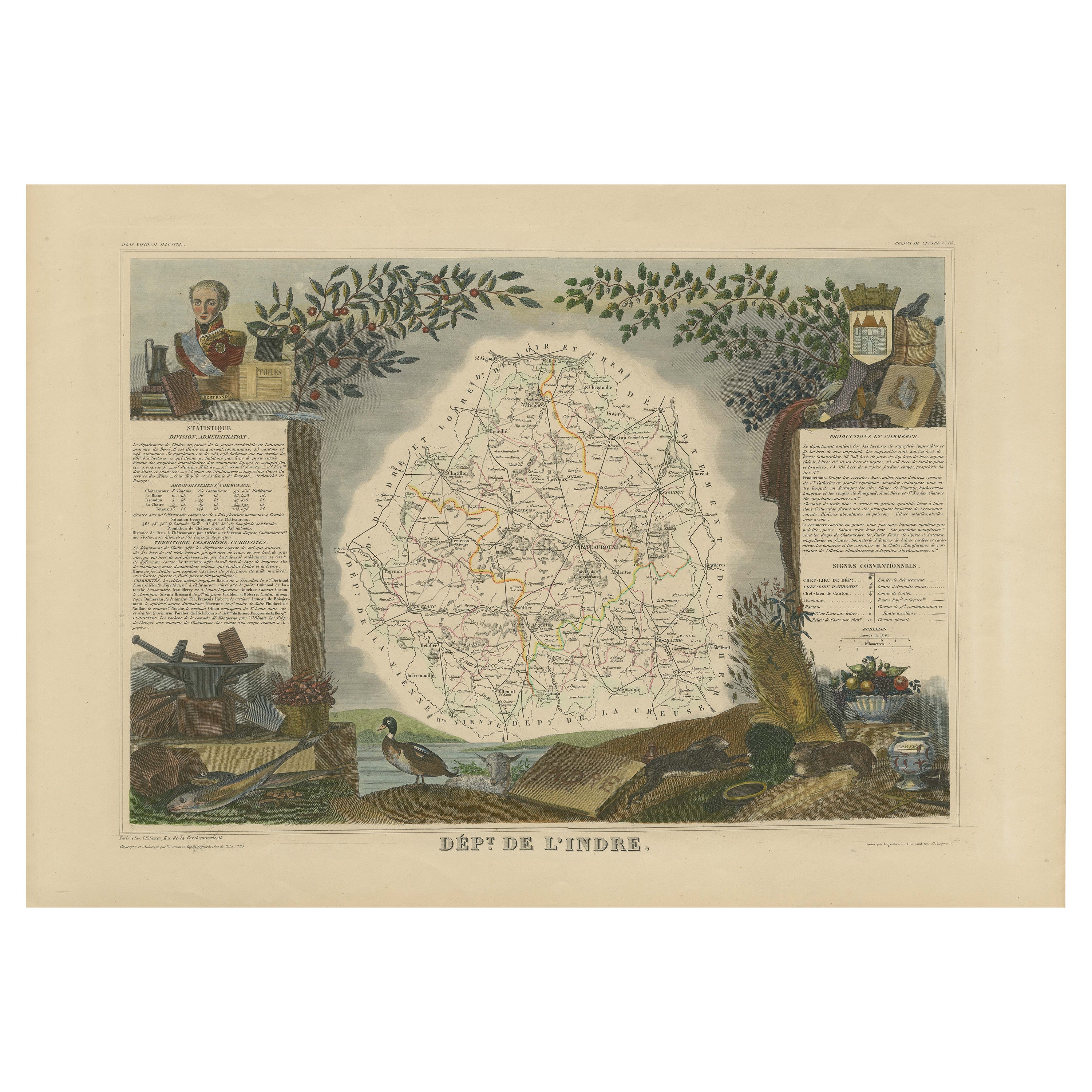
Antique Map of the Indre Region in France, ca. 1852
Located in Langweer, NL
Antique map titled 'Dépt. de l'Indre'.
Map of the French department of Indre, France. Part of the Loire Valley wine region, this area is known for its production of Chinon wines, typically red, and production of Pouligny-Saint-Pierre, goats'-milk cheese. It is also the birthplace of the great philosopher Rene Descartes...
Category
Antique Mid-19th Century Maps
Materials
Paper
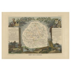
$208 Sale Price
20% Off
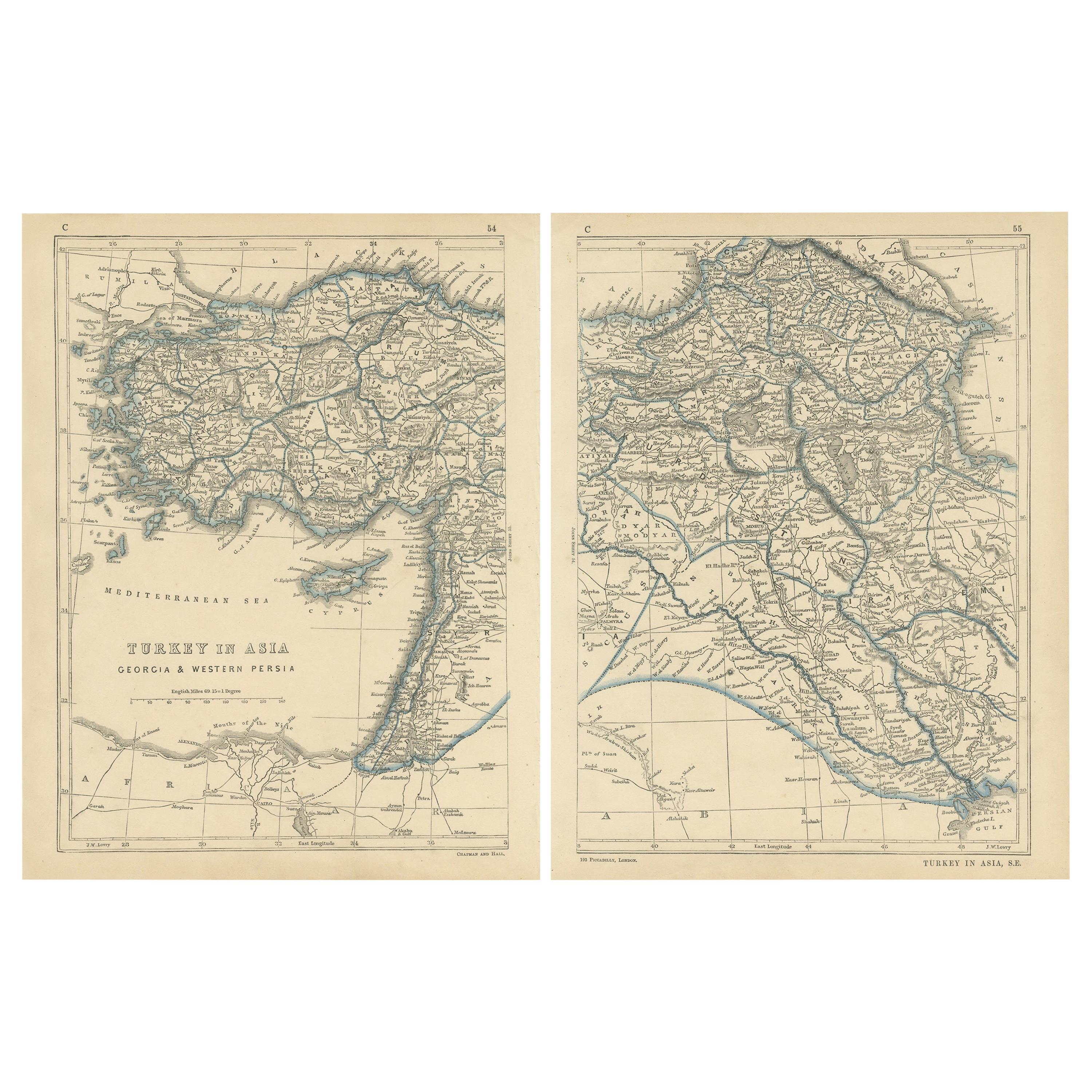
Antique Map of Eastern Persia, 1852
Located in Langweer, NL
Antique map titled 'Eastern Persia'. Original map of Eastern Persia. This map originates from 'Lowry's Table Atlas constructed and engraved from the most recent Authorities' by J.W. ...
Category
Antique Mid-19th Century Maps
Materials
Paper

$92 Sale Price
20% Off
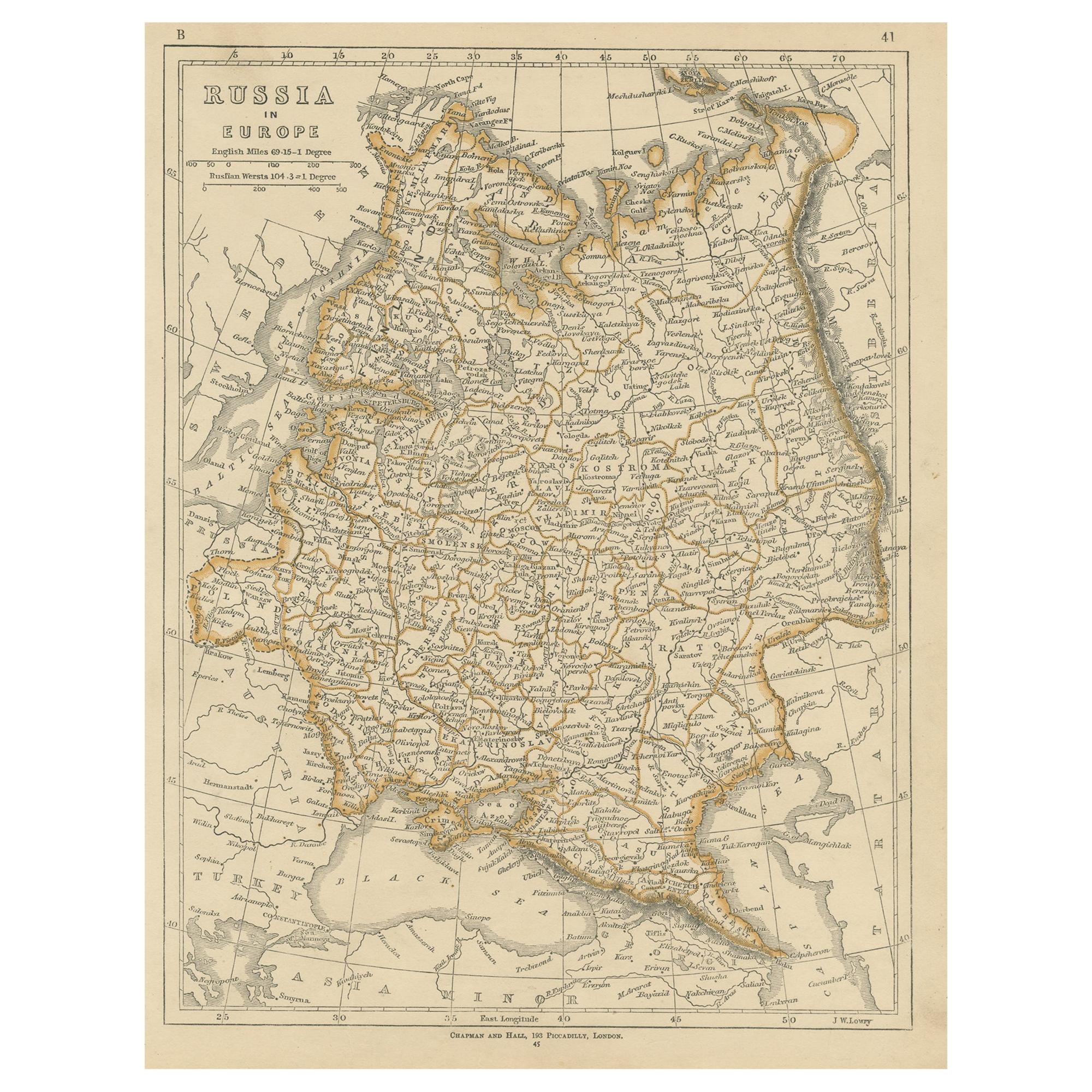
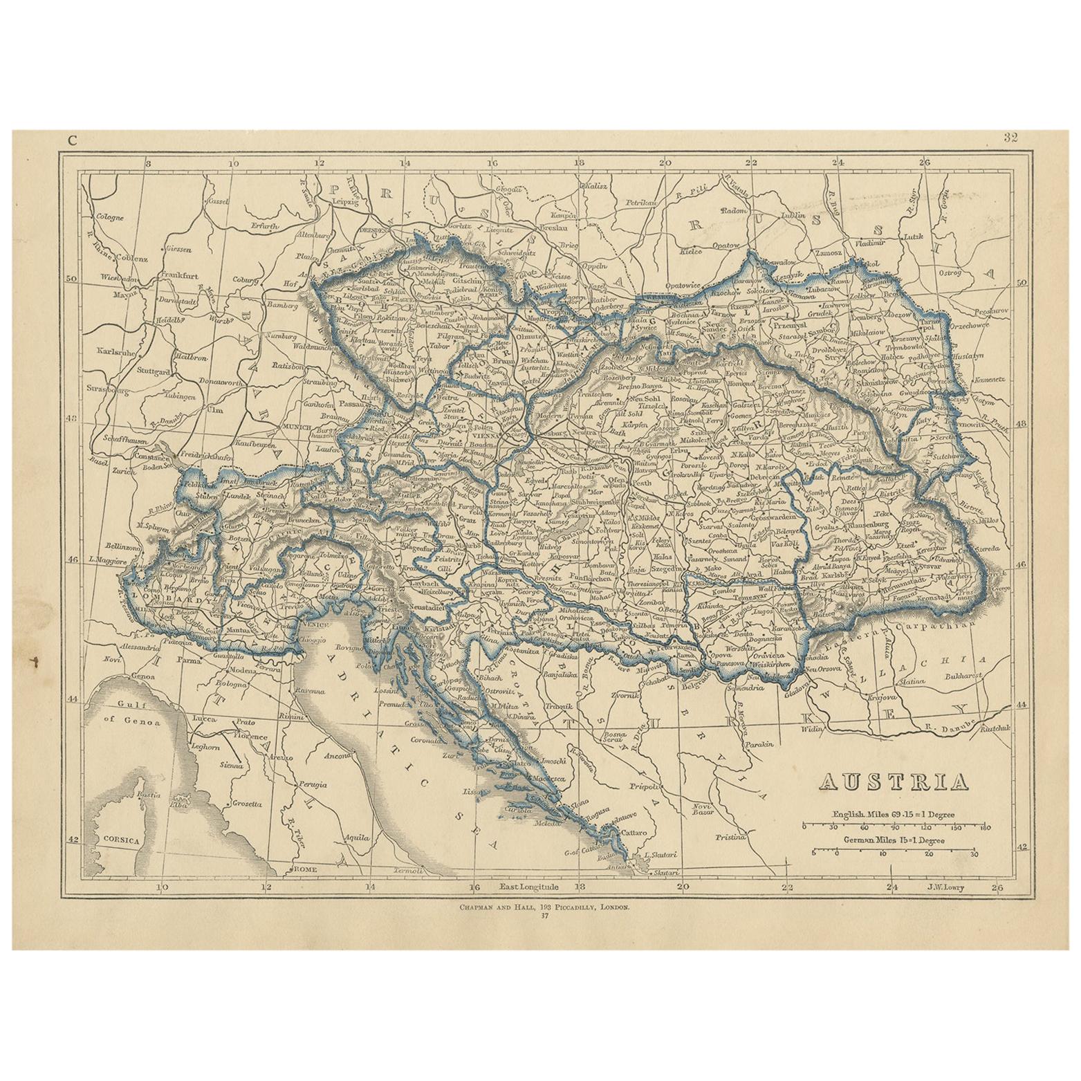
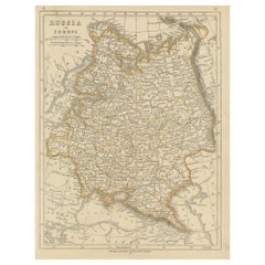
Antique Map of Russia in Europe by Lowry, 1852
Located in Langweer, NL
Antique map titled 'Russia in Europe'. Original map of Russia in Europe. This map originates from 'Lowry's Table Atlas constructed and engraved from the most recent Authorities' by J...
Category
Antique Mid-19th Century Maps
Materials
Paper
You May Also Like
Antique Map of Principality of Monaco
By Antonio Vallardi Editore
Located in Alessandria, Piemonte
ST/619 - "Old Geographical Atlas of Italy - Topographic map of ex-Principality of Monaco" -
ediz Vallardi - Milano -
A somewhat special edition ---
Category
Antique Late 19th Century Italian Other Prints
Materials
Paper

Original Antique Map of Asia. C.1780
Located in St Annes, Lancashire
Great map of Asia
Copper-plate engraving
Published C.1780
Two small worm holes to right side of map
Unframed.
Category
Antique Early 1800s English Georgian Maps
Materials
Paper

Original Antique Map of South America. C.1780
Located in St Annes, Lancashire
Great map of South America
Copper-plate engraving
Published C.1780
Two small worm holes to left side of map
Unframed.
Category
Antique Early 1800s English Georgian Maps
Materials
Paper

Original Antique Map of Ireland- Kerry. C.1840
Located in St Annes, Lancashire
Great map of Kerry
Steel engraving
Drawn under the direction of A.Adlard
Published by How and Parsons, C.1840
Unframed.
Category
Antique 1840s English Maps
Materials
Paper

Original Antique Map of Europe, Arrowsmith, 1820
Located in St Annes, Lancashire
Great map of Europe
Drawn under the direction of Arrowsmith.
Copper-plate engraving.
Published by Longman, Hurst, Rees, Orme and Brown, 1820
...
Category
Antique 1820s English Maps
Materials
Paper

Original Antique Map of Hungary, Arrowsmith, 1820
Located in St Annes, Lancashire
Great map of Hungary
Drawn under the direction of Arrowsmith.
Copper-plate engraving.
Published by Longman, Hurst, Rees, Orme and Brown, 1820
Unframed.
Category
Antique 1820s English Maps
Materials
Paper
