Items Similar to Antique Map of Lotharingia (Lorraine) by Danckerts, c. 1700 – Hand-Colored


Want more images or videos?
Request additional images or videos from the seller
1 of 7
Antique Map of Lotharingia (Lorraine) by Danckerts, c. 1700 – Hand-Colored
$1,117.31
£832.05
€940
CA$1,542.60
A$1,710.20
CHF 898.77
MX$20,930
NOK 11,224.78
SEK 10,535.58
DKK 7,156.85
About the Item
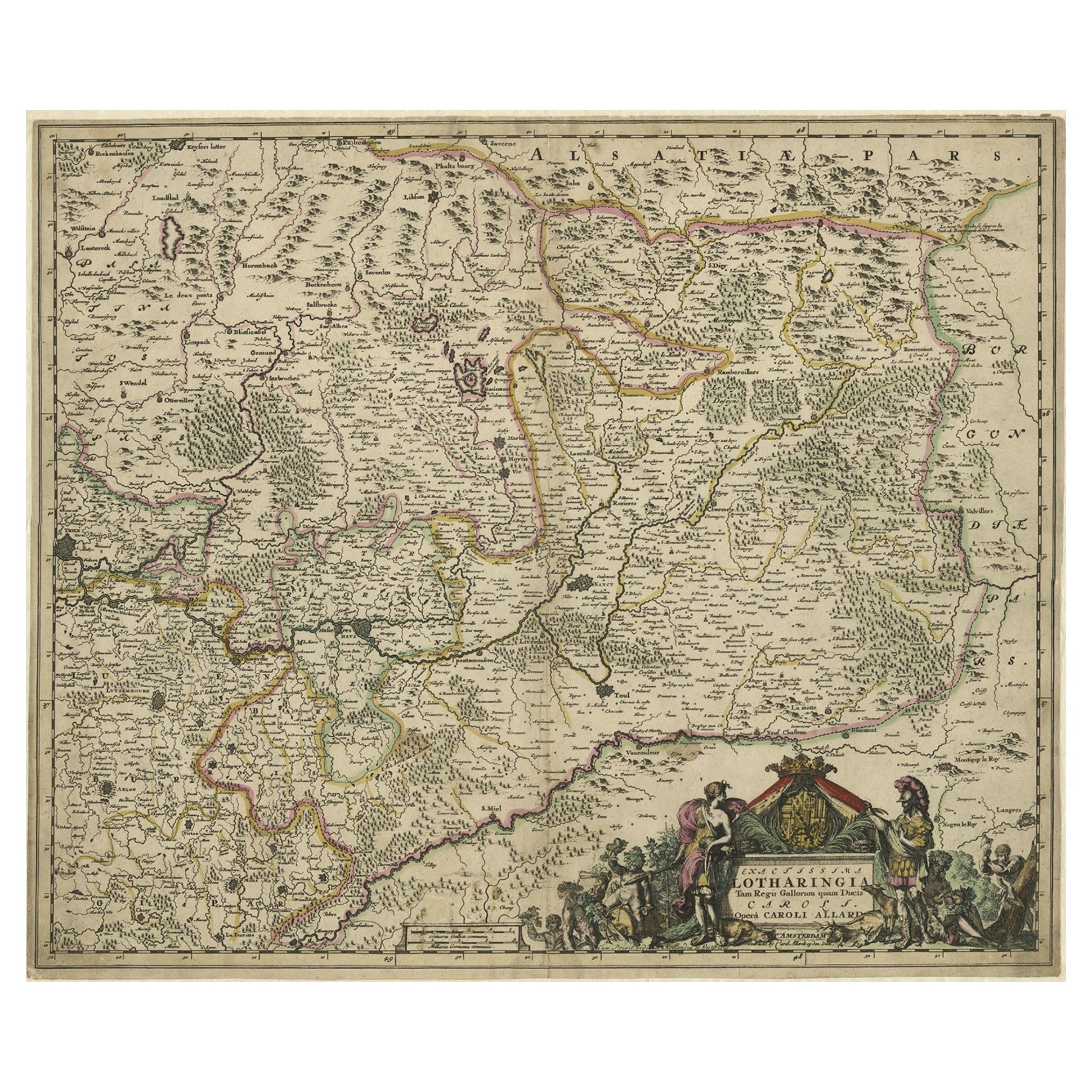
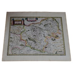
Antique Map of Lotharingia (Lorraine) by Theodorus Danckerts circa 1700 Hand-Colored
This beautifully detailed antique map of Lotharingia, now the Lorraine region in northeastern France, was created by the Dutch cartographer Theodorus Danckerts around 1700. The map provides an intricate representation of the region’s geographical features, including rivers, mountains, towns, and political divisions. The engraving is enhanced with hand-applied color, highlighting borders and key locations. The map reflects the expertise of Dutch cartographers during the late 17th and early 18th centuries, known for their precision and artistic embellishments.
The decorative title cartouche in the lower left corner is adorned with allegorical figures, a reclining river god, and a coat of arms representing Lorraine. The script and fine detailing add to its aesthetic appeal, making it not only a valuable historical document but also a striking decorative piece. The map was printed on high-quality paper typical of the period and remains an excellent example of early European cartography.
### Important Cities on the Map
This antique map of Lotharingia or Lorraine by Theodorus Danckerts includes several historically significant cities. Nancy was the capital of the Duchy of Lorraine and served as an important political and cultural center. Metz was a major fortress city and a key trade hub, frequently contested between France and the Holy Roman Empire. Toul was one of the Three Bishoprics and played a significant religious and administrative role. Verdun, also one of the Three Bishoprics, became famous for its strategic military position and later battles. Sarrebourg was an essential market town located on important trade routes. Thionville was heavily fortified due to its proximity to the Luxembourg border and was often involved in military conflicts. Epinal was an important fortified settlement along the Moselle River. Strasbourg, although more associated with Alsace, has strong historical connections to Lorraine in trade, politics, and culture.
### Wine Production in Lorraine
Lorraine has a long tradition of wine production, although it is not as widely recognized as regions like Burgundy, Bordeaux, or Champagne. The cooler climate and distinct soil composition allow for the production of high-quality but limited wines. The Côtes de Toul area is known for its light rosé wines, known as Vin Gris, as well as some white wines. The Moselle AOC produces primarily white wines, with Auxerrois and Müller-Thurgau being common grape varieties. The Vin de Pays de la Meuse region has smaller-scale production with local wines. While Lorraine was historically a more significant wine-producing area, phylloxera and industrialization reduced the vineyard landscape over time.
### Lorraine as a Battlefield in Wars
Lorraine has been a major battleground in European history due to its strategic location between France and Germany. During the Thirty Years’ War from 1618 to 1648, the region was repeatedly invaded and occupied by both French and Imperial forces, causing devastation to the local population. In the Franco-Dutch War of 1672 to 1678, Lorraine was occupied by France, marking its growing strategic importance. The War of the Spanish Succession from 1701 to 1714 saw battles fought in the region as European powers contested control.
In the Franco-Prussian War of 1870 to 1871, Lorraine, along with Alsace, was annexed by Germany after France’s defeat, making it a focal point of national tensions. During World War I from 1914 to 1918, Lorraine was a major theater of conflict, with Verdun being one of the most infamous and deadly battles in military history. In World War II from 1939 to 1945, the region was again occupied by Germany and later saw intense fighting as Allied forces pushed to liberate it.
The historical significance of Lorraine in both military and political history makes maps of the region valuable to collectors and historians interested in European conflicts and territorial changes.
Condition summary
This antique map is in very good condition considering its age. The paper has developed a warm patina, characteristic of maps from the early 1700s. The hand-coloring remains vibrant, though some areas may show minor fading. The edges exhibit slight toning and wear, consistent with historical handling. There is occasional foxing and light staining, but nothing that significantly detracts from the overall presentation. No major folds or tears are present, ensuring the integrity of the print remains intact.
Framing tips
To preserve and display this historical map effectively, it is recommended to use archival-quality materials. UV-protective glass or acrylic will prevent further fading of the hand-coloring, while acid-free matting in neutral or antique tones will enhance its presentation. A classic wooden frame, either dark-stained or gilded, will complement the map’s period aesthetic. Secure museum-grade mounting is advised to avoid adhesive damage and to maintain its value over time. Whether displayed in a study, library, or office, this antique map serves as an elegant and historically significant focal point.
- Dimensions:Height: 20.67 in (52.5 cm)Width: 24.02 in (61 cm)Depth: 0.01 in (0.2 mm)
- Materials and Techniques:Paper,Engraved
- Period:1700-1709
- Date of Manufacture:circa 1700
- Condition:Good conditon with light toning and wear, consistent with historical handling. Occasional foxing and light staining, but nothing that significantly detracts from the overall presentation. No major folds or tears are present, except the folding line.
- Seller Location:Langweer, NL
- Reference Number:Seller: BG-13659-41stDibs: LU3054343856492
About the Seller
5.0
Recognized Seller
These prestigious sellers are industry leaders and represent the highest echelon for item quality and design.
Platinum Seller
Premium sellers with a 4.7+ rating and 24-hour response times
Established in 2009
1stDibs seller since 2017
2,609 sales on 1stDibs
Typical response time: <1 hour
- ShippingRetrieving quote...Shipping from: Langweer, Netherlands
- Return Policy
Authenticity Guarantee
In the unlikely event there’s an issue with an item’s authenticity, contact us within 1 year for a full refund. DetailsMoney-Back Guarantee
If your item is not as described, is damaged in transit, or does not arrive, contact us within 7 days for a full refund. Details24-Hour Cancellation
You have a 24-hour grace period in which to reconsider your purchase, with no questions asked.Vetted Professional Sellers
Our world-class sellers must adhere to strict standards for service and quality, maintaining the integrity of our listings.Price-Match Guarantee
If you find that a seller listed the same item for a lower price elsewhere, we’ll match it.Trusted Global Delivery
Our best-in-class carrier network provides specialized shipping options worldwide, including custom delivery.More From This Seller
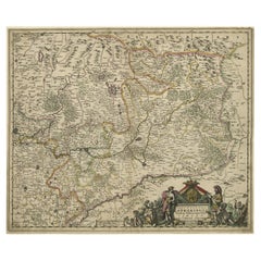
View AllStriking Antique Map of Luxembourg and Northern France 'Lotharingen', c.1680
Located in Langweer, NL
Description: Antique map titled 'Exactissima Lotharingia tam Regis Gallorum quam Ducis.' -
Striking map of Luxembourg and Northern France. Includ...
Category
Antique 1680s Maps
Materials
Paper
$618 Sale Price
20% Off
Rare Hand-Colored Map of Lorraine and Barrois, France by Frederik De Wit c. 1688
Located in Langweer, NL
Title: Rare Hand-Colored Map of Lorraine and Barrois by Frederik De Wit c. 1688
Description: This remarkable 17th-century map, titled "Generalis Lotharingiae Ducatus," offers a deta...
Category
Antique 1680s Maps
Materials
Paper

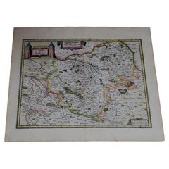
Antique Map of the Lorraine 'North-East France' by J. B. Homann, circa 1720
Located in Langweer, NL
Antique map of Lorraine in north-east France by J. B. Homann. Covering the area around Metz, Nancy and Sarrebruck with Luxembourg in the North and Mulhouse in Southeast. With a decor...
Category
Antique Early 18th Century Maps
Materials
Paper

$608 Sale Price
20% Off
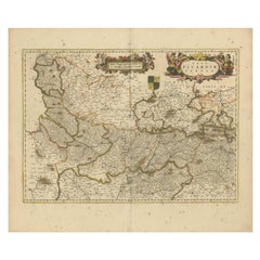
Picardy Map - Hand-Colored 17th-Century Engraving by Frederik De Wit c. 1688
Located in Langweer, NL
Title: Picardy Map - Hand-Colored 17th-Century Engraving by Frederik De Wit c. 1688
Description: This beautifully detailed map, "Nova Picardiae Tabula," captures the Picardy region ...
Category
Antique 1680s Maps
Materials
Paper
Antique Map of the Limoges Region in France, c.1690
Located in Langweer, NL
Antique map titled 'Le Diocèse de Limoges'. Large map of the Limoges region, France.
The map is dedicated to the bishop of Limoges, Antoine de Charpin.
Artists and Engravers:...
Category
Antique 17th Century Maps
Materials
Paper

$618 Sale Price
20% Off
Hand-Colored 17th-Century Map of Orléanais in France by Frederik De Wit c. 1688
Located in Langweer, NL
Title: Hand-Colored 17th-Century Map of Orléanais by Frederik De Wit c. 1688
Description: This beautifully crafted map, "Gouvernement General du Pays Orléanois," illustrates the Orl...
Category
Antique 1680s Maps
Materials
Paper

You May Also Like
West Germany: Original Hand Colored 17th Century Map by Johannes Janssonius
By Johannes Janssonius
Located in Alamo, CA
An original hand colored copperplate engraved map entitled in Latin "Archiepiscopatus Maghdeburgensis et Anhaltinus Ducatus cum terris adjacentibus", published in Amsterdam in 1640 i...
Category
Mid-17th Century Old Masters More Prints
Materials
Engraving

1571-1638 Willem Blaeu map entitled, "Ilcadorino, " Hand Colored Ric0009
Located in Norton, MA
Willem Blaeu map entitled,
"Ilcadorino,".
Hand colored.
Description: large, unusual, and nice antique copper engraved map of Ilcadorino, by Willem BL...
Category
Antique 16th Century Dutch Maps
Materials
Paper

1656 Jansson Map Metz Region of France Entitled "Territorium Metense" Ric0014
Located in Norton, MA
1656 Jansson map Metz Region of France entitled "Territorium Metense."
Ric0014
" Authentic" - Map of the historical region surrounding Metz, in Lorraine, France.
Oriented with ...
Category
Antique 17th Century Dutch Maps
Materials
Paper

1633 map, entitled "La douche de Berry, " Original Hand Colored Ric.0005
Located in Norton, MA
1633 map, entitled
"La douche de Berry,"
Hand Colored
Ric.0005
Description:
1633 map, entitled "La douche de Berry,"
Dimension: Paper: 23.3" W x 20.3" H (59 cm W x 51.7 cm H) ; ...
Category
Antique 17th Century Dutch Maps
Materials
Paper
1633 Map, Entitled "La Douche De Berry, " Original Hand Colored Ric.0005
Located in Norton, MA
1633 map, entitled.
"La douche de Berry,"
Hand Colored
Ric.0005
Description:
1633 map, entitled "La douche de Berry,".
Dimension: Paper: 23.3" W x 20.3" H (59 cm W x 51.7...
Category
Antique 17th Century Unknown Maps
Materials
Paper
Antique Colored Belgium Map Flandria Gallica Flanders Henricus Hondius
Located in Dayton, OH
Antique hand colored map of Flanders, Belgium, engraved by Henricus Hondius.
Sans frame - 21.25” x 18”.
Category
Antique 19th Century Renaissance Maps
Materials
Paper

$280 Sale Price
20% Off
More Ways To Browse
Roman Capital
Engravings 1700
French Wine Map
Wine 17th
German Recliner
Dutch Military
Colored Wine Glass
Bordeaux Wine
Stained Glass Dutch
French Antique Wine Cooler
17th Century Wine Glasses
Burgundy Wine Glasses
Coat Of Arms Stained Glass
Mulled Wine
Library Recliners
Vintage Scandanavian Chairs
19th Century Red Glass
Antique French Console Table Tables