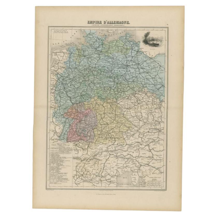
Antique Map of North America by Migeon '1880'
View Similar Items
Want more images or videos?
Request additional images or videos from the seller
1 of 5
Antique Map of North America by Migeon '1880'
About the Item
- Creator:J. Migeon (Artist)
- Dimensions:Height: 13.59 in (34.5 cm)Width: 18.71 in (47.5 cm)Depth: 0.02 in (0.5 mm)
- Place of Origin:
- Period:
- Date of Manufacture:1880
- Condition:Wear consistent with age and use. General age-related toning. Please study images carefully.
- Seller Location:Langweer, NL
- Reference Number:Seller: BG-11793-401stDibs: LU3054314496152
About the Seller
5.0
Recognized Seller
These prestigious sellers are industry leaders and represent the highest echelon for item quality and design.
Platinum Seller
Premium sellers with a 4.7+ rating and 24-hour response times
Established in 2009
1stDibs seller since 2017
2,433 sales on 1stDibs
Typical response time: 1 hour
Authenticity Guarantee
In the unlikely event there’s an issue with an item’s authenticity, contact us within 1 year for a full refund. DetailsMoney-Back Guarantee
If your item is not as described, is damaged in transit, or does not arrive, contact us within 7 days for a full refund. Details24-Hour Cancellation
You have a 24-hour grace period in which to reconsider your purchase, with no questions asked.Vetted Professional Sellers
Our world-class sellers must adhere to strict standards for service and quality, maintaining the integrity of our listings.Price-Match Guarantee
If you find that a seller listed the same item for a lower price elsewhere, we’ll match it.Trusted Global Delivery
Our best-in-class carrier network provides specialized shipping options worldwide, including custom delivery.More From This Seller
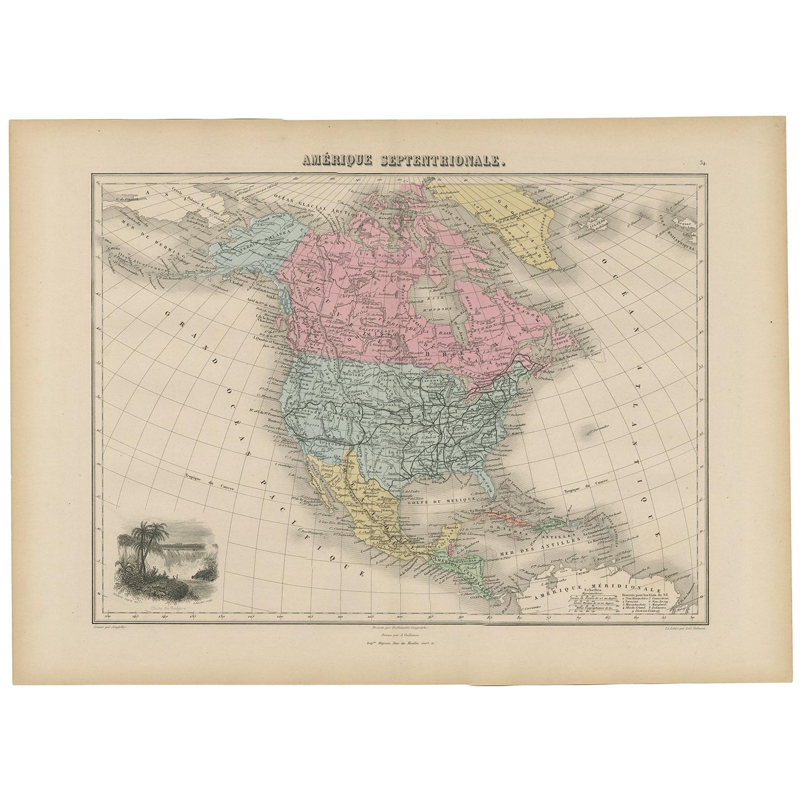
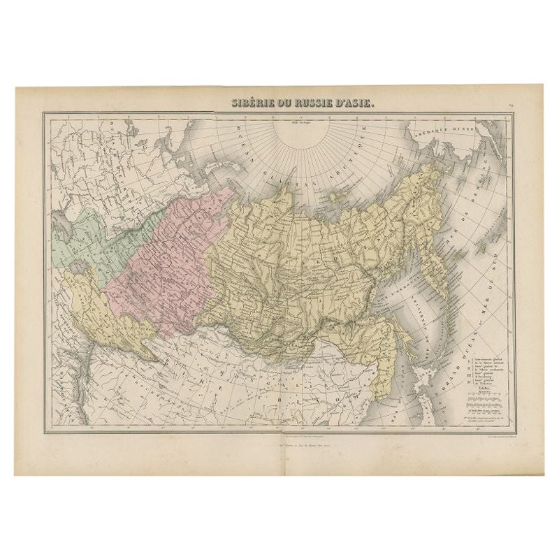
View AllAntique Map of North and Central America by Migeon '1880'
By J. Migeon
Located in Langweer, NL
Antique map titled 'Amérique Septentrionale'. Old map of North and Central America. With a decorative vignette of the Niagara Falls. This map originates from 'Géographie Universelle ...
Category
Antique Late 19th Century French Maps
Materials
Paper
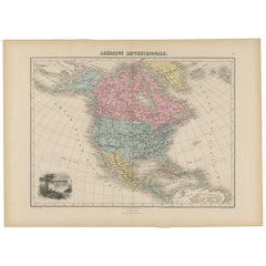
$138 Sale Price
20% Off
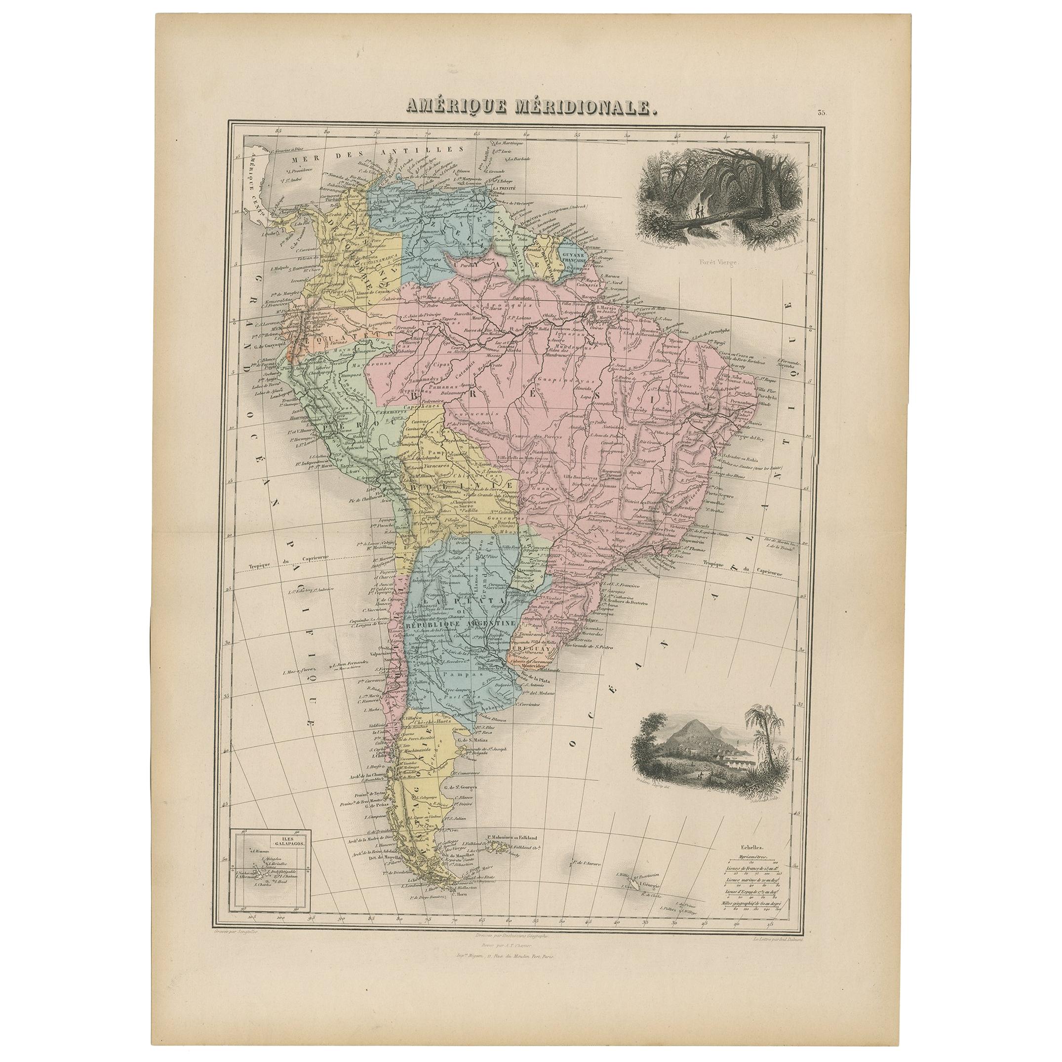
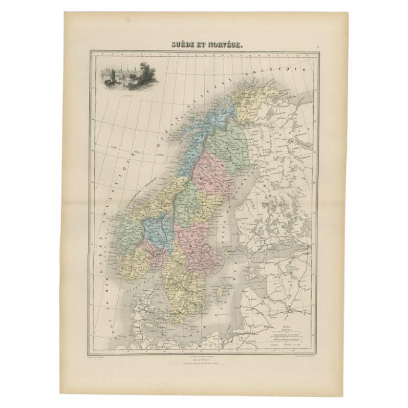
Antique Map of South America by Migeon '1880'
By J. Migeon
Located in Langweer, NL
Antique map titled 'Amérique Méridionale'. Old map of South America. With an inset map of the Galapagos Islands and decorative vignettes. This map...
Category
Antique Late 19th Century French Maps
Materials
Paper

$138 Sale Price
20% Off
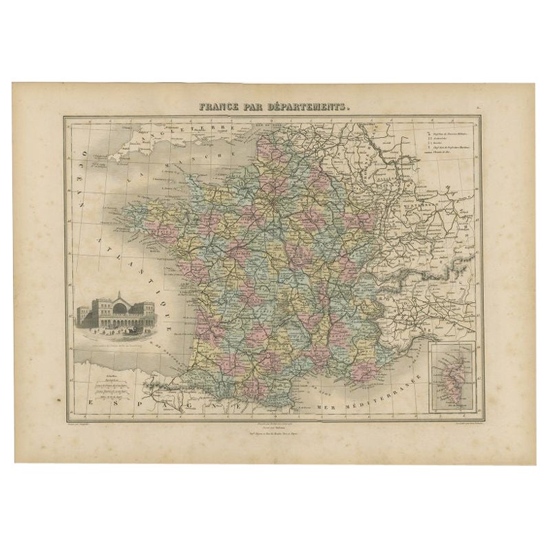
Antique Map of the Departments of France by Migeon, 1880
By J. Migeon
Located in Langweer, NL
Antique map titled 'France par Départements'. Old map of France with a decorative vignette of Strasbourg and an inset map of Corsica. This map originate...
Category
Antique 19th Century Maps
Materials
Paper
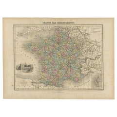
$110 Sale Price
20% Off
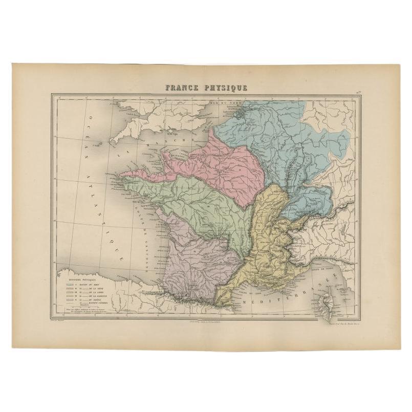
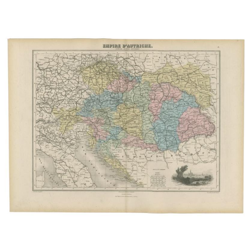
Antique Map of France by Migeon, 1880
Located in Langweer, NL
Antique map titled 'France Physique'. Old map of France. This map originates from 'Géographie Universelle Atlas-Migeon' by J. Migeon.
Artists and Engravers: Published by J. Migeon...
Category
Antique 19th Century Maps
Materials
Paper

$120 Sale Price
20% Off
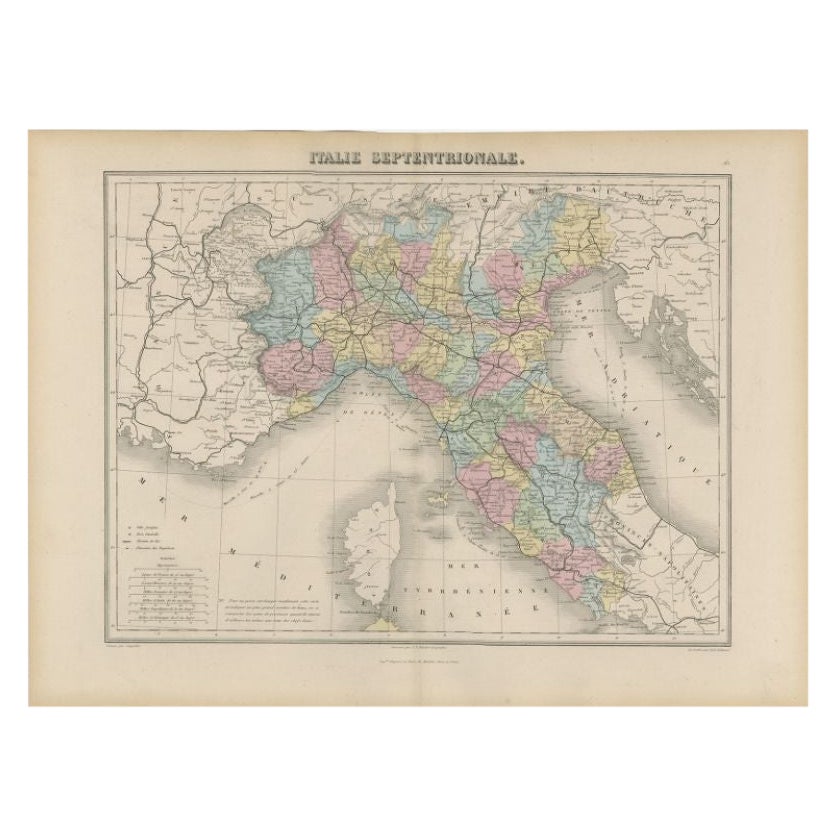
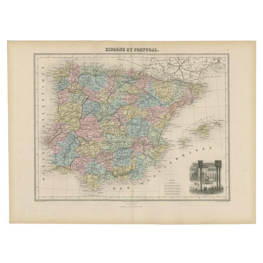
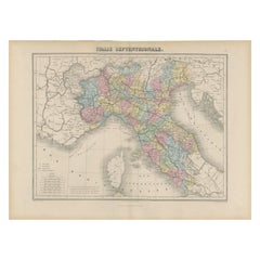
Antique Map of Northern Italy by Migeon, 1880
Located in Langweer, NL
Antique map titled 'Italie Septentrionale'. Old map of the northern part of Italy. This map originates from 'Géographie Universelle Atlas-Migeon' by J. Migeon. Artists and Engravers:...
Category
Antique 19th Century Maps
Materials
Paper
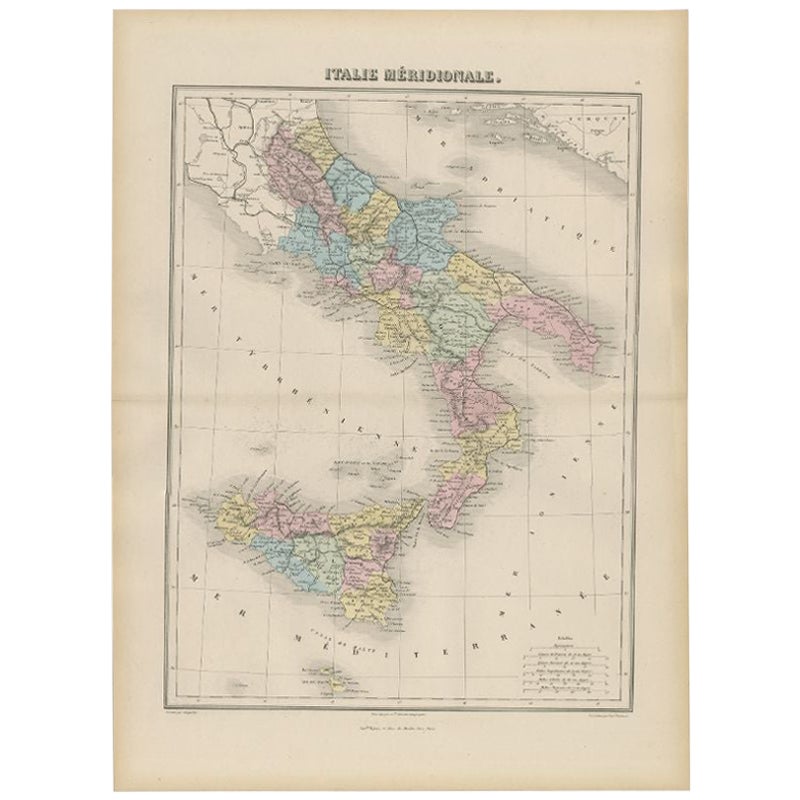
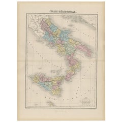
Antique Map of Southern Italy by Migeon, 1880
Located in Langweer, NL
"Antique map titled 'Italie Méridionale'. Old map of southern Italy including Sicily/Sicilia. This map originates from 'Géographie Universelle Atlas-Mig...
Category
Antique 19th Century Maps
Materials
Paper
You May Also Like
1864 Map of North America, Antique Hand-Colored Map, by Adolphe Hippolyte Dufour
Located in Colorado Springs, CO
Offered is a map of North America entitled Amerique du Nord from 1864. This rare, separately published wall map was produced by Adolphe Hippolyte Dufour. This map includes vibrant an...
Category
Antique 1860s French Maps
Materials
Paper

University Chart “Black Map of North America
Located in Godshill, Isle of Wight
University Chart “Black Map of North America
W&A K Johnston’s Charts of Physical Maps By G W Bacon,
This is a Black Physical map of North A...
Category
Early 20th Century Industrial Maps
Materials
Linen

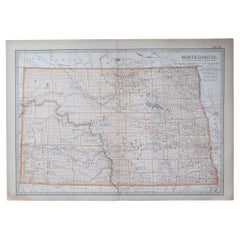
Original Antique Map of the American State of North Dakota, 1903
Located in St Annes, Lancashire
Antique map of North Dakota
Published By A & C Black. 1903
Original colour
Good condition
Unframed.
Free shipping
Category
Antique Early 1900s English Maps
Materials
Paper
Original Antique Map of the American State of North Carolina, 1903
Located in St Annes, Lancashire
Antique map of North Carolina
Published By A & C Black. 1903
Original colour
Good condition
Unframed.
Free shipping
Category
Antique Early 1900s English Maps
Materials
Paper

Large University Chart “Political Map of North America” by Bacon
Located in Godshill, Isle of Wight
Large University Chart “Political Map of North America” by Bacon
W&A K Johnston’s Charts of Physical Maps By G W Bacon,
This is colourful Physical map ...
Category
Early 20th Century American Empire Posters
Materials
Linen

Large University Chart “Political Map of North America” by Bacon
Located in Godshill, Isle of Wight
Large University chart “Political Map of North America” by Bacon
W&A K Johnston’s Charts of Political Maps by G W Bacon,
This is colorful Physical ...
Category
Early 20th Century American Empire Posters
Materials
Linen
