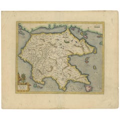
Antique Map of the Peloponnesos peninsula by Mercator, circa 1620
View Similar Items


Want more images or videos?
Request additional images or videos from the seller
1 of 5
Antique Map of the Peloponnesos peninsula by Mercator, circa 1620
About the Item
- Creator:Gerard Mercator (Artist)
- Dimensions:Height: 18.12 in (46 cm)Width: 21.66 in (55 cm)Depth: 0.02 in (0.5 mm)
- Materials and Techniques:
- Period:Early 17th Century
- Date of Manufacture:circa 1620
- Condition:General age-related toning. Minor wear and soiling. Repair on folding line and a larger tear in the right margin. Latin text on verso, please study images carefully.
- Seller Location:Langweer, NL
- Reference Number:Seller: BG-12417-31stDibs: LU3054318571662
Gerard Mercator
Gerard Mercator (1512-1594) was one of the most famous cartographers of the 16th century and, in fact, of all time. Mercator was known for his strict adherence to scientific methods of the day. He was responsible for advancing the technology of map making. For example his method of representing land masses in a cylindrical projection with north up and south down, first described in 1569, became the standard map projection for navigation. It is still referred to as The Mercator projection.
About the Seller
5.0
Recognized Seller
These prestigious sellers are industry leaders and represent the highest echelon for item quality and design.
Platinum Seller
Premium sellers with a 4.7+ rating and 24-hour response times
Established in 2009
1stDibs seller since 2017
2,439 sales on 1stDibs
Typical response time: 1 hour
Authenticity Guarantee
In the unlikely event there’s an issue with an item’s authenticity, contact us within 1 year for a full refund. DetailsMoney-Back Guarantee
If your item is not as described, is damaged in transit, or does not arrive, contact us within 7 days for a full refund. Details24-Hour Cancellation
You have a 24-hour grace period in which to reconsider your purchase, with no questions asked.Vetted Professional Sellers
Our world-class sellers must adhere to strict standards for service and quality, maintaining the integrity of our listings.Price-Match Guarantee
If you find that a seller listed the same item for a lower price elsewhere, we’ll match it.Trusted Global Delivery
Our best-in-class carrier network provides specialized shipping options worldwide, including custom delivery.More From This Seller
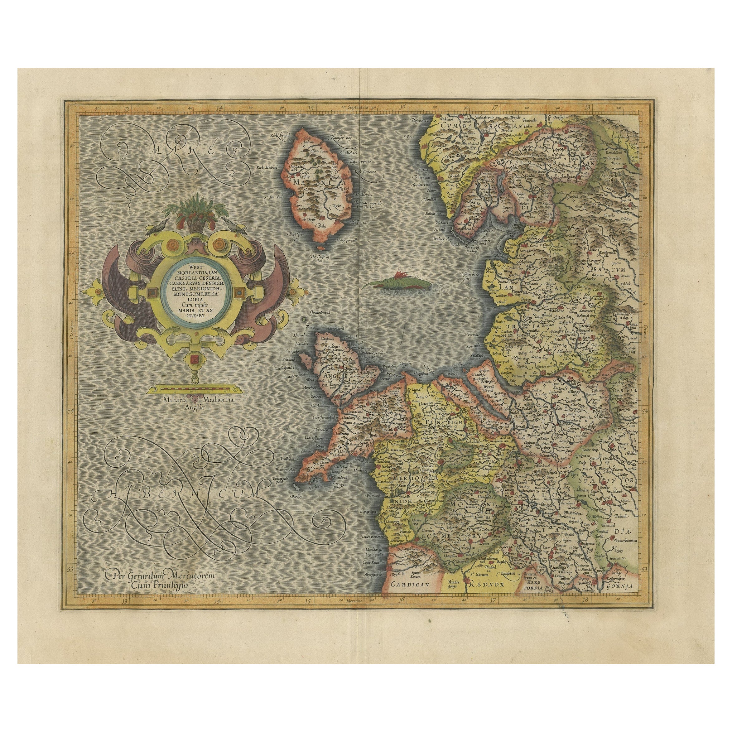
View AllAntique Map of the Northeast of England by Mercator 'circa 1620'
Located in Langweer, NL
Antique map titled 'Eboracum Lincolnia, Derbia, Staffordia, Notinghamia, Lecestria, Rutlandia, et Norfolcia'. Decorative early map of the northeast of England, comprising the countie...
Category
Antique Early 17th Century Maps
Materials
Paper

$504 Sale Price
20% Off
Antique Map of Westfalia, Germany by Mercator/Hondius, circa '1620'
Located in Langweer, NL
Antique map titled 'Westfalia cum dioecelsi Bremensi'. Original antique map of Germany. Published by Mercator/Hondius, circa '1620'
17th Century antique detailled map of Westphali...
Category
Antique 16th Century Maps
Materials
Paper

$871 Sale Price
20% Off
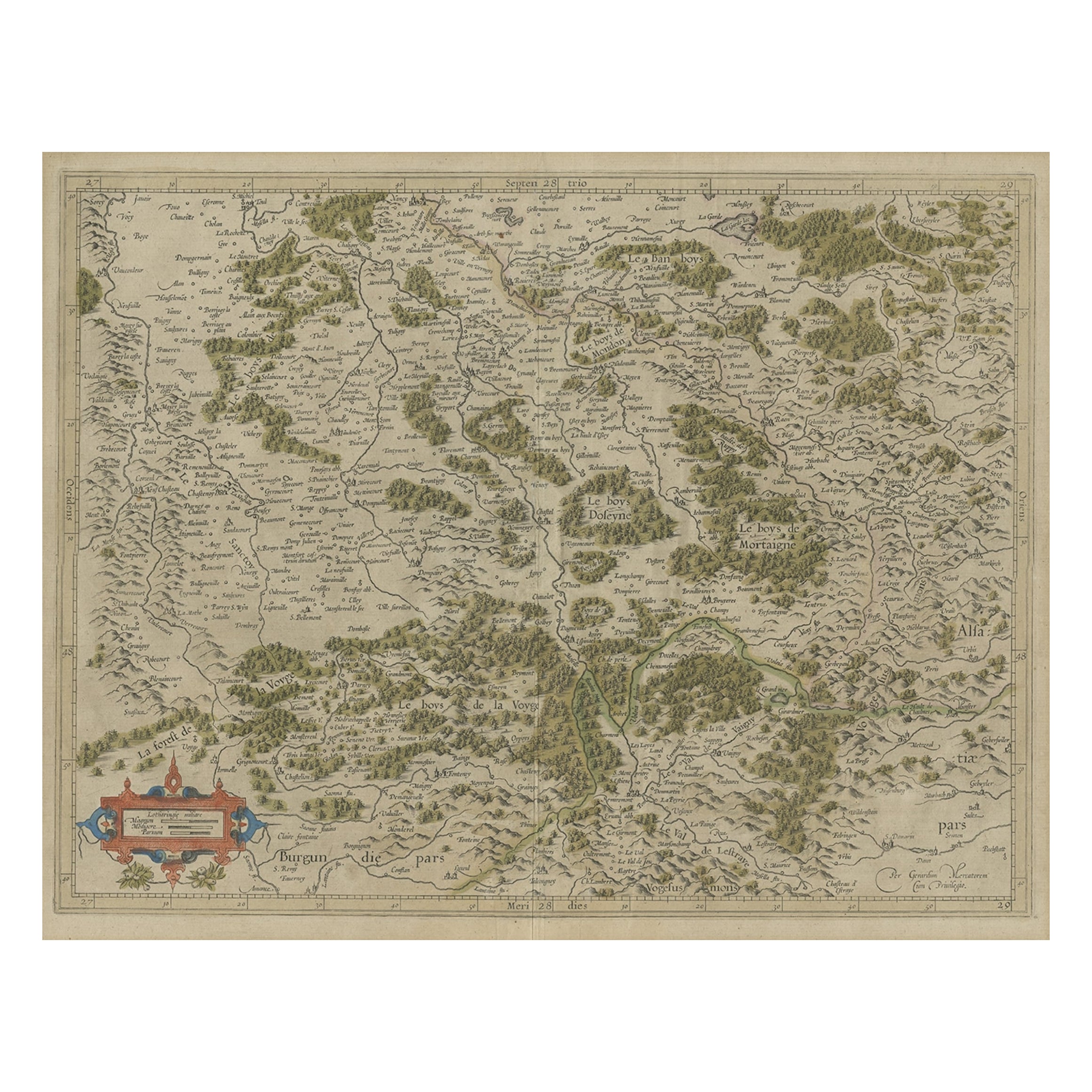
Antique Map of the Southern Lorraine Region by Mercator, c.1625
By Gerard Mercator
Located in Langweer, NL
Antique map titled 'Lotharingiae Ducatus'. Old map of the southern portion of the Lorraine region, France. Lorraine is a cultural and historical region in north-eastern France, now l...
Category
Antique 17th Century Maps
Materials
Paper
$266 Sale Price
20% Off
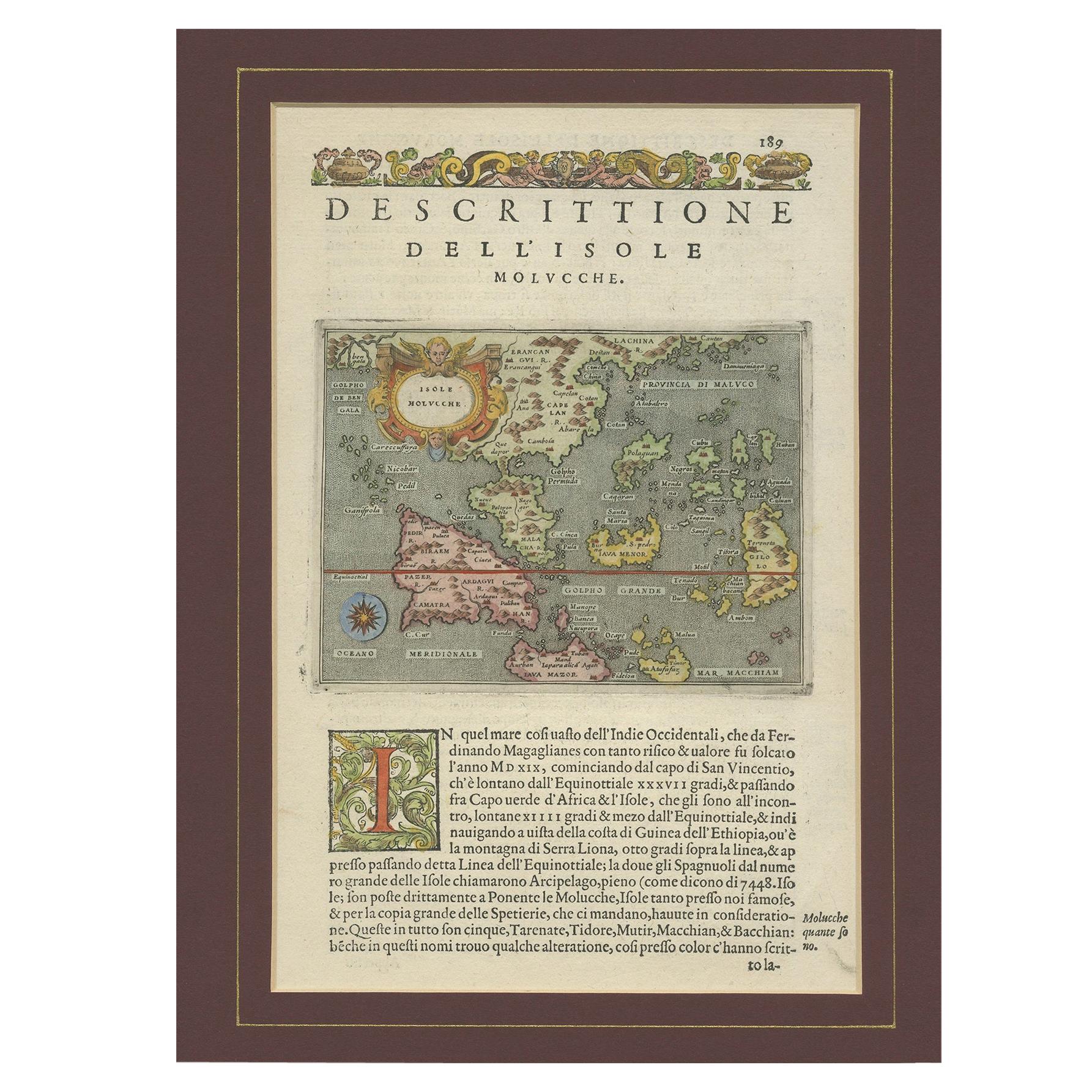
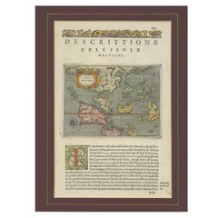
Antique Map of the Moluccas by Porcacchi, 'circa 1620'
Located in Langweer, NL
Antique map titled 'Isole Molucche'. The map depicts the East Indies and Indochina, including modern-day Indonesia and the Philippines. The area covered stretches from the Bay of Bengal...
Category
Antique Early 17th Century Maps
Materials
Paper
$660 Sale Price
20% Off
Antique Map of Styria by Mercator 'circa 1650'
Located in Langweer, NL
Antique map titled 'Stiria'. Original antique map of Styria, Austria. Published by G. Mercator, circa 1650.
Category
Antique Mid-17th Century Maps
Materials
Paper

$413 Sale Price
20% Off
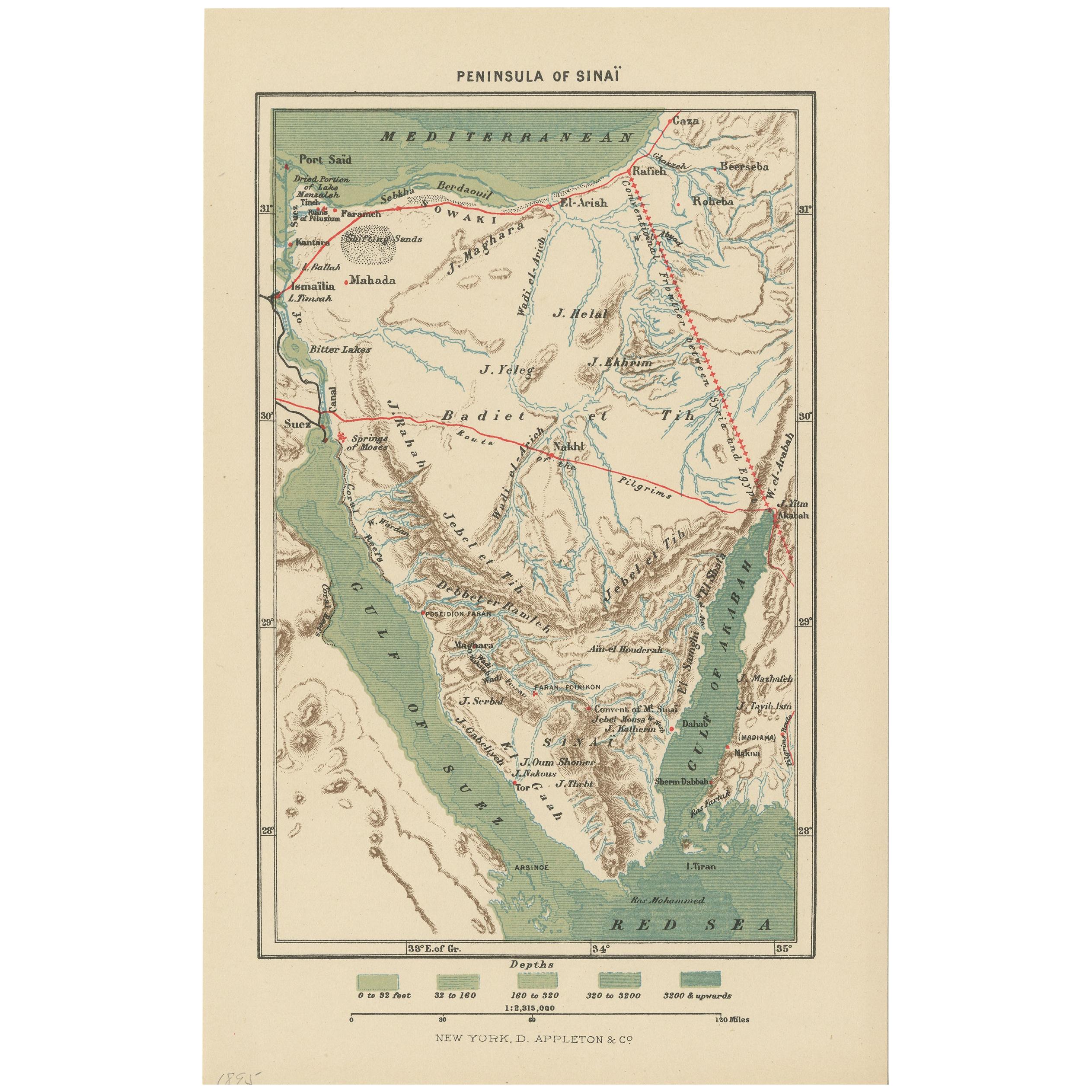
Antique Map of the Sinai Peninsula, '1895'
Located in Langweer, NL
Antique map titled 'Peninsula of Sinaï'. Lithographed map of the Sinai Peninsula, a peninsula in Egypt, and the only part of the country located in Asia. It is situated between the M...
Category
Antique Late 19th Century Maps
Materials
Paper

$91 Sale Price
20% Off
You May Also Like
Northern Scotland: A 17th Century Hand-colored Map by Mercator
By Gerard Mercator
Located in Alamo, CA
This is a framed hand-colored 17th century map of Northern Scotland by Gerard Mercator entitled "Scotiae pars Septentrionalis", published in Amsterdam in 1636. It is a highly detailed map of the northern part of Scotland, with the northwest Highlands and the cities Inverness and Aberdeen, as well as the Orkney Islands and the Hebrides. There is a decorative title cartouche in the upper left corner.
The map is presented in an antiqued brown wood...
Category
Antique 1630s Dutch Maps
Materials
Paper

Northern Scotland: A 16th Century Hand-colored Map by Mercator
By Gerard Mercator
Located in Alamo, CA
A framed hand-colored 16th century map of Northern Scotland by Gerard Mercator entitled "Scotiae pars Septentrionalis", published in Amsterdam in 1636. It is a highly detailed map of the northern part of Scotland, with the northwest Highlands and the cities Inverness and Aberdeen, as well as the Orkney Islands and the Hebrides. There is a decorative title cartouche in the upper left corner.
The map is presented in an antiqued brown wood...
Category
Antique 16th Century Dutch Maps
Materials
Paper

17th Century Hand-Colored Map of Southeastern England by Mercator and Hondius
By Gerard Mercator
Located in Alamo, CA
A 17th century copperplate hand-colored map entitled "The Sixt Table of England" by Gerard Mercator and Jodocus Hondius, published in Amsterdam in 1635 in 'Cosmographicall Descriptio...
Category
Antique Mid-17th Century Dutch Maps
Materials
Paper

Southeastern Ireland: A 17th Century Hand Colored Map by Mercator and Hondius
By Gerard Mercator
Located in Alamo, CA
A 17th century copperplate hand-colored map entitled "The Second Table of Ireland, Udrone" by Gerard Mercator and Jodocus Hondius, published in Amsterdam in 1635 in 'Cosmographicall ...
Category
Antique Mid-17th Century Dutch Maps
Materials
Paper

Original Antique Map of The World by Thomas Clerk, 1817
Located in St Annes, Lancashire
Great map of The Eastern and Western Hemispheres
On 2 sheets
Copper-plate engraving
Drawn and engraved by Thomas Clerk, Edinburgh.
Published by Mackenzie And Dent, 1817
...
Category
Antique 1810s English Maps
Materials
Paper

Original Antique Map of Spain and Portugal, circa 1790
Located in St Annes, Lancashire
Super map of Spain and Portugal
Copper plate engraving by A. Bell
Published, circa 1790.
Unframed.
Category
Antique 1790s English Other Maps
Materials
Paper
