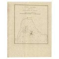
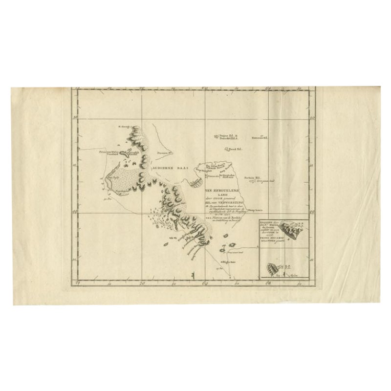
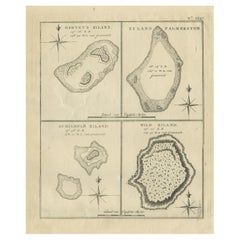
Antique Map of Porto Praya by Cook, 1803
View Similar Items


Want more images or videos?
Request additional images or videos from the seller
1 of 5
Antique Map of Porto Praya by Cook, 1803
About the Item
- Dimensions:Height: 10.63 in (27 cm)Width: 8.47 in (21.5 cm)Depth: 0 in (0.01 mm)
- Materials and Techniques:
- Period:
- Date of Manufacture:1803
- Condition:
- Seller Location:Langweer, NL
- Reference Number:Seller: BG-11487-421stDibs: LU3054327616342
About the Seller
5.0
Platinum Seller
These expertly vetted sellers are 1stDibs' most experienced sellers and are rated highest by our customers.
Established in 2009
1stDibs seller since 2017
1,938 sales on 1stDibs
More From This SellerView All
- Antique Map of Suffren Island by Cook, 1803Located in Langweer, NLAntique map Australia titled 'Gezigt van het Eil. Suffren'. Antique map of Suffren Island. Originates from 'Reizen Rondom de Waereld door James C...Category
Antique 19th Century Maps
MaterialsPaper
- Antique Map of the Friendly Islands by Cook, 1803Located in Langweer, NLAntique map Friendly Islands titled 'Kaart van de Vrienden Eilanden'. Antique map of the Friendly Islands depicting Rotterdam or Anamocka, Middelburg or Eaoowe and Amsterdam or Tonga...Category
Antique 19th Century Maps
MaterialsPaper
- Antique Map of the Friendly Islands by Cook, 1803Located in Langweer, NLAntique map Friendly Islands titled 'Kaart van de Vrienden-Eilanden'. Antique map of the Friendly Islands depicting Rotterdam or Anamocka, Middelburg or Eaoowe and Amsterdam or Tonga...Category
Antique 19th Century Maps
MaterialsPaper
- Antique Map of the Harbour of Taloo by J. Cook, 1803By James CookLocated in Langweer, NLAntique map French Polynesia titled 'Schets van de Havenen aan de Noord Zijde van Eimeo'. Plan of the harbour of Taloo in the Island of Moorea, one of the Society Islands, French Polynesia. Originates from 'Reize rondom de Waereld door James Cook...Category
Antique Early 19th Century Dutch Maps
MaterialsPaper
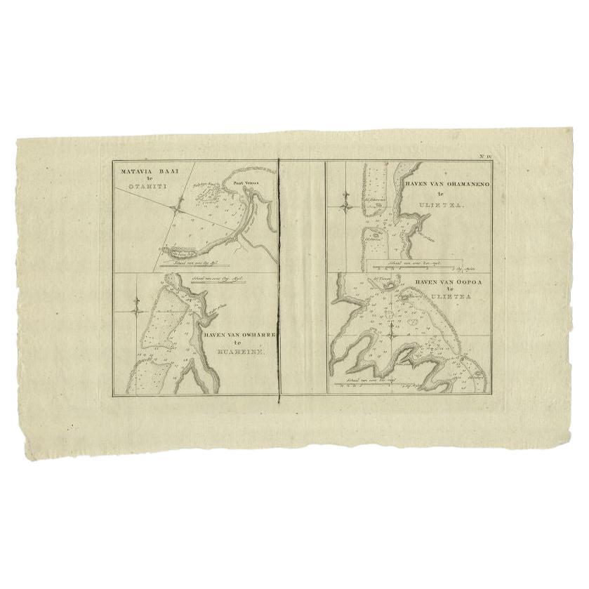
- Antique Map of the Harbors of Matavai by Cook, 1803Located in Langweer, NLAntique map Oceania titled 'Matavia Baai te Otahiti (..)'. Antique map depicting the harbors of Matavai on the north coast of Tahiti; Ohamaneno and Oopoa on Raiatea (Ulieta on the ch...Category
Antique 19th Century Maps
MaterialsPaper
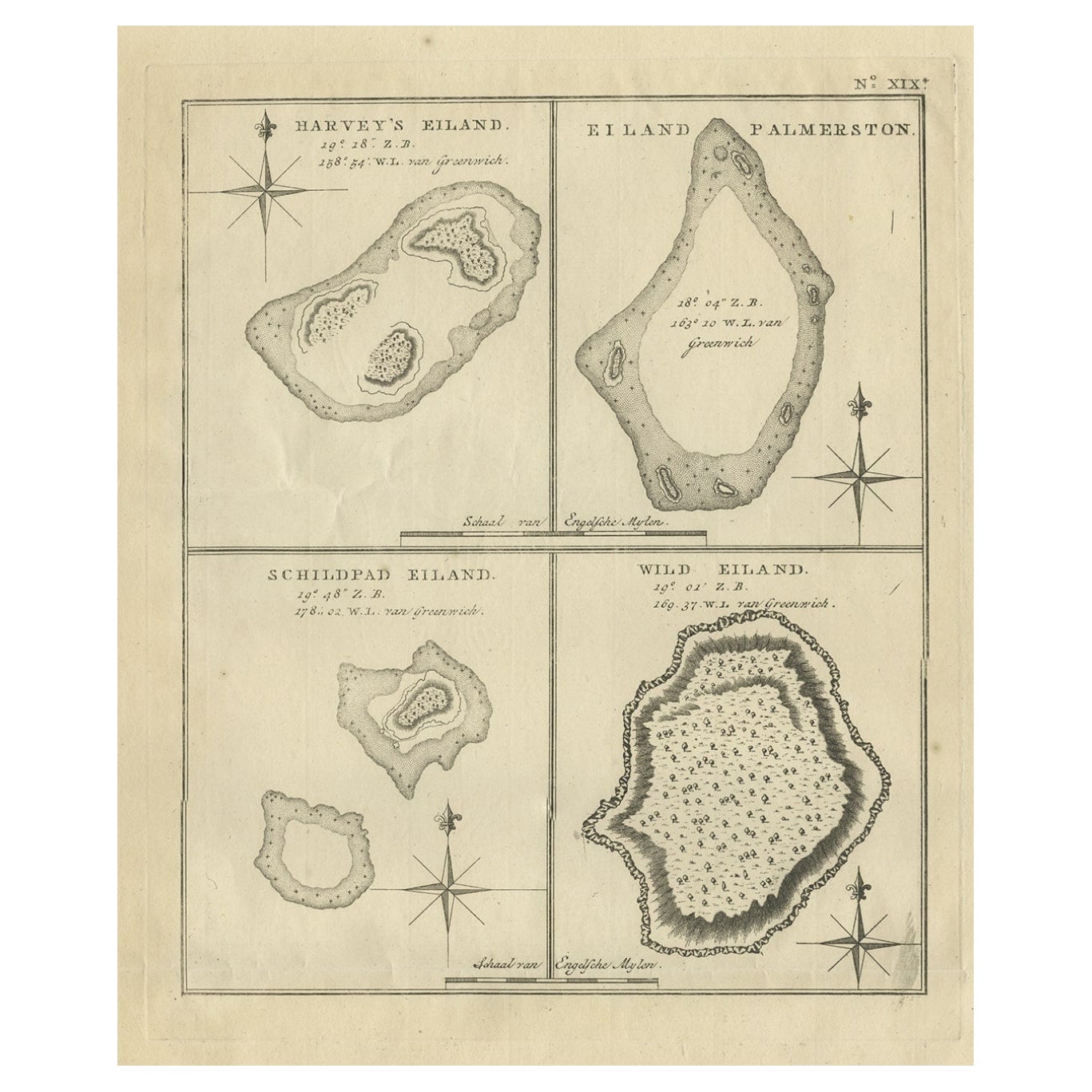
- Antique Map of Harvey Island and Surroundings by Cook, 1803Located in Langweer, NLAntique map Oceania titled 'Harvey's Eiland...''. This map originates from 'Reizen Rondom de Waereld door James Cook''. Old engraving by James Cook 1778. Engraved by Robert Bern...Category
Antique 19th Century Maps
MaterialsPaper


You May Also Like
- Antique 1803 Italian Map of Asia Including China Indoneseia IndiaLocated in Amsterdam, Noord HollandAntique 1803 Italian Map of Asia Including China Indoneseia India Very nice map of Asia. 1803. Additional information: Type: Map Country of Manufacturing: Europe Period: 19th centu...Category
Antique 19th Century European Maps
MaterialsPaper
 $584 Sale Price20% Off
 - Captain Cook's Exploration of Tahiti 18th C. Hand-Colored Map by BellinBy Jacques-Nicolas BellinLocated in Alamo, CAThis beautiful 18th century hand-colored copper plate engraved map is entitled "Carte de l'Isle de Taiti, par le Lieutenant J. Cook" was created by Jacques Nicolas Bellin and publish...Category
Antique Mid-18th Century French Maps
MaterialsPaper
- 1861 Topographical Map of the District of Columbia, by Boschke, Antique MapLocated in Colorado Springs, COPresented is an original map of Albert Boschke's extremely sought-after "Topographical Map of the District of Columbia Surveyed in the Years 1856 ...Category
Antique 1860s American Historical Memorabilia
MaterialsPaper
- 1907 Map of Colorado, Antique Topographical Map, by Louis NellLocated in Colorado Springs, COThis highly detailed pocket map is a topographical map of the state of Colorado by Louis Nell from 1907. The map "has been complied from all availabl...Category
Antique Early 1900s American Maps
MaterialsPaper
- Antique Map of Italy by Andriveau-Goujon, 1843By Andriveau-GoujonLocated in New York, NYAntique Map of Italy by Andriveau-Goujon, 1843. Map of Italy in two parts by Andriveau-Goujon for the Library of Prince Carini at Palazzo Carini i...Category
Antique 1840s French Maps
MaterialsLinen, Paper
 $3,350 / set
 - Antique Map of Principality of MonacoBy Antonio Vallardi EditoreLocated in Alessandria, PiemonteST/619 - "Old Geographical Atlas of Italy - Topographic map of ex-Principality of Monaco" - ediz Vallardi - Milano - A somewhat special edition ---Category
Antique Late 19th Century Italian Other Prints
MaterialsPaper
 $227 Sale Price74% Off


Recently Viewed
View AllMore Ways To Browse
Antique Cook
1803 Furniture
Long Island Artists
Wood Cook
Long Island Map
Map Of Long Island
Maps Of Long Island
Cook Islands
Antique Van Cleef
Antique Cape House
Antique Victorian Cape
Antique Long Island Map
Antique Maps Of Long Island
Antique Map Of Long Island
Antique Map Long Island
James Cook Map
Cape Verde
Porto Plate