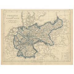
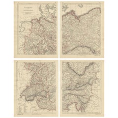
Antique Map of Prussia and German States by Lowry, 1852
View Similar Items


Want more images or videos?
Request additional images or videos from the seller
1 of 5
Antique Map of Prussia and German States by Lowry, 1852
About the Item
- Dimensions:Height: 9.65 in (24.5 cm)Width: 12.21 in (31 cm)Depth: 0.02 in (0.5 mm)
- Materials and Techniques:
- Period:
- Date of Manufacture:1852
- Condition:General age-related toning, blank verso. Minor wear, please study image carefully.
- Seller Location:Langweer, NL
- Reference Number:Seller: BG-12593-21stDibs: LU3054321548162
About the Seller
5.0
Recognized Seller
These prestigious sellers are industry leaders and represent the highest echelon for item quality and design.
Gold Seller
Premium sellers maintaining a 4.3+ rating and 24-hour response times
Established in 2009
1stDibs seller since 2017
2,467 sales on 1stDibs
Typical response time: 1 hour
Authenticity Guarantee
In the unlikely event there’s an issue with an item’s authenticity, contact us within 1 year for a full refund. DetailsMoney-Back Guarantee
If your item is not as described, is damaged in transit, or does not arrive, contact us within 7 days for a full refund. Details24-Hour Cancellation
You have a 24-hour grace period in which to reconsider your purchase, with no questions asked.Vetted Professional Sellers
Our world-class sellers must adhere to strict standards for service and quality, maintaining the integrity of our listings.Price-Match Guarantee
If you find that a seller listed the same item for a lower price elsewhere, we’ll match it.Trusted Global Delivery
Our best-in-class carrier network provides specialized shipping options worldwide, including custom delivery.More From This Seller
View AllAntique Map of the United States by Lowry, '1852'
Located in Langweer, NL
Antique map titled 'United States'. Four individual sheets of the United States. This map originates from 'Lowry's Table Atlas constructed and engraved from the most recent Authoriti...
Category
Antique Mid-19th Century Maps
Materials
Paper

$282 Sale Price / set
20% Off
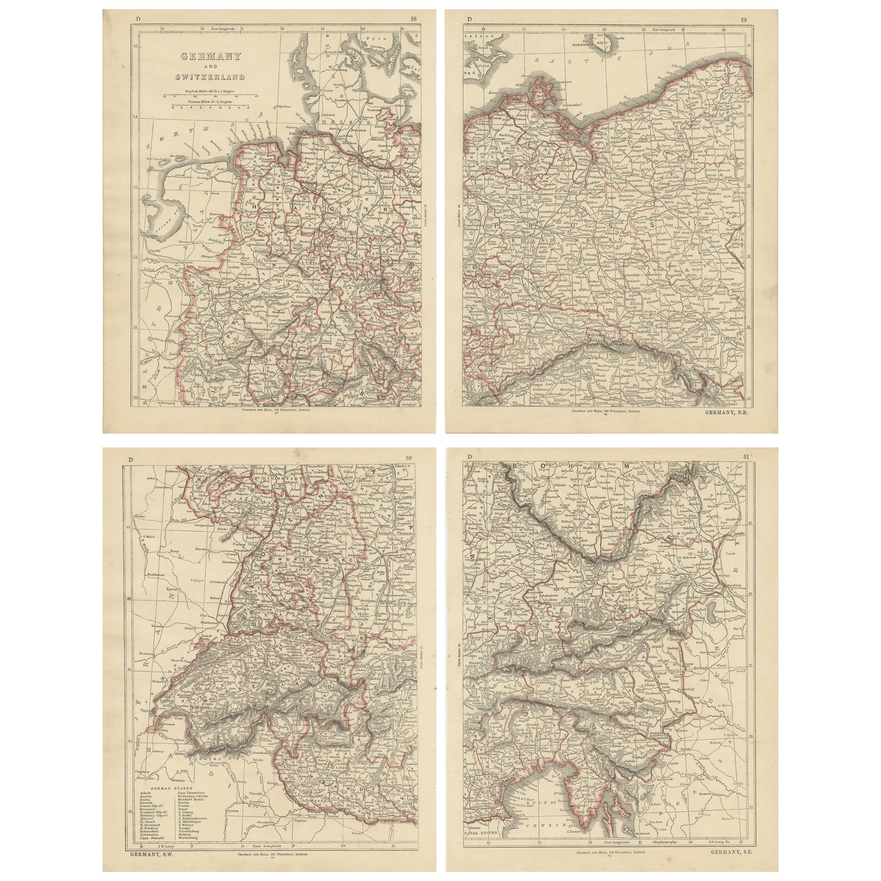
Antique Map of Germany and Switzerland by Lowry, '1852'
Located in Langweer, NL
Antique map titled 'Germany and Switzerland'. Four individual sheets of Germany and Switzerland. This map originates from 'Lowry's Table Atlas constructed and engraved from the most ...
Category
Antique Mid-19th Century Maps
Materials
Paper
$235 Sale Price / set
20% Off
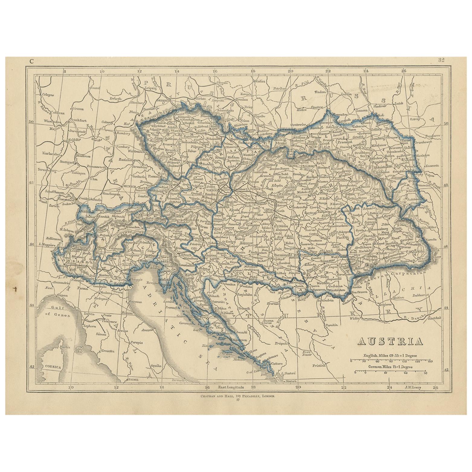
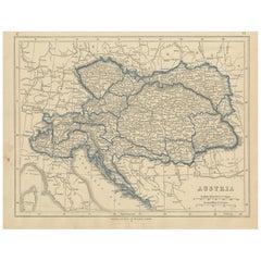
Antique Map of Austria by Lowry, 1852
Located in Langweer, NL
Antique map titled 'Austria'. Original map of Austria. This map originates from 'Lowry's Table Atlas constructed and engraved from the most recent Autho...
Category
Antique Mid-19th Century Maps
Materials
Paper
$94 Sale Price
20% Off
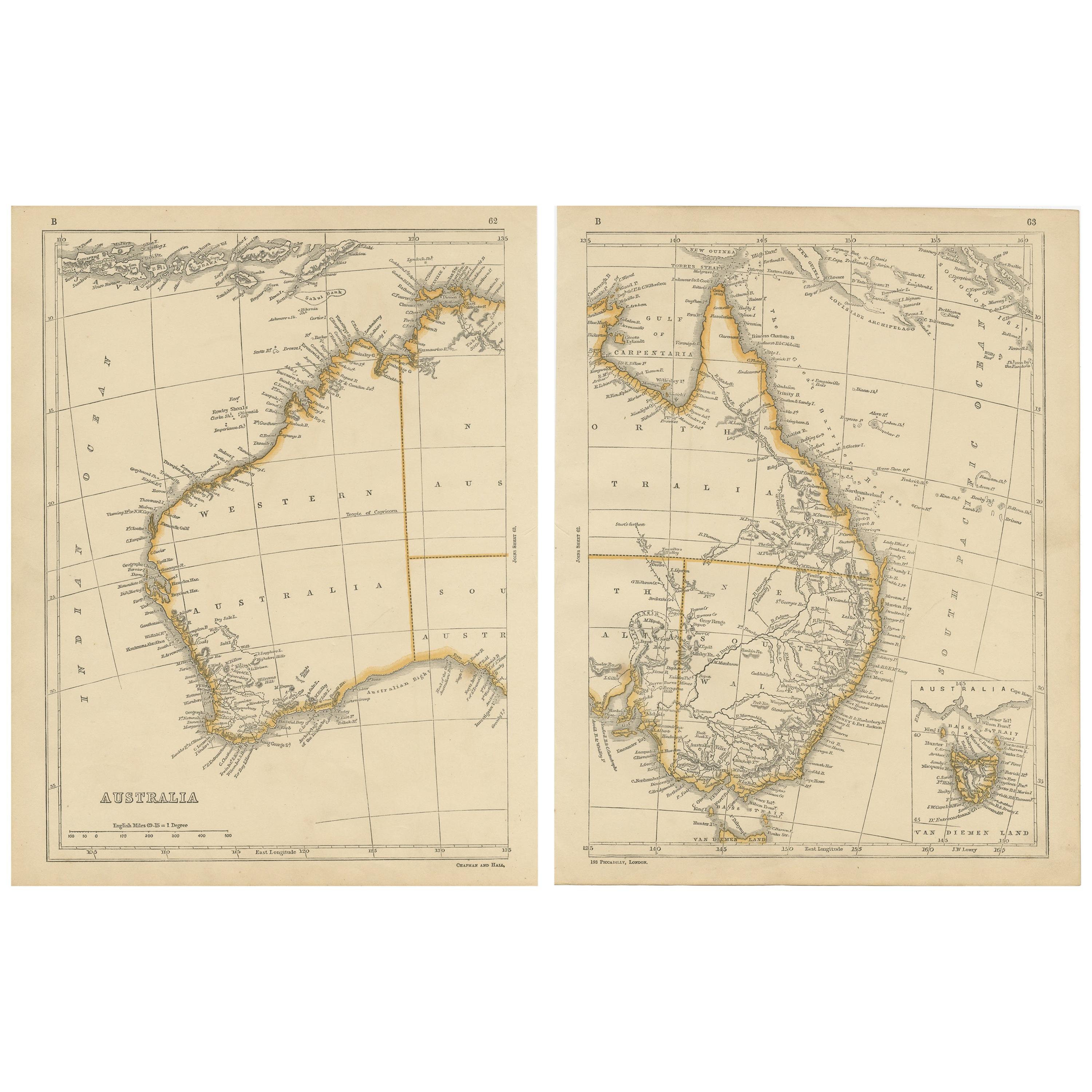
Antique Map of Australasia by Lowry, 1852
Located in Langweer, NL
Antique map titled 'Australasia'. Original map of Australasia. This map originates from 'Lowry's Table Atlas constructed and engraved from the most recent Authorities' by J.W. Lowry....
Category
Antique Mid-19th Century Maps
Materials
Paper

$94 Sale Price
20% Off
Antique Map of Europe by Lowry, 1852
Located in Langweer, NL
Antique map titled 'Europe'. Original map of Europe. This map originates from 'Lowry's Table Atlas constructed and engraved from the most recent authorities' by J.W. Lowry. Published...
Category
Antique Mid-19th Century Maps
Materials
Paper

$141 Sale Price
20% Off
Antique Map of Denmark by Lowry, 1852
Located in Langweer, NL
Antique map titled 'Denmark'. Original map of Denmark. This map originates from 'Lowry's Table Atlas constructed and engraved from the most recent Authorities' by J.W. Lowry. Publish...
Category
Antique Mid-19th Century Maps
Materials
Paper

$94 Sale Price
20% Off
You May Also Like
Prussia, Poland, N. Germany, Etc: A Hand-colored 17th Century Map by Janssonius
By Johannes Janssonius
Located in Alamo, CA
This is an attractive hand-colored copperplate engraved 17th century map of Prussia entitled "Prussia Accurate Descripta a Gasparo Henneberg Erlichensi", published in Amsterdam by Joannes Janssonius in 1664. This very detailed map from the golden age of Dutch cartography includes present-day Poland, Latvia, Lithuania, Estonia and portions of Germany. This highly detailed map is embellished by three ornate pink, red, mint green and gold...
Category
Antique Mid-17th Century Dutch Maps
Materials
Paper

Original Antique Map of United States, Grattan and Gilbert, 1843
Located in St Annes, Lancashire
Great map of United States
Drawn and engraved by Archer
Published by Grattan and Gilbert. 1843
Original colour
Unframed.
Category
Antique 1840s English Maps
Materials
Paper

Antique Map of Italy by Andriveau-Goujon, 1843
By Andriveau-Goujon
Located in New York, NY
Antique Map of Italy by Andriveau-Goujon, 1843. Map of Italy in two parts by Andriveau-Goujon for the Library of Prince Carini at Palazzo Carini i...
Category
Antique 1840s French Maps
Materials
Linen, Paper

$3,350 / set
Antique Map of Principality of Monaco
By Antonio Vallardi Editore
Located in Alessandria, Piemonte
ST/619 - "Old Geographical Atlas of Italy - Topographic map of ex-Principality of Monaco" -
ediz Vallardi - Milano -
A somewhat special edition ---
Category
Antique Late 19th Century Italian Other Prints
Materials
Paper

Original Antique Map of Spain and Portugal, circa 1790
Located in St Annes, Lancashire
Super map of Spain and Portugal
Copper plate engraving by A. Bell
Published, circa 1790.
Unframed.
Category
Antique 1790s English Other Maps
Materials
Paper

Original Antique Map of Ireland- Tipperary and Waterford. C.1840
Located in St Annes, Lancashire
Great map of Tipperary and Waterford
Steel engraving
Drawn under the direction of A.Adlard
Published by How and Parsons, C.1840
Unframed.
Category
Antique 1840s English Maps
Materials
Paper

Recently Viewed
View AllMore Ways To Browse
North American Fiberglass Benches
North American Rosewood Dining Room Chairs
Oak Octagon End Table
Oak Parquetry Coffee Table
Octagonal Book Table
Ole Wanscher Senator France
Orange Ball Chair
Orange Barrel Chairs
Ormolu Piano
Orrefors Martti Rytkonen
Oulton Leather
Our Lady Of Sorrows
Outdoor Day Beds
Outdoor Round Teak Dining Table
Oval Footstool
Overman Sweden
Ovoid Chair
Oxblood Marble