Items Similar to Antique Map of Scandinavia and the Baltic – Andriveau-Goujon, circa 1860s


Want more images or videos?
Request additional images or videos from the seller
1 of 10
Antique Map of Scandinavia and the Baltic – Andriveau-Goujon, circa 1860s
$469.63
£347.47
€390
CA$649.35
A$712.91
CHF 371.92
MX$8,627.16
NOK 4,661.50
SEK 4,392.36
DKK 2,969.47
About the Item
Antique Map of Scandinavia and the Baltic – Andriveau-Goujon, circa 1860s
This impressive antique map presents Northern Europe, focusing on the Scandinavian Peninsula, the Baltic region, and parts of Northern Germany, Poland, and Russia. It was published by E. Andriveau-Goujon of Paris, likely in the early-to-mid 1860s as part of his renowned *Atlas Universel*. The map is engraved and hand-colored, showcasing the political geography of the region in the mid-19th century.
At the center of the map is the Baltic Sea, bordered by Denmark, Sweden, Finland (then part of the Russian Empire), the Baltic provinces, Prussia, and Poland. The entire Scandinavian Peninsula is clearly delineated, with Norway and Sweden distinguished in soft color tones. Major cities such as Stockholm, Christiania (Oslo), Helsinki, Riga, Königsberg, and Warsaw are labeled, along with countless smaller towns and regional roads.
The upper left corner includes a color-coded key to political boundaries, identifying territories such as:
– Royaume de Suède et Norvège
– Grand-Duché de Finlande
– Empire de Russie
– Royaume de Prusse
– Royaume de Pologne
– Royaume de Danemark
– Empire d’Autriche
– Confédération Germanique
The map reflects the complex and often overlapping sovereignties of the period, with Finland shaded under Russian control and Poland still referenced as a kingdom within the Russian Empire. The use of soft pastel coloring adds clarity to the territorial divisions while maintaining the map’s decorative charm.
Highly detailed rivers, lakes, mountain ranges, and coastal features are crisply engraved, showing the engraver’s skill and Andriveau-Goujon’s typical cartographic precision. As an artifact from the pre-industrial reordering of Northern Europe, it offers valuable context for understanding 19th-century geopolitics, trade, and cultural spheres.
Condition: Very good condition. Slight age toning and minimal foxing in the wide blank margins. Original centerfold as issued. Crisp impression with original pastel hand coloring. Plate number “29” in lower right.
Framing tips: Best displayed in a simple dark wood or black frame with a wide ivory or pale gray mat. An additional inner mat in blue or sage green would complement the cool Nordic tones of the map.
Technique: Engraving with original hand coloring
Maker: E. Andriveau-Goujon, Paris, circa 1860s
- Dimensions:Height: 27.64 in (70.2 cm)Width: 20.91 in (53.1 cm)Depth: 0.01 in (0.2 mm)
- Materials and Techniques:Paper,Engraved
- Place of Origin:
- Period:
- Date of Manufacture:1861
- Condition:Condition: Very good condition. Slight age toning and minimal foxing in the wide blank margins. Original centerfold as issued. Crisp impression with original pastel hand coloring. Plate number “29” in lower right.
- Seller Location:Langweer, NL
- Reference Number:Seller: BG-14099-91stDibs: LU3054346185522
About the Seller
5.0
Recognized Seller
These prestigious sellers are industry leaders and represent the highest echelon for item quality and design.
Platinum Seller
Premium sellers with a 4.7+ rating and 24-hour response times
Established in 2009
1stDibs seller since 2017
2,641 sales on 1stDibs
Typical response time: <1 hour
- ShippingRetrieving quote...Shipping from: Langweer, Netherlands
- Return Policy
Authenticity Guarantee
In the unlikely event there’s an issue with an item’s authenticity, contact us within 1 year for a full refund. DetailsMoney-Back Guarantee
If your item is not as described, is damaged in transit, or does not arrive, contact us within 7 days for a full refund. Details24-Hour Cancellation
You have a 24-hour grace period in which to reconsider your purchase, with no questions asked.Vetted Professional Sellers
Our world-class sellers must adhere to strict standards for service and quality, maintaining the integrity of our listings.Price-Match Guarantee
If you find that a seller listed the same item for a lower price elsewhere, we’ll match it.Trusted Global Delivery
Our best-in-class carrier network provides specialized shipping options worldwide, including custom delivery.More From This Seller
View AllAntique Map of Scandinavia 1857 – Sweden & Norway in Detail
Located in Langweer, NL
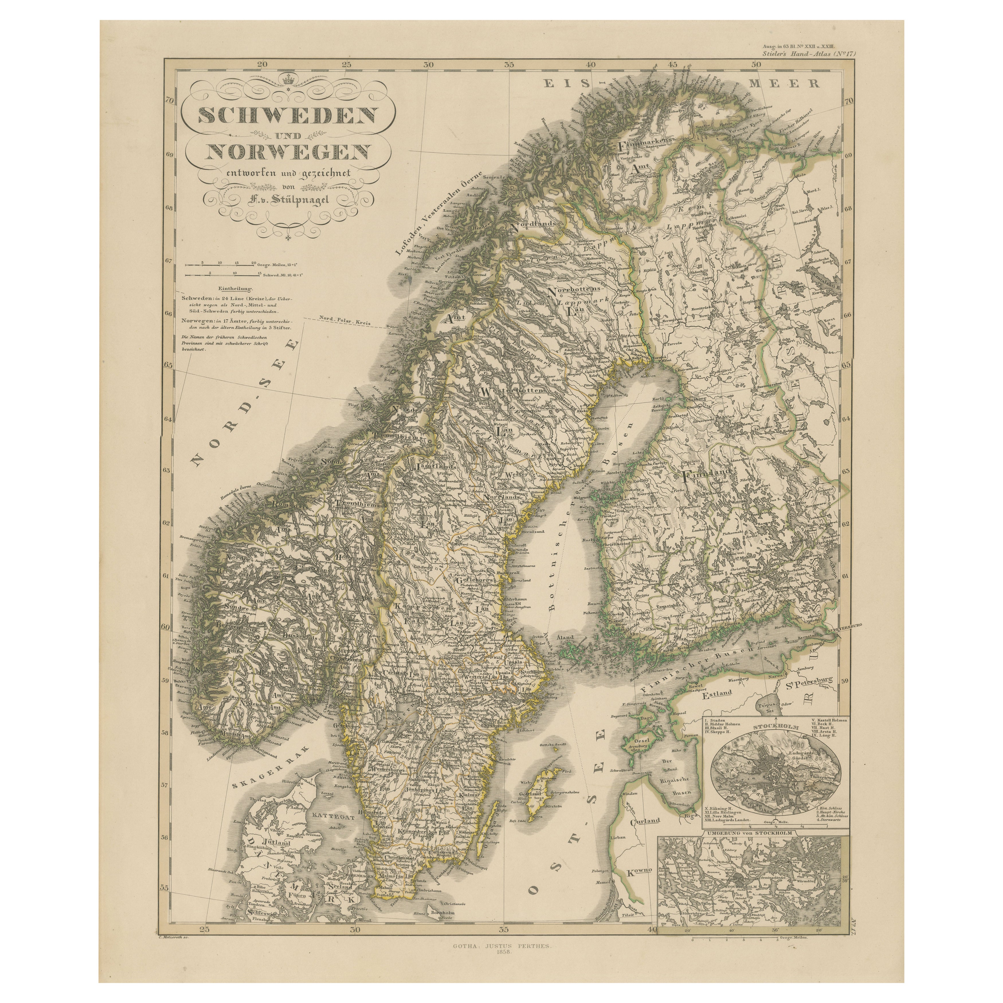
Sweden and Norway Map – Stieler Atlas Engraving, 1858
This fine antique map titled Schweden und Norwegen (Sweden and Norway) was published in 1858 by Justus Perthes of Gotha and dra...
Category
Antique Mid-19th Century German Maps
Materials
Paper
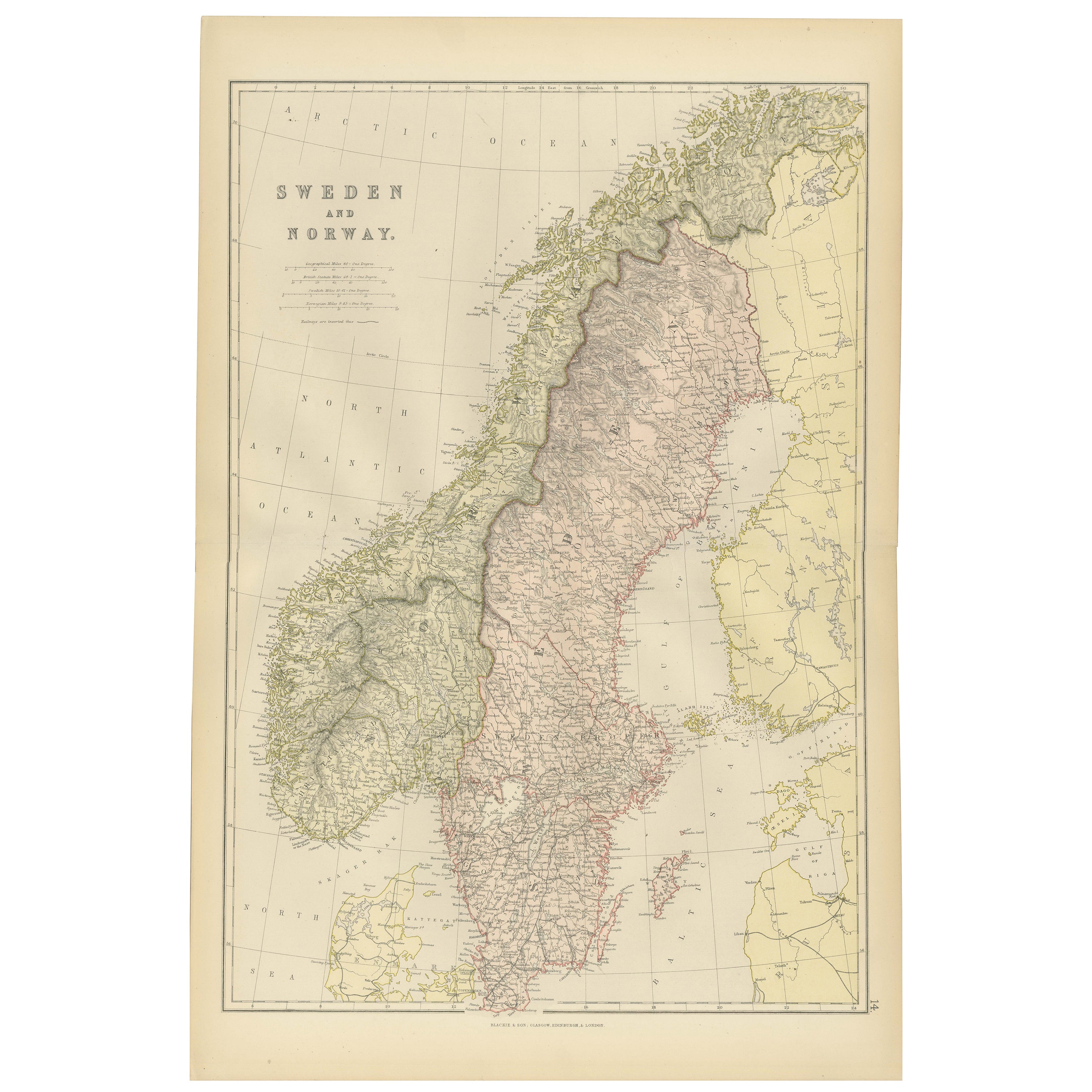
Sweden & Norway – Antique Map of Scandinavia with Stockholm Inset, 1865
Located in Langweer, NL
Sweden & Norway – Antique Map of Scandinavia with Stockholm Inset, 1865
This finely detailed antique map titled Sweden & Norway (Scandinavia) offers a comprehensive 19th-century vie...
Category
Antique Mid-19th Century English Maps
Materials
Paper

$264 Sale Price
20% Off
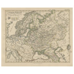
1857 Engraved Map of Russia, Finland & Scandinavia – Historic Print
Located in Langweer, NL
Antique Map of European Russia Including Scandinavia – Stieler Atlas 1857
This antique map titled "Europäisches Russland nebst Schweden und Norwegen" (European Russia together with ...
Category
Antique Mid-19th Century German Maps
Materials
Paper
1882 Map of Sweden and Norway Highlighting Geographical and Political Features
Located in Langweer, NL
This 1882 map of Sweden and Norway, published by Blackie and Son as part of the 'Comprehensive Atlas and Geography of the World,' provides a detailed depiction of the Scandinavian Pe...
Category
Antique 1880s Maps
Materials
Paper

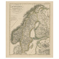
Antique Map of Sweden and Norway by W. G. Blackie, 1859
Located in Langweer, NL
Antique map titled 'Sweden and Norway'. Original antique map of Sweden and Norway. This map originates from ‘The Imperial Atlas of Modern Geography’. Published by W. G. Blackie, 1859.
Category
Antique Mid-19th Century Maps
Materials
Paper

$240 Sale Price
20% Off
Antique Map of Sweden and Norway by Petri, c.1873
Located in Langweer, NL
Antique map titled 'Zweden en Noorwegen'. Old map depicting Sweden and Norway. This map originates from 'School-Atlas van alle Deelen der Aarde'. Artists and Engravers: Published by ...
Category
Antique 19th Century Maps
Materials
Paper

$112 Sale Price
20% Off
You May Also Like
Russia in Europe with Poland and Finland. Century Atlas antique vintage map
Located in Melbourne, Victoria
'The Century Atlas. Russia in Europe with Poland and Finland'
Original antique map, 1903.
Central fold as issued. Map name and number printed on the reverse corners.
Sheet 40cm by ...
Category
Early 20th Century Victorian More Prints
Materials
Lithograph

Original Antique Map of Sweden, Engraved by Barlow, 1806
Located in St Annes, Lancashire
Great map of Sweden
Copper-plate engraving by Barlow
Published by Brightly & Kinnersly, Bungay, Suffolk. 1806
Unframed.
Category
Antique Early 1800s English Maps
Materials
Paper

Large Original Vintage Map of Sweden and Norway circa 1920
Located in St Annes, Lancashire
Great map of Sweden and Norway
Original color. Good condition
Published by Alexander Gross
Unframed.
Category
Vintage 1920s English Victorian Maps
Materials
Paper

1849 Map of "Europaische Russland", 'Meyer Map of European Russia', Ric. R017
Located in Norton, MA
1849 Map of
"Europaische Russland"
( Meyer Map of European Russia)
Ric.r017
A lovely map of European Russia dating to 1849 by Joseph Meyer. It covers the European portions of...
Category
Antique 19th Century Unknown Maps
Materials
Paper

Russia, Western and Southern Part. Century Atlas antique vintage map
Located in Melbourne, Victoria
'The Century Atlas. Russia, Western and Southern Part'
Original antique map, 1903.
Inset map tilted 'St Petersburg and Environs'.
Central fold as issued. Map name and number printe...
Category
Early 20th Century Victorian More Prints
Materials
Lithograph

Denmark. Century Atlas antique vintage map
Located in Melbourne, Victoria
'The Century Atlas. Denmark'
Original antique map, 1903.
Inset maps of 'Faroe Islands', 'Iceland' and 'Copenhagen'.
Central fold as issued. Map name and number printed on the reve...
Category
Early 20th Century Victorian More Prints
Materials
Lithograph

More Ways To Browse
Pair Of Danish Chairs
Veneer Dining Tables
1970 Italian Armchair
Furniture Uk
House Of Denmark Table And Chairs
Louis Marble Top Side Table
Antique Russian Rugs
Baker Furniture By
For Kids
Sterling Silver Flatware Set Service For 12
Tufted Bar
Pair Of French Antique Armchairs
1970s Brass Glass Coffee Table
Antique Column Base
Charles Rennie Mackintosh For Cassina
Glass Salt
Italian Modern Silver Vases
Vintage Resin Tables