Items Similar to Antique Map of Sri Lanka with an unusual five-sided shape, circa 1606
Want more images or videos?
Request additional images or videos from the seller
1 of 6
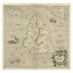
Antique Map of Sri Lanka with an unusual five-sided shape, circa 1606
About the Item
Antique map titled 'Ins. Ceilan quae incolis Tenarisin dicitur'. This exquisite, early map of Sri Lanka is shown with an unusual five-sided shape. North is oriented to the left by an elaborate compass rose. The map was beautifully engraved by Petrus Plancius with pictorial detail of mountains, roads, forests, villages, kingdoms, mines, stupas and spice plantations. It is embellished with three strapwork cartouches and further adorned with a finely rendered sailing ship and animals roaming the interior (including a large elephant with his manhout). Latin text on verso. Published circa 1606.
- Dimensions:Height: 16.93 in (43 cm)Width: 22.05 in (56 cm)Depth: 0.02 in (0.5 mm)
- Materials and Techniques:
- Period:Early 17th Century
- Date of Manufacture:c.1606
- Condition:Repaired: Few closed tears. General age-related toning. Original folding line, with split. Few closed tears, also sl. affecting image. Latin text on verso. Please study image carefully.
- Seller Location:Langweer, NL
- Reference Number:Seller: BG-13522-11stDibs: LU3054335447262
About the Seller
5.0
Recognized Seller
These prestigious sellers are industry leaders and represent the highest echelon for item quality and design.
Platinum Seller
Premium sellers with a 4.7+ rating and 24-hour response times
Established in 2009
1stDibs seller since 2017
2,442 sales on 1stDibs
Typical response time: 1 hour
- ShippingRetrieving quote...Shipping from: Langweer, Netherlands
- Return Policy
Authenticity Guarantee
In the unlikely event there’s an issue with an item’s authenticity, contact us within 1 year for a full refund. DetailsMoney-Back Guarantee
If your item is not as described, is damaged in transit, or does not arrive, contact us within 7 days for a full refund. Details24-Hour Cancellation
You have a 24-hour grace period in which to reconsider your purchase, with no questions asked.Vetted Professional Sellers
Our world-class sellers must adhere to strict standards for service and quality, maintaining the integrity of our listings.Price-Match Guarantee
If you find that a seller listed the same item for a lower price elsewhere, we’ll match it.Trusted Global Delivery
Our best-in-class carrier network provides specialized shipping options worldwide, including custom delivery.More From This Seller
View AllLarge Antique Map of Ceylon, Sri Lanka
Located in Langweer, NL
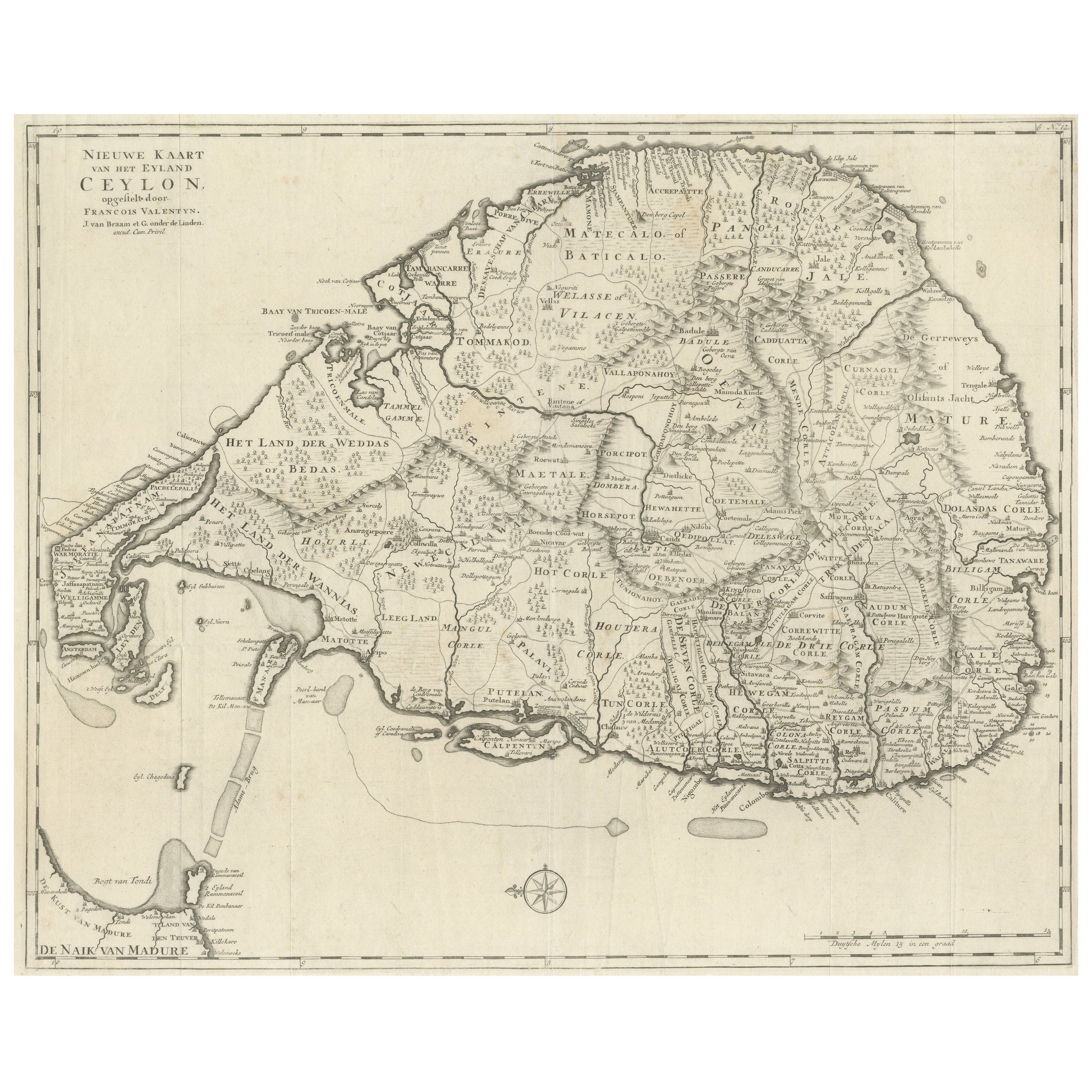
Antique map titled 'Nieuwe Kaart van het Eyland Ceylon opgestelt door Francois Valentyn'. Beautiful map of Sri Lanka. Originates from 'Oud en Nieuw Oost ...
Category
Antique Mid-18th Century Maps
Materials
Paper
$731 Sale Price
20% Off
Antique Ptolemaic Map of Ceylon or nowadays Sri Lanka
Located in Langweer, NL
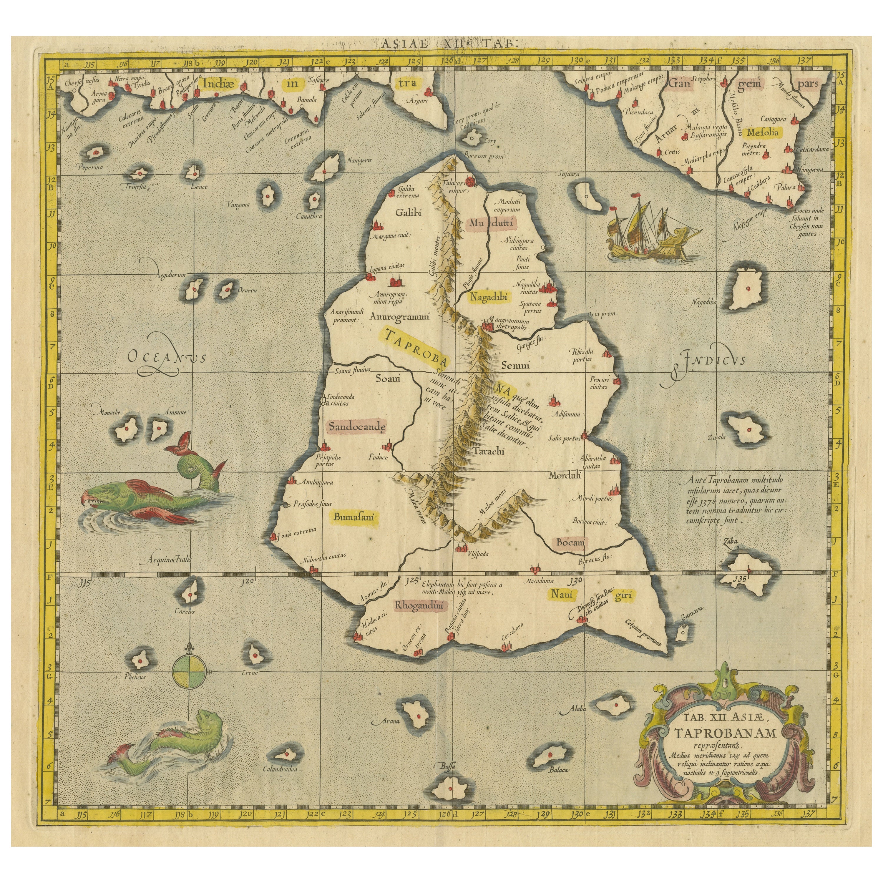
Antique map titled 'Tab XII. Asiae Taprobanam'. Ptolemaic map of Sri Lanka. Ptolemy drew on the accounts of travelers and sailors and though the information was secondhand and often ...
Category
Antique Mid-18th Century Maps
Materials
Paper
$638 Sale Price
20% Off
Antique Map of Southern India, the Maldives and Sri Lanka with Currents
Located in Langweer, NL
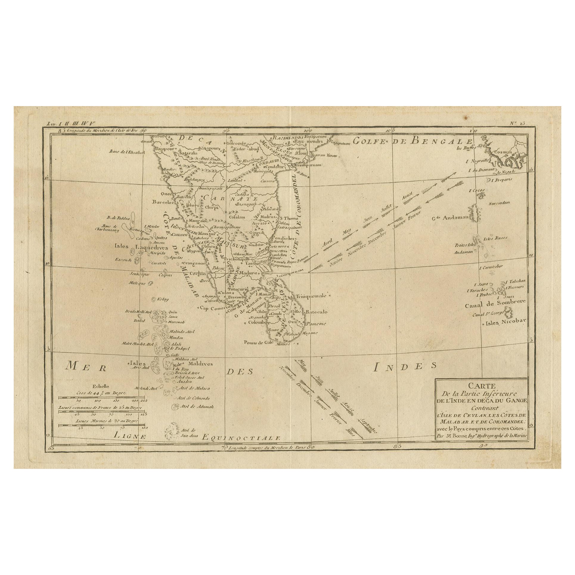
Antique map titled 'Carte de la Partie Inferieure De L'Inde En Deca Du Gange (..)'. Interesting map of Southern India, the Maldives and Sri Lanka. Includes a month by month charting ...
Category
Antique Late 18th Century Maps
Materials
Paper

$259 Sale Price
20% Off
Mercator's Ptolemaic map of Taprobana, (Ceylon) Sri Lanka
Located in Langweer, NL
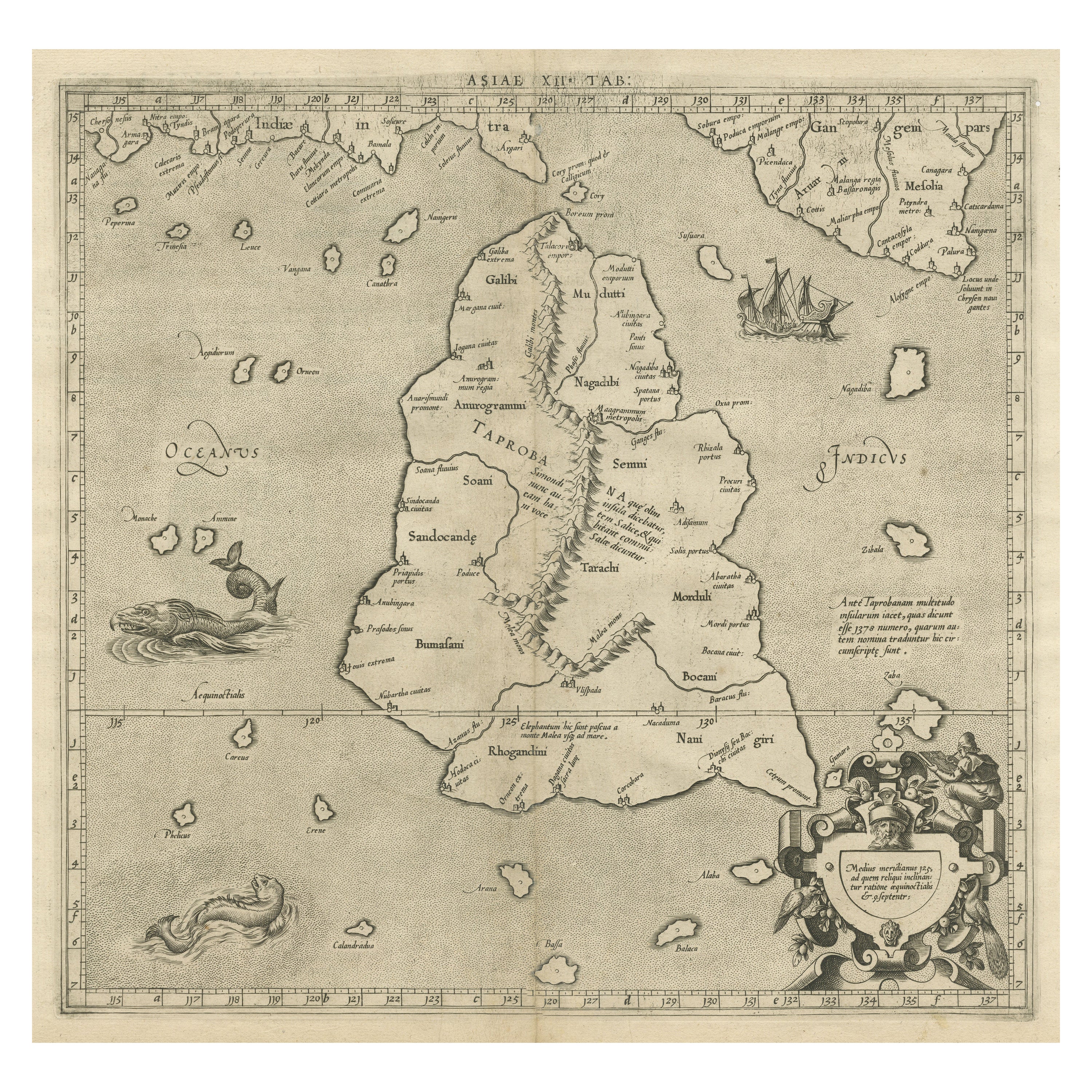
Antique map titled 'Asiae XII Tab'. Mercator's Ptolemaic map of Taprobana. The map shows Ptolemy's erroneous location of the island of Sri Lanka near the equator, with a bit of India...
Category
Antique 16th Century Maps
Materials
Paper
$537 Sale Price
20% Off
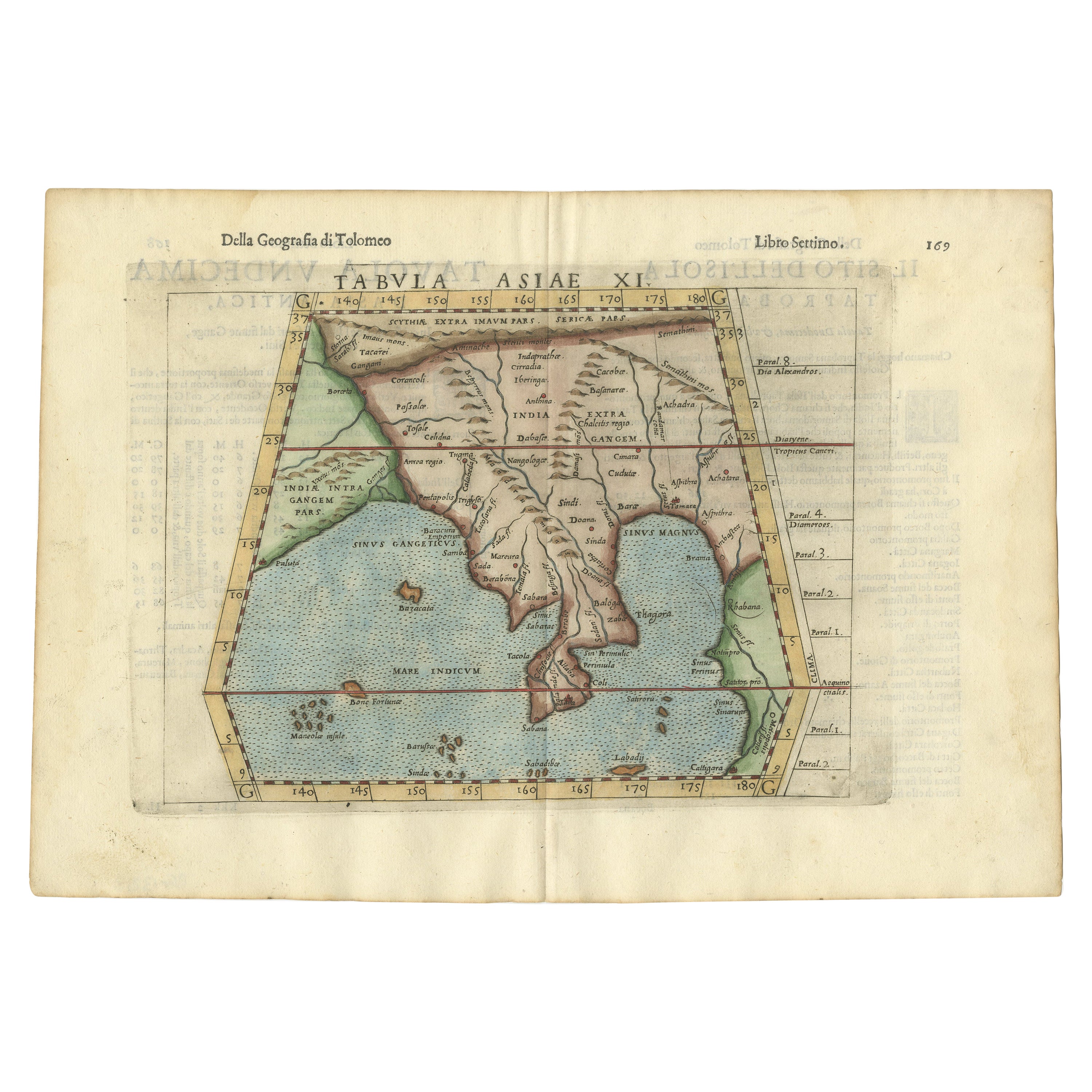
Antique Hand-Coloured Map of India, Sri Lanka, Maldives, ca.1599
Located in Langweer, NL
Title: Tabula Asiae XI - 1599
Very old and decorative map of India, Sri Lanka and the Maledives. Put this map in a frame on the wall and amaze your visitors. This original engravi...
Category
Antique 16th Century Maps
Materials
Paper

$518 Sale Price
20% Off
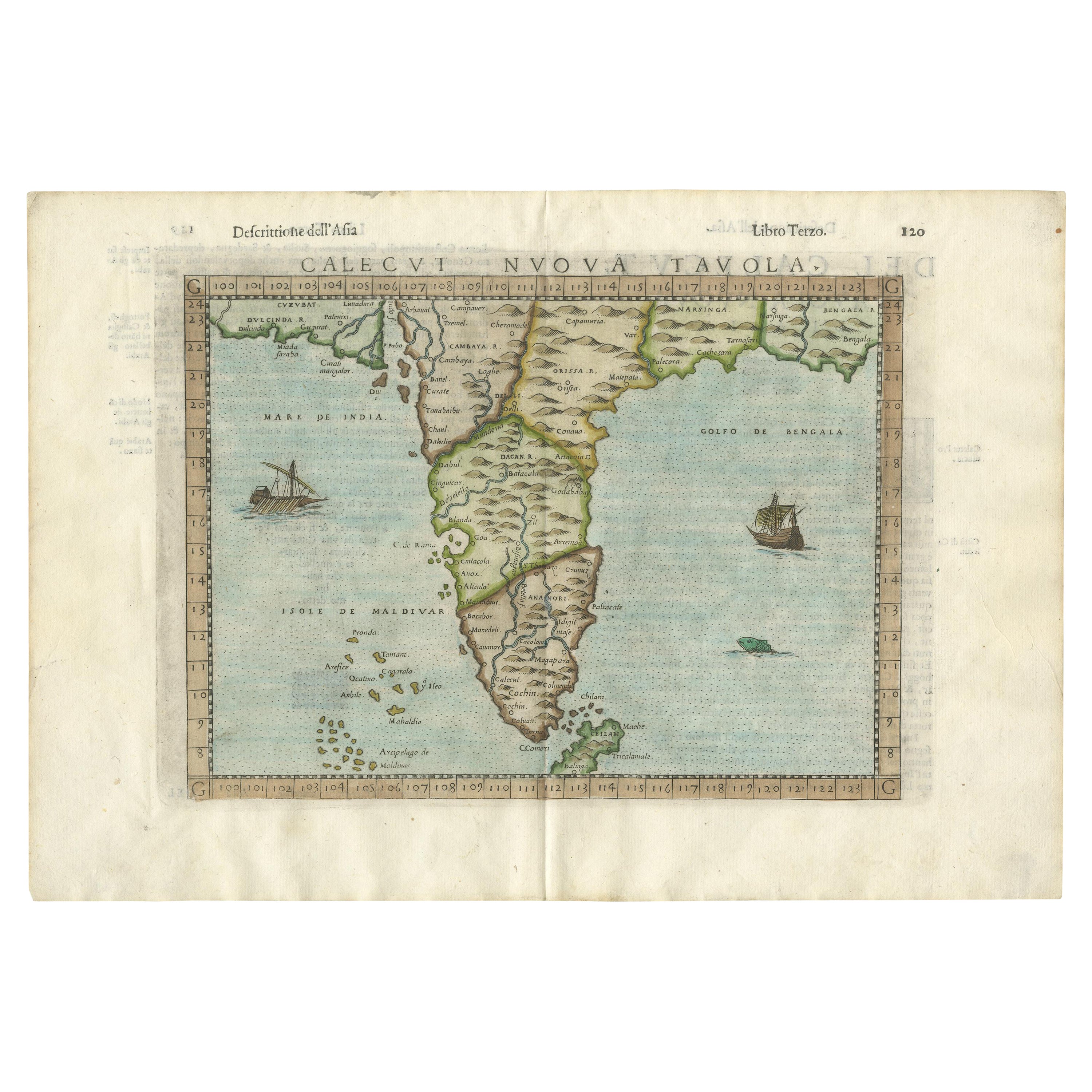
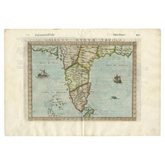
Rare Attractive Antique Map of Asia, India, Sri Lanka, Maldives, 1599
Located in Langweer, NL
Original Antique map of Asia, India, Ceylon (Sri Lanka), Maldives by Rosaccio / Ruscelli in attractive coloring.
Title: Calecut Nuova Tavola
Year: 1599
Relief shown pictorially.
...
Category
Antique 16th Century European Maps
Materials
Paper
$694 Sale Price
20% Off
You May Also Like
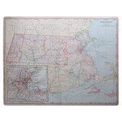
Large Original Antique Map of Massachusetts, USA, circa 1900
Located in St Annes, Lancashire
Fabulous map of Massachusetts
In 2 sheets. They can be joined but I have not done it
Original color
Engraved and printed by the George F. Cram ...
Category
Antique 1890s American Maps
Materials
Paper
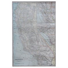
Large Original Antique Map of California, USA, circa 1900
Located in St Annes, Lancashire
Fabulous map of California
Original color
Engraved and printed by the George F. Cram Company, Indianapolis.
Published, circa 1900
Unframed
Free shipping.
Category
Antique 1890s American Maps
Materials
Paper
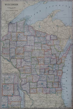
Large Original Antique Map of Wisconsin, USA, circa 1900
Located in St Annes, Lancashire
Fabulous map of Wisconsin
Original color
Engraved and printed by the George F. Cram Company, Indianapolis.
Published, circa 1900
Unframed
Category
Antique 1890s American Maps
Materials
Paper
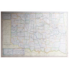
Large Original Antique Map of Oklahoma, USA, circa 1900
Located in St Annes, Lancashire
Fabulous map of Oklahoma
Original color
Engraved and printed by the George F. Cram Company, Indianapolis.
Published, circa 1900
Unframed
Repair to...
Category
Antique 1890s American Maps
Materials
Paper
Antique Map Of Brabantia Ducantus By Bleau Circa 1640
Located in Brussels, Brussels
map of theBrabantia Ducantus (Belgium) circa 1640 by Bléau. Bléau was well known for antique atlas that he draw during the 17 century
beautiful map, double page folded in the middle,...
Category
Antique 17th Century French Renaissance Maps
Materials
Paper

Original Antique Map of Spain and Portugal, circa 1790
Located in St Annes, Lancashire
Super map of Spain and Portugal
Copper plate engraving by A. Bell
Published, circa 1790.
Unframed.
Category
Antique 1790s English Other Maps
Materials
Paper

Recently Viewed
View AllMore Ways To Browse
Antique Plantation Furniture
Italian Leather Folding Chairs
Kashmir Woven Rugs
Kohn Vienna Secession
Lamb Antique Furniture
Laminate Kitchen Table
Large Drop Leaf Table
Large Ice Bucket
Large Jewellery Chest
Limestone And Wood Table
Luxury Safari Lodge
Mahogany Side Table With Black Top
Marble Coffee Table Danish
Marble Mosaic Tile
Marble Plinth Side Table
Mario Bellini Blue
Masculine Rug
Matching Curved Sofas