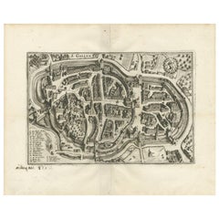
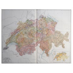
Antique Map of St. Gallen 'Switzerland' by M. Merian, circa 1650
View Similar Items


Want more images or videos?
Request additional images or videos from the seller
1 of 5
Antique Map of St. Gallen 'Switzerland' by M. Merian, circa 1650
About the Item
- Dimensions:Height: 12.8 in (32.5 cm)Width: 16.15 in (41 cm)Depth: 0.02 in (0.5 mm)
- Materials and Techniques:
- Period:Mid-17th Century
- Date of Manufacture:circa 1650
- Condition:General age-related toning. Please study image carefully.
- Seller Location:Langweer, NL
- Reference Number:Seller: BG-102071stDibs: LU3054310792943
About the Seller
5.0
Platinum Seller
These expertly vetted sellers are 1stDibs' most experienced sellers and are rated highest by our customers.
Established in 2009
1stDibs seller since 2017
1,933 sales on 1stDibs
More From This SellerView All
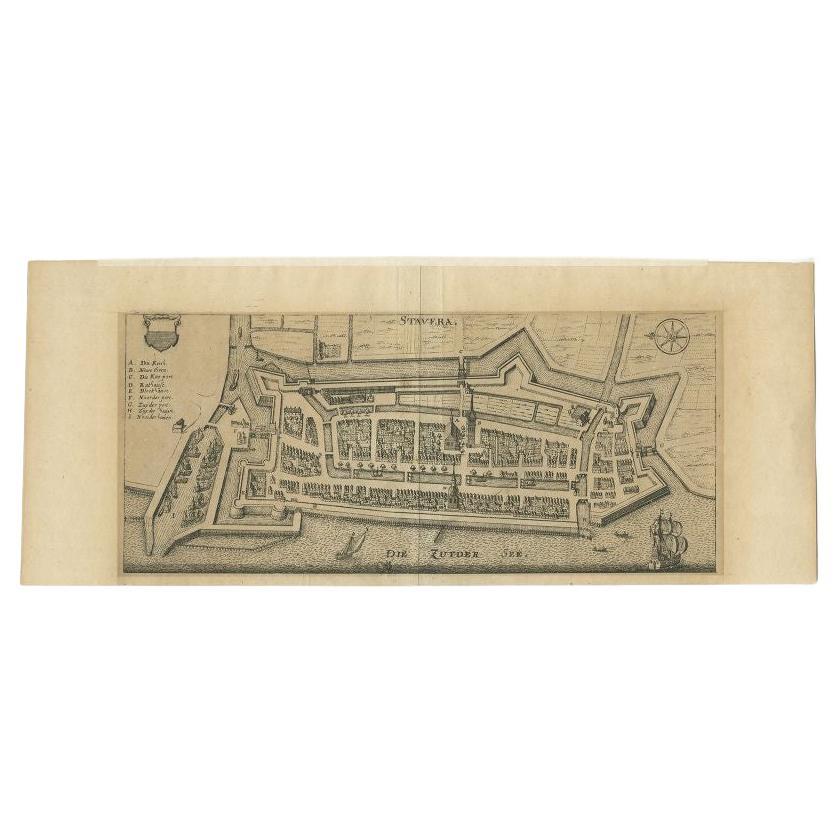
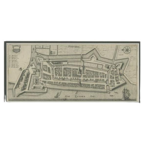
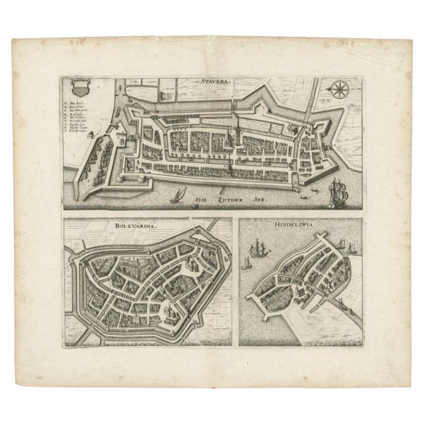
- Antique Map of Stavoren by Merian, c.1650Located in Langweer, NLAntique map titled 'Stavera'. Map of the city of Stavoren, Friesland. With German legend. Trimmed, originally published on one sheet with a map of Bolsward and Hindeloopen. Artists a...Category
Antique 17th Century Maps
MaterialsPaper
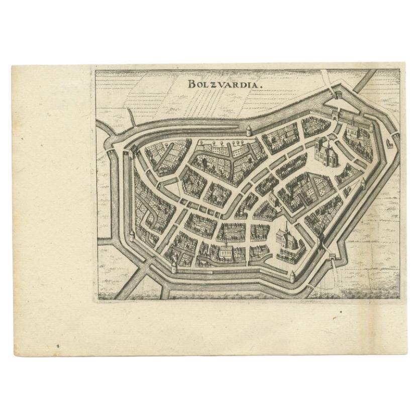
- Antique Map of the City of Bolsward by Merian, c.1650Located in Langweer, NLAntique map titled 'Bolzvardia'. Old map of the city of Bolsward, Friesland. This map was published with two other maps on one sheet (Hindeloopen and Stavoren). Artists and Engravers...Category
Antique 17th Century Maps
MaterialsPaper
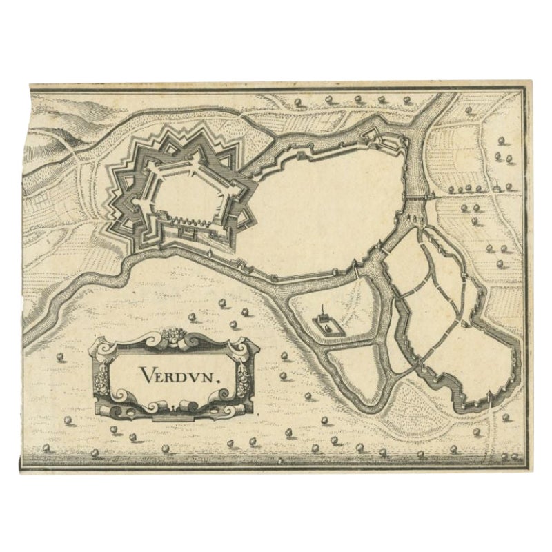
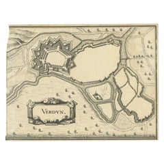
- Antique Map of the City of Verdun by Merian, c.1650Located in Langweer, NLAntique map titled 'Verdun'. Orginal antique map of Verdun, a small city in the Meuse department in Grand Est in northeastern France. This map originates from 'Topographia Germaniae'...Category
Antique 17th Century Maps
MaterialsPaper
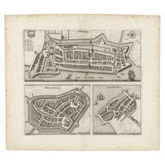
- Antique Map of Stavoren, Bolsward and Hindeloopen by Merian, c.1650Located in Langweer, NLAntique map titled 'Stavera, Bolzvardia, Hindelopia'. Three maps on one sheet depicting Stavoren, Bolsward and Hindeloopen (Friesland, The Netherlands). With German legend. Artists a...Category
Antique 17th Century Maps
MaterialsPaper
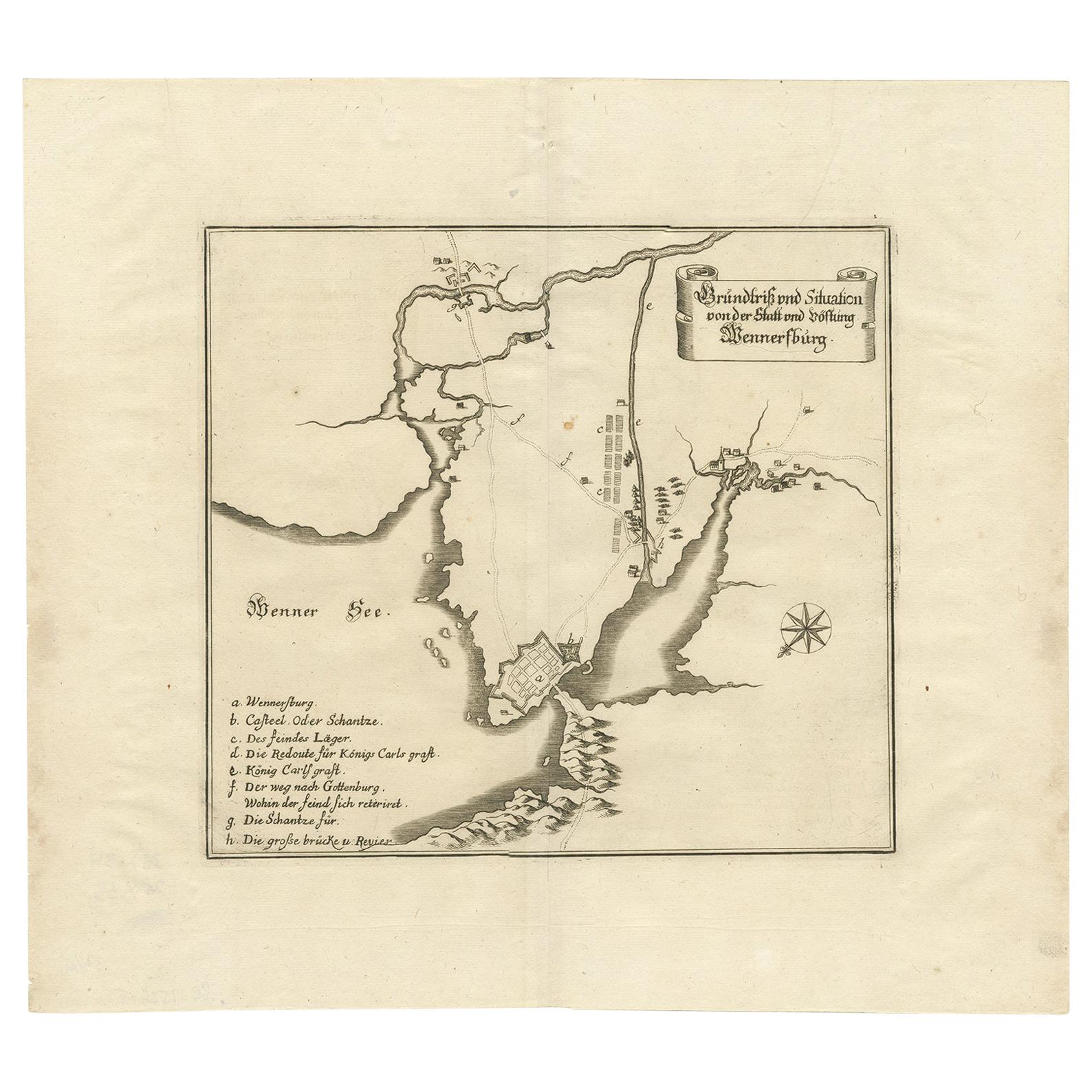
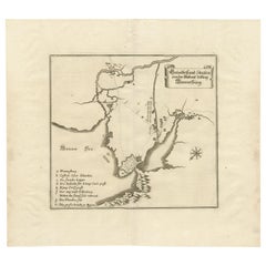
- Antique Map of Vänersborg by Merian 'circa 1680'Located in Langweer, NLAntique map titled 'Grundtriss und Situation von der Statt und Vöstung Wennersburg'. Copper engraved plan of Vänersborg, Sweden. This map orginates from 'Theatrum Europaeum' by Meria...Category
Antique Late 17th Century Maps
MaterialsPaper
You May Also Like
- Large Original Vintage Map of Switzerland, circa 1920Located in St Annes, LancashireGreat map of Switzerland Original color. Good condition Published by Alexander Gross Unframed.Category
Vintage 1920s English Maps
MaterialsPaper
- Original Antique Map of Switzerland, Engraved By Barlow, Dated 1807Located in St Annes, LancashireGreat map of Switzerland Copper-plate engraving by Barlow Published by Brightly & Kinnersly, Bungay, Suffolk. Dated 1807 Unframed.Category
Antique Early 1800s English Maps
MaterialsPaper
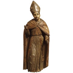
- Large Antique Polychromed Wood Statue of a Bishop, circa 1650Located in Dallas, TXThis 64 inch high antique statue of a Bishop dates to circa 1650 and is German in origin. Starting in the 15th and 16th centuries, there was a large demand for ecclesiastical carvings throughout central and western Europe. Large statues were commissioned for churches and smaller items were for private use. This bishop statue...Category
Antique 17th Century German Figurative Sculptures
MaterialsFabric, Glass, Wood, Paint
- Original Antique Map of Belgium by Tallis, Circa 1850Located in St Annes, LancashireGreat map of Belgium Steel engraving Many lovely vignettes Published by London Printing & Publishing Co. ( Formerly Tallis ), C.1850 Origin...Category
Antique 1850s English Maps
MaterialsPaper
- Original Antique Map of Cyprus. Circa 1880Located in St Annes, LancashireGreat map of Cyprus Drawn and Engraved by R.Walker Published W.Mackenzie, London Original colour Unframed.Category
Antique 1880s English Maps
MaterialsPaper

- Original Antique Map of South America, circa 1830Located in St Annes, LancashireGreat map of South America Copper plate engraving Published by Butterworth, Livesey & Co., circa 1830 Unframed.Category
Antique Early 1800s English Other Maps
MaterialsPaper


Recently Viewed
View AllMore Ways To Browse
M S Merian
Cartier 1730
Christoph Weigel On Sale
Dao Antique Map
Devonia Antique
Eso Antique Map
Eso Antique Maps
J Karte
M S Merian
Nicolaes Visscher II On Sale
W. & A.K. Johnston On Sale
Willem Blaeu On Sale
Yemen 1789
Andalusia Map
Atlas School Supply On Sale
Old Teak Petite Artisan
Rand Mcnally Map Of California
Rand Mcnally Map Of Colorado