Items Similar to Antique Map of Sweden by Delamarche, 1806


Want more images or videos?
Request additional images or videos from the seller
1 of 5
Antique Map of Sweden by Delamarche, 1806
About the Item
Antique map titled 'La Suede.' Decorative map of Sweden and part of Finland by Robert de Vaugondy, revised and published by Delamarche. Source unknown, to be determined. Artists and Engravers: Made by 'Charles Francois Delamarche' after an anonymous artist. Charles Francois Delamarche (1740-1817) founded the important and prolific Paris based Maison Delamarche map publishing firm in the late 18th century. A lawyer by trade Delamarche entered the map business with the acquisition from Jean-Baptiste Fortin of Robert de Vaugondy's map plates and copyrights and later addes many plates from other sources as well. Charles Delamarche eventually passed control of the firm to his son Felix Delamarche (18th C. - 1st half 19th C.) and geographer Charles Dien (1809-1870). It was later passed on to Alexandre Delamarche, who revised and reissued several Delamarche publications in the mid-19th century. The firm continued to publish maps and globes until the middle part of the 19th century.
Artist: Made by 'Charles Francois Delamarche' after an anonymous artist. Charles Francois Delamarche (1740-1817) founded the important and prolific Paris based Maison Delamarche map publishing firm in the late 18th century. A lawyer by trade Delamarche entered the map business with the acquisition from Jean-Baptiste Fortin of Robert de Vaugondy's map plates and copyrights and later addes many plates from other sources as well. Charles Delamarche eventually passed control of the firm to his son Felix Delamarche (18th C. - 1st half 19th C.) and geographer Charles Dien (1809-1870). It was later passed on to Alexandre Delamarche, who revised and reissued several Delamarche publications in the mid-19th century. The firm continued to publish maps and globes until the middle part of the 19th century.
Condition: Good, given age. Soft crease upper right. Original middle fold as issued. General age-related toning and/or occasional minor defects from handling. Please study image carefully.
Date: 1806
Overall size: 38.3 x 28.4 cm.
Image size: 0.001 x 19.4 x 24.3 cm.
Antique prints have long been appreciated for both their aesthetic and investment value. They were the product of engraved, etched or lithographed plates. These plates were handmade out of wood or metal, which required an incredible level of skill, patience and craftsmanship. Whether you have a house with Victorian furniture or more contemporary decor an old engraving can enhance your living space. We offer a wide range of authentic antique prints for any budget.
- Dimensions:Height: 11.19 in (28.4 cm)Width: 15.08 in (38.3 cm)Depth: 0 in (0.01 mm)
- Materials and Techniques:
- Period:
- Date of Manufacture:1806
- Condition:
- Seller Location:Langweer, NL
- Reference Number:Seller: PCT-616741stDibs: LU3054327772912
About the Seller
5.0
Recognized Seller
These prestigious sellers are industry leaders and represent the highest echelon for item quality and design.
Gold Seller
Premium sellers maintaining a 4.3+ rating and 24-hour response times
Established in 2009
1stDibs seller since 2017
2,467 sales on 1stDibs
Typical response time: 1 hour
- ShippingRetrieving quote...Shipping from: Langweer, Netherlands
- Return Policy
Authenticity Guarantee
In the unlikely event there’s an issue with an item’s authenticity, contact us within 1 year for a full refund. DetailsMoney-Back Guarantee
If your item is not as described, is damaged in transit, or does not arrive, contact us within 7 days for a full refund. Details24-Hour Cancellation
You have a 24-hour grace period in which to reconsider your purchase, with no questions asked.Vetted Professional Sellers
Our world-class sellers must adhere to strict standards for service and quality, maintaining the integrity of our listings.Price-Match Guarantee
If you find that a seller listed the same item for a lower price elsewhere, we’ll match it.Trusted Global Delivery
Our best-in-class carrier network provides specialized shipping options worldwide, including custom delivery.More From This Seller
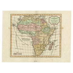
View AllAntique Map of Africa by Delamarche, 1806
Located in Langweer, NL
Antique map titled 'L'Afrique'.
Decorative map of Africa by Robert de Vaugondy, revised and published by Delamarche. Source unknown, to be determined.
Artists and Engravers: Charl...
Category
Antique 19th Century Maps
Materials
Paper
$251 Sale Price
20% Off
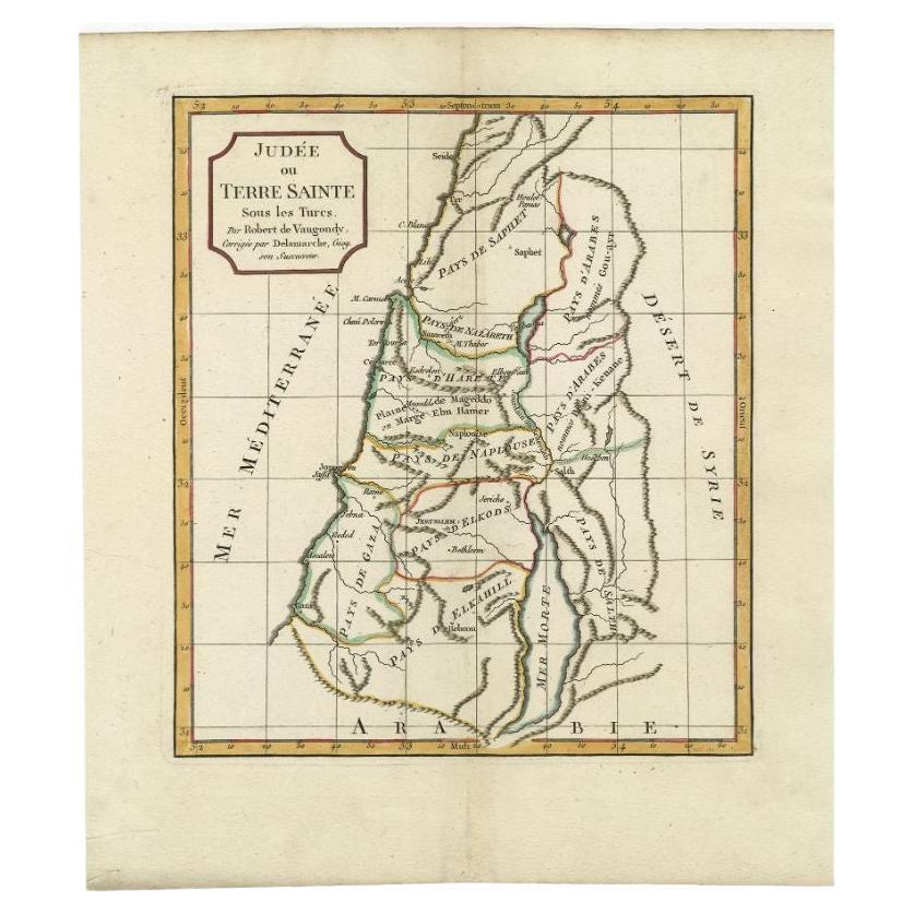
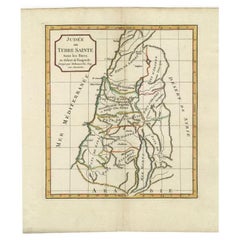
Antique Map of the Holy Land by Delamarche, 1806
By Charles Francois Delamarche
Located in Langweer, NL
Antique map titled 'Judee ou Terre Sainte sous les Turcs.' This map shows the holy land under the Turcs. By Robert de Vaugondy, revised and published by ...
Category
Antique 19th Century Maps
Materials
Paper
Antique Map of the British Isles by Delamarche, 1806
Located in Langweer, NL
Antique map titled 'Les Isles Britanniques.' Decorative map of the British Isles by Robert de Vaugondy, revised and published by Delamarche. Source unkno...
Category
Antique 19th Century Maps
Materials
Paper

$139 Sale Price
20% Off
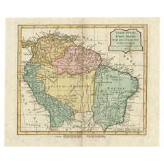
Antique Map of the Northern Part of South America by Delamarche, 1806
Located in Langweer, NL
Antique map titled 'Terre-Ferme, Perou, Bresil, Pays de L'Amazone.' This map shows the northern part of South America with Peru, Brazil, Guyana etc. By Robert de Vaugondy, revised an...
Category
Antique 19th Century Maps
Materials
Paper
$163 Sale Price
20% Off
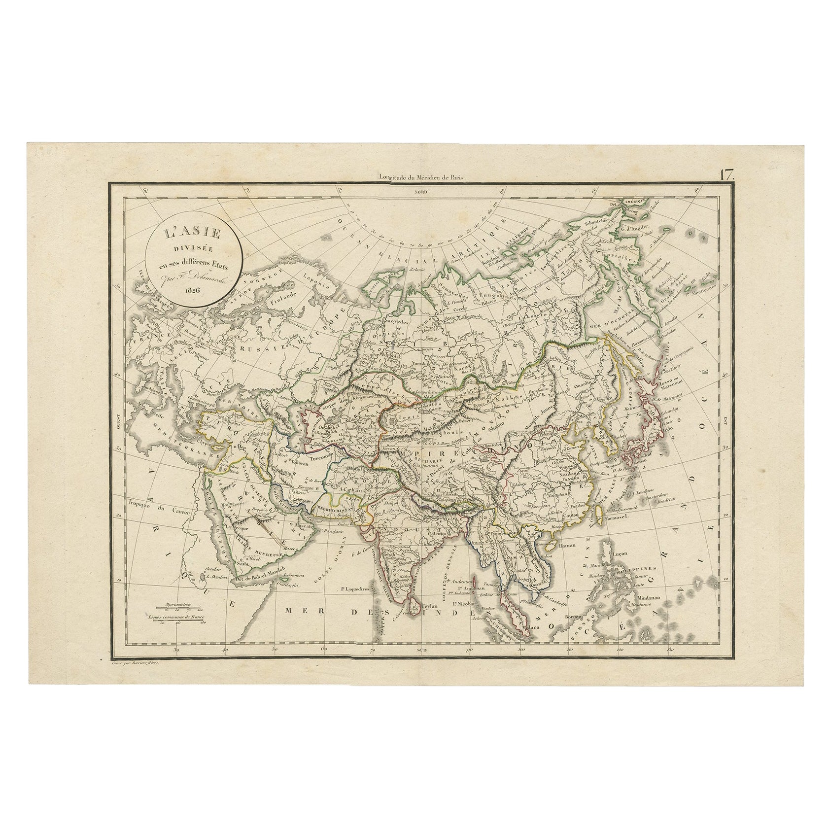
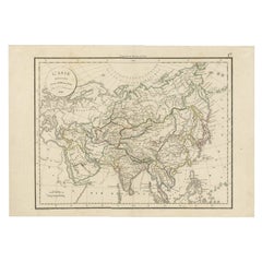
Antique Map of Asia by Delamarche, 1826
Located in Langweer, NL
Vaugondy's map plates and copyrights and later addes many plates from other sources as well. Charles Delamarche eventually passed control of the firm to his son Felix Delamarche (18t...
Category
Antique 19th Century Maps
Materials
Paper
$223 Sale Price
20% Off
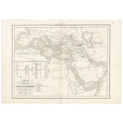
Antique Map of Southern Europe by F. Delamarche, 1837
Located in Langweer, NL
Title: Géographie des Hébreux ou Tableau de la Dispersion des enfants de Noé
- **Origin**: From 'Atlas De La Géographie Ancienne' by F. Delamarche
- **Date of Publication**: 1837
D...
Category
Antique Mid-19th Century Maps
Materials
Paper
$223 Sale Price
20% Off
You May Also Like
Original Antique Map of Sweden, Engraved by Barlow, 1806
Located in St Annes, Lancashire
Great map of Sweden
Copper-plate engraving by Barlow
Published by Brightly & Kinnersly, Bungay, Suffolk. 1806
Unframed.
Category
Antique Early 1800s English Maps
Materials
Paper

America "Amérique Septentrionale": A 19th Century French Map by Delamarche
By Maison Delamarche 1
Located in Alamo, CA
This framed mid 19th century map of North America entitled "Amérique Septentrionale" by Felix Delamarche was published in Paris in 1854 by Quay de l'Horloge du Palais, avec les Carte...
Category
Antique Mid-19th Century American Other Maps
Materials
Paper

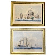
Antique Pair of English Maritime Colored Etchings 1806.
Located in Vero Beach, FL
Antique Pair of English Maritime Colored Etchings 1806.
English hand-colored etchings of a 90 Gun Ship at Spithead and a Collier with a view of the S...
Category
Antique 19th Century English Romantic Nautical Objects
Materials
Glass, Giltwood, Paper
$640 Sale Price / set
20% Off
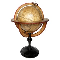
Terrestrial Table Globe by Félix Delamarche, Paris, 1821
By Félix Delamarche
Located in Milano, IT
Terrestrial table globe
Félix Delamarche
Paris, 1821
It measures 20.47 in height, Ø max 14.17 in; the sphere Ø 9.44 in (h 52 cm x Ø max 36.5 cm; the sphere Ø 24 cm)
Wood, printed...
Category
Antique 1820s French Restauration Scientific Instruments
Materials
Metal
Antique Map of Italy by Andriveau-Goujon, 1843
By Andriveau-Goujon
Located in New York, NY
Antique Map of Italy by Andriveau-Goujon, 1843. Map of Italy in two parts by Andriveau-Goujon for the Library of Prince Carini at Palazzo Carini i...
Category
Antique 1840s French Maps
Materials
Linen, Paper

$3,350 / set
Antique Map of Principality of Monaco
By Antonio Vallardi Editore
Located in Alessandria, Piemonte
ST/619 - "Old Geographical Atlas of Italy - Topographic map of ex-Principality of Monaco" -
ediz Vallardi - Milano -
A somewhat special edition ---
Category
Antique Late 19th Century Italian Other Prints
Materials
Paper

Recently Viewed
View AllMore Ways To Browse
Japanese Wood Rocking Chairs
Jasperware Pitcher
Jindrich Halabala For Thonet
Jupe Table
Kagan Biomorphic
Kane Brian
Kar Studio
Karl Palda Set Glass
Karl Springer Lizard Table
Kartell Masters Stool
Kartell Nightstand
Karu Lounge Chair
Karuselli Lounge Chair
Keel Dining
Kevi Chair
King Tutankhamun
Kings Crown Glass
Kittinger Buffalo