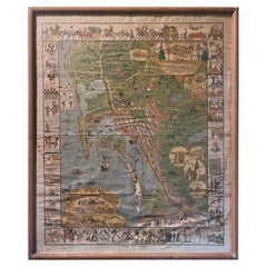
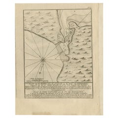
Antique Whimsical Map of San Diego, California by Jo Mora for Marston Stores
View Similar Items


Want more images or videos?
Request additional images or videos from the seller
1 of 17
Antique Whimsical Map of San Diego, California by Jo Mora for Marston Stores
About the Item
- Creator:A. Marston & Co. (Retailer),Jo Mora (Artist)
- Dimensions:Height: 30.5 in (77.47 cm)Width: 25.25 in (64.14 cm)Depth: 0.5 in (1.27 cm)
- Materials and Techniques:
- Place of Origin:
- Period:
- Date of Manufacture:1928
- Condition:Wear consistent with age and use. Minor losses. Minor fading. The map and frame are in fair condition with a number of stains, blotches and wrinkles (please see pictures).
- Seller Location:San Diego, CA
- Reference Number:Seller: #19681stDibs: LU936626520402
About the Seller
4.9
Platinum Seller
Premium sellers with a 4.7+ rating and 24-hour response times
Established in 2000
1stDibs seller since 2012
4,058 sales on 1stDibs
Authenticity Guarantee
In the unlikely event there’s an issue with an item’s authenticity, contact us within 1 year for a full refund. DetailsMoney-Back Guarantee
If your item is not as described, is damaged in transit, or does not arrive, contact us within 7 days for a full refund. Details24-Hour Cancellation
You have a 24-hour grace period in which to reconsider your purchase, with no questions asked.Vetted Professional Sellers
Our world-class sellers must adhere to strict standards for service and quality, maintaining the integrity of our listings.Price-Match Guarantee
If you find that a seller listed the same item for a lower price elsewhere, we’ll match it.Trusted Global Delivery
Our best-in-class carrier network provides specialized shipping options worldwide, including custom delivery.More From This Seller
View AllUniversity of Southern California Traveler Mascot Wood Carving by Carter Hoffman
Located in San Diego, CA
A very cool and hard to find University of Southern California (USC) "Traveler" horse mascot wood carving by Carter Hoffman, circa 1950s. The piece is i...
Category
Mid-20th Century American Animal Sculptures
Materials
Wood
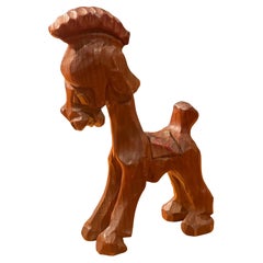
$520 Sale Price
20% Off
Massive Vintage Wall Map of the Soviet Union 'Sowjetunion' by Karl Wenschow
By Denoyer-Geppert
Located in San Diego, CA
A massive vintage wall map of the Soviet Union (Sowjetunion) published by Karl Wenschow in Munich, Germany, circa 1950s. The map was distributed by De...
Category
Mid-20th Century American Maps
Materials
Paper, Wood
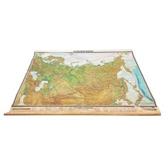
$540 Sale Price
20% Off
Vintage "View of the Center of Paris Taken from the Air" Lithograph Map
Located in San Diego, CA
A very stylish "View of the Center of Paris Taken from the Air" lithograph map published by the Paris Ministry of Tourism, circa early 1950s. The piece measures 27" x 43" and shows...
Category
20th Century French Mid-Century Modern Prints
Materials
Paper

$680 Sale Price
20% Off
Antique Track & Field Discus by Cantabrian of England
Located in San Diego, CA
A nice antique track & field discus by Cantabrian of England, circa 1940s. The piece is in very good vintage condition and measures 9"D x 2"H. it is signed in the middleplate and h...
Category
Early 20th Century Sports Equipment and Memorabilia
Materials
Iron
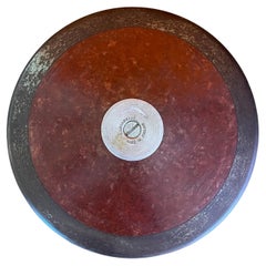
$220 Sale Price
20% Off
Huge Europe and Asia Vintage Wall Map
Located in San Diego, CA
A huge Europe and Asia vintage wall map, circa 1950s. The map is in fair vintage condition and measures 78"W x 73"H". #2863
Category
Mid-20th Century American Maps
Materials
Paper
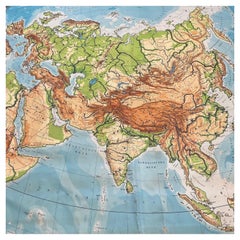
$380 Sale Price
20% Off
Ellamarie Woolley San Diego 200 Arts & Crafts Poster
By Ellamarie Woolley
Located in San Diego, CA
A super rare and hard to find Ellamarie Woolley San Diego 200 arts & crafts poster, circa 2000. The piece is in good condition with a very small water stain on the bottom right of th...
Category
21st Century and Contemporary North American Posters
Materials
Wood, Paper
$380 Sale Price
20% Off
You May Also Like
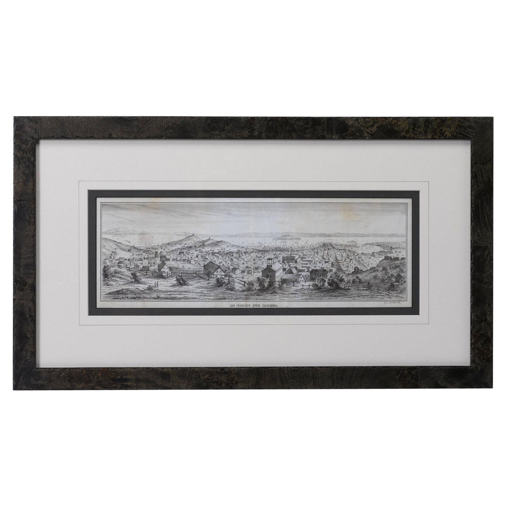
"San Francisco, Upper California” 1851 Antique Map of San Francisco
Located in Colorado Springs, CO
This is a pictorial lettersheet view of the city and harbor of San Francisco. This lithograph was printed on grey wove paper, across a double sheet, by famed lithographers Britton & ...
Category
Antique 1850s American Prints
Materials
Paper

$1,200 Sale Price
20% Off
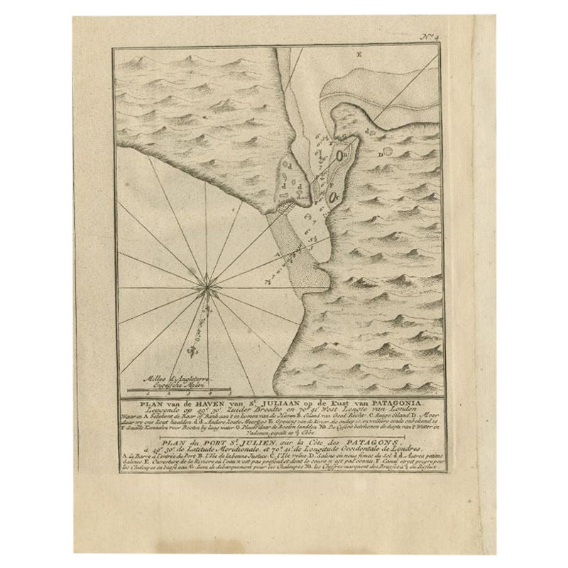
Antique Map of Puerto San Julian in Patagonia, 1749
Located in Langweer, NL
Antique map titled 'Plan van de Haven van St. Juliaan op de Kust van Patagonia (..) - Plan du Port St. Julien, sur la Côte des Patagons (..)'. Original antique map of St. Julian on t...
Category
Antique 18th Century Maps
Materials
Paper
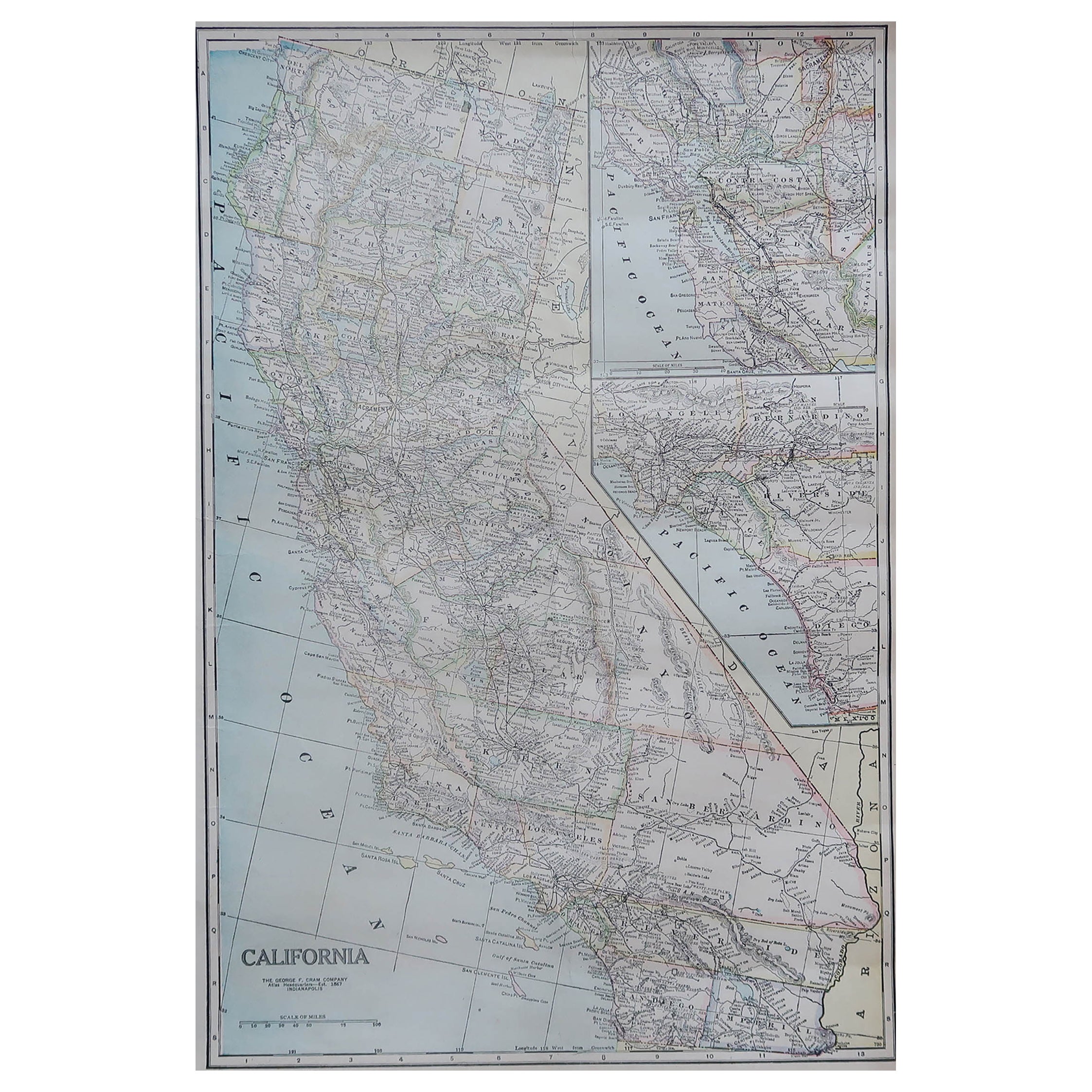
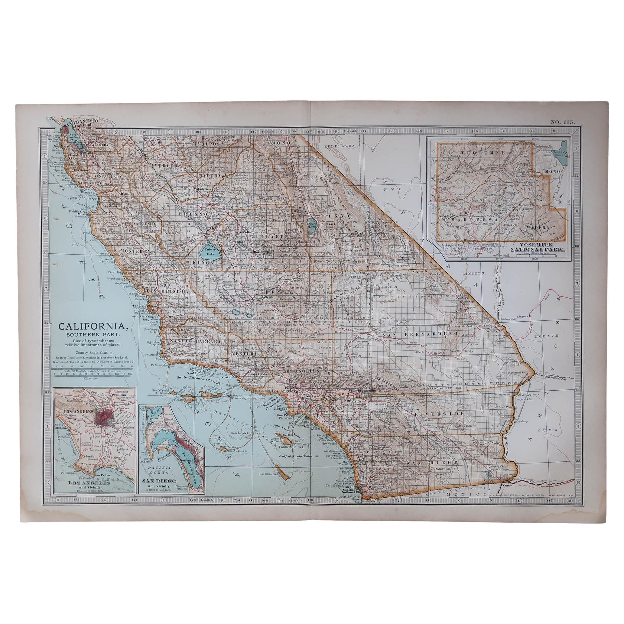
Large Original Antique Map of California, USA, circa 1900
Located in St Annes, Lancashire
Fabulous map of California
Original color
Engraved and printed by the George F. Cram Company, Indianapolis.
Published, circa 1900
Unframed
Free shipping.
Category
Antique 1890s American Maps
Materials
Paper
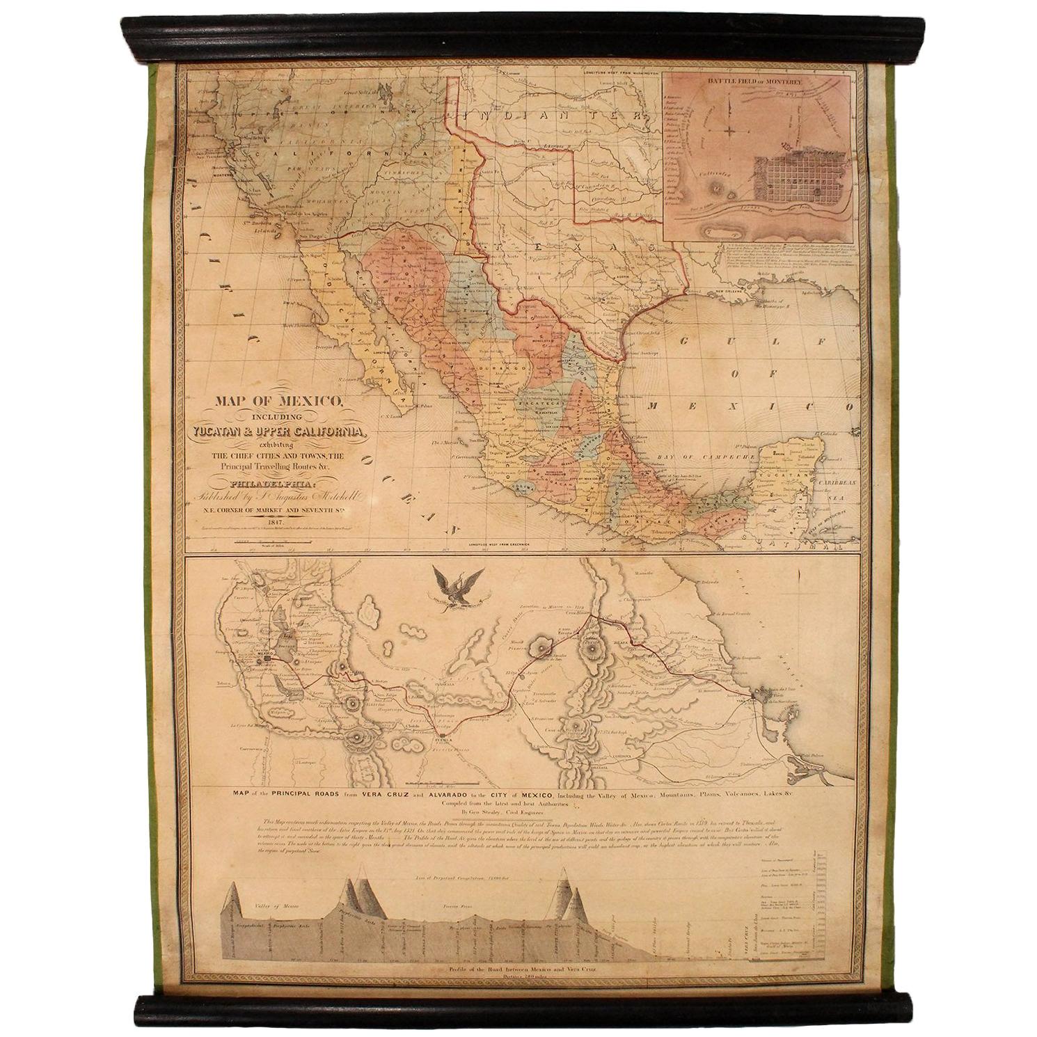
1847 Antique Map of Mexico, Texas and California by Samuel Augustus Mitchell
By Samuel Augustus Mitchell 1
Located in Colorado Springs, CO
Presented is the second edition of Samuel Augustus Mitchell's Map of Mexico, Including Yucatan & Upper California, an important map showing the progress of the Mexican-American War. ...
Category
Antique 1840s American Maps
Materials
Paper

Antique Map of America with California as an Island by Homann '1710'
Located in Langweer, NL
This antique map, titled "Totius Americae Septentrionalis et Meridionalis," represents a significant cartographic piece from 1710 by Johann Baptist Homann. Here's a description of this remarkable map:
- Title: Totius Americae Septentrionalis et Meridionalis (...)
- Date: Published in 1710 by Johann Baptist Homann.
Description:
This map is a first edition of Johann Baptiste Homann's map of America, and it is notable for several cartographic features and historical representations:
1. California as an Island...
Category
Antique Early 18th Century Maps
Materials
Paper

$2,180 Sale Price
25% Off
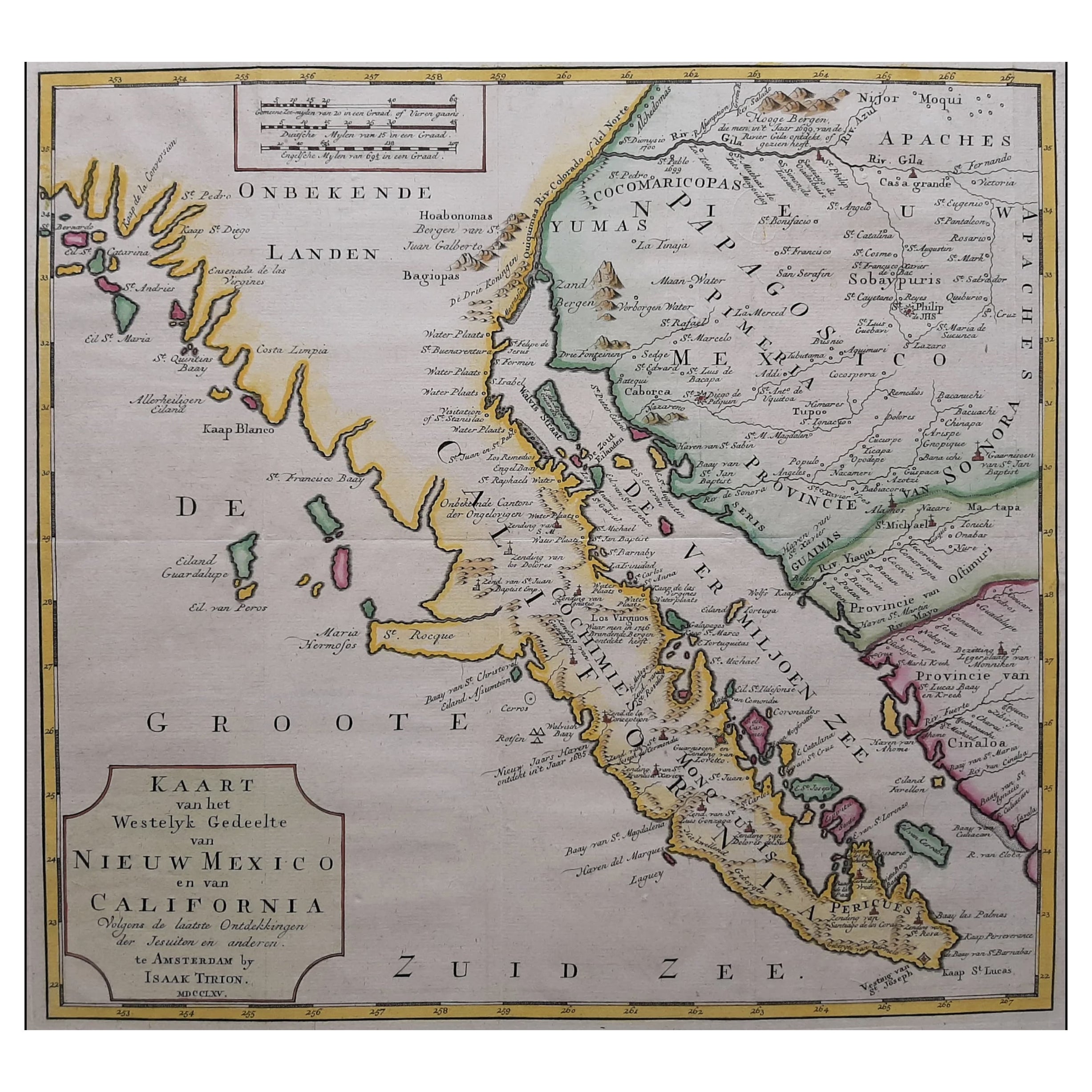
Original Antique Map of the Western Part of NEW MEXICO & CALIFORNIA
Located in Langweer, NL
Title: "Map of the Western Part of NEW MEXICO and CALIFORNIA According to the Latest Discoveries by the Jesuits and Others"
Description:
This exquisite original Dutch map, titled "...
Category
Antique 1760s Maps
Materials
Paper
$1,209 Sale Price
20% Off
Recently Viewed
View AllMore Ways To Browse
Argentina Industria
Arizona Coffee Table
Armorial Spanish
Arne Hovmand Olsen Rare
Arne Jacobsen Coffee Table By Fritz Hansen
Arne Norell Green
Art Deco Champagne Coupes
Art Deco Clarice Cliff
Art Deco Crucifix
Art Deco Kettle
Art Deco Piano Stool
Art Nouveau Liquor Sets
Arthur Jones
Artifort Mushroom Ottoman
Artifort Orange Slice Armchair
Ashanti Gold
Ashtray Hedgehog
Asian 3 Drawer Chest